Julia Platt: The Unwavering Force Behind Monterey’s Ecological Conservation

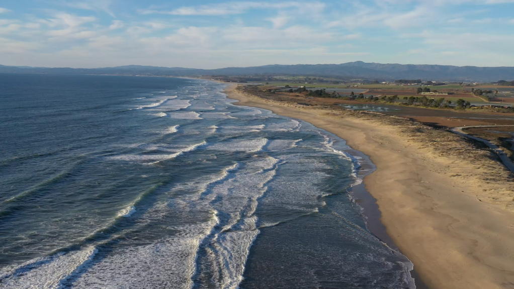
Monterey Bay (Photo: Erik Olsen)

In the 18th century, when Spanish and French explorers ventured along the northern California coast they encountered Monterey Bay and marveled at the astonishing ecological abundance of this 25-mile wide bite mark in the land. The shores buzzed with the lively interactions of sea birds, sea otters played amidst the luxuriant kelp beds, and the waters teemed with many species of whale. 

Yet, by the late 19th and early 20th centuries, this rich tapestry of marine life and biodiversity had largely been erased, replaced by the destructive industrial operations of sardine canneries. These factories, though they brought economic activity and prosperity to a few, also introduced a plague of environmental problems that began a period of staggering ecological decline. 
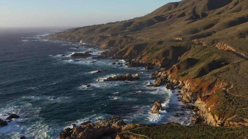
California Coast out of Big Sur (photo: Erik Olsen)

But the tide turned in the early 20th century, in large part due to the efforts of a determined, pioneering woman who took a stand against the sardine industry and began an effort of restoration that helped make Monterey Bay one of the most celebrated shorelines in the world.. 

This transformational figure was Julia Platt, whose contributions were instrumental in the conservation efforts that led to the revival of Monterey’s natural and economic landscape. As mayor of Monterey and a pioneer in marine conservation, Platt used her authority and vision to establish protected marine areas and implement regulations that curbed overfishing and habitat destruction. Her efforts laid the groundwork for a broader environmental awareness and action within the community.

Julia Platt began her career not in politics, but in science. She was born on September 14, 1857, in San Francisco, California, and later moved to Burlington, Vermont. She studied at the University of Vermont and then at Harvard University for her graduate studies.

During her academic journey, Julia faced the limitations imposed on women in academia at the time. In the late 1800s in the United States, it was nearly impossible for a woman to pursue a Ph.D. in zoology due to prevailing gender biases. However, the University of Freiburg in Baden, Germany, presented her with an opportunity to break through these barriers. She seized this chance and became one of the first women to earn a zoological Ph.D. there, challenging the norms and paving the way for future generations. 

Her academic achievements were significant, and she had already made significant contributions to science, including pioneering research on chick embryo development and identifying a new head segment in shark embryos. 

But upon returning to the US, she once again ran up against the glass ceiling of academia. While she worked with some of the top zoologists of the time, she could not find steady work in science. Admitting defeat, but determined to make her mark, she decided on politics, writing to a friend, “Without work, life isn’t worth living. If I cannot obtain the work I wish, then I must take up with the next best.” 

Cannery Row in Monterey 2023 – (Photo by Erik Olsen)

Monterey Bay’s legendary biodiversity was under serious threat. In 1854, a whale was as valuable as several pounds of pure gold, and J.P. Davenport harvested them using exploding lances, processing the carcasses in shore-based vats of boiling oil. By the late 19th century, the lucrative abalone industry had attracted Chinese fishermen village to the shores of Pacific Grove over-burdening the population. During the Gold Rush, prospectors consumed fourteen million seabird eggs from the Farallon islands, a practice that decimated seabird populations. From the 1910s to the 1940s, Monterey Bay’s sardine population fueled a burgeoning canning industry, reaching unprecedented scales that caused horrific smells in town and rendered the beach useless for recreation. 

Each of these industries ultimately collapsed under the weight of its own exploitation; otters, whales, seabirds, abalone, and sardines were all harvested to the brink of extinction.

Whales at Moss Landing near Monterey

In 1899, as the age of 42, she moved to Pacific Grove, the photogenic seaside hamlet next to Monterey where industrial canning and the environmental destruction wrought by it was at its peak. The pollution from canning operations (romanticized in John Steinbeck’s Cannery Row) made the beaches unusable and the smell wafting from Monterey made conditions almost unlivable. Platt decided to redirect her passion for understanding the intricacies of life into preserving it. 

Photo by Eadweard Muybridge of egg collectors on South Farallon Island
Courtesy of New York Public Library via Wikicommons

Taking matters into her own hands, she ran for public office. In 1931, at the age of 70, she became the mayor of Pacific Grove. Despite facing challenges as one of the few female mayors of her time, she wielded her position with an iron will and a clear vision for the future. She was an ardent advocate for beach access for all people, and wielded crowbars, hammers and her own strong will against the rich beachfront land owners who sought to fence off their properties. In this regard, she was a pioneer, foreshadowing the California Coastal Act of 1976—one of the most treasured aspects of California’s landmark coastal protection system—which protects the state’s iconic coastlines from unchecked development and preserves their natural beauty and accessibility for future generations.

Platt’s most significant and lasting contribution as mayor was the establishment of one of the first marine protected areas in California. She passionately argued for the designation of a marine refuge along the coastline, driven by her belief in the innate value of conserving marine habitats and their inhabitants. With her guidance, what became the Lovers Point-Julia Platt State Marine Reserve (SMR) and Edward F. Ricketts State Marine Conservation Area (SMCA), became two of four marine protected areas (MPAs) located on the Monterey Peninsula between Monterey and Pacific Grove.

Bixby Bridge near Monterey (Photo: Erik Olsen)

Thanks to Platt’s efforts, the region saw a revival in its marine biodiversity. Her initiatives ensured that the delicate balance of the marine ecosystem was maintained and allowed for species that were on the brink of being decimated due to human activities to thrive once more.

Julia Platt was more than just Monterey’s mayor; she was its guardian. Through her vision and determination, she transformed Monterey into a beacon of marine conservation. Even after her tenure as mayor, Platt’s legacy lived on. Her initiatives paved the way for future conservation efforts, including the establishment of the iconic Monterey Bay Aquarium.
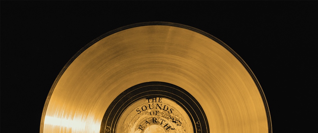
JPL and the Voyager Golden Record: Humanity’s A Cosmic Mixtape in Space

The Jet Propulsion Laboratory (JPL) in La Canada Flintridge, California is well-known for building and sending spacecraft far into the cosmos to help us better understand the universe. But the agency was also extensively involved in one of the most ambitious and symbolic projects in the history of space exploration, one that in many ways was more art than science: the Voyager Golden Record.

In 1977, as the twin Voyager spacecraft prepared to journey beyond the confines of our solar system, they carried with them what might be the most profound artifacts ever created by humanity: the Voyager Golden Records. These records, designed to last a billion years, are time capsules intended not for Earthlings but for potential extraterrestrial finders or future humans. Engraved in gold-plated copper discs, the records encapsulate the Earth’s diverse cultural and natural heritage—from music to languages to sounds of nature.

Photo: NASA/JPL-Cal Tech

The idea of the Golden Record was developed by a talented team led by Carl Sagan, the renowned astronomer and science communicator. Sagan, alongside other prominent figures such as Frank Drake, Ann Druyan, science journalist Jon Lomberg, and Linda Salzman Sagan, crafted a selection that aimed to represent the entirety of Earth. The content ranged from classical music by Bach and Beethoven to greetings in 55 languages, natural sounds like thunderstorms and whales, and a diverse set of 115 images depicting life and culture on Earth.

But producing a record that could survive the harsh environment of space, while also being understandable and playable by beings of unknown technology, posed unique challenges. This is where the Jet Propulsion Laboratory (JPL) stepped in, playing a pivotal role in transforming this ambitious vision into a tangible, durable artifact capable of traversing the cosmos.

Inspection of the engraving of the Voyager Golden Record.
Photo: NASA/JPL-Cal Tech

JPL, managed by Caltech under a NASA contract, was primarily responsible for the construction and operation of the Voyager spacecraft. Their expertise was crucial not just in the scientific instrumentation and engineering of the spacecraft but also in integrating the Golden Records. The lab’s engineers worked meticulously to ensure that the records were equipped with everything needed for potential playback: a cartridge, a needle, and symbolic instructions detailing their use. These instructions, etched onto the record’s cover, provided a universal map indicating Earth’s location in relation to pulsar stars, which are highly stable and can be used as galactic landmarks.

JPL’s involvement extended to the actual physical preparation of the records. They coordinated closely with RCA Records to produce the master disc from which the Voyager records were replicated. The final products were then plated in gold and encased in a protective aluminum jacket, designed to withstand the vacuum of space, cosmic rays, and extreme temperatures.

Photo: NASA/JPL-Cal Tech

The technical contributions of JPL ensured that the Golden Records were not only a feat of cultural expression but also a marvel of scientific and engineering ingenuity. By equipping the Voyager spacecraft with these messages, JPL helped bridge the human desire to explore and communicate with the tangible reality of space travel. The records, mounted aboard Voyagers 1 and 2, continue to be ambassadors of Earth, carrying sounds, music, and images intended to convey the story of our world to whoever, or whatever, might find them.

Today, both Voyager spacecraft, with their Golden Records, have entered interstellar space, marking them as the most distant human-made objects in existence. They serve as reminders of humanity’s ambition to reach beyond our immediate grasp and to communicate across vast cosmic distances. JPL’s role in this historic endeavor highlights the profound connection between human creativity and technological advancement, ensuring that our message to the cosmos will endure long after the original voices have faded.

JPL written on the Voyager Golden Record
Photo: NASA/JPL-Cal Tech

As these records voyage through the cosmos, they remind us not just of where we have been, but also of the far reaches that our curiosity can take us. Through the combined efforts of visionaries like Carl Sagan and the engineering prowess of JPL, the Voyager Golden Record stands as a testament to the best of human knowledge, culture, and technological achievement.

How It Works
The Voyager Golden Records are phonograph records, much like the vinyl records used to listen to music before digital media became widespread. They are constructed from copper discs coated in gold to withstand the harsh environment of space. Each record is encased in a protective aluminum jacket, along with a cartridge and a needle. Instructions in symbolic language explain the origin of the spacecraft and indicate how the record should be played. The playback speed (16 2/3 revolutions per minute) is much slower than typical records, which typically spin at 33 1/3 or 45 rpm.

What’s on the Golden Record
The content of the Golden Record is a meticulously curated selection intended to represent the diversity of life and culture on Earth:

Sounds of Earth: The records include audio of nature sounds like thunder, wind, and animals (including the songs of birds and whales). Human sounds like footsteps, a heartbeat, and laughter are also embedded, capturing the biological and social essence of Earth.

The DNA structure magnified, light hit image is one of the pictures electronically placed on the phonograph records which are carried onboard the Voyager 1 and 2 spacecraft. Credit: Jon Lomberg

Musical Selections: There are 27 musical tracks from different cultures and eras, ranging from classical pieces by Bach and Beethoven to traditional songs from various cultures, including a Navajo chant and a Peruvian wedding song. These selections were intended to showcase the diversity of musical expression on Earth.

Greetings in 55 Languages: A variety of spoken greetings from “Hello” in English to ancient languages like Akkadian. The inclusion of a broad range of languages aims to depict the linguistic diversity of humanity.

Images: The record also contains 115 analog-encoded photographs and diagrams. These images show a wide range of subjects, including humans of different sexes and races, everyday activities, scientific knowledge like mathematical definitions, and the Solar System. The intent was to offer a visual summary of our planet and its inhabitants.

Message from the UN Secretary-General and the President of the United States: There are also printed messages from prominent global leaders at the time, including U.S. President Jimmy Carter and United Nations Secretary-General Kurt Waldheim.

Sounds of Human Origin: Beyond natural and environmental sounds, the record also includes a montage of the sounds of Earth, a screaming chimpanzee, a medley of human-originated noises like tools, vehicles, and a kiss, among others.

The idea behind the Voyager Golden Record is not just to communicate where and who we are but also to share a message of hope and peace with any possible recipient, even if that recipient is far in the future. The chances of the Voyager spacecraft actually being found by extraterrestrial life are slim, but the Golden Record serves as a profound gesture of goodwill and a testament to the human spirit’s longing to reach out and explore the universe.

Rocks in Motion: Pinnacles National Park, the Geological Odyssey of Thomas Dibblee Jr. and California’s Dynamic Terrain

Pinnacles National Park (NPS)

Pinnacles National Park’s open landscape of dramatic rock formations and craggy spires looks otherworldly, especially in golden hour light. But few people who visit the park, located in Central California, southeast of the San Francisco Bay Area, are aware that the rock formations were once at the center of a fierce debate in the history of California geology.  

And at the center of the controversy was a young geologist named Thomas Dibblee Jr. 

Pinnacles National Park, formerly Pinnacles National Monument, tells the story of ancient volcanic activity and the relentless geologic forces of the San Andreas Fault. This fault, a major boundary between the Pacific and North American tectonic plates, is the platform for the dramatic northward journey of the park’s volcanic remnants. Dibblee’s research illuminated how, over millions of years, the landscapes we see today were sculpted by the movements of these tectonic plates and how the shape of California as a state has changed dramatically.

Thomas Dibblee Jr. 

The crux of Dibblee’s discovery lies in the relationship between Pinnacles National Park and a volcanic source located near present-day Neenach, close to Palmdale in Southern California. The geological narrative that Dibblee pieced together revealed that the rock formations at Pinnacles originated from volcanic eruptions that occurred approximately 23 million years ago, near what is now Neenach. Over millions of years, the relentless movement along the San Andreas Fault has transported these formations over 195 miles (314 kilometers) to their current location. At the time, very few people, geologists included, believed that was possible.

Dibblee had to be wrong. But it turned out, he was not, and his measurements and discovery launched a passionate debate about the speed of geologic forces.

Dibblee’s findings not only shed light on the significant distances that landscapes can travel over geological timeframes but also provided a tangible connection between the theory of plate tectonics and observable geological features. The juxtaposition of Pinnacles National Park and the Neenach volcanic formation serves as a clear indicator of the San Andreas Fault’s role in shaping California’s geological, indeed it’s physical, identity.

Pinnacles National Park (NPS)

A key aspect of Dibblee’s methodology was his keen observational skills, which enabled him to recognize that the rocks at Pinnacles National Park were strikingly similar in composition and age to those near Neenach, even though these areas are separated by about 195 miles (314 kilometers) today. He noted the volcanic origins of these formations and, through detailed mapping, was able to correlate specific rock types and strata between these distant locations.

Another crucial element in Dibblee’s discovery was his understanding of the San Andreas Fault as a major geological feature capable of significant lateral movement (remember the San Andreas is a slip or sliding fault). By correlating the age and type of rocks across this fault line, Dibblee inferred that the only plausible explanation for the similarity between the rocks at Pinnacles and those near Neenach was that they had once been part of the same volcanic field, which had been split and displaced over millions of years due to the movement of the San Andreas Fault.

Rock formations at Pinnacles National Park (Brocken Inaglory)

Dibblee’s work also benefited from the broader scientific context of his time, particularly the emerging theory of plate tectonics in the mid-20th century. This theoretical framework provided a mechanism for understanding how large-scale movements of the Earth’s crust could result in the displacement of geological formations over vast distances. Dibblee’s findings at Pinnacles and Neenach became a compelling piece of evidence supporting the theory of plate tectonics, showcasing the San Andreas Fault’s role in shaping California’s landscape.

But Dibblee’s ideas were controversial at the time. Many in the scientific community were hesitant to embrace a theory that suggested such dramatic movement across the Earth’s crust, partly because it challenged existing paradigms and partly due to the limitations of the geological evidence available at the time. The prevailing theories favored more static models of the earth’s crust, with changes occurring slowly over immense periods. Dibblee’s insights into tectonic movements and the geological history of regions like the Pinnacles National Park were ahead of their time and laid the groundwork for the acceptance of plate tectonics.

This Pinnacles revelation was groundbreaking, emphasizing the dynamic and ever-changing nature of the Earth’s surface. Dibblee’s ability to piece together these monumental shifts in the Earth’s crust from his detailed maps and observations has left a lasting impact on our understanding of geological processes. His work at Pinnacles and the recognition of its journey alongside the San Andreas Fault underscores the importance of detailed geological mapping in unraveling the Earth’s complex history.

San Andreas Fault looking northwest onto the Carrizo Plain (John Wiley)

Born in 1911 in Santa Barbara, California, Dibblee’s life and work were deeply intertwined with the rugged terrains and picturesque landscapes of the Golden State, Dibblee’s journey into geology began at a young age, fostered by his natural curiosity and the geological richness of his native state. After earning his degree from Stanford in 1936, Tom embarked on his professional journey with Union Oil, later moving to Richfield. It was during this period that his extensive field mapping efforts culminated in the discovery of the Russell Ranch oil field near New Cuyama. By the year 1952, Tom had meticulously mapped every sedimentary basin in California with potential for oil, cementing his legendary status. His reputation for traversing the state’s backcountry on foot for extended weeks became a defining aspect of his character and contributed to his storied career in geology. 

Dibblee Dibblee moved onto a career at the United States Geological Survey (USGS) that would span over six decades, much of it spent with the agency and then later through independent projects. His work ethic and passion for fieldwork were unparalleled; Dibblee was known for his meticulous and comprehensive approach, often spending long days in the field, mapping out California’s complex strata with precision and care.

One of Dibblee’s most significant contributions to geology was his detailed geological mapping. Over his career, Dibblee mapped over 240,000 square kilometers of California’s terrain, an achievement that provided an invaluable resource for understanding the state’s geological history and structure. He mapped large swaths of the Mojave Desert, the Coast Range and the Los Padres National Forest, earning a presidential volunteer action award in 1983 from President Reagan.

His maps are celebrated for their accuracy and detail, serving as critical tools for academic research, oil exploration, environmental planning, and education. The Dibblee Geological Foundation, established to honor his work, continues to publish these maps, ensuring that his legacy lives on.

Dibblee Map

Dibblee’s insights into the geology of California were pivotal in several areas, including the understanding of the San Andreas Fault, a major fault line that has been the focus of extensive seismic research due to its potential for large earthquakes. Dibblee’s mapping efforts helped to clarify the fault’s characteristics and behavior, contributing to our understanding of earthquake risks in California and aiding in the development of safer building practices and disaster preparedness strategies.

Furthermore, Dibblee’s work shed light on the process of plate tectonics and the geological history of the western United States. His observations and mapping of sedimentary formations and fault systems in California provided empirical evidence that supported the theory of plate tectonics, a cornerstone of modern geology that explains the movement of the Earth’s lithospheric plates and the formation of various geological features.

Thomas Dibblee Jr.’s contributions to the field of geology are not just confined to his maps and scientific discoveries. He was also a mentor and inspiration to many aspiring geologists, sharing his knowledge and passion for the Earth’s history through lectures, field trips, and personal guidance. His dedication to his work and his ability to convey complex geological concepts in an accessible manner made him a respected figure among his peers and students alike. Through his dedication and pioneering work, Dibblee has left an indelible mark on the field of geology, making him a true giant in the scientific exploration of our planet.

Feathers on the Flyway: Unraveling Avian Mysteries at Bear Divide with the Moore Lab

Western tanager (Ryan Terrill)

Within a 45 minute drive from the urban chaos of downtown Los Angeles, lies a natural, ornithological marvel: Bear Divide, a vital corridor for the annual migration of numerous bird species. The divide is a small dip in the otherwise impregnable San Gabriel mountains, allowing birds in the midst of their migration to pass through safely at relatively low altitudes. This area is not just a haven for bird enthusiasts but also a critical research site, especially for the team from the Moore Lab of Zoology at Occidental College, who have been delving into the intricacies of these migratory patterns.

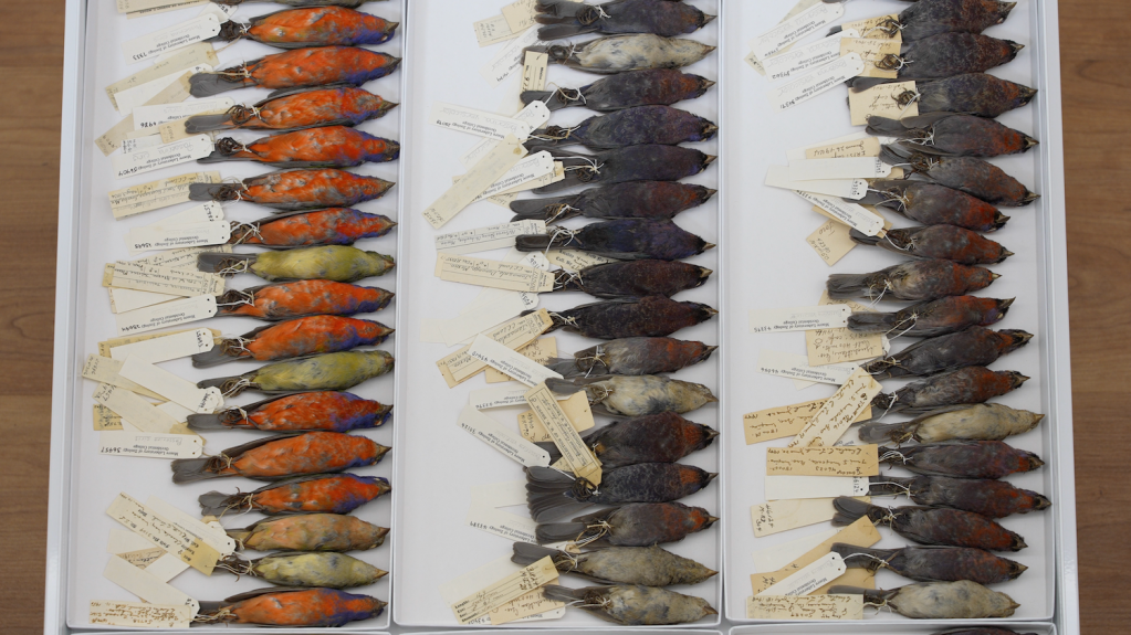
The Moore Lab of Zoology is renowned for its extensive bird specimen collection, one of the largest of its kind in the world for Mexican birds.

Part of the large bird collection at the Moore Lab (Erik Olsen)

Bear Divide is strategically positioned along the Pacific Flyway, a significant north-south migratory route used by birds traveling between Alaska and Patagonia. The geographical features of the San Gabriels provide an ideal resting and feeding ground for these birds, making Bear Divide a crucial stopover during their long journeys. It’s this unique combination of location and topography that makes Bear Divide an essential component of avian migration.

U.S. Fish and Wildlife Service

The discovery of Bear Divide was a lucky happenstance. A bird researcher was conducting overnight monitoring in the spring of 2016, and when morning came, he noticed legions of small songbirds whizzing past his monitoring spot. His report caught the attention of postdoc bird scientist Ryan Terrill at Moore Lab at the time, and he began an effort to monitor the birds. Terrill and his team would ultimately record as many as 20,000 birds in a single morning. The effort has continued to this day with startling results. Terrill has since left and is now the science director at the Klamath Bird Observatory.

“Last year 2023 we counted 53,511 birds of 140 species from February to May,” said John McCormack, a professor of biology and the Director and Curator of the Moore Laboratory of Zoology. “And of course, we missed many thousands more because most travel at night. It’s easy to say that there are hundreds of thousands of birds passing through Bear Divide.”

Swainson’s Hawk (Marky Mutchler)

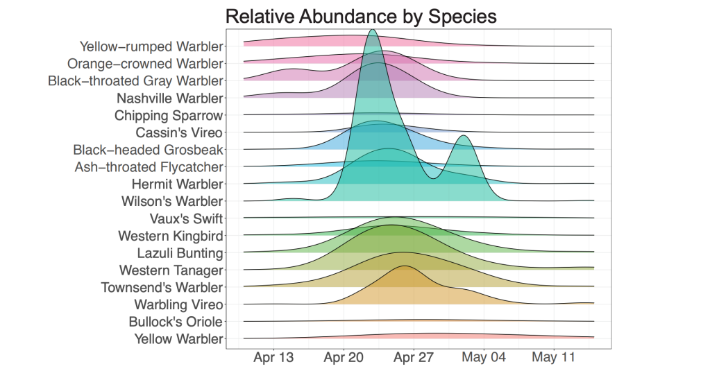
As many as 13,000 western tanagers, lazuli buntings, chipping sparrows, hermit warblers, orioles, grosbeaks and warblers pass through Bear Divide on a single day. Why they do so, is not entirely understood. The unusual topography of Bear Divide essentially serves as a funnel for the migrating birds, with many of them shooting through the gap just a meter or two above ground.

“Personally, I really think it’s one of the best birding spots in the world,” Terrill told the LA Times.

McCormack says that the “ultimate goal is to better understand the Pacific Flyway and how it’s used, especially by small terrestrial birds. Little is known about their movements because they are hard to see and usually travel at night.”

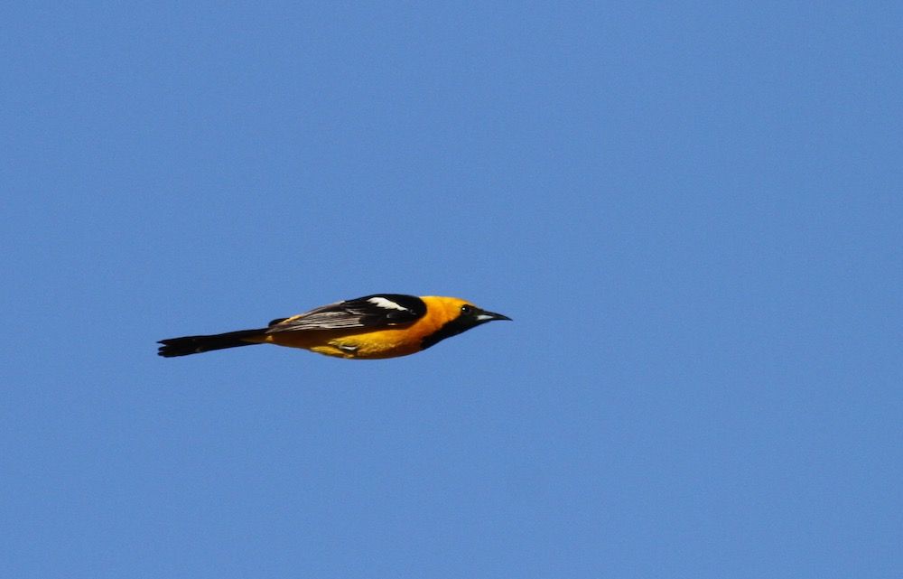
Hooded Oriole (Ryan Terrill)

Because many of the species sighted at Bear Divide are in steep decline. The lab says that year-to-year counts will help set a baseline for future trends that can be associated with weather, climate, and urbanization. “Tracking individual birds will give granular knowledge on how migratory birds use the landscape, which helps individuals and homeowners create corridors for them to travel,” says McCormack.

The best time to catch the show at Bear Divide is late winter early Spring. McCormack says Cliff Swallows and Lawrence’s Goldfinch are some of the early movers in March, and that by May, streaking by are Yellow Warblers, sunset-faced Western Tanagers, and bright blue Lazuli Buntings.

“There is so much we still don’t know about these birds and their world,” Lauren Hill, the site’s lead bird bander, told the Los Angeles Times. “For example, no one knows where they were before showing up here after sunrise.”

Lazuli Bunting zips past the camera at Bear Divide (Ryan Terrill)

The team is counting birds in order to establish a baseline of the populations coming through Bear Divide so they can understand how much we are changing the environment and what effect that may have on bird populations, many of which are in severe decline.

Their research spans a variety of topics, including how climate change is impacting migration routes and the effects of urbanization on bird populations. The lab has recently begun a program to put satellite trackers on birds at Bear Divide to follow individual birds, providing deep insight into their migration and resting patterns. This research is not only pivotal in understanding avian behavior but also crucial in shaping conservation policies.

One of the most fascinating aspects of Bear Divide is the sheer variety of bird species it attracts. From the diminutive hummingbirds to the impressive birds of prey, each species adds a unique dimension to the study of migration. The Moore lab’s findings have shed light on the varied responses of different species to environmental changes, offering a glimpse into the broader ecological shifts occurring across the globe.

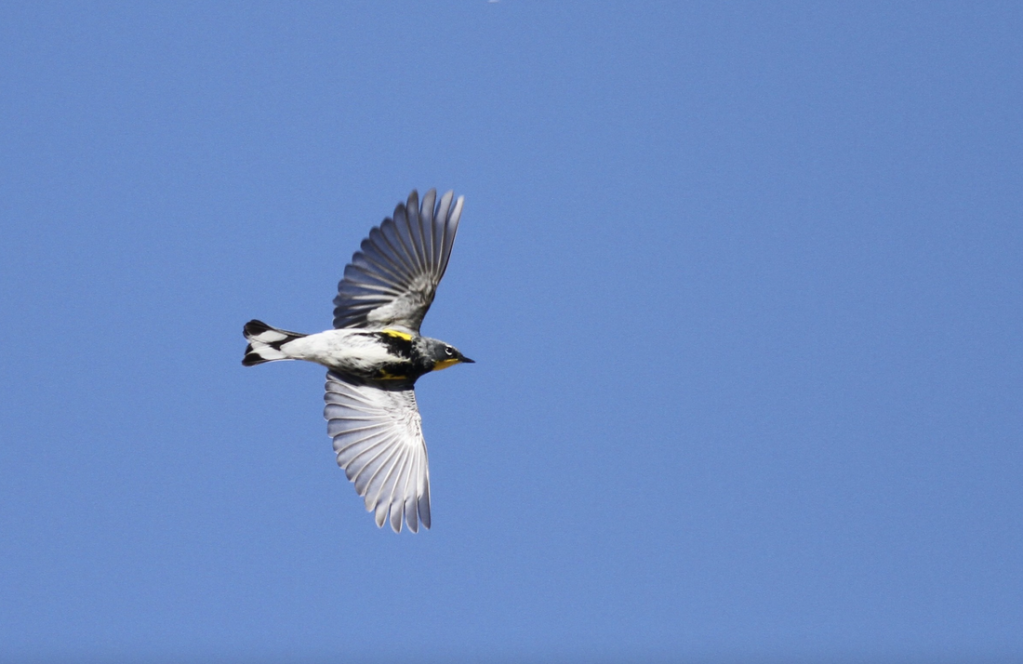
Yellow-rumped Warbler (Ryan Terrill)

One compelling result of the Moore Lab’s study at Bear Divide suggests that the peak of a particular species’ migration is correlated with the latitude of its breeding site. Species that breed at higher latitudes migrated through Bear Divide at later dates. It’s also unusual in the West for species to migrate during the day. Most species of birds using the Pacific Flyway are known to migrate at night.

The Moore Lab of Zoology

In addition to its scientific contributions, the Moore lab is also known for its involvement in citizen science. Collaborating with local birdwatchers and volunteers, the lab extends its research capabilities and cultivates a community actively engaged in bird conservation. This collaborative approach not only enhances the breadth of their research but also underscores the importance of community involvement in conservation efforts.

Bear Divide is that it’s public land, so anyone with a legitimate research project can get permission to work there. UCLA graduate student Kelsey Reckling, who has worked as a counter at Bear Divide since the beginning, is leading the counting efforts this Spring to understand changes in numbers of birds and species across years. Cal State L.A. graduate student Lauren Hill leads the group of bird banders, who catch some of the birds and record data, attaching a lightweight metal band around one leg and releasing them. Her lab mate Tania Romero is putting small, lightweight tracking devices on Yellow Warblers, which send signals to a network of tracking (MOTUS) towers across the continent.

Many bird species are under serious threat around the globe from a number of different impacts, including climate change, pesticides and habitat loss. Birds play a critical role in the health of our planet. They regulate ecosystems by preying on insects, pollinating plants, and spreading seeds. Healthy ecosystems are important for breathable air, food, and a regulated climate.

Bear Divide (Ian Davies)

According to a 2019 study, nearly 3 billion breeding birds have been lost in North America and the European Union since 1970. That’s about 30% of the bird population in North America. The 2022 State of the Birds Report for the United States found that bird declines are continuing in almost every habitat, except wetlands. Protecting birds’ habitats, and migration routes and reducing mortality through conservation efforts are crucial to ensuring the survival of these magnificent creatures.

The research conducted at Bear Divide by the Moore lab transcends academic interests, emphasizing the interconnectivity of ecosystems and underscoring the need to preserve natural migration corridors amid urban expansion. The insights gained here are invaluable to both the scientific community and conservation efforts, highlighting the need for a balanced approach to wildlife preservation and ecological sustainability.

Band-tailed Pigeon (Ryan Terrill)

“What’s magical about Bear Divide is that it’s the first real place to see small, migrating birds at eye level in daylight hours,” says McCormack. “I don’t want to oversell it: it’s still a lot of small birds zinging by in a wide open place and it takes a while to get good at identifying them. But by seeing them out there, struggling against the wind and the cold, but still making progress, it gives you a real sense of how amazing their journeys are–and how we shouldn’t make them harder if there’s anything we can do about it.”

Mysteries Etched in Earth: Unraveling the Secrets of the Blythe Intaglios, California’s Nazca Lines

Blythe Intaglio of a human figure in Southern California (Wikipedia)

In the vast expanses of California’s Colorado Desert, less than four hours from Los Angeles, a series of ancient and enigmatic figures etched into the earth—the Blythe Intaglios—have long puzzled anthropologists and captivated the imagination of those who visit them or view them from the sky. They were brought to modern attention somewhat by chance. In 1932, George Palmer, a pilot flying over the Mojave Desert between Las Vegas, Nevada and Blythe, glimpsed these enigmatic formations, sparking curiosity and awe. 

Named for the nearby town of Blythe, California, these large geoglyphs (human-made designs created on the ground by arranging or moving objects in a landscape), sprawl across the desert floor, and are an extraordinary example of prehistoric art, yet they remain one of the lesser-known archaeological wonders of North America. The Colorado Desert, just south of the Mojave, contains the only known desert intaglios in North America. 

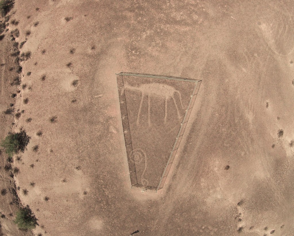
The Blythe Intaglios are best observed from above by drone or by plane, where their full scale and intricacy become apparent. The largest figure – of a human with outstretched arms – spans an immense 171 feet, an impressive endeavor considering the primitive tools likely used in their creation. One has to wonder why they were created at all since the people who made them certainly had no way of viewing them from the air. In addition to humans, the figures depict animals such as a rattlesnake and possibly a horse (yeah, what is that thing?), as well as geometric shapes, each meticulously carved by removing the dark desert varnish to reveal the lighter soil underneath. Intaglios in general are classified by their shapes, such as anthropomorphs (humanlike), zoomorphs (animal-like) and various geometric shapes.

Blythe Intaglio quadruped (Wikipedia)

The intaglios are mostly located along the Colorado River, a fact that some scientists consider significant. Rivers often hold a central place in the spiritual and cultural lives of indigenous peoples. For the tribes associated with the Blythe Intaglios, such as the Mojave and Quechan, the Colorado River was likely a vital part of their spiritual and everyday life. The proximity of these geoglyphs to the river suggests that they could have been part of a broader cultural landscape that included the river as a critical element. The river may have been seen as a source of life and a spiritual boundary, making the nearby land a significant place for creating these monumental figures.

While the Nazca Lines in Peru have gained worldwide fame, the Blythe Intaglios, though similar in form and function, have remained relatively obscure. Most Californians probably have no idea that such unique archaeological artifacts can be found in the state, let alone so close to a major urban center. This obscurity, however, adds to their mystique. 

The geoglyphs are believed to date back at least a thousand years, but their exact age remains uncertain. If the quadruped figures represent horses (reintroduced in North America by the Spanish) then a historical date of sometime after the 1500s would be supported. Archaeologist Jay von Werlhof obtained radiocarbon dates for the figures, ranging from 900 BCE to 1200 CE. The human figures, particularly the largest, are thought to represent Mastamho, the creator of life in Mojave and Quechan mythology. The animal figures, like the mountain lions, are steeped in symbolic meaning, potentially reflecting the tribes’ cosmology and spiritual beliefs.

Nazca Lines in Peru. (UNESCO World Heritage Site)

The precise purpose of the Blythe Intaglios is a matter of ongoing debate. Some scholars propose that they were part of religious rituals or celestial observances. The alignment and positioning of the figures suggest a possible astronomical function, marking significant events in the lunar or solar calendars. Or perhaps making them was just a fun way to pass the time and express creativity.  

Despite their historical and cultural significance, the Blythe Intaglios have not been immune to threats. Off-road vehicle traffic and natural erosion have damaged some of the figures. Conservation efforts are in place, but the remote location and sheer scale of the site present unique challenges. Fences have been erected around some figures to protect them, but much work remains to ensure their preservation.

The Blythe Intaglios are more than just ancient art; they are a profound testament to the rich and diverse cultural heritage of the indigenous peoples of the Southwest. These geoglyphs offer a window into a past that likely predates European influence, a past that is integral to understanding the complex tapestry of American history. In a world where such treasures are increasingly vulnerable to the ravages of time and human interference, the Blythe Intaglios are a fascinating example of the enduring power of human expression over time and the mysteries beneath our feet.