If I told you that some of the richest, densest communities of marine life anywhere in the world thrive off California, you might not be surprised. We all know California has a vibrant marine ecosystem offshore. But if I told you that much of that life clings to the submerged steel legs of offshore oil rigs, you might pause, blink, and say: really?
The answer is yes.
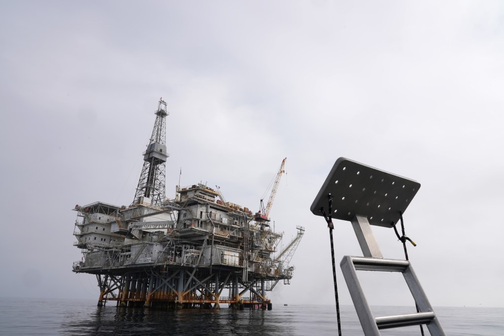
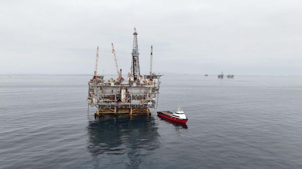
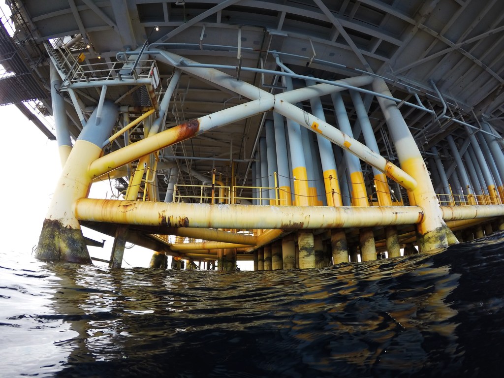
I know because I have dived a few of them several times. Most recently this November, when I took a dive boat called the Giant Stride out of San Pedro and motored 12 miles out to the Eureka platform, which sits in 700 feet of water. From the deck, the rig looms like a floating city of steel and shadow, its massive pylon legs disappearing into the depths below.
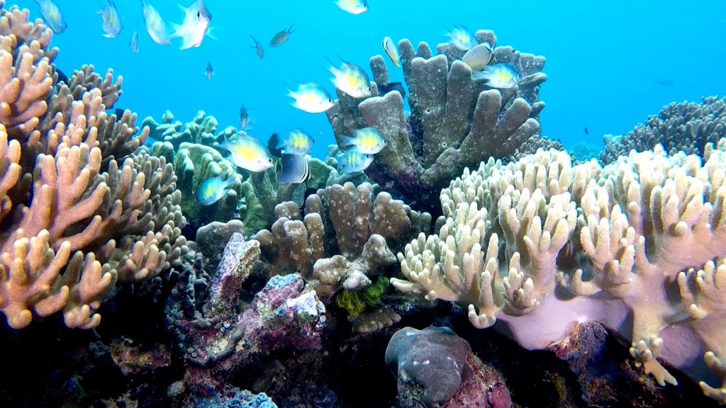
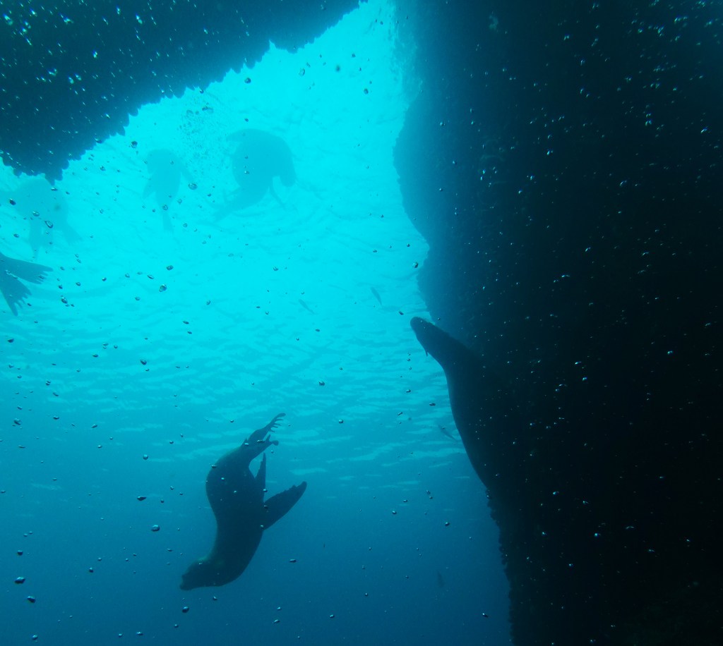
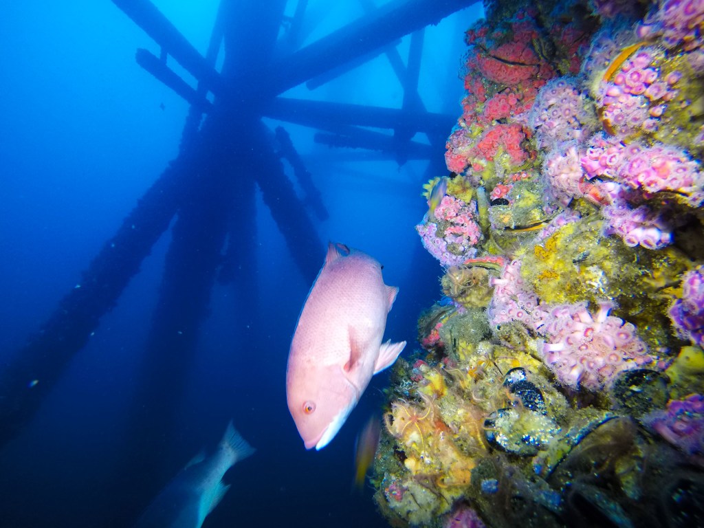
But below the surface is another world, one teeming with millions of colorful fish, including blazing orange garibaldi, schools of dark blue blacksmiths, halfmoons, calico bass, yellowtail, and even the occasional mola mola or sunfish. A few rigs are the playground of scores of jubilant sea lions, many of them precocious youngsters that swoop and spin in the waters beneath the massive structure of the rigs like children let loose in a grassy park.
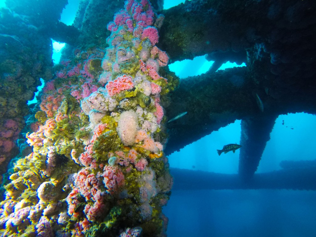
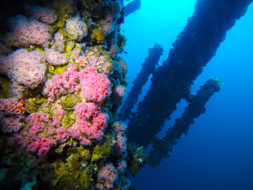
And then there are the pylons themselves and the life they support. Made of welded steel, these massive structures hold the entire oil platform above the water, millions of tons of machinery and deck space, often topped by a helicopter pad, all balanced on the integrity of engineering. Some descend straight down into the darkening waters, while others are reinforced by diagonal braces and horizontal crossbeams, a lattice of intersecting steel that keeps the rig steady against waves and wind.
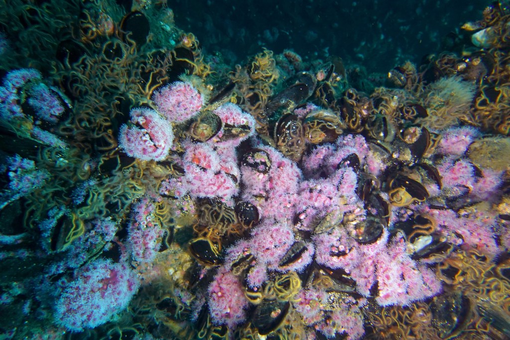
But up close, you can hardly make out the metal. The substructure is so encrusted with life, layers of scallops, brittle stars, mussels, anemones, barnacles, and sponges, that the steel beneath has vanished into a living reef. In some areas, there are thousands of brittle stars clinging to the structure, they lie so thick on it that it’s hard to imagine how they compete for food. But food here is plentiful, and that abundance is one reason these rigs harbor so much life. They stand near the edge of the continental shelf, where the seafloor plunges into deeper water and cold, nutrient-rich currents surge upward toward the light. Those nutrients ignite blooms of plankton, feeding swarms of tiny crustaceans and filter feeders that coat the rig’s pilings. Those smaller creatures, in turn, sustain fish, sea lions, and even passing seabirds, a food web in full expression, built around the steel spine of an oil platform.

All of this is not just my observation, however. Numerous studies have been done about the life on the rigs and most of them point to an astonishing fact: these rigs are some of the most productive ecosystems on the planet. In one study, University of California Santa Barbara marine biologist Milton Love and his colleagues found that certain platforms, including Eureka, produced more fish biomass per square meter than even the most productive natural environments in the world. More than mangroves, coral reefs, estuaries, etc.
This is good news for everyone. But there’s more. Other research suggests that the life flourishing on these offshore rigs doesn’t stay confined to them; it drifts, swims, and spawns its way back toward the coast, helping to replenish nearshore habitats. Rockfish are a perfect example. Once severely overfished, several species have made a remarkable comeback in California waters, perhaps due in part to these structures. As we wrote recently, the recovery of rockfish is one of the state’s quiet success stories.
But there’s a hitch.

Several of these rigs are now nearing, or have already reached, the end of their productive lifespan, meaning that they no longer produce much oil. What should be done with them? In California, when offshore oil rigs reach the end of their productive life, state law mandates their decommissioning, which involves safely plugging wells, dismantling structures, and restoring the environment. Traditionally, this has meant full removal of the platform and associated infrastructure: a very expensive proposition, likely costing in the billions of dollars.
However, the California Marine Resources Legacy Act (AB 2503), enacted in 2010, introduced an alternative known as the “rigs-to-reefs” program. This legislation allows oil companies to apply for permits to partially remove decommissioned rigs, essentially shearing off the part of the structure above water and leaving a portion of it underwater to serve as artificial reefs. Obviously they’d do it deep enough, about 80 feet, that the structure would not become a hazard to ship traffic. The goal is to enhance marine habitats by preserving the ecosystems that have developed around these structures over time. Rig removal is a growing billion-dollar-a-year business, and by removing only part of the rig and leaving behind the rest, an oil company can save millions in decommissioning costs.
As of January 2024, there are eight offshore production platforms in various stages of decommissioning; several have had multiple owners and operators. It’s complicated, but the biggest issue is liability. That is, what happens down the line when there is a leak, or if the plugging of the wells was done improperly? Who pays for that? This is all being hashed out, as it has been for some 20 years now. Californians hate oil washing up on their beaches. Many hate the idea of the oil companies getting a financial break after plundering the sea floor for oil. But there is no denying that all that life is there. You can see it. And, as Milton Love said: “If you remove a platform, you may be killing tens of millions of animals because they happened to settle on steel instead of a rock. Which I think is a tragedy.”
Oil companies have not used California’s Rigs-to-Reefs law because it leaves them financially and legally burdened. They must keep long-term liability for the structures and give up to 80 percent of their cost savings to the state, which makes full removal simpler and less risky than the complex and politically sensitive reefing process.
And so, as some of these platforms near the end of their productive lives, a significant debate has emerged over their future. Should they be removed entirely, or could they be repurposed into artificial reefs that continue to support marine biodiversity? The discussion is not just about engineering challenges or environmental concerns; it’s about reimagining the relationship between human infrastructure and the natural world.
Amber Sparks led the expedition I took out to the rigs. I’ve dived with her several times before and believe she’s a passionate advocate for sea life and for a healthy offshore California marine ecosystem. She and her co-founder Emily Hazelwood are strong supporters of reefing the rigs, and through their work with Blue Latitudes, they collaborates with scientists, government agencies, and oil companies to explore ways decommissioned platforms could be transformed into permanent marine habitats rather than dismantled and removed.
“The big question is, are these structures good habitat that should be left in place to continue to thrive as reefs, or should they be removed? In my opinion, they would be really valuable to be left in place as reefs.”

So where do things stand today? A December 2023 Public Environmental Impact Statement (PEIS) from the Bureau of Safety and Environmental Enforcement and Bureau of Ocean Energy Management marks the most recent major development in the offshore rig debate, and it could significantly shape future decommissioning of California’s oil platforms. Though the PEIS identifies partial removal as the environmentally preferable option (italics mine) because it would preserve the habitat of existing biological communities, the agencies involved selected “Alternative 1a”, mandating complete removal of platform jackets and associated infrastructure offshore southern California. The final decision over what to do with the rigs has not yet been made, but the current wisdom suggests that they may have to go. As a diver and novice fisherman, I consider this a shame.
Public opposition to “big oil” remains strong in California, fueling demands among small but vocal groups for the complete removal of oil rigs, despite the potential loss of coral-like ecosystems. Environmental groups like the Natural Resources Defense Council argue that retaining any portion of these structures enables the oil industry to persist as an environmental threat.
“People here have been waiting for these oil platforms to go away,” Linda Krop, an environmental lawyer with the Environmental Defense Center, an advocacy group based in Santa Barbara, told the me when I reported on this for the New York Times. Ms. Krop challenged the notion that the science definitively supports the role of rigs in fostering marine life. She argued that leaving the rigs in place would effectively reward polluters by allowing them to avoid the expense of removal.
Globally, the concept of Rigs-to-Reefs has seen success, particularly in the Gulf of Mexico, where over 500 platforms have been converted into artificial reefs. These structures have become magnets for fish and invertebrates, supporting commercial and recreational fishing and diving industries. However, critics argue that not all programs are created equal. In some regions, lax regulations have allowed oil companies to avoid fully addressing environmental risks, leaving behind structures that degrade over time and release pollutants. California’s approach, with its stringent oversight and commitment to environmental benefits, aims to avoid these pitfalls while maximizing ecological gains.
What happens to California’s oil platforms will reveal how the state chooses to balance economic legacy with ecological responsibility. Few would argue that oil companies deserve further rewards after decades of drilling and profits, yet the decision ahead is not so simple, it is about what becomes of the ecosystems that have grown around their steel foundations. There should be a way to move forward responsibly, one that removes the risk and legacy of drilling while preserving the thriving marine life that has made these structures their home.