Tejon Pass is a Journey Through Time, Terrain, and Tectonics

Interstate 5 coming out of the Grapevine near Tejon Pass (Photo: Erik Olsen)

There’s a drive that I’ve done many times where I tend to look around and wonder about the place. It’s while I’m on I-5 headed north, a while after passing Santa Clarita, Magic Mountain (I always strain to see if there are people on the roller coasters), and the CalArts up on the hill (where so many Pixar legends once trained).

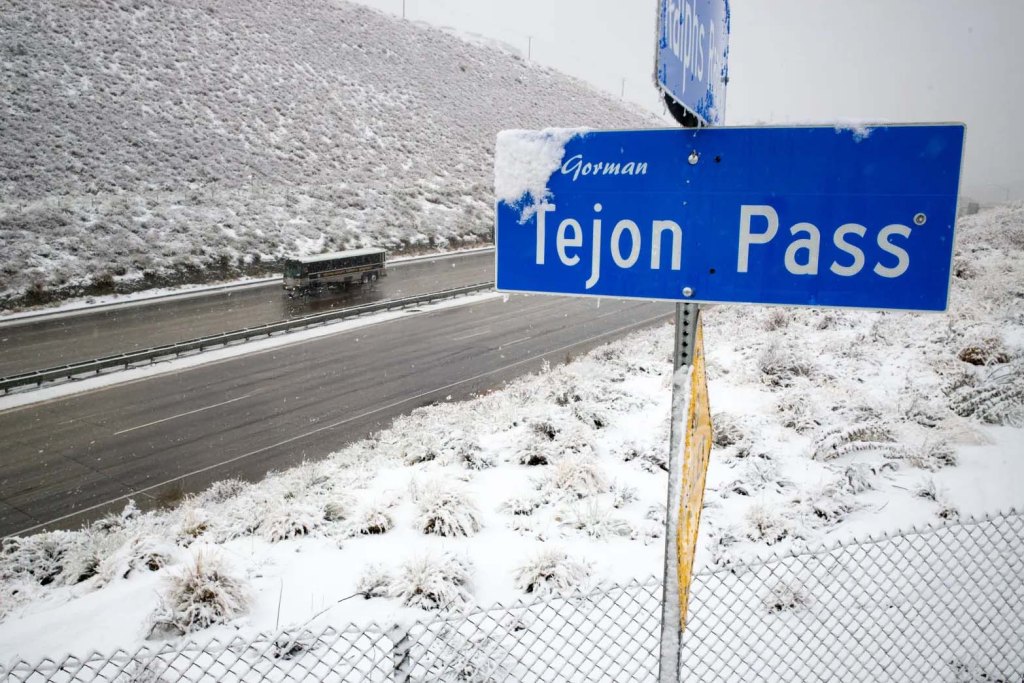
Perhaps you’ve done it, too. Maybe you get gas in Castaic, then you pass Pyramid Lake, and you’ve fully left the San Fernando Valley behind. Then the climb begins and the terrain changes dramatically. It’s subtle at first. The road starts to rise, winding past low ridges covered in golden grass and sun-bleached rock. Then the grade steepens. You see warning signs for trucks: “Turn off A/C to avoid overheating.” Semis tuck into the right lanes, their flashers blinking, straining against gravity. You’re ascending into the Tehachapi Mountains. The name comes from the Southern Paiute word “Tihachipia” meaning “hard climb”, which makes a ton of sense when you’re there. These mountains are part of the geologically fascinating Transverse Ranges, which we’ve written about before. Up ahead is Tejon Pass, the official name for the mountain crossing, but it’s more famously known to most drivers as the Grapevine, the steep stretch of I-5 that descends into the Central Valley.

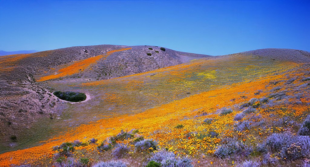
The highway carves through steep canyon walls and hillsides sometimes bright with flowers, sometimes scarred by past wildfires. If it’s summer, the air gets drier and hotter; in winter, it might be raining or even snowing. You’re crossing one of the most weather-vulnerable stretches of highway in the state. The road is wide but unforgiving. Watch for crosswinds, or the occasional patrol car tucked into a turnout. Tejon Pass is more than just a mountainous pathway connecting the San Joaquin Valley to Los Angeles. It’s a geological and historical hotspot that tells a story of native tribes, daring transportation, seismic activity, and human ingenuity.

The weather can change quickly near Tejon Pass (Photo: Erik Olsen)

Rising to an elevation of 4,160 feet, Tejon Pass’s unique topography is a fascinating blend of rugged mountains, deep canyons, and expansive plateaus. At the summit, the land briefly levels out. There’s a moment where the mountains give you a glimpse in both directions. Behind, the tangled ridges of Southern California. Ahead, a vast, hazy bowl: the southern end of the Central Valley. You pass the Fort Tejon Historical Park turnoff, and suddenly, you’re descending.

The road plunges down in a series of long, controlled curves. Runaway truck ramps cut into the hillside like scars. Then, like stepping through a door, you’re out of the mountains. Flatness stretches to the horizon. Orchards, oil derricks, and cattle fields mark your arrival in the valley. The air feels different. Denser, warmer. You’re in Kern County now, approaching the outskirts of Bakersfield, and the Grapevine is behind you. It’s as if you crossed an invisible line, a border between two Californias.

CALIFORNIA CURATED ART ON ETSY

Purchase stunning coffee mugs and art prints of California icons.
Check out our Etsy store.

Perhaps one of the most captivating aspects of Tejon Pass is its seismic significance. The region is situated at the intersection of two major fault lines: the San Andreas Fault and the Garlock Fault. This combination has made the area a hotspot for seismic activity and has resulted in a number of substantial earthquakes over the years.

Image of the Garlock Fault created with data from NASA’s Shuttle Radar Topography Mission (SRTM)

The most significant of these occurred in 1857, with an estimated magnitude of 7.9. Known as the Fort Tejon earthquake, it caused a rupture along the San Andreas Fault, leaving a lasting imprint on the landscape. Although the area was sparsely populated at the time, the quake’s impacts were far-reaching and could be felt as far as Las Vegas. The event is a reminder of the LA region’s seismic vulnerability, spurring modern research and monitoring to understand and mitigate future risks.

Tejon Pass near Grapevine, California, in 1868

Long before European contact, Tejon Pass was a vital passageway for several Native American tribes, including the Chumash and Tataviam. The area around present-day Gorman, near the pass, was home to the Tataviam village of Kulshra’jek, which functioned as a significant trading crossroads for centuries. These Indigenous communities recognized the strategic importance of the pass, utilizing it for travel, trade, and communication across regions.

With the arrival of European settlers, the pass continued to play a vital role in California’s development. It became one of the state’s oldest continuously used roadside rest stops, a title it still holds today. The pass has borne witness to the evolution of transportation, from horse-drawn carriages to modern highways.

However, not all the tales from Tejon Pass are picturesque. The area has earned the foreboding nickname “Dead Man’s Curve.” This name references a notoriously dangerous curve on the old Ridge Route, infamous for its high number of accidents. The treacherous curve became symbolic of the broader challenges of early automotive travel through the mountains, where both engineering and human limitations were tested.

A section of the 1915 Ridge Route in Lebec, California, known as “deadman’s curve,” was abandoned when the highway was improved over the Tejon Pass. photo by George Garrigues.

The Ridge Route, completed in 1915, was California’s first paved highway directly connecting the Los Angeles Basin with the San Joaquin Valley. Engineered to traverse the challenging terrain of the Sierra Pelona Mountains, it followed a winding path from Castaic to Gorman, culminating at Tejon Pass. This innovative route was a significant milestone in California’s transportation history, facilitating automobile travel between Southern and Central California. ​

A notable segment of this route is known as “The Grapevine,” located in the northern portion descending into the Central Valley. The name originates from the Spanish term “La Cañada de las Uvas,” meaning “The Canyon of the Grapes,” a reference to the wild grapevines that early Spanish explorers, including Don Pedro Fages in 1772, observed growing abundantly in the area.

Over time, the Ridge Route underwent several significant transformations to accommodate increasing traffic and improve safety. In 1933, it was replaced by a three-lane alternate highway, later designated as U.S. Route 99. This was expanded into a four-lane expressway by 1953 . Eventually, the route evolved into the modern eight-lane beast known as the Interstate 5 Freeway, completed in 1970, which continues to serve as a vital artery for transportation in California. You will encounter lots and lots of trucks. ​

Driving Tejon Pass and the Grapevine

Today, Tejon Pass continues to serve as a crucial thoroughfare for Californians and visitors alike, with Interstate 5 traversing the landscape. The Tejon Ranch Conservancy plays a central role in protecting and interpreting this remarkable landscape. Established as part of a landmark 2008 conservation agreement, the Conservancy is tasked with stewarding over 240,000 acres of permanently protected land—making it one of the largest private conservation efforts in California history. Its mission goes beyond preservation; the Conservancy offers guided hikes, wildlife tracking programs, and educational outreach that invite the public to engage directly with the land.

Superbloom near Tejon Ranch (Tejon Ranch Conservancy)

Soon, however, you leave Tejon Pass behind and continue north on I-5, dropping into the southern end of the Central Valley. You pass through the outskirts of Buttonwillow and Lost Hills, where the landscape flattens into a broad, arid plain. It’s mile after mile of industrial agriculture, just endless rows of almonds, pistachios, and oil wells under a hazy sky. The scenery turns monotonous, and although it does have a story (mostly about moving water), it’s one we’ll save for later.

Tejon Pass is one of those places most people barrel through without a second thought. It’s just a steep stretch of I-5 between Los Angeles and the Central Valley, a name on a weather report when the Grapevine closes in winter. But if you take a moment to look beyond the guardrails and gas stations, you’ll find a landscape layered with deep history and surprising complexity. Knowing what lies beneath the pavement won’t make the climb any less steep—but it might make the ride a little more meaningful.

Hannes Keller’s Deadly 1,000-Foot Descent off Catalina Island Was the Dive of the Century

An ambitious quest for underwater exploration that ended in tragedy beneath the Pacific waves.

The city of Avalon on Catalina Island (Erik Olsen)

In 1962, Swiss physicist and deep-sea diving pioneer Hannes Keller embarked on an ambitious and perilous mission to push the boundaries of human endurance and underwater exploration. California, with its dramatic coastline and history of daring maritime ventures, became the setting for this bold effort to make history in diving. Partnered with British diver and journalist Peter Small, Keller aimed to descend inside a specially designed diving bell named Atlantis to an unprecedented depth of 1,000 feet off the coast of Catalina Island. Their plan involved exiting the pressurized diving bell once it reached the ocean floor, a groundbreaking and dangerous procedure that would allow them to perform tasks outside in the extreme depths. What promised to be a historic achievement, however, took a tragic turn.

Keller’s passion for deep-sea diving had recently garnered international attention, fueled by his record-breaking dives and groundbreaking research into advanced breathing gas mixtures. Working alongside Dr. Albert Bühlmann, a renowned physiologist specializing in respiration, Keller employed cutting-edge technology, including an IBM computer, to meticulously design gas formulas that could counteract the dangers of deep diving. Their innovative work addressed the twin challenges of nitrogen narcosis and decompression sickness, promising to revolutionize underwater exploration.

For Keller, diving was initially an unconventional pursuit. He was engaged in teaching mathematics to engineering students in his native town of Winterthur, close to Zurich, and had aspirations to become a pilot. However, the prohibitive cost of flying on a teacher’s salary led him to explore other avenues. Introduced to the burgeoning sport of scuba diving by a friend in the late 1950s, Keller applied his mathematical and scientific acumen to the field. He soon concluded that the existing techniques in deep-sea diving were outdated and ripe for revolutionary advancement.

“If a man could go, for instance, to 1,000 feet down and do practical work,” Mr. Keller wrote in The Sydney Morning Herald, “then all the continental shelf zone could be explored, a total of more than 16 million square miles.”

Keller prepares for his May 1961 chamber dive at the United States Navy Experimental Diving Unit (NEDU). Photo: US Navy

Keller and Bühlmann worked collaboratively to expand their computerized concoction of breathing gases, ultimately selecting a dive site off near Avalon Bay at Catalina Island in Southern California. This location was chosen due to its dramatic underwater geography, where the ocean floor descends sharply from the coast into the deep ocean.

At the time, it was widely believed that no human being could safely dive to depths beyond three hundred feet. That was because, beginning at a depth of one hundred feet, a diver breathing normal air starts to lose his mind due to nitrogen narcosis.

Partnering with Peter Small, co-founder of the British Sub Aqua Club, Hannes Keller planned their historic descent using a specially designed diving bell named Atlantis. This advanced pressurized chamber, deployed from a surface support vessel, was staffed by a skilled technical crew tasked with monitoring gas levels and maintaining constant communication with the divers through a surface-to-bell phone link. The Atlantis diving bell represented a significant leap in underwater technology, providing a controlled environment that allowed divers to venture into previously unreachable depths. Its design and operational success revolutionized the field of deep-sea exploration, offering invaluable insights into human physiology under extreme pressure and laying the groundwork for future advancements in underwater science and technology.

Keller’s experimental dives piqued the interest of the U.S. Navy, as they saw the potential to revolutionize diving safety and practicality. If proven successful, Keller’s methods could transform existing dive tables and enable safer, more practical deep-sea exploration. Encouraged by the promising outcomes of Keller’s preliminary chamber tests and several less extreme open-sea trials, the Navy allowed him to perform a test dive at their primary experimental facility, adjacent to the Washington dive school. They also became a financial supporter of Keller’s ambitious thousand-foot dive.

To carefully scrutinize the operation, the Navy designated Dr. Robert Workman, one of their foremost decompression specialists, to be present on site. A few days after reaching Catalina in late November, Dr. Workman joined Dr. Bühlmann, the rest of Keller’s team, and various onlookers aboard Eureka, an experimental offshore drilling vessel provided by Shell Oil Co. Shell, like other oil and gas enterprises, had a vested interest in innovative techniques that could enhance the productivity of commercial divers. If the dive was successful, the company would receive Keller’s secret air mixture technology and thereby become an instant frontrunner in offshore oil exploration. Their interest was particularly relevant as offshore drilling initiatives were venturing into deeper waters, both off the California shore and in the Gulf of Mexico.

Resembling a huge can of soup, Atlantis stood seven feet tall and had a diameter slightly greater than four feet. Its structure featured an access hatch at the bottom and was adorned with an array of protruding pipes and valves, adding to its industrial appearance.

British journalist Peter Small (BSAC)

As a journalist, Peter Small intended to pen a first-hand narrative of the groundbreaking dive. On December 1, as part of a final preparatory dive, Small and Keller were lowered inside Atlantis to a depth of three hundred feet, where they spent an hour scuba diving outside the bell. During the decompression process within the bell, both divers experienced relatively mild symptoms of decompression sickness, commonly known as the bends. Keller felt the effects in his belly, while Small was afflicted in his right arm. Decompression sickness is still a relatively poorly understood phenomenon, and it remains unpredictable as to which part of the body it might affect.

Keller’s symptoms abated on their own that night, but Small’s discomfort lingered until he underwent recompression treatment. Despite this warning sign, Keller was determined to continue with the dive as planned, without conducting further incremental tests at increasing depths before the ambitious thousand-foot descent. His decision was likely influenced, at least in part, by the assembled crowd of journalists and other spectators eager to witness the historic dive. The constraints of time, finances, and equipment availability added to the pressure, compelling the team to proceed with the experimental dive as scheduled.

The diving bell Atlantis is lifted out of the water after Keller and the journalist Peter Small descended 1,020 feet to the Pacific Ocean floor in December 1962.

On Monday, December 3, around noon, Atlantis began its descent beneath the surface of the Pacific, enclosing its two divers within. The journey towards the ocean floor took under thirty minutes. Upon reaching the target depth of a thousand feet, a series of dark and chaotic moments ensued. Keller exited the bell to plant a Swiss flag and an American flag on the ocean floor. In the process, his breathing hoses became entangled with the flags, and after clambering back inside Atlantis, he lost consciousness.

The gas mixture had somehow become compromised. Peter Small also blacked out, despite never having left the diving bell. As Atlantis was hastily ascended to within two hundred feet of the surface, several support divers swam down to meet the bell. Tragically, one of these support divers, Christopher Whittaker, a young man of just nineteen, disappeared without a trace.

Pacific Ocean off Catalina Island (Erik Olsen)

Keller came to roughly a half-hour after the incident, and Small regained consciousness, but it took nearly two hours for him to do so. Upon awakening, Small engaged Keller in coherent questions about what had transpired. He reported feeling cold and, although he retained the ability to speak, see, and hear, he could not feel his legs. Despite not experiencing any pain, he was too weak to stand. Leaning against his Swiss counterpart, he drifted off to sleep as their decompression within the bell continued.

Several hours later, as Atlantis was being transported back to shore to Long Beach from the dive site near Catalina, Keller discovered that Small had ceased breathing and had no pulse. Desperate to revive him, Keller administered mouth-to-mouth resuscitation and cardiac massage, but to no avail. Small was cold and pallid. The remaining pressure inside the bell, about two atmospheres, was hastily released in a frantic effort to get Small to a hospital after being trapped inside Atlantis for eight hours. Tragically, upon arrival, he was promptly pronounced dead.

The Atlantis diving bell (Paul Tzimoulis)

The Los Angeles County coroner identified the cause of death as decompression sickness. An examination revealed that Small’s tissues and organs were filled with Nitrogen gas bubbles. However, Keller contended that other factors, such as a potential heart attack and the panic Small displayed upon reaching the thousand-foot mark, contributed to the tragedy.

Regardless of the underlying causes, the catastrophic dive to thirty atmospheres and the loss of two lives led to a rapid waning of interest in Keller’s previously sensational methods. The potential for failure of this magnitude had been a concern to many in the deep diving community and the day’s events set back research in the emerging field of saturation diving. Even before this event, saturation diving had only tepid support from the Navy, but this made some people loss faith in the technique. Of course, it would not be the end of saturation diving, not by a long shot. 

Hannes Keller in his later years. (Credit: Keller, Esther, Niederglatt, Switzerland)

Modern deep-water diving owes much to the groundbreaking experiments of Hannes Keller. His historic dive to 1,020 feet (311 meters) off Catalina Island was a remarkable achievement that captivated the world. Far from being a mere stunt, as some critics claimed, Keller’s dive was a meticulously planned scientific endeavor designed to push the boundaries of human exploration of the ocean depths. This Swiss adventurer’s pioneering work laid the foundation for advances in deep-sea diving techniques, leaving an enduring legacy in the field.

CALIFORNIA CURATED ART ON ETSY

Purchase stunning art prints of iconic California scenes.
Check out our Etsy store.

Christopher Swann, a diving historian, said the dive “was a milepost in the sense that it was the first time something like that had been done.”

Keller ended up living a rich and long life, dying on December 1, 2022, at at a nursing home in Wallisellen, Switzerland, near his home in Niederglatt. He was 88.

Baja California Is Slowly Breaking Away from the Mainland and May One Day Become an Island

Baja California and the Sea of Cortez (Photo: Erik Olsen)

Geological forces are always at work, reshaping the planet, just usually on a timescale too slow for us to notice. But over the long haul, they can completely transform places we think of as fixed and familiar, like Southern California and northern Mexico. I’ve been down to Baja a bunch of times, including a few unforgettable multi-day kayak trips in the Sea of Cortez. Paddling past sheer cliffs and sleeping on empty beaches under the stars, it’s easy to feel like the landscape has been frozen in time. But that sense of permanence? It’s an illusion.

Baja California stretches like a crooked finger pointing toward the tropics, wedged between the restless Pacific and the calm, warm waters of the Gulf of California. This long, skinny slice of land, more than 1,200 miles from Mexicali to Cabo, is full of contrasts: sun-blasted deserts, jagged mountains, hidden oases and mangroves. But it’s not just a finger of land: it’s a fracture. Baja was ripped from mainland Mexico by slow, grinding tectonic forces, the Pacific Plate dragging it north and leaving the Gulf in its wake. And it’s still on the move.

Kayaking the Sea of Cortez out of Loreto, Mexico on the Baja Peninsula (Photo: Erik Olsen)

Every year, Baja creeps a little farther away from the continent, slowly widening the gap. Some scientists think that, millions of years from now, the whole rift could flood, turning parts of northern Mexico into a vast inland sea. It’s the continent, cracking apart right under our feet. it’s just taking its time.

This process is linked to the activity of the San Andreas Fault and other associated fault systems, which collectively form a boundary between the Pacific Plate and the North American Plate. The movement of these tectonic plates is a slow but relentless process, occurring over millions of years. (Slow, and yet as we’ve documented, there’s been quite a bit of movement over that long period of time).

The Pacific Plate is moving northwest relative to the North American Plate, and the San Andreas Fault system primarily accommodates this movement. In essence, the Baja California Peninsula is moving with the Pacific Plate alongside and away from the North American Plate. 

The separation is taking place at an average rate of about 2 to 5 centimeters per year. Over millions of years, these movements accumulate, leading to significant shifts in the geography of regions like Baja California. According to some geologists, within the next 20-30 million years, this tectonic movement could eventually break Baja and the westernmost part of California off of North America to create a vast inland sea, if not an island.

The movement of the continental crust in the area is due in part to seafloor spreading at a massive underwater seam called the East Pacific Rise. This mid-ocean ridge stretches from the southeastern Pacific near Antarctica all the way north into the Gulf of California. Its northernmost extension, known as the Gulf of California Rift Zone, reaches close to the mouth of the Colorado River, helping drive the slow but steady separation of the Baja California Peninsula from mainland Mexico.

Check out our Etsy store for California wildlife gifts.

That geological rift didn’t just shape the land—it created an entirely new sea. The story of Baja California’s tectonic journey isn’t just about earthquakes and shifting plates, it’s also a story of water. The Gulf of California, also known as the Sea of Cortez, is a geologically young sea, having formed around 5.3 million years ago when the Baja Peninsula began drifting northwest. That rifting process continues today, slowly widening the gulf and redrawing the landscape of northwest Mexico.

The azure waters of the Sea of Cortez (Photo: Erik Olsen)

This body of water is a critical habitat for marine life, including several species of whales and dolphins that depend on its warm waters. Jacques Cousteau, the famous French oceanographer, famously referred to the Gulf of California as “the world’s aquarium” due to its vast array of (declining) marine life.

The Sea of Cortez today is under threat from our short time so far on the planet. Unfortunately, overfishing and pollution, including nitrogen-rich runoff from the Colorado River, which (sort of) flows directly into the gulf, imperils wildlife. Nutrient flows can lead to a dramatic decrease in oxygen, depriving plants and animals of the life-giving gas. The potential extinction of the critically endangered vaquita (Phocoena sinus), represents one of the most urgent conservation crises in the region. The vaquita is the world’s most endangered marine cetacean, with estimates suggesting only a few individuals remain. This dire situation is primarily due to bycatch in illegal gillnets used for fishing another endangered species, the totoaba fish, whose swim bladder is highly valued in traditional Chinese medicine.

Habitat destruction is another growing concern, as mangroves, estuaries, and reefs, vital for the breeding and feeding of marine species, are increasingly destroyed to make way for tourism infrastructure and coastal development. Climate change intensifies these problems, with rising sea temperatures and ocean acidification threatening reefs and the broader ecosystem.

Baja California as seen in April 1984, from the bay of a Space Shuttle  (Photo: NASA)

The birth of the Sea of Cortez also has an intriguing connection to a body of water hundreds of miles to the north: the Salton Sea. The Salton Sea, California’s largest lake, sits in the Salton Trough, an area geologists consider a “rift zone,” an extension of the same tectonic forces at work in the Gulf of California.

As the North American and Pacific Plates continue their slow-motion dance, the area around the Salton Sea may sink further, eventually linking with the Gulf of California. If this occurs, seawater could flood the basin, creating a new body of water significantly opening the Sea of Cortez. As mentioned above, eventually this could lead to the full separation of the peninsula from the mainland. However, such a dramatic event is likely millions of years in the future, if it happens at all. Interestingly, the Salton Sea acts as a mirror, reflecting the past processes that led to the formation of the Sea of Cortez.

Salton Sea (Wikipedia)

The Sea of Cortez stands at a crossroads, shaped by both human impact and tectonic drift. Baja California is slowly pulling away from mainland Mexico, a process that could one day create a vast inland sea and dramatically reshape the region. While no one alive today will witness the full transformation, its ultimate impacts could be extreme—redrawing coastlines, shifting ecosystems, and isolating parts of southern California and Mexico in ways we can scarcely imagine.

Where the Sand on Southern California’s Beaches Comes From

Southern California’s sandy beaches are more than just popular spots for surfing and sunbathing—they’re the product of a dramatic geologic story that’s been unfolding for millions of years. With their sweeping ocean views and turquoise waters, these iconic coastlines attract millions every year. But few people stop to think about how these beaches actually came to be.

To get the full picture, you have to go way back—about 200 million years, to the Mesozoic era. Back then, the land we now know as Southern California was underwater, part of a vast oceanic plate. As the North American continent drifted westward, it collided with and began to override the Pacific plate. This slow-motion crash, called subduction, set the stage for the coast we see today.

This subduction zone generated intense heat and pressure, melting portions of the oceanic crust and upper mantle. The resulting magma rose to the surface, forming a chain of volcanic islands and large underground magma chambers. Over time, these chambers cooled and solidified into granite, forming what’s now known as the Southern California batholith—an enormous mass of igneous rock that underlies much of the region. This tectonic activity also helped uplift and shape many of the mountain ranges we see today, including the Santa Monica and San Gabriel Mountains.

CALIFORNIA CURATED ART ON ETSY

Purchase stunning art prints of iconic California scenes.
Check out our Etsy store.

Beach sand, particularly in Southern California, is primarily composed of quartz and feldspar mixed with silvery mica and milky quartz. These minerals originally existed in the granite of the local mountains, miles from the shoreline. Studies have shown that much of the sand on Southern California beaches actually comes from the San Gabriel mountain range. 

“Sediment that’s derived from granite-type watersheds is generally comprised of a lot of quartz,” says UCLA geography professor Tony Orme. “It tends to be light in color.”

San Gabriel Mountains

The San Gabriel Mountains are part of the Transverse Ranges, are known for their rugged terrain, diverse ecosystems, and recreational opportunities, stretching approximately 68 miles from Los Angeles County to San Bernardino County.

It may be surprising to learn that the San Gabriel Mountains, towering over Los Angeles, play a critical role in forming the region’s stunning beaches. They are, in fact, the primary source of much of Southern California’s beach sand, particularly around Los Angeles. But how does this granitic mountain material end up miles away on the beach?

The answer lies in the forces of erosion and weathering. The mountains’ granite is gradually worn down over time by rain, wind, and cycles of freezing and thawing. This erosion process, which can take millions of years, results in smaller and smaller particles. Rainfall and streams transport these eroded particles down the mountain slopes and into the regions rivers.

Southern California beach

These rivers, such as the Los Angeles and San Gabriel Rivers, act as conveyor belts, carrying the eroded material – the future sand of our beaches – toward the Pacific Ocean. Renowned geomorphologist Douglas Sherman of the University of Alabama has extensively studied these sediment transport processes, highlighting their importance in coastal formation.

Sand continuously migrates from land to sea. As rivers met the ocean, they deposited their sediment load, forming deltas. Coastal currents then took over, redistributing these sediments along the shoreline, a process known as longshore drift. Waves, powered by the coastal winds, continually pushes this sediment onto the shore, gradually creating the wide, sandy beaches we enjoy today.

This ongoing transfer is accompanied by watershed run-off and the erosion of bluffs and hillsides, which carry sand toward the beach. Grains of sand then embark on a southward journey along the coast, while the smaller sediment particles are swept further offshore and deposited deep on the ocean floor.

Lifeguard tower (Erik Olsen)

While there is still widespread belief among geologists that most of California’s sand originates in the mountains, two relatively recent studies conducted by researchers at the University of California, San Diego have suggested that another key source of erosion might be the grand sea cliffs of the region.

“Much to our surprise,” expressed Scott Ashford, formerly a professor of engineering at UCSD, and now at Oregon State, who employed a mobile laser imaging system to examine coastal formations for one of the studies. “It’s revealing that our comprehension of the beach system isn’t as thorough as we’ve presumed.”

CALIFORNIA CURATED ON ETSY

Purchase stunning art prints of iconic California scenes.
Check out our Etsy store.

His research analyzed six years’ worth of imaging data from the 50-mile (80-kilometer) coastline stretching from Dana Point to La Jolla. Previously, geologists had conjectured that up to 90% of the beach sand in this sector originated from deposits transported by coastal rivers, but Ashford’s research indicated that the sea cliff erosion accounts for some 67% of Southern California’s beach sand. However, since Ashford’s study was focused on such a small area of the coast, many geologists are wary of embracing his conclusions.

The coastal journey of the sand concludes either when it is blown inland to form dunes or more frequently, when it descends into a submarine canyon, such as Monterey Canyon in Northern California. The deep underwater chasm of a canyon signifies the endpoint of a littoral cell. A littoral cell is a unique coastal region where sand embarks on a journey from land into the ocean, traverses down the coast, and then exits the system. The volume of sand accessible to beaches equals the quantity entering the littoral cell minus the quantity exiting. Changes to this sand budget can result in the contraction or even complete vanishing of beaches.

Hermosa Beach (Erik Olsen)

The formation of Southern California’s beaches is not a completed process but an ongoing one. Waves and currents continue to shape the coastline, sometimes depositing sand to widen the beach, and at other times eroding the shoreline. Los Angeles has paved most of its major rivers, reducing the amount of sand that comes from the mountains onto the beaches. In fact, it is not uncommon for Southern California beaches to be missing close to 50% of their historical sand supply.

California has added sand to its beaches for decades through projects called “nourishment”. These projects are often used to restore eroded beaches and protect against sea level rise. Sand is typically dredged offshore and pumped onto the shore, where trucks spread it around. The goal is to widen the beach so that wave energy breaks sooner and dissipates towards the bluff face.

Rosanna Xia’s book, California Against the Sea: Visions for Our Vanishing Coastline (2023) is an excellent source of information on California beach erosion and the threats posed by the loss of significant portions of the coast. The book explores how human activities like coastal development, urbanization, and dam construction have intensified natural erosion processes. She provides a historical context for these developments and their long-term impacts, while also exploring innovative adaptation strategies and community-led efforts to protect the coastline. Balancing a sense of urgency with cautious optimism, Xia presents a vision for a resilient future where informed policies and sustainable practices can help safeguard California’s coastal treasures for generations to come.

Los Angeles River

Understanding the geological history of Southern California’s beaches not only adds depth to our appreciation of these natural wonders but also highlights the need for careful stewardship. By minimizing our environmental impact, reducing development and mitigating the effects of climate change, we can ensure that these incredible landscapes continue to evolve and endure for generations to come.

Why Are Dinosaur Fossils So Scarce in California?

Hadrosaur on ancient California landscape. Hadrosaurs like this AI generated one are among the very few dinosaurs whose fossils have ever been found in California.

You’ve surely seen those dramatic museum displays: fearsome T-Rex skulls, triceratops horns, towering brachiosaur skeletons – tangible reminders of a world with giant animals that roamed our planet millions of years ago. Some states are rich in the fossils of ancient dinosaurs. Montana, Wyoming, Utah all have rich fossil records. But not California. Very few dinosaur fossils have ever been found in the Golden State.

But why? We’ve got Hollywood, Silicon Valley, lots of oil, and the Giant Redwoods, but where are our prehistoric dinosaur residents hiding?

To understand this prehistoric puzzle, we have to venture back into the geologic past, and also consider some unique aspects of California’s geographical and geologic evolution.

Dinosaurs were mostly present during the Mesozoic Era, from about 252 million to 66 million years ago. The Mesozoic is divided into three periods: the Triassic, Jurassic, and Cretaceous. The dinosaurs reign likely ended with a massive meteorite impact that caused a mass extinction, wiping out the dinosaurs and up to 80% of life on Earth.

(There’s a cool California story related to this discovery.)

While dinosaur fossils are found around the globe, their distribution is far from even. Fossilization itself is a relatively rare event that depends on several specific conditions. Generally, fossilization requires rapid burial to protect the remains from scavengers and environmental factors, as well as a lack of oxygen to slow down decay. Over time, minerals gradually replace organic material, preserving the structure and creating a fossil, but only a small fraction of organisms ever undergo this process.

Jack Horner, Curator of Paleontology at Museum of the Rockies, provides scale for Tyrannosaurus rex fossils at excavation site near the Fort Peck Reservoir, Fort Peck, Mont., June 1990. (Photo: courtesy Museum of the Rockies

So, when a dinosaur died, its body needed to be quickly covered by sediment, like sand, mud, or volcanic ash. This prevented the remains from being scavenged or decomposed and allowed for the slow process of mineralization, where bones and teeth gradually turn to stone.

Even if these conditions were met, the resulting fossils had to survive millions of years of geologic processes, such as erosion, plate tectonics, and volcanic activity. To find dinosaur fossils today, the layers of rock in which they are embedded must be exposed at the Earth’s surface.

But now here’s where California’s unique geologic history comes into play. Most of the land we see today in California wasn’t even above sea level during the Mesozoic Era, instead it was submerged beneath the Pacific Ocean. Only small, scattered volcanic islands or bits of uplifted crust occasionally broke the surface, shaped by the intense movement of tectonic plates. That means there were no T. rexes or Stegosaurs ambling through Yosemite Valley…which, by the way, hadn’t even formed yet.

California’s active geology works against fossil preservation. The state sits on the boundary of tectonic plates (the Pacific and North American plates), resulting in significant geological activity including earthquakes, volcanic activity, mountain building, and erosion. These processes tend to destroy fossils rather than preserve them.

Head section of Olenellid trilobite in a Latham Shale slab. (Credit: National Park Service)

California, in the form we recognize today, is relatively new land that finally began rising out of the ocean near the end of the dinosaur age, as mountain ranges like the Sierra Nevada started to form and ancient sea basins uplifted. While these earlier conditions weren’t favorable for preserving land-dwelling dinosaur fossils, they did leave behind a rich marine fossil record, including ammonites, marine reptiles, and countless microfossils.

That said, there have been several discoveries of particular animals in California, representing animals much later in the dinosaur story. The majority of the dinosaur fossils found in California are the bones of hadrosaurs, duck-billed dinosaurs that lived during the Late Cretaceous period. These herbivorous dinosaurs thrived in what was once a coastal plain environment, and their remains have been uncovered in parts of California like the Point Loma Formation near San Diego, the Panoche Hills area near Fresno, and in Baja California.

Mosasaur artists rendering (Wikipedia)

While much of California was underwater during the Late Cretaceous, it was home to mosasaurs, large carnivorous marine reptiles that lived in oceans all over the world. These fearsome predators had long, streamlined bodies with powerful fins and jaws lined with sharp teeth. They hunted fish, ammonites, and possibly even other mosasaurs. Some species grew as big as modern whales and ruled the seas at the very end of the dinosaur age. Mosasaurs shared the world with creatures like Triceratops and Tyrannosaurus, but they vanished along with the dinosaurs during the mass extinction at the close of the Cretaceous. Today, paleontologists recognize mosasaur fossils by distinctive features on their skeletons, including unique muscle attachment scars and specialized bone knobs.

CALIFORNIA CURATED ART ON ETSY

Purchase stunning art prints of iconic California scenes.
Check out our Etsy store.

Back to hadrosaurs, however. There is the duck-billed plant-eater Augustynolophus, a member of the hadrosaur family, which recently was named the official state dinosaur of California. All known specimens of Augustynolophus have been found only in California, in particular the Moreno Formation in the San Joaquin Valley. Only two specimens have ever been found. The first fossil was uncovered in Fresno County in 1939. The second was discovered nearby in 1941 in San Benito County, according to the Natural History Museum of Los Angeles County website. Named after paleontologist William J. Morris and NHMLA patron Gretchen AugustynAugustynolophus remains one of few dinosaurs that have been discovered in the state.

Artists recreation of the hadrosaur Augustynolophus by the Natural History Museum of Los Angeles County

As mentioned above, the action of plate tectonics, the slow but powerful movements of sections of the Earth’s crust, has significantly affected California’s fossil record. Over millions of years, California has been built from pieces of the Earth’s crust that traveled here aboard tectonic plates.

Much of the rock we see at the surface today, especially along the coast and in the western mountains, arrived during the Cenozoic Era, after the age of dinosaurs. These younger rocks, while not bearing dinosaur fossils, have yielded rich caches of mammal fossils, including creatures like saber-toothed cats, mammoths, and dire wolves, which roamed California long after the dinosaurs.

In recent years, paleontologists have begun to find more dinosaur fossils in California, albeit still far fewer than in states like Utah, Montana, or Wyoming. These discoveries, often of marine animals or those who lived near the coast, are expanding our understanding the ancient Californian landscape.

Saber-toothed cat (State of California Capitol Museum)

In 2022, a remarkable fossil discovery was made during a construction project at San Pedro High School in Los Angeles. The excavation revealed a massive trove of marine fossils from the Miocene Epoch, dating back around 5 to 23 million years (so, not technically dinosaur fossils). Among the finds were the remains of ancient whales, sharks, fish, and mollusks, offering a rare glimpse into Southern California’s prehistoric past when the region was submerged under a warm, shallow sea. This discovery provided paleontologists with valuable insights into the marine ecosystems that once thrived in the area.

Among the fossils found under San Pedro High School are juvenile megalodon teeth, right, the great white shark’s ancestor; those from mako sharks, center; and from smaller sharks.
 (Wayne Bischoff / Envicom Corp.)

In addition to the marine fossils, a few terrestrial remains were also uncovered, hinting at a nearby coastline that once supported a variety of land animals. The discovery of such well-preserved fossils captured the attention of scientists and the local community alike, briefly turning the San Pedro High School campus into an unexpected center of scientific excitement. For students and residents, the find offered a cool reminder of the ancient worlds buried just beneath their everyday lives.

While California’s record of dinosaur fossils is relatively sparse, its mammal fossil record is nothing short of astonishing. Sites like the La Brea Tar Pits in Los Angeles preserve an incredible array of Ice Age mammals, from saber-toothed cats and mammoths to giant ground sloths. These fossils provide an unparalleled window into the vibrant ecosystems that thrived long after the age of dinosaurs ended, showcasing California’s rich and varied prehistoric past.

saber toothed cat
Saber-toothed cat fossil skeleton at the La Brea Tar Pits in Los Angeles (Photo: Erik Olsen)

While it might be tempting to feel a little disappointed that California doesn’t have an abundance of dinosaur fossils, that’s simply the way the landscape evolved. But there’s still plenty to celebrate. California’s unique geologic past has produced a vibrant fossil record of other ancient life — from towering prehistoric sequoias to tiny, long-lost plankton. Every fossil, big or small, offers a glimpse into the rich, complicated, and ever-changing story of this remarkable place we call California.

How Citrus Transformed California

A Look into the Roots and Ripened Impact of the Citrus Industry

You might associate California with Hollywood, Silicon Valley, or even its stunning coastline. However, a significant cornerstone in the Golden State’s development, prosperity, and identity was quite literally golden: zesty, golden orbs of citrus fruit. California’s citrus industry had a profound impact on the state’s economic, labor, and global landscape, particularly within Southern California. 

San Gabriel Mission

The citrus industry in California has surprisingly humble beginnings. Spanish missionaries brought orange seeds to California in 1769. The San Gabriel Mission was established in 1771 and had extensive gardens that included a variety of fruits and vegetables. The seeds for the Mission’s citrus trees are believed to have come from the Spanish missions in Baja California, Mexico, which in turn got them from the Spanish mainland. The original citrus varieties in Spain were likely brought over from Asia, as citrus trees are native to South Asia and the East Indies. 

But the true beginning of what became a multibillion-dollar industry can be attributed to one man. In 1841, William Wolfskill, an American-Mexican pioneer, cowboy, and agronomist in Los Angeles, planted the first commercial orange grove on a 100-acre ranch near what is now downtown Los Angeles. Wolfskill, a frontier entrepreneur, had initially tried his hand at vineyards, but saw potential in the rugged, fertile Californian soil for more than just grapes.

William Wolfskill

Obtaining his initial seeds from the orchards of the San Gabriel Mission, Wolfskill’s citrus venture started small. However, his methodical approach to farming and his adoption of innovative irrigation techniques allowed his grove to flourish in the Mediterranean-like climate of Southern California. Wolfskill’s oranges were renowned for their quality, gaining him a reputation that extended beyond the borders of California.

Known as the father of the California citrus industry, his foresight and innovation set the stage for the development of an industry that became a cornerstone of the state’s economy and identity. Wolfskill’s real legacy lies in his profound impact on California’s agricultural landscape. When William Wolfskill passed away in Los Angeles in 1866, citrus was booming, but it was mostly a local industry. 

Valencia Oranges

The real turning point for the Californian citrus industry was the completion of the transcontinental railroad in 1869. The railroad’s establishment allowed for the efficient transportation of his citrus crops to markets in the east, bringing the sweet, sun-kissed taste of California’s oranges to consumers across the country. This access to nationwide markets transformed local citrus farming into a profitable commercial industry.

The citrus boom in California reached its zenith in the late 19th and early 20th century. It was during this period that the citrus industry became a pivotal part of the state’s economy and helped shape its cultural identity. The industry’s growth was inextricably tied to specific regions, primarily Southern California, including Riverside, Los Angeles, and Orange counties.

Orange groves cover the Southern California landscape early in the 20th century.

Riverside, the city in which the iconic parent Washington navel orange tree still stands, was the epicenter of the navel orange industry. These sweet, seedless fruits were a hit across the nation, revolutionizing the American diet and transforming Riverside from a small town to a thriving city.

Characterized by its bright orange skin, seedless interior, and distinctive “navel” at the blossom end, the navel orange is a variety synonymous with California. But its journey to the Golden State began thousands of miles away, in the far-off city of Bahia, Brazil.

The navel orange is a natural mutation that occurred in a Selecta orange tree, a variety of sweet orange, in the early 19th century in Bahia. This mutation caused a secondary fruit to develop at the base of the primary fruit, giving the appearance of a ‘navel’. The resultant fruit was larger, sweeter, and seedless, distinguishing it from other orange varieties.

Navel Orange

But the navel orange is not the only variety that came to define California citrus. Orange County, aptly named, was a crucial player in the citrus game, its groves sprawling over thousands of acres. At one point, Orange County was the largest producer of Valencia oranges in the world.

Valencia oranges, named for the city of Valencia in Spain, are believed to have originally come from Southeast Asia, just like all other citrus varieties. Citrus trees are native to regions including present-day China, India, Myanmar, and surrounding countries. Over centuries, traders and explorers disseminated citrus fruits across the globe.

The Valencia orange was brought to the United States in the mid-19th century. In California, they found a new home in the perfect growing conditions of Southern California. The peak ripening season of Valencia oranges — late spring through mid-summer — complemented that of the navel oranges, which ripen in the winter. This made Valencia oranges an appealing addition for California citrus growers as they could provide fresh oranges to markets year-round by growing both varieties.

Los Angeles County, although now synonymous with the urban sprawl of the film industry, was once carpeted with citrus groves. The rolling, sun-dappled orchards were integral to the local economy and became an iconic image of the Golden State.

But the growth of the citrus industry brought about significant labor issues. As the demand for citrus surged, so did the need for labor. Initially, much of the work was done by Chinese immigrants. However, with the implementation of the Chinese Exclusion Act of 1882, growers turned to Japanese immigrants, then later to Mexican immigrants.

Working conditions in the citrus fields were often harsh, leading to numerous labor disputes and strikes, notably the Citrus Strike of 1936 by Mexican workers in Tulare County. The citrus industry thus played a significant role in the evolution of labor rights and immigration policy in California and the United States more broadly.

The golden fruits of California did not just revolutionize the state but also had far-reaching global impacts. California’s citrus industry significantly influenced agricultural practices worldwide. Its innovative irrigation systems, pest control methods, and marketing strategies were adopted by many other countries.

However, the industry also faced challenges on the global stage. Competition from other citrus-growing regions, like Florida and countries in the Mediterranean, put pressure on California’s growers. Additionally, changes in international trade policies and global consumer preferences continually shaped the trajectory of the state’s citrus industry.

Today, while the landscape has changed with urbanization and competition, California’s citrus industry remains a significant part of the state’s agriculture, generating billions of dollars annually. Moreover, the citrus industry’s historical and cultural impact is undeniably intertwined with California’s identity. Its echoes can still be seen in the names of places, like Orange County, or tasted in the sweet tang of a California navel orange.

The story of citrus in California is a tale of transformation, from a single orange grove in Los Angeles to a global industry that rippled through the state’s economy, workforce, and identity. It’s a testament to the power of agriculture to shape a region and its people and serves as a vivid reminder of California’s golden past.

California Citrus State Historical Park

Today, California Citrus State Historical Park preserves some of the rapidly vanishing cultural landscape of the citrus industry and tells the story of this industry’s role in the history and development of California. Furthermore, it recaptures the time when “Citrus was King” in California, recognizing the importance of the citrus industry in southern California.

Hey there! If you enjoy California Curated, consider donating the price of a coffee to support its creation!

J. Robert Oppenheimer: The Berkeley Era and The Birth of the Manhattan Project

With the release of the movie Oppenheimer, it’s worth taking a look at the role that California played in one of the most important technological developments of the 20th century: the making of the atomic bomb. The Manhattan Project, the prodigious scientific endeavor that produced the world’s first nuclear weapons, cast a long, dark shadow over the mid-20th century. But amid the mushroom clouds, there lies a tale of innovation and scientific genius that originated from an unlikely source—the University of California, Berkeley.

The film team filmed several scenes at Berkeley, adding a vintage car and 1940s-era lampposts to the campus. Oppenheimer taught at UC Berkeley from 1929 to 1943 — his office was on the third floor of Physics North (then named LeConte Hall) 

For years, America’s physics powerhouse resided in the East. But in the post-WWI era, the western horizon blazed with opportunity. Visionary administrators at Caltech and UC Berkeley threw financial muscle behind their bold mission: to make physics research a priority.

By the dawn of the 1930s, their investments bore fruit. The American Physical Society‘s president hailed California as a hotbed of physics innovation, equating it with the East in the academic landscape of the discipline. Universities played high-stakes poker for the talents of up-and-coming physicists like Oppenheimer and Ernest Lawrence, known for his groundbreaking work in photoelectricity and ionization.

Visit the California Curated store on Etsy for original prints showing the beauty and natural wonder of California.

J. Robert Oppenheimer, one of the leading physicists of the 20th century, is often remembered as the ‘father of the atomic bomb’. However, his journey toward this formidable title began at Berkeley, an intellectual crucible where his talent for theoretical physics was honed, ultimately leading him to oversee the Manhattan Project, a scientific endeavor that would change the world.

J. Robert Oppenheimer, Enrico Fermi and Ernest O. Lawrence at UC Berkeley in 1940. Courtesy: Lawrence Berkeley National Laboratory

Oppenheimer’s relationship with Berkeley began in 1929 when he joined as an Assistant Professor of Physics. This was an exciting period in the realm of science. Quantum mechanics was in its infancy and a new breed of scientists was emerging, eager to unlock the secrets of the universe. Oppenheimer, with his insatiable curiosity and infectious enthusiasm, was just the right person for this time of exploration.

During his years at Berkeley, Oppenheimer made significant contributions to quantum mechanics, notably his work on the Oppenheimer-Phillips process. This theory describes a particular type of nuclear reaction that occurs during the absorption of a neutron by a nucleus, an understanding that would later prove pivotal to the development of nuclear energy.

Outside the laboratory, Oppenheimer was an adored figure, known for his quick wit and charismatic teaching style. He was instrumental in building the physics program at Berkeley into perhaps the finest in the country by attracting some of the brightest minds of the time. Together, they would be known as dubbed the “luminaries”.

J. Robert Oppenheimer (Ed Westcott/U.S. Department of Energy via Bay City News)

“The group met secretly in his office at the northwest corner of the top floor of ‘old’ LeConte Hall. This office, like others on the top floor, has glass doors opening out onto a balcony,” wrote Raymond T. Birge, former chair of the Berkeley physics department at the time. “This balcony is readily accessible from the roof. To prevent this method of entry, a very heavy iron netting was placed over the balcony. A special lock was placed on the door to the office and only Oppenheimer had the key. No janitor could enter the office, nor could I, as chairman of the department,”

Hans Bethe, one of the great German-American theoretical physicists of the age said Oppenheimer established UC Berkeley as the “greatest school of theoretical physics the United States has ever known.”

Although he was increasingly recognized as a pivotal figure in theoretical physics, former students say he remained accessible, consistently urging his students to question norms and extend limits. He actively promoted a culture of inquiry among his students, even if his responses occasionally seemed harsh. However, Oppenheimer’s questions to his student speakers were meant to clarify rather than to humiliate, often aimed more at enlightening the audience than himself. His rapport with his students was unexpectedly casual. He provided an open-door policy, inviting his students to visit his office anytime to utilize the physics resources within his personal collection.

J. Robert Oppenheimer with Glenn T. Seaborg and Ernest O. Lawrence in early 1946. (Photo courtesy of Berkeley Lab)

Oppenheimer’s life at Berkeley wasn’t all physics. A man of varied interests, he was an avid hiker, horseback rider, and aficionado of literature, poetry, and art. These varied interests made him a multifaceted character and helped him foster connections with many prominent figures across different fields. His unique combination of scientific genius, humanity, and leadership qualities made him a standout candidate for the enormous task that lay ahead – the Manhattan Project.

While no major Manhattan Project facilities graced the Golden State, Berkeley, nestled in the heart of California, emerged as an unsung hero of the project. Berkeley offered more than a tranquil academic setting; it provided an assembly line of experts that would revolutionize nuclear science. Not only was Berkeley home to Oppenheimer the university also attracted other nuclear-era luminaries like Ernest Lawrence, and chemists Glenn Seaborg.

Berkeley had always been special. California’s first land-grant university, founded in 1868, Berkeley underwent a metamorphosis under the leadership of Robert Sproul. From 1930 to 1958, Sproul spearheaded the transformation of Berkeley into a hub of intellectual firepower. The University of California system burgeoned across the state, with Berkeley, the original campus, earning a reputation as one of the nation’s foremost research institutions. Its powerhouse physics department became a beacon in the dark world of the Manhattan Project.

Berkeley’s list of accomplishments in physics is long and distinguished, but one discovery stands out – the identification of plutonium. Edwin McMillan, a promising physicist at Berkeley, ventured into the wilderness of uranium fission products. In 1940, he stumbled upon an unknown substance – element 93, or as he named it, “neptunium,” a hat tip to the distant planet Neptune. McMillan predicted that neptunium decayed into plutonium, the elusive element 94.

Glenn Seabord – Wikipedia

Glenn Seaborg, another Berkeley savant, picked up where McMillan left off when the latter migrated east to work at MIT. Seaborg unveiled the heart of plutonium, exposing its fundamental chemical and nuclear properties, including its high propensity for fission. As the world’s leading expert on plutonium, Seaborg directed the ambitious effort to separate plutonium from uranium and other reactor products.

Meanwhile, Ernest Lawrence led a research group that broke boundaries with the cyclotrons at the Rad Lab. They used the 60-inch cyclotron to bombard uranium with neutrons, producing plutonium for scrutiny. But Lawrence had a revelation. In 1941, he realized the cyclotron could also operate as a mass spectrometer, effectively isolating uranium-235 from uranium-238. This technique was later adopted at Oak Ridge’s Y-12 Separation Plant, enabling large-scale separation. The cyclotron, rechristened as a “Calutron” in a nod to the University of California, had revolutionized nuclear science.

Recording of the “Rainier” shot, Nevada Test Site, Sept. 19, 1957.
Atomic Energy Commission/U.S. Department of Energy via Wikipedia Commons

While these figures were all played prominent roles in the development of the atomic bomb dropped on Hiroshima and Nagasaki in 1945, it is Oppenheimer who is best remembered. After fourteen years at Berkeley, Oppenheimer was plucked from the physics department at Berkeley by General Leslie Groves to assume leadership of the research program at Los Alamos. Even after his move, Oppenheimer fostered a close alliance between Berkeley and the Manhattan Project. In a shroud of secrecy, the University of California took on the management of the operations at Los Alamos. The university even set up a Los Angeles office that handled material logistics for the lab.

Despite decades passing and the veils of secrecy lifting, the legacy endures. The Los Alamos lab continues to operate under the University of California’s management, preserving Berkeley’s indelible imprint on the atomic age. It’s a testament to the institution’s groundbreaking contributions and a tribute to the remarkable scientists who once walked its hallowed halls.