The Enduring Legacy of Hydraulic Mining in California

While the gold rush was an incredible boon for California, hydraulic miningโ€™s environmental tollโ€”eroded hillsides and choked riversโ€”remains a stark reminder of the cost of progress.

โ€œEarth provides enough to satisfy every manโ€™s needs, but not every manโ€™s greed.โ€ โ€” Mahatma Gandhi

โ€œGreed is a bottomless pit which exhausts the person in an endless effort to satisfy the need without ever reaching satisfaction.โ€ โ€” Erich Fromm

It was the tail end of the 19th century, a time of gunslingers and gold-diggers, of pioneers venturing forth into the vast expanse of the American West. The year was 1853, and the place was California. From the bustling seaports of San Francisco to the rugged mining towns dotting the Sierra Nevada foothills, the Golden State was witnessing an unprecedented phenomenon. This was the era of the California Gold Rush, a frenzy of ambition, adventure, and avarice that transformed the state and the nation.

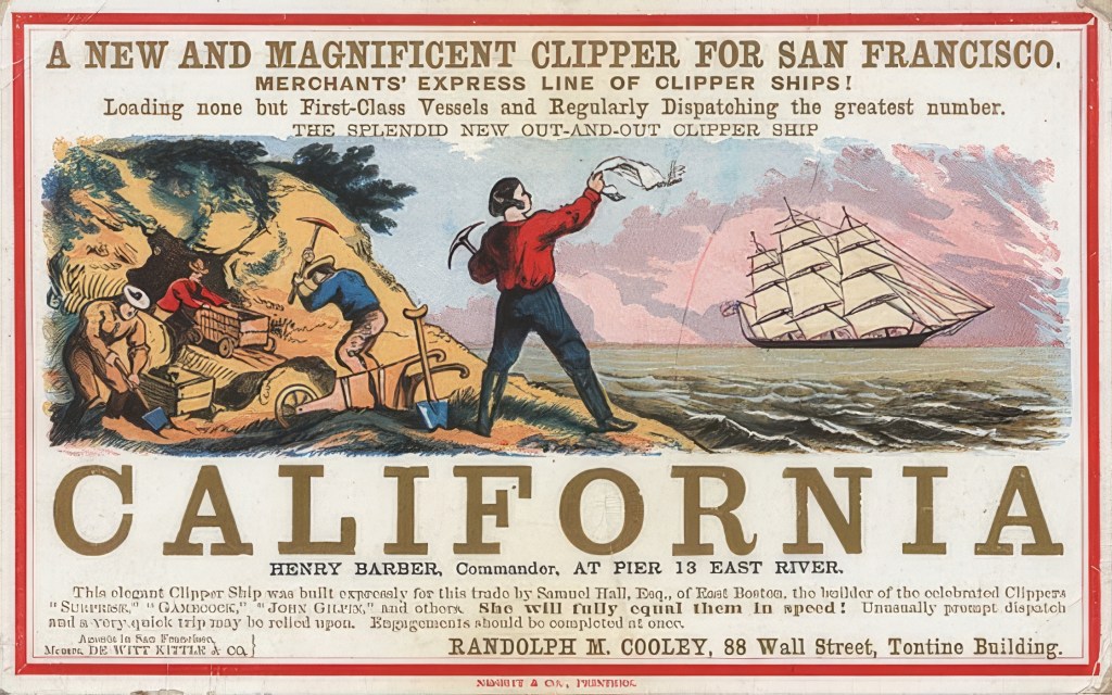
The Gold Rush began in 1848 when gold nuggets were discovered at Sutter’s Mill in Coloma, near Sacramento. Soon after, miners from around the world rushed to California, lured by the promise of riches. But as the easily accessible placer deposits in river beds were quickly exhausted, the miners were forced to develop new, more efficient methods of extraction to mine the deeper and harder-to-reach gold seams. Thus, hydraulic mining – a form of mining that utilized high-pressure water jets to wash away soil and rock, revealing the precious metal underneath – was born.

CALIFORNIA CURATED ART ON ETSY

Purchase stunning art prints of iconic California scenes.
Check out our Etsy store.

Enter: The Innovators

Hydraulic mining in California is inextricably linked with two significant figures: Edward E. Matteson, an entrepreneurial miner, and Anthony Chabot, a young businessman turned water systems innovator. Matteson is credited as the originator of hydraulic mining in 1853, having invented the process out of necessity while trying to extract gold from the gravels of Nevada County, in a site later known as “Blue Tent.”

Matteson’s invention involved directing a powerful stream of water from a makeshift canvas hose onto a hillside, effectively washing away the dirt and gravel to expose the gold underneath. This crude but effective method marked a turning point in gold mining, facilitating the extraction of gold from areas previously deemed unprofitable or inaccessible.

University of California

However, it was Anthony Chabot who took Matteson’s idea and turned it into an industrial-scale operation. Chabot, known as the “Water King,” was a successful entrepreneur who had established multiple water systems in California. Intrigued by Matteson’s invention, he developed the hydraulic nozzle, or “monitor,” in 1855. With this high-pressure water cannon, miners could erode whole mountainsides in their search for gold, making hydraulic mining the most effective and popular method of gold extraction at that time.

The profits from hydraulic mining were enormous. As a result, the state economy boomed and many jobs were created. From 1860 to 1880, California’s mining operations yielded $170 million. San Francisco had more millionaires than New York or Boston. 

The Scourge of the Sierra

From the mid-1850s to the mid-1880s, hydraulic mining reigned supreme in California, especially in the counties of Nevada, Placer, and Yuba, where extensive networks of canals, reservoirs, and sluices were constructed to support the practice. Hydraulic mines became colossal operations, employing hundreds of workers and dislodging millions of tons of earth annually. But this progress came at a tremendous cost to the environment.

California State Library

The enormous water pressure used in hydraulic mining dislodged vast quantities of soil, rock, and debris, collectively referred to as “slickens.” These slickens were often laden with mercury, a neurotoxin used extensively in gold amalgamation processes. Water cannons, such as the one above, were used to wash away earth and mountains to access gold. In the early days of the gold rush, these cannons were small with canvas hoses, but more force was eventually needed. By the 1870s these cannons were anywhere from 13 to 18 feet long and could blast water 500 feet. The rivers of Northern California became choked with these toxic tailings, devastating local ecosystems.

 “I am at a loss to illustrate the tremendous force with which the water is projected from the pipes. The miners assert that they can throw a stream four hundred feet into the air. … Those streams directed upon an ordinary wooden building would speedily unroof and demolish it,” wrote a reporter for the San Francisco Daily Alta.

One notable example is the Yuba River. In its heyday, hydraulic mining along the Yuba generated approximately 685 million cubic yards of debris, enough to bury Manhattan under ten feet of waste. Much of this sediment still remains, hindering river navigation and threatening local wildlife to this day. The Feather and American rivers also bear the scars of this destructive practice.

The Aftermath and Lingering Effects

By the 1870s, the catastrophic consequences of hydraulic mining were impossible to ignore. Downstream communities, most notably Marysville and Sacramento, suffered frequent and devastating floods exacerbated by mining debris. Agricultural lands were rendered useless by layers of sterile slickens, and fish populations in rivers dwindled alarmingly. The long-term health impacts of widespread mercury contamination are still being understood today.

The tension between the mining industry and the downstream farming communities ultimately culminated in the landmark case of Woodruff vs. North Bloomfield Gravel Mining Company in 1884. This case, presided over by Judge Lorenzo Sawyer, resulted in the famous “Sawyer Decision,” which effectively banned hydraulic mining due to its destructive environmental impact.

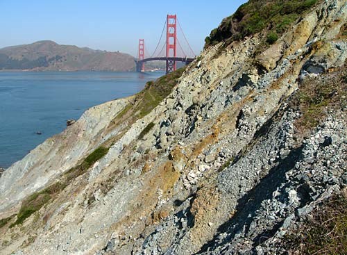
But while the Sawyer Decision marked the end of large-scale hydraulic mining, the scars left on the landscape of Northern California are far from healed. The evidence of this destruction is still visible in the stark, eroded hillsides and vast debris fields of Malakoff Diggins State Historic Park in Nevada County, once the site of California’s largest hydraulic mine.

Wikipedia

Modern research is shedding new light on the enduring impacts of hydraulic mining. A study published in 2022 by the University of California, Davis, found that the mercury used in 19th-century mining operations has had far-reaching effects on the state’s ecosystems. Scientists discovered elevated levels of the neurotoxin in local wildlife, suggesting that the legacy of the Gold Rush continues to impact California’s environment and its inhabitants.

The Sierra Fund has introduced the Resilient Sierra Initiative to address the long-term impacts of mining in the Sierra Nevada. Their research estimates that around 26 million cubic yards of sediment remain trapped in reservoirs, which could be released as the climate changes, potentially increasing the frequency and severity of downstream flooding.

CALIFORNIA CURATED ART ON ETSY

Purchase stunning art prints of iconic California scenes.
Check out our Etsy store.

The advent of hydraulic mining during the California Gold Rush was undoubtedly a milestone in mining technology. It enabled the extraction of enormous amounts of gold and facilitated the growth and development of California. However, this innovation came with a heavy price. The ecological damage caused by hydraulic mining has left indelible marks on the landscape and continues to influence the state’s environment and communities.

Throughout history, humanity has often pursued wealth at the expense of the natural world. While some impacts are minor and fade over time, far too often, we cross a clear line without pausing to reflect on the damage weโ€™re inflicting. Hydraulic mining in California serves as a powerful reminder: that line exists.

More information: KQED Documentary

Maybe You’ve heard of Josiah Whitney, Mt. Whitney’s Namesake

Mount Whitney, the highest mountain in the contiguous United States, is one of the great peaks in California. A wildly popular destination for hikers, climbers, and backpackers, Whitney is located in Inyo National Forest and Sequoia National Park, California.

But how did Mt. Whitney get its name?

โ€œThe culminating peak of the Sierraโ€ was identified in 1864 by a team from the California Geological Survey and named Mount Whitney in honor of the teamโ€™s leader, State Geologist Josiah Whitney. During that same expedition, survey member Clarence King made two attempts to reach the summit but did not succeed.

But Whitney wasnโ€™t the mountainโ€™s only name. When a group of fishermen made the first recorded ascent in 1873, they called it โ€œFishermanโ€™s Peak,โ€ a name that stuck locally for some time before Mount Whitney became the official designation. Long before that, the Indigenous Paiute people called the mountain Too-man-i-goo-yah, meaning โ€œthe very old manโ€ or โ€œthe guardian spirit,โ€ reflecting its towering presence and cultural significance.

Josiah Dwight Whitney was an American geologist and surveyor who made significant contributions to the field of geology in California. Born in Northampton, Massachusetts, in 1819, Whitney became interested in science at an early age and studied geology and mineralogy at Yale University. In 1860, he was appointed the State Geologist of California and founded the California Geological Survey, one of the oldest geological surveys in the nation.

Because gold fever still gripped much of the world at that time, most people assumed Whitney’s work would focus on locating valuable mineral resources, but Whitney instead pursued a broader scientific agendaโ€”paleontology, historical geology, petrology, stratigraphy, and tectonics. He delivered meticulous studies of mineralogy and placed Californiaโ€™s geology within a global framework, prioritizing knowledge over immediate economic gain. The state, unimpressed by his academic approach, eventually cut his funding.

Whitney’s work in California was groundbreaking and helped establish the state as a hub of geological research. He conducted extensive surveys of the state’s natural resources, including minerals, soils, and water sources. He was also instrumental in mapping the state’s topography and geology, including the Sierra Nevada mountain range, where he made several important discoveries.

One of Whitney’s most significant contributions to California’s geology was the discovery of the existence of glacial action in the Sierra Nevada mountains. In 1864, he published a report describing the glacial formations he had observed in the mountains, including the formation of Yosemite Valley, which he attributed to the action of glaciers. This report was groundbreaking at the time and helped establish the study of glacial geology as a major area of research.

In addition to his work as a geologist, Whitney was also a skilled surveyor and cartographer. He was responsible for creating some of the first accurate maps of California, which were used by explorers, settlers, and scientists alike. His maps were highly detailed and included information about the state’s geology, topography, and natural resources.

Photo of the author at the top of Mount Whitney (Heidi Schumann for the New York Times)

In 1875, Whitney was elected to the National Academy of Sciences, and in 1880, he was awarded the Wollaston Medal by the Geological Society of London. Perhaps the most enduring recognition of his work is the fact that the highest peak in the contiguous United States is named after him. Mount Whitney, which stands at 14,505 feet, was named in his honor in 1896.

Whitney’s legacy lives on through the California Geological Survey, which he founded and served as its first director. The survey played an important role in the development of California, providing valuable information about the state’s natural resources and geology. It continues to operate today, providing information and expertise to policymakers, scientists, and the public.

Serpentine is the Geological Gem of California

Serpentine (Wikipedia)

Ask anyone what the California state rock is, and I doubt whether many people would answer correctly. Is it granite, the magnificent slabby stone that creates the sheer face of Half Dome and El Capitan in Yosemite? Is it obsidian, the glinty black stone so favored by some Native American tribes that they would walk hundreds of miles to collect it and bring home to make tools and weapons?

No, the state rock of California is neither of these. The state rock of California is serpentine.

Serpentine is more than just a pretty rockโ€”it tells a fascinating geological story. Found in many parts of California, particularly in the Coast Ranges and the Sierra Nevada foothills, serpentine is a direct link to the deep, dynamic forces that shape the planet. Because it originates from the mantle, serpentine represents a rare glimpse into Earthโ€™s interior, a reminder that what lies beneath us is always in motion. Beyond its aesthetic appeal, serpentine plays an important role in the environment. The soils that develop from serpentine rock are famously inhospitable to many plants due to their high levels of magnesium and low levels of essential nutrients like calcium. Yet, these tough conditions have led to the evolution of specialized plantsโ€”some of which are found nowhere else on Earth. Californiaโ€™s serpentine landscapes, with their sparse but highly adapted plant life, are home to unique ecological communities that have fascinated scientists for decades.

serpentine
A piece of polished serpentine reveals its beauty. (gemstones.com)

Serpentine is formed through the metamorphic process, where pre-existing rocks are transformed into new types under high temperatures, pressures, and chemical processes. Serpentine is primarily composed of hydrous magnesium silicate minerals, such as antigorite, chrysotile, and lizardite (yes, lizardite). Its distinct, vibrant green color and serpent-like appearance make it easily recognizable and intriguing to rock enthusiasts and casual observers alike. It is also widely collected and used as jewelry.

Serpentine is predominantly found in the coastal ranges of California, particularly in the Klamath Mountains and the Sierra Nevada foothills. It is also present in smaller quantities throughout the state. The prevalence of Serpentine in California is a result of the state’s complex geological history, which includes the subduction of oceanic plates beneath the continental North American Plate. This tectonic activity created ideal conditions for the formation of Serpentine. The recognition and study of serpentine in California contributed to the understanding of modern plate tectonic theory.

Serpentine (Wikipedia)

While not considered a precious gemstone, Serpentine holds significant value due to its unique aesthetic and limited distribution. It is often used as an ornamental stone for jewelry, sculptures, and architectural elements. In addition, Serpentine is historically known for its use in carving, particularly by Native American tribes in California. Serpentine’s low hardness and smooth texture make it ideal for intricate carvings and designs. In recent years, Serpentine has gained popularity among collectors and as a decorative addition to gardens and landscaping.

Serpentine was designated as California’s state rock in 1965, thanks to the efforts of state Assemblyman John Knox. This choice was influenced by the rock’s unique beauty, the significant role it played in California’s geological history, and its importance in the state’s mining industry during the late 19th and early 20th centuries. Asbestos, a fibrous mineral found in some forms of Serpentine, was once highly sought after for its heat-resistant properties. However, due to its association with health risks (asbestos is a known carcinogen that has long been associated with lung cancer), the use of asbestos has significantly declined, and current appreciation of Serpentine is largely focused on its aesthetic qualities.

Serpentinite outcrop on the coastal bluffs of the Presidio (National Park Service)

However, the state almost dropped serpentine from its state rock designation due to the high relative quantity of asbestos that serpentine contains. Asbestos occurs naturally in many minerals and in many places. And in fact some serpentine rocks do host chrysotile, a form of asbestos. But geologists say chrysotile is less harmful than some other forms of asbestos and would be a danger โ€” like scores of other rocks โ€” only if a person were to breathe its dust repeatedly.

Fascinatingly, serpentine landscapes host a rare and diverse range of plant species adapted to its high magnesium and low calcium environment, often thriving in soils toxic to other vegetation. This peculiar combination of geology and ecology makes California’s serpentine areas not just a subject of geological interest, but also a haven for biological research, offering insights into how life adapts to extreme conditions.

One well-studied group of organisms are plants that display serpentine endemism, meaning they are specially adapted to survive in these harsh soils. A key adaptation in plants involves tolerating high levels of toxic metals and nutrient deficiencies, which can drive speciation and lead to unique ecological communities. Studies on species like Arabidopsis arenosa have shown that genetic variation plays a crucial role in these adaptations, with gene flow and mutations contributing to their survival strategies in serpentine soilsโ€‹.

Serpentine rock (Wikipedia)

Native Americans in California found a variety of practical and cultural uses for serpentine, a mineral abundant in the state and prized for its unique properties. It was particularly valued for its distinctive greenish color, soft texture, and ability to be easily shaped and polished. These qualities made it a favored material for crafting tools, ornaments, and ceremonial objects. Tribes used serpentine to create beads, pendants, and pipes, all of which could be intricately carved and polished to a smooth finish.

In addition to its practical uses, serpentine held significant spiritual and healing value for some Native American groups. The rock’s cool, smooth surface and striking color were believed to possess special properties, and it was often used in rituals or as a symbol of protection and healing. The association with spiritual energy likely contributed to its use in ceremonies or as amulets meant to bring good fortune or ward off harm.

Serpentine stones available for purchase on Ebay (Ebay)

Serpentine also played a role in trade among tribes. Crafted serpentine objects, such as polished ornaments and ceremonial items, were valuable trade goods. These items could be exchanged for other resources, reflecting the mineral’s cultural and economic importance. The widespread availability of serpentine in California’s unique geological landscape made it an accessible yet valuable material for Native American communities, shaping both their daily lives and spiritual practices.

Serpentine is not just a beautiful rock; it is a symbol of California’s rich geological and cultural heritage. By understanding the origins and significance of Serpentine, we can appreciate the complex processes that have shaped our planet and the remarkable diversity of its natural resources. Furthermore, the presence of Serpentine in California is an excellent example of the interconnectedness of geology, ecology, and human history, as the unique habitats it creates support rare plant species and have inspired the artistic endeavors of numerous cultures throughout time.

The Rich Historical and Geological Past of the Alabama Hills

Mobius Arch in Alabama Hills. Lone Pine, California
The Mobius Arch in the Alabama Hills in California (Erik Olsen)

The drive from Los Angeles north along Highway 395 towards Mammoth Lakes is one of the great road trips in all of California. The drive offers breathtaking views of the Sierra Nevada mountain range, the (much older) White Mountains, the vibrantly picturesque Owens Valley, and the Mojave Desert (which, let’s face it, is kinda boring, especially if you’ve done the drive as many times as I have). The highway winds its way through a diverse range of geological and historical features, making it an ideal destination for road trippers, history buffs, and outdoor enthusiasts alike.

One of the highway’s more magnificent sights is observable when making a left turn up Whitney Portal Road in Lone Pine. Just a few miles up, you will find the magnificent Alabama Hills, a range of hills located in the Owens Valley near the main entrance to Mount Whitney. The hills are known for their unique geological formations, including massive rounded boulders and natural arches, and their rich history and cultural significance.

Scene from Iron Man with Robert Downey Jr. The Alabama Hills stood in for Afghanistan.

The hills are world famous not just for their scenic beauty and appeal to photographers. They have also appeared in more than 700 movie and television productions, including some of the most famous and iconic Westerns ever made. The first film made there was the silent 1920 western โ€œThe Round Up,โ€ starring Roscoe โ€œFattyโ€ Arbuckle.

More recently, several major films made use of the Alabama Hills as exotic backdrops. In addition to Iron Man (2008), where Tony Stark crash-lands after escaping captivity, and Gladiator (2000), where the rugged landscape serves as part of the journey for Maximus, the Alabama Hills has also appeared in:

The Lone Ranger (2013) โ€“ The dramatic landscape contributes to the filmโ€™s adventurous, untamed feel.

Django Unchained (2012) โ€“ Here, the rocky outcrops stand in for the American West, giving a distinctive backdrop to Quentin Tarantinoโ€™s Western.

Tremors (1990) โ€“ The Hillsโ€™ remote, desolate look is a perfect setting for this cult classic monster movie.

Star Trek V: The Final Frontier (1989) โ€“ Alabama Hills doubles as alien terrain in this installment of the sci-fi series.

CALIFORNIA CURATED ON ETSY

Purchase stunning art prints of iconic California scenes.
Check out our Etsy store.

Other earlier films include:

  • “Gunga Din” (1939)
  • “Rio Bravo” (1959)
  • “How the West Was Won” (1962)
  • “The Lone Ranger” (1956-1957 TV series)
  • “Gunsmoke” (1955-1975 TV series)
  • “The Great Train Robbery” (1903, silent film)

A very nice explanation (with lots of visuals) of the area’s Hollywood past can be seen at the Museum of Western Film History in Lone Pine.

Alabama Hills (Erik Olsen)

Geologically, the Alabama Hills are primarily made up of biotite monzogranite, an intrusive igneous rock, rather than metamorphic rock. This type of granite was formed from magma that cooled slowly beneath the Earth’s surface, allowing large crystals of quartz, feldspar, and biotite to develop. The landscape, featuring spherical, egg-shaped, teardrop forms, and natural arches, was sculpted over millions of years through a combination of chemical weathering and wind erosion.

California barrel cactus or desert barrel cactus Ferocactus cylindraceus at the Alabama Hills (Erik Olsen)

One of the most striking aspects of the Alabama Hills is the sharp contrast they present with the neighboring glacially carved ridges of the Sierra Nevada. There are almost 10,000 feet of vertical difference between Mount Whitneyโ€™s majestic granite peaks and the rolling boulders of the Alabama Hills. The Sierraโ€™s jagged, ice-carved peaks seem to rise abruptly from the gentle, rounded contours of the hills. Geologically, both landforms consist of the same granitic rock, but they have been shaped by very different forces. While glaciers carved the high peaks of the Sierra Nevada, creating sharp ridges and deep valleys, the Alabama Hills experienced a slower, more gradual transformation. Erosion by wind, rain, and temperature changes slowly sculpted the monzogranite, creating the unique and surreal formations we see today.

While the geological history of the Alabama Hills is well known, its biology is equally fascinating. At first glance, the landscape may seem inhospitable to life, but a closer inspection reveals a surprisingly diverse ecosystem adapted to the harsh conditions. In recent years, new studies have shed light on the resilience and adaptation strategies of plants and animals in this region.

The Alabama Hills are home to a variety of plant species, many of which have evolved to survive in the dry, rocky soil. Sagebrush, saltbush, and other desert plants dominate the landscape, while prickly cacti add a distinct desert charm. One particularly intriguing plant is Atriplex hymenelytra, commonly known as desert holly, which has adapted to the high-salinity soil by developing silvery leaves that reflect sunlight, reducing water loss and protecting the plant from extreme temperatures.

Atriplex hymenelytra, Desert holly.

Wildlife, too, has found ways to thrive in this rugged terrain. The Alabama Hills are home to numerous bird species, reptiles, and small mammals. Species like the western fence lizard, desert cottontail, and even mountain lions are part of this surprisingly vibrant ecosystem. Birdwatchers can often spot red-tailed hawks, ravens, and sometimes even golden eagles soaring above the hills, taking advantage of the thermal updrafts created by the warm rock surfaces.

Recent studies have added to our understanding of the Alabama Hillsโ€™ unique environment. One particularly interesting research project conducted by ecologists focuses on the role of cryptobiotic soil crustsโ€”thin layers of lichens, mosses, and bacteria that live on the surface of desert soils. These crusts play a critical role in preventing erosion and retaining moisture in arid environments like the Alabama Hills. The study revealed that these soil crusts are more widespread than previously thought, and their destruction by human activity, such as off-road vehicle use, could have significant ecological consequences.

Alabama Hills vegetation (Erik Olsen)

Cryptobiotic crusts act as a protective cover on desert soils, anchoring loose particles and reducing susceptibility to wind and water erosion. When these crusts are damaged, the soil is left vulnerable to erosion, which can lead to large-scale soil loss. This erosion depletes the land of nutrients, reduces soil fertility, and diminishes its ability to support native vegetation.

Additionally, geologists continue to study the impact of erosion and weathering on the Alabama Hillsโ€™ distinctive rock formations. Advances in remote sensing technology have allowed scientists to map the regionโ€™s geological features in more detail than ever before, providing new insights into how these formations developed and how they are likely to change in the future.

The hills were (controversially) named after the CSS Alabama, a Confederate warship that operated during the American Civil War. The name was given to the hills by a group of Confederate sympathizers who were prospecting in the area in the 1860s. Several groups have launched campaigns to change the name to erase its connection with Southern slavery.

Alabama Hills (Erik Olsen)

In addition to their geological and historical importance, the Alabama Hills are also important for their recreational opportunities. The hills offer a variety of outdoor activities such as hiking, rock climbing, and photography. The range of hills is also a popular spot for stargazers and astro-photographers, due to the relatively low light pollution in the region.

The Alabama Hills are a must-see destination for anyone interested in geology, history, or outdoor activities in California.

The Volcanic History of Owens Valley and the Long Valley Caldera

Hot Springs geological site near Mammoth Lakes, California. (Erik Olsen)

Beneath the seemingly calm and serene landscape of the Eastern Sierra in California lies one of the planet’s most explosive features โ€” a volcanic giant that has been slumbering for thousands of years. It’s the Long Valley Caldera, a vast geological structure that stands as a testament to one of the most violent volcanic eruptions in Earth’s recent history.

The caldera sits in the Owens Valley, situated between the towering peaks of the Sierra and the older, but majestic White Mountains. It is renowned globally for its volcanic history. Situated about 3000 miles north of Los Angeles, the Long Valley Caldera was born around 760,000 years ago during a cataclysmic eruption that ejected an estimated 150 cubic miles of material. It was a massive eruption, one of the largest in North American history. To put this into perspective, the 1980 eruption of Mount St. Helens released just about 0.3 cubic miles of material, indicating the colossal magnitude of the Long Valley eruption.

The aftermath of this gigantic eruption formed a vast depression, or caldera, measuring about 200 square miles. This is not a necessarily a unique event in Earth’s history, as there are many similar calderas worldwide, one of the largest in the world being in Yellowstone National Park. What makes the Long Valley Caldera distinctive is the incredible geothermal activity that continues beneath the surface, reminding us of the latent power it holds.

Visit the California Curated store on Etsy for original prints showing the beauty and natural wonder of California.

Inside the caldera, one discovers a geological wonderland that resembles a surreal moonscape, with its otherworldly terrain, bizarre formations, and strikingly barren features. Hot springs and fumaroles, areas where volcanic gases escape from the ground, are scattered across the area. This dynamic geology can be seen at nearby Mammoth Mountain itself, a lava dome complex located on the caldera’s rim. The area also holds an intricate hydrothermal system, with ground temperatures at depth reaching boiling point and more. On April 6, 2006, three members of the Mammoth Mountain ski patrol tragically lost their lives after falling into a volcanic fumarole near the summit. The incident happened while they were conducting safety operations to secure a snow-covered geothermal vent following an unprecedented snowfall.

Over the next several hundred thousand years, the Long Valley Caldera experienced a series of volcanic eruptions, including the formation of several domes and lava flows. The most recent eruption occurred about 600 years ago, creating the Inyo Craters, a group of small cinder cones located on the western edge of the caldera. If you spend much time up in the Eastern Sierra, you will discover that there are fascinating volcanic features everywhere.

One of the most notable features of the Long Valley Caldera is the presence of a magma chamber beneath the caldera floor, located at a depth of about 5 to 10 kilometers (3 to 6 miles), with deeper zones of partially molten rock extending down to 20-30 kilometers (12-18 miles). The magma chamber is responsible for the ongoing geothermal activity in the area, including hot springs and geysers, such as the famous Mono Lake Tufa State Natural Reserve.

The Long Valley Caldera is one of the most active volcanic sites in the United States.
Here, the Owens River flows through it, winding south through Owens Valley.(Erik Olsen)

Volcanism in the region is relatively recent, and it remains extremely active today. Upon entering the town of Mammoth Lakes, there is a small, but steep rise to the East. This area, called the Resurgent Dome, has also uplifted about 80 cm (about 2.5 feet) since 1980.

The current tranquillity of the Long Valley Caldera might deceive the casual observer into thinking that it poses no danger. This assumption is not entirely true. The United States Geological Survey (USGS) closely monitors the caldera due to its high volcanic risk.

In 1980, the region experienced a swarm of strong earthquakes, arousing concern among geologists about possible renewed volcanic activity. Since then, seismic activities have been routinely observed, along with ground deformation โ€” indications that magma might be accumulating underneath. Scientists recently tried to take the temperature of that lava. Here is a more detailed discussion of Long Valley Calderaโ€™s deep and shallow hydrothermal systems.

Sierra reflected in Little Alkali Lake near the Long Valley Caldera (Erik Olsen)

The Long Valley Caldera and Mammoth Mountain are classified as “High Threat” volcanoes by the USGS. The primary concerns are volcanic eruptions and the release of harmful gases, such as carbon dioxide, from the ground. At Horseshoe Lake, near Mammoth Mountain, high concentrations of carbon dioxide escaping from the soil have led to tree die-offs, as the gas displaces oxygen in the root zone. Such an eruption could disrupt local communities, cause significant economic impact due to damaged infrastructure, and affect air travel by releasing ash clouds.

The scenario might seem dire, but it’s crucial to understand that the chances of a massive eruption like the one 760,000 years ago are extremely low. Most potential future eruptions are likely to be smaller events, possibly similar to those experienced at the Mammoth Mountain area.

In addition to its volcanic history, Owens Valley also played an important role in the history of California. In the late 19th and early 20th centuries, the valley was the site of a major water rights dispute between the city of Los Angeles and local farmers and ranchers. The city ultimately won the dispute, and the water from the Owens River was used to fuel the growth of Los Angeles, leading to the displacement of many local residents.

The Long Valley Caldera continues to be a focal point for scientific research and natural wonder. Ongoing studies are uncovering new details about its volcanic past, current geothermal activity, and future potential for eruption. As we deepen our understanding of this dynamic landscape, we also gain valuable insights into the natural processes that shape our world and the potential impacts of climate change. It’s amazing to think that there is so much fascinating geologic activity right here in California, so close to LA. Whether through scientific discovery or personal exploration, the Long Valley Caldera offers a unique window into the powerful forces that govern our planet.

Clair Patterson: The little-known California scientist who may have saved millions of lives.

Clair Patterson. (Courtesy of the Archives, California Institute of Technology)

At Caltech, Clair Patterson’s relentless determination to understand the health impacts of atmospheric lead changed the world for the better.

It started by asking one of the biggest questions of them all: how old is the earth?

One might think that we’ve known the answer to this question for a long time, but the truth is that a definitive age for our planet was not established until 1953, and it happened right here in California.

Some of the earliest estimates of the earth’s age were derived from the Bible. Religious scholars centuries ago did some simple math, synthesizing a number of passages of Biblical scripture and calculated that the time to their present-day from the story of Genesis was around 6,000 years. That must have seemed like a really long time to people back then.

Of course, once science got involved, the estimated age changed dramatically, but even into the 18th century, people’s sense of geologic time was still on human scales, largely incapable of comprehending an age into the billions of years. In 1779, the Comte du Buffon tried to obtain a value for the age of Earth using an experiment: He created a small globe that resembled Earth in composition and then measured its rate of cooling. His conclusion: Earth was about 75,000 years old.

But in 1907, scientists developed the technique of radiometric dating, allowing scientists to compare the amount of uranium in rock with the amount of lead, the radioactive decay byproduct of uranium. If there was more lead in a rock, then there was less uranium, and thus the rock was determined to be older. Using this technique in 1913, British geologist Arthur Holmes put the Earthโ€™s age at about 1.6 billion years, and in 1947, he pushed the age to about 3.4 billion years. Not bad. That was the (mostly) accepted figure when geochemist Clair Patterson arrived at the California Institute of Technology in Pasadena from the University of Chicago in 1952. (Radiometric dating remains today the predominant way geologists measure the age of rocks.)

The Canyon Diablo meteorite was used by Clair Patterson to determine the age of the earth. Credit: Geoffrey Notkin
Canyon Diabloย meteorite. (Photo: Geoffrey Notkin)

By employing a much more precise methodology, and using samples from the Canyon Diablo meteorite, Patterson was able to place the creation of the solar system, and its planetary bodies such as the earth, at around 4.6 billion years. (It is assumed that the meteorite formed at the same time as the rest of the solar system, including Earth). Subsequent studies have confirmed this number and it remains the accepted age of our planet.

Patterson’s discovery and the techniques he developed to extract and measure lead isotopes led one Caltech colleague to call his efforts “one of the most remarkable achievements in the whole field of geochemistry.”

But Patterson was not done.

In the course of his work on lead isotopes, Patterson began to realize that lead was far more prevalent in the environment that people imagined. In the experiments he was doing at Caltech, lead was everywhere.

Image of Clair Patterson in his Caltech lab. Courtesy of the Archives, California Institute of Technology
Clair Patterson at CalTech (Courtesy of the Archives, California Institute of Technology)

โ€œThere was lead there that didnโ€™t belong there,โ€ Patterson recalled in a CalTech oral history. โ€œMore than there was supposed to be. Where did it come from?โ€

Patterson’s discovery was “one of the most remarkable achievements in the whole field of geochemistry.”

Barclay Kamb, California Institute of Technology

Patterson was flummoxed by the large amounts of environmental lead he was seeing in his experiments. It seemed to be everywhere: in the water, air and in people’s hair, skin and blood. Figuring out why this was the case took him the rest of his career.

He found it so hard to get reliable measurements for his earth’s age experiments that he built one of the first scientific “clean rooms”, now an indispensable part of many scientific disciplines, and a precursor to the ultra-clean semiconductor fabrication plants (so-called “fabs”) where microprocessor chips are made. In fact, at that time, Patterson’s lab was the cleanest laboratory in the world.

On the occasion of Clair Patterson receiving the Tyler Prize. The Tyler Prize is awarded for environmental achievement.
(Courtesy of the Archives, California Institute of Technology)

To better understand this puzzle, Patterson turned to the oceans, and what he found astonished him. He knew that if he compared the lead levels in shallow and deep water, he could determine how oceanic lead had changed over time. In his experiments, he discovered that in the ocean’s oldest columns of water, down deep, there was little lead, but towards the surface, where younger water circulates, lead values spiked by 20 times.

Then, going back millions of years, he analyzed microscopic plant and animal life from deep sediments and discovered that they contained 1/10 to 1/100th the amount of lead found at the time around the globe.

Smog in Los Angeles in 1970. (Courtesy of UCLA Library Special Collections – Los Angeles Times Photographic Archive)

He decided to look in places far from industrial centers, ice caves in Greenland and Antarctica, where he would be able to see clearly how much lead was in the environment many years ago. He was able to show a dramatic increase in environmental lead beginning with the start of lead smelting in Greek and Roman times. Historians long ago documented the vast amounts of lead that were mined in Rome. Lead pipes connected Roman homes, filled up bathtubs and fountains and carried water from town to town. Many Romans knew of lead’s dangers, but little was done. Rome, we all know, collapsed. Jean David C. Boulakia, writing in the American Journal of Archaeology, said: โ€œThe uses of lead were so extensive that lead poisoning, plumbism, has sometimes been given as one of the causes of the degeneracy of Roman citizens. Perhaps, after contributing to the rise of the Empire, lead helped to precipitate its fall.โ€

In his Greenland work, Patterson’s data showed a โ€œ200- or 300-fold increaseโ€ in lead from the 1700s to the present day; and, most astonishing, the largest concentrations occurred only in the last three decades. Were we, like the Romans, perhaps on the brink of an environmental calamity that could hasten the end of our civilization? Not if Patterson could help it.

Exterior shot of the California Institute of Technology. Credit: Erik Olsen
California Institute of Technology. Credit: Erik Olsen

That may be far too grandiose and speculative, but there was no doubting that there was so much more lead in the modern world, and it seemed to have appeared only recently. But why? And how?

In a Eureka moment, Patterson realized that the time frame of atmospheric lead’s rise he was seeing in his samples seemed to correlate perfectly with the advent of the automobile, and, more specifically, with the advent of leaded gasoline.

CALIFORNIA CURATED ON ETSY

Purchase stunning art prints of iconic California scenes.
Check out our Etsy store.

Leaded gas became a thing in the 1920s. Previously, car engines were plagued by a loud knocking sound made when pockets of air and fuel prematurely exploded inside an internal combustion engine. The effect also dramatically reduced the engine’s efficiency. Automobile companies, seeking to get rid of the noise, discovered that by adding tetraethyl lead to gasoline, they could stop the knocking sound, and so-called Ethyl gasoline was born. “Fill her up with Ethyl,” people used to say when pulling up to the pump.

Despite what the Romans may have known about lead, it was still an immensely popular material. It was widely used in plumbing well into the 20th century as well as in paints and various industrial products. But there was little action taken to remove lead from our daily lives. The lead in a pipe or wall paint is one thing (hey, don’t eat it!), but pervasive lead in our air and water is something different.

After World War I, every household wanted a car and the auto sales began to explode. Cars were perhaps the most practical invention of the early 20th century. They changed everything: roads, cities, work-life and travel. And no one wanted their cars to make that infernal racket. So the lead additive industry boomed, too. By the 1960s, leaded gasoline accounted for 90% of all fuel sold worldwide.

But there signs even then that something was wrong with lead.

A New York Times story going back to 1924 documented how one man was killed and another driven insane by inhaling gases released in the production of the tetraethyl lead at the Bayway plant of the Standard Oil Company at Elizabeth, N.J. Many more cases of lead poisoning were documented in ensuing years, with studies showing that it not only leads to physical illness but also to serious mental problems and lower IQs. No one, however, was drawing the connection between all the lead being pumped into the air by automobiles and the potential health impacts. Patterson saw the connection.

Ford Model T. Credit: Harry Shipler

When Patterson published his findings in 1963, he was met with both applause and derision. The billion-dollar oil and gas industry fought his ideas vigorously, trying to impugn his methods and his character. They even tried to pay him off to study something else. But it soon became apparent that Patterson was right. Patterson and other health officials realized that If nothing was done, the result could be a global health crisis that could end up causing millions of human deaths. Perhaps the decline of civilization itself.

Patterson was called before Congress to testify on his findings, and while his arguments made little traction, they caught the attention of the nascent environmental movement in America, which had largely come into being as a result of Rachel Carson’s explosive 1962 book Silent Spring, which documented the decline in bird and other wildlife as a result of the spraying of DDT for mosquito control. People were now alert to poisons in the environment, and they’d come to realize that some of the industrial giants that were the foundation of our economy were also having serious impacts on the planet’s health.

Downtown Los Angeles today. (Erik Olsen)

Patterson was unrelenting in making his case, but he still faced serious opposition from the Ethyl companies and from Detroit. The government took half-hearted measures to address the problem. The EPA suggested reducing lead in gasoline step by step, to 60 to 65 percent by 1977. This enraged industry, but also Patterson, who felt that wasn’t nearly enough. Industry sued and the case to the courts. Meanwhile, Patterson continued his research, collecting samples around Yosemite, which showed definitely that the large rise in atmospheric lead was new and it was coming from the cities (in this case, nearby San Francisco and Los Angeles). He analyzed human remains from Egyptian mummies and Peruvian graves and found they contained far less lead than modern bones, nearly 600 times less.

Years would pass with more hearings, more experiments, and the question of whether the EPA should regulate leaded gas more heavily went to U.S. Court of Appeals. The EPA won, 5-4. โ€œManโ€™s ability to alter his environment,โ€ the court ruled, โ€œhas developed far more rapidly than his ability to foresee with certainty the effects of his alterations.โ€

The Clean Air Act of 1970 initiated the development of national air-quality standards, including emission controls on cars.

Drone shot of rush-hour traffic over Los Angeles. Credit: Erik Olsen
Drone over Los Angeles. (Credit: Erik Olsen)

In 1976, the EPA’s new rules went into effect and the results were almost immediate: environmental lead plummeted. The numbers continued to plummet as lead was further banned as a gasoline additive and from other products like canned seafood (lead was used as a sealant). Amazingly, there was still tremendous denial within American industry.

Although the use of leaded gas declined dramatically beginning with the Clear Air Act, it wasn’t until 1986, when the EPA called for a near ban of leaded gasoline that we seemed to finally be close to ridding ourselves of the scourge of atmospheric lead. With the amendment of the Clean Air Act four years later, it became unlawful for leaded gasoline to be sold at all at service stations beginning December 31, 1995. Patterson died just three weeks earlier at the age of 73.

Clair Patterson is a name that few people know today, yet his work not only changed our understanding of the earth itself, but also likely saved millions of lives. When Patterson was finally accepted into the National Academy of Science in 1987, Barclay Kamb, a Caltech colleague, summed his career up thusly: “His thinking and imagination are so far ahead of the times that he has often gone misunderstood and unappreciated for years, until his colleagues finally caught up and realized he was right.”

Clair Patterson is one of the most unsung of the great 20th-century scientists, and his name deserves to be better known.


To learn more about Clair Patterson, read the fascinating oral history from Caltech Archives.

The Majesty and Mystery of California’s Bristlecone Pines

Bristlecone Pine
Bristlecone Pine in the White Mountains (National Park Service)

Lying east of the Owens Valley and the jagged crags of the Sierra Nevadas, the White Mountains rise high above the valley floor, reaching over 14,000 feet, nearly as high as their far better-known relatives, the Sierra Nevadas. Highway 168 runs perpendicular to Highway 395 out of Big Pine and leads up into the mountains to perhaps the most sacred place in California.

Far above sea level, where the air is thin, live some of the most amazing organisms on the planet: the ancient bristlecone pines. To the untrained eye, the bristlecone seems hardly noteworthy. Gnarled and oftentimes squat, especially when compared to the majestic coastal redwoods and giant sequoias living near the coast further west, they hardly seem like mythical beings. But to scientists, they are a trove of information, offering clues to near immortality and to the many ways that the earthโ€™s climate has changed over the last 5,000 years.ย 

In the January 20, 2020 edition of the New Yorker, music writer Alex Ross writes about the trees and the scientists who are trying to unlock the secrets of the bristleconeโ€™s unfathomable endurance. The trees, he writes, “seem sentinel-likeโ€.

Video of ancient bristlecone pine that I shot and put together.

Bristlecones are the longest living organism on earth. The treeโ€™s Latin name is Pinus longaeva, and it grows exclusively in subalpine regions of the vast area known to geologists as the Great Basin, which stretches from the eastern Sierra Nevadas to the Wasatch Range, in Utah. Bristlecones grow between 9,800 and 11,000 feet above sea level, where some people get dizzy and there are few other plants or animals that thrive. The greatest abundance of bristlecones can be found just east of the town of Bishop, California in the Ancient Bristlecone Pine Forest. There, a short walk from where you park your car, you can stroll among these antediluvian beings as they imperceptibly twist, gnarl and reach towards the heavens. 

While most of the bristlecones in the national Ancient Bristlecone Pine Forest are mere hundreds of years old, there are many that are far older. Almost ridiculously so. Methuselah, a Great Basin bristlecone, is 4,851 years old, as measured by its rings, taken by scientists decades ago using a drilled core. Consider that for a moment: this tree, a living organism, planted its tentacle-like roots into the soil some 2000 years before the birth of Christ, around the time that the Great Pyramids of Egypt were built. By contrast, the oldest human being we know of lived just 122 years. That’s 242 human generations passing in the lifetime of a single bristlecone that still stands along a well-trodden trail in the high Sierras. 

Bristlecone and starry sky: National Park Service
National Park Service

That said, if you were to try and see Methuselah for yourself, you are out of luck. The Forest Service is so protective of its ancient celebrity that it will not even share its picture. Whatโ€™s more, itโ€™s probably the case that there are bristlecones that are even older than Methuselah. Scientists think there could be trees in the forest that are over 5,000 years old. 

How the bristlecone has managed this incredible feat of endurance is a mystery to researchers. Many other tree species are prone to insect infestations, wildfires, climate change. In fact, over the last two decades, the vast lodgepole pine forests of the Western United States and British Columbia have been ravaged by the pine beetle. Millions of acres of trees have been lost, including more than 16 million of the 55 million acres of forest in British Columbia.  

But insects donโ€™t seem to be a problem for bristlecones. Bristlecone wood is so dense that mountain-pine beetles and other pests can rarely burrow their way into it. Further, the region where the bristlecones live tends to be sparse with vegetation, and thus far less prone to wildfire. 

Jeff Sullivan
Jeff Sullivan

So how do the trees manage to live so long? 

A recent study by scientists at the University of North Texas looked at the amazing longevity of the ginkgo tree, examining individuals in China and the US that have lived for hundreds, perhaps more than a thousand years. One thing they found is that the treesโ€™ immune systems remain largely intact, even youthful, throughout their lives. It turns out the genes in the cambium, or the cylinder of tissue beneath the bark, contain no โ€œprogramโ€ for senescence, or death, but continue making defenses even after hundreds of years. Researchers think the same thing might be happening in the bristlecone. This is not the case in most organisms and certainly not humans. Like replicants in the movie Blade Runner, we seem to have a built-in clock in our cells that only allows us to live for so long. (I want more life, f$@$@!

Scientists at the University of Arizonaโ€™s Laboratory of Tree-Ring Research (LTRR) have built up the worldโ€™s largest collection of bristlecone cross-sections, which they carefully examine under the microscope, looking for clues about how the trees have managed to survive so long, and how they can inform us of the many ways the earthโ€™s climate has changed over the millennia.

The LTRR houses the nation’s only dendrochronology lab (the term for the study of tree rings), and the researchers there have made several discoveries using tree cores that have changed or confirmed climate models. For example, in 1998, the climatologist Michael E. Mann published the โ€œhockey stick graph,โ€ that revealed a steep rise in global mean temperature from about 1850 onward (i.e. the start of the industrial revolution). There was intense debate about this graph, with many scientists and climate change skeptics saying that Mannโ€™s projections were too extreme. But numerous subsequent studies, some using the treesโ€™ rings new models, confirmed the hockey-stick model. 

Bristlecone Pine

The bristlecones will continue to help us understand the way the earth is changing and to see into the deep human past in a way few other living organisms can do. They also improve our understanding of possible future environmental scenarios and the serious consequences of allowing carbon levels in the atmosphere to continue to grow. 

In this sense, they truly are sentinels.

Bristlecone pine in the White Mountains (Unsplash)

Interestingly, it wasn’t until 1953 that we found out just how ancient these trees are. Credit for this breakthrough goes to Edmund Schulman, a dendrochronologist. Schulman and his colleague Frits Went stumbled upon an ancient limber pine while conducting research in Sun Valley, Idaho. This tree, which they found to be around 1,650 years old, got them thinking: could there be even older trees hidden away in the mountains?

Shulman then traveled to the White Mountains and began a long-term exploration of the Bristlecone forest. He took core samples from many trees and made a startling discovery. At night, at his camp, he began counting the annual growth rings on a slender piece of wood. He counted and counted, not daring to believe what was unfolding before his eyes. When he finally put down his magnifying glass in the enveloping darkness, he had counted rings that went back past the year 2046 BCE. Schulman had stumbled upon a tree that had been alive for over four millennia. Not only alive, but continuing to grow!

Schulman had effectively expanded our understanding of how long a single tree can endureโ€”providing key insights into environmental longevity, climate history, and even the resilience of life on Earth.

Bristlecone forest in the White Mountains of California (Erik Olsen)

In tribute to the momentous find, he dubbed the tree “Pine Alpha,” a name that’s as much a testament to the tree’s age as it is to the groundbreaking nature of Schulman’s work. Until then, no one knew a living tree could be that old. The discovery was a pivotal moment that opened up a new frontier in the study of dendrochronology, and it became a cornerstone example of how trees serve as living records of Earth’s history.

It should be said that the trees themselves, in their gnarled, frozen posture, are truly are beautiful. They should be protected and preserved, admired and adulated. Indeed, Federal law prohibits any attempt to damage the trees, including taking a mere splinter from the forest floor. The trees have also become an obsession for photographers, particularly those who favor astrophotography. A quick search on Instagram reveals a stunning collection of images showing the majesty and haunting beauty of these ancient trees. 

So, if you are ever headed up Highway 395 into the Sierras, it is well worth the effort to make the right-hand turn out of Big Pine to visit the Ancient Bristlecone Pine Forest. The air is thin, but the views are spectacular. And where else can you walk among the oldest living things on the planet?

Note: there is a wonderful video produced by Patagonia on the bristlecones and some of the scientists who study them. Itโ€™s well worth watching.