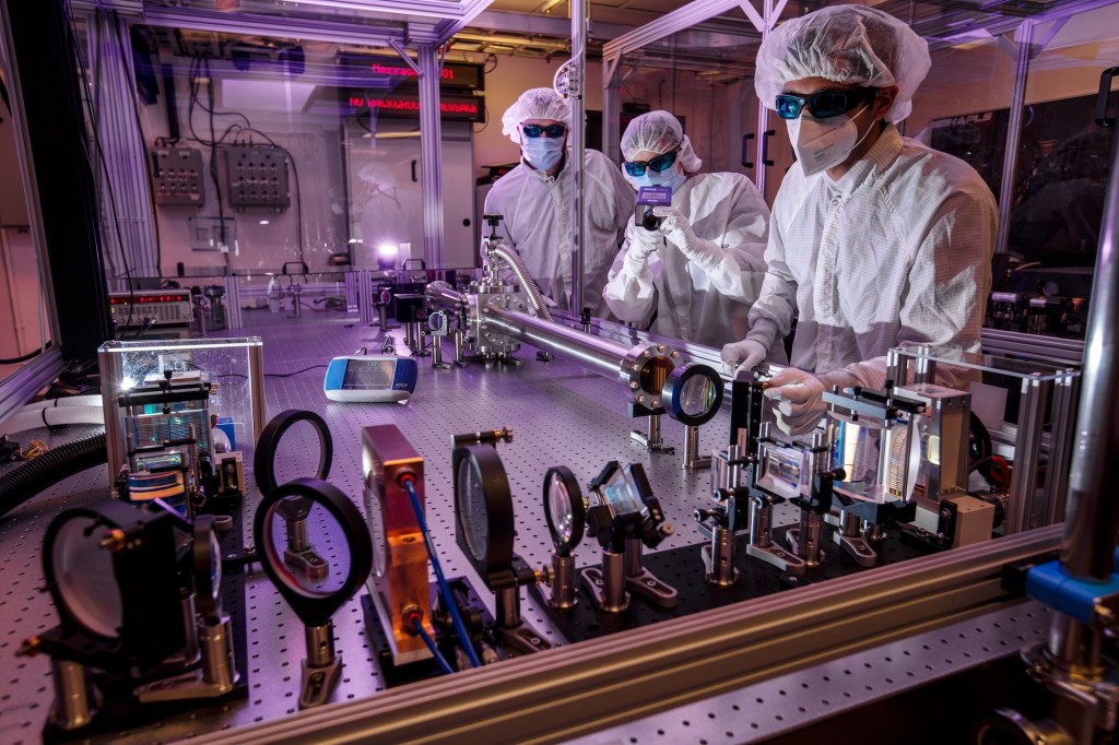
Researchers at Lawrence Livermore National Laboratory working with the Big Aperture Thulium (BAT) laser system, part of the laser and plasma research that laid the groundwork for generating the extreme ultraviolet light at the heart of today’s most advanced chipmaking machines. (Photo: Jason Laurea/LLNL)
When I started this Website, my hope was to share California’s astonishing range of landscapes, laboratories, and ideas. This state is overflowing with scientific discovery and natural marvels, and I want readers to understand, and enjoy, how unusually fertile this state is for discovery. If you’re not curious about the world, then this Website is definitely not for you. If you are, then I hope you get something out of it when you step outside and look around.
I spend a lot of time in the California mountains and at sea, and I am endlessly amazed by the natural world at our doorstep. I am also fascinated by California’s industrial past, the way mining, oil, and agriculture built its wealth, and how it later became a cradle for the technologies and industries now driving human society forward. Of course, some people see technologies like gene editing and AI as existential risks. I’m an optimist. I see tools that, while potentially dangerous, used wisely, expand what is possible.
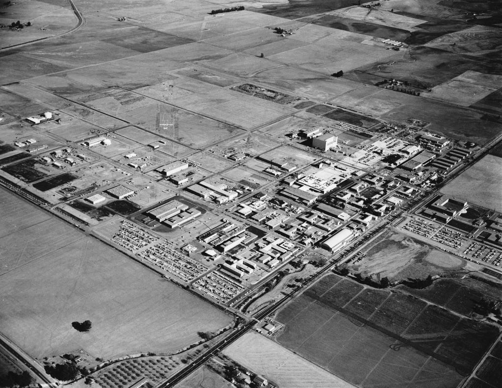
An aerial view of Lawrence Livermore National Laboratory in 1960, when the Cold War spurred rapid expansion of America’s nuclear and scientific research campus east of San Francisco Bay. (Photo: LLNL Public Domain)
Today’s story turns toward technology, and one breakthrough in particular that has reshaped the modern world. It is not just in the phone in your pocket, but in the computers that train artificial intelligence, in advanced manufacturing, and in the systems that keep the entire digital economy running. The technology is extreme ultraviolet lithography (EUV). And one of the most important points I want to leave you with is that the origins of EUV are not found in Silicon Valley startups or corporate boardrooms but in California’s national laboratories, where government-funded science made the impossible possible.
This article is not a political argument, though it comes at a time when government funding is often questioned or dismissed. My purpose is to underscore how much California’s national labs have accomplished and to affirm their value.
This story begins in the late 1980s and 1990s, when it became clear that if Moore’s Law was going to hold, chipmakers would need shorter and shorter wavelengths of light to keep shrinking transistors. Extreme ultraviolet light, or EUV, sits way beyond the visible spectrum, at a wavelength far shorter than ordinary ultraviolet lamps. That short wavelength makes it possible to draw patterns on silicon at the tiniest scales…and I mean REALLY tiny.
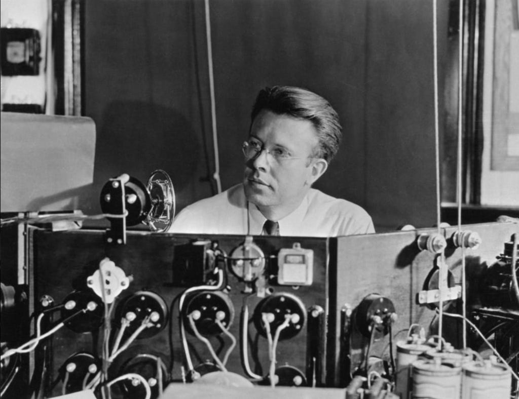
Ernest Orlando Lawrence at the controls of the 37-inch cyclotron in 1938. A Nobel Prize–winning physicist and co-founder of Lawrence Livermore National Laboratory, Lawrence’s legacy in nuclear science and high-energy research paved the way for the laboratory’s later breakthroughs in lasers and plasma physics — work that ultimately fed into the extreme ultraviolet light sources now powering the world’s most advanced chipmaking machines. (LLNL Public Domain)
At Lawrence Berkeley National Laboratory, researchers with expertise in lasers and plasmas were tasked with figuring out how to generate a powerful, reliable source of extreme ultraviolet light for chipmaking. Their solution was to fire high-energy laser pulses at microscopic droplets of tin, creating a superheated plasma that emits at just the right (tiny) wavelength for etching circuits onto silicon.
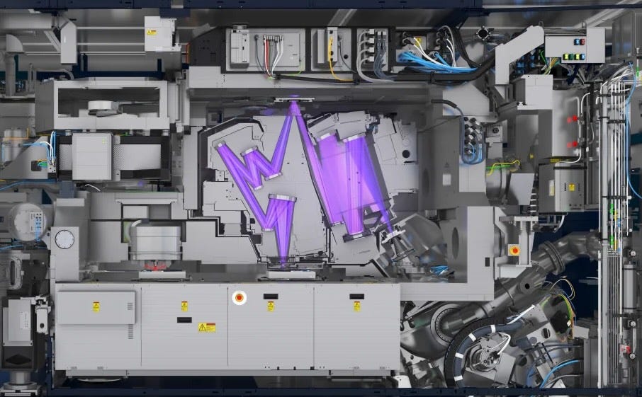
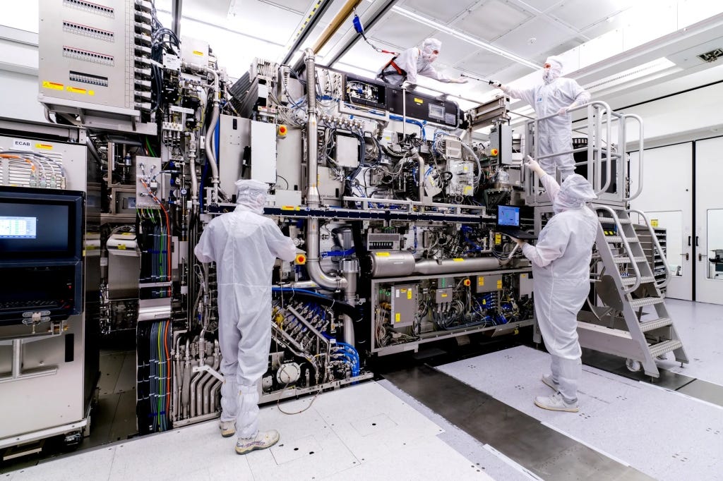
The movement of light on mirrors in an ASML EUV lithography machine. More on it below.
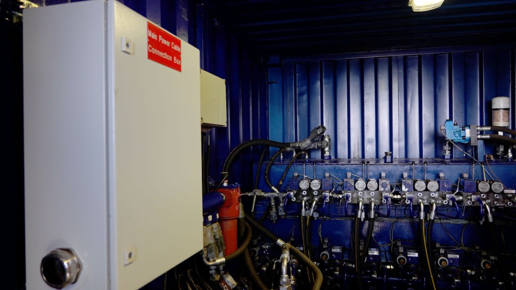
Generating the light was only the first step. To turn it into a working lithography system required other national labs to solve equally daunting problems. Scientists at Berkeley’s Center for X Ray Optics developed multilayer mirrors that could reflect the right slice of light with surprising efficiency. A branch of Sandia National Laboratories located in Livermore, California, worked on the pieces that translate light into patterns. So, in all: Livermore built and tested exposure systems, Berkeley measured and perfected optics and materials, and Sandia helped prove that the whole chain could run as a single machine.
Each EUV lithography machine is about the size of a bus, costs more than $150 million, and shipping one requires 40 freight containers, three cargo planes, and 20 trucks. (Photo: ASML)
It matters that this happened in public laboratories. The labs had the patient funding and the unusual mix of skills to attempt something that might not pay off for many years. The Department of Energy supported the facilities and the people. DARPA helped connect the labs with industry partners and kept the effort moving when it was still risky. There was no guarantee that the plasma would be bright enough, that the mirrors would reflect cleanly, or that the resists (the light-sensitive materials coated onto silicon wafers) would behave. The national labs could take that on because they are designed to tackle long horizon problems that industry would otherwise avoid.
Only later did private industry scale the laboratory breakthroughs into the giant tools that now anchor modern chip factories. The Dutch company ASML became the central player, building the scanners that move wafers with incredible precision under the fragile EUV light. Those systems are now capable of etching transistor features as small as 5 nanometers…5 billionths of a meter. You really can’t even use the “smaller than a human hair” comparison here since human hair variation is so large at this scale as to render that comparison kind of useless. However, many people still do.
The ASML machines are marvels of tech and engineering. Truly amazing feats human design. And they integrate subsystems from all over the world: Zeiss in Germany manufactures the mirrors, polished to near-atomic perfection, while San Diego’s Cymer (now part of ASML) supplies the laser-driven plasma light sources. The technology is so complex that a single scanner involves hundreds of thousands of components and takes months to assemble.
ASML’s EXE:5000 High-NA EUV lithography machine — a room-sized tool that etches the tiniest features on the world’s most advanced computer chips. (ASML)
It was TSMC and Samsung that then poured billions of dollars into making these tools reliable at scale, building the factories that now turn EUV light into the chips powering AI and smartphones and countless other devices. Trillions of dollars are at stake. Some say the fate of humanity lies in balance should Artificial General Intelligence eventually emerge (again, I don’t say that, but some do). All of this grew from the ingenuity and perseverance, along with the public funding, that sustained these California labs.
It’s disappointing that many of the companies profiting most from these technological breakthroughs are not based in the United States, even though the core science was proven here in California. That is fodder for a much longer essay, and perhaps even for a broader conversation about national industrial policy, something the CHIPS Act is only beginning to deal with.
However, if you look closely at the architecture of those monster machines, you can still see the fingerprints of the California work. A tin plasma for the light. Vacuum chambers that keep the beam alive. Reflective optics that never existed at this level before EUV research made them possible.
A photorealistic rendering of an advanced microprocessor, etched in silicon with extreme ultraviolet light — the kind of breakthrough technology pioneered in U.S. national labs, but now fabricated almost entirely in Taiwan, where the future of digital society is being made.
We often celebrate garages, founders, and the venture playbook. Those are real parts of the California story. This is a different part, just as important. The laboratories in Livermore, Berkeley, and Sandia are public assets. They exist because voters and policymakers chose to fund places where hard problems can be worked on for as long as it takes. The payoff can feel distant at first, then suddenly it is in your pocket. Like EUV. Years of quiet experiments on lasers, mirrors, and materials became the hidden machinery of the digital age.
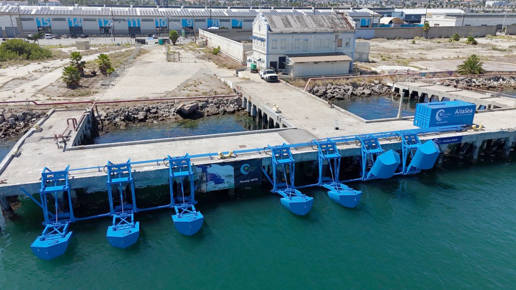
Turning the steady motion of the Pacific into clean electricity, Eco Wave Power’s pilot at the Port of Los Angeles tests whether wave energy can become a real piece of California’s renewable future.
Eco-Wave’s Wave Energy Station at the Port of Los Angeles (Photo: Erik Olsen)
Earlier this week at the Port of Los Angeles, I stood with my colleague Tod Mesirow as a blue ribbon was cut and seven steel floaters dipped into the tide at AltaSea Marine Center in San Pedro. It was a milestone moment: the first onshore wave-energy project in the United States.
Wave energy is the process of converting the up-and-down motion of ocean waves into electricity. Engineers have been experimenting with the idea for decades, with pilot projects around the world, but very little major success. While no country has yet deployed wave power at large scale, efforts like this onshore wave-energy project in the United States aim to prove it can become a reliable part of the renewable mix.
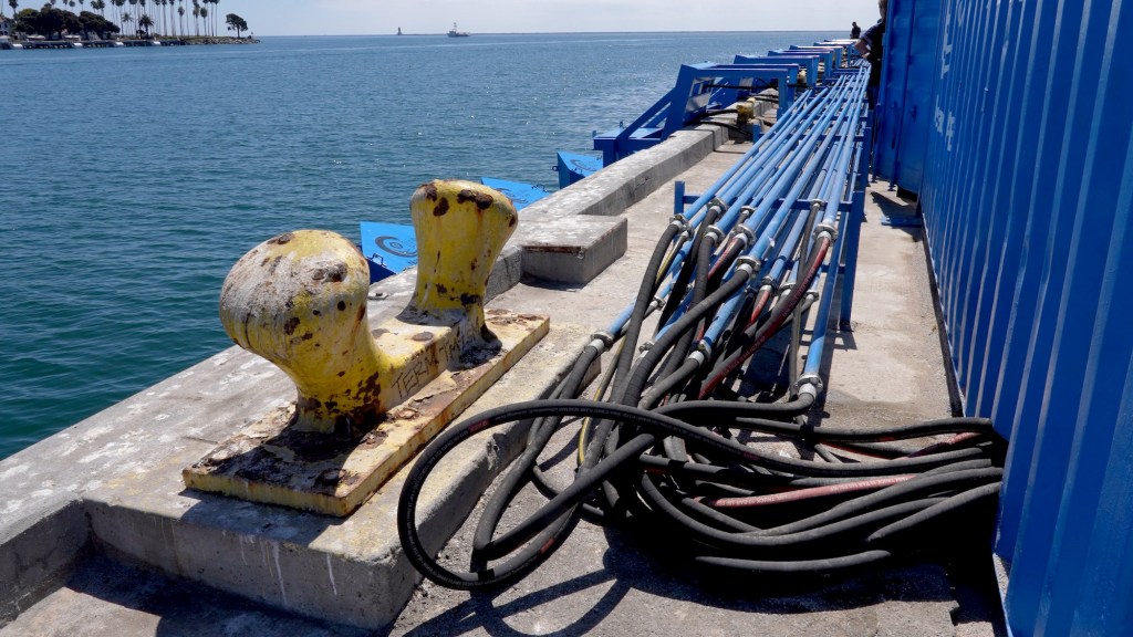
Hydraulic hoses outside the Eco Wave Power container channel pressurized, eco-friendly fluid from the rising and falling floats. This motion drives pistons that power a generator, turning the steady rhythm of small waves along the Port of Los Angeles into clean electricity ready for the grid. (Photo: Erik Olsen)
Eco Wave Power, the company behind the technology, framed the event as the beginning of a new chapter in renewable energy, one that could eventually bring the restless motion of the sea onto the grid on a meaningful scale. As my instagram feed will attest, big waves contain a lot of power (the algorithm knows I love big wave surfing). But that’s not what this project is about. Instead, it relies on the small, steady waves that are almost always present along the California coast. Each rise and fall pushes eco-friendly hydraulic fluid through a system of pistons and pipes, building pressure that drives a motor connected to a generator. The process transforms the ocean’s rhythm into electricity, which can then be fed into the nearby grid. This approach doesn’t depend on dramatic swells, but on the reliable pulse of the sea.
Inna Braverman, the CEO of Eco-Wave told me that the pilot project’s small capacity is a proof of concept for a much larger series of installations along the California coast. “The installed capacity of this conversion unit is 100 kilowatts,” Braverman says. “The amount of power actually generated depends on the height and the weight period of the waves. So, 100 kilowatt installed capacity is up to 100 households.”
The choice of location is not incidental. The Port of Los Angeles is one of the busiest harbors in the world, lined with piers, breakwaters, and aging industrial structures that provide ideal platforms for attaching wave-energy devices. Unlike offshore wind, which requires building foundations in open water, Eco Wave Power’s design capitalizes on existing waterfront infrastructure, keeping costs lower and operations more accessible. The port also happens to be surrounded by electrical infrastructure, with substations and transmission lines nearby. That means energy generated by the floaters can be quickly sent into the grid, without the long and costly buildouts often required for renewable projects in remote places. And perhaps most importantly, this demonstration is unfolding at the doorstep of greater Los Angeles, a region of nearly 19 million people where clean energy demand is immense. To test wave power here is to bring it directly into the heart of a major population center, where its success or failure will matter on a national scale.
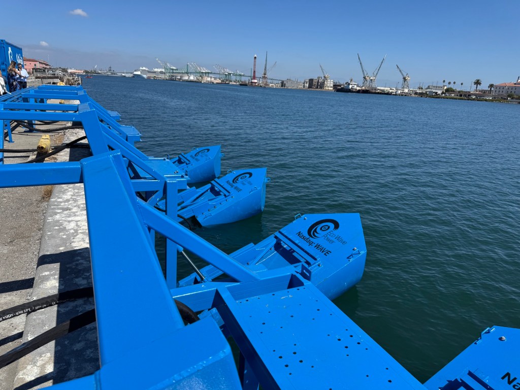
Harnessing the Pacific’s rhythm, Eco Wave Power’s bright blue floats rise and fall along the Port of Los Angeles breakwater, marking the nation’s first onshore wave-energy project and a new experiment in turning ocean motion into clean electricity. (Photo: Erik Olsen)
Congresswoman Nanette Díaz Barragán called the project “history in the making” and tied it to her proposed $1 billion Marine Energy Technologies Acceleration Act, aimed at scaling up wave and tidal systems nationwide. California has already passed Senate Bill 605, directing the creation of a wave-energy roadmap, and local leaders like Port of Los Angeles officials spoke of the technology as a key tool to help the San Pedro Bay port complex reach its zero-emission goal within the next decade.
For Eco Wave Power, this was not just a ribbon cutting but the opening of a U.S. market that has long been cautious about marine renewables. Braverman announced future projects in Taiwan, India, and Portugal, while partners from Africa described feasibility studies in South Africa and Kenya. Taiwan’s pilot at Suao Port could grow to 400 megawatts, while the Port of Ngqura in South Africa is being studied as a showcase for diversifying away from coal.
Inside the power container at the Port of Los Angeles, hydraulic fluid from the rising and falling floats is pressurized to drive a generator, transforming the steady rhythm of the ocean into clean electricity ready to be fed into the grid. (Photo: Erik Olsen)
The optimism is real, but the facts are more sobering. Wave energy has been tested in several places around the globe, often with promising beginnings but mixed long-term outcomes. The Mutriku plant in Spain has generated steady power for more than a decade, but at modest efficiency. Sweden’s Sotenäs project closed after just a few years of operation. The ocean is brutal on hardware: salt, storms, and marine growth wear down even the best-engineered devices. Costs remain high, and grid-scale capacity is far from proven.
Still, the potential is undeniable. The International Energy Agency estimates that global wave and tidal power could, in theory, supply a significant fraction of the world’s electricity needs. Unlike solar or wind, waves are relatively constant, offering a stable, predictable form of renewable generation. That reliability could make wave energy an important complement to other renewables, especially as grids grow more complex and storage remains expensive.
Inna Braverman, founder and CEO of Eco Wave Power, speaks at the ribbon-cutting ceremony at the Port of Los Angeles, celebrating the launch of the nation’s first onshore wave-energy project and highlighting the technology’s potential to turn the ocean’s motion into clean, renewable electricity (Photo: Erik Olsen)
But honesty requires saying wave power will not, on its own, solve the climate crisis. It is a piece of the puzzle, not the whole picture. The bulk of clean energy in the near term will continue to come from solar and wind, with geothermal, hydropower, and nuclear filling important roles. If wave energy finds its footing, it will likely be as a regional player, most valuable in countries with long, energetic coastlines and strong political will to diversify.
Watching the floaters rise and fall yesterday, we could sense the tension between ambition and reality. This pilot is small, but it demonstrates a willingness to try something new, to take the step from research tank to open water. Braverman called it “opening the door to a new era of clean energy.” That door may open slowly, and perhaps only partway, but the act of trying matters. The ocean is vast and restless, and if we can learn to work with it, wave energy could one day be one of the many forces nudging us toward a sustainable future.
Southern California’s beaches are a miracle. More than just landscapes, they’re cultural treasures. In movies, ads, and music, the coastline often feels like its own character. To many of us who live here, the coastline is not just a place to swim or sunbathe but a symbol of freedom, fun, and the state’s enduring connection to the Pacific Ocean.
And let’s face it, the beach would not be the beach without sand.
Pick up some California wildlife gifts at our Etsy store. Seriously, they’re cool.
I didn’t realize how essential sand is until I read Vince Beiser’s The World in a Grain. It quickly became one of my favorite nonfiction books in recent years … and I read a lot of nonfiction. Think about it: without sand, there would be no roads, no skyscrapers, no glass. That means no windows, no windshields, no microscopes or telescopes. No fiber-optic cables. No computer chips, since silicon, the foundation of modern technology, is essentially refined sand. The list is endless. I get that it’s not all beach sand per se, but that’s a quibble.
However, that’s not what I want to focus on here. What struck me, as I was walking along the beach the other day, was a simpler question: where does all the sand on Southern California’s beaches actually come from?
San Gabriel Mountains (Photo: Erik Olsen)
Well, put yourself for a moment on the beach in Southern California. No shoes. It turns out most of the grains between your toes actually began their journey high in the mountains above LA, on craggy slopes far from the shore. Mostly, we are talking about the San Gabriel Mountains and other peaks in the Transverse Ranges that run east-west across Southern California. The rugged, crumbling peaks are made of granite and other crystalline rocks rich in quartz, feldspar, and mica. Through the relentless process of erosion, wind and rain loosen these minerals, which tumble into streams and rivers, such as the San Gabriel and Santa Ana and are carried out to sea. During storms, torrents of sediment rush downhill toward the coast, and that’s where ocean currents take over.
This region where wave action dominates is called the littoral zone (no, not the literal zone), and it is where sand gets pushed around through a process known as longshore drift. Waves arriving at an angle push sediment along the shore, creating a conveyor belt that can carry grains for miles.
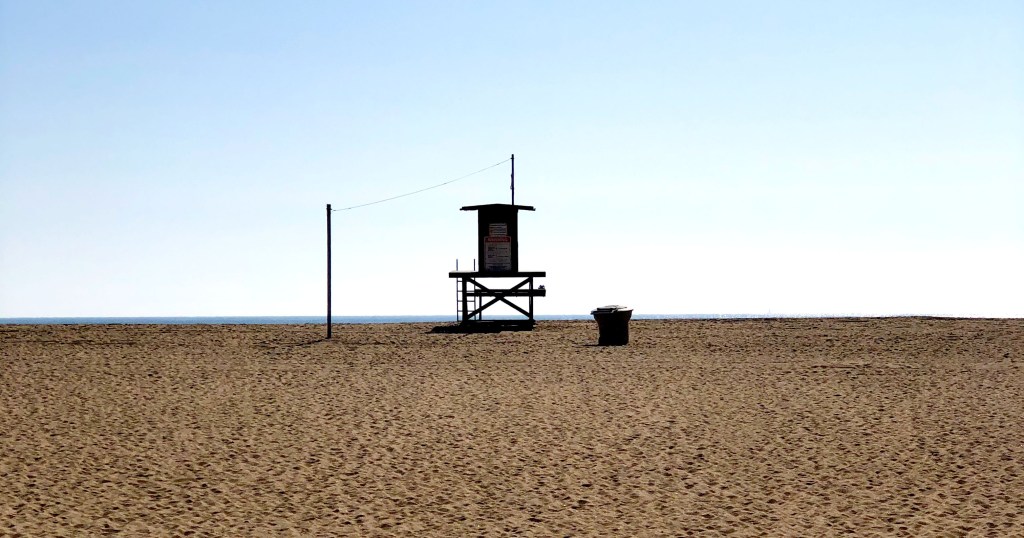
Lifeguard tower in Southern California (Photo: Erik Olsen)
In Southern California, this natural process has been reshaping the shoreline for thousands of years, constantly adding sand to some beaches while stripping it away from others. A lot has changed recently though (I mean “recent” in geologic terms). Humans, as we often do, have f*cked things up a bit, changing the nature of our beaches since the late 1800s. The piece I wrote recently about the Wedge in Newport is a good example. Breakwaters and other “shoreline armoring” built along our coast have altered the movement of sand, sending much of it into deep water where it is lost.
Dams have also cut off a huge portion of sediment that would once have reached the coast, reducing Southern California’s natural sand supply by nearly half. To make up the difference, beach managers spend millions each year dredging sand from offshore deposits or harbor entrances and pumping it onto the shore. We’ve been doing this for nearly a century. Between 1930 and 1993, more than 130 million cubic yards of sand were placed on Southern California beaches, creating wide stretches like Santa Monica and the Silver Strand that are much larger today than they would have been naturally. And if you think this is a temporary thing, forget it. With climate change driving stronger storms and rising seas, the need to keep replenishing sand is only going to grow.
Big Tujunga Dam in Southern California (Photo: Erik Olsen)
For decades, geologists believed that rivers supplied as much as 90 percent of California’s beach sand. That view has shifted. Research from Scripps Institution of Oceanography shows that coastal cliffs also play a huge role on some beaches. Along the stretch from Dana Point to La Jolla, cliff erosion has been shown to contribute about half of the beach-sized sediment, and in some places up to 68 percent. This is especially true in dry years, when rivers deliver less. Still, on a statewide scale, rivers remain the main suppliers of sand. Studies from the California Coastal Sediment Management Workgroup show that, under present conditions, rivers account for about 90 percent of sand reaching Southern California beaches, with bluff erosion contributing roughly 10 percent.
Littoral cells in Southern California (Source: California Coastal Commission)
The sand’s story does not end at the shoreline. California’s coast is divided into littoral cells, essentially self-contained systems with their own sand sources, transport pathways, and sinks. Most sand in Southern California moves north to south, carried by waves arriving from the northwest. Eventually, much of it is lost into submarine canyons like Mugu, Newport, and Redondo, where it drops into deep water and exits the system.
Beach sand can also come from more subtle sources. Shell fragments from marine life, volcanic ash from distant eruptions, and even windblown desert dust can mix into the sediment. Perhaps not surprisingly, in recent decades, scientists have discovered another ingredient in our sand: plastic. Studies at Point Reyes and Golden Gate National Parks found an average of about 140 microplastic particles per kilogram of beach sand, which works out to roughly 50 pieces in a single measuring cup. Even beaches farther south, like Cabrillo, average nearly 40 pieces per kilogram.
Staff collect sand samples at Cabrillo National Monument. Testing revealed that Cabrillo sand had the lowest average concentration of microplastics of all of the West Coast parks studied. Point Reyes and Golden Gate had the highest. (Photo: National Park Service)
Offshore sediment cores show that microplastic deposition has doubled every 15 years since the 1940s, with most fragments being synthetic fibers shed from clothing. These findings show that California’s sand is no longer entirely natural; it now carries the pernicious imprint of modern consumer life, with fragments of plastic woven into its mix of minerals and shells. Interestingly, the concentration of microplastics off the coast of California, where researchers carried out their studies, appears to be lower than in many other parts of the world. “If they were doing the same thing in the Yellow Sea in China, right outside some of the big rivers like the Yangtze and Yellow River, the concentrations would probably be huge and cause adverse effects,” University of Michigan eco-toxicologist Allen Burton told Wired Magazine.
But look, the chance to walk or run on the beach is one of the real gifts of living in California. The sand that sticks to your towel, finds its way into your shoes, or gets stuck into your hair has traveled a long, remarkable journey to reach the shore. It’s true that some of it now includes plastic, which is unfortunate, but that doesn’t diminish the joy of being at the beach. In a world where so much feels fast, fleeting, and digital, there’s something really cool and satisfying about putting your toes in the sand, a remarkable substance that is totally crucial to modern civilization, yet which is also timeless and ancient and part of the natural world around us.
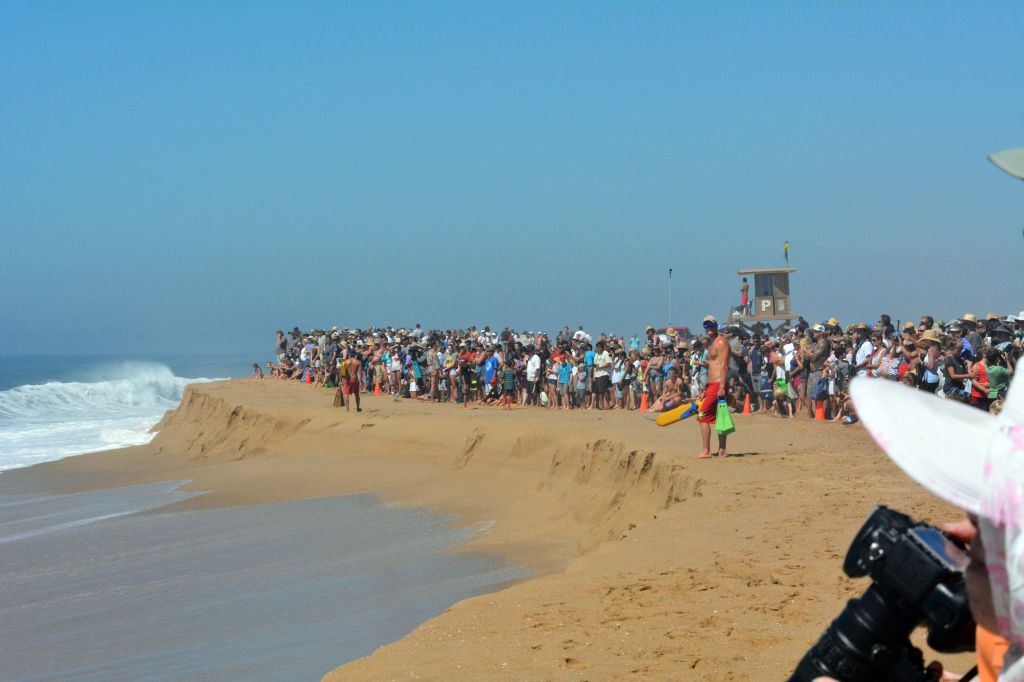
Having spent much of my youth in Newport Beach, my life was shaped by the ocean. I spent countless days in the surf, bodyboarding, bodysurfing, or playing volleyball on the sand with friends. When a southern storm rolled through, we’d rush to Big Corona and throw ourselves into the heavy swells, often getting slammed hard and learning deep respect for the ocean, a respect that I still harbor today. Sometimes the waves were so large they were genuinely terrifying, the kind of surf that would have made my mother gasp, had this not been an era when parents rarely knew what their kids were doing from dawn to dusk. That freedom, especially in Southern California, made the ocean feel like both a playground and a proving ground.
Across the channel at the Newport jetty was where the action was most intense. The surf was bigger, louder. We sat on the sand and held back, watching the brave and sometimes the foolish throw themselves into the water. That place, then and now, is called the Wedge.
The Wedge in Newport Beach, California (Photo: Alex Verharst 2016)
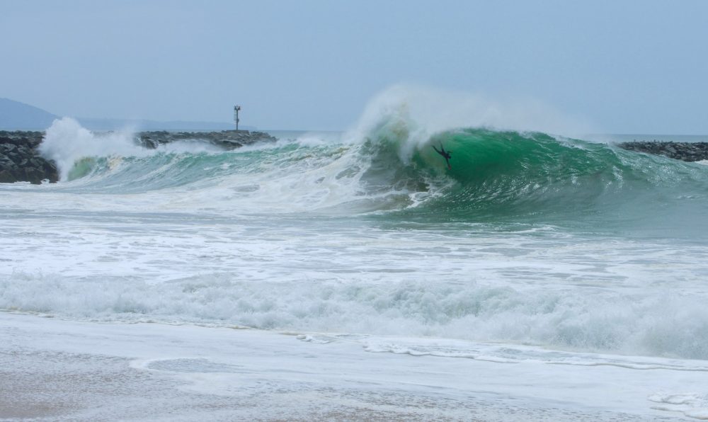
There is something unforgettable about the Wedge and the way its waves crash with such raw force. Sometimes they detonate just offshore, sending water skyrocketing into the air; other times they slam thunderously against the sand, eliciting groans and whoops from bystanders. The waves behave strangely at the Wedge, smashing into one another, often combining their force, and creating moments of exquisite chaos.
These colliding waves are what make the place both spectacular and dangerous, the result of a unique mix of physics and geology that exists almost nowhere else on earth. That combination has made it, to this day, one of the world’s most famous surf and bodysurfing spots. If you want a glimpse of what I mean, just search YouTube, where the insanity speaks for itself. This compilation is from earlier this year.
The Wedge’s origin story begins in the 1930s, when the U.S. Army Corps of Engineers extended Newport Harbor’s West Jetty to protect the harbor mouth from sand buildup and currents. What no one anticipated was that this angled wall of rock would create a perfect mirror for waves arriving from the south and southwest. Instead of dispersing, these waves slam into the jetty and reflect diagonally back toward the shore. The reflected energy doesn’t dissipate, it collides with the next incoming wave. When the two wave crests line up in phase, their energies combine, and the result is a much steeper, taller, and more powerful wave. In physics this is known as constructive interference: two sets of energy stacking into a single, towering peak.
This wave-doubling effect only works under specific conditions. Long-period south swells, often generated by hurricanes off Mexico or storms deep in the South Pacific, line up nearly parallel to the jetty. Their orientation means maximum contact and reflection. Surfers and bodysurfers describe the result as a pyramid-shaped breaker, or wedge, rising steeply before collapsing with extraordinary force. On the biggest days, these waves can reach 20 to 30 feet, twice the size of surrounding surf.
Crowds gather to watch the carnage at The Wedge in Newport Beach (Photo by D Ramey Logan)
Geology and geography make the situation even more dramatic. The seafloor near The Wedge slopes upward very steeply into a narrow strip of beach. Instead of allowing waves to break gradually, the bathymetry forces them to jack up suddenly, creating a thick lip that pitches forward into shallow water. It’s called a shorebreak, and man, they can be dangerous. More on that in a moment.
Unlike classic point breaks such as Malibu, where waves peel cleanly along a gradual reef, The Wedge produces brutal closeouts: vertical walls of water that crash all at once, leaving no escape route.
It actually can get worse. After each wave explodes on the beach, the backwash races seaward, colliding with the next incoming swell and adding more turbulence. Surfers call it chaos; lifeguards call it dangerous, even life-threatening. Spinal injuries, broken bones, and concussions are common at The Wedge. By 2013, the Encyclopedia of Surfing estimated that the Wedge had claimed eight lives, left 35 people paralyzed, and sent thousands more to the hospital with broken bones, dislocations, and other trauma—making it the most injury-prone wave break in the world. A 2020 epidemiological survey places The Wedge among the most lethal surf breaks globally (alongside Pipeline and Teahupo’o), largely due to head-first “over the falls” impacts on the shallow sea floor.
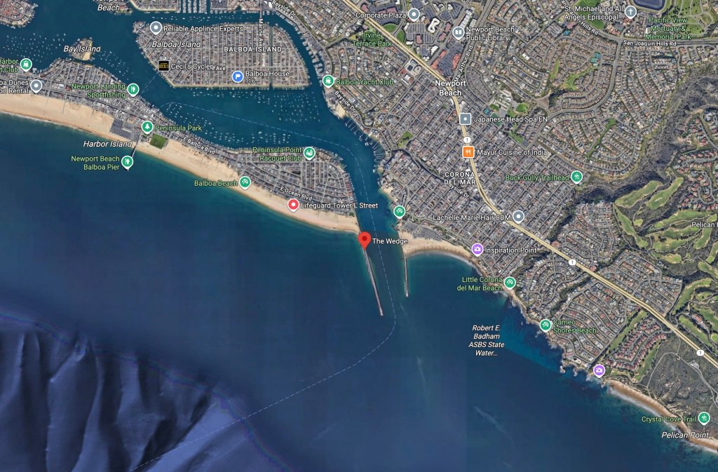
The Wedge in Google Maps
Interesting fact: Long before the Wedge was built, the waves pounding that corner of the Newport Beach jetty were already fierce. In 1926, Hollywood icon John Wayne (then still Marion Morrison) tried bodysurfing there while he was a USC football player. He was slammed into the sand, shattering his shoulder and ending his athletic scholarship. The accident closed the door on his football career but opened the one that led him to Hollywood stardom.
Oceanographers have studied the physics behind the Wedge’s unique surfbreak in broader terms. Research into wave reflection and interference confirms what locals have known for decades: man-made structures like jetties can redirect swell energy in ways that amplify, rather than reduce, wave height. Studies on steep nearshore bathymetry show how sudden shoaling increases the violence of breaking waves. The Wedge combines both effects in one location, making it a rare and extreme case study in coastal dynamics. In other words, yes, it’s gnarly.
Of course, with all that danger comes spectacle, and when the Wedge is firing, it’s not unusual for hundreds of spectators to line the sand and jetty to watch. In August 2025, the California Coastal Commission approved plans for a 200-foot ADA-compliant concrete pathway and a 10-foot-wide viewing pad along the northern jetty, designed to make the experience safer and more inclusive. The project will provide better access for people using wheelchairs, walkers, and strollers, while also giving life guards and first responders improved vantage points when the surf turns chaotic.
I still get to the Wedge on occasion to watch the carnage. And while in my younger years, I might have ventured out to catch a wave or two if the conditions were relatively mellow, today, I prefer the view from shore, leaving the powerful surf to the younger bodysurfers hungry for a rush.
The ocean covers about 70 percent of Earth’s surface and holds 96 percent of its water. But because it’s saturated with salt, it isn’t drinkable. Sailors have known this for centuries, and that’s a profound challenge for California, with more than 800 miles of coastline and a history of drought that has persisted for over two decades despite occasional relief from heavy rains.
Remember those rains?
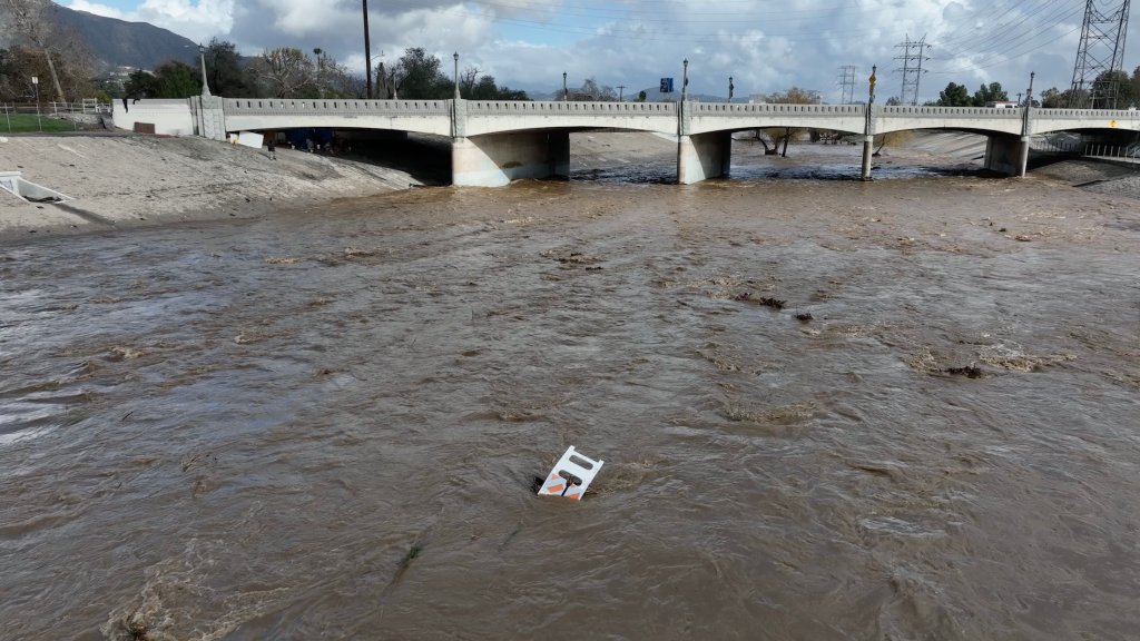
The atmospheric rivers of 2024 in California briefly filled reservoirs and restored snowpack, but drought has already returned to parts of the state, underscoring the state’s precarious water future and fueling renewed debate over desalination as a long-term water solution.
The Los Angeles Rifer flows high following atmospheric river storms in 2024 (Photo: Erik Olsen)
Several regions facing severe drought have turned to desalination with notable success. Israel now supplies up to 40 percent of its domestic water through desalination and is widely recognized as a global leader in technological innovation. In the Gulf, countries like Saudi Arabia, the United Arab Emirates, Kuwait, and Qatar depend heavily on desalinated water, with the region producing roughly 40 percent of the world’s supply of desal. Saudi Arabia’s Ras Al-Khair plant, for example, is the largest hybrid desalination facility in the world. Australia has also invested heavily, with Adelaide’s desalination plant able to provide up to half of the city’s water and ramping up to full capacity during the 2024–2025 drought.
By contrast, California, the world’s fourth-largest economy, continues to struggle with recurring droughts despite some relief from those recent rains.
Many new projects are underway to recycle and store water, but desalination remains an important option that could play a larger role in how California manages supplies for its residents and farmers. For now, the state has only a handful of desalination plants, with just two operating at significant scale, leaving California far behind global leaders.
The Piggyback Yard rail site in Los Angeles, long used for freight operations, is now at the center of a proposal to transform the space into a massive stormwater capture and storage project. (Photo: Erik Olsen)
California will keep bouncing between wet and dry years, and that reality has pushed seawater and brackish-water desalination from a thought experiment into a real, if specialized, tool. It’s a big deal: The promise is reliable “drought-proof” supply. The tradeoffs are clear: high costs, heavy energy demands, and the challenge of careful siting. California has pushed the frontier of desalination technology, but it remains far from being an integral or dependable part of the state’s supply. Many observers doubt it ever will be.
But let’s take a look at where we are.
Desalination is already part of daily life in a few places. The 50-million-gallon-per-day Claude “Bud” Lewis Carlsbad Desalination Plant supplies roughly a tenth of the San Diego region’s potable demand, making it the largest seawater desalination facility in the United States. Water from Carlsbad is reliable during drought, but that reliability carries a premium: Recent public figures put its delivered cost in the low-to-mid $3,000s per acre-foot, higher than most imported supplies when those are plentiful. Even advocates frame the key tradeoff as price and energy intensity in exchange for certainty.
Rules matter as much as membranes. Since 2015, California has required new ocean desal plants to use the best available site, design, technology, and mitigation measures to minimize marine life mortality at intakes and to limit brine impacts at outfalls. These standards make facilities gentler on the ocean and they shape where plants can be built and what they cost. But it’s complicated.
The permitting bar is real, some say too onerous. In May 2022 the California Coastal Commission unanimously denied the proposed Huntington Beach seawater desalination plant after staff raised concerns about high costs, harm to marine life from an open-ocean intake, exposure to sea-level rise, and a lack of demonstrated local demand. That decision did not end desalination, but it clarified where and how it can pencil out. The same year, the Commission unanimously approved the smaller Doheny project in Dana Point because it uses subsurface intake wells and showed stronger local need and siting.
The Seawater Desalination Test Facility in Port Hueneme, Ventura. (Photo: John Chacon / California Department of Water Resources)
Doheny is frequently described as a late-2020s project, but its official timeline has slipped as partners and financing have taken longer to come together. That’s so California. The South Coast Water District has projected completion and operations in 2029, with key procurement milestones running through 2025. Given California’s regulatory climate, I’d say these dates are optimistic rather than bankable.
Elsewhere on the coast, the California American Water project for the Monterey Peninsula cleared a major hurdle in November 2022. Designed to add about 4.8 million gallons per day and pair with recycled water to replace over-pumping groundwater (a huge issue), it underscored desal’s role where other options are limited. In August 2025, the CPUC projected a 2050 supply deficit of 815 million gallons per year and cleared the way for construction to begin by year’s end. So, yeah. We’ll see.
Project site map of the Doheny Ocean Desalination Project (South Coast Water District)
Desalination is not only ocean-sourced. Several California systems quietly run on brackish water, which is less salty and cheaper to treat than seawater. Antioch’s brackish plant on the San Joaquin River is designed for about 6 million gallons per day to buffer the city against salinity spikes during drought. It was slated to come online this year, but operations have yet to begin (at least, I could not find any new info to this effect). Up the coast, Fort Bragg installed a small reverse-osmosis system in 2021 to deal with high-tide salt intrusion in the Noyo River during critically low flows, and it has piloted wave-powered desal buoys for emergency resilience.
Santa Barbara’s Charles E. Meyer plant was reactivated in 2017 after years in standby and now functions as a reliability supply the city can dial into. In 2024 it contributed a meaningful slice of deliveries.
These are targeted, local solutions, not silver bullets, and that is the point.
Energy remains the biggest driver of desalination costs. Even with modern technology cutting usage to 2.5 to 4 kilowatt-hours per cubic meter, desal still requires far more power and therefore higher expense than water recycling or imported supplies. Beyond cost, desalination also brings added challenges, from greenhouse gas emissions tied to electricity use to the disposal of concentrated brine back into the ocean.
Santa Barbara’s Charles E. Meyer plant (City of Santa Barbara)
But the reality today is that the biggest additions to statewide water supply are coming from large-scale potable reuse, aka recycling. San Diego’s Pure Water program begins adding purified water to the drinking system in 2026 and scales toward about 83 million gallons per day by 2035. Metropolitan Water District’s Pure Water Southern California is planning up to roughly 150 million gallons per day at full build-out. These projects do not replace desal everywhere, but they change the calculus in big metro areas by creating local, drought-resilient supplies with generally lower energy and environmental footprints.
With most desalination projects carrying steep costs, success may hinge on innovation. Several new approaches now being tested in California waters are showing early promise. In 2025, OceanWell began testing underwater desalination pods in a reservoir near Malibu. These cylindrical units are designed to test how membranes perform when microorganisms are present in the water, since bacteria and algae can grow on the surfaces and form biofilms that clog the system.
A drawing of OceanWell’s underwater desalination pod system (OceanWell)
The longer-term vision is “water farms” made up of subsea pods tethered 1,300 feet down, where natural hydrostatic pressure does much of the work. Each pod could produce up to a million gallons of fresh water per day with roughly 40 percent less energy than a conventional onshore plant. Because the brine would be released gradually at depth, the approach could also reduce ecological impacts. OceanWell has said its first commercial-scale project, called Water Farm 1, could be operating by 2030 if tests and permitting go as planned. It’s interesting, for sure, but in the end, we’re talking long-shot here.
Big picture, desalination works best as a specialty tool—it’s not the answer everywhere, but it can be a game-changer in the right spots. Think coastal towns with little groundwater, islands or peninsulas with fragile aquifers, or inland areas that get hit with salty water now and then. California’s rules now push projects toward gentler ocean intakes and better brine disposal, but the real strategy is a mix: conservation, stormwater capture, groundwater banking, recycled water, and just the right amount of desal. Those huge atmospheric river storms are not predictable. Who knows if we’ll get another next year or the year after that? The next drought will come, and the communities that invested in a full toolkit will be the ones that hold up the best.
Hey readers — we’re working on ways to keep California Curated going, and one new effort is our Etsy shop. It’s filled with science-inspired fish and bird designs that make great gifts for friends, family, or even yourself. Check it out and help support our work!
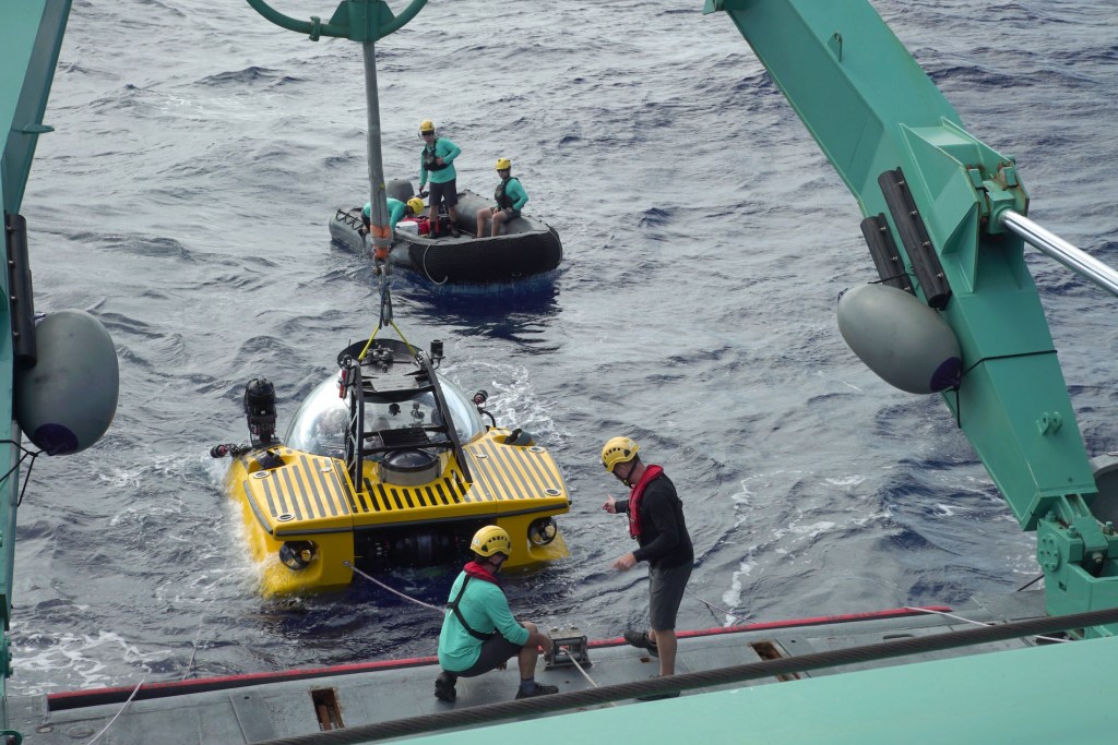
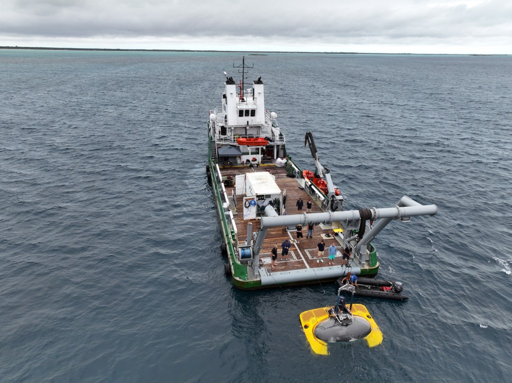
It’s time for California to put people back in the deep. A human-occupied submersible belongs in California waters, and we’ve waited long enough.
For decades, the state had a strong human-occupied submersible presence, from Navy test craft in San Diego to long-serving civilian science HOVs like the Delta. Those vehicles have been retired or relocated, leaving the West Coast without a single home-based, active human-occupied research submersible (I am not counting OceanGate’s Titan sub for numerous reasons, like the fact it was based in Seattle, but foremost is it was not “classed,” nor was it created for scientific use). Restoring that capability would not only honor California’s legacy of ocean exploration but also put the state back at the forefront of direct human observation in the deep sea. The time has come.
Side note: I’ve had the rare privilege of diving beneath the waves in a submersible three times in three different subs, including one descent to more than 2,000 feet with scientists from the Woods Hole Oceanographic Institution. Without exaggeration, it stands among the greatest experiences of my life.
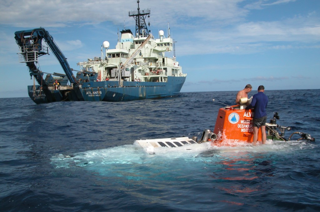
The United States once had a small fleet of working research HOVs. Today it has essentially one deep-diving scientific HOV in regular service: Alvin, operated by Woods Hole Oceanographic Institution (WHOI) for the National Deep Submergence Facility. Alvin is magnificent, now upgraded to reach 6,500 meters, but it is based on the Atlantic (in Massachusetts) and scheduled years in advance at immense cost.
The human-occupied submersible Alvin surfaces during the 2004 “Mountains in the Sea” Expedition, returning from a dive to explore deep seamount habitats teeming with corals, sponges, and other rarely seen marine life. (Photo: NOAA, Public Domain)
It helps to remember how we got here. The Navy placed Alvin in service in 1964, a Cold War investment that later became a pillar of basic research, investigating hydrothermal vents, shipwrecks and underwater volcanoes, among many, many other accomplishments. Over six decades of safe operations, Alvin has logged thousands of dives and undergone multiple retrofits, each expanding its depth range. Now rated to 6,500 meters, it can reach 98 percent of the ocean floor. WHOI’s partnership model with the Navy and universities shows exactly how public investment and science can reinforce each other. But Alvin is based on the East Coast: all that capability, history, and expertise is thousands of miles away. California needs its own Alvin. Or something even better…and perhaps cheaper. Though by cheaper I do not mean less safe.
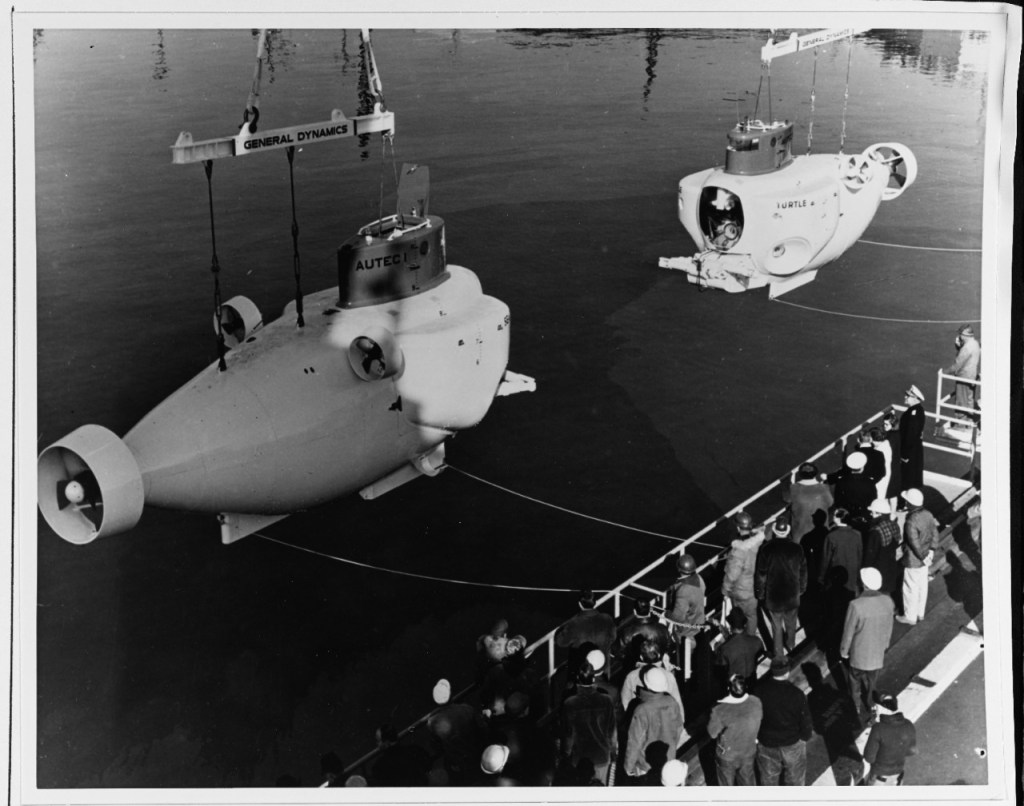
For a time, California actually had multiple HOVs. The Navy fielded sister craft to Alvin, including Turtle and Sea Cliff. Both Turtle and Sea Cliff spent their careers with Submarine Development Group ONE in San Diego. Turtle was retired in the late 1990s, and Sea Cliff, launched in 1968 and later upgraded for greater depths, also left service by the end of that decade, ending the Navy’s home-ported HOV presence on the West Coast.
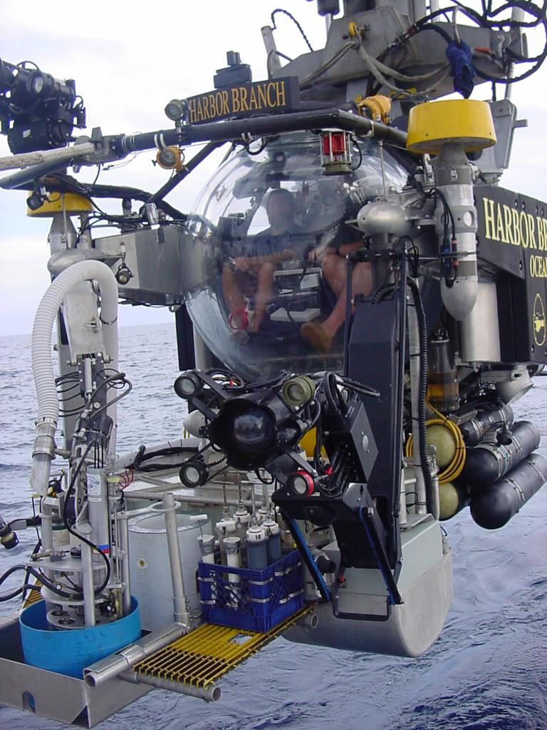
On the Atlantic side, Harbor Branch’s two Johnson Sea Link HOVs supported science and search-and-recovery work for decades before the program ended in 2011 due to funding constraints and shifting research priorities. I’ve interviewed renowned marine biologist Edith Widder several times, and she often speaks about how pivotal her dives in the Johnson Sea Link submersibles were to her career studying animal bioluminescence.
“Submersibles are essential for exploring the planet’s largest and least understood habitat, ” Widder told me. “A human-occupied, untethered submersible offers an unmatched window into ocean life, far surpassing what remotely operated vehicles can provide. ROVs, with their noisy thrusters and blazing lights, often scare away marine animals, and even the most advanced cameras still can’t match the sensitivity of the fully dark-adapted human eye for observing bioluminescence.”
In the central Pacific, the University of Hawaiʻi’s HURL operated Pisces IV and V for much of the 2000s and 2010s, then suspended operations amid funding and ship transitions. Through attrition and budget choices, the working U.S. fleet shrank from a handful to essentially one deep-diving research HOV today.
Manned submersibles are costly to build and operate, and they demand specialized crews, maintenance, and support ships or platforms. It’s easy to list reasons why California shouldn’t invest in a new generation of human-occupied subs. But that mindset has kept us out of the deep for far too long. It’s time to turn the conversation around and recognize why having one here would be a transformative asset for science, education, and exploration.
The Seacliff and Turtle submersibles (Photo: U.S. Naval History and Heritage Command photo. Public Domain)
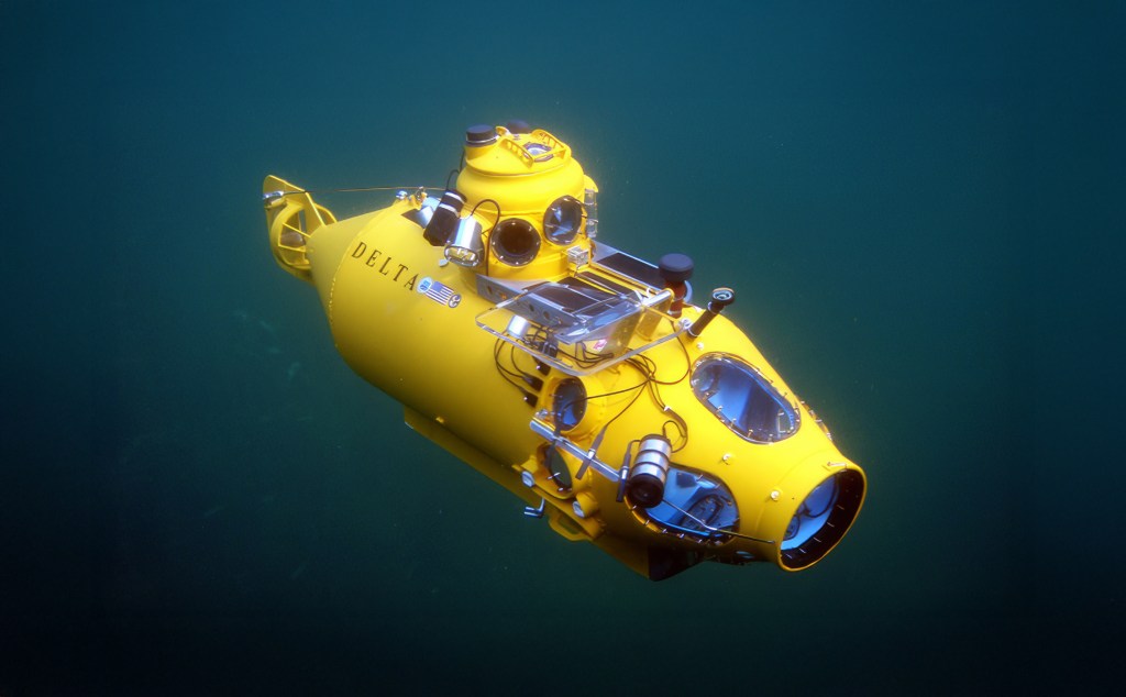
California’s own human-occupied sub legacy is short, but notable. In addition to the Navy submersibles noted above, the Delta submersible, a compact, ABS-class HOV rated to about 1,200 feet, operated from Ventura and later Moss Landing, supporting dozens of fishery and habitat studies from the Southern California Bight to central California. Built by Delta Oceanographics in Torrance, Delta dives in the mid-1990s produced baseline data that still underpin rockfish management, MPA assessments, and predictive habitat maps. The sub’s ability to place scientists directly on the seafloor allowed for nuanced observations of species behavior, habitat complexity, and human impacts that remote tools often miss. Many of these datasets remain among the most detailed visual records of California’s deeper reef ecosystems.
The Monterey Bay Aquarium Research Institute (MBARI) operates a world-class research fleet with a robust remotely operated vehicle (ROV) program, but no human-occupied vehicle—a strategic decision the institute made years ago in favor of robotics over direct human dives. (Photo: Erik Olsen)
In the late 1990s, the program shifted north to Moss Landing, where it was operated in partnership with the Monterey Bay Aquarium Research Institute (MBARI) and other institutions. At the time, MBARI was still in the early years of exploring human-occupied vehicles, like Bruce Robison’s experience piloting the Deep Rover HOV in Monterey Canyon in 1985. To many at MBARI, human occupancy in submersibles began to seem more like a luxury than a necessity. If the goal was to maximize scientific output and engineering innovation, remotely operated vehicles offered longer bottom times, greater payload capacity, and fewer safety constraints. That realization drove MBARI to invest heavily in ROV technology, setting the stage for a long-term move away from human-occupied systems.
Which leads us to the present moment: California’s spectacular coast faces mounting environmental threats, just as public interest in ocean science wanes. And yet, we have no human-occupied research submersible, no way for scientists or the public to directly experience the deep ocean that shapes our state’s future.
The Delta submersible, once a workhorse of California’s deep-sea research with over 5,800 dives, operated from Ventura and later Moss Landing between the 1980s and 2000s. Sold in 2011 in a non-functional state, it remains out of service—symbolizing the end of the state’s home-ported human-occupied submersible era.
Look, robots are incredible. MBARI’s ROVs and AUVs set global standards, and they should continue to be funded and expanded. But if you talk to veteran deep-sea biologists and geologists, they will tell you that being inside the environment changes the science.
Dr. Adam Soule, chief scientist for Deep Submergence at the Woods Hole Oceanographic Institution (WHOI) agrees, “Having a human presence in the deep sea is irreplaceable. The ability for humans to quickly and efficiently process the inherently 3D world around them allows for really efficient operations and excellent sampling potential. Besides, there is no better experience for inspiring young scientists and for ensuring that any scientist can get the most out of unmanned systems than immersing themselves in the environment.”
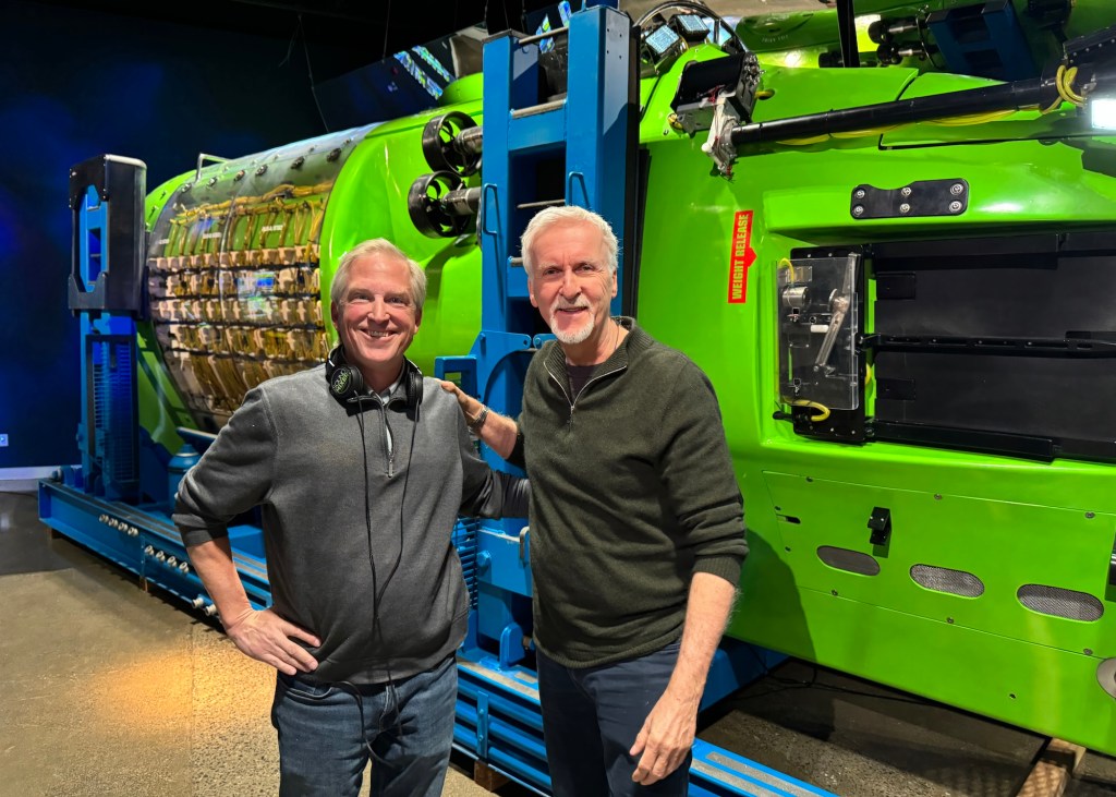
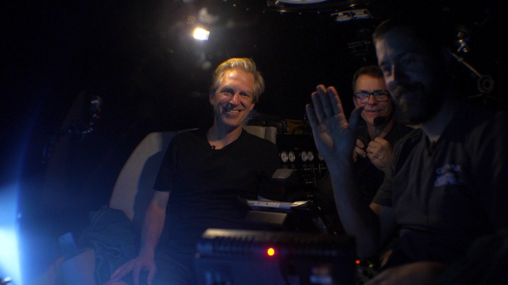
Some of our most prominent voices are also speaking out about the need to explore the ocean. I recently produced an hour-long episode of the PBS science program NOVA and one episode was about the new generation of submersibles being built right now by companies like Florida-based Triton Submarines. I had the privilege of talking to filmmaker and ocean explorer James Cameron, who was adamant that human participation in ocean exploration is critical to sustaining public interest and political will.
“The more you understand the ocean, the more you love the ocean, the more you’re fascinated by it, and the more you’ll fight to protect it,” Cameron told me.
The author with James Cameron in front of his submersible the Deepsea Challenger. (Erik Olsen)
Human eyes and brains pick up weak bioluminescence out of the corner of vision, pivot to follow a squid that just appeared at the edge of a light cone, or decide in the moment to pause and watch a behavior a diving team has never seen before. NOAA’s own materials explain the basic value of HOVs this way: you put scientists directly into the natural deep-ocean environment, which can improve environmental evaluation and sensory surveillance. Presence is a measurement instrument.
California is exactly where that presence would pay off. Think about Davidson Seamount, an underwater mountain larger than many national parks, added to the Monterey Bay National Marine Sanctuary because of its ancient coral gardens and extraordinary biodiversity. We know this place mostly through ROVs, and we should keep using them, but a California HOV could carry sanctuary scientists, MBARI biologists, and students from Hopkins Marine Station or Scripps into those coral forests to make fine-scale observations, sample with delicacy, and come home with stories that move the public. Put a student in that viewport and you create a career. Put a donor there and you create a program.
A time-lapse camera designed by MBARI engineers allowed researchers to observe activity at the Octopus Garden between research expeditions. (Photo: MBARI)
Cold seeps and methane ecology are another natural fit. Off Southern California and along the borderlands there are active methane seep fields with complex microbial and animal communities. Recent work near seeps has even turned up newly described sea spiders associated with methane-oxidizing bacteria, a striking reminder that the deep Pacific still surprises us. An HOV complements ROV sampling by letting observers linger, follow odor plumes by sight and instrument, and make rapid, in-situ decisions about fragile communities that are easy to miss on video. That kind of fine-grained exploration connects directly to California’s climate priorities, since methane processes in the ocean intersect with carbon budgets.
There are practical use cases all over the coast. A California HOV could support geohazard work on active faults and slope failures that threaten seafloor cables and coastal infrastructure. It could conduct pre- and post-event surveys at oil-and-gas seep sites in the Santa Barbara Channel to ground-truth airborne methane measurements. It could document deep-water MPA effectiveness where visual census by divers is impossible. It could make repeated visits to whale falls, oxygen minimum zone interfaces, or sponge grounds to study change across seasons.
An autonomous underwater craft used to map DDT barrels on the seafloor off California. (Photo: Scripps Institution of Oceanography at U.C. San Diego)
It could also play a crucial role in high-profile discoveries like the recent ROV surveys that revealed thousands of corroding barrels linked to mid-20th-century DDT dumping off Southern California. Those missions produced stark imagery of the problem, but a human-occupied dive would have allowed scientists to make on-the-spot decisions about barrel sampling, trace-chemical measurements, and sediment core collection, as well as to inspect surrounding habitats for contamination impacts in real time. The immediacy of human observation could help shape quicker, more targeted responses to environmental threats of this scale.
And it’s not just the seafloor that matters. Some of the most biologically important parts of the ocean lie well above the bottom. The ocean’s twilight zone, roughly 200 to 1,000 meters deep, is a vast, dimly lit layer that contains one of the planet’s largest reservoirs of life by biomass. (My dive with WHOI was done to study the ocean’s twilight zone). Every day, trillions of organisms participate in the planet’s largest migration, the diel vertical migration, moving up toward the surface at night to feed and returning to depth by day. This zone drives global carbon cycling, supports commercial fish stocks, and is home to remarkable gelatinous animals, squid, and deepwater fishes that are rarely seen in situ.
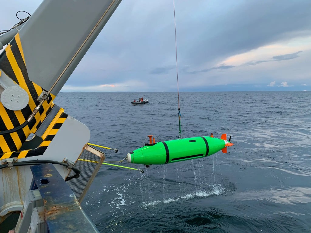
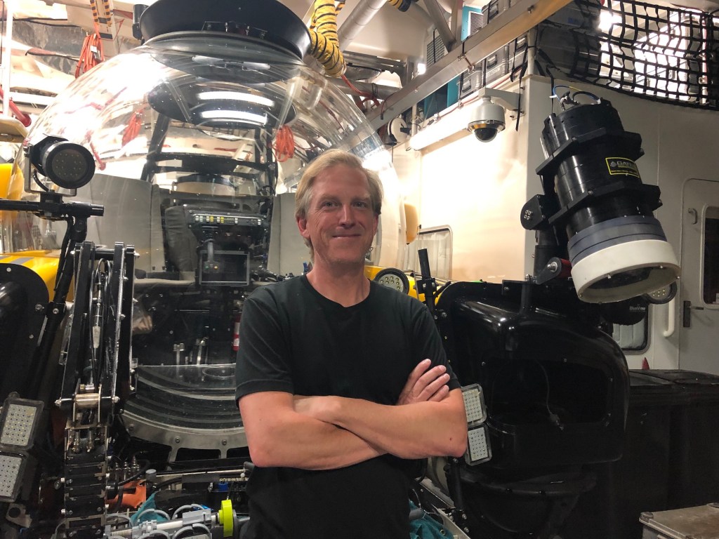
Launching the Triton 3300/3 (Photo: Erik Olsen)
The Triton 3300/3’s 1,000-meter depth rating (I’ve been in one twice) puts the entire twilight zone within reach, enabling direct observation of these daily movements, predator-prey interactions, and delicate species that often disintegrate into goo in nets. Human presence here allows scientists to make real-time decisions to follow unusual aggregations, sample with precision, and record high-quality imagery that captures how this midwater world works, something uncrewed systems alone rarely match.
It could even serve as a classroom at depth for carefully designed outreach dives, giving educators footage and first-person accounts that no livestream can quite match. Each of these missions is stronger with people on site, conferring, pointing, deciding, and noticing.
While Monterey Bay would be a natural fit because of MBARI, Hopkins, and the sanctuary’s deepwater treasures, Southern California could be just as compelling. Catalina Island, with its proximity to submarine canyons, coral gardens, and cold seeps of the Southern California Bight, offers rich science targets and the existing facilities of USC’s Wrigley Marine Science Center. Los Angeles or Long Beach would add the advantage of major port infrastructure and a vast urban audience, making it easier to combine high-impact research with public tours, donor events, and media outreach. And San Diego with its deep naval history, active maritime industry, Scripps Institution of Oceanography, and proximity to both U.S. and Mexican waters, could serve as a southern hub for exploration and rapid response to discoveries or environmental events. These regions could even share the vehicle seasonally: Monterey in summer for sanctuary work, Catalina/LA or San Diego in winter for Southern California Bight missions, spreading both benefits and funding responsibility.
The author in front of the Triton 3300/3 in the Bahamas (Photo: Erik Olsen)
For budgeting, a proven benchmark is the Triton 3300/3, a three-person, 1,000-meter (3,300-foot) human-occupied vehicle used widely in science and filming. New units are quoted in the four to five million dollar range, with recent builds coming in around $4–4.75 million depending on specifications. Beyond the vehicle, launch and recovery systems such as a 25–30-ton A-frame or LARS and the deck integration required for a suitable support ship can run into the high six to low seven figures. Modern acrylic-sphere subs like the Triton are designed for predictable, minimized scheduled maintenance, but budgets still need to account for annual surveys, battery service, insurance, and ongoing crew training. Taken together, a California-based HOV program could be launched for an initial capital investment of roughly $6–7 million, with operating budgets scaled to the number of missions each year. So, not cheap. But doable for someone of means and purpose and curiosity. See below.
Who would benefit if California restored this capability? Everyone who already works here. MBARI operates a world-class fleet of ROVs and AUVs but has no resident HOV. Scripps Institution of Oceanography, Hopkins Marine Station, and USC’s Wrigley Marine Science Center train generations of ocean scientists who rarely get the option to do HOV work without flying across the country and waiting for a slot. NOAA and the sanctuaries need efficient ways to inspect resources and respond to events. A west-coast human-occupied research submersible based in Monterey Bay, Catalina, Los Angeles, or San Diego would plug into ship time on vessels already here, coordinate with ROV teams for hybrid dives, and cut mobilization costs for Pacific missions.
A new Triton 660 AVA submersible slips into the turquoise waters of the Bahamas, beginning its first voyage. Built for dives to 660 feet (200 meters), it offers passengers a front-row seat to reefs, shipwrecks, and marine life far beyond normal scuba limits, making it an ideal draw for high-end tourism. (Photo: Erik Olsen)
What would it take? A benefactor and a compact partnership. California has the donors (hello, curious billionaires!), companies, and public-private institutions to do this right. A philanthropic lead gift could underwrite acquisition of a proven, classed HOV and its support systems, while MBARI, Scripps, or USC could provide engineering, pilots, and safety culture within the UNOLS standards that govern HOV operations. No OceanGates. Alvin’s long record shows the model. Add a state match for workforce and student access, and a sanctuary partnership to guarantee annual science priorities, and you have a durable program that serves research, stewardship, and public engagement.
Skeptics will say that robots already do the job. They do a lot of it. They do not do all of it. If the U.S. is content to have only one deep research HOV based on the opposite coast, we will forego the unique perspectives and serendipity that only people bring, and we will keep telling California students to wait their turn or watch the ROV feed from their laptops or phones. California can do better. We did, for years, when the Delta sub spent long seasons quietly counting fish and mapping habitats off Ventura and the Channel Islands. Then that capability faded. If we rebuild it here, we restore a missing rung on the ladder from tidepools to trenches, and we align the state’s science, climate, and education missions with a tool that is both a laboratory and a conversion experience.
The author at more than 2000 feet beneath the surface of the ocean. (Photo: Erik Olsen)
Start with a compact, 1,000-meter-class HOV that can work daily in most of California’s shelf and slope habitats. Pair it with our ROVs for tandem missions and cinematography of the sub and its occupants in action. Commit a share of dives to student and educator participation, recorded and repackaged for museums and broadcast. Reserve another share for rapid-response science at seeps, landslides, unusual biological events, or contamination crises like the DDT dumpsite. Build a donor program around named expeditions to Davidson Seamount, Catalina’s coral gardens, and the Channel Islands. Then, if the community wants to go deeper, plan toward a second vehicle or an upgrade path. The science is waiting. The coast is ready. And the case is clear. California should restore its human-occupied submersible fleet.
I love reading New York Times obituaries, not because of any morbid fascination with death, but because they offer a window into extraordinary lives that might otherwise go unnoticed. These tributes often highlight people whose work had real impact, even if their names were never widely known. Unlike the celebrity coverage that fills so much of the media, these obituaries can be quietly riveting, full of depth, insight, and genuine accomplishment.
For two years I managed the New York Times video obituary series called Last Word. We interviewed people of high accomplishment who had made a difference in the world BEFORE they died, thus giving them a chance, at a latter age (in our case 75 was the youngest, but more often people would be in their 80s) to tell their own stories about their lives. They signed an agreement acknowledging that the interview would not be shown until after their death. Hence the series title: Last Word. Anyway, when I ran the program, I produced video obituaries for people as varied as Neil Simon, Hugh Hefner, Sandra Day O’Connor, Philip Roth, Edward Albee, and my favorite, the great Harvard biologist E.O. Wilson. Spending time and learning about their lives in their own words was a joy.
All of that is to say that obituaries often reveal the lives and accomplishments of people who have changed the world. These are stories that might never be told so thoughtfully or thoroughly anywhere else.
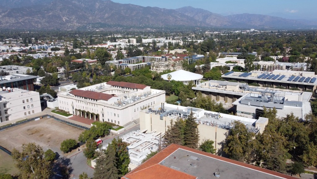
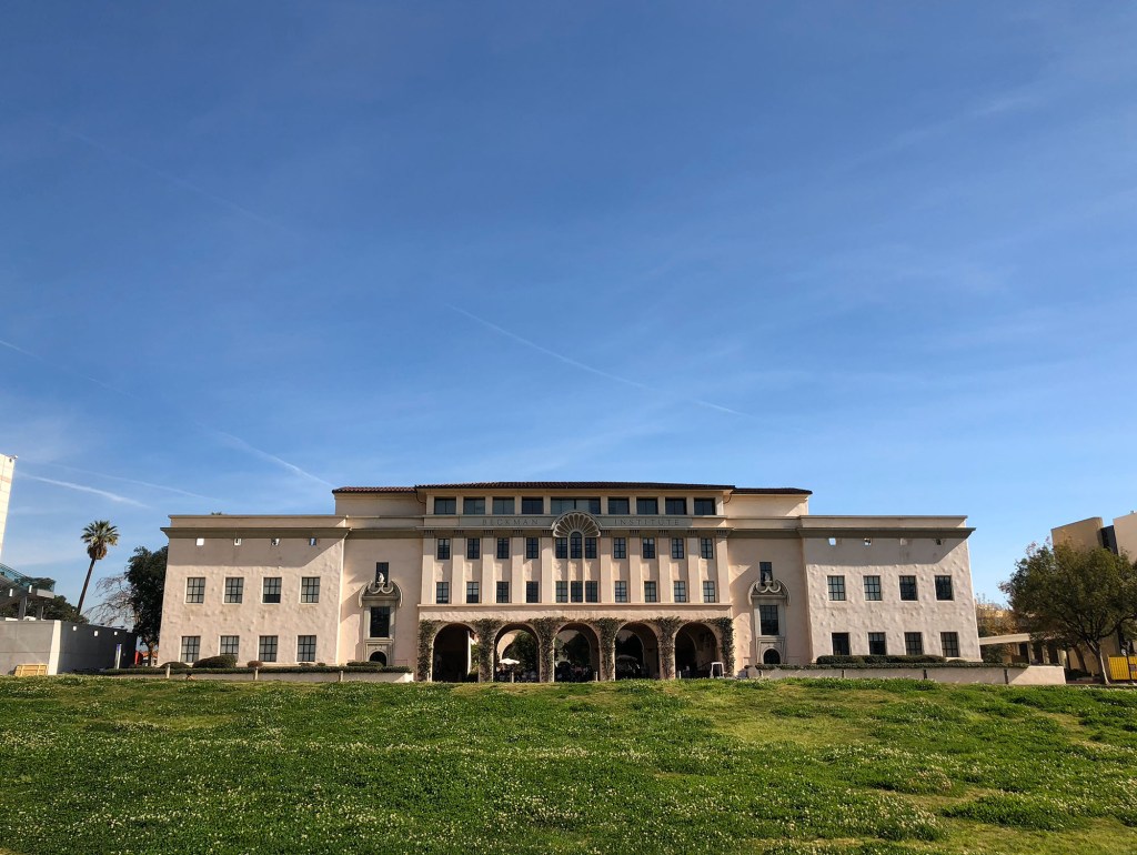
California Institute of Technology (Photo: Erik Olsen)
Which bring us to a quiet lab at Caltech in 1958, where two young biologists performed what some still call “the most beautiful experiment in biology”. Their names were Matthew Meselson and Franklin Stahl, and what they uncovered helped confirm the foundational model of modern genetics. With a simple centrifuge, a dash of heavy nitrogen, and a bold hypothesis, they confirmed how DNA, life’s instruction manual, copies itself. And all of it took place right here in California at one of the world’s preeminent scientific institutions: the California Institute of Technology or CalTech, in Pasadena. The state is blessed to have so many great scientific minds and institutions where people work intensely, often in obscurity, to uncover the secrets of life and the universe.
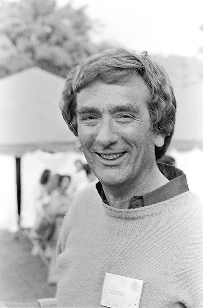
Franklin Stahl died recently at his home in Oregon, where he had spent much of his career teaching and researching genetics. The New York Times obituary offered a thoughtful account of his life and work, capturing his contributions to science with typical respect. But after reading it, I realized I still didn’t fully grasp the experiment that made him famous, the Meselson-Stahl experiment, the one he conducted with Matthew Meselson at Caltech. It was mentioned, of course, but not explained in a way that brought its brilliance to life. So I decided to dig a little deeper.
Franklin Stahl in an undated photo. (Cold Spring Harbor Laboratory Library and Archives)
The Meselson-Stahl experiment didn’t just prove a point. It told a story about how knowledge is built: carefully, creatively, and with a precision that leaves no room for doubt. It became a model for how science can answer big questions with simple, clean logic and careful experimentation. And it all happened in California.
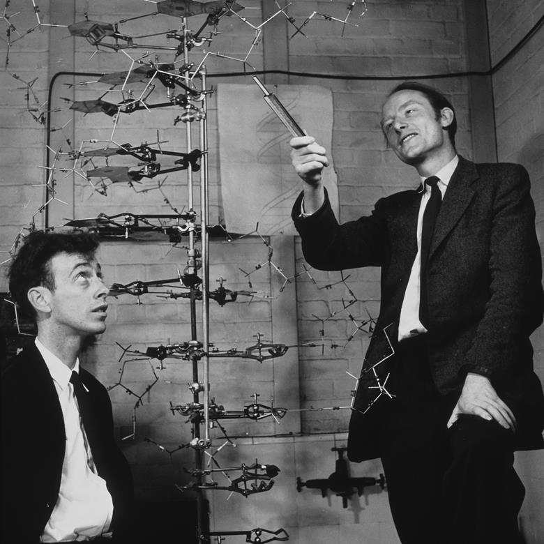
Let’s back up: When Watson and Crick proposed their now-famous double helix structure of DNA in 1953 (with significant, poorly recognized help from Rosalind Franklin), they also suggested a theory about how it might replicate. Their idea was that DNA separates into two strands, and each strand acts as a template to build a new one. That would mean each new DNA molecule is made of one old strand and one new. It was called the semi-conservative model. But there were other theories too. One proposed that the entire double helix stayed together and served as a model for building an entirely new molecule, leaving the original untouched. Another suggested that DNA might break apart and reassemble in fragments, mixing old and new in chunks. These were all plausible ideas. But only one could be true.
Watson and Crick with their model of the DNA molecule (Photo: A Barrington Brown/Gonville & Caius College/Science Photo Library)
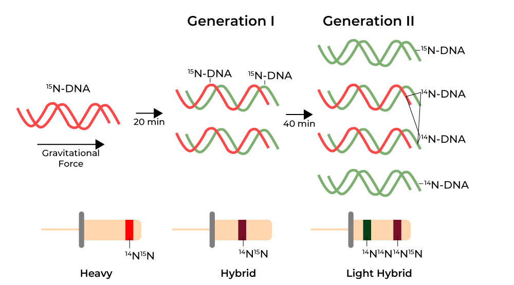
To find out, Meselson and Stahl grew E. coli bacteria in a medium containing heavy nitrogen (nitrogen is a key component of DNA), a stable isotope that made the DNA denser than normal. After several generations, all the bacterial DNA was fully “heavy.” Then they transferred the bacteria into a medium with normal nitrogen and let them divide. After one generation, they spun the DNA in a centrifuge that separated it by weight. If DNA copied itself conservatively, the centrifuge would show two bands: one heavy, one light. If it was semi-conservative, it would show a single band at an intermediate weight. When they performed the experiment, the result was clear. There was only one band, right between the two expected extremes. One generation later, the DNA split into two bands: one light, one intermediate. The semi-conservative model was correct.
Their results were published in Proceedings of the National Academy of Sciences in 1958 and sent shockwaves through the biological sciences.
Meselson and Stahl experiment in diagram.
To me, the experiment brought to mind the work of Gregor Mendel, an Augustinian monk who, in the mid-1800s, quietly conducted his experiments in the garden of a monastery in Brno, now part of the Czech Republic. By breeding pea plants and meticulously tracking their traits over generations, Mendel discovered the basic principles of heredity, dominant and recessive traits, segregation, and independent assortment, decades before the word “gene” even existed. Like Mendel’s experiments, the Meselson-Stahl study was striking in its simplicity and clarity. Mendel revealed the rules; Meselson and Stahl uncovered the mechanism.
There’s a fantastic video where the two men discuss the experiment that is worth watching. It was produced produced by iBiology, part of the nonprofit Science Communication Lab in Berkeley. In it Meselson remembered how the intellectual climate of CalTech at the time was one of taking bold steps, not with the idea of making a profit, but for the sheer joy of discovery: “We could do whatever we wanted,” he says. “It was very unusual for such young guys to do such an important experiment.”
California Institute of Technology (Photo: Erik Olsen)
Most people think of Caltech as a temple of physics. It’s where Einstein lectured, where the Jet Propulsion Laboratory was born (CalTech still runs it), and where the gravitational waves that rippled through spacetime were detected. But Caltech has a quieter legacy in biology. Its biologists were among the first to take on the structure and function of molecules inside cells. The institute helped shape molecular biology as a new discipline at a time when biology was still often considered a descriptive science. Long before Silicon Valley made biotech a household term, breakthroughs in genetics and neurobiology were already happening in Southern California.
The Meselson-Stahl experiment is still taught in biology classrooms (my high school age daughter knew of it) because of how perfectly it answered the question it set out to ask. It was elegant, efficient, and unmistakably clear. And it showed how a well-constructed experiment can illuminate a fundamental truth. Their discovery laid the groundwork for everything from cancer research to forensic DNA analysis to CRISPR gene editing. Any time a scientist edits a gene or maps a mutation, they are relying on that basic understanding of how DNA replicates.
In a time when science often feels far too complex, messy, or inaccessible, the Meselson-Stahl experiment is a reminder that some of the most important discoveries are also the simplest. Think Occam’s Razor. Two young scientists, some nitrogen, a centrifuge, a clever idea, and a result that changed biology forever.