I’m going to keep this week’s article shorter than usual. I want to talk about the ocean. I know I do this a lot; many articles on California Curated are ocean-related (please explore, I think you’ll enjoy them). But that’s because I honestly believe it’s the most important feature on the planet. Protecting the ocean is the most important thing we can do. Let me explain.
The ocean covers more than 70 percent of Earth’s surface. So why do we even call this place Earth? We should call it Planet Ocean. Or Thalassa, from the Greek word for sea.
But it’s not just the size that matters, it’s the ocean’s vast, mysterious depth and the essential role it plays in sustaining life on Earth. The ocean is vital to all living things. Tiny organisms called phytoplankton absorb more carbon dioxide from the atmosphere than any other biological force on the planet. Through photosynthesis, they transform sunlight and carbon into organic matter, forming the base of the marine food web. Despite making up just a fraction of Earth’s plant biomass, phytoplankton are responsible for nearly half of all global carbon fixation. Zooplankton are tiny animals that eat phytoplankton. Zooplankton feed small fish, which feed bigger fish, which feed us. That’s the food chain. It’s literally a scaffolding for all life on earth. And a huge percentage of humanity depends on it to survive. If one link breaks, the whole thing risks collapse.
Phytoplankton (Photo: NOAA)
Which brings me to why I’m writing this. I recently watched the new National Geographic documentary Oceans, narrated by David Attenborough. I love Attenborough. His calm, British-inflected voice has been the backdrop to so much of my science education over the years. He feels like a wise grandfather. Kind, brilliant, and usually right.
In this film, he is absolutely right.
The documentary takes us to places no human has ever seen. In one scene, the team attaches cameras to a deep-sea trawling net. The footage is devastating. These massive nets kill everything in their path. Octopuses, fish, coral, entire ecosystems. Most of the species caught never even make it to market. They are bycatch, considered waste and tossed back into the sea. It’s wasteful, brutal, and legal. These trawlers are still out there, operating at scale, stripping the sea of life.
Bottom Trawling scene from Oceans with David Attenborough (National Geographic)
The film also shows how industrial fishing has hammered fish populations around the world. We are seeing species crash and food chains fracture. According to the Food and Agriculture Organization, nearly 35 percent of the world’s fish stocks are being overfished, a figure that has more than tripled since the 1970s. This kind of collapse has never happened before at this scale. And it is not getting better. We are talking about extinctions. We are talking about systems breaking down.
Friends often tell me the biggest threats to our planet are climate change, pollution, and microplastics. They’re not wrong. All this stuff is connected in a way. But if you ask me what really threatens human survival, it’s the breakdown of ocean ecosystems. If we lose one part of that chain for good, it won’t just be bad. It could be the beginning of the end. And I mean for humans, for organized society, not for all life on earth.
And yet, there is hope.
Kelp bed and bass in a marine protected area (MPA) in California’s Channel Islands (Photo: Erik Olsen)
Like any great documentary, Oceans ends with a sliver of optimism. It brings us back to California. Specifically, to the Channel Islands, one of my favorite places on Earth. I’ve been out there many times, several times recently reporting on ghost lobster traps and exploring. It’s stunning. And there is something very special going on.
Park rangers patrol the waters off the Channel Islands (Photo: Erik Olsen)
Much of the Channel Islands are protected as a Marine Protected Area, or MPA. You can’t fish. You can’t extract. And, most importantly, the rules are enforced. There are rangers out there at most all times patrolling. That part is key. I’ve done stories in places like Belize, Kiribati and Indonesia where the protections exist on paper but don’t work in practice. Kiribati, for instance, established the Phoenix Islands Protected Area, one of the largest MPAs on the planet. But it’s so vast and remote that enforcing its protections is nearly impossible. It’s a good idea on paper, but a cautionary tale in execution. But here in California, the rangers take it seriously. Because of that, the ecosystem is bouncing back. Twenty years after protection began, the kelp, the fish, the invertebrates, they’re thriving. These islands are alive.
California’s MPAs are a model for the world. They prove that if we give the ocean space and time, it will heal. But they remain the exception. They don’t have to be.
Marine Protected Area (MPA) sign in Corona del Mar, CA (Photo: Erik Olsen)
There’s a global movement right now to protect 30 percent of the world’s oceans by 2030. It’s called 30 by 30. Just recently, at the 2025 UN Ocean Conference in Nice, France, more than 70 countries reaffirmed their commitment to the 30 by 30 goal, calling for urgent action to protect ocean biodiversity and create well-managed, effectively enforced MPAs around the world. I’m not naive. I don’t think we’ll hit that goal perfectly. But we are finally moving in the right direction. And we don’t have another option. The ocean is too important.
So I’ll step off the soapbox now and let you enjoy your day. But before you click away, please take a moment to think about the ocean. Think about what it gives us. Think about how it restores us. As a diver, I can tell you there’s nothing like the world beneath the waves. It’s as strange, beautiful, and alien as any other planet we’ve imagined. The creatures there rival anything you’d find in Mos Eisley on Tatooine.
The author filming cuttlefish in Indonesia. Such strange creatures. (Photo: Erik Olsen)
Watch the documentary. Let it educate and inspire you. It might fill you with dread too. But in the end, its message is hopeful. And that message lands right here off the coast of California, the greatest state in the country. Or at least, that’s the opinion of one well-traveled guy with a newsletter about the state he loves.
In California’s southeastern desert, the Salton Sea stretches across a wide, shimmering basin, a lake where there shouldn’t be one. At about 340 square miles, it’s the state’s largest lake. But it wasn’t created by natural forces. It was the result of a major engineering failure. I’ve long been fascinated with the place: its contradictions, its strangeness, its collision of nature and human ambition. It reflects so many of California’s tensions: water and drought, industry and wilderness, beauty and decay. And it was only relatively recently that I came to understand not just how the Salton Sea came to exist, but how remarkable the region’s geological past really is, and how it could play a major role in the country’s sustainable energy future.
In the early 1900s, the Imperial Valley was seen as promising farmland: its deep, silty soil ideal for agriculture, but the land was arid and desperately needed irrigation. To bring water from the Colorado River, engineers created the Imperial Canal, a massive infrastructure project meant to transform the desert into productive farmland. But the job was rushed. The canal had to pass through the Mexican border and loop back into California, and much of it ran through highly erodible soil. Maintenance was difficult, and by 1904, silt and sediment had clogged portions of the canal.
The Southern Pacific Railroad was forced to move it lines several times as the raging, unleashed Colorado River expanded the Salton Sea. (Credit: Imperial Irrigation District)
To keep water flowing, engineers hastily dug a temporary bypass channel south of the clogged area, hoping it would only be used for a few months. But they failed to build proper headgates, critical structures for controlling water flow. In 1905, an unusually heavy season of rain and snowmelt in the Rockies caused the Colorado River to swell. The torrent surged downriver and overwhelmed the temporary channel, carving it wider and deeper. Before long, the river completely abandoned its natural course and began flowing unchecked into the Salton Sink, an ancient, dry lakebed that had once held water during wetter epochs but had long since evaporated. (This has happened many times over in the region’s history).
For nearly two years, the Colorado River flowed uncontrolled into this depression, creating what is now known as the Salton Sea. Efforts to redirect the river back to its original course involved a frantic, expensive engineering campaign that included the Southern Pacific Railroad and U.S. government assistance. The breach wasn’t fully sealed until early 1907. By then, the sea had already formed: a shimmering, accidental lake nearly 35 miles long and 15 miles wide, with no natural outlet, in the middle of the California desert.
In the 1950s and early ’60s, the Salton Sea was a glamorous desert escape, drawing crowds with boating, fishing, and waterskiing. Resorts popped up along the shore, and celebrities like Frank Sinatra, Jerry Lewis, Rock Hudson, the Beach Boys, and the Marx Brothers came to visit and perform. It was billed as a new Palm Springs with water, until rising salinity and environmental decline ended the dream. There have been few if any similarly starge ecological accidents like it.
The erosive power of the floodwaters was immense. The river repeatedly scoured channels that created waterfalls, which cut back through the ground, eroding soil at a rate of about 1,200 meters per day and carving gorges 15 to 25 meters deep and more than 300 meters wide. (Credit: Imperial Irrigation District)
The creation of the Salton Sea was both a blessing and a curse for the people of the Imperial Valley. On the one hand, the lake provided a new source of water for irrigation, and the fertile soil around its shores proved ideal for growing crops. On the other hand, the water was highly saline, and the lake became increasingly polluted over time, posing a threat to both human health and the environment.
Recently, with most flows diverted from the Salton Sea for irrigation, it has begun to dry up and is now considered a major health hazard, as toxic dust is whipped up by heavy winds in the area. The disappearance of the Salton sea has also been killing off fish species that attract migratory birds.
The New York Times recently wrote about the struggles that farmers face as the Salton Sea disappears, and how the sea itself will likely disappear entirely at some point.
“There’s going to be collateral damage everywhere,” Frank Ruiz, a program director with California Audubon, told the Times. “Less water coming to the farmers, less water coming into the Salton Sea. That’s just the pure math.”
Salton Sea can be beautiful, if toxic (Photo: Wikipedia)
To me, the story of the Salton Sea is fascinating: a vivid example of how human intervention can radically reshape the environment. Of course, there are countless cases of humans altering the natural world, but this one feels particularly surreal: an enormous inland lake created entirely by accident, simply because a river, the Colorado, one of the most powerful in North America, was diverted from its course. It’s incredible, and incredibly strange. What makes the region even more fascinating, though, is that the human-made lake sits in a landscape already full of geological drama.
The area around the Salton Sea is located in a techtonically active region, with the San Andreas Fault running directly through it. The San Andreas Fault is a major plate boundary, where the Pacific Plate is moving north relative to the North American Plate (see our story about how fast it’s moving here). As pretty much every Californian knows, the legendary fault is responsible for the earthquakes and other tectonic activity across much of California.
If you look at a map of the area, you can see how the low lying southern portion of the Salton Sea basin goes directly into the Gulf of California. Over millions of years, the desert basin has been flooded numerous times throughout history by what is now the Gulf of California. As the fault system cuts through the region, the Pacific Plate is slowly sliding northwest, gradually pulling the Baja Peninsula away from mainland Mexico. Over millions of years, this tectonic motion is stretching and thinning the crust beneath the Imperial Valley and Salton Basin. If the process continues, geologists believe the area could eventually flood again, forming a vast inland sea, perhaps even making an island out of what is today Baja California. (We wrote about this earlier.)
Entrance to the Salton Sea Recreation Area (Wikipedia)
Yet even as the land shifts beneath it, the Salton Sea’s future may be shaped not just by geology, but by energy. Despite the ongoing controversy over the evaporating water body, the Salton Sea may play a crucial role in California’s renewable energy future. The region sits atop the Imperial Valley’s geothermal hotspot, where underground heat from all that tectonic activity creates ideal conditions for producing clean, reliable energy. Already home to one of the largest geothermal fields in the country, the area is now gaining attention for something even more strategic: lithium.
An aerial view of geothermal power plants among the farmland around the southern shore of the Salton Sea. (Credit: Courtesy Lawrence Berkeley National Lab)
Beneath the surface, the hot, mineral-rich brine used in geothermal energy production contains high concentrations of lithium, a critical component in electric vehicle batteries. Known as “Lithium Valley,” the Salton Sea region has become the focus of several ambitious extraction projects aiming to tap into this resource without the large environmental footprint of traditional lithium mining. Gov. Gavin Newsom called the area is “the Saudi Arabia of lithium.” Even the Los Angeles Times has weighed in, claiming that “California’s Imperial Valley will be a major player in the clean energy transition.”
Companies like Controlled Thermal Resources (CTR) and EnergySource are developing direct lithium extraction (DLE) technologies that pull lithium from brine as part of their geothermal operations. The promise is a closed-loop system that produces both renewable energy and battery-grade lithium on the same site. If it proves viable, the Salton Sea could significantly reduce U.S. dependence on foreign lithium and cement California’s role in the global shift to clean energy. That’s a big if…and one we’ll be exploring in depth in future articles.
Toxic salt ponds along the Western shoreline (Photo: EmpireFootage)
Such projects could also potentially provide significant economic investment in the region and help power California’s green energy ambitions. So for a place that looks kind of wrecked and desolate, there actually a lot going on. We promise to keep an eye on what happens. Stay tuned.
I love reading New York Times obituaries, not because of any morbid fascination with death, but because they offer a window into extraordinary lives that might otherwise go unnoticed. These tributes often highlight people whose work had real impact, even if their names were never widely known. Unlike the celebrity coverage that fills so much of the media, these obituaries can be quietly riveting, full of depth, insight, and genuine accomplishment.
For two years I managed the New York Times video obituary series called Last Word. We interviewed people of high accomplishment who had made a difference in the world BEFORE they died, thus giving them a chance, at a latter age (in our case 75 was the youngest, but more often people would be in their 80s) to tell their own stories about their lives. They signed an agreement acknowledging that the interview would not be shown until after their death. Hence the series title: Last Word. Anyway, when I ran the program, I produced video obituaries for people as varied as Neil Simon, Hugh Hefner, Sandra Day O’Connor, Philip Roth, Edward Albee, and my favorite, the great Harvard biologist E.O. Wilson. Spending time and learning about their lives in their own words was a joy.
All of that is to say that obituaries often reveal the lives and accomplishments of people who have changed the world. These are stories that might never be told so thoughtfully or thoroughly anywhere else.
California Institute of Technology (Photo: Erik Olsen)
Which bring us to a quiet lab at Caltech in 1958, where two young biologists performed what some still call “the most beautiful experiment in biology”. Their names were Matthew Meselson and Franklin Stahl, and what they uncovered helped confirm the foundational model of modern genetics. With a simple centrifuge, a dash of heavy nitrogen, and a bold hypothesis, they confirmed how DNA, life’s instruction manual, copies itself. And all of it took place right here in California at one of the world’s preeminent scientific institutions: the California Institute of Technology or CalTech, in Pasadena. The state is blessed to have so many great scientific minds and institutions where people work intensely, often in obscurity, to uncover the secrets of life and the universe.
Franklin Stahl died recently at his home in Oregon, where he had spent much of his career teaching and researching genetics. The New York Times obituary offered a thoughtful account of his life and work, capturing his contributions to science with typical respect. But after reading it, I realized I still didn’t fully grasp the experiment that made him famous, the Meselson-Stahl experiment, the one he conducted with Matthew Meselson at Caltech. It was mentioned, of course, but not explained in a way that brought its brilliance to life. So I decided to dig a little deeper.
Franklin Stahl in an undated photo. (Cold Spring Harbor Laboratory Library and Archives)
The Meselson-Stahl experiment didn’t just prove a point. It told a story about how knowledge is built: carefully, creatively, and with a precision that leaves no room for doubt. It became a model for how science can answer big questions with simple, clean logic and careful experimentation. And it all happened in California.
Let’s back up: When Watson and Crick proposed their now-famous double helix structure of DNA in 1953 (with significant, poorly recognized help from Rosalind Franklin), they also suggested a theory about how it might replicate. Their idea was that DNA separates into two strands, and each strand acts as a template to build a new one. That would mean each new DNA molecule is made of one old strand and one new. It was called the semi-conservative model. But there were other theories too. One proposed that the entire double helix stayed together and served as a model for building an entirely new molecule, leaving the original untouched. Another suggested that DNA might break apart and reassemble in fragments, mixing old and new in chunks. These were all plausible ideas. But only one could be true.
Watson and Crick with their model of the DNA molecule (Photo: A Barrington Brown/Gonville & Caius College/Science Photo Library)
To find out, Meselson and Stahl grew E. coli bacteria in a medium containing heavy nitrogen (nitrogen is a key component of DNA), a stable isotope that made the DNA denser than normal. After several generations, all the bacterial DNA was fully “heavy.” Then they transferred the bacteria into a medium with normal nitrogen and let them divide. After one generation, they spun the DNA in a centrifuge that separated it by weight. If DNA copied itself conservatively, the centrifuge would show two bands: one heavy, one light. If it was semi-conservative, it would show a single band at an intermediate weight. When they performed the experiment, the result was clear. There was only one band, right between the two expected extremes. One generation later, the DNA split into two bands: one light, one intermediate. The semi-conservative model was correct.
Their results were published in Proceedings of the National Academy of Sciences in 1958 and sent shockwaves through the biological sciences.
Meselson and Stahl experiment in diagram.
To me, the experiment brought to mind the work of Gregor Mendel, an Augustinian monk who, in the mid-1800s, quietly conducted his experiments in the garden of a monastery in Brno, now part of the Czech Republic. By breeding pea plants and meticulously tracking their traits over generations, Mendel discovered the basic principles of heredity, dominant and recessive traits, segregation, and independent assortment, decades before the word “gene” even existed. Like Mendel’s experiments, the Meselson-Stahl study was striking in its simplicity and clarity. Mendel revealed the rules; Meselson and Stahl uncovered the mechanism.
There’s a fantastic video where the two men discuss the experiment that is worth watching. It was produced produced by iBiology, part of the nonprofit Science Communication Lab in Berkeley. In it Meselson remembered how the intellectual climate of CalTech at the time was one of taking bold steps, not with the idea of making a profit, but for the sheer joy of discovery: “We could do whatever we wanted,” he says. “It was very unusual for such young guys to do such an important experiment.”
California Institute of Technology (Photo: Erik Olsen)
Most people think of Caltech as a temple of physics. It’s where Einstein lectured, where the Jet Propulsion Laboratory was born (CalTech still runs it), and where the gravitational waves that rippled through spacetime were detected. But Caltech has a quieter legacy in biology. Its biologists were among the first to take on the structure and function of molecules inside cells. The institute helped shape molecular biology as a new discipline at a time when biology was still often considered a descriptive science. Long before Silicon Valley made biotech a household term, breakthroughs in genetics and neurobiology were already happening in Southern California.
The Meselson-Stahl experiment is still taught in biology classrooms (my high school age daughter knew of it) because of how perfectly it answered the question it set out to ask. It was elegant, efficient, and unmistakably clear. And it showed how a well-constructed experiment can illuminate a fundamental truth. Their discovery laid the groundwork for everything from cancer research to forensic DNA analysis to CRISPR gene editing. Any time a scientist edits a gene or maps a mutation, they are relying on that basic understanding of how DNA replicates.
In a time when science often feels far too complex, messy, or inaccessible, the Meselson-Stahl experiment is a reminder that some of the most important discoveries are also the simplest. Think Occam’s Razor. Two young scientists, some nitrogen, a centrifuge, a clever idea, and a result that changed biology forever.
At Inspiration Point, Yosemite, sticky whiteleaf manzanita tends to occupy south slopes, greenleaf manzanita tends to occupy north slopes. (Photo: NPS)
As an avid hiker in Southern California, I’ve become a deep admirer of the chaparral that carpets so many of the hills and mountains in the region. When I was younger, I didn’t think much of these plants. They seemed dry, brittle, and uninviting, and they’d often leave nasty red scrapes on your legs if you ever ventured off-trail.
But I’ve come to respect them, not only because they’ve proven to be remarkably hardy, but because when you look closer, they reveal a kind of beauty I failed to appreciate when I was younger. I’ve written here and elsewhere about a few of them: the fascinating history of the toyon (Heteromeles arbutifolia), also known as California holly, which likely inspired the name Hollywood and is now officially recognized as Los Angeles’ native city plant; the incredible durability of creosote bush, featured in a recent Green Planet episode with David Attenborough; and the laurel sumac, whose taco-shaped leaves help it survive the region’s brutal summer heat.
Manzanita branches in the high Sierra. The deep red colored bark enhanced by water. (Photo: Erik Olsen)
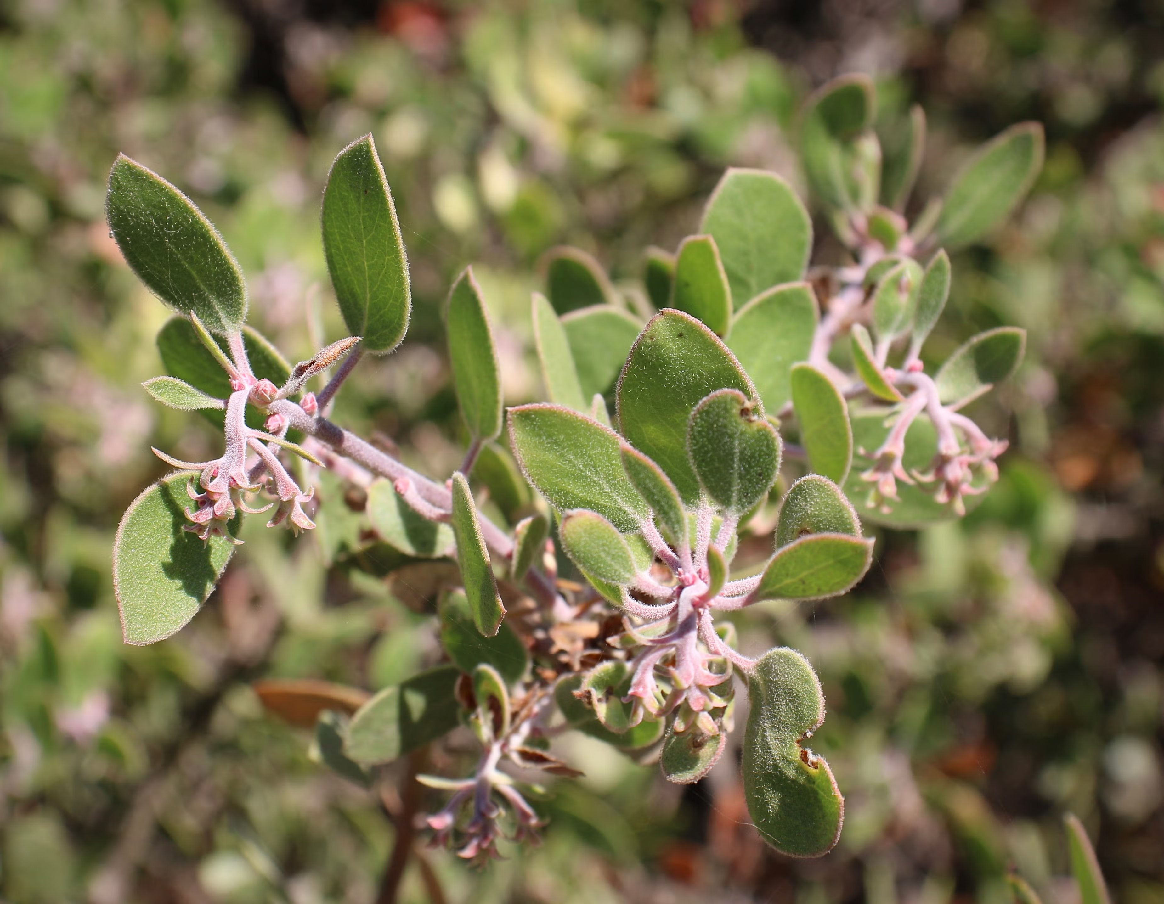
But there’s another plant I’ve come to admire, one that stands out not just for its resilience but for its deep red bark and often gnarled, sculptural form. It’s manzanita, sometimes called the Jewel of the Chaparral, and it might be one of the most quietly extraordinary plants in California.
If you’ve ever hiked a sun-baked ridge or wandered a chaparral trail, chances are you’ve brushed past a manzanita. With twisting, muscular limbs the color of stained terra cotta and bark so smooth it looks hand-polished, manzanita doesn’t just grow. It sculpts itself into the landscape, twisting and bending with the contours of hillsides, rocks, and other plants.
There are more than 60 species and subspecies of manzanita (Arctostaphylos), and most are found only in California. Some stand tall like small trees as much as 30 feet high; others crawl low along rocky slopes. But all of them are masters of survival. Their small, leathery leaves are coated with a waxy film to lock in moisture during the long dry seasons. They bloom in late winter with tiny pink or white bell-shaped flowers, feeding early pollinators when little else is flowering. By springtime, those flowers ripen into red fruits: the “little apples” that give the plant its name.
Manzanita flowers (Santa Barbara Botanical Garden)
One of manzanita’s more fascinating traits is how it deals with dead wood. Instead of dropping old branches, it often retains them, letting new growth seal off or grow around the dead tissue. You’ll see branches striped with gray and red, or dead limbs still anchored to the plant. It’s a survival strategy, conserving water, limiting exposure, and creating the twisted, sculptural forms that make manzanita distinctive.
And fire is key to understanding manzanita’s world. Like many California plants, many manzanita species are fire-adapted: some die in flames but leave behind seeds that only germinate after exposure to heat or smoke. Others resprout from underground burls after burning. Either way, manzanita is often one of the first plants to return to the land after a wildfire, along with laurel sumac, stabilizing the soil, feeding animals (and people), and shading the way for the next wave of regrowth.
Manzanita’s astonishing red bark The reddish color of manzanita bark is primarily due to tannins, naturally occurring compounds that also contribute to the bark’s bitter taste and deter insects and other organisms from feeding on it. (Photo: NPS)
Botanically, manzanitas are a bit of a mystery. They readily hybridize and evolve in isolation, which means there are tiny populations of hyper-local species, some found only on a single hill or canyon slope. That makes them incredibly interesting to scientists and especially vulnerable to development and climate change.
Their red bark is the result of high concentrations of tannins, bitter compounds that serve as a natural defense. Tannins are present in many plants like oaks, walnuts and grapes, and in manzanitas, they make the bark unpalatable to insects and animals and help resist bacteria, fungi, and decay. The bark often peels away in thin sheets, shedding microbes and exposing fresh layers underneath. It’s a protective skin, both chemical and physical, built for survival in the dry, fire-prone landscapes of California.
Whiteleaf manzanita leaves and berries (Photo: NPS)
The plants still have mysteries that are being uncovered. For example, a new species of manzanita was only just discovered in early 2024, growing in a rugged canyon in San Diego County. Named Arctostaphylos nipumu to honor the Nipomo Mesa where it was discovered and its indigenous heritage, it had gone unnoticed despite being located just 35 miles from the coast and not far from populated areas. The discovery, announced by botanists at UC Riverside, highlights that unique species localization, as the plants are found sometimes growing only on a single ridge or in a specific type of soil. Unfortunately, this newly identified species is already at risk due to development pressures and habitat loss. According to researchers, only about 50 individuals are known to exist in the wild, making A. nipumu one of California’s rarest native plants, and a reminder that the story of manzanita is still unfolding, even in places we think we know well.
A new species of manzanita – A. nipumu – was discovered in San Diego County last year (2024), surprising reserachers. (Photo: UCR)
For hikers, photographers, and anyone with an eye for the unusual, manzanita is a cool plant to stumble upon. I will often stop and admire a particularly striking plant. I love when its smooth bark peels back in delicate curls, looking like sunburned skin or shavings of polished cinnamon. It’s hard to walk past a manzanita without reaching out to touch that smooth, cool bark. That irresistible texture may not serve any evolutionary purpose for the plant, but it’s one more reason to wander into California’s fragrant chaparral, where more species of manzanita grow than anywhere else on Earth.
Images from the most powerful astronomical discovery machine ever created, and built in California
A breathtaking zoomed-in glimpse of the cosmos: this first image from the Vera C. Rubin Observatory reveals a deep field crowded with galaxies, offering just a taste of the observatory’s power to map the universe in unprecedented detail. (Credit: NSF–DOE Vera C. Rubin Observatory)
I woke up this morning to watch a much-anticipated press conference about the release of the first images from the Vera Rubin Telescope and Observatory. It left me flabbergasted: not just for what we saw today, but for what is still to come. The images weren’t just beautiful; they hinted at a decade of discovery that could reshape what we know about the cosmos.I just finished watching and have to catch my breath. What lies ahead is very, very exciting.
The first images released today mark the observatory’s “first light,” the ceremonial debut of a new telescope. These images are the result of decades of effort by a vast and diverse global team who together helped build one of the most advanced scientific instruments ever constructed. In the presser, Željko Ivezić, Director of the Rubin Observatory and the guy who revealed the first images, called it “the greatest astronomical discovery machine ever built.”
This image combines 678 separate images taken by NSF–DOE Vera C. Rubin Observatory in just over seven hours of observing time. Combining many images in this way clearly reveals otherwise faint or invisible details, such as the clouds of gas and dust that comprise the Trifid nebula (top) and the Lagoon nebula, which are several thousand light-years away from Earth. (Credit: NSF–DOE Vera C. Rubin Observatory)
The images shown today are a mere hors d’oeuvre of what’s to come, and you could tell by the enthusiasm and giddiness of the scientists involved how excited they are about what lies ahead. Here’s a clip of Željko Ivezić as the presser ended. It made me laugh.
So, that first image you can see above. Check out the detail. What would normally be perceived as black, empty space to us star-gazing earthlings shows anything but. It shows that in each tiny patch of sky, if you look deep enough, galaxies and stars are out there blazing. If you know the famous Hubble Deep Field image, later expanded by NASA’s James Webb Space Telescope, you may already be aware that there is no such thing as empty sky. The universe contains so much stuff, it is truly impossible for our brains (or at least my brain) to comprehend. Vera Rubin will improve our understanding of what’s out there and what we’ve seen before by orders of magnitude.
This image captures a small section of NSF–DOE Vera C. Rubin Observatory’s view of the Virgo Cluster, revealing both the grand scale and the faint details of this dynamic region of the cosmos. Bright stars from our own Milky Way shine in the foreground, while a sea of distant reddish galaxies speckle the background. (Credit: NSF–DOE Vera C. Rubin Observatory)
I’ve been following the Rubin Observatory for years, ever since I first spoke with engineers at the SLAC National Accelerator Laboratory about the digital camera they were building for a potential story for an episode of the PBS show NOVA that I produced (sadly, the production timeline ultimately didn’t work out). SLAC is one of California’s leading scientific institutions, known for groundbreaking work across fields from particle physics to astrophysics. (We wrote about it a while back.)
The night sky seen from inside the Vera Rubin Observatory (Credit: NSF–DOE Vera C. Rubin Observatory)
Now fully assembled atop Chile’s Cerro Pachón, the Vera C. Rubin Observatory is beginning its incredible and ambitious mission. Today’s presser focused on unveiling the first images captured by its groundbreaking camera, offering an early glimpse of the observatory’s vast potential. At the heart of the facility is SLAC’s creation: the world’s largest digital camera, a 3.2-gigapixel behemoth developed by the U.S. Department of Energy.
This extraordinary instrument is the central engine of the Legacy Survey of Space and Time (LSST), a decade-long sky survey designed to study dark energy, dark matter, and the changing night sky with unprecedented precision and frequency. We are essentially creating a decade-long time-lapse of the universe in detail that has never been captured before, revealing the dynamic cosmos in ways previously impossible. Over the course of ten years, it will catalog 37 billion individual astronomical objects, returning to observe each one every three nights to monitor changes, movements, and events across the sky. I want to learn more about how Artificial Intelligence and machine learning are being brought to bear to help scientists understand what they are seeing.
The camera, over 5 feet tall and weighing about three tons, took more than a decade to build. Its focal plane is 64 cm wide-roughly the size of a small coffee table-and consists of 189 custom-designed charge-coupled devices (CCDs) stitched together in a highly precise mosaic. These sensors operate at cryogenic temperatures to reduce noise and can detect the faintest cosmic light, comparable to spotting a candle from thousands of miles away.
The LSST Camera was moved from the summit clean room and attached to the camera rotator for the first time in February 2025. (Credit: RubinObs/NOIRLab/SLAC/DOE/NSF/AURA)
Rubin’s camera captures a massive 3.5-degree field of view-more than most telescopes can map in a single shot. That’s about seven times the area of the full moon. Each image takes just 15 seconds to capture and only two seconds to download. A single Rubin image contains roughly as much data as all the words The New York Times has published since 1851. The observatory will generate about 20 terabytes of raw data every night, which will be transmitted via a high-speed 600 Gbps link to processing centers in California, France, and the UK. The data will then be routed through SLAC’s U.S. Data Facility for full analysis.
The complete focal plane of the future LSST Camera is more than 2 feet wide and contains 189 individual sensors that will produce 3,200-megapixel images. Crews at SLAC have now taken the first images with it. Explore them in full resolution using the links at the bottom of the press release. (Credit: Jacqueline Orrell/SLAC National Accelerator Laboratory)
The images produced will be staggering in both detail and scale. Each exposure will be sharp enough to reveal distant galaxies, supernovae, near-Earth asteroids, and other transient cosmic phenomena in real time. By revisiting the same patches of sky repeatedly, the Rubin Observatory will produce an evolving map of the dynamic universe-something no previous observatory has achieved at this scale.
What sets Rubin apart from even the giants like Hubble or James Webb is its speed, scope, and focus on change over time. Where Hubble peers deeply at narrow regions of space and Webb focuses on the early universe in infrared, Rubin will cast a wide and persistent net, watching the night sky for what moves, vanishes, appears, or explodes. It’s designed not just to look, but to watch. Just imaging the kind of stuff we will see!
The LSST Camera’s imaging sensors are grouped into units called “rafts.” Twenty-one square rafts, each with nine sensors, will capture science images, while four smaller rafts with three sensors each handle focus and telescope alignment. (Credit: Farrin Abbott/SLAC National Accelerator Laboratory)
This means discoveries won’t just be about what is out there, but what happens out there. Astronomers expect Rubin to vastly expand our knowledge of dark matter by observing how mass distorts space through gravitational lensing. It will also help map dark energy by charting the expansion of the universe with unprecedented precision. Meanwhile, its real-time scanning will act as a planetary defense system, spotting potentially hazardous asteroids headed toward Earth.
But the magic lies in the possibility of the unexpected. Rubin may detect rare cosmic collisions, unknown types of supernovae, or entirely new classes of astronomical phenomena. Over ten years, it’s expected to generate more than 60 petabytes of data-more than any other optical astronomy project to date. Scientists across the globe are already preparing for the data deluge, building machine learning tools to help sift through the torrent of discovery.
And none of it would be possible without SLAC’s camera. A triumph of optics, engineering, and digital sensor technology, the camera is arguably one of the most complex and capable scientific instruments ever built. I don’t care if you’re a Canon or a Sony person, this is way beyond all that. It’s a monument to what happens when curiosity meets collaboration, with California’s innovation engine powering the view.
As first light filters through the Rubin Observatory’s massive mirror and into SLAC’s camera, we are entering a new era of astronomy-one where the universe is not just observed, but filmed, in exquisite, evolving detail. This camera won’t just capture stars. It will reveal how the universe dances.
I recently took two scuba diving trips out to the Channel Islands to investigate and help remove ghost lobster traps: abandoned or lost gear that poses a serious threat to marine life. While out there, I also had a chance to explore the marine protected areas surrounding Anacapa and Santa Cruz Islands, getting a firsthand look at how these underwater reserves are helping to restore ocean health and marine life (another story on that coming). Diving in the Channel Islands is a great way for certified divers to experience the incredible biodiversity of California’s coastal waters, even if the water is cold as hell.
The Channel Islands are actually relatively close to the California mainland, just 12 miles from Ventura in the case of Anacapa. But the wild and windswept chain feels like a world apart. On a clear day, you can see them from Ventura or Santa Barbara, but oddly, few people actually visit. Compared to other national parks, they remain relatively unknown, which only adds to their quiet allure. Sometimes called the “Galápagos of North America,” these eight islands are a refuge for wildlife and a place where evolution unfolds before your eyes.
U.S. Park Service rangers patrol the marine protected area off of Anacapa Island in California’s Channel Islands (Photo: Erik Olsen)
(Here’s a cool bit of history: there are eight Channel Islands today, but 20,000 years ago, during the last ice age when sea levels were much lower, four of them—San Miguel, Santa Rosa, Santa Cruz, and Anacapa—were connected as a single landmass called Santarosae.)
For scientists and nature lovers, the Channel Islands are more than just scenic, they’re a natural laboratory. Each island has its own shape, size, and ecological personality, shaped by millions of years of isolation. That makes them an ideal setting for the study of island biogeography, the branch of biology that looks at how species evolve and interact in isolated environments. What happens here offers insight into how life changes and adapts not just on islands, but across the planet.
Sea lions on the Channel Islands (NPS)
Island biogeography is anchored in the theory proposed by E.O. Wilson and Robert MacArthur in the 1960s. Their theory, focusing on the balance between immigration and extinction of species on islands, is brilliantly exemplified in the Channel Islands.
The Channel Islands’ rich mosaic of habitats, from windswept cliffs and rocky shores to chaparral-covered hillsides and dense offshore kelp forests, provides an ideal setting for studying how species adapt to varied and changing conditions. Each island functions like a separate ecological experiment, shaped by isolation, resource limits, and time. Evolution has had free rein here, tweaking species in subtle ways and, occasionally, producing striking changes.
One of the most significant studies conducted in the Channel Islands focused on the island fox (Urocyon littoralis), a species found nowhere else on Earth. Research led by the late evolutionary biologist Robert Wayne at UCLA and others showed that the fox populations on each of the six islands they inhabit have evolved in isolation, with distinct genetic lineages and physical traits. This makes them a remarkable example of rapid evolution and adaptive divergence, core processes in island biogeography.
Genetic analyses revealed that each island’s fox population carries unique genetic markers, shaped by long-term separation and adaptation to local environments. These differences aren’t just genetic, they’re physical and behavioral too. Foxes on smaller islands, for instance, tend to be smaller in body size, likely an evolutionary response to limited resources, a phenomenon known as insular dwarfism. Variations in diet, foraging behavior, and even coat coloration have been documented, offering scientists an unparalleled opportunity to study evolutionary processes in a real-world, relatively contained setting.
Excavation of pygmy mammoth bones on the Channel Islands (Photo: National Park Service)
This phenomenon of insular dwarfism isn’t unique to the island fox. One of the most striking examples from the Channel Islands is the pygmy mammoth (Mammuthus exilis), whose fossilized remains were discovered on Santa Rosa Island. Evolving from the much larger Columbian mammoth, these ancient giants shrank to about half their original size after becoming isolated on the islands during the last Ice Age. Limited food, reduced predation, and restricted space drove their dramatic transformation, a powerful illustration of how isolation and environmental pressures can reshape even the largest of species.
Furthermore, the Channel Islands have been instrumental in studying plant species’ colonization and adaptation. Due to their isolation, the islands host a variety of endemic plant species. Research by Kaius Helenurm, including genetic studies on species such as the Santa Cruz Island buckwheat (Eriogonum arborescens) and island mallow (Malva assurgentiflora), has shown how these plants have adapted to the islands’ unique environmental pressures and limited gene flow.
Island mallow (Malva assurgentiflora), a vibrant flowering plant found only on the Channel Islands, thrives in the harsh coastal environment—its striking blooms a testament to the power of isolation and adaptation. (Photo: Curtis Clark)
The islands have been a scientific boon to researchers over the decades because they are not only home to many diverse and endemic species, but their proximity to the urban centers and the universities of California make them amazingly accessible. It’s been suggested that if Darwin had landed on the Channel Islands, he arguably could have come up with the theory of natural selection off of California, rather than happening upon the Galapagos. A 2019 book about the islands, titled North America’s Galapagos: The Historic Channel Islands Biological Surveyrecounts the story of a group of researchers, naturalists, adventurers, cooks, and scientifically curious teenagers who came together on the islands in the late 1930s to embark upon a series of ambitious scientific expeditions never before attempted.
The Channel Islands are renowned for their high levels of endemism — species that are found nowhere else in the world. This is a hallmark of island biogeography, as isolated landmasses often lead to the development of unique species. Darwin’s On the Origin of Species was one of the first extensive efforts to describe this phenomenon. For example, as mentioned above, the Channel Islands are home to the island fox (Urocyon littoralis), a small carnivore found only here. Each island has its own subspecies of the fox, differing slightly in size and genetics, a striking example of adaptive radiation, where a single species gives rise to multiple different forms in response to isolation and environmental pressures. That said, the foxes are also incredibly cute, but can be rather annoying if you are camping on the islands because they will ransack your food stores if you do not keep them tightly closed.
Island Fox on Santa Cruz Island (photo: Erik Olsen)
Bird life on the Channel Islands also reveals remarkable diversity and endemism. Much like the finches of the Galápagos, these islands are home to distinct avian species shaped by isolation and adaptation. The Santa Cruz Island Scrub Jay, for instance, is noticeably larger and more vividly colored than its mainland relatives, a reflection of its unique island habitat. Also, jays in pine forests tend to have longer, shallower bills, while those in oak woodlands have shorter, deeper bills. Evolutionary adaptations right out of the Darwinian playbook. Likewise, the San Clemente House Finch has evolved traits suited to its specific environment, illustrating how even common species can diverge dramatically when given time and separation.
The Island Scrub-Jay (Aphelocoma insularis), found only on Santa Cruz Island, is larger and more vividly colored than its mainland cousin—an unmistakable symbol of how isolation shapes evolution. (Photo: National Park Service)
The impacts of invasive species on island ecosystems, another critical aspect of island biogeography, are also evident in the Channel Islands. The islands have been an superb laboratory for the practice of conservation and human-driven species recovery. For example, efforts to remove invasive species, like pigs and rats, and the subsequent recovery of native species, like the island fox, provide real-time insights into ecological restoration and the resilience of island ecosystems.
These efforts at conservation and species recovery extend beyond the island fox. In 1997, the U.S. Fish and Wildlife Service identified that 13 plant species native to the northern Channel Islands in California were in dire need of protection under the Endangered Species Act. This need arose due to several decades of habitat degradation, primarily attributed to extensive sheep grazing. These conservation efforts have yielded good news. For instance, the island bedstraw (Galium buxifolium) expanded from 19 known sites with approximately 500–600 individuals in 1997 to 42 sites with over 15,700 individuals. Similarly, the Santa Cruz Island dudleya (Dudleya nesiotica) population stabilized at around 120,000 plants. As a result of these recoveries, both species were removed from the federal endangered species list in 2023, coinciding with the 50th anniversary of the Endangered Species Act.
Santa Cruz Island Dudleya (Photo: National Park Service)
Conservation efforts at the Channel Islands extend beneath the waves, where marine protected areas (MPAs) have played a crucial role in restoring the rich biodiversity of the underwater world. I’ve seen the rich abundance of sea life firsthand on several dives at the Channel Islands, where the biodiversity feels noticeably greater than at many mainland dive sites in Southern California.
The Channel Islands Marine Protected Areas (MPAs), established in 2003, were among the first of their kind in California. The MPAs around Anacapa, Santa Cruz, and other islands act as refuges where fishing and other extractive activities are limited or prohibited, allowing marine ecosystems to recover and thrive. Over the past two decades, scientists have documented increases in the size and abundance of key species such as kelp bass, lobsters, and sheephead, alongside the resurgence of lush kelp forests that anchor a vibrant web of marine life. These protections have not only benefited wildlife but have also created living laboratories for researchers to study ecological resilience, predator-prey dynamics, and the long-term impacts of marine conservation, all taking place in the context of island biogeography.
Kelp bass in the kelp forest at the Channel Islands (Photo: Erik Olsen)
What makes all of this possible is the remarkable decision to keep these islands protected and undeveloped. Unlike much of the California coast, the Channel Islands were set aside, managed by the National Park Service and NOAA as both a national park and a marine sanctuary. These protections have preserved not just the landscapes, but the evolutionary stories still unfolding in real time. It’s a rare and precious thing to have a living laboratory of biodiversity right in our backyard, and a powerful reminder of why preserving wild places matters.
Ghost lobster trap off Santa Cruz Island in California’s Channel Islands (Photo: Erik Olsen)
Lobster is delicious. Let’s just get that out of the way. Yes, I’m sure there are some who either don’t enjoy the taste of this prolific crustacean, or who are allergic, but for my part, lobster (with a small vial of melted butter) is ambrosia from the sea.
But beyond its place on the plate, the California spiny lobster plays a vital ecological role: hunting sea urchins, hiding in rocky reefs, and helping to keep kelp forests in balance. Its value extends far beyond what it fetches at market. But beneath the surface, particularly around the Channel Islands lurks a growing problem that doesn’t just threaten lobsters. It threatens the entire marine ecosystem: ghost traps.
Dive ship Spectre off of Anacapa Island in California’s Channel Islands (Photo: Erik Olsen)
In Southern California, lobster fishing is both a cultural tradition and a thriving industry, worth an estimated $44 million annually to California’s economy from commercial landings as well as recreational fishing, tourism, and seafood markets.
In late April, I traveled to the Channel Islands with my colleague Tod Mesirow to see the problem of ghost lobster traps firsthand. We were aboard the Spectre dive ship and pulled out of Ventura Harbor on an overcast morning, the sky a uniform gray that blurred the line between sea and cloud. The swell was gentle, but the air carried a sense of anticipati on. We were invited by the Benioff Ocean Science Laboratory, which is conducting research and outreach in the area. Our visit took us to Anacapa and Santa Cruz Islands, where I would be diving to observe the traps littering the sea floor. Tod, meanwhile, remained topside, capturing footage and speaking with marine scientists. Even before entering the water, we could see the toll: frayed lines tangled in kelp, buoys adrift, and entire areas where dive teams had marked clusters of lost gear.
California spiny lobsters alive when the ghost trap was recovered (Photo: Erik Olsen)
Ghost traps are lobster pots that have been lost or abandoned at sea. Made of durable metal mesh and often outfitted with bait containers and strong ropes, these traps are built to last. And they do. For years. Sometimes decades. The problem is, even when their human operators are long gone, these traps keep fishing.
“It’s not uncommon to find multiple animals dead inside a single trap,” said Douglas McCauley, a marine science professor at UC Santa Barbara and director of the Benioff Ocean Science Laboratory who was onboard with us and leading the project. “It’s heartbreaking. These traps are still doing exactly what they were built to do, just without anyone coming back to check them.”
Douglas McCauley, director of the Benioff Ocean Science Laboratory at the University of California Santa Barbara holding a lobster caught in a ghost trap off the coast of the Channel Islands (Photo: Erik Olsen)
Around the Channel Islands National Marine Sanctuary, where fishing pressure is high and waters can be rough, thousands of traps are lost every season. Currents, storms, or boat propellers can sever buoys from their lines, leaving the traps invisible and unrecoverable. Yet they keep doing what they were designed to do: lure lobsters and other sea creatures inside, where they die and become bait for the next unfortunate animal. It’s a vicious cycle known as “ghost fishing.”
“They call them ghost traps because, like a ghost sailing ship, they keep doing their thing. They keep fishing.” said McCauley.
Statewide, the numbers are staggering. Approximately 6,500 traps are reported lost off the California coast each fishing season, according to The California Department of Fish and Wildlife. The folks at the Benioff Ocean Science Laboratory said as many as 6,000 may lie off the coast of the Channel Islands alone. Ocean Divers removing marine debris have found traps stacked three and four high in underwater ravines—rusting, tangled, but still deadly. These ghost traps don’t just catch lobsters; they also trap protected species like sheephead, cabezon, octopuses, and even the occasional sea turtle or diving seabird.
Diver and Project Scientist Chase Brewster of the Benioff Ocean Science Laboratory collecting data on ghost lobster traps near California’s Channel Islands (Photo: Erik Olsen)
Nowhere is this more evident than around the Channel Islands. These rugged islands are home to some of California’s richest kelp forests and underwater canyons. The islands and their surrounding waters are home to over 2,000 plant and animal species, with 145 of them being unique to the islands and found nowhere else on Earth. In fact, the Channel Islands are often referred to as North America’s Galapagos for the immense diversity of species here.
The islands are also the site of the state’s most productive spiny lobster fisheries. Every fall, hundreds of commercial and recreational fishers flood the area, setting thousands of traps in a race to catch California spiny lobsters (Panulirus interruptus). But rough swells and heavy gear mean traps go missing. Boats sometimes cut the lines of traps, making them near impossible to retrieve from the surface. And because this region is a patchwork of state waters, federal waters, and marine protected areas (MPAs), cleanup and regulation are anything but straightforward.
California Spiny Lobster off Anacapa Island (Photo: Erik Olsen)
The traps are often difficult to locate, partly because of their remote placement and the notoriously rough waters around the Channel Islands. But the Benioff Ocean Science Laboratory has a powerful asset: side scan sonar. From the ship, they can scan and map the seafloor, where the ghost traps often appear as dark, rectangular shapes against the sand. Once spotted, the team uses GPS to log their exact location.
“It’s creates a picture made of sound on the seafloor and you see these large lego blocks staring at you in bright yellow on the screen and those are your lobster traps,” sayd McCauley. “There’s nothing else except a ghost trap that looks like that.”
Plunging into the frigid waters off Santa Cruz Island was a jolt to the system. Visibility was limited, just 10 to 15 feet, but I followed two scientists from the Benioff Ocean Science Laboratory down to a depth of 45 feet. Their task: to attach a rope to the trap so it could be hauled up by the boat’s winch.
Dive ship Spectre off the coast of Santa Cruz Island in California’s Channel Islands (Photo: Erik Olsen)
The water was thick with suspended particles, the light dimming quickly as we dropped lower. My 7mm wetsuit was just barely enough to stave off the cold. On the seafloor, the ghost trap emerged, a large rectangular cage resting dark and ominous in the sand. And it was teeming with life. Fish darted around its edges, lobsters clambered along the frame, and inside, several animals moved about, trapped and slowly dying. It was easy to see how a single trap could wreak quiet havoc for years.
California law technically requires all lobster traps to include biodegradable “escape panels” with zinc hinges that degrade over time, eventually allowing trapped animals to escape. But enforcement is tricky, and the panels don’t always work as intended. In practice, many traps, especially older or illegally modified ones, keep fishing long after they should have stopped. That’s what we were out here to find.
A baby octopus caught in a ghost trap in the waters off California’s Channel Islands (Photo: Erik Olsen)
Complicating matters is the fact that once a trap goes missing, there’s no easy way to retrieve it. Fishers are not legally allowed to touch traps that aren’t theirs, even if they’re obviously abandoned. And while a few small nonprofits and volunteer dive teams conduct periodic ghost gear removal missions, they can’t keep pace with the scale of the problem.
“At this fishery, we can’t get them all,” says McCauley. “But by going through and getting some species out and getting them back in the water, we’re making a difference. But in the process, we’re coming up with new ideas, new technologies, new research methods, which we think could play a role in and actually stopping this problem in the first instance.”
Once abundant along California’s coast, this large abalone spotted off Santa Cruz Island is a rare sight today—a quiet reminder of how overfishing, disease, and environmental change have decimated their populations. (Photo: Erik Olsen)
Back topside, the recovery team aboard the Spectre used a powerful hydraulic winch to haul the trap onto the deck. After climbing out of the cold water, still shivering, I joined the others to get a closer look. The trap was heavy and foul-smelling, but what stood out most was what was inside: lobsters, maybe ten or more. Some had perished, but many were alive and thrashed their tails when lifted by the scientists. Females could be identified by their broader, flatter tail fins—adapted to hold eggs. The team carefully measured each one before tossing them back into the sea, the lobsters flipping backward through the air and disappearing into the depths.
There were other animals, too. Large, rounded crabs known as Sheep crabs, common to these waters, scuttled at the bottom of the trap. Sea snails were clustered along the mesh, and in one cage, there were dozens of them, clinging and crawling with slow purpose. Even baby octopuses made appearances, slithering out onto the deck like confused aliens. I picked one up gently, marveling at its strange, intelligent eyes and soft, shifting forms, before tossing it back into the sea in hopes it would have another chance at life.
Ghost lobster trap lies on the seafloor off of Santa Cruz Island in California’s Channel Islands (Photo: Erik Olsen)
By then, the day had brightened and the sun had come out, easing the chill that lingered after the dive. The traps would be taken back to Ventura, where they’d likely be documented and disposed of. But this day wasn’t just about saving individual animals or pulling traps off the seafloor—it was about data. The Benioff team wants to understand just how big of a problem ghost traps really are. It’s not just about the number of traps lost each season, but the broader ecological toll: how many animals get caught, how many die, and how these traps alter the underwater food web. Every recovered trap adds a piece to the puzzle. This trip was about science as much as rescue.
State agencies, including the California Department of Fish and Wildlife (CDFW), have started pilot programs aimed at tackling ghost gear. In 2023, CDFW launched a limited recovery permit program that allows fishers to collect derelict traps at the end of the season, provided they notify the state. But participation is voluntary and poorly funded.
Elsewhere, states like Maine and Florida have created large-scale, state-funded programs to identify and remove ghost traps, often employing fishers in the off-season. California, despite having the nation’s fourth-largest lobster fishery, has yet to make a similar investment.
Ghost lobster traps recovered from the seafloor off the coast of California’s Channel Islands (Photo: Erik Olsen)
Some solutions are already within reach. Mandating GPS-equipped buoys for commercial traps could help track and retrieve gear before it’s lost. More robust escape hatch designs, made from materials that dissolve in weeks rather than months, would shorten the lifespan of a lost trap. And expanding retrieval programs with funding from fishing license fees or federal grants could make a big dent in ghost gear accumulation.
But even more powerful than regulation may be public awareness. Ghost traps are out of sight, but their damage is far from invisible. Every trap left behind in the Channel Islands’ waters becomes another threat to biodiversity, another source of plastic and metal waste, and another reminder that marine stewardship doesn’t stop when the fishing season ends.
Key to the whole effort is data:
“Every one of the animals that we put back in the water today, we’ll be taking a measure,” says McCauley. “After a little bit of crunching in the lab, we’ll be able to say, oh, actually, you know, every single trap undercuts the fishery by x percent for every single year that we don’t solve the problem.”
Doug McCauley with a lobster trap retrieved from the seafloor off the coast of California’s Channel Islands (Photo: Erik Olsen)
As we headed back toward Ventura, Tod and I talked with Douglas McCauley and Project Scientist Neil Nathan from the Benioff Ocean Science Laboratory. The team had collected a total of 13 traps that day alone, and 34 over the several days they’d been out. There was a sense of satisfaction on board, quiet but real. Each trap removed was a small win for the ecosystem, a little less pressure on an already strained marine environment.
“I would call today an incredible success, ” said Neil Nathan. “Feeling great about the number of traps we collected.”
California has long been a leader in ocean conservation. If it wants to stay that way, it needs to take ghost fishing seriously, not just around the Channel Islands, but up and down the coast. After all, we owe it to the lobsters, yes, but also to the underwater forests, reef communities, and countless species whose lives are tangled in the nets we leave behind.