Julia Platt was the Unwavering Force Behind Monterey’s Ecological Conservation

Monterey Bay (Photo: Erik Olsen)

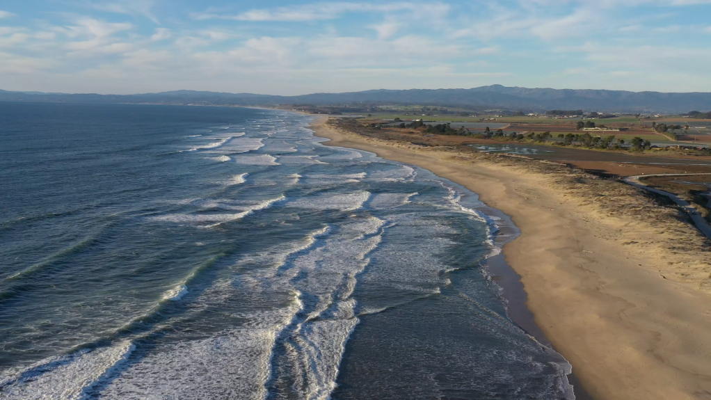
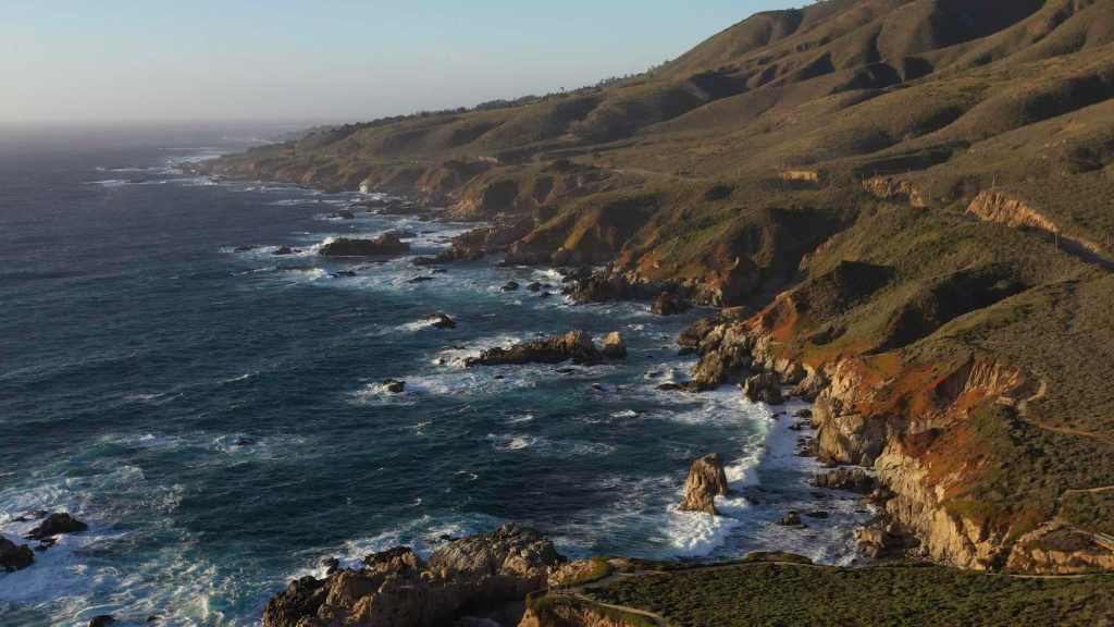
In the 18th century, when Spanish and French explorers ventured along the northern California coast they encountered Monterey Bay and marveled at the astonishing ecological abundance of this 25-mile wide bite mark in the land. The shores buzzed with the lively interactions of sea birds, sea otters played amidst the luxuriant kelp beds, and the waters teemed with many species of whale. 

Yet, by the late 19th and early 20th centuries, this rich tapestry of marine life and biodiversity had largely been erased, replaced by the destructive industrial operations of sardine canneries. These factories, though they brought economic activity and prosperity to a few, also introduced a plague of environmental problems that began a period of staggering ecological decline. 

California Coast out of Big Sur (photo: Erik Olsen)

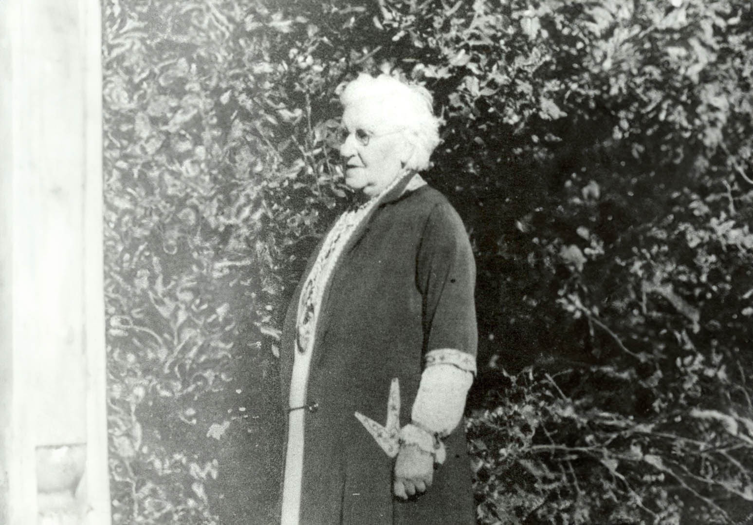
But the tide turned in the early 20th century, in large part due to the efforts of a determined, pioneering woman who took a stand against the sardine industry and began an effort of restoration that helped make Monterey Bay one of the most celebrated shorelines in the world.

CALIFORNIA CURATED ON ETSY

Purchase stunning art prints of iconic California scenes.
Check out our Etsy store.

 This transformational figure was Julia Platt, whose contributions were instrumental in the conservation efforts that led to the revival of Monterey’s natural and economic landscape. As mayor of Pacific Grove and a pioneer in marine conservation, Platt used her authority and vision to establish protected marine areas and implement regulations that curbed overfishing and habitat destruction. Her efforts laid the groundwork for a broader environmental awareness and action within the community.

Julia Platt began her career not in politics, but in science. She was born on September 14, 1857, in San Francisco, California, and later moved to Burlington, Vermont. She studied at the University of Vermont and then at Harvard University for her graduate studies.

During her academic journey, Julia faced the limitations imposed on women in academia at the time. In the late 1800s in the United States, it was nearly impossible for a woman to pursue a Ph.D. in zoology due to prevailing gender biases. However, the University of Freiburg in Baden, Germany, presented her with an opportunity to break through these barriers. She seized this chance and became one of the first women to earn a zoological Ph.D. there, challenging the norms and paving the way for future generations. 

Her academic achievements were significant, and she had already made significant contributions to science, including pioneering research on chick embryo development and identifying a new head segment in shark embryos. 

But upon returning to the US, she once again ran up against the glass ceiling of academia. While she worked with some of the top zoologists of the time, she could not find steady work in science. Admitting defeat, but determined to make her mark, she decided on politics, writing to a friend, “Without work, life isn’t worth living. If I cannot obtain the work I wish, then I must take up with the next best.” 

Cannery Row in Monterey 2023 – (Photo by Erik Olsen)

Monterey Bay’s legendary biodiversity was under serious threat. In 1854, a whale was as valuable as several pounds of pure gold, and J.P. Davenport harvested them using exploding lances, processing the carcasses in shore-based vats of boiling oil. By the late 19th century, the lucrative abalone industry had attracted Chinese fishermen village to the shores of Pacific Grove over-burdening the population. During the Gold Rush, prospectors consumed fourteen million seabird eggs from the Farallon islands, a practice that decimated seabird populations. From the 1910s to the 1940s, Monterey Bay’s sardine population fueled a burgeoning canning industry, reaching unprecedented scales that caused horrific smells in town and rendered the beach useless for recreation. 

Each of these industries ultimately collapsed under the weight of its own exploitation; otters, whales, seabirds, abalone, and sardines were all harvested to the brink of extinction.

Whales at Moss Landing near Monterey

In 1899, as the age of 42, she moved to Pacific Grove, the photogenic seaside hamlet next to Monterey where industrial canning and the environmental destruction wrought by it was at its peak. The pollution from canning operations (romanticized in John Steinbeck’s Cannery Row) made the beaches unusable and the smell wafting from Monterey made conditions almost unlivable. Platt decided to redirect her passion for understanding the intricacies of life into preserving it. 

Photo by Eadweard Muybridge of egg collectors on South Farallon Island
Courtesy of New York Public Library via Wikicommons

Taking matters into her own hands, she ran for public office. In 1931, at the age of 70, she became the mayor of Pacific Grove. Despite facing challenges as one of the few female mayors of her time, she wielded her position with an iron will and a clear vision for the future. She was an ardent advocate for beach access for all people, and wielded crowbars, hammers and her own strong will against the rich beachfront land owners who sought to fence off their properties. In this regard, she was a pioneer, foreshadowing the California Coastal Act of 1976—one of the most treasured aspects of California’s landmark coastal protection system—which protects the state’s iconic coastlines from unchecked development and preserves their natural beauty and accessibility for future generations.

Platt’s most significant and lasting contribution as mayor was the establishment of one of the first marine protected areas in California. She passionately argued for the designation of a marine refuge along the coastline, driven by her belief in the innate value of conserving marine habitats and their inhabitants. With her guidance, what became the Lovers Point-Julia Platt State Marine Reserve (SMR) and Edward F. Ricketts State Marine Conservation Area (SMCA), became two of four marine protected areas (MPAs) located on the Monterey Peninsula between Monterey and Pacific Grove.

Bixby Bridge near Monterey (Photo: Erik Olsen)

Thanks to Platt’s efforts, the region saw a revival in its marine biodiversity. Her initiatives ensured that the delicate balance of the marine ecosystem was maintained and allowed for species that were on the brink of being decimated due to human activities to thrive once more.

Julia Platt was more than just Pacific Grove’s mayor; she was its guardian. Through her vision and determination, she transformed Monterey into a beacon of marine conservation. Even after her tenure as mayor, Platt’s legacy lived on. Her initiatives paved the way for future conservation efforts, including the establishment of the iconic Monterey Bay Aquarium.

Feathers on the Flyway: Unraveling Avian Mysteries at Bear Divide with the Moore Lab

Western tanager (Ryan Terrill)

“Personally, I really think it’s one of the best birding spots in the world,” Ryan Terrill, science director at the Klamath Bird Observatory.

Within a 45 minute drive from the urban chaos of downtown Los Angeles, lies a natural, ornithological marvel: Bear Divide, a vital corridor for the annual migration of numerous bird species. Every year — roughly between March 15 and June 15, with peak migration between April 10 and May 20 — thousands of birds funnel through the narrow pass. The divide is a small dip in the otherwise impregnable San Gabriel mountains, allowing birds in the midst of their migration to pass through safely at relatively low altitudes. This area is not just a haven for bird enthusiasts but also a critical research site, especially for the team from the Moore Lab of Zoology at Occidental College, who have been delving into the intricacies of these migratory patterns.

The Moore Lab of Zoology is renowned for its extensive bird specimen collection, one of the largest of its kind in the world for Mexican birds.

Part of the large bird collection at the Moore Lab at Occidental College in Pasadena (Erik Olsen)

Bear Divide is strategically positioned along the Pacific Flyway, a significant north-south migratory route used by birds traveling between Alaska and Patagonia. The geographical features of the San Gabriels provide an ideal resting and feeding ground for these birds, making Bear Divide a crucial stopover during their long journeys. It’s this unique combination of location and topography that makes Bear Divide an essential component of avian migration.

U.S. Fish and Wildlife Service

The discovery of Bear Divide was a lucky happenstance. A bird researcher was conducting overnight monitoring in the spring of 2016, and when morning came, he noticed legions of small songbirds whizzing past his monitoring spot. His report caught the attention of postdoc bird scientist Ryan Terrill at Moore Lab at the time, and he began an effort to monitor the birds. Terrill and his team would ultimately record as many as 20,000 birds in a single morning.

“It really is overwhelming to stand on the road and have 5,000 birds of 80 species fly by your knees in a morning,” Terrill said. The effort has continued to this day with startling results. Terrill has since left and is now the science director at the Klamath Bird Observatory.

CALIFORNIA CURATED ON ETSY

Purchase stunning coffee mugs and art prints of iconic California species.
Check out our Etsy store.

“Last year 2023 we counted 53,511 birds of 140 species from February to May,” said John McCormack, a professor of biology and the Director and Curator of the Moore Laboratory of Zoology. “And of course, we missed many thousands more because most travel at night. It’s easy to say that there are hundreds of thousands of birds passing through Bear Divide.”

Swainson’s Hawk (Marky Mutchler)

As many as 13,000 western tanagers, lazuli buntings, chipping sparrows, hermit warblers, orioles, grosbeaks and warblers pass through Bear Divide on a single day. Why they do so, is not entirely understood. The unusual topography of Bear Divide essentially serves as a funnel for the migrating birds, with many of them shooting through the gap just a meter or two above ground.

“Personally, I really think it’s one of the best birding spots in the world,” Terrill told the LA Times.

McCormack says that the “ultimate goal is to better understand the Pacific Flyway and how it’s used, especially by small terrestrial birds. Little is known about their movements because they are hard to see and usually travel at night.”

Hooded Oriole (Ryan Terrill)

Because many of the species sighted at Bear Divide are in steep decline. The lab says that year-to-year counts will help set a baseline for future trends that can be associated with weather, climate, and urbanization. “Tracking individual birds will give granular knowledge on how migratory birds use the landscape, which helps individuals and homeowners create corridors for them to travel,” says McCormack.

The best time to catch the show at Bear Divide is late winter early Spring. McCormack says Cliff Swallows and Lawrence’s Goldfinch are some of the early movers in March, and that by May, streaking by are Yellow Warblers, sunset-faced Western Tanagers, and bright blue Lazuli Buntings.

“There is so much we still don’t know about these birds and their world,” Lauren Hill, the site’s lead bird bander, told the Los Angeles Times. “For example, no one knows where they were before showing up here after sunrise.”

Lazuli Bunting zips past the camera at Bear Divide (Ryan Terrill)

The team is counting birds in order to establish a baseline of the populations coming through Bear Divide so they can understand how much we are changing the environment and what effect that may have on bird populations, many of which are in severe decline.

Their research spans a variety of topics, including how climate change is impacting migration routes and the effects of urbanization on bird populations. The lab has recently begun a program to put satellite trackers on birds at Bear Divide to follow individual birds, providing deep insight into their migration and resting patterns. This research is not only pivotal in understanding avian behavior but also crucial in shaping conservation policies.

One of the most fascinating aspects of Bear Divide is the sheer variety of bird species it attracts. From the diminutive hummingbirds to the impressive birds of prey, each species adds a unique dimension to the study of migration. The Moore lab’s findings have shed light on the varied responses of different species to environmental changes, offering a glimpse into the broader ecological shifts occurring across the globe.

Yellow-rumped Warbler (Ryan Terrill)

One compelling result of the Moore Lab’s study at Bear Divide suggests that the peak of a particular species’ migration is correlated with the latitude of its breeding site. Species that breed at higher latitudes migrated through Bear Divide at later dates. It’s also unusual in the West for species to migrate during the day. Most species of birds using the Pacific Flyway are known to migrate at night.

The Moore Lab of Zoology

In addition to its scientific contributions, the Moore lab is also known for its involvement in citizen science. Collaborating with local birdwatchers and volunteers, the lab extends its research capabilities and cultivates a community actively engaged in bird conservation. This collaborative approach not only enhances the breadth of their research but also underscores the importance of community involvement in conservation efforts.

Bear Divide is on public land, so anyone with a legitimate research project can get permission to work there. UCLA graduate student Kelsey Reckling, who has worked as a counter at Bear Divide since the beginning, is leading the counting efforts this Spring to understand changes in numbers of birds and species across years. Cal State L.A. graduate student Lauren Hill lea ds the group of bird banders, who catch some of the birds and record data, attaching a lightweight metal band around one leg and releasing them. Her lab mate Tania Romero is putting small, lightweight tracking devices on Yellow Warblers, which send signals to a network of tracking (MOTUS) towers across the continent.

Many bird species are under serious threat around the globe from a number of different impacts, including climate change, pesticides and habitat loss. Birds play a critical role in the health of our planet. They regulate ecosystems by preying on insects, pollinating plants, and spreading seeds. Healthy ecosystems are important for breathable air, food, and a regulated climate.

Bear Divide (Ian Davies)

According to a 2019 study, nearly 3 billion breeding birds have been lost in North America and the European Union since 1970. That’s about 30% of the bird population in North America. The 2022 State of the Birds Report for the United States found that bird declines are continuing in almost every habitat, except wetlands. Protecting birds’ habitats, and migration routes and reducing mortality through conservation efforts are crucial to ensuring the survival of these magnificent creatures.

The research conducted at Bear Divide by the Moore lab transcends academic interests, emphasizing the interconnectivity of ecosystems and underscoring the need to preserve natural migration corridors amid urban expansion. The insights gained here are invaluable to both the scientific community and conservation efforts, highlighting the need for a balanced approach to wildlife preservation and ecological sustainability.

Band-tailed Pigeon (Ryan Terrill)

“What’s magical about Bear Divide is that it’s the first real place to see small, migrating birds at eye level in daylight hours,” says McCormack. “I don’t want to oversell it: it’s still a lot of small birds zinging by in a wide open place and it takes a while to get good at identifying them. But by seeing them out there, struggling against the wind and the cold, but still making progress, it gives you a real sense of how amazing their journeys are–and how we shouldn’t make them harder if there’s anything we can do about it.”

The Blythe Intaglios are the California’s Nazca Lines. They are True Mysteries Etched in Earth.

Blythe Intaglio of a human figure in Southern California (Wikipedia)

In the vast expanses of California’s Colorado Desert, less than four hours from Los Angeles, a series of ancient and enigmatic figures etched into the earth—the Blythe Intaglios—have long puzzled anthropologists and captivated the imagination of those who visit them or view them from the sky. They were brought to modern attention somewhat by chance. In 1932, George Palmer, a pilot flying over the Mojave Desert between Las Vegas, Nevada and Blythe, glimpsed these enigmatic formations, sparking curiosity and awe. 

Named for the nearby town of Blythe, California, these large geoglyphs (human-made designs created on the ground by arranging or moving objects in a landscape), sprawl across the desert floor, and are an extraordinary example of prehistoric art, yet they remain one of the lesser-known archaeological wonders of North America. The Colorado Desert, just south of the Mojave, contains the only known desert intaglios in North America. 

The Blythe Intaglios are best observed from above by drone or by plane, where their full scale and intricacy become apparent. The largest figure – of a human with outstretched arms – spans an immense 171 feet, an impressive endeavor considering the primitive tools likely used in their creation. One has to wonder why they were created at all since the people who made them certainly had no way of viewing them from the air. In addition to humans, the figures depict animals such as a rattlesnake and possibly a horse (yeah, what is that thing?), as well as geometric shapes, each meticulously carved by removing the dark desert varnish to reveal the lighter soil underneath. Intaglios in general are classified by their shapes, such as anthropomorphs (humanlike), zoomorphs (animal-like) and various geometric shapes.

Blythe Intaglio quadruped (Wikipedia)

The intaglios are mostly located along the Colorado River, a fact that some scientists consider significant. Rivers often hold a central place in the spiritual and cultural lives of indigenous peoples. For the tribes associated with the Blythe Intaglios, such as the Mojave and Quechan, the Colorado River was likely a vital part of their spiritual and everyday life. The proximity of these geoglyphs to the river suggests that they could have been part of a broader cultural landscape that included the river as a critical element. The river may have been seen as a source of life and a spiritual boundary, making the nearby land a significant place for creating these monumental figures.

While the Nazca Lines in Peru have gained worldwide fame, the Blythe Intaglios, though similar in form and function, have remained relatively obscure. Most Californians probably have no idea that such unique archaeological artifacts can be found in the state, let alone so close to a major urban center. This obscurity, however, adds to their mystique. 

The geoglyphs are believed to date back at least a thousand years, but their exact age remains uncertain. If the quadruped figures represent horses (reintroduced in North America by the Spanish) then a historical date of sometime after the 1500s would be supported. Archaeologist Jay von Werlhof obtained radiocarbon dates for the figures, ranging from 900 BCE to 1200 CE. The human figures, particularly the largest, are thought to represent Mastamho, the creator of life in Mojave and Quechan mythology. The animal figures, like the mountain lions, are steeped in symbolic meaning, potentially reflecting the tribes’ cosmology and spiritual beliefs.

Nazca Lines in Peru. (UNESCO World Heritage Site)

The precise purpose of the Blythe Intaglios is a matter of ongoing debate. Some scholars propose that they were part of religious rituals or celestial observances. The alignment and positioning of the figures suggest a possible astronomical function, marking significant events in the lunar or solar calendars. Or perhaps making them was just a fun way to pass the time and express creativity.  

CALIFORNIA CURATED ON ETSY

Purchase stunning coffee mugs and art prints of iconic California species.
Check out our Etsy store.

Despite their historical and cultural significance, the Blythe Intaglios have not been immune to threats. Off-road vehicle traffic and natural erosion have damaged some of the figures. Conservation efforts are in place, but the remote location and sheer scale of the site present unique challenges. Fences have been erected around some figures to protect them, but much work remains to ensure their preservation.

California’s Colorado Desert (Wikipedia)

The Blythe Intaglios are more than just ancient art; they are a wonderful example of the rich and diverse cultural heritage of the indigenous peoples of the Southwest. These geoglyphs offer a window into a past that likely predates European influence, a past that is integral to understanding the complex tapestry of American history. Places like the Blythe Intaglios are in constant threat of disappearing forever, but they’re important because they connect us with the human past and remind us of the power of human expression over time and the mysteries beneath our feet.

The Enigmatic Island Fox: A Tale of Survival and Conservation

Nature Conservancy

In the rugged, isolated beauty of California’s Channel Islands, a small, curious creature scampers through the chapparal, playing a crucial role in the archipelago’s ecosystem. It’s the Island Fox (Urocyon littoralis), a species that encapsulates both the vulnerability and resilience of island ecosystems.

The island fox only lives on six of the eight Channel Islands off the coast of southern California–they are found nowhere else on Earth. Each island population is recognized as a separate endemic or unique subspecies. This divergence is a classic case of allopatric speciation, where geographic isolation leads to the evolution of different species.

The Island Fox, notably smaller than its mainland cousin, the gray fox, stands as a striking example of insular dwarfism – a phenomenon found in the theory of island biogeography where species evolve smaller sizes on islands. It should be noted that island biogeography, which explores the distribution of species and ecosystems in island environments, finds a perfect case study in the Channel Islands. For instance, the discovery of remains of the pygmy mammoth (Mammuthus exilis) on Santa Rosa Island provides a classic example of how isolation and limited resources can lead to significant evolutionary changes. 

Skeleton of the Pygmy Mammoth at the Santa Barbara Museum of Natural History

The Island Fox is known for its curiosity and intelligence. It’s primarily nocturnal but is often active during the day, especially when tourists and their food are around. Visitors to the most popular Channel Islands like Anacapa, Santa Rosa, and Santa Cruz may regularly see the foxes scurrying around campsites looking for scraps of food. They readily approach humans, perhaps an unfortunate sign that they have become too habituated to humans. The island fox is an omnivore, with a diet ranging from fruits and insects to small mammals and birds. Its diet shifts with the seasons, reflecting the availability of different food sources on the islands.

Island Foxes typically form monogamous pairs during the breeding season, which runs from January to March. The female gives birth to a litter of two to four pups around 50 days after mating. These pups are weaned and ready to fend for themselves after about 9 months, reaching sexual maturity at 10 months. The average lifespan of an Island Fox in the wild is 4 to 6 years, though they can live longer in captivity.

Island Fox on the Channel Islands (Photo: Erik Olsen)

The story of the Island Fox’s conservation is one of remarkable success but also a stark reminder of the fragility of island ecosystems. In the late 1990s, the Island Fox population faced a catastrophic decline, primarily due to predation by golden eagles and a disease outbreak. By 2004, fewer than 100 foxes remained on some islands, leading to their classification as an endangered species.

Island Fox looking for food scraps. (Photo: Erik Olsen)

A concerted effort by conservationists, including the National Park Service and the Nature Conservancy, initiated a recovery program. This program involved breeding foxes in captivity, vaccinating them against diseases, and relocating golden eagles while reintroducing bald eagles, a natural competitor. Remarkably, by 2016, the Island Fox populations had bounced back sufficiently for them to be removed from the endangered species list, marking one of the fastest recoveries of an endangered species in U.S. history.

The Island Fox’s journey from the brink of extinction to a conservation success story is a testament to the power of dedicated conservation efforts. It also highlights the importance of maintaining ecological balance in sensitive environments like the Channel Islands.

California’s SLAC and the Mission to Unveil the Mysteries of Matter and the Cosmos

The BaBar Detector at SLAC with physicist Michael Kelsey inside wearing a red hard hat, 2002. 
(Peter Ginter/SLAC National Accelerator Laboratory)

The SLAC National Accelerator Laboratory in Menlo Park, California, is a testament to human curiosity and the pursuit of the unknown. Since its inception in 1962, originally as the Stanford Linear Accelerator Center (as it was previously known), it has been on the forefront of scientific discovery in numerous scientific disciplines. It is truly one of the nation’s great scientific institutions, being at the forefront of numerous major discoveries that have deeply impacted – and will impact – the world. 

Six scientists have received four Nobel prizes for their groundbreaking research conducted at SLAC, which led to the discovery of two elementary particles, confirmed that protons consist of quarks, and elucidated the process by which DNA orchestrates the synthesis of proteins in cells.

Stanford’s Roger Kornberg received the 2006 chemistry Nobel for work on RNA transcriptase, shown on screens.  
(Peter Ginter/SLAC National Accelerator Laboratory)

Administered by Stanford University and sponsored by the U.S. Department of Energy, SLAC has grown into a multifaceted research institution that explores a broad program in atomic and solid-state physics, chemistry, biology, and medicine. The lab employs the use of X-rays generated from synchrotron radiation and a free-electron laser, among other tools, to push the boundaries of our understanding in areas ranging from elementary particle physics to cosmology​​.

CALIFORNIA CURATED ART ON ETSY

Purchase stunning coffee mugs and art prints of iconic California species.
Check out our Etsy store.

SLAC’s roots can be traced back to the construction of the 3.2-kilometer Stanford Linear Accelerator in 1966, the world’s longest linear accelerator at the time. This remarkable structure has been pivotal in fundamental research that led to the discovery of the charm quark in 1976, the quark structure inside protons and neutrons in 1990, and the tau lepton in 1995, each discovery earning a Nobel Prize in Physics​​. This pioneering spirit is also embedded in SLAC’s cultural heritage, having provided a meeting space for the Homebrew Computer Club, which significantly contributed to the home computer revolution of the late 1970s and early 1980s​​. For example, Steve Wozniak debuted the prototype Apple-1 at the Homebrew Computer Club in 1976. 

Steve Jobs and Steve Wozniak
Apple 1

SLAC has also played a significant role in the digital age, hosting the first World Wide Web server outside of Europe in December 1991, a milestone that underscores its contribution beyond the realm of physics​​. In the 1990s, the Stanford Linear Collider delved into the properties of the Z boson, further cementing SLAC’s position at the cutting edge of particle physics research​​.

New projects and experiments are undertaken at SLAC all the time, and new discoveries are constantly being made to help us understand the nature of matter, biological processes and the evolution of the universe, as well as to help bring us into a greener future. In November 2023, a team at SLAC along with the Toyota Motor Company made significant advances in fuel cell efficiency.

The Linac Coherent Light Source (LCLS), a free-electron laser facility, has been a highlight of SLAC’s facilities, providing intense X-ray radiation for diverse research areas since 2009. In September 2023, SLAC fired up the world’s most powerful X-ray laser, the LCLS-II, to explore atomic-scale, ultrafast phenomena that are key to a broad range of applications, from quantum materials to clean energy technologies and medicine.

“This achievement marks the culmination of over a decade of work,” said LCLS-II Project Director Greg Hays. “It shows that all the different elements of LCLS-II are working in harmony to produce X-ray laser light in an entirely new mode of operation.”  

It was in the facility that scientists and researchers developed the first X-ray free-electron lasers (XFELs). XFELs are like X-ray microscopes, and generate exceptionally bright and fleeting bursts of X-ray light, enabling researchers to observe the dynamics of molecules, atoms, and electrons with unparalleled clarity, exactly as these events unfold in their native, rapid timescales—a realm where the intricacies of chemistry, biology, and materials science play out. These facilities have played a pivotal role in numerous scientific breakthroughs, such as producing the first “molecular movie” that reveals the intricacies of complex chemical reactions, capturing the precise moments when plants and algae harness solar energy to generate the oxygen we rely on, and probing the intense conditions that shape the formation of planets and extraordinary events like diamond precipitation.

Over the years, SLAC has evolved to support a growing community of scientists. As of 2021, the lab employs approximately 1,600 staff members from 55 different countries, in addition to 470 postdoctoral researchers and graduate students. The center welcomes over 3,000 visiting researchers annually​​. This community has access to facilities such as the Stanford Synchrotron Radiation Lightsource for materials science and biology experiments and the Fermi Gamma-ray Space Telescope for astrophysics research​​.

After decades of effort and help from SLAC’s X-ray laser, scientists have finally seen the process by which nature creates the oxygen we breathe. (SLAC)

The lab is also working at the forefront of astronomy and imaging. The SLAC National Accelerator Laboratory is at the helm of an ambitious project, crafting the world’s largest digital camera for the Vera Rubin Observatory’s Legacy Survey of Space and Time (LSST). Set to capture the southern sky from high on a mountaintop in Chile, this camera is a marvel of engineering and scientific collaboration. Its 3.2-gigapixel capacity allows it to snap detailed images every 15 seconds, offering an unprecedented window into the cosmos. The camera’s wide field of view can image an area 40 times larger than the full moon in one shot, and its advanced filters enable astronomers to probe the universe across a range of wavelengths. As part of the decade-long LSST, it will gather vast amounts of data, propelling our understanding of dark matter, dark energy, galaxy formation, and more​

SLAC has developed the world’s largest digital camera for the Vera Rubin Observatory’s Legacy Survey of Space and Time (LSST)

In 2008, the lab was renamed from the Stanford Linear Accelerator Center to SLAC National Accelerator Laboratory, reflecting a broader scientific mission. Since then, the lab has continued to receive significant funding, including $68.3 million in Recovery Act Funding in 2009​​. Notably, SLAC and Stanford University initiated the Bits and Watts project to develop better, greener electric grids, although SLAC later withdrew due to concerns over an industry partner​​.

SLAC’s current endeavors include the Facility for Advanced Accelerator Experimental Tests (FACET), where research on plasma acceleration continues to advance the field​​. Theoretical research at the lab spans quantum field theory, collider physics, astroparticle physics, and particle phenomenology​​. Moreover, SLAC has contributed to the development of the klystron, a high-power microwave amplification tube that amplifies high radio frequencies and has aided in archaeological discoveries such as revealing hidden text in the Archimedes Palimpsest​​.

Archimedes Palimpsest (Wikipedia)

Other recent updates from SLAC include a new system for turning seawater into hydrogen fuel​​​​. They have also made advancements in understanding the production of nitroxide, a molecule with potential biomedical applications, and the operation of superconducting X-ray lasers at temperatures colder than outer space​​​​.

The SLAC National Accelerator Laboratory’s legacy is rich with scientific triumphs, and its future beckons with the promise of unraveling more of the universe’s deepest secrets. Whether through peering into the atomic structure or probing the vast cosmos, SLAC remains a beacon of discovery and innovation.

Roadcut Revelations: Unearthing California’s Deep History Along the Highway

Roadcut in Southern California on Angeles Crest Highway (Photo: Erik Olsen)

“Man is a geologic agent,” the late California geologist Eldridge Moores.

Roadcuts in California, those slices through hills and mountainsides made during the construction of roads, are like open books to geologists. They reveal the intricate and often dramatic geological history of the state. When you drive along the highways of California, you’re likely to pass by these exposed cliffs of rock. To the everyday traveler, they might just be a part of the landscape, but to geologists, they are invaluable windows into the Earth’s past.

““Geologists on the whole are inconsistent drivers. When a roadcut presents itself, they tend to lurch and weave,” wrote the great geology (and many other topics) writer John McPhee in his excellent book Annals of the Former World. “To them, the roadcut is a portal, a fragment of a regional story, a proscenium arch that leads their imaginations into the earth and through the surrounding terrane.”

Glacier carved domes tell the story of thousands of years of glaciation in California. (Photo: Erik Olsen)

Roadcuts expose layers of rock that have been hidden from view for millions of years. Each layer, or stratum, tells a story of what the environment was like when that layer was deposited. By studying these layers, geologists can reconstruct a timeline of events that shaped the region. For example, they can identify periods of volcanic activity, times when the area was submerged under an ancient ocean, or epochs when massive glaciers were carving out the valleys.

California is especially interesting due to its active tectonic setting. It’s not just the San Andreas Fault that captivates geologists; there are numerous lesser-known faults that crisscross the state, and roadcuts can expose these hidden fractures. By studying the composition of rocks along these faults, geologists learn about the nature of past seismic activity and can make predictions about future earthquakes.

The rock composition in California varies widely, offering a rich tapestry of geological history. In the Sierra Nevada, granite roadcuts tell of a time when massive chambers of magma slowly cooled and crystallized deep beneath the Earth’s surface. Elsewhere, roadcuts through sedimentary rocks like sandstone and shale may contain fossils, giving clues about the life forms that once inhabited the region.

The San Gabriel Mountains consist of granite rocks of several kinds and a variety of other crystalline rocks, mainly schists, some of which were originally shales and sandstones but have been altered (metamorphosed) by great igneous intrusions and compression. (Photo: Erik Olsen)

These man-made artifacts also reveal the forces that have shaped California’s diverse landscapes. In roadcuts, geologists might find evidence of powerful geological processes such as metamorphism, where existing rock types are transformed into new types due to high pressure and temperature conditions. For instance, the presence of metamorphic rocks like schist and gneiss can indicate ancient collision zones where Earth’s tectonic plates have crashed together.

The value of California roadcuts is wonderfully illustrated in John McPhee’s “Assembling California.” The book is an excellent narrative that weaves the tale of California’s complex geology with the lives of the geologists who study it. Eldridge Moores, a late prominent geologist from the University of California, Davis (Moores died in 2018), played a significant role in deciphering the geological history of the region, particularly through his fieldwork involving roadcuts.

Roadcut in San Gabriel mountains. (Photo: Erik Olsen)

At the time Eldridge Moores entered the field, the theory of plate tectonics was only beginning to gain traction. In the early 1960s, the idea that continents drifted and that vast slabs of the Earth’s crust moved over the mantle was still controversial, met with skepticism by many geologists trained in older, fixist models. Moores, however, embraced the theory early, recognizing in it an explanation for the chaotic structures he saw in California’s mountain belts. As a young researcher, he studied the Troodos ophiolite in Cyprus, an exposed section of ancient oceanic crust, and realized that similar rock assemblages—serpentinized peridotites, deep-sea sediments, and basaltic lavas—were scattered across California.

“It was a very exciting time. I still get goosebumps even talking about it,” Moores told KQED in 2017. “A turning point, I think it was, in the plate tectonic revolution, that was the watershed of geology.”

With plate tectonics as a guiding framework, Moores understood that these rocks were remnants of vanished oceans, relics of seafloor that had been uplifted and accreted onto the edge of North America. His work helped reveal that much of California had arrived in pieces, a geological patchwork of island arcs, deep-sea basins, and continental fragments welded together by subduction. While others were still debating the validity of plate tectonics, Moores was already applying it, using it to decode the assembly of an entire state.

Eldridge Moores at the Cordelia fault.  (Photo: UC Davis)

Moores was renowned for his work on ophiolites, sections of the ocean floor that have been thrust up onto the continent. One of his notable discoveries was the identification of ophiolite sequences in the roadcuts along the highways of the Sierra Nevada. These discoveries were crucial in understanding the ancient tectonic movements that shaped western North America.

Through roadcuts, Moores and his colleagues were able to observe and study the juxtaposition of different rock types, providing further evidence for the theory of plate tectonics. They could literally walk along the cuts and see how different terranes—large packets of rock with a distinct geological history—were stitched together like a geological quilt, offering insight into the past locations of tectonic plates.

CALIFORNIA CURATED ON ETSY

Purchase stunning coffee mugs and art prints of iconic California species.
Check out our Etsy store.

“Nature is messy,” Moores once told McPhee. “Don’t expect it to be uniform and consistent.”

There are thousands of roadcuts across California, each exposing a fragment of the state’s chaotic geology. The Palmdale Roadcut, a striking geological feature along the San Andreas Fault, has been an invaluable resource for geologists studying the dynamics of this infamous fault line. This natural cut exposes a cross-section of the earth, revealing layers of rock and sediment that have been shifted and shaped by seismic activity over millions of years. The rock here is a chaotic mélange—fault gouge, shattered granite, and twisted layers of sedimentary rock that have been pulverized and ground together by the relentless motion of the Pacific and North American plates. By analyzing these layers, geologists can better understand the history and behavior of the San Andreas Fault, including the patterns of past earthquakes and the movements of tectonic plates. This, in turn, contributes significantly to the broader understanding of seismic risks and aids in preparing for future seismic events.

The Palmdale Road Cut on Hwy 14 in Southern California is a 90-foot slice through swirling sediments that have spent millions of years being squeezed and twisted by the San Andreas fault. Some say that this view of the fault is one of the best in all of California.
(Photo: Erik Olsen)

Another geologist, Garniss Curtis, used California roadcuts to study volcanic rocks and their embedded minerals, which allowed for the dating of geologic events with greater precision. His work on the potassium-argon dating method turned roadcuts into time machines, where the age of rocks could be determined with the help of exposed minerals.

One of California’s most well-known roadcuts, the Charlie Brown Outcrop (map), is a favorite among geologists. Located along Highway 178 near the Nevada border, it has been highlighted by geology teacher Garry Hayes, author of the acclaimed Geotripper blog. Hayes says of the roadcut (also known as the Shoshone Roadcut):

“There are really three stories told in this exposure, that of distant ash eruptions, a violent eruption close by, and earthquakes with associated mountain-building.”

Charlie Brown outcrop along highway 178 in California. (Google Maps)

These geologists, among others, have used roadcuts as a means to peel back the layers of time, revealing the processes that have operated to create the state’s diverse geologic scenery. Roadcuts have provided the evidence for groundbreaking theories and have been instrumental in mapping the geological evolution of California. The work of these scientists exemplifies the roadcut’s role as a natural laboratory, a place where Earth’s geologic history is on full display for those who know how to read the rocks.

Moreover, roadcuts are crucial for educating the next generation of geologists. They serve as natural laboratories where students can practice identifying rock types, deciphering the sequence of geological events, and understanding the dynamic forces that continue to shape the Earth.

Roadcuts in California, those slices through hills and mountainsides made during the construction of roads, are like open books to geologists. They reveal the intricate and often dramatic geological history of the state. (Photo: Erik Olsen)

In Assembling California, McPhee remarked that “geologists are like dermatologists: they study, for the most part, the outermost two per cent of the earth. They crawl around like fleas on the world’s tough hide, exploring every wrinkle and crease, and try to figure out what makes the animal move.”

Manmade creations like roadcuts greatly assist geologists in their work. In essence, roadcuts are not just incidental byproducts of infrastructure development; they are key to understanding California’s complex geological evolution. They tell stories of ancient environments, tectonic upheavals, and the slow but inexorable forces that continue to mold the landscape. For geologists in California, the roadcut is a portal into the deep past, offering a tangible connection to the processes that have made the state what it is today.

Underground Fury: The 1985 Methane Blast That Rocked Los Angeles and Rerouted Its Subways

A 1985 methane explosion in L.A.’s Fairfax district turned a Ross Dress for Less into a disaster scene.
Photo by Dean Musgrove, courtesy of the Herald-Examiner Collection – Los Angeles Public Library.

In the heart of Los Angeles, on a seemingly ordinary spring day in 1985, a sudden explosion tore through the Ross Dress for Less store at the corner of 3rd Street and Fairfax Avenue. This wasn’t an industrial accident nor was it an act of malice—it was a force of nature that had been lurking unseen beneath the city’s streets: methane gas.

The Fairfax District, a bustling area known for its shopping and historic Farmers Market, is also part of the larger Salt Lake Oil Field, a subterranean landscape rich in hydrocarbons. Over millions of years, decaying organic matter trapped in the earth’s crust had transformed into vast reservoirs of oil and methane gas. It was this methane that had stealthily migrated close to the surface, building up in closed spaces, waiting for an ignition source to set off a dramatic release.

On that day, as shoppers browsed through discounted apparel, an explosive mixture of methane, oxygen, and sewer gases found its spark. The blast shattered the storefront windows and caused a partial cave-in of the roof, turning the shop’s interior into a mangled wreck of metal debris. Twenty-three individuals were left with injuries severe enough to necessitate hospital care. In the aftermath, police cordoned off a four-block radius encompassing the bizarre spectacle of gas fires that jetted into the night sky, a haunting tableau that persisted until dawn.

The aftermath of the explosion was a scene of chaos and confusion. Emergency services sprang into action, addressing the immediate humanitarian concerns. But once the dust settled, a more profound issue loomed: the implications for the city’s ambitious underground Metro Rail project.

At the time, Los Angeles was in the throes of planning and constructing the Metro Red Line, a subway system that promised to link various parts of the sprawling city. Wilshire Boulevard, one of the busiest thoroughfares in Los Angeles, was to be a central artery in this new subterranean network. However, the explosion at Ross Dress for Less exposed the heretofore underestimated risk of tunneling through methane-rich zones.

The city of Los Angeles created a methane zone map showing shaded regions of the methane zone and methane buffer zones.

Fears quickly escalated about the potential for similar explosions occurring elsewhere, particularly along the planned subway routes. The public, already wary of the high costs and disruptions associated with the Metro line, grew increasingly concerned about the dangers of tunneling through methane pockets.

In the wake of the explosion, city officials and Metro Rail engineers faced a daunting challenge. They needed to ensure public safety without derailing the critical infrastructure project. This task required a multifaceted approach. First, there was a thorough scientific investigation. Experts from various fields, including geologists, engineers, and safety specialists, were brought in to assess the risks of methane gas in the Fairfax District and along the proposed Metro route.

In a comprehensive regulatory response, the city imposed stringent building codes and established the Methane Zone Ordinance, which required new constructions in certain areas to implement gas detection and venting systems.

But the blast also resulted in a measure of technological innovation. The Metro Rail project incorporated state-of-the-art methane detection systems and emergency ventilation procedures in its design, setting a new standard for subway safety. The process was aided to some extent by significant community engagement. Public meetings and forums were held to address community concerns, offer reassurances, and provide education on the measures being taken to prevent future incidents.

B Line train at Union Station (Wikipedia)

Despite these efforts, the fear of what lay beneath Los Angeles’ streets had a chilling effect on the Metro’s progress. The Red Line faced delays as policymakers and the public grappled with the cost and complexity of making the subway safe. It wasn’t until the early 2000s, with the introduction of advanced tunneling technologies and robust safety protocols, that the Metro expansion regained momentum.

The 1985 methane explosion, while a localized event, reverberated through time to shape the development of Los Angeles in profound ways. It brought to the forefront the invisible risks of urban growth, challenged engineers and city planners to innovate, and ultimately reaffirmed the resilience of a city determined to rise above its subterranean challenges.

1983 rendering for the planned subway station at Wilshire and Fairfax – a casualty of the Ross explosion.
\Courtesy of the Metro Transportation Library and Archive.

The dangers of methane beneath Los Angeles are far from gone. The Porter Ranch leak, also known as the Aliso Canyon gas leak, was a massive methane leak in the Santa Susana Mountains near the neighborhood of Porter Ranch in the northwest section of the San Fernando Valley.. Discovered on October 23, 2015, gas was discovered escaping from a well within the Aliso Canyon underground storage facility. On January 6, 2016, Governor Jerry Brown issued a state of emergency, and numerous media reports suggested that the methane could be dangerous to residents.  On February 11, the gas company reported that it had the leak under control, and finally  on February 18, state officials announced that the leak was permanently plugged. Still, an estimated 97,100 tonnes (95,600 long tons; 107,000 short tons) of methane and 7,300 tonnes (7,200 long tons; 8,000 short tons) of ethane were released into the atmosphere.

Today, as the Los Angeles Metro continues to expand, the lessons learned from that explosive day in 1985 continue to resonate, ensuring that safety remains at the core of the city’s march toward the future.

Hey there! If you enjoy California Curated, consider donating the price of a coffee to support its creation!