The Majestic San Gabriel Mountains: A Deep Dive into Their Formation, History, and Biodiversity

Photo: “LA Skyline Mountains2” by Nserrano is licensed under  CC BY-SA 3.0

Towering over Los Angeles like quiet guardians, the San Gabriel Mountains stretch across the northern edge of the city, keeping watch over the busy sprawl below. More than just a dramatic barrier, these mountains are packed with stories of shifting earth, ancient rock, wild weather, and the people who’ve passed through them for thousands of years. They are also a primary source of Southern California beaches. They’re not just a backdrop; they’re a vital part of the region’s identity, full of science, history, and amazing nature.

Part of the Transverse Ranges, a rare east-west trending group of mountains in California, the San Gabriels rise abruptly from the San Gabriel Valley and form a kind of barrier between L.A. and the Mojave Desert. Framed by Interstate 5 to the west and Interstate 15 to the east, the range is anchored on its north side by the famous San Andreas Fault, where the Pacific and North American tectonic plates constantly grind against each other. That ongoing crush is what helped push these peaks up so quickly. Geologically speaking, they’re growing surprisingly quickly.

Side note: The Transverse Ranges also include the Santa Monica Mountains, San Bernardino Mountains, Santa Ynez Mountains, Topatopa Mountains, Tehachapi Mountains, Santa Susana Mountains, and Sierra Madre Mountains.

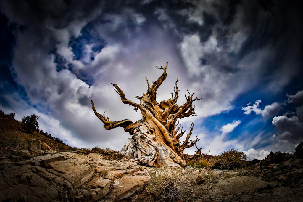
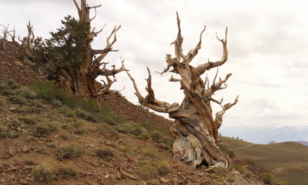
Inside the range you’ll find the Angeles and San Bernardino National Forests, along with the San Gabriel Mountains National Monument, first established in 2014 and significantly expanded in 2024 to protect more than 450,000 acres of rugged, biodiverse, and culturally significant terrain. (There is excellent hiking in these mountains.) These protected areas include steep canyons, chaparral, rare wildlife, and sites that are important to the history and traditions of Native American communities.

A pool of water from the Arroyo Seco in the San Gabriel Mountain (Erik Olsen)

The rocks here are some of the oldest in the region, but the mountains also tell stories from more recent times: gold miners, early astronomers, hikers, and wildfire researchers. The San Gabriels help shape the weather, store precious snowpack, and remind everyone in L.A. that nature is always nearby and always in motion.

The San Gabriel Mountains offer an impressive rise in elevation, they really kind of explode out of the earth. While the foothills begin at nearly sea level, the highest point in the range is Mount San Antonio, but most people know it as Mount Baldy because, let’s face it, with its distinctive, treeless summit, it looks kind of bald. This peak reaches an altitude of 10,064 feet (3,068 meters). The quick transition from the bustling city to towering peaks is part of the magic of these mountains, a dramatic wall standing guard over downtown Los Angeles.

While the San Gabriels are much smaller in terms of length than, say the Appalachians, they are significantly taller on average. The highest peak in the Appalachians, Mount Mitchell in North Carolina, reaches 6,684 feet (2,037 meters). That’s considerably lower than Mount Baldy in the San Gabriels. The San Gabriels, therefore, boast higher peaks even though they cover a smaller area. However, compared to the Appalachians, which are thought to be billions of years old, the San Gabriel Mountains are relatively young, geologically speaking, and are characterized by rugged and steep features. In essence, being younger, they’ve undergone less erosion.

San Gabriel mountains from La Cañada Flintridge (Photo: Erik Olsen)

It is believed that much of the sand on California’s legendary beaches originated in the San Gabriel mountains, the result of erosion and various rivers and streams that run into the Pacific Ocean.

To understand the story of the San Gabriel Mountains, we need to embark on a temporal journey spanning millions of years. The mountains’ tale starts about 100 million years ago, during the Mesozoic Era, when massive tectonic plates—the Pacific and North American plates—began to converge. The interaction of these tectonic plates was dramatic, with the Pacific Plate subducting, or diving beneath, the North American Plate. This subduction caused the rocks to melt and, over time, rise to form granitic masses known as plutons.

Rocks of a roadcut in the San Gabriel Mountains (Erik Olsen)

As the ages rolled on, these plutons were uplifted, and the erosion of the surrounding softer rocks exposed the granitic cores, giving birth to the San Gabriel Mountains we see today. The primary rock composition of these mountains is granite, with large-grained crystals of feldspar, quartz, and mica that glitter when the sun kisses their surfaces. These mountains also feature significant deposits of sedimentary rocks, particularly in the lower elevations, which date back to the Mesozoic and Cenozoic eras.

CALIFORNIA CURATED ON ETSY

Purchase stunning art prints of iconic California scenes.
Check out our Etsy store.

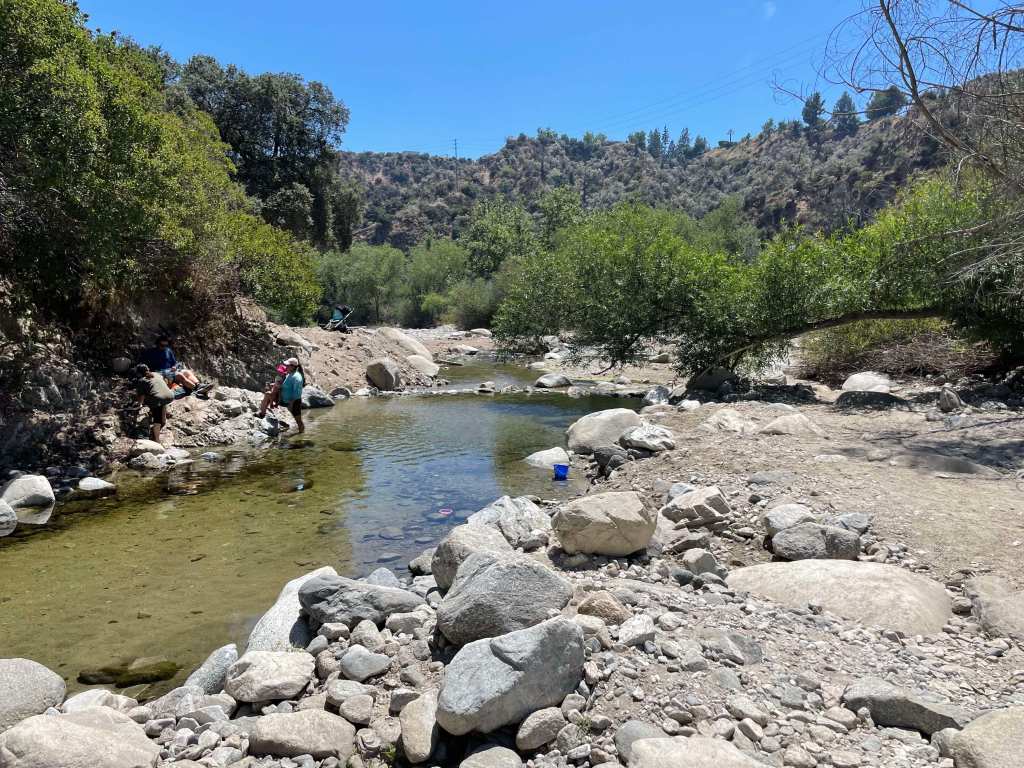
The drainage system of the San Gabriel Mountains is defined by numerous canyons, streams, and arroyos that channel water down from the high elevations into the valleys below. The Arroyo Seco, one of the most well-known waterways, begins near Mount Wilson and flows southwest through Pasadena before merging with the Los Angeles River. Other important streams include the Big Tujunga Creek, which cuts through the mountains to feed into the San Fernando Valley, and the San Gabriel River, which drains much of the range’s eastern side. These waterways are seasonal, swelling during winter rains and spring snowmelt, and often run dry during summer months. Their canyons have been carved by the relentless forces of erosion, creating deep ravines that are vital for wildlife and plant habitats.

Heavy rains cause flooding in the Arroyo Seco near Pasadena. (Erik Olsen)

The San Gabriel Mountains play a critical role in the watershed that serves the greater Los Angeles area. Rain and snowmelt from the mountains replenish groundwater basins and feed into reservoirs, such as the San Gabriel Reservoir and the Morris Reservoir, which are essential for water supply. These mountains act as a natural guidance system, capturing precipitation and funneling it into the region’s aquifers and rivers, supporting both the municipal water supply and flood control efforts. The watershed is crucial for Los Angeles, which depends on these local sources of water to supplement imported supplies from distant regions like the Colorado River and the Owens Valley. The mountain runoff helps maintain the flow of the Los Angeles River, contributing to the city’s efforts to recharge groundwater and ensure a reliable water supply in this semi-arid region.

Visit the California Curated store on Etsy for original prints showing the beauty and natural wonder of California.

When it rains it pours, and sometimes causes landslides

Flood control has long been a central concern in managing the water systems of the San Gabriel Mountains, particularly due to the area’s vulnerability to intense, episodic storms. The steep slopes of the mountains funnel rainwater rapidly into urban areas, leading to a heightened risk of flash floods and debris flows. Over time, this led to the construction of a vast network of catchment basins, dams, and debris basins at the foot of the mountains. These basins are designed to capture stormwater runoff, preventing the overflow of water into densely populated areas and managing the sediment and debris that comes with mountain runoff, which can clog waterways and exacerbate flooding.

Catchment basins in the San Gabriel Mountains are critical for controlling debris flows that occur during and after heavy rains, which can be particularly dangerous in areas where wildfires have stripped the landscape of vegetation. When intense rainstorms hit the steep, fire-scarred slopes, they trigger massive torrents of mud, boulders, and tree debris that rush down the mountain canyons toward the urban foothills. These debris flows can overwhelm creeks and spill into residential neighborhoods, causing widespread destruction. The catchment basins are designed to trap this debris before it reaches populated areas, but their effectiveness depends on regular maintenance and clearing. When these basins fill up too quickly or are not properly maintained, debris can overtop them, leading to significant flooding and property damage.

default

A stark example of the dangers posed by debris flows occurred in Montrose in 1934. Following a series of intense storms in the aftermath of the New Year’s Day floods, massive debris flows roared out of the San Gabriel Mountains, devastating the communities of Montrose, La Crescenta, and Tujunga. The floods and debris flows buried homes and roads under several feet of mud and debris, killing at least 45 people. The Montrose landslide became a tragic reminder of the risks associated with living near the San Gabriel Mountains, particularly in the face of severe weather. This event spurred greater investments in flood control infrastructure, including the construction of more robust debris basins to mitigate the effects of future storms.

A fascinating article on the efforts to control debris flows from the San Gabriels, though a bit dated, was penned by John McPhee—whose work we greatly admire. It remains a deeply engaging read on the subject.

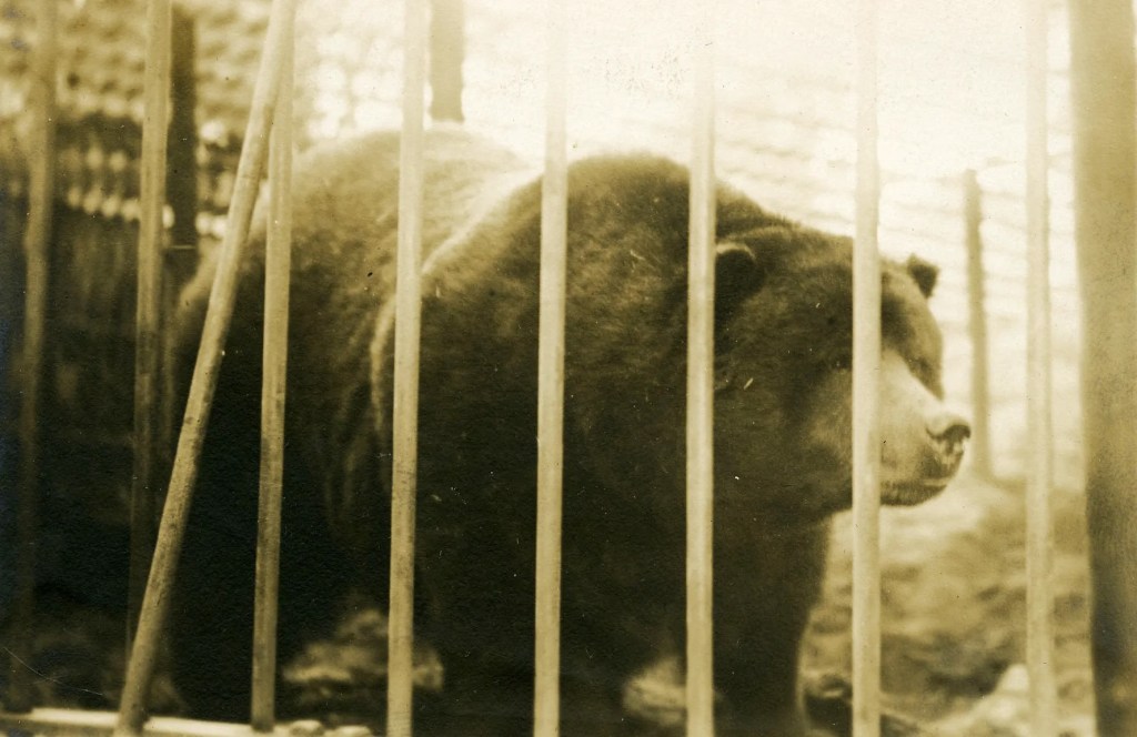
The San Gabriel Mountains aren’t just a spectacle of natural processes; they’ve also been a silent witness to numerous significant historical events. The grave of Owen Brown can be found in the mountains just outside of La Canada Flintridge. Owen was the third son of abolitionist John Brown, and has a resting place that has stirred intrigue and speculation for generations. Owen’s grave has become a kind of pilgrimage site for those interested in American history.

Locals gather to celebrate the installation of a gravestone honoring abolitionist Owen Brown on January 29, 1898,
nearly a decade after his death. Photo: Brown family and Paul Ayers.

Owen Brown was a fervent abolitionist like his father and participated in the famous raid on Harpers Ferry. After the tumultuous events that marked his early life, he moved to California, seeking solace in the west. He settled near El Prieto Canyon and lived a relatively secluded life. After his death in 1889, he was buried on a hillside overlooking the canyon, and his grave was marked with a simple headstone. Over time, nature, vandals, and other factors led to the original headstone’s disappearance, adding a layer of mystique to the grave’s location. However, in 2019, a replica of the gravestone was installed.

Mount Wilson telescope

Mount Wilson is another historical wonder in the range. Standing at a towering height of 5,710 feet, it’s not just its elevation that sets Mt. Wilson apart. In the early 20th century, the Mount Wilson Observatory was established, and it soon became a hub of astronomical discoveries. It was here that Edwin Hubble, using the Hooker Telescope, provided evidence of the expansion of the universe—a groundbreaking observation that eventually led to the Big Bang Theory.

Infrastructure Marvel: The Angeles Crest Highway
The human connection to the San Gabriel Mountains was further cemented with the construction of the Angeles Crest Highway in the 1930s. Spanning approximately 66 miles, this scenic byway was a colossal engineering challenge. Its creation provided access to previously remote regions and breathtaking panoramic views that today lure thousands of tourists and nature enthusiasts. The highway is also one of the highest in Southern California, with a summit of 7,903 feet at the Dawson Saddle.

Angeles Crest Highway roadcut (Photo: Erik Olsen)

Driving on the Angeles Crest Highway is an experience that’s both thrilling and a bit nerve-wracking. Winding and twisting through the mountains, you can come across steep drop-offs, sharp turns, and narrow lanes. With elevation changes ranging from around 1,200 feet to more than 7,900 feet, it’s a route that demands respect and attention from those behind the wheel.

Flora, Fauna, and Natural History: A Biodiversity Hotspot
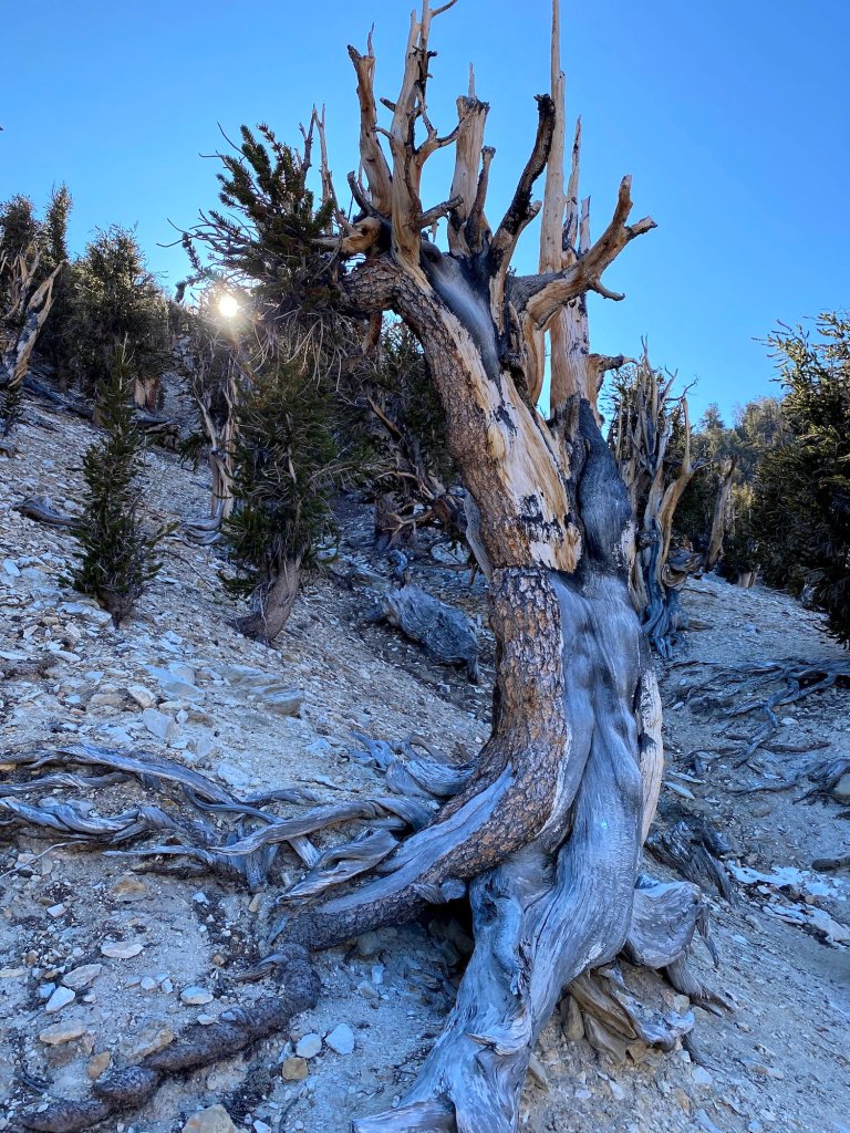
Beyond geology and history, the San Gabriel Mountains are a treasure trove of biodiversity. The montane environment, with its varied elevation and climate zones, has given rise to a rich tapestry of flora and fauna. Iconic trees like the Jeffrey pine, Coulter pine, and California black oak adorn the landscape. Wildflowers paint the meadows in vibrant hues, from the golden yarrow to the scarlet larkspur.

The fauna is just as diverse, with animals like the California condor, bighorn sheep, and mountain lions roaming the rugged terrain. The waters that trickle and rush down these mountains are home to arroyo chubs and Santa Ana suckers.

The California condor is known to inhabit the San Gabriel range

Protection of this vital ecosystem came in the form of the San Gabriel Mountains National Monument designation in 2014, ensuring that the mountains’ rich biodiversity and cultural significance will be preserved for generations.

The San Gabriel Mountains are more than just a scenic backdrop. They reflect the Earth’s active geology, hold key historical moments, and support diverse ecosystems. Amid growing urbanization, these mountains remain a lasting reminder of the interconnectedness of life, history, and natural forces.

Ghost of the West: The Tragic Story of the California Grizzly Bear’s Journey from Wilderness to State Flag

In the expansive and diverse landscape of California, many iconic animals are an integral part of the state’s reputation for natural beauty and untamed wilderness. Yet, one particular creature looms larger in the Californian narrative than many others – a species that has been extinct for nearly a century, but lives on as a powerful symbol: the California Grizzly Bear (Ursus arctos californicus).

The California Grizzly Bear, a subspecies of the Grizzly Bear, was a formidable presence in the wild terrains of California. This remarkable beast could grow up to 8 feet tall when standing on its hind legs, and adult males often weighed in excess of 2000 pounds. They sported a lustrous fur coat that varied in color from blond to dark brown, making them a striking, and sometimes terrifying, sight in the California wilderness.

The famous California Grizzly “Monarch” was housed in an enclosure at Golden Gate Park around 1910.
It passed away the following year. (California State Archives)

The name “Grizzly” could have meant “grizzled,” a term referring to the animal’s golden and grey tips of hair. Or quite possibly it meant “fear-inspiring” (as a phonetic spelling of “grisly”). The naturalist George Ord formally classified it in 1815 as Ursus horribilis (“terrifying bear”).

This giant was an omnivore with a varied diet that changed with the seasons. The bear’s dietary staples included seeds, berries, roots, fish, and small mammals. But the California Grizzly was also known to take down larger prey, such as deer and elk, when the opportunity presented itself. The first recorded encounters with California grizzly bears are found in diaries kept by several members of the 1769 Portola expedition, the first European land exploration of the southern stretch of the West Coast. Several place names that include the Spanish word for bear (oso) trace their origins back to that first overland expedition. For example, the city of Los Osos

Prior to Spanish settlement in the second half of the 1700s, it is estimated that 10,000 grizzly bears inhabited what is today considered modern-day California.

CALIFORNIA CURATED ON ETSY

Purchase stunning art prints of iconic California scenes.
Check out our Etsy store.

Stories about the California Grizzly Bear echo throughout the annals of California’s history and literature. In his book “The Mountains of California,” renowned naturalist John Muir recounted his encounters with these awe-inspiring creatures, stating, “When I discovered him, he was standing in a narrow strip of meadow, and I was concealed behind a tree on the side of it.”

California State Flag featuring the California Grizzly

As enduring as any mountain or redwood forest, the legacy of the California Grizzly Bear persists in the emblem of the state flag.

The inclusion of the grizzly bear on the California flag traces its roots back to a revolt in 1846, before California was a part of the United States. At the time, California was under Mexican rule and a group of American settlers staged a revolt known as the Bear Flag Revolt, in which they declared California to be an independent republic.

The settlers needed a flag to represent their new republic, so they designed a simple flag that included a grizzly bear, a single red star (inspired by the lone star of Texas), and the words “California Republic.” The grizzly bear was chosen because it was seen as a powerful and formidable creature, much like the settlers saw themselves. It was intended to represent strength, unyielding resistance, and independence. The republic was short-lived, however, because soon after the Bear Flag was raised, the U.S. military began occupying California, which went on to join the union in 1850.

The man who drew the bear on the original flag, William L. Todd, was a cousin of Mary Todd Lincoln, the wife of Abraham Lincoln. Unfortunately, Todd was not a great artist, and his bear looked more like a pig, which led to some ridicule and a new design.

The original California state flag, as designed by William L. Todd

In 1911, the design of the flag was standardized, and the grizzly bear became the central figure that we recognize today. The bear depicted on the flag is named “Monarch” after the last California grizzly bear captured and held in captivity. Monarch was captured in 1889 by newspaper reporter Allan Kelly, at the behest of William Randolph Hearst. Monarch’s remaining life was not pleasant. He spent his remaining 22 years in captivity, and was moved to Woodwards Gardens in San Francisco, and then to the zoo at Golden Gate Park. After the bear’s death in 1911, it was mounted and preserved (ahem, poorly) at the Academy of Sciences at Golden Gate Park.

Monarch on display. (Wikipedia)

Despite its iconic status, the California Grizzly Bear could not withstand the pressures of expanding human civilization. The arrival of settlers during the California Gold Rush in the mid-19th century marked the beginning of the end for the bear. As the human population exploded, the bears’ natural habitats were destroyed to make way for towns and agriculture. Additionally, the bear, seen as a threat to livestock and a danger to humans, was hunted extensively.

By the early 20th century, the California Grizzly Bear was on the brink of extinction. The last confirmed sighting of a California grizzly bear occurred in 1924 within Sequoia National Park. This marked the end of the species’ presence in the state, following decades of hunting and habitat loss. Prior to this, the last known grizzly in Southern California was killed in 1916 near Sunland, in the San Fernando Valley. The California grizzly, once abundant throughout the region, was declared extinct in the wild by the mid-1920s. The California Grizzly was declared extinct in 1924.

In recent years, discussions have emerged about the feasibility of reintroducing grizzly bears to California. Research indicates that the state possesses substantial suitable habitat for grizzlies, particularly in the Sierra Nevada and other mountainous regions. Some studies suggest that California could support a population of approximately 500 grizzly bears. ​

In 2014, the Center for Biological Diversity filed a legal petition urging the U.S. Fish and Wildlife Service to expand grizzly bear recovery efforts across the American West, including California. The petition identified 110,000 square miles of potential grizzly habitat in areas such as the Sierra Nevada. However, the U.S. Fish and Wildlife Service rejected this petition, citing concerns about habitat suitability and potential human-bear conflicts. ​

California grizzly taxidermy specimen at the Santa Barbara Museum of Natural History (Vahe Martirosyan)

The following year, in 2015, the Center for Biological Diversity initiated a petition directed at the California state legislature to reintroduce grizzly bears to the state. This effort aimed to raise public awareness and encourage state officials to explore the possibility of reintroduction. Despite these initiatives, the California Department of Fish and Wildlife has expressed reservations, emphasizing the significant changes in the state’s landscape and human population density since the grizzly’s extirpation. Officials have highlighted the potential challenges of human-bear interactions, given California’s current population of nearly 40 million people.

The debate over reintroducing grizzly bears to California continues, balancing ecological restoration goals with concerns about human safety and land use. While the state retains areas that could potentially support grizzlies, the complexities of modern coexistence present significant challenges to reintroduction efforts.

The Long Life and Accidental Death of the Prometheus Bristlecone Pine

Bristlecone Pines in the White Mountains of California (Erik Olsen)

Amid the barren, high-altitude desert of California’s White Mountains, the Bristlecone Pines stand as enduring sentinels, their gnarled forms chronicling millennia of survival in one of the planet’s most unforgiving landscapes. For thousands of years, these ancient organisms have endured drought, freezing temperatures, and brutal winds. Each twisted trunk and weathered branch tells a story of resilience. Yet in a bitter twist, one of the oldest among them, a tree known as Prometheus that once grew in the nearby Great Basin National Park, met its end not from the slow violence of nature but from a single human decision. And it wasn’t the result of malice or careless destruction, like the foolish vandals who felled the U2 Joshua Tree. It was a mistake, made in the name of science.

The Prometheus stump. All that is left of one of the oldest organisms on Earth.

Prometheus, named after the Titan who defied the gods in Greek mythology, was an extraordinary specimen of the Pinus longaeva species, or the Great Basin Bristlecone Pine. It is believed to have germinated around the time of the Bronze Age, making it likely older than the Great Pyramids of Giza. By the 1960s, when its existence was noted by researchers, it was already around 4900 years old. Unfortunately, that’s when tragedy struck.

In 1964, a young geographer named Donald Rusk Currey was studying climate dynamics of the Little Ice Age. He was especially drawn to Bristlecone pines because their rings hold valuable records of past climate conditions, a core focus of dendrochronology, the study of tree rings, which continues to be an important scientific tool today. Some details of the story vary, but Currey had supposedly been coring several trees in the area to measure their age, but he encountered difficulties with Prometheus. He was unaware that the tree was not only ancient, but likely the oldest non-clonal organism on the planet. The coring tool broke, and unable to get the data he needed, Currey believed that cutting down the tree was the only way to continue his research. The Forest Service, unaware of the tree’s significance, approved the request.

And so he cut it down.

Bristlecone forest in the White Mountains of California (Erik Olsen)

Once Prometheus was cut down, its extraordinary age became clear. By counting its growth rings, Currey estimated that Prometheus was at least 4,844 years old, making it the oldest known tree in the world at the time. A few years later, this age was increased to 4,862 by Donald Graybill of the University of Arizona‘s Laboratory of Tree-Ring Research.

The scientific community and general public were outraged at the unnecessary loss, sparking conversations about the protection of these ancient trees. In the words of one writer-activist, Currey had “casually killed (yes, murdered!)” the world’s oldest tree. As if a curse had been unleashed, a year after Prometheus was cut down, a young Forest Service employee died of a heart attack while trying to remove a slab from the tree. Currey was obviously beside himself. Whoops.

Whether Prometheus should be considered the oldest organism ever known depends on how we define “oldest” and “organism.” Some clonal species may claim even more ancient origins when we consider the entire genetic individual rather than a single stem or trunk. The creosote bush ring known as King Clone, located in the Mojave Desert in California, is estimated to be nearly 12,000 years old. Similarly, the massive aspen colony known as Pando in Utah spans over 100 acres and may be more than 14,000 years old. Unlike Prometheus, which was a single, ancient tree, these clonal colonies persist by continuously regenerating themselves, allowing the larger organism to survive for tens of thousands of years.

Creosote growing in the Mojave Desert (Photo: Erik Olsen)

Prometheus’s death brought global attention to the incredible age and ecological value of Bristlecone Pines, sparking a deeper appreciation for their role in Earth’s history. In the years since, increased protections have been put in place to preserve these ancient trees. Today, they are part of the Inyo National Forest’s Ancient Bristlecone Pine Forest, a protected area in the White Mountains that draws scientists and visitors from around the world.

California is home to the oldest, tallest, and largest trees on the planet, not just the ancient Bristlecone Pines, but also the sky-scraping coast redwoods and the enormous giant sequoias. It’s also the most biodiverse state in the U.S., making it one of the most ecologically exceptional places on Earth.

CALIFORNIA CURATED ART ON ETSY

Purchase stunning art prints of iconic California scenes.
Check out our Etsy store.

Even as we mourn Prometheus, it’s important to remember that it is not the end of the story for the Bristlecone Pines. There are still many of these ancient trees alive today. One of them, named Methuselah, is known to be 4,851 years old and is often considered the oldest living tree in the world. While it is known to live somewhere in the White Mountains of California, its exact location is kept a secret to protect it. The tree’s name refers to the biblical patriarch Methuselah, who ostensibly lived to 969 years of age.

There’s also the potential for even older specimens. Given the harsh, remote habitats these trees often occupy, it is likely that there are older Bristlecones yet to be discovered.

California’s White Mountains (Photo: Erik Olsen)

The cutting of Prometheus was a mistake, an irreversible loss. But its story became a turning point, highlighting the need to treat ancient and rare life with more care. While Prometheus is gone, many other long-lived and fragile organisms still exist. Its fate is a reminder that our curiosity should always be balanced by a responsibility to protect what can’t be replaced.

Today, a cross-section of Prometheus is on display at the Great Basin National Park visitor center in Nevada, as well as the U.S. Forest Service’s Institute of Forest Genetics in Placerville, California. The tree’s thousands of growth rings are a reminder of its incredible longevity and a sobering memory of the tree that had survived for millennia. The region’s diverse landscapes are home to an incredible abundance of life, from ancient trees to unique coastal ecosystems. Protecting and understanding these natural treasures ensures they remain for future generations to study, appreciate, and enjoy.

Ten Little-Known Facts About California

Giant Sequoia

California is known for its sunny beaches, bustling cities, and iconic landmarks such as the Golden Gate Bridge and Hollywood sign. However, the state is also home to a wealth of scientific discoveries and phenomena that are not as well-known. From ancient fossils to cutting-edge research, California has a lot to offer in the realm of science. In this list, we’ll explore ten of the most fascinating scientific things that you probably didn’t know about California. Get ready to be amazed by the natural wonders and innovative research that make this state such a unique and exciting place for science enthusiasts.

  1. California is home to the tallest tree in the world, a coastal redwood named Hyperion that measures 379.7 feet (115.7 meters) in height. The state is also home to the largest (by volume) tree, named General Sherman in Sequoia National Park. General Sherman is 274.9 feet high and has a diameter at its base of 36 feet, giving it a circumference of 113 feet. General Sherman’s estimated volume is around 52,508 cubic feet (1,487 cubic meters), which would correspond to an estimated weight of around 2.7 million pounds.
  2. The Salton Sea, a large inland lake in southern California, is actually an accidental body of water that was created by a flood in 1905 when Colorado River floodwater breached an irrigation canal being constructed in the Imperial Valley and flowed into the Salton Sink.
  3. The San Andreas Fault, the state’s best-known and most dangerous fault that runs through the middle of California and to the coast, moves about 2 inches (5 centimeters) per year (or, so they say, the speed that a fingernail grows).
  4. The state of California has more national parks than any other state in the US, with nine in total. Among them is one of the crown jewels of the National Park system: Yosemite National Park.
  5. California is one of the only places in the world where you can find naturally occurring asphalt, at the La Brea Tar Pits in Los Angeles. 
  6. The oldest living organism on Earth, a bristlecone pine tree named Methuselah, can be found in the White Mountains of California and is over 4,800 years old.
  7. The Monterey Bay Aquarium in Monterey, California was the first aquarium to successfully keep a great white shark in captivity for more than 16 days. The first great white that the aquarium tried to display died after 11 days in 1984 because it would not eat.
  8. The Joshua Tree, a type of yucca plant (NOT a tree) found in the Mojave Desert, is named after the biblical figure Joshua because of its outstretched branches that resemble a person reaching up to the sky in prayer.
  9. The California grizzly bear, which appears on the state flag, went extinct in the early 1900s due to hunting and habitat loss. The last California grizzly was seen near Yosemite in 1924, going extinct after decades of hunting. Fossils of the California grizzly can be seen at the La Brea tar Pits.  
  10. The California Institute of Technology, also known as Caltech, is one of the world’s leading scientific research institutions and has produced 39 Nobel laureates, more than any other university in the world.

The Majesty and Mystery of California’s Bristlecone Pines

Bristlecone Pine
Bristlecone Pine in the White Mountains (National Park Service)

Lying east of the Owens Valley and the jagged crags of the Sierra Nevadas, the White Mountains rise high above the valley floor, reaching over 14,000 feet, nearly as high as their far better-known relatives, the Sierra Nevadas. Highway 168 runs perpendicular to Highway 395 out of Big Pine and leads up into the mountains to perhaps the most sacred place in California.

Far above sea level, where the air is thin, live some of the most amazing organisms on the planet: the ancient bristlecone pines. To the untrained eye, the bristlecone seems hardly noteworthy. Gnarled and oftentimes squat, especially when compared to the majestic coastal redwoods and giant sequoias living near the coast further west, they hardly seem like mythical beings. But to scientists, they are a trove of information, offering clues to near immortality and to the many ways that the earth’s climate has changed over the last 5,000 years. 

In the January 20, 2020 edition of the New Yorker, music writer Alex Ross writes about the trees and the scientists who are trying to unlock the secrets of the bristlecone’s unfathomable endurance. The trees, he writes, “seem sentinel-like”.

Video of ancient bristlecone pine that I shot and put together.

Bristlecones are the longest living organism on earth. The tree’s Latin name is Pinus longaeva, and it grows exclusively in subalpine regions of the vast area known to geologists as the Great Basin, which stretches from the eastern Sierra Nevadas to the Wasatch Range, in Utah. Bristlecones grow between 9,800 and 11,000 feet above sea level, where some people get dizzy and there are few other plants or animals that thrive. The greatest abundance of bristlecones can be found just east of the town of Bishop, California in the Ancient Bristlecone Pine Forest. There, a short walk from where you park your car, you can stroll among these antediluvian beings as they imperceptibly twist, gnarl and reach towards the heavens. 

While most of the bristlecones in the national Ancient Bristlecone Pine Forest are mere hundreds of years old, there are many that are far older. Almost ridiculously so. Methuselah, a Great Basin bristlecone, is 4,851 years old, as measured by its rings, taken by scientists decades ago using a drilled core. Consider that for a moment: this tree, a living organism, planted its tentacle-like roots into the soil some 2000 years before the birth of Christ, around the time that the Great Pyramids of Egypt were built. By contrast, the oldest human being we know of lived just 122 years. That’s 242 human generations passing in the lifetime of a single bristlecone that still stands along a well-trodden trail in the high Sierras. 

Bristlecone and starry sky: National Park Service
National Park Service

That said, if you were to try and see Methuselah for yourself, you are out of luck. The Forest Service is so protective of its ancient celebrity that it will not even share its picture. What’s more, it’s probably the case that there are bristlecones that are even older than Methuselah. Scientists think there could be trees in the forest that are over 5,000 years old. 

How the bristlecone has managed this incredible feat of endurance is a mystery to researchers. Many other tree species are prone to insect infestations, wildfires, climate change. In fact, over the last two decades, the vast lodgepole pine forests of the Western United States and British Columbia have been ravaged by the pine beetle. Millions of acres of trees have been lost, including more than 16 million of the 55 million acres of forest in British Columbia.  

But insects don’t seem to be a problem for bristlecones. Bristlecone wood is so dense that mountain-pine beetles and other pests can rarely burrow their way into it. Further, the region where the bristlecones live tends to be sparse with vegetation, and thus far less prone to wildfire. 

Jeff Sullivan
Jeff Sullivan

So how do the trees manage to live so long? 

A recent study by scientists at the University of North Texas looked at the amazing longevity of the ginkgo tree, examining individuals in China and the US that have lived for hundreds, perhaps more than a thousand years. One thing they found is that the trees’ immune systems remain largely intact, even youthful, throughout their lives. It turns out the genes in the cambium, or the cylinder of tissue beneath the bark, contain no “program” for senescence, or death, but continue making defenses even after hundreds of years. Researchers think the same thing might be happening in the bristlecone. This is not the case in most organisms and certainly not humans. Like replicants in the movie Blade Runner, we seem to have a built-in clock in our cells that only allows us to live for so long. (I want more life, f$@$@!

Scientists at the University of Arizona’s Laboratory of Tree-Ring Research (LTRR) have built up the world’s largest collection of bristlecone cross-sections, which they carefully examine under the microscope, looking for clues about how the trees have managed to survive so long, and how they can inform us of the many ways the earth’s climate has changed over the millennia.

The LTRR houses the nation’s only dendrochronology lab (the term for the study of tree rings), and the researchers there have made several discoveries using tree cores that have changed or confirmed climate models. For example, in 1998, the climatologist Michael E. Mann published the “hockey stick graph,” that revealed a steep rise in global mean temperature from about 1850 onward (i.e. the start of the industrial revolution). There was intense debate about this graph, with many scientists and climate change skeptics saying that Mann’s projections were too extreme. But numerous subsequent studies, some using the trees’ rings new models, confirmed the hockey-stick model. 

Bristlecone Pine

The bristlecones will continue to help us understand the way the earth is changing and to see into the deep human past in a way few other living organisms can do. They also improve our understanding of possible future environmental scenarios and the serious consequences of allowing carbon levels in the atmosphere to continue to grow. 

In this sense, they truly are sentinels.

Bristlecone pine in the White Mountains (Unsplash)

Interestingly, it wasn’t until 1953 that we found out just how ancient these trees are. Credit for this breakthrough goes to Edmund Schulman, a dendrochronologist. Schulman and his colleague Frits Went stumbled upon an ancient limber pine while conducting research in Sun Valley, Idaho. This tree, which they found to be around 1,650 years old, got them thinking: could there be even older trees hidden away in the mountains?

Shulman then traveled to the White Mountains and began a long-term exploration of the Bristlecone forest. He took core samples from many trees and made a startling discovery. At night, at his camp, he began counting the annual growth rings on a slender piece of wood. He counted and counted, not daring to believe what was unfolding before his eyes. When he finally put down his magnifying glass in the enveloping darkness, he had counted rings that went back past the year 2046 BCE. Schulman had stumbled upon a tree that had been alive for over four millennia. Not only alive, but continuing to grow!

Schulman had effectively expanded our understanding of how long a single tree can endure—providing key insights into environmental longevity, climate history, and even the resilience of life on Earth.

Bristlecone forest in the White Mountains of California (Erik Olsen)

In tribute to the momentous find, he dubbed the tree “Pine Alpha,” a name that’s as much a testament to the tree’s age as it is to the groundbreaking nature of Schulman’s work. Until then, no one knew a living tree could be that old. The discovery was a pivotal moment that opened up a new frontier in the study of dendrochronology, and it became a cornerstone example of how trees serve as living records of Earth’s history.

It should be said that the trees themselves, in their gnarled, frozen posture, are truly are beautiful. They should be protected and preserved, admired and adulated. Indeed, Federal law prohibits any attempt to damage the trees, including taking a mere splinter from the forest floor. The trees have also become an obsession for photographers, particularly those who favor astrophotography. A quick search on Instagram reveals a stunning collection of images showing the majesty and haunting beauty of these ancient trees. 

So, if you are ever headed up Highway 395 into the Sierras, it is well worth the effort to make the right-hand turn out of Big Pine to visit the Ancient Bristlecone Pine Forest. The air is thin, but the views are spectacular. And where else can you walk among the oldest living things on the planet?

Note: there is a wonderful video produced by Patagonia on the bristlecones and some of the scientists who study them. It’s well worth watching.