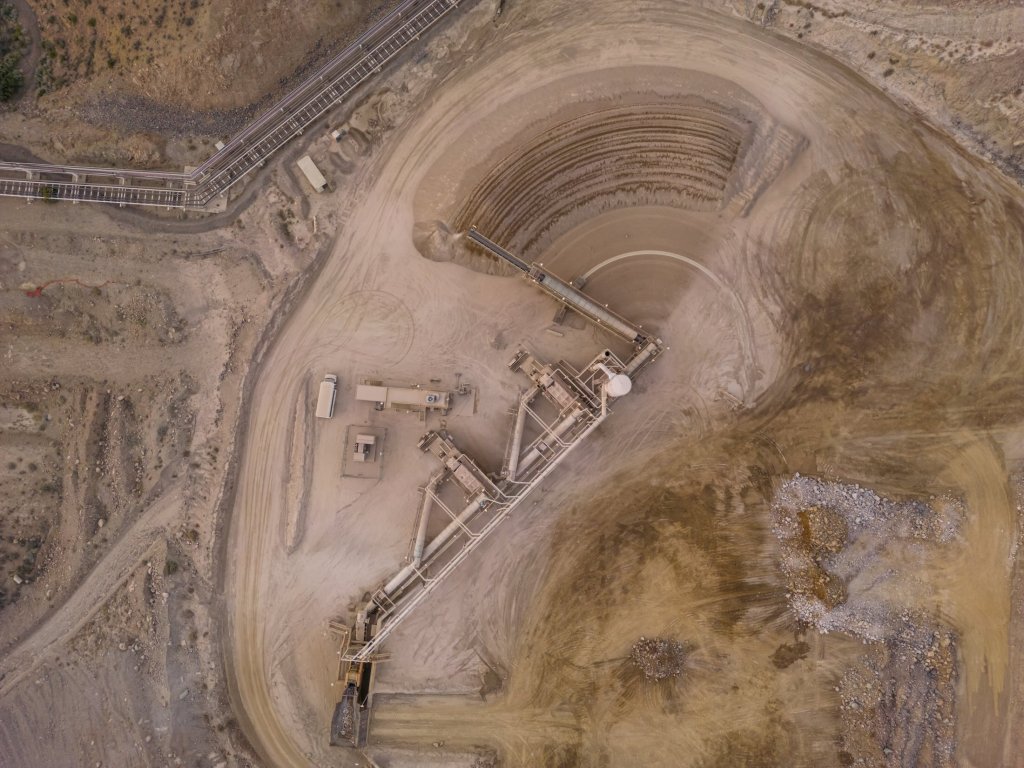
Desalination, the process of turning seawater into potable water, is gaining traction as a viable solution to California’s perennial drought issues. The Golden State, with its sprawling 850-mile coastline and notorious aridity, is primed for desalination to play a pivotal role in its water management strategies.
The mission of the Seawater Desalination Test Facility in Port Hueneme, Ventura. John Chacon / California Department of Water Resources
California’s history with droughts is long and storied, with the state experiencing some of its driest years on record recently. Traditional sources of water, such as snowpacks and reservoirs, have become increasingly unreliable due to the erratic patterns of climate change. While an atmospheric river storm in 2023 and several powerful storms in 2024 and 2025 significantly eased California’s drought conditions for the time being, there is widespread concern that serious drought conditions will soon return and become the new norm.
As a response, several desalination plants have emerged along the coast. One notable example is the Claude “Bud” Lewis Carlsbad Desalination Plant in San Diego County, which is the largest in the Western Hemisphere, providing about 50 million gallons of drinking water daily.
Every day, 100 million gallons of seawater pass through semi-permeable membranes, producing 50 million gallons of fresh water delivered directly to municipal users. The Carlsbad plant, which has been fully operational since 2015, now provides roughly 10 percent of the freshwater supply used by the region’s 3.1 million residents—although at nearly double the cost of water from the region’s primary alternative sources.
Desalination is not just a process but a symphony of advanced technologies working in concert. The most prevalent method used in California is reverse osmosis (RO). RO employs a semi-permeable membrane that allows water molecules to pass through while blocking salt and other impurities. This membrane is the linchpin of the operation, designed to withstand the high pressures necessary to reverse the natural process of osmosis where normally, water would move from a low-solute concentration to a high-solute concentration.
Reverse osmosis desalination is an energy-intensive process, one that demands a significant amount of power to be effective. At its core, the technique involves forcing seawater through a semi-permeable membrane to separate salt and other minerals, yielding fresh water. This process, however, requires substantial pressure, much higher than the natural osmotic pressure of seawater, to push the water through the membrane. Achieving and maintaining this pressure consumes a considerable amount of energy. Furthermore, the energy demands are compounded by the need for constant system maintenance and the treatment of the highly saline brine that’s left over. This energy requirement is a key challenge in making reverse osmosis desalination a more widespread solution for water scarcity, as it not only increases operational costs but also has environmental implications, especially if the energy comes from non-renewable sources.
John Chacon / California Department of Water Resources
The science behind these membranes is fascinating. They are not just filters; they are engineered at the molecular level. The membranes are typically made from polyamide, created through complex chemical reactions that result in a thin film where the magic happens. Water molecules navigate through this film via tiny pores, leaving behind salts and minerals.
This scientific marvel, however, has additional environmental challenges. Along with the vast energy needs of reverse osmosis, there are also concerns about water pollution. Brine, which is the concentrated saltwater byproduct, must be carefully managed to avoid harming marine ecosystems when it’s discharged back into the ocean.
Charles E. Meyer Desalination Plant in Santa Barbara, California, plays a key role in improving water reliability and resiliency during the drought years. Florence Low / California Department of Water Resources.
Innovations continue to improve the technology, aiming to make desalination more energy-efficient and environmentally friendly. New approaches such as forward osmosis, which uses a natural osmotic pressure difference rather than mechanical pressure, and the use of alternative energies like solar and wind power are on the horizon. There’s also ongoing research into biomimetic membranes, inspired by nature’s own filtration systems, such as those found in the roots of mangrove trees or in the kidneys of animals.
In addition to the sprawling, successful desalination plant in Carlsbad, numerous other projects are on the way. The Doheny Ocean Desalination Project, located in Dana Point, has seen a significant increase in projected costs but is still moving forward. It’s expected to be completed by 2027 and will provide about 5 million gallons of drinking water daily to residents in Orange County.
In November, the California Coastal Commission greenlit a permit for the Monterey Bay Area Desalination Plant, a vast $330 million seawater desalination plant in Marina, a modest city of 22,500 people located roughly 15 minutes north of the more prosperous Monterey. The proposed Cal-Am desalination facility, if finalized, is set to produce 4.8 million gallons of fresh water daily.
Monterey Bay at Moss Landing, California. Photo: Erik Olsen
However, Marina’s Mayor, Bruce Delgado, stands in opposition to the project. He argues that it would alter the character of Marina and negatively impact its natural surroundings. Delgado contends that while his city would shoulder the environmental and industrial impacts of the plant, the adjacent, wealthier areas such as Carmel-by-the-Sea, Pacific Grove, and Pebble Beach would enjoy most of the benefits.
In February 2024, the California Department of Water Resources (DWR) released a report identifying future brackish water desalination projects to enhance the state’s water reliability. The report aims to meet goals outlined in California’s Water Supply Strategy: Adapting to a Hotter, Drier Future, which targets increasing water supply by implementing new brackish desalination projects providing 28,000 acre-feet per year by 2030 and 84,000 acre-feet per year by 2040.
As California looks to the future, the role of desalination is poised to expand. The state’s water plan includes the potential for more desalination facilities, particularly in coastal cities that are most affected by drought and have direct access to the sea. The integration of desalination technology with California’s complex water infrastructure speaks to a broader trend of marrying innovation with necessity.
The implications for drought-prone regions extend beyond just survival; they encompass the sustainability of ecosystems, economies, and communities. While desalination is not a panacea for all of California’s water woes, it represents a critical piece of the puzzle in the quest for water security in an era of uncertainty. As the technology advances, it may well become a cornerstone of how humanity adapts to a changing climate, making what was once undrinkable, a wellspring of life.
The Unlikely Intersection of Military Training and Coastal Preservation
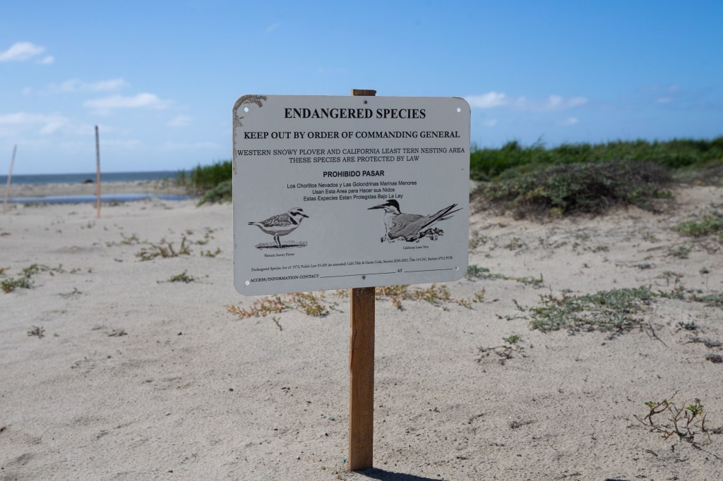
An endangered species sign is posted along the coastline on Marine Corps Base Camp Pendleton, California, March 29, 2022. (U.S. Marine Corps photo by Lance Cpl. Nataly Espitia)
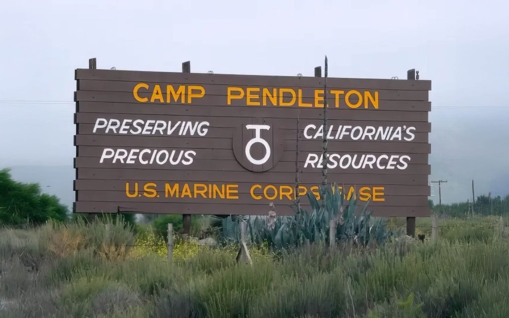
Driving along the Pacific Coast Highway, much of the Southern California coastline is a continuous stretch of development—expensive homes, commercial malls, and highways and railways built right up against the ocean. Then, unexpectedly, you reach Marine Corps Base Camp Pendleton, a vast, largely undeveloped expanse that starkly contrasts with the urban sprawl. This uninterrupted stretch of coastline offers a rare glimpse into what the region once looked like, a reminder of California’s natural beauty before widespread development.
We’re not suggesting that coastal development is inherently bad, but having stretches of coastline that preserve the coast’s natural state offers a valuable reminder of what it once looked like. One drawback of the base is that, as an active military installation, public access is highly restricted. However, this limited access has helped preserve the coastline in ways that might not have been possible otherwise. (Another well-known and much more accessible area with restricted development lies just to the north at Crystal Cove State Park in Orange County, a protected stretch of land established in 1979 that remains open to the public. It features some of the finest beaches in Southern California – IMHO.)
California least terns (Ernesto Gomez, Public Domain)
Marine Corps Base Camp Pendleton spans approximately 125,000 acres, including more than 17 miles of coastline in northwestern San Diego County. With less than 20% of the land developed, the base serves as a critical ecological buffer between the densely urbanized regions to its north and south. The base has served as a critical training ground for the U.S. Marine Corps since 1942. However, its restricted access and limited development have inadvertently preserved some of Southern California’s last remaining wild coastal terrain. As a result, the base has become an unlikely sanctuary for a rich array of plant and animal species, many of which are endangered or rare.
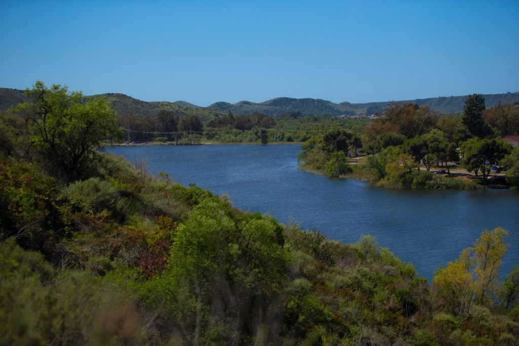
The base’s diverse ecosystems offer a window into California’s historical and biological landscapes prior to extensive development. Camp Pendleton’s coastal dunes, estuaries, chaparral, riparian woodlands, and sage scrub provide a range of habitats that are now scarce elsewhere. The base is home to 19 federally listed species, including the California least tern, a seabird that relies on the base’s protected beaches for nesting. The Santa Margarita River, one of the last free-flowing rivers in Southern California, cuts through the base, providing essential water resources for both wildlife and plant communities.
“Camp Pendleton is a biodiversity hotspot,” Melissa Vogt, a conservation law enforcement officer with Environmental Security said in a statement. “If it weren’t for Camp Pendleton existing, all this coastline would be condos and hotels.”
Camp Pendleton
Because of its ecological significance, Camp Pendleton has become a prime location for scientific study. Botanists have discovered species like the Pendleton button-celery (Eryngium pendletonense), a plant found only within the base. The relatively undisturbed nature of the land allows researchers to examine Southern California’s native ecosystems as they once were, offering insights into habitat conservation and restoration efforts beyond the base’s borders. There are few places left like it along the Southern California coast. Among other species benefiting from these efforts is the coast horned lizard (Phrynosoma blainvillii), a reptile that relies on sandy soils and native chaparral for shelter and food. The base’s protected status has helped sustain this lizard’s population, which has declined in many other parts of its range due to habitat loss.
Arroyo toad – Anaxyrus californicus (US Fish and Wildlife Service)
The base’s management practices have contributed to the survival of species once thought to be on the brink of extinction. One of the most notable examples is the Pacific pocket mouse, a tiny rodent that was believed extinct until a population was rediscovered within Camp Pendleton in the 1990s. Conservationists, including the San Diego Zoo Wildlife Alliance, have since reintroduced captive-bred individuals to increase their numbers in protected areas on the base.
Similarly, the base’s wetlands and riparian zones serve as critical habitat for the southwestern willow flycatcher, an endangered songbird, as well as the arroyo toad, which depends on unspoiled riverbanks for breeding. Without the base’s restrictions on urban development, many of these species might have disappeared entirely from Southern California.
Lake O’Neill, located on Marine Corps Base Camp Pendleton, California, is a popular destination for fishing and camping and is a home to a wide variety of wildlife. (U.S. Marine Corps photo by Lance Cpl. Nataly Espitia)
Recognizing the base’s ecological value, Camp Pendleton has taken significant steps toward wildlife preservation through proactive environmental management. The Environmental Security Department has worked closely with researchers to document biodiversity, implement habitat restoration efforts, and ensure compliance with the Endangered Species Act. A key part of these efforts includes protecting breeding grounds and restoring sensitive habitats, such as the coastal dune systems that support the California least tern and the western snowy plover. Entomologists from the San Diego Natural History Museum have conducted extensive surveys on the base, cataloging insect and spider species across six distinct vegetation zones. These studies not only provide valuable data on the health of Southern California’s ecosystems but also help track how climate change is affecting biodiversity in the region.
“For any wildlife biologist that’s working with a threatened or endangered species, the ultimate goal is getting the animal off the list and making sure the species is doing well,” Nate Redetzke, Environmental Security wildlife biologist, said on the official US Marines Website.
The base has also implemented a long-term natural resource management plan that balances military training with conservation efforts. It may seem unlikely for troop transport vehicles to operate alongside protected coastal wilderness, but the balance between military use and conservation has largely been seen as a success.
Western snowy plover (Wikipedia)
The efforts include extensive land management practices such as erosion control, invasive species removal, and water quality monitoring to sustain Camp Pendleton’s ecosystems. In recent years, conservation teams have also focused on restoring the estuary habitats along the Santa Margarita River to enhance biodiversity and ensure the resilience of species that depend on these wetlands. This includes seasonal restrictions in certain areas to protect breeding wildlife, habitat restoration projects, and collaborations with state and federal agencies to support species recovery programs. Again, it’s complicated, but it seems to be working. These efforts were recognized when the U.S. Fish and Wildlife Service awarded Camp Pendleton the Military Conservation Partner Award in 2022 for its leadership in environmental stewardship.
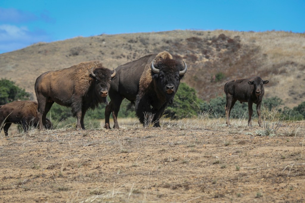
Remarkably, the base is also home to a small herd of American bison, which have roamed Camp Pendleton for decades. Originally introduced in the 1970s as part of a now-defunct recreational program, these bison have since adapted to the landscape, living largely undisturbed within the base’s remote areas. While not native to the region, their presence adds another layer of ecological interest to this protected land, demonstrating how species can persist in unexpected places.
An American bison herd roams the hills on Marine Corps Base Camp Pendleton, California. (Marine Corps Photo by Lance Cpl. Andrew Cortez)
Camp Pendleton’s example demonstrates that large-scale conservation can happen in unexpected places. While military training remains its primary function, the base has unintentionally preserved one of the last remaining stretches of undeveloped Southern California coastline. In doing so, it has provided scientists with a unique opportunity to study and protect a wide range of species that might have otherwise been lost.
Of course, Camp Pendleton isn’t the only place where government protection for reasons other than conservation has preserved a remarkably untouched stretch of California’s coastline. Vandenberg Space Force Base, further north, restricts public access due to its role in military space launches, but in doing so, it has safeguarded miles of rugged shoreline and sensitive habitats. Similarly, Point Reyes National Seashore, though managed primarily for recreation and historical preservation, remains a rare example of undeveloped coastal wilderness in the Bay Area. Off the coast, some of the Channel Islands, particularly those further out but within Channel Islands National Park, have remained largely untouched due to federal protection, while others have suffered from past military activity and invasive species. Like Camp Pendleton, these areas demonstrate how federal oversight, whether for military, scientific, or historical purposes, has unintentionally maintained some of California’s last truly wild coastal spaces.
Rare earth metals are now essential to the global economy, powering everything from smartphones and electric vehicles to wind turbines and defense systems. As China continues to dominate the market—producing more than 70% of the world’s supply—the urgency to find reliable alternatives has grown. The United States is locked in a high-stakes race to secure new sources of rare earth elements, along with other critical minerals like lithium and nickel, which are key to the clean energy transition. At the center of this effort is a storied mine in California that not only helped launch the rare earth industry decades ago but now stands as America’s most promising hope for rebuilding a domestic supply chain.
Mining shaped California’s growth, from the 1849 Gold Rush to key industries like mercury, silver, copper, tungsten, and boron. While some have declined, others, like the Rio Tinto U.S. Borax Mine in Boron, California, remain major global suppliers, while rare earth element extraction continues to be an important industry.
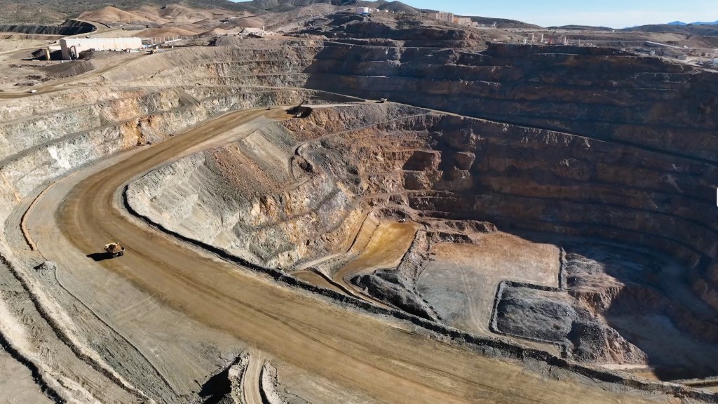
MP Materials’ Mountain Pass rare earths mine in California is a remarkable example of industrial resurgence and the strategic importance of critical metals in the modern era. Located in Mountain Pass in the remote Californian desert near the Nevada border (it’s easily viewable from Interstate 15), this mine, initially developed in the mid-20th century, has seen dramatic shifts in fortune, technology, and geopolitics, reflecting the complex role rare earth elements (REEs) play in global industries.
The rock at Mountain Pass contains an average of 7 to 8 percent rare earth elements—a remarkably high concentration by industry standards. This richness is a key factor in the mine’s potential. However, extracting these valuable elements from the surrounding material remains a challenge.
Discovered in 1949 while prospectors searched for uranium, the Mountain Pass deposit instead revealed bastnaesite, an ore rich in rare earth elements like neodymium, europium, and dysprosium. These elements are indispensable to modern technologies, powering innovations across consumer electronics, environmental solutions, and advanced military systems.
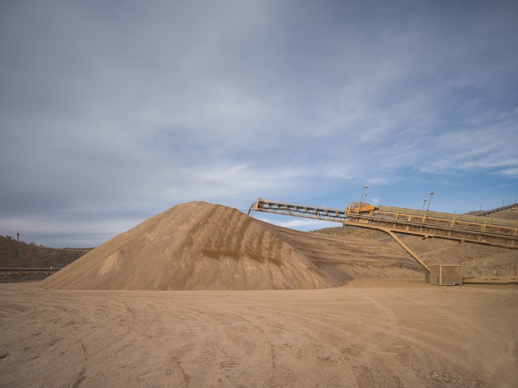
A computer-controlled arm deposits the raw crushed ore into a mound at the MP Materials mine and ore processing site in Mountain Pass, CA. (Courtesy: MP Materials)
Smartphones, for instance, are packed with rare earth elements that enable their functionality. Europium and gadolinium enhance the brightness and color of their screens. Lanthanum and praseodymium contribute to the efficiency of their circuits, while terbium and dysprosium enable the compact, high-performance speakers. Beyond smartphones, rare earth elements are essential to electric vehicles and renewable energy technologies, particularly in the production of permanent magnets. Thanks to their distinctive atomic structure, rare earth elements can produce magnetic fields far stronger than those generated by other magnetizable materials like iron. This exceptional capability arises from their partially filled 4f electron shell, which is shielded by outer electrons. This configuration not only gives them unique magnetic properties but also results in complex electronic arrangements and a tendency for unpaired electrons with similar spins. These characteristics make rare earth elements indispensable for creating the most advanced and powerful commercial magnets, as well as for applications in cutting-edge electronics.
Permanent magnets are among the most significant uses of rare earths, as they convert motion into electricity and vice versa. In the 1980s, scientists discovered that adding small amounts of rare earth metals like neodymium and dysprosium to iron and boron created incredibly powerful magnets. These magnets are ubiquitous in modern technology: tiny ones make your phone vibrate, medium-sized ones power the wheels of electric cars, and massive ones in wind turbines transform the motion of air into electricity. A single wind turbine can require up to 500 pounds of rare earth metals, highlighting their critical role in reducing greenhouse gas emissions.
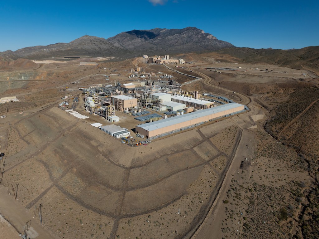
MP Materials Processing Facility in Mountain Pass, California (Courtesy: MP Materials)
Additionally, rare earths play a significant role in environmental applications. Cerium is used in catalytic converters to reduce vehicle emissions, while lanthanum enhances the efficiency of water purification systems. Rare earth-based phosphors are employed in energy-efficient lighting, such as LED bulbs, which are central to reducing global energy consumption.
The importance of these elements underpins the strategic value of deposits like Mountain Pass, making the extraction and refinement of rare earths a critical aspect of both technological progress and national security. In the military domain, rare earths are integral to cutting-edge systems. They are used in the production of advanced lasers, radar systems, night vision equipment, missile guidance systems, and jet engines. According the the Department of Defense, for example, the F-35 Lightning II aircraft requires more than 900 pounds of rare earth elements. Alloys containing rare earth elements also strengthen armored vehicles, while lanthanum aids in camera lenses and night vision optics, giving military forces a strategic advantage.
Bastnaesite concentrate. Bastnaesite is a mineral that plays a crucial role in the production of rare earth metals. (Courtesy of MP Materials)
To fully appreciate the significance of rare earth elements and their crucial role in the United State’s economic future, it’s essential to explore the history of Mountain Pass, one of the most important rare earth mines in the world. This storied site not only played a pivotal role in meeting the surging demand for these elements but also serves as a case study in the challenges of balancing industrial ambition with environmental responsibility.
The Molybdenum Corporation of America, later renamed Molycorp, initially capitalized on the booming demand for europium in color televisions during the 1960s. In 1952, the company acquired the Mountain Pass site, recognizing its rich deposits of rare earth minerals. As the first major player in rare earths in the United States, it began operations at Mountain Pass, establishing a foothold in the burgeoning industry. Over the ensuing decades, Mountain Pass became the world’s premier source of rare earths, serving a growing market for advanced materials.
By the 1990s, however, the mine faced significant challenges. Environmental damage caused by leaks of heavy metals andradioactive wastewater led to regulatory scrutiny and costly fines, culminating in the mine’s closure. During its dormancy, global rare earth production shifted overwhelmingly to China, which gained near-monopoly control over the market. By the time Molycorp attempted to revive the site in the early 2000s, it struggled against operational inefficiencies, low rare earth prices, and fierce Chinese competition. Molycorp eventually declared bankruptcy, leaving the mine idle once again.
MP Materials Mine Facility (Photo: Erik Olsen)
In 2017, MP Materials, led by investors including Michael Rosenthal and Jim Litinsky, acquired the shuttered Mountain Pass mine after recognizing its untapped potential. Initially, they anticipated an established mining or strategic buyer would emerge. Faced with the risk of losing the mine’s permit and seeing it permanently closed through reclamation, they made the bold decision to operate it themselves. To restart operations, MP Materials partnered with Shenghe Resources, a Chinese state-backed company that provided critical early funding and became the company’s primary customer. Through this arrangement, MP shipped raw rare earth concentrate to China for processing, laying the foundation for a business model that was heavily reliant on the Chinese supply chain.
Over the next several years, Mountain Pass far exceeded expectations. By 2022, it was producing 42,000 metric tons of rare earth oxides—three times the best output achieved under its previous owner, Molycorp—and accounted for about 15% of global production. In 2024, the mine hit a U.S. production record with over 45,000 metric tons of REO in concentrate. But even as the mine’s output surged, MP Materials’ ties to China remained central to its operations. Shenghe not only purchased the bulk of that concentrate but also maintained an 8% ownership stake. In 2024, roughly 80% of MP’s revenue came from this relationship. That changed in 2025, when China imposed steep tariffs and new export restrictions. MP responded by halting all shipments to China, shifting instead to processing much of its output domestically and selling to U.S.-aligned markets like Japan and South Korea. It has since invested nearly $1 billion to build out a full domestic supply chain and launched a joint venture with Saudi Arabia’s Ma’aden, marking a decisive pivot away from reliance on China.
The processing of rare earth elements, particularly for high-value applications like magnets, involves a complex, multi-step value chain. It begins with extraction, where ores containing rare earths are mined, followed by beneficiation, a process that concentrates the ore to increase its rare earth content. Next, separation and refining isolate individual rare earth oxides through solvent extraction or other chemical methods. These refined oxides then undergo metallization, where they are reduced into their metallic form, making them suitable for further industrial use. The metals are then alloyed with other elements to enhance their properties, and finally, the material is shaped into high-performance magnets essential for applications in electric vehicles, wind turbines, and advanced electronics. Each of these steps presents significant technical, economic, and environmental challenges, making rare earth processing one of the most intricate and strategically important supply chains in modern technology.
Bastnaesite ore (Wikipedia)
Despite MP Materials’ success and efforts to ramp up facets of processing at its Mountain Pass mine in California, a critical portion of the rare earth refining process—metallization, alloying, and magnet manufacturing—remains dependent on other countries, including China and Japan. These procedures are both intricate and environmentally taxing, and California’s stringent regulatory framework, designed to prioritize environmental protections, has made domestic processing particularly challenging. Across the rare earths industry, this dependence on Chinese facilities exposes a significant vulnerability in the rare earth supply chain, leaving the United States and other countries reliant on foreign infrastructure to produce critical materials essential for technologies such as electric vehicles and advanced military systems.
However, to address the dependency on foreign processing, MP Materials is investing heavily in building a fully domestic rare earth supply chain. At its Mountain Pass mine in California, the company is enhancing its processing and separation capabilities to refine rare earth elements on-site. Meanwhile, at its new Independence facility in Fort Worth, Texas, MP Materials has begun producingneodymium-praseodymium (NdPr) metal and trialing sintered neodymium-iron-boron (NdFeB) magnets. This facility marks the first domestic production of these critical materials in decades, with the capability to produce 1,000 metric tons of magnets annually, amounting to the production of roughly half a million EV motors.
“This is our ultimate goal,” says Matt Sloustcher, EVP of Corporate Affairs for MP Materials. “To handle the entire separation and refining process on-site—but that ramp-up takes time.”
Individual slings of PrNd Oxide, the primary product produced at MP Materials. (Courtesy: MP Materials)
MP Materials asserts that the new U.S.-based rare earth supply chain it is developing will be a “zero discharge” facility, recycling all water used on-site and disposing of dry waste in lined landfills. That will make it a far more environmentally sustainable than its counterparts in Asia, where rare earth mining and processing have led to severe pollution and ecological damage. The company says it is making progress. MP Materials’ Sloustcher pointed California Curated to a Life Cycle Assessment (LCA) study published in the American Chemical Society which “found that NdFeB magnets produced from Mountain Pass ore have about one-third the environmental footprint of those from Bayan Obo, China’s largest rare earth mine.”
“With record-setting upstream and midstream production at Mountain Pass and both metal and magnet production underway at Independence , we have reached a significant turning point for MP and U.S. competitiveness in a vital sector,” said James Litinsky, Founder, Chairman, and CEO of MP Materials in a company release.
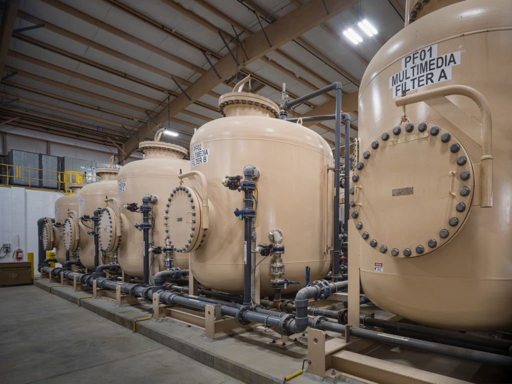
Interior view of the Water Treatment Plant at the MP Materials mine and ore processing site in Mountain Pass, CA. (Courtesy: MP Materials)
MP Materials has also partnered with General Motors to produce rare earth magnets for electric vehicles, signaling its commitment to integrating domestic production into key industries. The push for domestic EV production is not just about economic security but also about environmental sustainability, as reducing the carbon footprint of mining, processing, and transportation aligns with the broader goal of clean energy independence.
The resurgence of the Mountain Pass mine aligns with a broader initiative by the U.S. government to secure domestic supplies of critical minerals. Recognizing Mountain Pass as a strategic asset, the Department of Defense awarded MP Materials a $35 million contract in February 2022 to design and build a facility for processing heavy rare earth elements at the mine’s California site Additionally, the Department of Energy has been actively supporting projects to strengthen the domestic supply chain for critical minerals, including rare earth elements, through various funding initiatives.
Mountain Pass’s operations, however, highlight the challenges inherent in mining rare earths. The extraction process involves significant environmental risks, particularly in managing wastewater and tailings ponds. MP Materials claims to prioritize sustainable practices, yet its long-term ability to minimize environmental impact while scaling production remains under scrutiny. The mine’s bastnaesite ore, with rare earth concentrations of 7–8%, is among the richest globally, making it economically competitive. Still, as mentioned above, processing bastnaesite to isolate pure rare earth elements involves complex chemical treatments, underscoring why global production remains concentrated in a few countries.
Overhead view of the Crusher at the MP Materials mine and ore processing site in Mountain Pass, CA. (Courtesy: MP Materials)
Today, Mountain Pass is not only a critical supplier but also a symbol of U.S. efforts to reduce dependency on Chinese rare earth exports as well as other minerals such as lithium and copper vital to a transition to clean energy technology. As demand for REEs surges with advancements in green energy and technology, the increasing mine’s output supports the production of permanent magnets used in electric motors, wind turbines, and countless other applications. This resurgence in domestic rare earth production offers hope for a revitalized U.S.-based supply chain, reducing dependence on foreign sources and ensuring a more stable, sustainable future for critical mineral access.
However, significant obstacles remain, including the environmental challenges of mining, the high costs of refining and processing, and the need to develop advanced manufacturing infrastructure. Overcoming these barriers will require coordinated efforts from industry, government, and researchers to make domestic production both economically viable and environmentally responsible, ensuring a truly climate-friendly future. With the global race for critical minerals intensifying, MP Materials’ success demonstrates the potential—and challenges—of revitalizing domestic mining infrastructure in an era of heightened resource competition.
As the world pivots toward renewable energy sources, the challenge of energy storage looms ever larger. The sun doesn’t always shine, and the wind doesn’t always blow — but the demand for electricity never stops. Currently, natural gas and coal are the primary ways we generate electricity. These are dirty, pollution-causing industries that will need to be phased out if we are to tackle the problems associated with climate change. Many different solutions to this problem are currently being investigated across the country and the world.
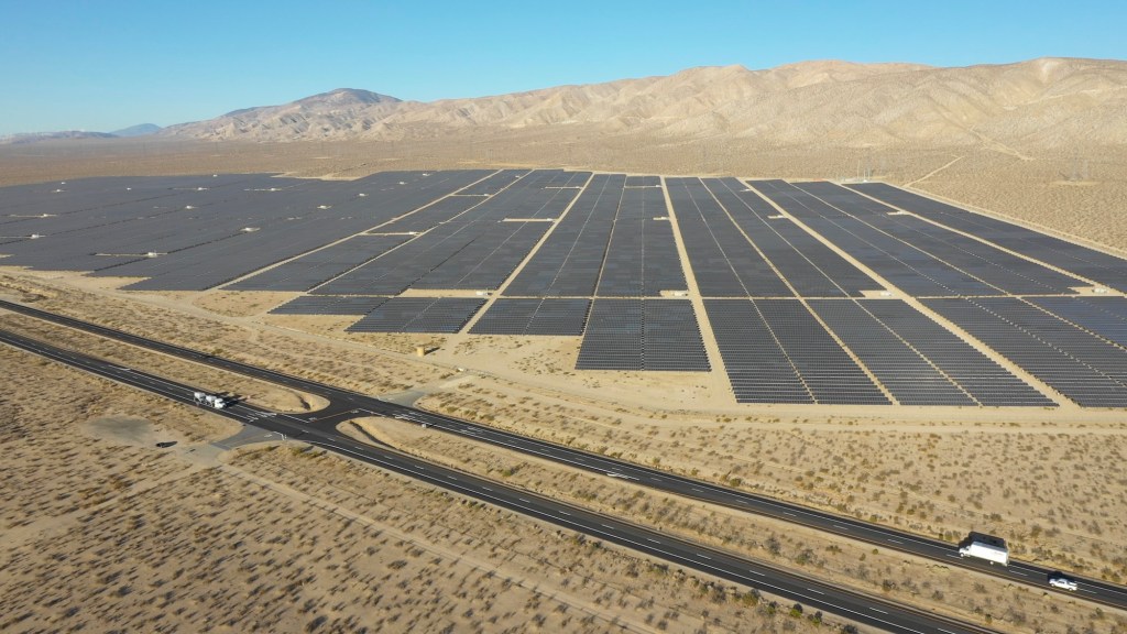
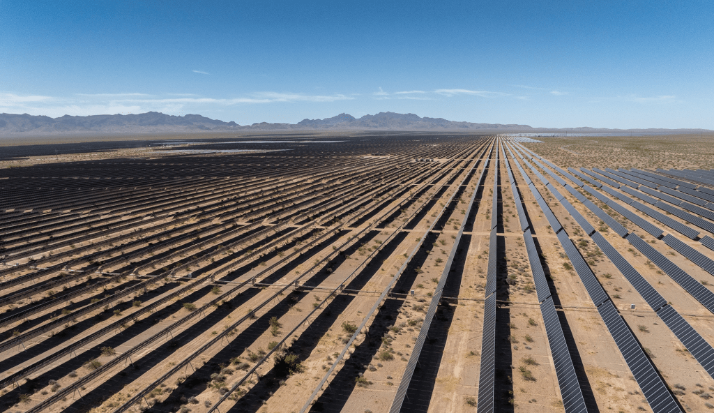
For example, the Gemini Solar + Battery Storage Project, located about 30 miles northeast of Las Vegas, is one of the largest solar battery facilities in the United States, launched in 2023. Spanning approximately 5,000 acres, it combines a 690-megawatt solar photovoltaic array with a 380-megawatt battery storage system, capable of powering about 50,000 homes and providing 10% of Nevada’s peak energy demand. By storing solar energy in massive batteries, the facility ensures a stable and reliable power supply even after the sun sets, addressing the intermittency challenges of renewable energy.
The Gemini Solar + Storage (“Gemini”) project in Clark County, Nevada is now fully operational. It uses lithium ion batteries from China to store solar power (Gemini Solar + Storage)
However, these facilities face significant challenges due to the inherent explosive potential of lithium batteries. The Moss Landing battery facility fire serves as a stark reminder of the challenges associated with large-scale energy storage. Housing one of the world’s largest lithium-ion battery systems, the facility experienced multiple fire incidents, raising concerns about the safety of these technologies. These fires were particularly alarming due to the potential for thermal runaway, a phenomenon where a single battery cell’s failure triggers a chain reaction in neighboring cells, leading to uncontrollable fires and explosions. While no injuries were reported, the incidents caused significant operational disruptions and prompted widespread scrutiny of fire safety protocols in energy storage systems. Investigations have pointed to the need for more robust cooling mechanisms, advanced monitoring systems, and comprehensive emergency response strategies to prevent similar events in the future.
Aside from the potential fire dangers of large battery facilities, building large-scale solar battery projects like Gemini is costly, often exceeding hundreds of millions of dollars, due to the expense of new lithium-ion batteries. A more sustainable and economical solution could involve repurposing old batteries, such as those from retired electric vehicles. These batteries, while unsuitable for cars, still retain enough capacity for energy storage, reducing costs, resource use, and electronic waste.
That’s where B2U Storage Solutions, a California-based company founded by Freeman Hall and Mike Stern, offers an innovative answer to this critical problem. By harnessing the power of old electric vehicle (EV) batteries to store renewable energy, B2U is giving these aging batteries a productive second life and helping enhance the viability of green energy grids. The effort could pave the way for not only improving solar storage but also reusing old batteries that might otherwise end up in landfills or pose environmental hazards.
According to Vincent Beiser in his wonderful new book Power Metal: The Race for the Resources That Will Shape the Future, “by 2030, used electric car batteries could store as much as two hundred gigawatt-hours of power per year. That’s enough to power almost two million Nissan Leafs.”
Founded in 2019, B2U emerged as a spin-off from Solar Electric Solutions (SES), a solar energy development company with a strong track record of success, having developed 100 megawatts across 11 projects in California since 2008. Freeman Hall, a seasoned renewable energy strategist, and Mike Stern, a veteran in solar project development, combined their expertise to address a growing challenge: how to create affordable and sustainable energy storage.
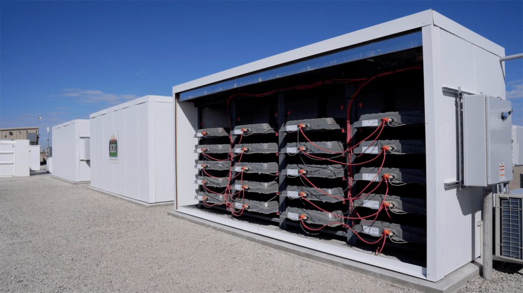
Leveraging their knowledge, B2U developed their patented EV Pack Storage (EPS) technology. This technology allows for the integration of second-life EV batteries without the need for costly repurposing, making large-scale energy storage more economically feasible. Their vision took shape in Lancaster, California, where they established the SEPV Sierra facility in 2020.
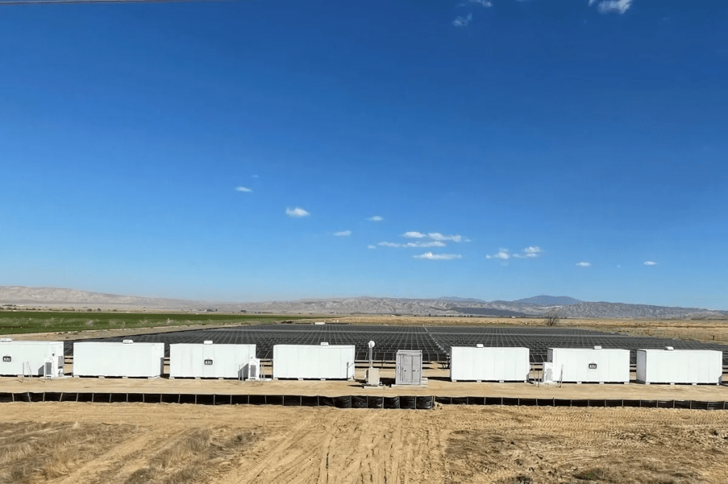
At the Lancaster site, B2U uses over 1,300 repurposed EV batteries to form a large-scale battery energy storage system (BESS). When solar farms generate more electricity than the grid can immediately use, the excess power is stored in these second-life batteries. Later, when the sun sets or demand peaks, that stored energy is released back into the grid. This process reduces waste and helps stabilize renewable energy supply.
B2U is not alone. The second-life market for EV batteries is projected to grow to $7 billion by 2033, according to a March report by market research firm IDTechEx. While most EVs rely on lithium-ion batteries, these typically lose viability for vehicle use after about eight to ten years. However, depending on their remaining capacity and “state of health”—a measure of cell aging—they can be repurposed for less demanding applications, such as stationary energy storage, the report notes.
B2U Storage Solutions has launched its second hybrid battery storage facility near New Cuyama in Santa Barbara County, California. This innovative project uses approximately 600 repurposed electric vehicle batteries, primarily from Honda Clarity models, to provide 12 megawatt-hours of storage capacity. Charged by a 1.5-megawatt solar array and supplemental grid power, the facility supplies electricity and grid services to the California energy market. By employing patented technology, the system integrates second-life EV batteries in their original casings, reducing costs and enhancing sustainability. Building on the success of its first facility in Lancaster, this project demonstrates a scalable approach to energy storage while minimizing electronic waste and supporting renewable energy adoption.
2015 Honda Clarity FCV (Wikipedia)
B2U claims its technology enables batteries to be repurposed in a nearly “plug-and-play” manner, eliminating the need for disassembly. The system is compatible with units from multiple manufacturers, including Honda, Nissan, Tesla, GM, and Ford, allowing them to be seamlessly integrated into a single storage system.
Renewable energy is essential to combating climate change, but its intermittent nature poses challenges for maintaining a reliable power grid. Without effective storage, surplus renewable power generated during peak periods is wasted, and fossil fuels must often be burned to cover shortfalls. By using second-life EV batteries, B2U provides a sustainable, cost-effective solution to this problem.
Freeman Hall and Mike Stern’s innovative approach at B2U addresses the pressing need for affordable energy storage while giving EV batteries a second life. Their Lancaster facility and the one in New Cuyama demonstrate how smart storage solutions can make renewable power more reliable and accessible. By extending the lifecycle of EV batteries and supporting a resilient energy grid, B2U is at the forefront of sustainable energy innovation.
As California works toward ambitious renewable energy goals and the world increasingly embraces electric vehicles, companies like B2U could play a crucial role in shaping a cleaner, more sustainable future.
The recent fires that swept through sections of Los Angeles will be remembered as some of the most destructive natural disasters in the city’s history—a history already marked by earthquakes, floods, and the potential for tsunamis. Yet, even a week later, confusion persists about what happened. Predictably, the finger-pointing has begun, with political opportunism often overshadowing rational analysis. This is, unfortunately, emblematic of our current climate, where facts are sometimes twisted to suit individual agendas. What we need now is a sound, scientific examination of the factors that led to this catastrophe—not just to better prepare for future disasters, but to deepen our understanding of the natural forces that shape our world.
One fact is indisputable: the fires were unusual in their ferocity and destruction. While studies, debates, and expert analyses following the disaster are inevitable, the immediate aftermath offers one clear conclusion—this fires were driven, in large part, by the extraordinary winds that descended on Los Angeles that night. On January 8th, Santa Ana winds roared through the chaparral-covered canyons of the San Gabriel Mountains like a relentless tidal wave of warm air. I witnessed this firsthand, standing outside on my porch as 100-foot trees bent under the gale forces, their massive branches snapped like twigs and flung into streets, homes, and vehicles. A few of them toppled entirely. Having lived in Los Angeles for most of my life, I can confidently say I had never experienced winds of this intensity.
Altadena Community Church. The church was a progressive Christian and open and affirming church and was the thirteenth church in the United Church of Christ that openly accepted LGBTQ people. (Erik Olsen)
The conditions were ripe for disaster. Southern California had not seen significant rainfall since May, leaving the chaparral bone dry. According to Daniel Swain, a climate scientist at UCLA and the University of California Agriculture and Natural Resources, this year marks either the driest or second-driest start to the rainy season in over a century. Dry chaparral burns quickly, and with the powerful winds driving the flames, the fire transitioned from a wildland blaze to an urban inferno. When the flames reached residential areas, entire neighborhoods of mostly wood-frame homes became fuel for the firestorm. In the lower foothills, it wasn’t just the vegetation burning—it was block after block of homes reduced to ash.
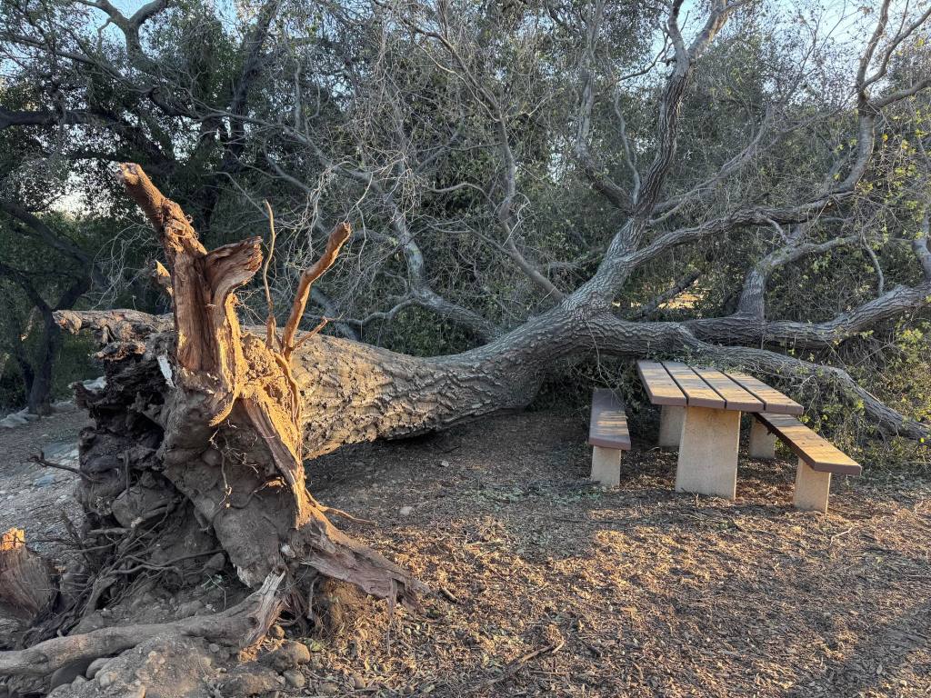
The wind was the true accelerant of this tragedy. Yesterday, I walked through the Hahamongna Watershed Park, formerly known as Oak Grove Park, renamed in the late 20th century to honor the Tongva people. In just 15 minutes, I passed more than a dozen massive oaks—centuries-old trees ripped from the ground, their intricate root systems exposed like nerves. These trees had withstood centuries of Southern California’s extremes—droughts, floods, heat waves—only to be toppled by this extraordinary wind event. Climate change undoubtedly influences fire conditions, but the immediate culprit here was the unrelenting, pulsating winds.
Downed oak tree after the Eaton Fire in Hahamonga watershed park (Erik Olsen)
Meteorologists had accurately predicted the intensity of this event, issuing warnings days in advance. Many residents took those warnings seriously, evacuating their homes before the fire reached its peak destruction. While the loss of 25+ lives is tragic, it is worth noting how many lives were saved by timely evacuations—a stark contrast to the devastating loss of life in the Camp Fire in Paradise a few years ago. Though the terrain and infrastructure of the two locations differ, the success of the evacuations in Los Angeles deserves recognition.
The winds of January 8th and 9th were exceptional, even by the standards of Southern California’s fire-prone history. They tore through canyons, uprooted trees, and transformed a wildfire into an urban disaster. Understanding these winds—their causes, their predictability, and their impacts—is essential not only to prevent future tragedies but to grasp the powerful natural forces that define life in Southern California. As the city rebuilds, let us focus on learning from this disaster, guided by science, reason, and a determination to adapt to a future where such events may become increasingly common.
Southern Californians know the winds by many names: the “devil winds,” the “Santa Anas,” or simply the harbingers of fire season. Dry, relentless, and ferocious, Santa Ana winds have long been a defining feature of autumn and winter in the region. This past season, they roared to life with exceptional vigor, whipping through Altadena and the Pacific Palisades, fanning flames that turned neighborhoods into tinderboxes. As these winds carried ash and terror across Southern California, a question lingered in the smoky air: what made this Santa Ana event so severe, and was climate change somehow to blame?
Home destroyed in Eaton Fire in Altadena (Erik Olsen)
To understand the recent fires, one must first understand the mechanics of the Santa Ana winds. They begin far inland, in the arid Great Basin, a sprawling high-altitude desert region encompassing parts of Nevada, Utah, and eastern California. Here, in the shadow of towering mountain ranges, a high-pressure system often takes hold in the fall and winter. This system is driven by cold, dense air that sinks toward the ground and piles up over the desert. When a contrasting low-pressure system develops offshore over the Pacific Ocean, it creates a steep pressure gradient that propels the cold air westward, toward the coast.
The high-pressure system over the Great Basin in January, which fueled the devastating fires in Los Angeles, was unusual in several ways. While these systems often dominate in the fall and winter, this particular event stood out for its intensity, prolonged duration, and timing. High-pressure systems in the Great Basin drive Santa Ana winds by forcing cold, dense air to sink and flow toward lower-pressure areas along the coast. In this case, the pressure gradient between the Great Basin and the coast was extraordinarily steep, generating winds of unprecedented strength. As the air descended, it warmed through compression, becoming hotter and drier than usual, amplifying fire risks in an already parched landscape.
Winds ravage a McDonalds in Altadena (Instagram)
As this air moves, it descends through mountain passes and canyons, accelerating and compressing as it drops to lower altitudes. This compression heats the air, causing it to become warmer and drier. By the time the winds reach urban areas like Altadena or the Pacific Palisades, they are hot, parched, and moving with hurricane-force gusts. The result is a perfect storm of conditions for wildfire: low humidity, high temperatures, and gale-force winds that can carry embers miles from their source.
In the case of the recent fires, these dynamics played out in particularly dramatic fashion. Winds clocked in at speeds exceeding 70 miles per hour, snapping tree branches and downing power lines—common ignition sources for wildfires.
The cold air over the Great Basin didn’t appear out of nowhere. Its origins lay in the Arctic, where polar air was funneled southward by a wavering jet stream. The jet stream, a high-altitude ribbon of fast-moving air that encircles the globe, has become increasingly erratic in recent years, a phenomenon many scientists attribute to climate change. The Arctic is warming faster than the rest of the planet, reducing the temperature difference between the poles and the equator. This weakening of the temperature gradient slows the jet stream, allowing it to meander in large, looping patterns. One such loop likely brought Arctic air into the Great Basin, setting the stage for the ferocious winds. While much is known about these patterns, it’s an emerging area of research with compelling evidence but not yet universal consensus.
As these winds swept across Southern California, they encountered vegetation primed for combustion. Years of drought, exacerbated by rising temperatures, had left the region’s chaparral and scrubland desiccated. When embers landed in this brittle fuel, the flames spread with devastating speed, aided by the winds that acted as bellows.
Agave covered in Phos Chek fire retardant (Erik Olsen)
While the direct cause of the fires was likely human—downed power lines or another ignition source—the conditions that turned a spark into an inferno were shaped by the interplay of natural and human-influenced factors. Climate change didn’t create the Santa Ana winds, but it likely amplified their effects. Warmer global temperatures have extended droughts, dried out vegetation, and created longer, more intense fire seasons. Meanwhile, the erratic jet stream may make extreme high-pressure events over the Great Basin more likely, intensifying the winds themselves.
This intersection of natural weather patterns and climate change creates a troubling new normal for Southern California. The Santa Ana winds, once a predictable seasonal nuisance, are now agents of destruction in an era of heightened fire risk. Their devilish power, long mythologized in Southern California lore, is now being reframed as a warning sign of a climate in flux.
As the smoke clears and communities begin to rebuild, the lessons from these fires are stark. Reducing fire risk will require not only better management of power lines and vegetation but also a reckoning with the larger forces at play. The Santa Anas will continue to howl, but their fury need not be a death sentence. To live in harmony with these winds, Californians must confront the deeper currents shaping their world. The question is whether we can act before the next spark ignites the next inferno.
California’s water crises have always inspired bold solutions, but few ideas rival the sheer audacity of John Isaacs’ proposal to tow a giant Antarctic iceberg to San Diego. A brilliant and unconventional researcher at the Scripps Institution of Oceanography, Isaacs made waves in 1949 with his imaginative, though controversial, plans to quench California’s chronic droughts by harnessing the frozen reservoirs of the polar regions.
Isaacs’ career was defined by his boundary-pushing ideas. A polymath with a keen interest in marine biology, engineering, and climate science, he often operated at the intersections of disciplines, challenging conventional thinking. The iceberg-towing proposal exemplified his knack for blending vision and pragmatism—if one were willing to stretch the definition of “pragmatic.”
Isaacs theorized that large Antarctic icebergs could be wrapped in insulation to slow their melting and then towed by tugboats up the Pacific coast. The journey, spanning thousands of miles, would end with the iceberg positioned off the coast of Southern California, where its meltwater could be harvested to replenish reservoirs. Isaacs estimated that a single large iceberg, some the size of Manhattan, could supply tens of billions of gallons of freshwater—enough to offset drought conditions for millions of people.
John D. Isaacs (Scripps Institution of Oceanography)
The concept wasn’t a fleeting thought. Isaacs expanded on his idea in 1956, suggesting the capture of an eight-billion-ton iceberg—20 miles long, 3,000 feet wide, and 1,000 feet deep—and towing it to San Clemente Island off San Diego in approximately 200 days. He even calculated that a fleet of six ocean-going tugs could accomplish the feat, taking about six months to tow the iceberg from the 65th parallel south to the Californian coast.
In October 1973, the RAND Corporation took Isaacs’ vision further with an extensive report titled “Antarctic Icebergs as a Global Fresh Water Source” for the National Science Foundation. This 96-page document, authored by J.L. Hult and N.C. Ostrander, provided the most detailed scheme to date, transforming the theoretical idea into a more structured and mathematical model. It envisioned the creation of an “iceberg train” and delved into the technicalities and logistics of towing icebergs across the ocean. Hult explained, “Bringing icebergs to where the water is needed was suggested by John Isaacs of Scripps Institute of Oceanography in the 1950s. It is our job to show how practical it is.” However, the plan was not without eccentricities—such as the suggestion of using a floating nuclear power plant to supply the energy needed for the operation. The RAND report exemplified the ambition of its era, though many of its assumptions leaned heavily on theoretical modeling rather than practical viability.
AI rendering of an iceberg being dismantled (Midjourney)
Isaacs wasn’t alone in dreaming big. His proposal came at a time when other researchers and engineers were exploring similarly outlandish ideas, like seeding clouds with silver iodide to induce rain or building massive aqueducts from Alaska. But Isaacs’ iceberg scheme captured imaginations for its sheer romance and its symbolic uniting of Earth’s polar extremes with parched California landscapes.
Isaacs knew his plan faced enormous technical, logistical, and financial hurdles. For one, towing an iceberg would require immense energy and coordination, as well as a fleet of powerful ships. The iceberg’s tendency to melt during transit—especially when entering warmer waters—posed another significant obstacle. To mitigate this, Isaacs suggested covering the iceberg in reflective materials or insulating blankets to slow heat absorption.
Then there was the issue of economics. Calculations revealed that the cost of transporting a single iceberg could run into the billions, far outweighing the price of more conventional water solutions like desalination plants or water recycling programs. Critics also worried about ecological disruption, from changing ocean currents to the impact on marine ecosystems along the iceberg’s route.
While Isaacs’ iceberg idea was never realized, it sparked a wave of creative thinking about unconventional water solutions. Today, some of the principles behind his ideas have resurfaced in modern innovations. Advanced engineering methods, including climate-resilient infrastructure and adaptive water management, owe a debt to the exploratory spirit of Isaacs’ era.
AI rendering of an aqueduct built to carry water from Alaska to California (Midjourney)
The iceberg-towing concept is occasionally revisited, especially as climate change intensifies water scarcity. For example, in recent years, researchers in the United Arab Emirates have considered similar plans to bring freshwater from polar ice to arid regions. Advances in materials science and energy efficiency have made some aspects of Isaacs’ vision more feasible, though the logistics remain daunting.
John Isaacs’ career extended far beyond icebergs. He contributed to deep-sea exploration, studied the effects of nuclear fallout on marine life, and was an early advocate for understanding the ocean’s role in climate systems. His interdisciplinary approach and willingness to embrace unorthodox solutions left a lasting impact on oceanography and environmental science.
Isaacs’ iceberg proposal remains a testament to his fearless creativity and his deep commitment to solving humanity’s greatest challenges. While the world never saw an iceberg floating past Los Angeles, Isaacs’ bold thinking continues to inspire researchers grappling with the complex interplay of science, technology, and the environment.
Marc Reisner’s Cadillac Desert: The American West and Its Disappearing Water remains a towering achievement in environmental journalism, decades after its publication in 1986. Chronicling the history, politics, and ecological consequences of water management in the American West, Cadillac Desert is not just an exposé of the past—it’s a cautionary tale that resonates today. With precision and passion, Reisner unraveled the intricacies of an arid region’s improbable transformation into one of the world’s most agriculturally productive and densely populated areas. His work has had a profound and lasting impact on how we understand water politics and environmental sustainability in California and beyond.
Cadillac Desert stands as a fitting successor to Wallace Stegner’s Beyond the Hundredth Meridian, continuing the exploration of water’s defining role in the American West. While Stegner championed the visionary work of John Wesley Powell and exposed the folly of ignoring the region’s arid realities, Reisner picked up the torch decades later to chronicle how those warnings were systematically ignored. Where Stegner painted a historical narrative of ambition and hubris, Reisner delivered a scathing and urgent critique of water politics, detailing the environmental and economic consequences of massive dam-building projects and unsustainable resource exploitation.
Colorado River
Cadillac Desert is, at its core, a gripping investigation into the manipulation of water resources in the American West. Reisner meticulously details how the construction of massive dams, reservoirs, and aqueducts enabled the transformation of a naturally dry landscape into a gargantuan economic powerhouse. From the Colorado River to the Los Angeles Aqueduct to California’s Central Valley, Cadillac Desert paints a vivid picture of engineering triumphs and environmental sacrifices, revealing the cost of this development to natural ecosystems, Indigenous communities, and future generations.
One of Reisner’s central stories is the tale of the Owens Valley. In the early 20th century, this fertile agricultural region was drained dry when the Los Angeles Aqueduct diverted its water to fuel the growing metropolis of Los Angeles. The story, replete with backroom deals, broken promises, and outraged locals, serves as a symbol of the greed and ambition that defined water politics in the West. Reisner weaves this narrative with the larger saga of William Mulholland, the ambitious engineer whose name is synonymous with both the success and hubris of L.A.’s water empire. This saga of water, power, and betrayal would later inspire the dark and iconic tale of Chinatown, the Roman Polanski film that captured the moral ambiguities and human cost of Los Angeles’ relentless thirst for growth.
Marc Reisner (Water Education Foundation)
Another cornerstone of the book is the story of the Colorado River, a waterway Reisner calls the most controlled and litigated river on Earth. He charts the creation of the Hoover Dam and the vast network of canals and reservoirs that distribute its water across seven states. The book reveals how over-allocation of the river’s resources, coupled with decades of drought, have pushed it to the brink of collapse—an issue that has only grown more urgent since Cadillac Desert was published.
Hoover Dam in 1936 (United States Bureau of Reclamation)
Reisner also dissects the Central Valley Project and the State Water Project, two gargantuan efforts to turn California into an agricultural Eden. By moving water from Northern California to the arid south, these projects enabled California’s emergence as a global agricultural leader. But Reisner doesn’t shy away from exposing the social and environmental consequences: drained wetlands, salt buildup in soils, and a system that prioritizes agribusiness over the needs of small farmers and urban residents.
What makes Cadillac Desert extraordinary is not just its scope but its style. Reisner’s journalistic rigor is matched by his ability to tell a compelling story. He brings characters like Mulholland and Floyd Dominy, the brash commissioner of the U.S. Bureau of Reclamation (part of the U.S. Department of the Interior), to life with vivid detail. At the same time, his writing is infused with moral urgency, challenging readers to question the sustainability of a society built on unsustainable water use.
Owens River in the Eastern Sierra (Erik Olsen)
The book’s legacy is immense. It galvanized environmentalists and policymakers, inspiring debates about water rights, conservation, and the future of development in the West. Documentaries, academic studies, and even contemporary water management policies owe much to the awareness Cadillac Desert raised. In California, where water battles continue to define politics and development, the book remains as relevant as ever.
As we face a future of intensifying droughts and climate change, Reisner’s insights grow more prescient by the day. California is still grappling with the overuse of groundwater, the challenges of aging infrastructure, and the inequities in water distribution. And while new technologies and policies offer hope, the central question Cadillac Desert poses—how do we balance human ambition with the limits of nature?—remains unanswered.
California Aqueduct (Erik Olsen)
Tragically, Reisner passed away in 2000 at the age of 51 from cancer, cutting short the life of a writer who had so much more to contribute to our understanding of environmental challenges. His death was a significant loss to the fields of journalism and environmental advocacy, but his legacy endures through his groundbreaking work. Cadillac Desert continues to inspire new generations to confront the urgent questions surrounding water use, conservation, and the future of the planet.
Marc Reisner’s Cadillac Desert is not just a history of water in the West; it is a call to rethink our relationship with one of the planet’s most precious resources. At once an epic tale and an urgent warning, it stands as a monumental testament to the price we pay for bending nature to our will.