Basking under the sun, barking from buoys, and sometimes tormenting boat owners, the California sea lion (Zalophus californianus) is a familiar, playful marine mammal common up and down the coast. Known for their intelligence, dog-like demeanor, and underwater agility, they are a symbol of the Golden State’s rich coastal biodiversity. Despite occasional years of periodic starvation and decline, the California sea lion has made a remarkable recovery over the last two decades and is now one the most common marine mammals seen along the California coast. It’s hard to go out in one of California’s many harbors and not see at least one prowling about, often poking their heads above water to take a loud breath.
California sea lions are part of the family Otariidae, which includes all eared seals. These agile marine mammals are well adapted for life in the ocean, with streamlined bodies, strong flippers, and a layer of blubber to help regulate body temperature. Male sea lions are larger than females, weighing up to 800 pounds (363 kg) and measuring around 8 feet (2.4 meters) in length. Females are slightly smaller, weighing around 250 pounds (113 kg) and measuring about 6 feet (1.8 meters) long. Although many people refer to them as seals, they are a different species, and it is fairly easy to tell them apart. Unlike true seals, sea lions have visible ear flaps and long front flippers that enable them to “walk” on land.
NOAA
Ranging from the Gulf of California to British Columbia, these marine mammals are a frequent sight around harbors, beaches, and offshore islands. These highly social creatures also congregate in large colonies on rocky shores, such as the Channel Islands off the coast of Southern California. During breeding season, males establish territories and compete fiercely for females, often engaging in vocal displays and physical battles. The females give birth to a single pup each year and provide maternal care for several months until the pup is ready to venture into the water.
California sea lions are opportunistic feeders, primarily preying on fish species such as anchovies, herring, salmon, and squid. With their excellent underwater vision and agile swimming abilities, they can dive to great depths, sometimes reaching over 900 feet (275 meters) to search for their prey. They are capable of consuming significant amounts of food, with adult males consuming up to 5-8% of their body weight each day.
Sea lions on a buoy in Orange County. (Erik Olsen)
Despite their formidable size and agility, California sea lions face predation from their most notorious adversary, the white shark (Carcharodon carcharias). White sharks are highly efficient hunters and occasionally target sea lions, particularly the young as well as inexperienced individuals. While these encounters are relatively rare, they underscore the ongoing struggle for survival that sea lions face in their natural habitat. Because of the resurgence in the sea lion population on the West Coast, white shark populations have also rebounded significantly, with a recent study suggesting that there can be as many as 40 juvenile white sharks just 50 feet from shore at some of the most popular beaches in SoCal. While this rise in the white shark population off California has made many people concerned about the potential for attacks on humans, records show that just 15 people have died by shark attacks in California since the 1950s.
The California sea lion population has experienced both remarkable recoveries and challenging times. In the early 20th century, they faced severe exploitation for their fur, resulting in significant declines in their numbers. However, conservation efforts and legal protection brought about a remarkable turnaround for these marine mammals.
Under the Marine Mammal Protection Act and state regulations, California sea lions are strictly protected, prohibiting hunting and harassment. Additionally, the establishment of marine protected areas and efforts to reduce pollution and fishery interactions have contributed to their recovery. As a result, the population rebounded, with estimates suggesting that there are now around 300,000 individuals along the coast of California.
Sea lions in Newport Beach. Credit Erik Olsen
Despite their resurgence, California sea lions face ongoing challenges, particularly during certain years when large-scale die-offs occur due to starvation. These events are often linked to El Niño weather patterns, which disrupt the marine ecosystem and cause shifts in fish populations. During such periods, the availability of prey may be limited, leading to malnutrition and high mortality rates among sea lion pups.
While California sea lions have made a remarkable recovery, ongoing conservation efforts are crucial to ensuring their long-term survival. Monitoring their populations, protecting their habitats, and addressing climate change impacts are vital steps to safeguarding these charismatic marine mammals. By raising awareness and promoting responsible stewardship of our coastal ecosystems, we can ensure a bright future for the California sea lion and the diverse marine life it represents.
There’s something quietly remarkable about living alongside California sea lions. They slip through the surf with ease, haul out on docks and rocks, and bring a sense of life and motion to the coastline. Like puppies of the sea, they’re curious, playful, and deeply social. But they’re also resilient animals that have weathered challenges and bounced back. Not that threats still don’t exist. But their presence is a reminder of the ocean’s complexity and beauty, and of how lucky we are in California to share our shores with them.
The 26th President of the United States was a soldier, a historian, an amateur scientist, a best-selling writer, an avid outdoorsman and much much more. He has been called the “father of conservation,” because, as president, he authorized the creation of 150 national forests, 18 national monuments, 5 national parks, 4 national game preserves, and 51 federal bird reservations. We think he deserves the moniker.
President Roosevelt and John Muir at the base of the Grizzly Giant. Credit: Photographer: Joseph Nisbet LeConte; Yosemite NP Archives
But many people may be unaware that TR has a very important California connection. 121 years ago, in 1903, just two years after becoming our nation’s youngest president at the age of forty-two, following the assassination of President William McKinley, Roosevelt embarked on one of the most important Presidential trips in the history of America.
In 1903, President Theodore Roosevelt embarked on a grand tour of the western United States. At the time, Roosevelt was already known for his passion for the outdoors and his desire to protect the nation’s natural resources. This trip would cement his legacy as a conservationist and lead to the expansion of America’s national parks.
The impact of his trip to California is still being felt today.
The trip, taken by railroad, took Roosevelt across the American continent. The 3,000-mile journey began in April from Washington D.C., and took TR through twenty-five states, and lasted nine weeks. He traveled through the American West and stopped at Yellowstone National Park for a hiking and camping trip with naturalist and essayist John Burroughs. He continued on and ended up touring a large swath of the state of California, including Yosemite, which had been declared a national park in 1890.
Yellowstone National Park (National Park Service)
It was a tenuous time for the American environment. Millions of buffalo had been slaughtered across the plains, often for sport, their carcasses left to rot in the sun. The passenger pigeon, a bird that once filled the skies by the billions, had been exterminated. But America was also in the midst of a nature renaissance, and Roosevelt was one of its pivotal figures. The impact of his trip to California is still felt today.
Millions of buffalo were slaughtered during the western expansion of the United States (Wikipedia)
In California, Teddy Roosevelt’s journey was a mix of official duties and personal exploration, reflecting his dual role as a statesman and an outdoorsman. After arriving in San Francisco, Roosevelt was greeted with great fanfare, delivering speeches to large crowds and meeting with local dignitaries. His visit to the city included a tour of its bustling port, symbolizing the growing importance of California as a gateway to the Pacific. Roosevelt also visited Stanford University, where he spoke about education, progress, and the future of the American West. His time in the urban centers highlighted California’s rapid development and its significance in the nation’s expansion.
However, the most profound part of Roosevelt’s time in California came during his visit to Yosemite National Park. He met with naturalist John Muir on May 15th, 1903. The meeting took place on a train in the dusty town of Raymond, California, the closest station to Yosemite. From there, the men traveled 40 miles (about 8 hours) by stagecoach, which gave them the opportunity to get acquainted. They stopped in Mariposa Grove, where TR saw his first sequoia and had his picture taken driving through the “Tunnel Tree,” which no longer stands.
That first night, President Roosevelt dismissed his aides and the press, which was unusual for him because he was a publicity hound. In the wilds of Yosemite, he and Muir spent three days “roughing it,” camping beneath the stars and enjoying conversation around a campfire. It was during those conversations that Muir made the case for the preservation of forests and other natural resources. Likely, these talks created the impetus for Roosevelt’s support for the 1906 Antiquities Act, arguably one of the most important pieces of conservation law in the United States. With the power to proclaim lands as monuments in the public interest, Roosevelt in 1908 set aside some 800,000 acres as Grand Canyon National Monument. Congress later gave it a national park status.
Arguably, no other President has had such a singular impact on protecting American lands, and it’s fair to say, we think, that his visit to California had a lot to do with it.
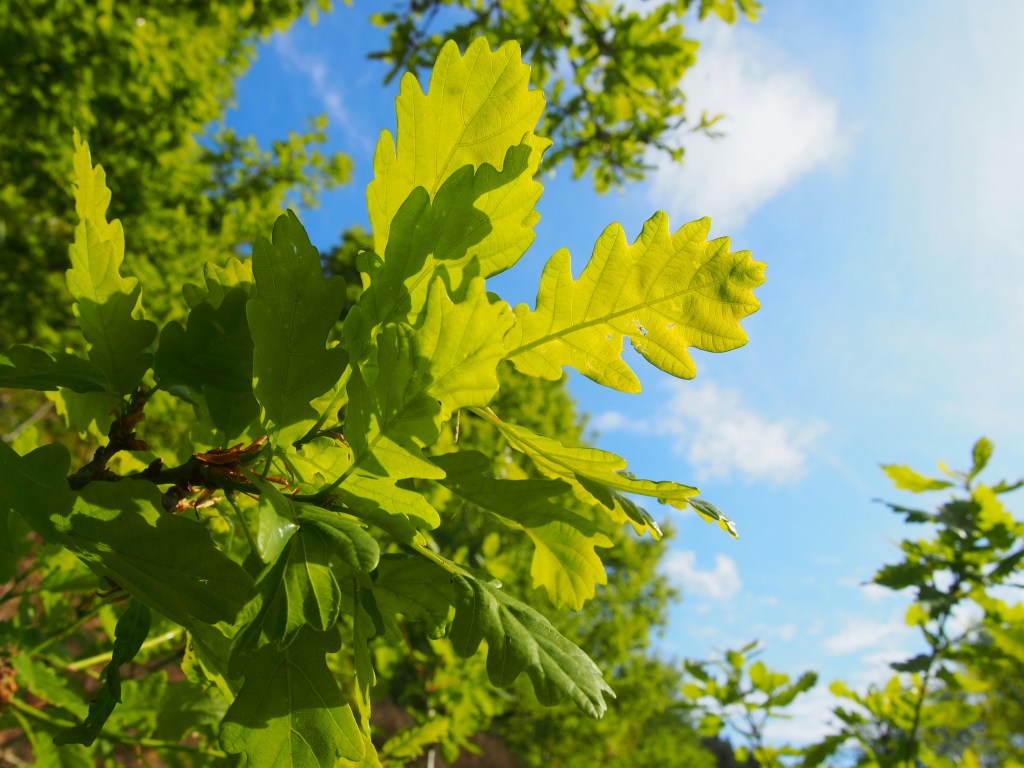
Oak trees hold a profound presence in the landscape of California, constituting a living link between the state’s rich biodiversity and cultural history. Approximately 20 species of oak trees have been recorded in California, each playing a vital role in the ecosystem and making these trees an essential part of the state’s natural landscape.
Among the most significant species are the Coast Live Oak, the Valley Oak, the Blue Oak, and the California Black Oak. The Coast Live Oak, resilient against the salty sea breeze, thrives along California’s coastal regions. The Valley Oak, a symbol of endurance, dominates the fertile inner valleys, while the Blue Oak’s blue-green foliage characterizes the hot, dry foothills of the Sierra Nevada and Coast Ranges. Meanwhile, the California Black Oak, found primarily in mountain regions, is appreciated for its vibrant autumnal foliage and acorns, an essential food source for various wildlife. (Most oak species, particularly those in California, tend to have evergreen foliage or don’t exhibit the same dramatic autumn color change as the black oak.)
Oak tree in Descanso Gardens in La Cañada Flintridge
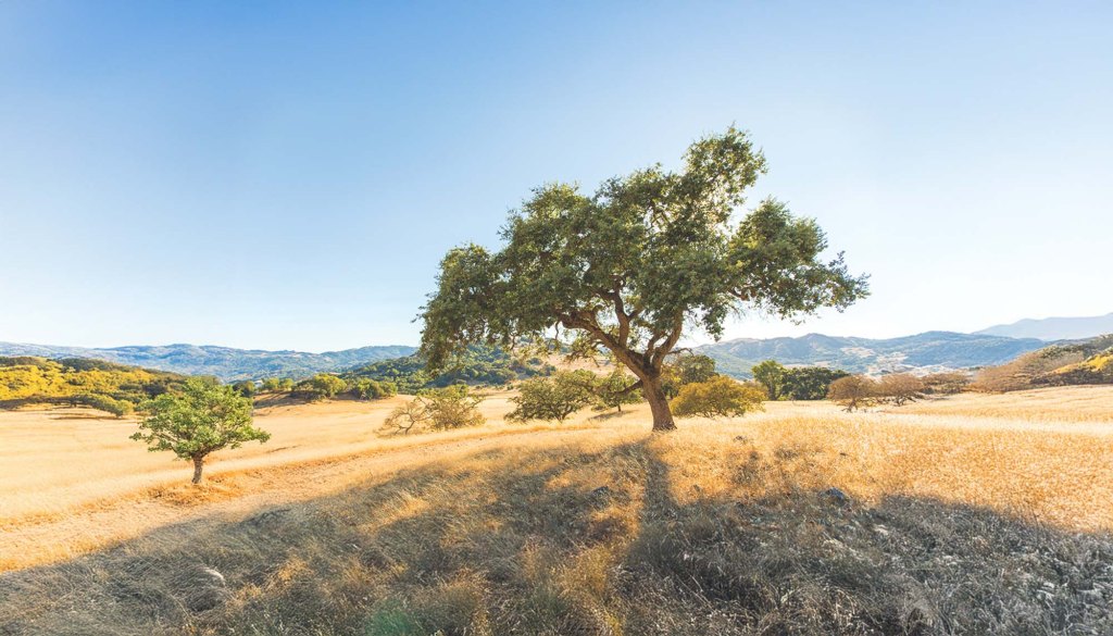
Oaks in California boast a rich history that dates back millions of years, with fossil records suggesting their presence since the Miocene epoch. This rich lineage is intertwined with the tree’s biological traits, with each species evolving to inhabit specific ecosystems. As a result, oak trees have managed to extend their reach across the state’s diverse terrain, from the sun-bathed coasts to the crisp mountain ranges. Whether deciduous or evergreen – with most species in California being the latter – oaks have a remarkable ability to withstand the dry summer months as well as the occasional harsh winter. This resilience can be attributed to their deep root systems and hardy leaves, allowing them to survive and thrive in the region’s unique climate.
Oak Tree in California
Genetics plays a huge role as well: Oaks have a robust genetic makeup that equips them with resilience against various environmental stresses. A study published in the journal “Nature Plants” in 2020, led by researchers at the University of California, Davis, revealed that the genome of the oak tree contains a rich diversity of genes involved in resistance to diseases and stresses. This genetic diversity allows oaks to adapt and survive in different environments and against various threats.
One of the most intriguing findings from the study is the presence of duplicated genes in the oak genome. These gene duplications have occurred over millions of years and are associated with enhanced disease resistance, essentially they get more than the regular protection. This genetic diversity allows oak trees to adapt to various threats, such as pests and pathogens, over time. The study also suggests that these somatic mutations—genetic changes that occur in the cells over the tree’s lifetime—are heritable, contributing to the ongoing evolution of the species and its capacity to survive in changing environments.
Oaks are also remarkably adept at withstanding environmental stresses such as drought, extreme temperatures, and poor soil conditions. Research in forest ecology, including studies published in journals like Trees and Forest Ecosystems, has shown that oaks’ physiological adaptability to different environmental conditions is a crucial factor in their long lifespan. These studies highlight how oaks exhibit significant plasticity in their physiological traits, allowing them to adjust to varying levels of water availability, temperature, and other environmental factors.
California oaks are not just a testament to natural resilience; they are an ecosystem unto themselves. They are the cornerstone of a vibrant biodiversity that encompasses hundreds of animal species. The trees provide shelter and serve as breeding habitats for various animals, from squirrels and deer to a myriad of bird species. The acorn, in particular, play a vital role as a food source. Insects, too, have carved out an existence around the oaks, with some species laying their eggs within the tree’s bark.
This intrinsic connection between the oaks and the animal kingdom extends to humans as well. Historical records show that indigenous tribes in the region used acorns as a staple food. In modern times, the strength and durability of oak wood have made it a preferred choice for construction and furniture-making. Oak is also used in the production of high-quality wine barrels, lending its unique character to the Californian wine industry. The top fifty most expensive wines in the world are oak-aged in some way.
The oak trees of California are renowned for their impressive size and longevity. The Valley Oak, the largest of California’s native oaks, can reach over 100 feet in height and live for several centuries. These grand trees also contribute significantly to carbon sequestration. A mature oak has the capacity to absorb up to 50 pounds of CO2 annually, thus helping mitigate climate change while improving air quality. A mature oak forest can store up to 50% more carbon than an equally-sized forest of other trees.
Despite their remarkable resilience, oaks in California face a myriad of challenges. Threats stem from habitat loss, climate change, and diseases such as Sudden Oak Death. Urban development often comes at the expense of oak woodlands, while shifts in climate patterns pose potential risks to the growth and distribution of oaks.
Coast Live Oak (Erik Olsen)
Conservation efforts to protect California’s majestic oaks have become increasingly critical in recent years, shaped by a heightened understanding of the tree’s ecological significance and the mounting threats they face. Various local, state, and federal entities, as well as numerous non-profit organizations, have joined forces in these endeavors, harnessing a broad array of strategies to ensure the survival and thriving of California’s oaks. The Oak Woodlands Conservation Act is a key legislative effort, providing funding to conserve oak habitats. Additionally, various organizations, such as the California Oak Foundation, run planting and restoration projects, as well as research initiatives to combat threats like Sudden Oak Death and climate change.
One of the primary conservation strategies involves the protection of oak habitats, specifically oak woodlands. These regions are often hotspots of biodiversity, and their preservation is crucial for the health of many interconnected species, including oaks themselves. For example, the Oak Woodlands Conservation Act, mentioned above and enacted by the state of California, provides funding to acquire oak woodland habitats for conservation purposes, ensuring these areas remain untouched by urban development or agriculture.
Leaves of California Black Oak
In addition to the legal protection of existing oak habitats, restoration projects are an important aspect of conservation efforts. These projects involve the replanting of oaks in areas where they have been lost due to disease, development, or other causes. The California Oak Foundation runs regular planting programs, involving local communities in the process to raise awareness about the importance of oaks and fostering a sense of responsibility for their protection.
Research also plays a vital role in oak conservation. Scientists are continually studying the threats faced by oaks, including diseases like Sudden Oak Death, and developing ways to mitigate them. They are also exploring the potential impacts of climate change on California’s oaks, seeking strategies to bolster their resilience against rising temperatures and shifting weather patterns. This research informs management strategies and policy-making, ensuring conservation efforts are based on the best available science.
By fostering a deeper connection between the people of California and their native oaks, these initiatives cultivate a broader culture of conservation that can help ensure the survival of these majestic trees for generations to come. The collective aim of these diverse conservation strategies is not merely the survival, but the flourishing of California’s oaks, securing their rightful place in the state’s rich and dynamic ecosystems.
The current effort to bring back the white abalone is one of numerous projects underway in California to revive the state’s once-thriving marine environment.
White abalone
If you grew up in Southern California in the 1970s, there were a few things that defined California: surfing, skateboarding, the Eagles (preferably on the radio while driving down the Pacific Coast Highway) and abalone.
The abalone was an icon of beach culture, celebrated in poetry and song, a wondrous gift from Mother Nature. Almost every house near the coast had upturned abalone shells on the coffee table or as decorative items in a garden, their opalescent mother-of-pearl interior shells glistening jewel-like beneath the warm California sun. They hung near front doors or in backyards by the half dozen from string or fishing line, acting as wind chimes when the cool breezes blew in from the Pacific. Our air, our light is different than other places.
They once numbered in the millions off the California coast, but now they are endangered. As the Los Angeles Times put it in 2019, “Abalone once were to California what lobster is to Maine and blue crab to Maryland, so plentiful they stacked one on top of another like colorful paving stones.”
But then something terrible happened.
The white abalone (Haliotis sorenseni) fishery, in particular, went out of control. Commercial abalone fishing from 1969–1972 was so lucrative and so unrestrained that the catch went from roughly 143,000 pounds per year to just 5,000 pounds per year in less than a decade. Millions of pounds were harvested by commercial fishermen, and diving for abalone was a common and favored pastime. In 1997, state officials in California ceased all white abalone fishing because population levels had reached perilous lows. By 2001, the numbers of white abalone found along the coast were so low that they became the first marine invertebrate listed as endangered on the Endangered Species Act. But it was too late. The population had declined by almost 99 percent.
It is estimated that around 1,600 individuals remain, and at one point, it was feared the species would go extinct by 2010 without intervention. Currently, there is growing concern that the small populations still surviving in the wild may be highly vulnerable to withering syndrome disease.
California is home to seven species of abalone (red, pink, black, green, white, pinto, and flat), none of them are plentiful any longer in California waters, but it is the white abalone, in particular, that became the most prized for its tender, flavorful flesh. We loved white abalone. And then they were gone.
White abalone. Credit: NOAA
Despite a fishing ban for over two decades, wild populations of white abalone have not shown signs of recovery. Abalone reproduce through broadcast spawning, where they release their gametes into the water. This method requires a certain population density to be effective, but current wild populations of white abalone are too sparse for successful natural reproduction.
In 2019, scientists at UC Davis’ Bodega Marine Lab in Bodega Bay launched one of the most important species restoration efforts in the history of the state. On November 18, 2019, researchers from the marine lab, in cooperation with the National Oceanic and Atmospheric Administration (NOAA) carefully released thousands of baby white abalone into the waters of Southern California. Biologists measured and marked each one with a unique numbered tag affixed to their shell to distinguish them from wild white abalone (of which there are perilously few). This marked the first release of endangered white abalone into the wild in coastal waters. What’s crazy is that the white abalone that have been bred in the lab constitute the largest population of the slow-moving mollusks in the world. That’s right, there are more white abalone living in captivity than there are in the wild. Until now.
“Early on we knew that this species was really in danger of going extinct and that the only viable alternative to save it was starting a captive breeding program,” said Ian Taniguchi, a biologist with the California Department of Fish and Wildlife (CDFW) who has been involved in white abalone restoration since 1992.
The White Abalone Restoration Program in California has made significant progress in recent years, although challenges remain. The program, now led by a coalition of organizations including NOAA Fisheries, the University of California, Davis, and The Bay Foundation, focuses on restoring the population of this critically endangered species through captive breeding and outplanting efforts.
Currently, the program has successfully bred and outplanted thousands of juvenile white abalone into the wild, particularly along the Southern California coast. These efforts are part of a broader strategy that includes improving spawning techniques, monitoring wild populations, and enhancing habitat conditions. Despite these efforts, white abalone populations in the wild are still vulnerable due to factors like disease, warming waters, and low population densities that hinder natural reproduction.
The program’s ongoing efforts include monitoring environmental conditions that affect abalone habitats, such as oxygen levels and temperature, to optimize outplanting strategies. Additionally, the restoration efforts are expanding, with new techniques and partnerships aimed at increasing the resilience of outplanted populations and ultimately ensuring the species’ survival in the wild
Cultured Abalone Farm (Photo: Jennifer Boyce)
“Early on we knew that this species was really in danger of going extinct and that the only viable alternative to save it was starting a captive breeding program.”
Ian Taniguchi, a biologist with the California Department of Fish and Wildlife (CDFW)
Abalone are far more valuable than merely as a food item. They are keepers of the kelp forest. According to scientists, the abalone eat kelp, but they also clear rocks of any dominant species and thus increase kelp diversity so that multiple kelp species can flourish. When the kelp is healthy and diverse, coastal waters see an explosion of diversity in fish and other animals that depend on kelp forest habitat.
While the success of the abalone recovery program hangs in the balance, its mere existence needs to be recognized as part of a much larger tapestry of species and ecosystem recovery projects currently underway that are aimed at restoring California’s coastal ecosystem to some semblance of what it was centuries ago.
That is, of course, impossible. The numerous written accounts by early California settlers (many of them Spanish) describe plants and animals in such unfathomable abundances, the likes of which we will never be able to return. But we can reclaim some of it. And after decades of witnessing severe declines in fish species, kelp, water quality and coastal habitat, it seems we may be finally turning a corner. Maybe.
Alone, each of these efforts is a small step in the right direction in making our seas healthy and fruitful. Together, they represent the most significant set of achievements to reverse the impact of human settlement on the ocean environment in the history of the world. Of course, we are nowhere near done, and the growing (and terrifying) threats from climate change could render all of this moot. Warming seas, the spread of new diseases (and old ones), acidification, all these things together could unravel these accomplishments in mere decades.
There are still many challenges ahead. Recent kelp die-offs in Northern California due to the explosion in purple urchin populations are extremely worrisome. Phenomena like sea star wasting disease and the marine heatwave of 2013-2015 may have wrought permanent change to our marine ecosystem. But the fact that we are now acting so aggressively to apply science and ingenuity to solve the myriad problems we ourselves caused should give us some hope that positive change is possible.
There is no time for rest. If anything now is the time to redouble our efforts to make our oceans cleaner, to help species recover and to restore the lost balance so that future generations can experience the incredible beauty and bounty of the sea.
The Pacific Coast Highway (PCH), also known as California State Route 1, is one of the most iconic roads in the United States, renowned for its breathtaking views of the Pacific Ocean and rugged coastline. This scenic highway stretches over 650 miles from Dana Point in Orange County in Southern California to Mendocino County in Northern California, offering travelers unparalleled vistas and a quintessential Californian road trip experience. While some suggest that PCH runs from Mexico to Canada, that is mistaken. U.S. Route 101 continues north from California, running along the coast through Oregon and Washington, up to the Olympic Peninsula. That said, it is still the longest state route in California and the second-longest in the US after Montana Highway 200. The story of its construction is as dramatic and intricate as the landscape it traverses.
The origins of the Pacific Coast Highway date back to the early 20th century, when the automobile was becoming an essential part of American life. The idea for a coastal highway was initially conceived to connect the state’s isolated coastal communities and improve access to California’s scenic beauty. The concept gained traction in the 1910s and 1920s, and construction began in earnest in the 1930s, to provide jobs during the Great Depression.
Lovely aerial of Pacific Coast Highway in Central California
“It took decades to get the highway built,” Carina Monica Montoya told the Los Angeles Times. Montoya is the author of, “Pacific Coast Highway In Los Angeles County” (The History Press, 2014).
The construction of the PCH was an engineering marvel, given the challenging terrain it had to navigate. The road had to be carved out of steep cliffs, cross numerous rivers, and be supported by bridges spanning deep ravines. One of the most significant and iconic portions of the highway, the Big Sur section, presented formidable challenges. This stretch of the road, which runs between San Simeon and Carmel, required extensive blasting and drilling into the rugged coastal mountains. The effort was spearheaded by the California Division of Highways (now CalTrans), with a workforce comprising both state employees and workers from the Civilian Conservation Corps (CCC), a New Deal program.
PCH
Key figures in the design and construction of the PCH included engineers and architects who had to innovate continuously to address the formidable natural obstacles. One notable engineer was John D. Isaacs, a prominent builder who contributed to the design and construction of several key bridges along the PCH, including the famous Bixby Creek Bridge. His innovative approach to bridge engineering helped overcome the difficulties presented by the steep canyons and coastal bluffs.
The Pacific Coast Highway took decades to complete fully, with different sections being opened to the public at various times. The Big Sur segment, for example, was officially completed in 1937 after nearly 18 years of labor. The total cost of constructing the highway is difficult to pinpoint precisely, given its piecemeal development, but it ran into tens of millions of dollars—an immense sum at the time.
The Pacific Coast Highway near Santa Monica, California, circa 1930s.
Several colorful characters also play a role in the highway’s history. The Pacific Coast Highway might not exist today if May Rindge, a resolute landowner, had succeeded in her long battle against the county. Since at least the 1890s, a primitive road, often submerged at high tide, hugged the rocky coast between Santa Monica and Malibu, passing under a natural arch and ending at a locked gate on Rindge’s 17,000-acre ranch.
As the owner of Rancho Topanga Malibu Sequit, Rindge was determined to protect her property. She and her late husband had long fought to keep homesteaders off their land. In 1906, she even forced the Southern Pacific Railroad to divert its Santa Barbara line around Malibu and through the San Fernando Valley.
In 1907, when the county proposed extending the coastal road through Malibu, Rindge posted armed guards at the entrances to her ranch and contested the county’s power of eminent domain in court. A stalemate ensued for years, but the road’s prospects improved in the early 1920s when it was included in the planned Roosevelt Highway. In 1923, the U.S. Supreme Court upheld the county’s right to appropriate the land for the highway, and in 1925, a superior court judge granted the county title to the right-of-way in exchange for $107,289, finally ending the dispute.
The book “The King and Queen of Malibu: The True Story of the Battle for Paradise” by David K. Randall (2016) tells the story of Ringe and a wonderful history of Malibu.
Lexus on PCH
Today, the Pacific Coast Highway is one of the most famous and iconic strips of road in the world. Featured in countless commercials as well as movies and TV shoots, sections of PCH are immediately recognizable. Of course, it helps a lot that the highway in in such close proximity to legions of DPs (Directors of Photography) who live in Los Angeles and work in commercials and film. Shooting on the highway is an easy day trip from LA and Hollywood, although it can be difficult to get permits to film on the highway given it is such a busy working road.
That said, the highway faces significant challenges due to climate change and coastal erosion. Rising sea levels and increased storm activity are accelerating the natural erosion processes along California’s coast. This has led to frequent landslides and road closures, particularly in the Big Sur region. One notable event was the massive landslide in 2017 at Mud Creek, which buried a section of the highway under 40 feet of debris, closing it for over a year and requiring extensive repairs. A timelapse of the landslide produced by the United States Geological Service can be seen here.
The Pacific Coast Highway in Newport Beach (Erik Olsen)
The New Yorker ran a piece on the concerns about the highway’s future viability as a means to travel long distances along the coast.
The Washington Post wrote back in 2021, “the engineering folly of a road built on sheer cliffs has meant that closures are annual events — the “whens,” not “ifs” — for the people and the economy it supports.”
The most recent slide to afflict the region took place in April 2024 following heavy rains, when large chunks of the road broke off, tumbling down a cliff and into the ocean near Rock Creek Bridge. Safety officials closed off about 40 miles of road as crews worked to assess the damage and stabilize the road.
Although the Pacific Coast Highway remains one of the greatest road trip routes of all time, the challenges in maintaining its full length are significant for the state and its residents. Despite its enduring popularity, the highway often operates in sections due to frequent closures and repairs caused by natural disasters like landslides, erosion, and wildfires. These ongoing issues demand substantial resources and effort to keep the entire highway operational, making its full-length service a constant struggle.
Still, it remains a pretty excellent place to take a drive. As the Boss once put it, roll down the window and let the wind blow back your hair.
Southern California is best known for its sun-soaked beaches and Hollywood glamour, but it also has a wilder, largely forgotten past: it was once an oil kingdom. It’s a story even many Californians don’t know, a tale of spectacular gushers, fortunes won and lost, and larger-than-life characters straight out of a movie. Without oil, Los Angeles, and much of Southern California, would be very different places today.
The story of oil in Southern California is inextricably linked to the Long Beach fields, an area that once seemed more like a scene from Texas or There Will Be Blood than the Golden State. The discovery of oil in this region wasn’t just a footnote in economic journals; it was a seismic event that transformed the landscape, both literally and metaphorically. And it provided an industrial center of gravity to a region of the state that was just beginning to emerge as one of the world’s great gateways of commerce.
Signal Hill, 1926 (Public Domain)
The early 20th century was the beginning of the era of oil in California. On June 23, 1921 at 9:30 a.m., the Alamitos No. 1 oil well on Signal Hill in Long Beach was drilling 2,765 feet beneath the surface when the drill struck an underground oil deposit. This oil was under high pressure due to natural gas, blowing a gusher of oil over 100 feet high, and heralding the start of the Long Beach oil boom.
This event marked the discovery of one of the most prolific oil fields in the Los Angeles basin. Throughout the 1920s, Signal Hill, along with the nearby Santa Fe Springs field, experienced numerous blowouts, which erupted into dramatic pillars of flame that could be seen for miles. These incidents eventually prompted calls for stricter safety regulations. Consequently, in 1929, the state mandated the use of blow-out prevention equipment on all oil wells drilled in California.
Signal Hill quickly mushroomed into a forest of oil derricks, with fortunes being made overnight. As one of the most productive oil fields in the world, the Long Beach field was at one point yielding a staggering one-third of California’s total oil production. By the mid-1920s, California was producing nearly a quarter of the world’s entire petroleum supply, much of it from the Long Beach area.
Signal Hill, Long Beach oil development. (Public domain)
That so much oil is present beneath the surface of this stretch of Southern California is a gift of geology. Millions of years ago, the area that is now Long Beach was covered by the ocean. This marine environment was ideal for the accumulation of organic material, such as the remains of tiny plants and animals, on the ocean floor.
Over time, layers of sediment buried this organic matter. The high pressure and temperatures associated with deep burial initiated the transformation of this organic material into hydrocarbons – essentially, the formation of oil. Southern California is, of course, known for its active tectonics, influenced by the Pacific and North American Plate boundary. This tectonic activity has created a complex network of faults and folds in the earth’s crust in the Long Beach area.
The folding of the earth’s layers into anticlines (a type of fold that is convex up and has its oldest beds at its core) and the formation of fault traps (where displaced rocks create a seal that traps oil) are particularly important. These structures create reservoirs where oil can accumulate and be preserved over geological time scales.
Map of the Long Beach oil field.
As the oil flowed, so did the stories of those who sought their fortune in black gold. Perhaps the most famous of these was Edward L. Doheny, a name synonymous with California oil. Doheny, an ambitious prospector, was one of the first to recognize the potential of the Los Angeles Basin’s oil fields. His success in the oil industry was meteoric, but it was not without controversy, as he was later embroiled in the infamous Teapot Dome scandal.
Portrait of oil magnate Edward L. Doheny (Wikipedia)
The impact of oil production in Southern California extended beyond economics. It reshaped the region’s landscape, both physically and culturally. Towns sprung up around oil fields, and workers flocked to the area, drawn by the promise of jobs and prosperity. Long Beach, once a sleepy coastal town, burgeoned into a bustling city.
During the 1920s, regulations on well spacing were minimal, allowing Signal Hill to market narrow town lots. These lots were swiftly purchased by aspiring oil tycoons who installed wells so close to each other that they almost touched. Despite the dense placement, the wells generally remained profitable, though they rapidly depleted the oil field. The hill earned the nickname “Porcupine Hill” due to its appearance from afar, bristling with numerous wooden oil derricks since the more compact “nodding-donkey” pumpjack had not yet been developed.
The booming oil industry in the region attracted a massive influx of workers and investments. As oil fields expanded, Long Beach rapidly transformed from a seaside resort into an industrial powerhouse. The surge in economic activity and the availability of abundant oil fueled the growth of industries in and around Long Beach, including the burgeoning shipping and maritime sectors.
Container ships outside the Port of Los Angeles during the Covid lockdown in 2020. (Photo: Erik Olsen)
The construction of the Port of Los Angeles, which began in earnest in the early 1900s, was driven by the need to support the growing economic activities in Southern California, including agriculture, manufacturing, and oil. The proximity of Long Beach to the port, only about 20 miles south, meant that it was strategically positioned to benefit from and contribute to the port’s activities. The port served as a critical node for shipping oil, among other goods, which further integrated Long Beach, and Southern California as a whole, into the global trade system.
Signal Hill in Long Beach today. (Erik Olsen)
Moreover, the infrastructure developments necessary to support the oil industry, such as roads, railroads, and later pipelines, also facilitated the growth of the port. These developments enhanced the logistical capabilities of the region, making it more attractive for commercial and industrial activities. The oil boom thus not only transformed Long Beach but also had a cascading effect on the development of the Port of Los Angeles, cementing the region’s role as a vital hub in international trade and commerce.
As big and diverse in industry Los Angeles has become, it mostly started with oil. The fact that Los Angeles is now hardly known for oil, but better known for its massive entertainment and tourism economies is an astonishing transformation.
Of course, the influx of wealth and people also brought challenges, including environmental concerns and the need for regulatory oversight. It is well known that several major oil spills have taken place off the coast, ruining beaches and killing animals by the millions. In 1969, the Santa Barbara oil spill released vast quantities of oil into the ocean, creating an environmental disaster along the California coastline. This catastrophic event galvanized public awareness and activism, leading to the creation of the first Earth Day, as well as significant environmental legislation, including the establishment of the U.S. Environmental Protection Agency.
The oil slick visible around Platform A in the Santa Barbara Channel emanated from fissures in the seabed. (Photo: USGS)
Oil spills continue to take place in Southern California and the existence of 26 rigs off the coast are a reminder of that oil boom era. Those rigs are coming to the end of their productive life, however, and an on-gong controversy is what to do with them. Remove them or leave them — or part of them — as artificial reefs?
Over time, oil production in Southern California has waxed and waned. The easily accessible oil has largely been extracted, and production has declined from its mid-20th-century peak. Yet, the legacy of this era persists. It’s etched into the region’s physical and cultural landscape, from the bobbing oil derricks still dotting Signal Hill to the fortunes and institutions built on oil money.
The story of oil in Southern California, particularly the Long Beach fields, is a saga of geologic luck, ambition, ingenuity, and, at times, dangerous greed. It’s a chapter in the state’s history that’s as rich and complex as the oil that still lies beneath its surface, and yet it remains largely unknown to many people who think of Southern California as a paradise of sand and rolling waves.
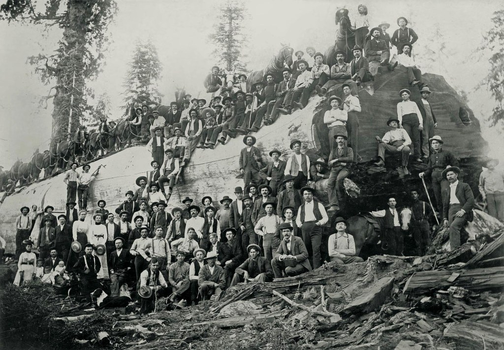
“A story of greed and mass destruction of a mighty forest.”
California has faced its share of environmental calamities. We’ve experienced wildfires that have denuded the landscape, destroying valuable forests and homes, and taking human lives. Oil spills have soiled coastlines and killed wildlife. But of all the great environmental crimes the state has faced, perhaps few rank as high as the destruction of Converse Basin Grove in the late 1800s. And yet very few people have ever heard of it.
Located in the southern part of the Sierra Nevada Mountains east of Fresno, just outside Kings Canyon National Park, Converse Basin Grove spans over 6,000 acres and 700 feet of elevation. The basin was once home to the densest and most majestic expanse of Giant Sequoia (Sequoiadendron giganteum) on the planet. This remarkable concentration of trees was largely due to the basin’s unique combination of geological and climatic conditions.
The grove’s deep, well-draining granitic soils provided a stable foundation for sequoia growth, allowing their extensive root systems to spread and access water efficiently. Additionally, the region’s position in the Sierra Nevada ensured a steady supply of moisture from winter snowfall, which melted slowly into the summer, maintaining the soil’s hydration even during dry months. Sequoias also depend on periodic low-intensity wildfires, which clear competing vegetation, release seeds from their cones, and create the mineral-rich soil conditions necessary for seedlings to establish. This natural fire cycle once maintained the grove’s density, fostering the exceptional concentration of ancient trees that once dominated area.
Loggers and a team of horses pose on a fallen sequoia 26 feet in diameter. Converse Grove, California 1917. (Wikipedia)
Between 1892–1918, the Sanger Lumber Company logged the grove using ruinous clearcutting practices, and cut down 8,000 giant sequoias, some of them over 2000 years old, in a decade-long event that has been described as “the greatest orgy of destructive lumbering in the history of the world.” Only 60-100 large specimens survived.
Currently, the most expansive remaining sequoia domain is the Giant Forest in Sequoia National Park, which has an estimated 8,400 giant sequoia trees that are more than one foot in diameter at their bases. The park is home to the world’s biggest tree, the General Sherman.
So how did this happen? The Converse Basin grove’s discovery in the late 19th century coincided with a burgeoning demand for lumber in the wake of California’s Gold Rush and subsequent population boom, particularly in San Francisco. A huge portion of early San Francisco was built using redwood. In fact, redwood was the dominant building material in much of 19th-century California, and San Francisco was practically a redwood city.
This demand drew the attention of loggers to the massive potential of sequoias. In particular, the Kings River Lumber Company, which secured this coveted area through both lawful and dubious means shortly after its incorporation in 1888. This marked the first instance of industrial-scale logging targeting the Sierra redwoods, a venture that required substantial initial investment due to the challenges of building a mill in the mountains and the engineering marvel needed to transport the colossal timber to lower elevations.
The 54-mile-long flume, or log conveyor, from Converse Basic Grove to the town of Sanger, about 20 miles from Fresno. (Photo: National Park Service)
To get the logs to mills from the High Sierra Mountains the SF-based company constructed a 54-mile-long flume, or log conveyor, from Converse Basic Grove to the town of Sanger, about 20 miles from Fresno. This giant wooden waterslide, balanced on trestles along steep canyon sides, allowed lumber to be swiftly transported to the nearest train station, some 60 miles away, in just half a day. Upon reaching the station in Sanger, a town that proudly proclaimed itself the “Flumeopolis of the West,” the lumber was dried, finished and prepared for rail transport to markets across California.
High trestle under construction on the Sanger Flume 1905. (Public Domain)
But how did this happen in the first place?
Rugged terrain and unnavigable streams had protected these big trees for decades. That it became possible to log so many magnificent trees in such a hard-to-reach place was due to the passage of one of the most unintentionally destructive environmental laws ever passed in the United States.
In 1878, the United States Congress enacted the Timber and Stone Act to promote the private ownership of timberland and support the logging industry. This legislation permitted individuals to claim federal lands in the Sierra Nevada mountains, acquiring individual parcels of 160 acres for a nominal fee if they simply filed a claim. Like other land laws of the era, it was also designed to encourage westward expansion by making it easier for settlers and speculators to acquire and develop land in the American West.
Stacks of lumber with workers at Converse Basin (Public Domain)
Prior to this legislation, there was no legal framework allowing individuals to purchase timberland directly from the government specifically for logging purposes, as opposed to agricultural use. However, following the enactment of the law in 1878, it became possible to acquire nonarable, nonmineral public lands at a minimal cost of $2.50 per acre. To claim these 160-acre parcels, the claimant only needed to attest that their intention was to utilize the land for practical, non-speculative purposes, excluding any plans for resale or contractual transfer to another entity.
This enabled the easy transfer of vast expanses of land from the government to lumber companies, which commonly enlisted and compensated individuals to file claims on their behalf. Among these companies was the Kings River Lumber Company, which acquired some of the lands legally, but also got its hands on vast acreages using dubious and illegal tactics that took place right under the noses of government regulators.
Converse Basin Panorama from 1900. (Photo: National Park Service)
The Timber and Stone Act required buyers to use the land for personal, non-speculative purposes, but the company circumvented these restrictions by using a practice known as “dummying.” In this scheme, the lumber company recruited individuals to act as stand-ins or “dummies” to file claims on parcels of the Converse Basin under the pretense that these claims were for personal use. After securing the claims, these individuals would then transfer the parcels to the Kings River Lumber Company, often for a profit. This allowed the company to amass large areas of prime sequoia forest, much of which was still old-growth timber, under dubious legal pretenses.
Lumber production began in Converse Basin in 1891, launching with 20 million board feet of timber flowing down the flume. But the company had been created through the issuance of massive debt, and the company was under pressure to increase output to become profitable. However, the flume frequently required costly repairs. In 1895, following an unsuccessful reorganization attempt, the firm was taken over by creditors and renamed Sanger Lumber. The new management pushed for maximum production, extending the narrow-gauge railroad deeper into the basin and constructing a new sawmill in 1897.
Cut end of tree showing welded crosscut saws. (Photo: National Park Service)
During its operation, Sanger Lumber was responsible for the felling of approximately eight thousand mature sequoias within the 5,000-acre Converse Basin, leaving only one giant standing. At the northern edge of the grove, overlooking Kings Canyon, loggers spared a single large tree, now among the world’s ten largest, and named it after their foreman, Frank Boole. The Boole Tree still stands today. It is the eighth tallest sequoia in the world and ranks No. 1 in base circumference, at 112 feet. Estimated to be more than 2,000 years old, the behemoth is the largest tree in America’s national forests, but it stands less as a monument to the grandeur of the trees themselves than as a testament to human avarice and recklessness.
The operation peaked in 1903 with a production of 191 million board feet, employing up to seven hundred men. However, the process was notoriously unsafe and wasteful. Decades later, the superintendent of Sequoia National Park noted the profound damage and inefficiency of the logging, with many fallen trunks left unprocessed, free to decompose over time.
Logging, Converse Basin, near Boole Tree. (Photo: National Park Service)
The entire operation ended without profit, leading to the sale of the company in 1905 and the eventual destruction of the Converse Basin mill. What followed was a period of secondary logging, akin to scavenging, that persisted into the 1910s. In a Harpers’ essay titled The Last Stand of the Redwoods, the Yale English professor Henry Seidel Canby wrote that a visit to the basin evoked a deep sense of melancholy, describing what he saw as “a vast and lonely cemetery”.
By 1905, after depleting the majestic stand of trees without turning a profit, a Michigan lumberman acquired the operation and shifted focus to a lower-elevation, mixed-species forest. The remaining structures at Converse Basin were deliberately burned, and logging continued on a smaller scale, resembling scavenging more than harvesting.
In 1935, the U.S. government repurchased the ravaged land for fifteen dollars per acre, incorporating it into what is now the Giant Sequoia National Monument. This area, marked by fields of blackened stumps and surrounded by new growth, stands as a public testament to the historic exploitation and a somber reminder of the past.
Converse Basin Grove today (Wikipedia)
The devastation of Converse Basin helped to catalyze the conservation movement in the early 20th century. Galvanized by the widespread destruction of such majestic trees, naturalists and conservationists, led by figures like John Muir, began to advocate more vehemently for the protection of natural landscapes. Their efforts were instrumental in the establishment of national parks and protected areas, ensuring that other groves and natural habitats were spared from the fate of Converse Basin.
Today, most remaining sequoia groves are publicly owned and managed for conservation purposes. Giant sequoia forests have faced extensive fire exclusion over the past century and suffer from the lack of frequent low-intensity fires that are necessary for giant sequoia reproduction. The long-term trend of Sierra snowpack reduction, in combination with warmer temperatures and widespread fir, pine, and cedar tree mortality from drought and pests, is greatly increasing the risk of severe fire and threatening the giant sequoia ecosystem.
U.S. Forest Service wildland firefighters protect Giant Sequoia tree during the Castle Fire in August 2020. (Photo: US Forest Service)
The 2020 Castle Fire, part of the larger SQF Complex Fire in California, was particularly devastating for the giant sequoia population. Estimates suggest that approximately 7,500 to 10,600 mature giant sequoias were killed by this fire, which represents 10-14% of the total population. These numbers underscore the severe impact of intense wildfires on these ancient trees, which are typically resilient to fire but have been increasingly vulnerable due to factors like drought and climate change. This event has highlighted the need for new strategies in forest management and fire prevention to protect these iconic trees.
Today, the area, with its fields of blackened stumps encircled by new growth, stands as a testament to both the destructive power of industrial logging and the fragility and resilience of nature.