The Legacy of One of North America’s Largest Volcanic Eruptions

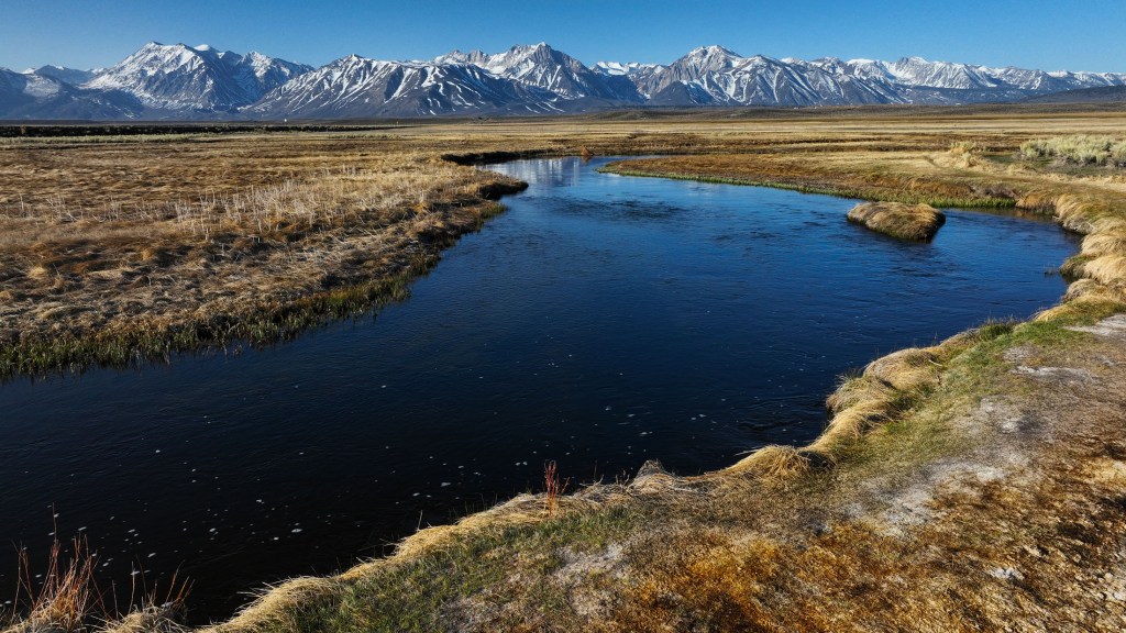
Here, the Owens River flows through it, winding south through Owens Valley. (Erik Olsen)
Driving up Highway 395 toward Mammoth Lakes is one of the most breathtaking road trips in California. The highway winds through the rugged Eastern Sierra, offering stunning views of snow-capped peaks, alpine meadows, and vast chaparral plains. But beneath this dramatic landscape lurks a hidden danger—an ancient volcanic giant that still stirs beneath the surface.
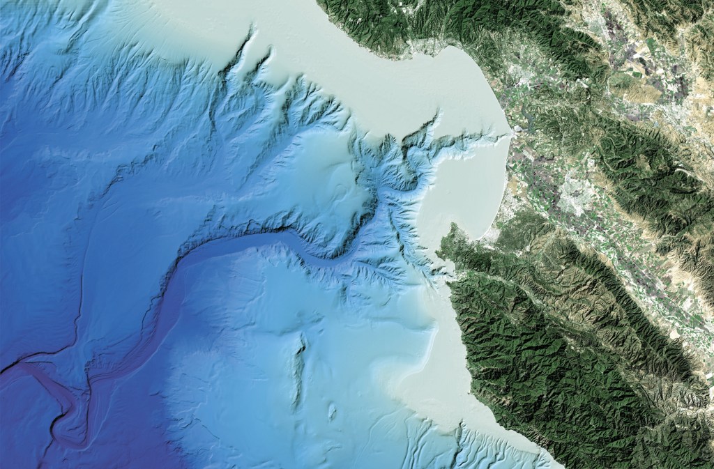
The Long Valley Caldera in eastern California is an extraordinary geological feature, spanning about 20 miles in length and 11 miles in width. It owes its existence to one of the most dramatic volcanic events in Earth’s history, a supereruption that occurred approximately 760,000 years ago. This event, known as the Bishop Tuff eruption, ejected an estimated 150 cubic miles of molten rock and ash into the atmosphere, far surpassing the 1980 eruption of Mount St. Helens, which released just 0.3 cubic miles of material. The magnitude of the Bishop Tuff eruption resulted in the collapse of the ground above the magma chamber, creating a massive depression known as a caldera. In other words, it’s hard to get your head around how big this eruption was.
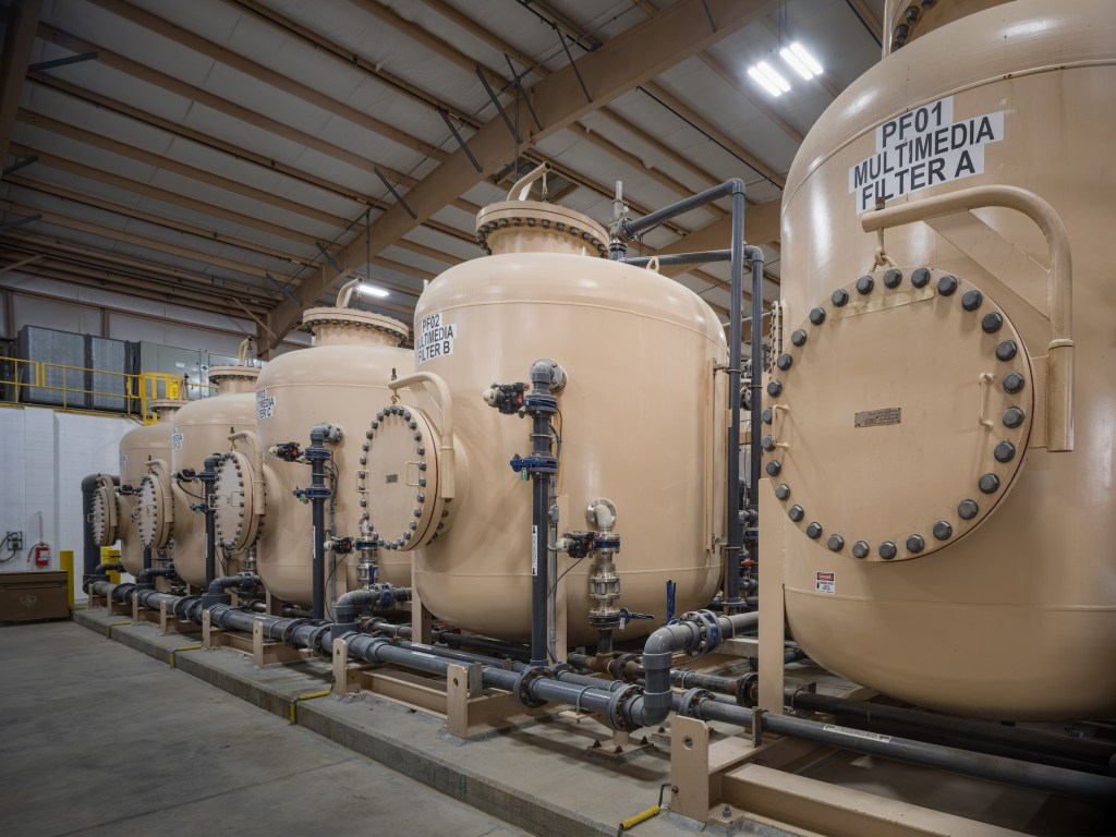
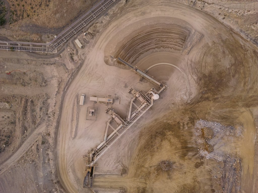
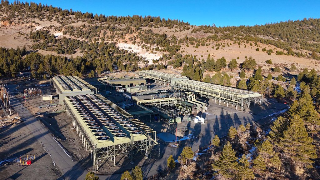
The Long Valley Caldera is a striking reminder of Earth’s immense, often hidden, volcanic power and its potential for destruction—located right here in California, near one of the nation’s most popular ski towns, Mammoth Lakes. Geothermal activity, visible in the form of hot springs, fumaroles, and hydrothermal systems, is a constant feature of the landscape. This activity has made the caldera a hub for geothermal energy production, with the Casa Diablo thermal power plant utilizing its subterranean heat to generate electricity. The energy produced at Casa Diablo is enough to power about 36,000 homes, making it an important renewable energy source for the region.
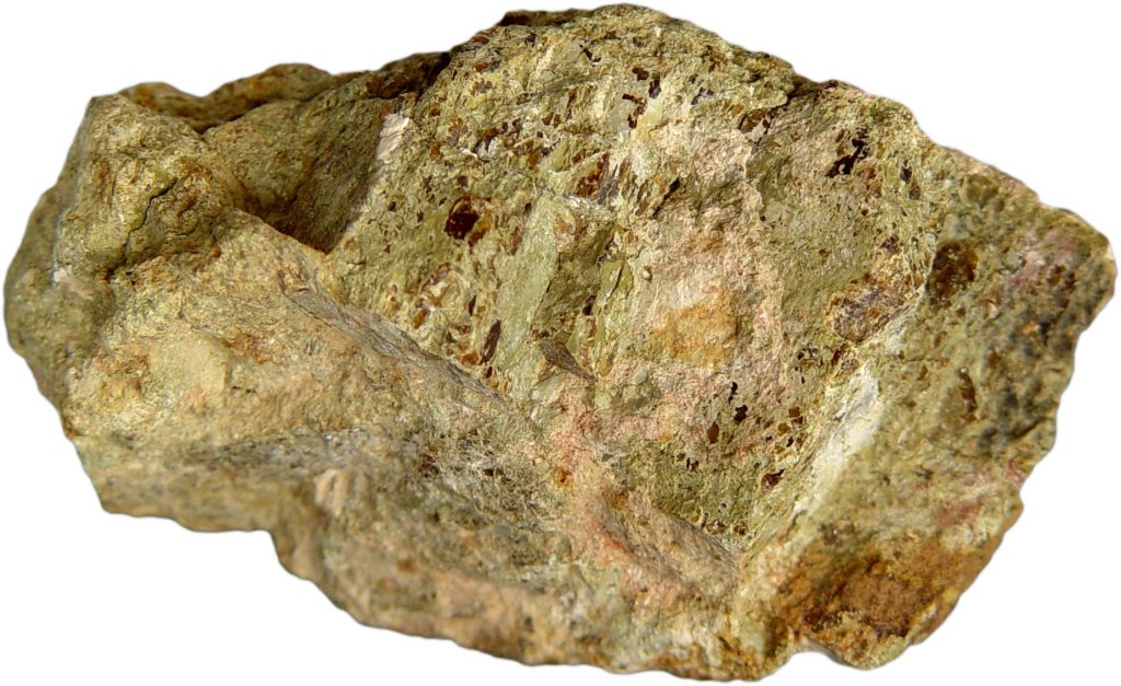
The surface of the caldera is also marked by the Bishop Tuff, a layer of welded volcanic ash that provides a vivid record of the eruption’s intensity and the pyroclastic flows that reshaped the landscape. Pyroclastic flows are fast-moving, hot clouds of gas and volcanic material that can destroy everything in their path. Often they are considered more dangerous than the lava that pours forth from an erupting volcano. For example, pyroclastic flows killed far more people at Pompeii than lava, as the 79 AD eruption of Mount Vesuvius unleashed fast-moving clouds of superheated gas, ash, and volcanic debris that raced down the slopes at over 100 mph, reaching temperatures above 1,000°F, instantly asphyxiating and incinerating thousands, while the slower-moving lava played a minimal role in fatalities.
Geothermal features at the Long Valley Caldera commonly support microbial communities of thermophilic bacteria and algae, which thrive in the caldera’s hot springs and fumaroles. These organisms not only influence the terrain by contributing to mineral precipitation but also serve as models for studying life in extreme environments, offering analogs for early Earth and potential extraterrestrial ecosystems. Scientists are just beginning to understand how these bacteria live and thrive in deep ocean vent systems. In some areas around the Long Valley Caldera and Mono Lake, mats of thermophilic bacteria and algae thrive around the geothermal features, like the many hot tubs that dot the landscape, forming colorful, textured surfaces. These microbial communities contribute to the unique environment and can even make the ground feel crunchy underfoot, offering a tangible connection to the caldera’s dynamic, living systems.
While the caldera’s formation was sudden and catastrophic, its story stretches back millions of years. Scientific studies at the Long Valley Caldera have advanced our understanding of volcanic processes, crustal dynamics, and geothermal systems. The Long Valley Caldera sits within the Basin and Range Province, an area of North America characterized by extensional tectonics, where the Earth’s crust is being pulled apart, allowing magma to rise to the surface.
Using seismic tomography, researchers have mapped the magma chamber beneath the caldera, revealing a layered structure with a partially molten zone capped by solidified magma. This configuration, as highlighted in a 2023 study published in Science Advances, helps explain the periodic episodes of unrest observed in the caldera and provides a basis for assessing potential future activity. Before the eruption, the region experienced significant volcanic activity, with lava flows and smaller eruptions setting the stage for what was to come. Even after the formation of the caldera, volcanic activity continued in the area. Rhyolitic lava flows emerged within the caldera, and the nearby Mono-Inyo Craters volcanic chain has seen eruptions as recently as 600 years ago, underscoring the region’s enduring geological vitality.
(Photo: Erik Olsen)
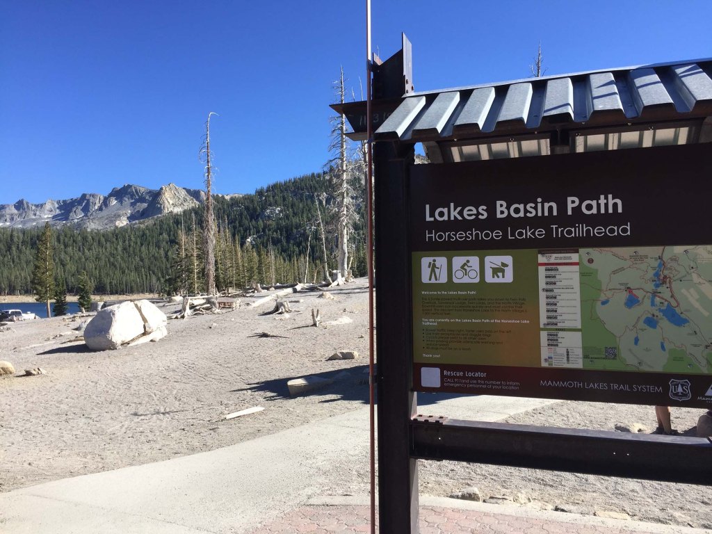
Another place where the region’s volcanic activity can be experienced firsthand is Horseshoe Lake, where carbon dioxide continuously seeps from the ground, suffocating tree roots and causing a vast die-off of trees. The result is a barren, almost ghostly landscape of skeletal trunks and lifeless ground, a stark reminder that Long Valley’s volcanic system is still active beneath the surface. The area is not just eerie but also hazardous—high concentrations of CO₂ can accumulate in low-lying areas, posing a serious risk to humans and animals. Signs around the site warn visitors of the danger, as pockets of odorless, colorless gas can be lethal if inhaled in high enough doses.

The caldera has not been entirely quiet since its dramatic birth. Ground deformation studies, using GPS and InSAR technology (satellites), have tracked uplift in the caldera’s floor, offering critical data on magma movement and hydrothermal activity. In a 2016 study published in Geophysical Research Letters, researchers linked changes in uplift patterns to deeper magmatic processes, reinforcing the importance of continuous monitoring. In 1980, a series of magnitude 6 earthquakes occurred along its southern margin, drawing the attention of volcanologists from USGS. These earthquakes were accompanied by noticeable uplift in the caldera’s floor, a sign of magma movement beneath the surface. Since then, the region has experienced periodic episodes of ground deformation and seismic activity, reminding scientists that the volcanic system beneath Long Valley is far from dormant.

Recent research has provided valuable insights into the caldera’s potential for future activity. While there is currently no indication of an imminent eruption, the area is closely monitored by the United States Geological Survey (USGS). This surveillance includes the measurement of ground deformation, gas emissions, and seismic activity, all of which serve as indicators of changes within the magma chamber. The 1980s unrest heightened awareness of the need for vigilance, particularly in regions where volcanic hazards could affect human populations.
As a result of these studies, the town of Mammoth Lakes took proactive measures to ensure public safety. Local authorities constructed an emergency evacuation route to serve as an escape in the event of a volcanic eruption or other natural disaster stemming from the Long Valley Caldera. After local businesses and residents expressed concerns that the original name implied danger, it was changed to Mammoth Scenic Loop to emphasize the area’s beauty and appeal. The United States Geological Survey (USGS) also intensified its monitoring efforts, implementing a color-coded alert system to communicate volcanic activity risks.
Beyond its scientific significance, the Long Valley Caldera is a destination for outdoor enthusiasts and other researchers. Numerous hot springs dot the landscape and are immensely popular among tourists and residents. Mammoth Lakes is one of California’s top recreational spots, providing amazing opportunities to hike and fish during the summer and excellent skiing in the winter months. For geologists, the caldera serves as a natural laboratory, providing an opportunity to study volcanic processes in a setting shaped by one of the most powerful eruptions in recent geological history.

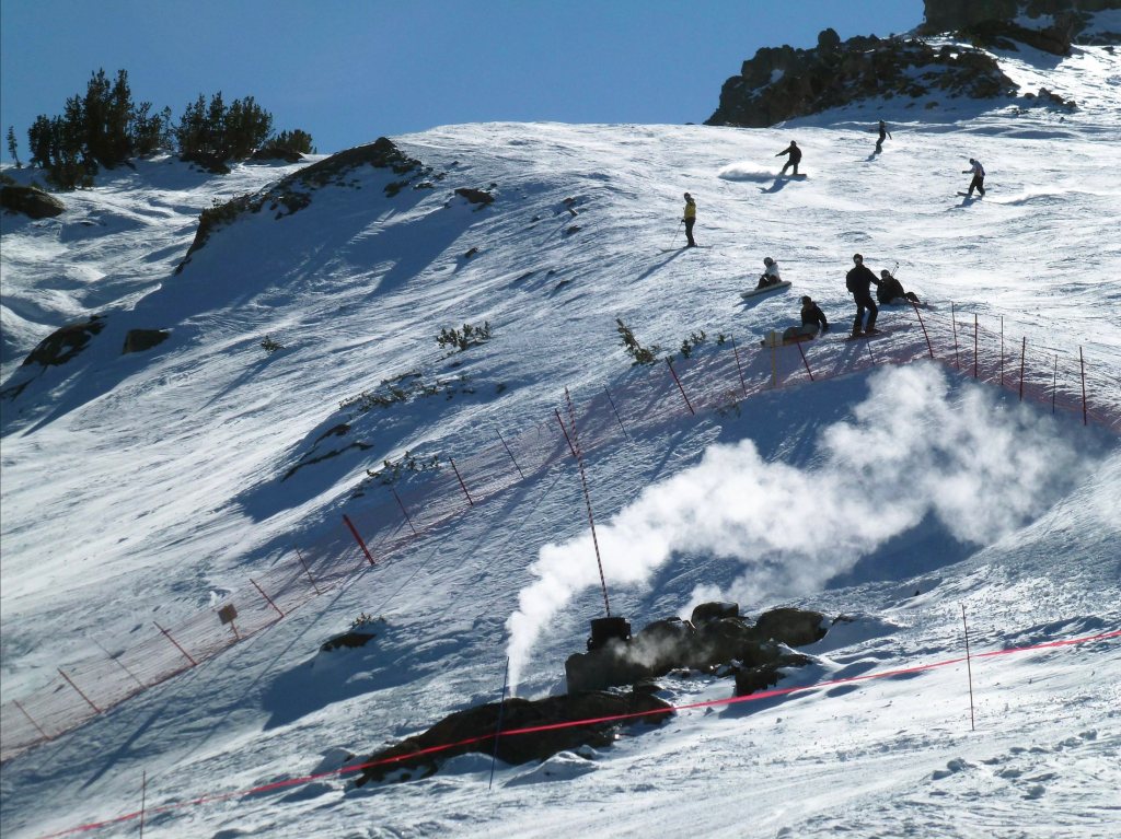
Of course, there remain certain dangers to all this volcanic activity. On April 6, 2006, three members of the Mammoth Mountain ski patrol tragically lost their lives after falling into a volcanic fumarole near the summit. The incident happened while they were conducting safety operations to secure a snow-covered geothermal vent following an unprecedented snowfall. If you’ve ever skied Mammoth before, there is a distinct sulphurous smell around the Christmas Bowl ski run at Chair 3 near McCoy Station.
Standing at the center of the Long Valley Caldera, surrounded by the remnants of a prehistoric supereruption, offers a profound sense of scale and wonder. The vastness of the caldera, framed by the Sierra Nevada and dotted with geothermal vents, creates a landscape that feels alive yet ancient. It’s amazing place to be, both during the day and at night when the stars spread out across the gaping Sierra sky. The ground beneath your feet, shaped by cataclysmic forces, whispers of Earth’s power and the quiet persistence of geological time. Yet beneath the surface, the processes that shaped it continue to evolve, as magma slowly shifts and geothermal systems release heat from the planet’s interior. As research continues and technology advances, the Long Valley Caldera will undoubtedly yield further insights into the intricate workings of our planet’s volcanic systems.