California’s Monterey Formation is one of the most fascinating geological formations in the United States. Stretching along the California coast from San Francisco to Los Angeles, this formation is notable for its incredible diversity of siliceous rocks—rocks rich in silica, such as shale, chert, diatomite, and porcelanite. While these rocks are interesting to geologists, the Monterey Formation is also significant for its potential to explain the origins of petroleum deposits that have fueled California’s economy for over a century. NASA’s Jet Propulsion Laboratory once called it “California’s primary petroleum source rock.”

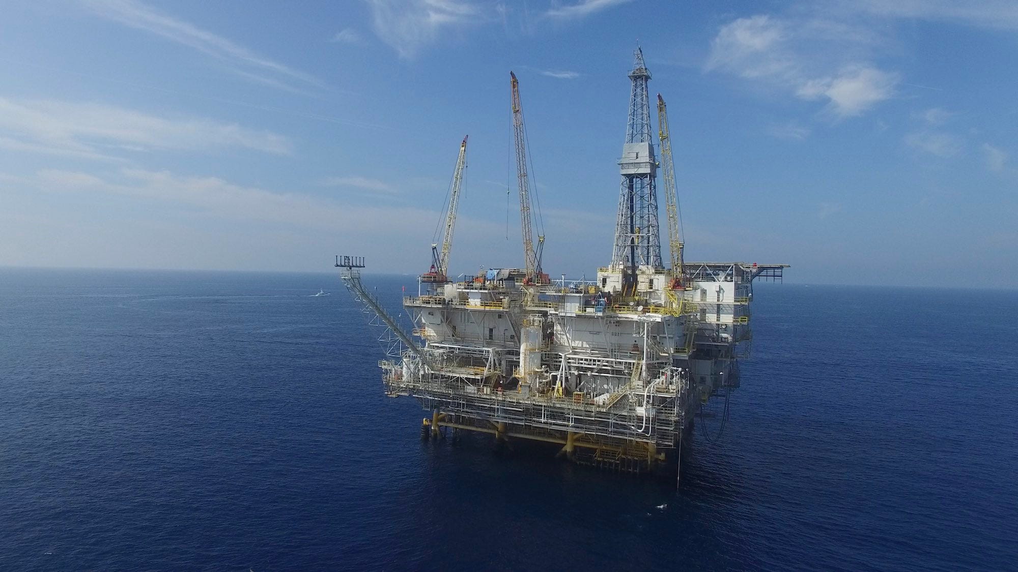
At the heart of the Monterey Formation’s geology is the unique composition of many different types of rock that come together in such a way that they create an ideal environment for trapping oil. The intricate layering of organic-rich shales, siliceous rocks, carbonates, and diatomites forms a complex network of porous and permeable spaces, allowing oil to migrate into these reservoirs. Over time, these rocks act like natural sponges, effectively capturing and holding large quantities of oil within their formations, making the Monterey Formation one of California’s most significant petroleum sources. It is estimated that over 38 billion barrels of oil have been produced to date from fields whose source rock is the Monterey.

Purchase stunning art prints of iconic California scenes.
Check out our Etsy store.
Diatomite, a light, porous rock formed from the fossilized remains of diatoms, is a dominant feature. Diatoms, microscopic algae with silica-based cell walls, thrived in nutrient-rich waters, leading to the thick layers of sediments that later became diatomite. Chert, another key rock type in the formation, is formed from the recrystallization of biogenic silica, adding to the complexity of the geological record. Interspersed with these are organic-rich shales, which contain substantial amounts of organic material called kerogen. Over millions of years, kerogen undergoes a biological transformation becoming the oil and gas that now serve as the backbone of California’s petroleum industry (see our story on the history of the Long Beach oil industry).

The Monterey Formation displays a fascinating and unusual mixture of geological deposits, from deep ocean basins to shallow continental shelves. During the Miocene, upwelling currents along the California coast brought nutrient-rich waters to the surface, fostering high biological productivity and depositing vast amounts of biogenic silica, a form of silicon dioxide (SiO₂) that is produced by living organisms. Periods of fluctuating sea levels, driven by climate changes and tectonic shifts, further shaped the environment. During low sea levels, parts of the continental shelf were exposed, allowing for erosion from wind and sun. These would shift to periods of high sea levels, which allowed for denser, deep-water sedimentation. In some layers, the presence of evaporites—minerals that form from the evaporation of water—suggests extensive episodes of arid conditions, similar to what we are experiencing now with California’s recurring periods of drought.
Much of the pioneering research on the geology, formation, and unique composition of the Monterey Formation was conducted by the late Robert Garrison, a distinguished professor of oceanography at the University of California, Santa Cruz. Garrison was considered the foremost expert on the Monterey Foundation, and his work was instrumental in revealing how the Monterey Formation’s diatomaceous and phosphatic deposits were shaped by a combination of oceanographic upwelling, climatic shifts, and tectonic activity during the Miocene epoch.
Petroleum geologists find the Monterey Formation especially intriguing because it serves as both a source and a reservoir for oil and gas, allowing them to better understand the processes of oil and gas generation, migration, and accumulation, as well as to develop more efficient extraction methods to maximize its economic potential. They are also quite beautiful. Walk along the beach near Crystal Cove in Orange County, for example, and examples of Monterey Formation rocks abound.

Oil is formed from the remains of ancient marine organisms, such as plankton and algae, that were buried under layers of sediment and subjected to heat and pressure over millions of years, transforming them into hydrocarbons. Some of these hydrocarbons migrated into more permeable rocks, creating substantial oil fields that have been exploited for decades in Southern California. Certain layers of the Monterey Formation, particularly the fractured chert and dolomitic sections, also serve as excellent reservoirs due to their porosity and permeability, allowing them to store oil and gas for long periods of time.
Beyond its geological and economic importance, the Monterey Formation is a treasure trove for paleontologists. Its layers preserve a variety of marine fossils, including diatoms, radiolarians, foraminifera, and coccolithophores. These microfossils offer a detailed look at past ocean conditions, helping scientists reconstruct the climatic and oceanographic history of the Miocene epoch. Additionally, the formation contains fossils of larger marine vertebrates, such as whales, seals, and fish, providing further insight into the ecosystems of ancient oceans.

However, the Monterey Formation is not just a source of knowledge and resources; it also presents challenges, particularly in terms of potential environmental harm and geohazards like landslides. The soft, diatomaceous earth layers within the formation are prone to landslides, especially when water-saturated or fractured by tectonic action. This makes some coastal areas of California, where the Monterey Formation is exposed, particularly vulnerable to slope instability, posing risks for construction and development. Many recent news stories have documented the increasing rate at which the California coast is tumbling into the sea. An excellent recent book on the subject is Rosanna Xia’s California Against the Sea: Visions for Our Vanishing Coastline.
California’s geology is a remarkable mosaic that tells a story of immense geological diversity and dynamic processes. Among its many treasures, the Monterey Formation stands out as a geological marvel—its intricate layers, rich fossil beds, and significant economic potential continue to captivate scientists and researchers from around the world. This unique formation is more than just rock; it is a time capsule that preserves millions of years of Earth’s history, from ancient marine ecosystems to dramatic shifts in climate and tectonic activity. As geologists, paleontologists, and environmental scientists delve deeper into its mysteries, the Monterey Formation reveals invaluable clues about the past while shaping our understanding of California’s ever-evolving landscape. It serves as a profound reminder of the powerful forces that have sculpted one of the most geologically varied regions on the planet and continues to inspire exploration and discovery in the fields of Earth science.