Ah, the changing of the leaves—a hallmark of autumn that heralds the end of long summer days and the arrival of crisp, cool weather. The spectacle is especially captivating in the high Sierra region of California, where deciduous trees put on a breathtaking show every year. This year’s show began in early October with an explosion of gold, persimmon, and vibrant orange blanketing the granite crags of the Eastern Sierra.
For years, the Eastern Sierra Fall Color Report has dutifully documented the arrival of Autumn and the magnificent changing hues of millions of trees. But have you ever stopped to wonder why the leaves change color? Why do leaves go from a robust green to vibrant hues of orange, red, and yellow? Well, it’s not just nature’s way of getting all dressed up for Halloween; there’s a complex interplay of biological, chemical, and physical processes at work.
(Photo: Erik Olsen)
Let’s start with the basics: chlorophyll. During the growing season, leaves are green due to chlorophyll, the molecule that helps plants photosynthesize. Photosynthesis is the process by which plants convert sunlight, water, and carbon dioxide into sugar and oxygen. Chlorophyll’s structure is such that it absorbs blue and red light well but reflects green light, making leaves appear green. However, as the days shorten and temperatures drop, it becomes a signal to the trees that it’s time to get ready for winter.
Structurally, chlorophyll is a complex molecule with a central magnesium ion surrounded by a long hydrocarbon tail. This structure is particularly adept at capturing and utilizing photons from sunlight for photosynthesis. Yet, chlorophyll is also a bit delicate, getting easily damaged by factors like intense light, exposure to oxygen, and even its own activity. That’s why plants are continuously synthesizing it during the growing season. In a sense, chlorophyll is both the engine and the fuel of the plant world, driving the processes that sustain not just the trees themselves but also the ecosystems that rely on them.
Seen through a microscope, chlorophyll is concentrated within organisms in structures called chloroplasts – shown here grouped inside plant cells. By Kristian Peters — Fabelfroh – Self-photographed, CC BY-SA 3.0
As autumn approaches, the biological clock inside trees ticks toward a season of preservation. Photosynthesis slows down, partly because there’s less sunlight but also because the plant is actively throttling this process. As a result, chlorophyll begins to break down and isn’t replenished. Other pigments present in leaves then take center stage, like carotenoids and anthocyanins. Carotenoids are always there, hanging out alongside chlorophyll, but are usually overshadowed by it. They are the ones that give leaves their yellow and orange hues, and are also the molecules that give the pink flamingo its rosy color.
Drone view of changing Fall colors in the Eastern Sierras
Anthocyanins are another class of pigments, but these are a little more high-maintenance; they form only when certain conditions are met. You see, anthocyanins are created through chemical reactions that are influenced by the pH levels in the leaf cells and the amount of sugar that is present. That’s why some years, when conditions are just so—like a warm, sunny fall following a cooler period—you’ll see a dazzling display of red leaves. Anthocyanins absorb light at both the blue and green ends of the spectrum and reflect red light, giving leaves their gorgeous red and purple shades. Anthocyanins are what help give boysenberries their deep purple color.
In California’s high Sierra region, where the elevation provides a unique set of environmental factors, the changing of the leaves can be particularly spectacular. Deciduous trees like the Black Oak, Quaking Aspen, and Dogwood populate these areas. The interplay of sunlight, soil acidity, and temperature variations at higher elevations creates an ideal stage for the full spectrum of fall colors to be displayed. Even within the same species of tree, or sometimes even on the same tree, you can see a diversity of colors due to slight variations in soil composition, moisture, and sunlight exposure.
Changing aspens in the Eastern Sierra (Erik Olsen)
It’s all a spectacular display, but it doesn’t last forever; in fact, the most vibrant colors only last a few weeks. And then the leaves die and fall off. It’s not gravity doing its thing, but rather a biological process called “abscission.” As winter approaches, a layer of specialized cells grows between the leaf stem and the tree, severing the vessels that supply nutrients and water to the leaf. This triggers the leaf to die and eventually fall, making way for new growth in the spring.
While the fall colors in California’s Eastern Sierra are an annual marvel, they’re not immune to the sweeping hand of climate change. Rising temperatures and shifting precipitation patterns have started to tinker with the timing and intensity of the autumnal display. For instance, warmer conditions could delay the onset of the color changes and potentially shorten the duration of peak colors, while altered moisture levels might impact the vibrancy of hues. Even subtle shifts in climate can affect the complex chemistry of leaf coloration. As much as the changing leaves are a symbol of nature’s constancy, they also serve as a barometer for the environmental changes unfolding on a global scale.
The transformation of leaves in the high Sierra is far more than a seasonal aesthetic; it’s a vivid illustration of how meticulously nature has calibrated life to adapt and thrive. As the leaves cycle through shades of green, orange, red, and finally brown, they tell a tale of survival and renewal, a complex story scripted in their very cells. This fall spectacle is a fleeting moment of brilliance, orchestrated by an array of biological, chemical, and physical processes, each contributing to the grand narrative of life on Earth. In essence, each leaf is a microcosm of resilience and change, characteristics not just of a California autumn, but of life itself.
Towering over Los Angeles like quiet guardians, the San Gabriel Mountains stretch across the northern edge of the city, keeping watch over the busy sprawl below. More than just a dramatic barrier, these mountains are packed with stories of shifting earth, ancient rock, wild weather, and the people who’ve passed through them for thousands of years. They are also a primary source of Southern California beaches. They’re not just a backdrop; they’re a vital part of the region’s identity, full of science, history, and amazing nature.
Part of the Transverse Ranges, a rare east-west trending group of mountains in California, the San Gabriels rise abruptly from the San Gabriel Valley and form a kind of barrier between L.A. and the Mojave Desert. Framed by Interstate 5 to the west and Interstate 15 to the east, the range is anchored on its north side by the famous San Andreas Fault, where the Pacific and North American tectonic plates constantly grind against each other. That ongoing crush is what helped push these peaks up so quickly. Geologically speaking, they’re growing surprisingly quickly.
Side note: The Transverse Ranges also include the Santa Monica Mountains, San Bernardino Mountains, Santa Ynez Mountains, Topatopa Mountains, Tehachapi Mountains, Santa Susana Mountains, and Sierra Madre Mountains.
Inside the range you’ll find the Angeles and San Bernardino National Forests, along with the San Gabriel Mountains National Monument, first established in 2014 and significantly expanded in 2024 to protect more than 450,000 acres of rugged, biodiverse, and culturally significant terrain. (There is excellent hiking in these mountains.) These protected areas include steep canyons, chaparral, rare wildlife, and sites that are important to the history and traditions of Native American communities.
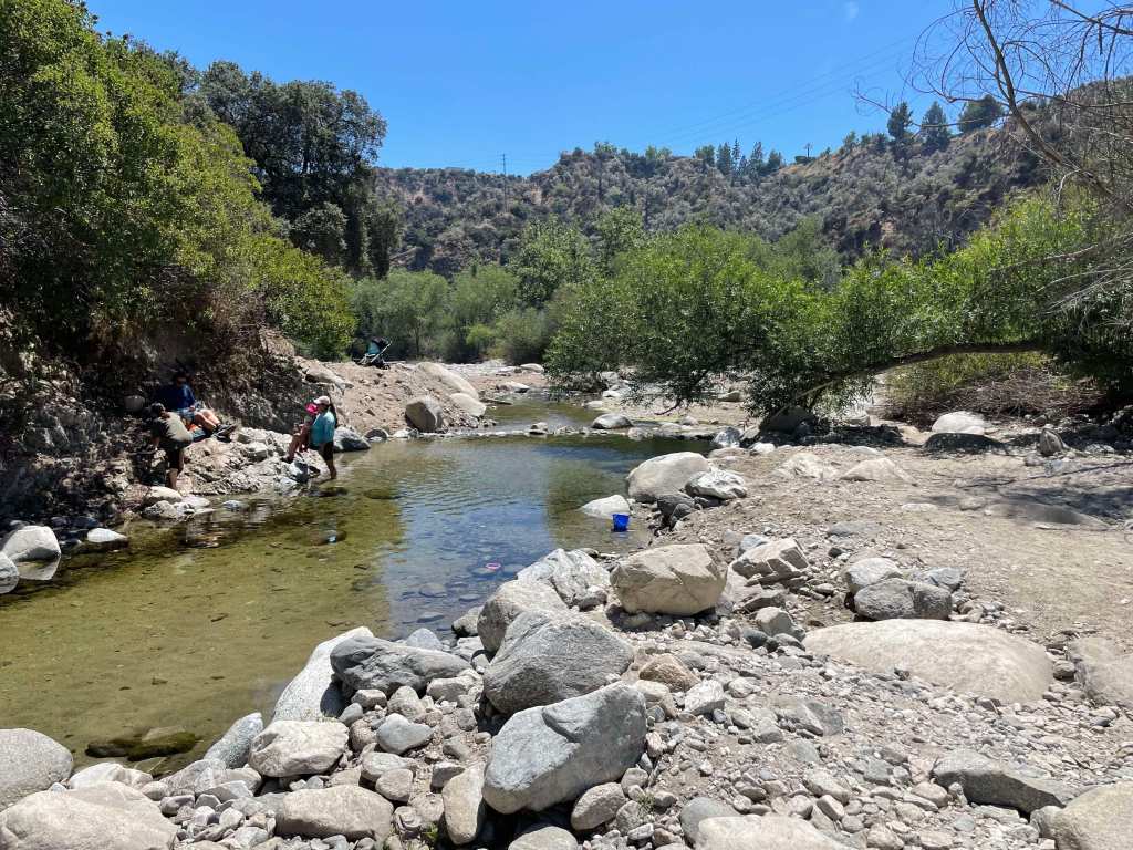
A pool of water from the Arroyo Seco in the San Gabriel Mountain (Erik Olsen)
The rocks here are some of the oldest in the region, but the mountains also tell stories from more recent times: gold miners, early astronomers, hikers, and wildfire researchers. The San Gabriels help shape the weather, store precious snowpack, and remind everyone in L.A. that nature is always nearby and always in motion.
The San Gabriel Mountains offer an impressive rise in elevation, they really kind of explode out of the earth. While the foothills begin at nearly sea level, the highest point in the range is Mount San Antonio, but most people know it as Mount Baldy because, let’s face it, with its distinctive, treeless summit, it looks kind of bald. This peak reaches an altitude of 10,064 feet (3,068 meters). The quick transition from the bustling city to towering peaks is part of the magic of these mountains, a dramatic wall standing guard over downtown Los Angeles.
While the San Gabriels are much smaller in terms of length than, say the Appalachians, they are significantly taller on average. The highest peak in the Appalachians, Mount Mitchell in North Carolina, reaches 6,684 feet (2,037 meters). That’s considerably lower than Mount Baldy in the San Gabriels. The San Gabriels, therefore, boast higher peaks even though they cover a smaller area. However, compared to the Appalachians, which are thought to be billions of years old, the San Gabriel Mountains are relatively young, geologically speaking, and are characterized by rugged and steep features. In essence, being younger, they’ve undergone less erosion.
San Gabriel mountains from La Cañada Flintridge (Photo: Erik Olsen)
To understand the story of the San Gabriel Mountains, we need to embark on a temporal journey spanning millions of years. The mountains’ tale starts about 100 million years ago, during the Mesozoic Era, when massive tectonic plates—the Pacific and North American plates—began to converge. The interaction of these tectonic plates was dramatic, with the Pacific Plate subducting, or diving beneath, the North American Plate. This subduction caused the rocks to melt and, over time, rise to form granitic masses known as plutons.
Rocks of a roadcut in the San Gabriel Mountains (Erik Olsen)
As the ages rolled on, these plutons were uplifted, and the erosion of the surrounding softer rocks exposed the granitic cores, giving birth to the San Gabriel Mountains we see today. The primary rock composition of these mountains is granite, with large-grained crystals of feldspar, quartz, and mica that glitter when the sun kisses their surfaces. These mountains also feature significant deposits of sedimentary rocks, particularly in the lower elevations, which date back to the Mesozoic and Cenozoic eras.
The drainage system of the San Gabriel Mountains is defined by numerous canyons, streams, and arroyos that channel water down from the high elevations into the valleys below. The Arroyo Seco, one of the most well-known waterways, begins near Mount Wilson and flows southwest through Pasadena before merging with the Los Angeles River. Other important streams include the Big Tujunga Creek, which cuts through the mountains to feed into the San Fernando Valley, and the San Gabriel River, which drains much of the range’s eastern side. These waterways are seasonal, swelling during winter rains and spring snowmelt, and often run dry during summer months. Their canyons have been carved by the relentless forces of erosion, creating deep ravines that are vital for wildlife and plant habitats.
Heavy rains cause flooding in the Arroyo Seco near Pasadena. (Erik Olsen)
The San Gabriel Mountains play a critical role in the watershed that serves the greater Los Angeles area. Rain and snowmelt from the mountains replenish groundwater basins and feed into reservoirs, such as the San Gabriel Reservoir and the Morris Reservoir, which are essential for water supply. These mountains act as a natural guidance system, capturing precipitation and funneling it into the region’s aquifers and rivers, supporting both the municipal water supply and flood control efforts. The watershed is crucial for Los Angeles, which depends on these local sources of water to supplement imported supplies from distant regions like the Colorado River and the Owens Valley. The mountain runoff helps maintain the flow of the Los Angeles River, contributing to the city’s efforts to recharge groundwater and ensure a reliable water supply in this semi-arid region.
When it rains it pours, and sometimes causes landslides
Flood control has long been a central concern in managing the water systems of the San Gabriel Mountains, particularly due to the area’s vulnerability to intense, episodic storms. The steep slopes of the mountains funnel rainwater rapidly into urban areas, leading to a heightened risk of flash floods and debris flows. Over time, this led to the construction of a vast network of catchment basins, dams, and debris basins at the foot of the mountains. These basins are designed to capture stormwater runoff, preventing the overflow of water into densely populated areas and managing the sediment and debris that comes with mountain runoff, which can clog waterways and exacerbate flooding.
Catchment basins in the San Gabriel Mountains are critical for controlling debris flows that occur during and after heavy rains, which can be particularly dangerous in areas where wildfires have stripped the landscape of vegetation. When intense rainstorms hit the steep, fire-scarred slopes, they trigger massive torrents of mud, boulders, and tree debris that rush down the mountain canyons toward the urban foothills. These debris flows can overwhelm creeks and spill into residential neighborhoods, causing widespread destruction. The catchment basins are designed to trap this debris before it reaches populated areas, but their effectiveness depends on regular maintenance and clearing. When these basins fill up too quickly or are not properly maintained, debris can overtop them, leading to significant flooding and property damage.
default
A stark example of the dangers posed by debris flows occurred in Montrose in 1934. Following a series of intense storms in the aftermath of the New Year’s Day floods, massive debris flows roared out of the San Gabriel Mountains, devastating the communities of Montrose, La Crescenta, and Tujunga. The floods and debris flows buried homes and roads under several feet of mud and debris, killing at least 45 people. The Montrose landslide became a tragic reminder of the risks associated with living near the San Gabriel Mountains, particularly in the face of severe weather. This event spurred greater investments in flood control infrastructure, including the construction of more robust debris basins to mitigate the effects of future storms.
The San Gabriel Mountains aren’t just a spectacle of natural processes; they’ve also been a silent witness to numerous significant historical events. The grave of Owen Brown can be found in the mountains just outside of La Canada Flintridge. Owen was the third son of abolitionist John Brown, and has a resting place that has stirred intrigue and speculation for generations. Owen’s grave has become a kind of pilgrimage site for those interested in American history.
Locals gather to celebrate the installation of a gravestone honoring abolitionist Owen Brown on January 29, 1898, nearly a decade after his death. Photo: Brown family and Paul Ayers.
Owen Brown was a fervent abolitionist like his father and participated in the famous raid on Harpers Ferry. After the tumultuous events that marked his early life, he moved to California, seeking solace in the west. He settled near El Prieto Canyon and lived a relatively secluded life. After his death in 1889, he was buried on a hillside overlooking the canyon, and his grave was marked with a simple headstone. Over time, nature, vandals, and other factors led to the original headstone’s disappearance, adding a layer of mystique to the grave’s location. However, in 2019, a replica of the gravestone was installed.
Mount Wilson is another historical wonder in the range. Standing at a towering height of 5,710 feet, it’s not just its elevation that sets Mt. Wilson apart. In the early 20th century, the Mount Wilson Observatory was established, and it soon became a hub of astronomical discoveries. It was here that Edwin Hubble, using the Hooker Telescope, provided evidence of the expansion of the universe—a groundbreaking observation that eventually led to the Big Bang Theory.
Infrastructure Marvel: The Angeles Crest Highway The human connection to the San Gabriel Mountains was further cemented with the construction of the Angeles Crest Highway in the 1930s. Spanning approximately 66 miles, this scenic byway was a colossal engineering challenge. Its creation provided access to previously remote regions and breathtaking panoramic views that today lure thousands of tourists and nature enthusiasts. The highway is also one of the highest in Southern California, with a summit of 7,903 feet at the Dawson Saddle.
Angeles Crest Highway roadcut (Photo: Erik Olsen)
Driving on the Angeles Crest Highway is an experience that’s both thrilling and a bit nerve-wracking. Winding and twisting through the mountains, you can come across steep drop-offs, sharp turns, and narrow lanes. With elevation changes ranging from around 1,200 feet to more than 7,900 feet, it’s a route that demands respect and attention from those behind the wheel.
Flora, Fauna, and Natural History: A Biodiversity Hotspot Beyond geology and history, the San Gabriel Mountains are a treasure trove of biodiversity. The montane environment, with its varied elevation and climate zones, has given rise to a rich tapestry of flora and fauna. Iconic trees like the Jeffrey pine, Coulter pine, and California black oak adorn the landscape. Wildflowers paint the meadows in vibrant hues, from the golden yarrow to the scarlet larkspur.
The fauna is just as diverse, with animals like the California condor, bighorn sheep, and mountain lions roaming the rugged terrain. The waters that trickle and rush down these mountains are home to arroyo chubs and Santa Ana suckers.
The California condor is known to inhabit the San Gabriel range
Protection of this vital ecosystem came in the form of the San Gabriel Mountains National Monument designation in 2014, ensuring that the mountains’ rich biodiversity and cultural significance will be preserved for generations.
The San Gabriel Mountains are more than just a scenic backdrop. They reflect the Earth’s active geology, hold key historical moments, and support diverse ecosystems. Amid growing urbanization, these mountains remain a lasting reminder of the interconnectedness of life, history, and natural forces.


