From Desert Treasures to Resilient Glass: How a California Boron Mine Transformed the World

U.S. Borax borate mine in California (Erik Olsen)

In the late 1800s, as California was emerging and gold fever captivated the public, a significant discovery in the vast, arid desert of modern-day Death Valley led to the development of a mining operation for one of the most versatile and useful materials on earth: borates.

With Hollywood and Silicon Valley dominating California’s identity, it’s easy to overlook the significant role extractive industries have played in shaping the state’s economic and industrial history. However, sites like the Rio Tinto Borax Mine in Boron, California, stand as enduring reminders of this often underappreciated chapter.

Despite the similar-sounding name, borates are far from boring. These indispensable compounds have a wide range of applications that significantly impact our daily lives. Remarkably, the mining operation in the desert of California is still active. In fact, it is one of the largest producers of borates in the world.

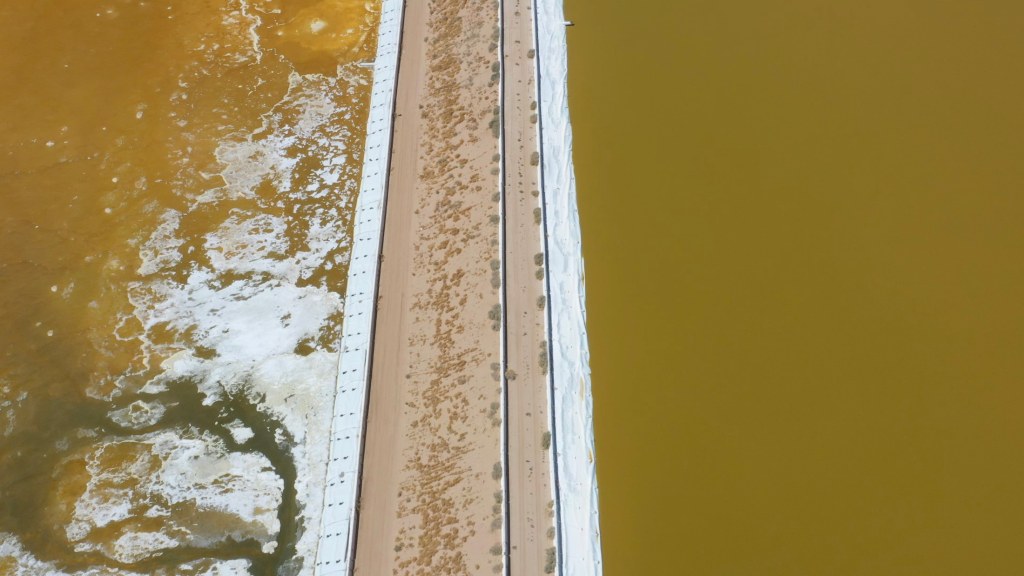
The evaporation ponds at the U.S. Borax Mine, used in the extraction of borates, have historically raised environmental concerns, including potential groundwater contamination and the management of hazardous waste byproducts. However, being located in a remote area far from major population centers has helped mitigate some of the risks associated with pollution, as the isolation reduces direct human exposure and minimizes immediate health impacts on surrounding communities. Additionally, the mine’s location in an arid climate helps slow the spread of contaminants in groundwater, though long-term environmental monitoring and mitigation remain critical. Efforts have also been made to manage waste responsibly and comply with environmental regulations to limit potential harm.

Rio Tinto U.S. Borax Mine in Boron, California (Erik Olsen)

U.S. Borax, part of the global mining company Rio Tinto, operates California’s largest open pit mine and the largest borax mine in the world, producing nearly half the world’s borates. It is located near Boron, California, just off California State Route 58 and North of Edwards Air Force Base. While the mine’s economic importance to California has been significant for decades, the critical contributions of borates to modern society remain a largely untold story.

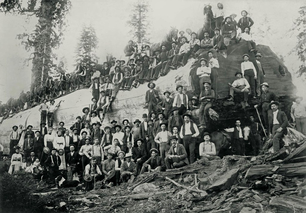
U.S. Borax has roots stretching back to the late 19th century, when the company, then called The Pacific Coast Borax Company emerged as a leader in borate mining and production following the discovery of substantial boron deposits in California. Founded by Francis Marion Smith, known as the “Borax King,” the company initially gained fame for its iconic 20 Mule Team Borax brand. The brand originated from the company’s need for an efficient way to transport borates from the remote mines in Death Valley to the nearest railhead in Mojave, California, covering a distance of about 165 miles.

To accomplish this, the company used large wagons pulled by teams of 20 mules. Each team consisted of 18 mules and 2 horses, and the wagons carried loads of up to 10 tons of borax. These mule teams became legendary for their endurance and reliability, making the long and arduous journey through the harsh desert environment.

Smith’s innovative methods and relentless pursuit of high-quality borates propelled U.S. Borax to the forefront of the industry. Over the decades, U.S. Borax has evolved, focusing on sustainable mining practices and advanced technologies to maintain its status as a key player in the global market, providing essential borate products for various industrial and consumer applications. 

Evaporation pools at US Borax in Boron, California (Erik Olsen)

These versatile minerals are critical in agriculture where borates serve as micronutrients, essential for the healthy growth of crops. They are also key ingredients in detergents, where their stain-fighting power ensures cleaner, brighter clothes. Moreover, borates are used in insulation and fiberglass, contributing to energy efficiency and safety in buildings. The importance of borates extends to pharmaceuticals and cosmetics, where they serve as vital components in various formulations. But perhaps the most impactful use of borates is in the production of borosilicate glass

You’ve likely encountered borosilicate glass before, most recognizably under the brand name Pyrex, produced by Corning. This stable, clear, and robust material can withstand a wide range of temperatures, from the intense heat of a Bunsen burner to the extreme cold of deep space. 

Hale telescope mirror on its way to California

Corning brought the future of borosilicate glass into the present by casting what was, at the time, the world’s largest primary telescope mirror. The primary mirror for the 200-inch Hale Telescope in California was cast out of Pyrex borosilicate glass and delivered to Caltech in the spring of 1936. Since manufacturing the Hale Telescope primary mirror blank, Corning has supplied many mirror blanks for astronomy tools worldwide.

Test tubes made of borosilicate glass

Borosilicate glass is one of the unsung heroes of the modern age. Unlike regular glass, which can leach small particles into liquids when exposed to potent chemicals, borosilicate glass remains chemically inert, making it ideal for test tubes, lab beakers, and medical vials. Almost every medicine or vaccine in history, including those developed for COVID-19, has relied on borosilicate containers for their development, storage, and transport. However, we often overlook the importance of these materials until there’s a shortage. 

This was the case during the COVID-19 pandemic when concerns arose that the primary obstacle to vaccine distribution might not be the pharmaceuticals themselves, but the containers needed for shipping. In response, thousands of workers along a complex supply chain—from mines to refineries to factories—helped avert a crisis. Corning even introduced a new type of glass, made with aluminum, calcium, and magnesium, to meet the high demand for medicinal vials.

Evaporation ponds at the US Borax mine in Boron, California (Erik Olsen)

The invention of borosilicate glass is credited to German chemist Otto Schott in the late 19th century. Schott was driven by the need for a type of glass that could withstand extreme temperatures and resist chemical corrosion. In 1887, he succeeded in creating this revolutionary material by adding boron oxide to traditional silica-based glass, resulting in a product with exceptional thermal and chemical stability. This breakthrough led to the founding of the Jena Glassworks, where Schott’s borosilicate glass was produced and quickly found applications in scientific and industrial settings. Its remarkable properties made it indispensable for laboratory equipment, cookware, and a variety of other uses. The material’s resilience and reliability have ensured its place as a critical component in modern science and technology, solidifying Schott’s legacy as a pioneer in glassmaking. 

Borosilicate glass lenses.

Due to its low coefficient of thermal expansion, borosilicate glass maintains the same optical properties across a range of temperatures, making it an ideal material for scientific lenses and other high-precision optical components, including lenses and mirrors for telescopes and microscopes. 

It is also used in lighting, particularly for high-intensity lamps and projectors. Artists and craftspeople value borosilicate glass for its workability and durability in creating intricate glass sculptures and jewelry. Its robustness extends to the industrial sector, where it is used in chemical processing equipment, tubing, and sight glasses in high-temperature and corrosive environments. Overall, the unique properties of borosilicate glass make it indispensable across a wide range of applications, from everyday household items to specialized scientific and industrial equipment.

CALIFORNIA CURATED ART ON ETSY

Purchase stunning art prints of iconic California scenes.
Check out our Etsy store.

The abundance of boron in the California desert, particularly the Mojave Desert, is due to a combination of geological conditions and historical processes. Volcanic activity in the region has contributed boron-rich rocks, which, along with tectonic activity, has created basins and depressions where water could accumulate and evaporate. These conditions, coupled with the arid climate, led to the evaporation of ancient lakes and the formation of borate minerals in playas—flat, dry lakebeds that form in desert regions when water evaporates completely, leaving behind a layer of minerals. Hydrothermal activity also played a role by depositing borate minerals through fractures in the Earth’s crust. These factors collectively resulted in significant boron deposits, such as those found in the U.S. Borax boron mine, one of the world’s largest sources of boron.

The US Borax mine in Boron, California, is a fine example of some of the little-known places where California’s industrial history is laid out for all to see, even if few people probably visit. The mine highlights the ingenuity and perseverance of those who ventured into the state’s arid deserts to unearth one of the most versatile and indispensable materials known to modern industry.

Dark Parks in California Allow Us to Reconnect with the Universe

The Milky Way above the Eastern Sierra.

Despite its vast expanse (over 163,000 square miles) California offers surprisingly few places where one can truly gaze upon the night sky in all its glory. Urban light pollution has dimmed the stars across much of the state, making it a rare treat to see more than a handful of celestial points on a clear night. In California’s largest metropolitan areas, like Los Angeles and the Bay Area, the glow from light pollution is so intense that the Milky Way is almost entirely washed out, leaving just the brightest planets and stars visible.

Of course, this is not just a California problem. It’s a sobering reality that underscores a serious global issue: as of 2016, due to artificial lighting, about one-third of humanity could no longer see the Milky Way. Yikes. The problem has only worsened as many cities switch to LED lighting. While LEDs have revolutionized how we light our world and reduced the cost of illumination compared to incandescent bulbs, they have also diminished our ability to see the stars.

Light pollution in Los Angeles as seen from Angeles National Forest (Photo: Erik Olsen)

All that light at night also messes with our lives, interfering with circadian rhythms, leading to sleep disorders, increased stress, and potential long-term health issues such as obesity and cardiovascular disease, according to studies. Artificial light also disrupts ecosystems, affecting nocturnal wildlife by altering their natural behaviors and migration patterns, and can lead to decreased biodiversity. In fact, scientific evidence suggests that artificial light at night has negative and deadly effects on many creatures, including amphibians, reptiles, birds, mammals, insects, and plants.

CALIFORNIA CURATED ON ETSY

Purchase stunning art prints of iconic California scenes.
Check out our Etsy store.

Dark parks in California offer a refuge from light pollution, providing a glimpse into the cosmos that most urban dwellers rarely experience. These parks are sanctuaries for stargazers, astronomers, and anyone longing to witness the majesty of the night sky. Spend a night camping in the Eastern Sierra, and you will know what I mean. There are few experiences in the natural world as profound as gazing into a blanket of millions and billions of stars and pondering the number of other worlds that might exist in the cosmos (it’s pretty much guaranteed there’s more than one, more than just us).

If only there was an organized effort to create and protect areas where darkness reigns. Enter the DarkSky International.

DarkSky International (previously the International Dark-Sky Association), founded in 1988, is dedicated to combating light pollution and preserving night skies through advocacy, education, and promotion of responsible outdoor lighting practices. They designate Dark Sky Places, including parks, reserves, and communities that meet rigorous lighting standards. As of now, there are just two designated Dark Sky Parks in California (see below) and over 130 across the United States. The IDA also works with policymakers to develop lighting regulations, supports scientific research on light pollution, and raises public awareness about the benefits of preserving dark skies for human health, wildlife, and the environment.

Death Valley National Park (Photo: NPS)

Dark skies are categorized using the Bortle Dark-Sky Scale, a system developed by amateur astronomer John E. Bortle to measure how much light pollution affects the visibility of stars and celestial objects. The scale ranges from Class 1, where the sky is pristine and free from artificial light, to Class 9, where the glow of urban lights makes it nearly impossible to see even the brightest stars. In a Bortle Class 1 sky, found in the most remote wilderness areas, you can see the Milky Way as a bright, detailed arc across the sky, along with countless stars and deep-sky objects. By contrast, in a Bortle Class 9 sky, such as in the heart of Los Angeles or New York City, only the moon, a few planets, and a handful of the brightest stars are visible. This scale offers a standardized way for scientists, conservationists, and amateur stargazers to assess the impact of artificial lighting and advocate for the preservation of natural darkness.

The night sky has always been a source of wonder and inspiration. For centuries, humans have looked up at the stars to navigate, tell time, and dream. Dark skies allow us to see celestial phenomena such as meteor showers, the Milky Way, and distant planets. They also foster a connection to the universe, reminding us of our place in a vast and mysterious cosmos. Beyond their aesthetic and inspirational value, dark skies have practical benefits too. They aid scientific research, support wildlife, and even improve human health by regulating our circadian rhythms, say researchers.

California light pollution map.

Advances in technology have revolutionized astrophotography, enabling photographers to capture the night sky in unprecedented detail. High-sensitivity digital cameras, sophisticated telescopes, and powerful image processing software allow for breathtakingly detailed images of celestial phenomena, from the intricate structures of distant galaxies to the ethereal glow of the Milky Way. These advancements have also made time-lapse photography more accessible, leading to a surge in mesmerizing time-lapse videos of the night sky. These videos, widely shared online (I’ve watched scores of them), showcase the dynamic beauty of the cosmos as stars and planets traverse the heavens. They offer viewers an immersive experience that reveals the universe’s grandeur and motion in a way static images cannot. This booming genre draws in audiences and encourages a deeper appreciation for the night sky, as well as the technology that makes stunning visual storytelling possible. Which raises an odd and unsettling question: what does it mean when we can have a better experience of the night sky by looking at a screen than by looking up at the sky itself?

For a glimpse into the latest in astrophotography, the Milky Way Photographer of the Year awards showcase some of the genre’s best work. Now in its seventh year, the competition by Capture the Atlas highlights 25 stunning images selected from over 5,000 entries, offering breathtaking views of our star-studded galaxy from around the world.

But all is not lost dear California friends. Outside the blazing urban megalopolises of Los Angeles/San Diego and San Francisco/San Jose, California boasts numerous places where visitors can escape the pervasive glow of artificial light. Here are a few of the best:

1. Death Valley National Park: Known for its extreme conditions and vast desert landscapes, Death Valley is one of the darkest places in the United States. The park is one of the two designated dark parks in California and the only one in the state classified as a Gold Tier Dark Sky Park. Its remote location and low humidity create ideal conditions for stargazing.The top ranger suggestions for star gazing locations in Death Valley National Park are: Mesquite Flat Sand Dunes, Harmony Borax Works, Badwater Basin and Ubehebe Crater.

2. Joshua Tree National Park: Famous for its unique rock formations and Joshua trees, this park is also a haven for astronomy enthusiasts. This is the second of California’s official dark parks. The park’s rugged terrain and minimal light pollution offer excellent visibility of the night sky. There are four designated stargazing areas in the park. They are the parking lots of Quail Springs, Hidden Valley, Cap Rock, and Ryan Mountain

Night skies ablaze with stars and the Milky Way in Joshua Tree National Park (Unsplash)

3. Anza-Borrego Desert State Park: As California’s largest state park, the 600,000-acre Anza-Borrego Desert State Park provides expansive desert vistas perfect for stargazing. The park is the third and final designated dark park in the state and hosts regular star parties and events to educate the public about the night sky. If you’re looking for a guided tour, check out the Borrego Night Sky Tours.

4. Mount Shasta: If you’re able to go further north, Mount Shasta’s high elevation and clear skies make it a prime spot for observing the stars. The area’s natural beauty adds to the experience of a night under the stars. Everitt Vista Point and Bunny Flat at Mt. Shasta are prime spots for stargazing, along with Lake Siskiyou, Somes Bar, and Shafter Campground. Medicine Lake, near Lava Beds National Monument, also shines in this celestial line-up. Lake Siskiyou offers stunning reflections of the night sky, while Somes Bar and Shafter Campground are known for minimal light pollution and excellent visibility.

5. Pfeiffer Big Sur State Park: Stretching along the central coast, this park offers stunning views of the Pacific Ocean and a dark sky backdrop perfect for stargazing. The park’s coastal location can provide unique opportunities to see the stars reflected in the ocean below.

Pfeiffer Big Sur State Park (Photo: Reddit)

6. Mount Wilson Observatory: Perched atop a 1,740-meter peak in the San Gabriel Mountains, the Mount Wilson Observatory in Southern California, founded in 1904, boasts some of the largest telescopes available for public use. While primarily an educational venue, it offers an exceptional stargazing experience and a chance to delve into astronomy, appealing to both enthusiasts and experts. It’s just above Los Angeles, so, yeah, the skies aren’t that clear, but we have seen the Milky Way up there before. The observatory provides guided and self-guided tours year-round, making it an ideal destination for learning about the cosmos.

7. Oasis. Said to be the darkest place in California, this tiny little farming town tucked in between Death Valley National Park and the Nevada state line is the gateway to some of the best night gazing skies in the California desert. There’s a whole lot of wild area to the south, between Oasis and Ubehebe Crater in DVNP, that boasts skies as dark as any in the United States.

Photo: NASA

Dark parks in California, like Death Valley National Park and Anza-Borrego Desert State Park, offer incredible opportunities to reflect on your place in the cosmos. Beneath the inky blackness of a truly dark sky, the Milky Way stretches across the heavens in astonishing detail, and countless stars shimmer with a clarity that feels almost unreal. Just think about this for a moment: The Milky Way galaxy is home to an estimated 100 to 400 billion stars. And that’s just one galaxy! There are estimated to be between 100 billion and 2 trillion other galaxies out there. I mean, what?! It’s a scale so vast it’s almost impossible to comprehend.

And that’s what makes light pollution so sad and tragic. While we gain comfort and protection in our cities, the light we generate robs us of the chance to truly grasp our place in the universe. We are so small, and yet, as far as we know, we’re the only life out there. That’s a lot more thought-provoking than any Marvel movie (no offense to Marvel fans).

It’s true that the profound experience of stargazing fosters a deeper connection to the natural world and our place within it, reminding us of the wonder and mystery that lie beyond our planet. These are important things to remember. We owe it to ourselves to occasionally step away from the glow of our homes and cities and stand beneath a truly dark sky, where the universe stretches out above in a breathtaking display. In moments of reflection, we appreciate the invaluable gift of darkness, which not only preserves the nocturnal environment but also fuels our curiosity and sense of wonder—just as it has for our ancestors for thousands of years. By celebrating and protecting these dark parks, we ensure that future generations can continue to gaze up in awe, finding inspiration in the endless expanse of the cosmos.

The Pacific Coast Highway (PCH): Icon of American Scenic Roadways

Pacific Coast Highway near Big Sur (Erik Olsen)

The Pacific Coast Highway (PCH), also known as California State Route 1, is one of the most iconic roads in the United States, renowned for its breathtaking views of the Pacific Ocean and rugged coastline. This scenic highway stretches over 650 miles from Dana Point in Orange County in Southern California to Mendocino County in Northern California, offering travelers unparalleled vistas and a quintessential Californian road trip experience. While some suggest that PCH runs from Mexico to Canada, that is mistaken. U.S. Route 101 continues north from California, running along the coast through Oregon and Washington, up to the Olympic Peninsula. That said, it is still the longest state route in California and the second-longest in the US after Montana Highway 200. The story of its construction is as dramatic and intricate as the landscape it traverses.

CALIFORNIA CURATED ON ETSY

Purchase stunning art prints of iconic California scenes.
Check out our Etsy store.

The origins of the Pacific Coast Highway date back to the early 20th century, when the automobile was becoming an essential part of American life. The idea for a coastal highway was initially conceived to connect the state’s isolated coastal communities and improve access to California’s scenic beauty. The concept gained traction in the 1910s and 1920s, and construction began in earnest in the 1930s, to provide jobs during the Great Depression.

Lovely aerial of Pacific Coast Highway in Central California

“It took decades to get the highway built,” Carina Monica Montoya told the Los Angeles Times. Montoya is the author of, “Pacific Coast Highway In Los Angeles County” (The History Press, 2014). 

The construction of the PCH was an engineering marvel, given the challenging terrain it had to navigate. The road had to be carved out of steep cliffs, cross numerous rivers, and be supported by bridges spanning deep ravines. One of the most significant and iconic portions of the highway, the Big Sur section, presented formidable challenges. This stretch of the road, which runs between San Simeon and Carmel, required extensive blasting and drilling into the rugged coastal mountains. The effort was spearheaded by the California Division of Highways (now CalTrans), with a workforce comprising both state employees and workers from the Civilian Conservation Corps (CCC), a New Deal program.

PCH

Key figures in the design and construction of the PCH included engineers and architects who had to innovate continuously to address the formidable natural obstacles. One notable engineer was John D. Isaacs, a prominent builder who contributed to the design and construction of several key bridges along the PCH, including the famous Bixby Creek Bridge. His innovative approach to bridge engineering helped overcome the difficulties presented by the steep canyons and coastal bluffs.

The Pacific Coast Highway took decades to complete fully, with different sections being opened to the public at various times. The Big Sur segment, for example, was officially completed in 1937 after nearly 18 years of labor. The total cost of constructing the highway is difficult to pinpoint precisely, given its piecemeal development, but it ran into tens of millions of dollars—an immense sum at the time.

The Pacific Coast Highway near Santa Monica, California, circa 1930s.

Several colorful characters also play a role in the highway’s history. The Pacific Coast Highway might not exist today if May Rindge, a resolute landowner, had succeeded in her long battle against the county. Since at least the 1890s, a primitive road, often submerged at high tide, hugged the rocky coast between Santa Monica and Malibu, passing under a natural arch and ending at a locked gate on Rindge’s 17,000-acre ranch.

As the owner of Rancho Topanga Malibu Sequit, Rindge was determined to protect her property. She and her late husband had long fought to keep homesteaders off their land. In 1906, she even forced the Southern Pacific Railroad to divert its Santa Barbara line around Malibu and through the San Fernando Valley.

In 1907, when the county proposed extending the coastal road through Malibu, Rindge posted armed guards at the entrances to her ranch and contested the county’s power of eminent domain in court. A stalemate ensued for years, but the road’s prospects improved in the early 1920s when it was included in the planned Roosevelt Highway. In 1923, the U.S. Supreme Court upheld the county’s right to appropriate the land for the highway, and in 1925, a superior court judge granted the county title to the right-of-way in exchange for $107,289, finally ending the dispute.

The book “The King and Queen of Malibu: The True Story of the Battle for Paradise” by David K. Randall (2016) tells the story of Ringe and a wonderful history of Malibu.

Lexus on PCH

Today, the Pacific Coast Highway is one of the most famous and iconic strips of road in the world. Featured in countless commercials as well as movies and TV shoots, sections of PCH are immediately recognizable. Of course, it helps a lot that the highway in in such close proximity to legions of DPs (Directors of Photography) who live in Los Angeles and work in commercials and film. Shooting on the highway is an easy day trip from LA and Hollywood, although it can be difficult to get permits to film on the highway given it is such a busy working road.

That said, the highway faces significant challenges due to climate change and coastal erosion. Rising sea levels and increased storm activity are accelerating the natural erosion processes along California’s coast. This has led to frequent landslides and road closures, particularly in the Big Sur region. One notable event was the massive landslide in 2017 at Mud Creek, which buried a section of the highway under 40 feet of debris, closing it for over a year and requiring extensive repairs. A timelapse of the landslide produced by the United States Geological Service can be seen here

The Pacific Coast Highway in Newport Beach (Erik Olsen)

The New Yorker ran a piece on the concerns about the highway’s future viability as a means to travel long distances along the coast.

The Washington Post wrote back in 2021, “the engineering folly of a road built on sheer cliffs has meant that closures are annual events — the “whens,” not “ifs” — for the people and the economy it supports.”

The most recent slide to afflict the region took place in April 2024 following heavy rains, when large chunks of the road broke off, tumbling down a cliff and into the ocean near Rock Creek Bridge. Safety officials closed off about 40 miles of road as crews worked to assess the damage and stabilize the road.

Photo: Caltrans District 5

Rosanna Xia, a reporter for the Los Angeles Times, masterfully chronicles the problems facing PCH and the California coast in general due to climate change and erosion in her book California Against the Sea: Visions for Our Vanishing Coastline

Although the Pacific Coast Highway remains one of the greatest road trip routes of all time, the challenges in maintaining its full length are significant for the state and its residents. Despite its enduring popularity, the highway often operates in sections due to frequent closures and repairs caused by natural disasters like landslides, erosion, and wildfires. These ongoing issues demand substantial resources and effort to keep the entire highway operational, making its full-length service a constant struggle.

Still, it remains a pretty excellent place to take a drive. As the Boss once put it, roll down the window and let the wind blow back your hair.

Hey there! If you enjoy California Curated, consider donating the price of a coffee to support its creation!

Black Gold Beach or How Oil Transformed Long Beach and Built the Southern California Economy

Signal Hill oil development (Photo: The Huntington Library, Art Museum, and Botanical Gardens)

Southern California is best known for its sun-soaked beaches and Hollywood glamour, but it also has a wilder, largely forgotten past: it was once an oil kingdom. It’s a story even many Californians don’t know, a tale of spectacular gushers, fortunes won and lost, and larger-than-life characters straight out of a movie. Without oil, Los Angeles, and much of Southern California, would be very different places today.

The story of oil in Southern California is inextricably linked to the Long Beach fields, an area that once seemed more like a scene from Texas or There Will Be Blood than the Golden State. The discovery of oil in this region wasn’t just a footnote in economic journals; it was a seismic event that transformed the landscape, both literally and metaphorically. And it provided an industrial center of gravity to a region of the state that was just beginning to emerge as one of the world’s great gateways of commerce.

Signal Hill, 1926 (Public Domain)

The early 20th century was the beginning of the era of oil in California. On June 23, 1921 at 9:30 a.m., the Alamitos No. 1 oil well on Signal Hill in Long Beach was drilling 2,765 feet beneath the surface when the drill struck an underground oil deposit. This oil was under high pressure due to natural gas, blowing a gusher of oil over 100 feet high, and heralding the start of the Long Beach oil boom.

This event marked the discovery of one of the most prolific oil fields in the Los Angeles basin. Throughout the 1920s, Signal Hill, along with the nearby Santa Fe Springs field, experienced numerous blowouts, which erupted into dramatic pillars of flame that could be seen for miles. These incidents eventually prompted calls for stricter safety regulations. Consequently, in 1929, the state mandated the use of blow-out prevention equipment on all oil wells drilled in California.

Signal Hill quickly mushroomed into a forest of oil derricks, with fortunes being made overnight. As one of the most productive oil fields in the world, the Long Beach field was at one point yielding a staggering one-third of California’s total oil production. By the mid-1920s, California was producing nearly a quarter of the world’s entire petroleum supply, much of it from the Long Beach area.

Signal Hill, Long Beach oil development. (Public domain)

That so much oil is present beneath the surface of this stretch of Southern California is a gift of geology. Millions of years ago, the area that is now Long Beach was covered by the ocean. This marine environment was ideal for the accumulation of organic material, such as the remains of tiny plants and animals, on the ocean floor.

CALIFORNIA CURATED ON ETSY

Purchase stunning art prints of iconic California scenes.
Check out our Etsy store.

Over time, layers of sediment buried this organic matter. The high pressure and temperatures associated with deep burial initiated the transformation of this organic material into hydrocarbons – essentially, the formation of oil. Southern California is, of course, known for its active tectonics, influenced by the Pacific and North American Plate boundary. This tectonic activity has created a complex network of faults and folds in the earth’s crust in the Long Beach area.

The folding of the earth’s layers into anticlines (a type of fold that is convex up and has its oldest beds at its core) and the formation of fault traps (where displaced rocks create a seal that traps oil) are particularly important. These structures create reservoirs where oil can accumulate and be preserved over geological time scales.

Map of the Long Beach oil field.

As the oil flowed, so did the stories of those who sought their fortune in black gold. Perhaps the most famous of these was Edward L. Doheny, a name synonymous with California oil. Doheny, an ambitious prospector, was one of the first to recognize the potential of the Los Angeles Basin’s oil fields. His success in the oil industry was meteoric, but it was not without controversy, as he was later embroiled in the infamous Teapot Dome scandal.

Portrait of oil magnate Edward L. Doheny (Wikipedia)

The impact of oil production in Southern California extended beyond economics. It reshaped the region’s landscape, both physically and culturally. Towns sprung up around oil fields, and workers flocked to the area, drawn by the promise of jobs and prosperity. Long Beach, once a sleepy coastal town, burgeoned into a bustling city.

During the 1920s, regulations on well spacing were minimal, allowing Signal Hill to market narrow town lots. These lots were swiftly purchased by aspiring oil tycoons who installed wells so close to each other that they almost touched. Despite the dense placement, the wells generally remained profitable, though they rapidly depleted the oil field. The hill earned the nickname “Porcupine Hill” due to its appearance from afar, bristling with numerous wooden oil derricks since the more compact “nodding-donkey” pumpjack had not yet been developed.

The booming oil industry in the region attracted a massive influx of workers and investments. As oil fields expanded, Long Beach rapidly transformed from a seaside resort into an industrial powerhouse. The surge in economic activity and the availability of abundant oil fueled the growth of industries in and around Long Beach, including the burgeoning shipping and maritime sectors.

Container ships outside the Port of Los Angeles during the Covid lockdown in 2020. (Photo: Erik Olsen)

The construction of the Port of Los Angeles, which began in earnest in the early 1900s, was driven by the need to support the growing economic activities in Southern California, including agriculture, manufacturing, and oil. The proximity of Long Beach to the port, only about 20 miles south, meant that it was strategically positioned to benefit from and contribute to the port’s activities. The port served as a critical node for shipping oil, among other goods, which further integrated Long Beach, and Southern California as a whole, into the global trade system.

Signal Hill in Long Beach today. (Erik Olsen)

Moreover, the infrastructure developments necessary to support the oil industry, such as roads, railroads, and later pipelines, also facilitated the growth of the port. These developments enhanced the logistical capabilities of the region, making it more attractive for commercial and industrial activities. The oil boom thus not only transformed Long Beach but also had a cascading effect on the development of the Port of Los Angeles, cementing the region’s role as a vital hub in international trade and commerce.

As big and diverse in industry Los Angeles has become, it mostly started with oil. The fact that Los Angeles is now hardly known for oil, but better known for its massive entertainment and tourism economies is an astonishing transformation.

Of course, the influx of wealth and people also brought challenges, including environmental concerns and the need for regulatory oversight. It is well known that several major oil spills have taken place off the coast, ruining beaches and killing animals by the millions. In 1969, the Santa Barbara oil spill released vast quantities of oil into the ocean, creating an environmental disaster along the California coastline. This catastrophic event galvanized public awareness and activism, leading to the creation of the first Earth Day, as well as significant environmental legislation, including the establishment of the U.S. Environmental Protection Agency.

The oil slick visible around Platform A in the Santa Barbara Channel emanated from fissures in the seabed. (Photo: USGS)

Oil spills continue to take place in Southern California and the existence of 26 rigs off the coast are a reminder of that oil boom era. Those rigs are coming to the end of their productive life, however, and an on-gong controversy is what to do with them. Remove them or leave them — or part of them — as artificial reefs?

Over time, oil production in Southern California has waxed and waned. The easily accessible oil has largely been extracted, and production has declined from its mid-20th-century peak. Yet, the legacy of this era persists. It’s etched into the region’s physical and cultural landscape, from the bobbing oil derricks still dotting Signal Hill to the fortunes and institutions built on oil money.

The story of oil in Southern California, particularly the Long Beach fields, is a saga of geologic luck, ambition, ingenuity, and, at times, dangerous greed. It’s a chapter in the state’s history that’s as rich and complex as the oil that still lies beneath its surface, and yet it remains largely unknown to many people who think of Southern California as a paradise of sand and rolling waves.

Giants Fallen: The Destruction of Converse Basin Grove and its Giant Sequoias

The true tragic story of one of the worst environmental crimes in California history.

The stump of a Giant Sequoia at Converse Grove in California. (Photo: National Park Service)

“A story of greed and mass destruction of a mighty forest.”

California has faced its share of environmental calamities. We’ve experienced wildfires that have denuded the landscape, destroying valuable forests and homes, and taking human lives. Oil spills have soiled coastlines and killed wildlife. But of all the great environmental crimes the state has faced, perhaps few rank as high as the destruction of Converse Basin Grove in the late 1800s. And yet very few people have ever heard of it.  

Located in the southern part of the Sierra Nevada Mountains east of Fresno, just outside Kings Canyon National Park, Converse Basin Grove spans over 6,000 acres and 700 feet of elevation. The basin was once home to the densest and most majestic expanse of Giant Sequoia (Sequoiadendron giganteum) on the planet. This remarkable concentration of trees was largely due to the basin’s unique combination of geological and climatic conditions.

The grove’s deep, well-draining granitic soils provided a stable foundation for sequoia growth, allowing their extensive root systems to spread and access water efficiently. Additionally, the region’s position in the Sierra Nevada ensured a steady supply of moisture from winter snowfall, which melted slowly into the summer, maintaining the soil’s hydration even during dry months. Sequoias also depend on periodic low-intensity wildfires, which clear competing vegetation, release seeds from their cones, and create the mineral-rich soil conditions necessary for seedlings to establish. This natural fire cycle once maintained the grove’s density, fostering the exceptional concentration of ancient trees that once dominated area.

Loggers and a team of horses pose on a fallen sequoia 26 feet in diameter. Converse Grove, California 1917. (Wikipedia)

Between 1892–1918, the Sanger Lumber Company logged the grove using ruinous clearcutting practices, and cut down 8,000 giant sequoias, some of them over 2000 years old, in a decade-long event that has been described as “the greatest orgy of destructive lumbering in the history of the world.” Only 60-100 large specimens survived.

CALIFORNIA CURATED ON ETSY

Purchase stunning art prints of iconic California scenes.
Check out our Etsy store.

Currently, the most expansive remaining sequoia domain is the Giant Forest in Sequoia National Park, which has an estimated 8,400 giant sequoia trees that are more than one foot in diameter at their bases. The park is home to the world’s biggest tree, the General Sherman

(See our feature on the biology behind the immense size of redwoods and sequoias here.)

General Sherman Tree (Photo: Erik Olsen)

So how did this happen? The Converse Basin grove’s discovery in the late 19th century coincided with a burgeoning demand for lumber in the wake of California’s Gold Rush and subsequent population boom, particularly in San Francisco. A huge portion of early San Francisco was built using redwood. In fact, redwood was the dominant building material in much of 19th-century California, and San Francisco was practically a redwood city.

This demand drew the attention of loggers to the massive potential of sequoias. In particular, the Kings River Lumber Company, which secured this coveted area through both lawful and dubious means shortly after its incorporation in 1888. This marked the first instance of industrial-scale logging targeting the Sierra redwoods, a venture that required substantial initial investment due to the challenges of building a mill in the mountains and the engineering marvel needed to transport the colossal timber to lower elevations.

The 54-mile-long flume, or log conveyor, from Converse Basic Grove to the town of Sanger, about 20 miles from Fresno.
(Photo: National Park Service)

To get the logs to mills from the High Sierra Mountains the SF-based company constructed a 54-mile-long flume, or log conveyor, from Converse Basic Grove to the town of Sanger, about 20 miles from Fresno. This giant wooden waterslide, balanced on trestles along steep canyon sides, allowed lumber to be swiftly transported to the nearest train station, some 60 miles away, in just half a day. Upon reaching the station in Sanger, a town that proudly proclaimed itself the “Flumeopolis of the West,” the lumber was dried, finished and prepared for rail transport to markets across California.

Fun fact: the massive flume later inspired modern amusement park log rides like the Timber Mountain Log Ride at Knotts Berry Farm in Southern California.

High trestle under construction on the Sanger Flume 1905. (Public Domain)

But how did this happen in the first place?

Rugged terrain and unnavigable streams had protected these big trees for decades. That it became possible to log so many magnificent trees in such a hard-to-reach place was due to the passage of one of the most unintentionally destructive environmental laws ever passed in the United States.

In 1878, the United States Congress enacted the Timber and Stone Act to promote the private ownership of timberland and support the logging industry. This legislation permitted individuals to claim federal lands in the Sierra Nevada mountains, acquiring individual parcels of 160 acres for a nominal fee if they simply filed a claim.  Like other land laws of the era, it was also designed to encourage westward expansion by making it easier for settlers and speculators to acquire and develop land in the American West.

Stacks of lumber with workers at Converse Basin (Public Domain)

Prior to this legislation, there was no legal framework allowing individuals to purchase timberland directly from the government specifically for logging purposes, as opposed to agricultural use. However, following the enactment of the law in 1878, it became possible to acquire nonarable, nonmineral public lands at a minimal cost of $2.50 per acre. To claim these 160-acre parcels, the claimant only needed to attest that their intention was to utilize the land for practical, non-speculative purposes, excluding any plans for resale or contractual transfer to another entity.

This enabled the easy transfer of vast expanses of land from the government to lumber companies, which commonly enlisted and compensated individuals to file claims on their behalf. Among these companies was the Kings River Lumber Company, which acquired some of the lands legally, but also got its hands on vast acreages using dubious and illegal tactics that took place right under the noses of government regulators. 

Converse Basin Panorama from 1900. (Photo: National Park Service)

The Timber and Stone Act required buyers to use the land for personal, non-speculative purposes, but the company circumvented these restrictions by using a practice known as “dummying.” In this scheme, the lumber company recruited individuals to act as stand-ins or “dummies” to file claims on parcels of the Converse Basin under the pretense that these claims were for personal use. After securing the claims, these individuals would then transfer the parcels to the Kings River Lumber Company, often for a profit. This allowed the company to amass large areas of prime sequoia forest, much of which was still old-growth timber, under dubious legal pretenses.

Lumber production began in Converse Basin in 1891, launching with 20 million board feet of timber flowing down the flume. But the company had been created through the issuance of massive debt, and the company was under pressure to increase output to become profitable. However, the flume frequently required costly repairs. In 1895, following an unsuccessful reorganization attempt, the firm was taken over by creditors and renamed Sanger Lumber. The new management pushed for maximum production, extending the narrow-gauge railroad deeper into the basin and constructing a new sawmill in 1897.

Cut end of tree showing welded crosscut saws. (Photo: National Park Service)

During its operation, Sanger Lumber was responsible for the felling of approximately eight thousand mature sequoias within the 5,000-acre Converse Basin, leaving only one giant standing. At the northern edge of the grove, overlooking Kings Canyon, loggers spared a single large tree, now among the world’s ten largest, and named it after their foreman, Frank Boole. The Boole Tree still stands today. It is the eighth tallest sequoia in the world and ranks No. 1 in base circumference, at 112 feet. Estimated to be more than 2,000 years old, the behemoth is the largest tree in America’s national forests, but it stands less as a monument to the grandeur of the trees themselves than as a testament to human avarice and recklessness. 

The operation peaked in 1903 with a production of 191 million board feet, employing up to seven hundred men. However, the process was notoriously unsafe and wasteful. Decades later, the superintendent of Sequoia National Park noted the profound damage and inefficiency of the logging, with many fallen trunks left unprocessed, free to decompose over time.

Logging, Converse Basin, near Boole Tree. (Photo: National Park Service)

The entire operation ended without profit, leading to the sale of the company in 1905 and the eventual destruction of the Converse Basin mill. What followed was a period of secondary logging, akin to scavenging, that persisted into the 1910s. In a Harpers’ essay titled The Last Stand of the Redwoods, the Yale English professor Henry Seidel Canby wrote that a visit to the basin evoked a deep sense of melancholy, describing what he saw as “a vast and lonely cemetery”.

By 1905, after depleting the majestic stand of trees without turning a profit, a Michigan lumberman acquired the operation and shifted focus to a lower-elevation, mixed-species forest. The remaining structures at Converse Basin were deliberately burned, and logging continued on a smaller scale, resembling scavenging more than harvesting.

In 1935, the U.S. government repurchased the ravaged land for fifteen dollars per acre, incorporating it into what is now the Giant Sequoia National Monument. This area, marked by fields of blackened stumps and surrounded by new growth, stands as a public testament to the historic exploitation and a somber reminder of the past.

Converse Basin Grove today (Wikipedia)

The devastation of Converse Basin helped to catalyze the conservation movement in the early 20th century. Galvanized by the widespread destruction of such majestic trees, naturalists and conservationists, led by figures like John Muir, began to advocate more vehemently for the protection of natural landscapes. Their efforts were instrumental in the establishment of national parks and protected areas, ensuring that other groves and natural habitats were spared from the fate of Converse Basin.

Today, most remaining sequoia groves are publicly owned and managed for conservation purposes. Giant sequoia forests have faced extensive fire exclusion over the past century and suffer from the lack of frequent low-intensity fires that are necessary for giant sequoia reproduction. The long-term trend of Sierra snowpack reduction, in combination with warmer temperatures and widespread fir, pine, and cedar tree mortality from drought and pests, is greatly increasing the risk of severe fire and threatening the giant sequoia ecosystem. 

U.S. Forest Service wildland firefighters protect Giant Sequoia tree during the Castle Fire in August 2020.
(Photo: US Forest Service)

The 2020 Castle Fire, part of the larger SQF Complex Fire in California, was particularly devastating for the giant sequoia population. Estimates suggest that approximately 7,500 to 10,600 mature giant sequoias were killed by this fire, which represents 10-14% of the total population. These numbers underscore the severe impact of intense wildfires on these ancient trees, which are typically resilient to fire but have been increasingly vulnerable due to factors like drought and climate change. This event has highlighted the need for new strategies in forest management and fire prevention to protect these iconic trees.

Today, the area, with its fields of blackened stumps encircled by new growth, stands as a testament to both the destructive power of industrial logging and the fragility and resilience of nature.

Julia Platt was the Unwavering Force Behind Monterey’s Ecological Conservation

Monterey Bay (Photo: Erik Olsen)

In the 18th century, when Spanish and French explorers ventured along the northern California coast they encountered Monterey Bay and marveled at the astonishing ecological abundance of this 25-mile wide bite mark in the land. The shores buzzed with the lively interactions of sea birds, sea otters played amidst the luxuriant kelp beds, and the waters teemed with many species of whale. 

Yet, by the late 19th and early 20th centuries, this rich tapestry of marine life and biodiversity had largely been erased, replaced by the destructive industrial operations of sardine canneries. These factories, though they brought economic activity and prosperity to a few, also introduced a plague of environmental problems that began a period of staggering ecological decline. 

California Coast out of Big Sur (photo: Erik Olsen)

But the tide turned in the early 20th century, in large part due to the efforts of a determined, pioneering woman who took a stand against the sardine industry and began an effort of restoration that helped make Monterey Bay one of the most celebrated shorelines in the world.

CALIFORNIA CURATED ON ETSY

Purchase stunning art prints of iconic California scenes.
Check out our Etsy store.

 This transformational figure was Julia Platt, whose contributions were instrumental in the conservation efforts that led to the revival of Monterey’s natural and economic landscape. As mayor of Pacific Grove and a pioneer in marine conservation, Platt used her authority and vision to establish protected marine areas and implement regulations that curbed overfishing and habitat destruction. Her efforts laid the groundwork for a broader environmental awareness and action within the community.

Julia Platt began her career not in politics, but in science. She was born on September 14, 1857, in San Francisco, California, and later moved to Burlington, Vermont. She studied at the University of Vermont and then at Harvard University for her graduate studies.

During her academic journey, Julia faced the limitations imposed on women in academia at the time. In the late 1800s in the United States, it was nearly impossible for a woman to pursue a Ph.D. in zoology due to prevailing gender biases. However, the University of Freiburg in Baden, Germany, presented her with an opportunity to break through these barriers. She seized this chance and became one of the first women to earn a zoological Ph.D. there, challenging the norms and paving the way for future generations. 

Her academic achievements were significant, and she had already made significant contributions to science, including pioneering research on chick embryo development and identifying a new head segment in shark embryos. 

But upon returning to the US, she once again ran up against the glass ceiling of academia. While she worked with some of the top zoologists of the time, she could not find steady work in science. Admitting defeat, but determined to make her mark, she decided on politics, writing to a friend, “Without work, life isn’t worth living. If I cannot obtain the work I wish, then I must take up with the next best.” 

Cannery Row in Monterey 2023 – (Photo by Erik Olsen)

Monterey Bay’s legendary biodiversity was under serious threat. In 1854, a whale was as valuable as several pounds of pure gold, and J.P. Davenport harvested them using exploding lances, processing the carcasses in shore-based vats of boiling oil. By the late 19th century, the lucrative abalone industry had attracted Chinese fishermen village to the shores of Pacific Grove over-burdening the population. During the Gold Rush, prospectors consumed fourteen million seabird eggs from the Farallon islands, a practice that decimated seabird populations. From the 1910s to the 1940s, Monterey Bay’s sardine population fueled a burgeoning canning industry, reaching unprecedented scales that caused horrific smells in town and rendered the beach useless for recreation. 

Each of these industries ultimately collapsed under the weight of its own exploitation; otters, whales, seabirds, abalone, and sardines were all harvested to the brink of extinction.

Whales at Moss Landing near Monterey

In 1899, as the age of 42, she moved to Pacific Grove, the photogenic seaside hamlet next to Monterey where industrial canning and the environmental destruction wrought by it was at its peak. The pollution from canning operations (romanticized in John Steinbeck’s Cannery Row) made the beaches unusable and the smell wafting from Monterey made conditions almost unlivable. Platt decided to redirect her passion for understanding the intricacies of life into preserving it. 

Photo by Eadweard Muybridge of egg collectors on South Farallon Island
Courtesy of New York Public Library via Wikicommons

Taking matters into her own hands, she ran for public office. In 1931, at the age of 70, she became the mayor of Pacific Grove. Despite facing challenges as one of the few female mayors of her time, she wielded her position with an iron will and a clear vision for the future. She was an ardent advocate for beach access for all people, and wielded crowbars, hammers and her own strong will against the rich beachfront land owners who sought to fence off their properties. In this regard, she was a pioneer, foreshadowing the California Coastal Act of 1976—one of the most treasured aspects of California’s landmark coastal protection system—which protects the state’s iconic coastlines from unchecked development and preserves their natural beauty and accessibility for future generations.

Platt’s most significant and lasting contribution as mayor was the establishment of one of the first marine protected areas in California. She passionately argued for the designation of a marine refuge along the coastline, driven by her belief in the innate value of conserving marine habitats and their inhabitants. With her guidance, what became the Lovers Point-Julia Platt State Marine Reserve (SMR) and Edward F. Ricketts State Marine Conservation Area (SMCA), became two of four marine protected areas (MPAs) located on the Monterey Peninsula between Monterey and Pacific Grove.

Bixby Bridge near Monterey (Photo: Erik Olsen)

Thanks to Platt’s efforts, the region saw a revival in its marine biodiversity. Her initiatives ensured that the delicate balance of the marine ecosystem was maintained and allowed for species that were on the brink of being decimated due to human activities to thrive once more.

Julia Platt was more than just Pacific Grove’s mayor; she was its guardian. Through her vision and determination, she transformed Monterey into a beacon of marine conservation. Even after her tenure as mayor, Platt’s legacy lived on. Her initiatives paved the way for future conservation efforts, including the establishment of the iconic Monterey Bay Aquarium.

JPL and the Voyager Golden Record: Humanity’s A Cosmic Mixtape in Space

The Jet Propulsion Laboratory (JPL) in La Canada Flintridge, California is well-known for building and sending spacecraft far into the cosmos to help us better understand the universe. But the agency was also extensively involved in one of the most ambitious and symbolic projects in the history of space exploration, one that in many ways was more art than science: the Voyager Golden Record.

In 1977, as the twin Voyager spacecraft prepared to journey beyond the confines of our solar system, they carried with them what might be the most profound artifacts ever created by humanity: the Voyager Golden Records. These records, designed to last a billion years, are time capsules intended not for Earthlings but for potential extraterrestrial finders or future humans. Engraved in gold-plated copper discs, the records encapsulate the Earth’s diverse cultural and natural heritage—from music to languages to sounds of nature.

Photo: NASA/JPL-Cal Tech

The idea of the Golden Record was developed by a talented team led by Carl Sagan, the renowned astronomer and science communicator. Sagan, alongside other prominent figures such as Frank Drake, Ann Druyan, science journalist Jon Lomberg, and Linda Salzman Sagan, crafted a selection that aimed to represent the entirety of Earth. The content ranged from classical music by Bach and Beethoven to greetings in 55 languages, natural sounds like thunderstorms and whales, and a diverse set of 115 images depicting life and culture on Earth.

But producing a record that could survive the harsh environment of space, while also being understandable and playable by beings of unknown technology, posed unique challenges. This is where the Jet Propulsion Laboratory (JPL) stepped in, playing a pivotal role in transforming this ambitious vision into a tangible, durable artifact capable of traversing the cosmos.

Inspection of the engraving of the Voyager Golden Record.
Photo: NASA/JPL-Cal Tech

JPL, managed by Caltech under a NASA contract, was primarily responsible for the construction and operation of the Voyager spacecraft. Their expertise was crucial not just in the scientific instrumentation and engineering of the spacecraft but also in integrating the Golden Records. The lab’s engineers worked meticulously to ensure that the records were equipped with everything needed for potential playback: a cartridge, a needle, and symbolic instructions detailing their use. These instructions, etched onto the record’s cover, provided a universal map indicating Earth’s location in relation to pulsar stars, which are highly stable and can be used as galactic landmarks.

JPL’s involvement extended to the actual physical preparation of the records. They coordinated closely with RCA Records to produce the master disc from which the Voyager records were replicated. The final products were then plated in gold and encased in a protective aluminum jacket, designed to withstand the vacuum of space, cosmic rays, and extreme temperatures.

Photo: NASA/JPL-Cal Tech

The technical contributions of JPL ensured that the Golden Records were not only a feat of cultural expression but also a marvel of scientific and engineering ingenuity. By equipping the Voyager spacecraft with these messages, JPL helped bridge the human desire to explore and communicate with the tangible reality of space travel. The records, mounted aboard Voyagers 1 and 2, continue to be ambassadors of Earth, carrying sounds, music, and images intended to convey the story of our world to whoever, or whatever, might find them.

Today, both Voyager spacecraft, with their Golden Records, have entered interstellar space, marking them as the most distant human-made objects in existence. They serve as reminders of humanity’s ambition to reach beyond our immediate grasp and to communicate across vast cosmic distances. JPL’s role in this historic endeavor highlights the profound connection between human creativity and technological advancement, ensuring that our message to the cosmos will endure long after the original voices have faded.

JPL written on the Voyager Golden Record
Photo: NASA/JPL-Cal Tech

As these records voyage through the cosmos, they remind us not just of where we have been, but also of the far reaches that our curiosity can take us. Through the combined efforts of visionaries like Carl Sagan and the engineering prowess of JPL, the Voyager Golden Record stands as a testament to the best of human knowledge, culture, and technological achievement.


The Voyager Golden Records are phonograph records, much like the vinyl records used to listen to music before digital media became widespread. They are constructed from copper discs coated in gold to withstand the harsh environment of space. Each record is encased in a protective aluminum jacket, along with a cartridge and a needle. Instructions in symbolic language explain the origin of the spacecraft and indicate how the record should be played. The playback speed (16 2/3 revolutions per minute) is much slower than typical records, which typically spin at 33 1/3 or 45 rpm.

The content of the Golden Record is a meticulously curated selection intended to represent the diversity of life and culture on Earth:

Sounds of Earth: The records include audio of nature sounds like thunder, wind, and animals (including the songs of birds and whales). Human sounds like footsteps, a heartbeat, and laughter are also embedded, capturing the biological and social essence of Earth.

The DNA structure magnified, light hit image is one of the pictures electronically placed on the phonograph records which are carried onboard the Voyager 1 and 2 spacecraft. Credit: Jon Lomberg

Musical Selections: There are 27 musical tracks from different cultures and eras, ranging from classical pieces by Bach and Beethoven to traditional songs from various cultures, including a Navajo chant and a Peruvian wedding song. These selections were intended to showcase the diversity of musical expression on Earth.

Greetings in 55 Languages: A variety of spoken greetings from “Hello” in English to ancient languages like Akkadian. The inclusion of a broad range of languages aims to depict the linguistic diversity of humanity.

Images: The record also contains 115 analog-encoded photographs and diagrams. These images show a wide range of subjects, including humans of different sexes and races, everyday activities, scientific knowledge like mathematical definitions, and the Solar System. The intent was to offer a visual summary of our planet and its inhabitants.

CALIFORNIA CURATED ART ON ETSY

Purchase stunning art prints of iconic California scenes.
Check out our Etsy store.

Message from the UN Secretary-General and the President of the United States: There are also printed messages from prominent global leaders at the time, including U.S. President Jimmy Carter and United Nations Secretary-General Kurt Waldheim.

Sounds of Human Origin: Beyond natural and environmental sounds, the record also includes a montage of the sounds of Earth, a screaming chimpanzee, a medley of human-originated noises like tools, vehicles, and a kiss, among others.

The idea behind the Voyager Golden Record is not just to communicate where and who we are but also to share a message of hope and peace with any possible recipient, even if that recipient is far in the future. The chances of the Voyager spacecraft actually being found by extraterrestrial life are slim, but the Golden Record serves as a profound gesture of goodwill and a testament to the human spirit’s longing to reach out and explore the universe.