The Pacific Coast Highway (PCH): Icon of American Scenic Roadways

Pacific Coast Highway near Big Sur (Erik Olsen)

The Pacific Coast Highway (PCH), also known as California State Route 1, is one of the most iconic roads in the United States, renowned for its breathtaking views of the Pacific Ocean and rugged coastline. This scenic highway stretches over 650 miles from Dana Point in Orange County in Southern California to Mendocino County in Northern California, offering travelers unparalleled vistas and a quintessential Californian road trip experience. While some suggest that PCH runs from Mexico to Canada, that is mistaken. U.S. Route 101 continues north from California, running along the coast through Oregon and Washington, up to the Olympic Peninsula. That said, it is still the longest state route in California and the second-longest in the US after Montana Highway 200. The story of its construction is as dramatic and intricate as the landscape it traverses.

CALIFORNIA CURATED ON ETSY

Purchase stunning art prints of iconic California scenes.
Check out our Etsy store.

The origins of the Pacific Coast Highway date back to the early 20th century, when the automobile was becoming an essential part of American life. The idea for a coastal highway was initially conceived to connect the state’s isolated coastal communities and improve access to California’s scenic beauty. The concept gained traction in the 1910s and 1920s, and construction began in earnest in the 1930s, to provide jobs during the Great Depression.

Lovely aerial of Pacific Coast Highway in Central California

“It took decades to get the highway built,” Carina Monica Montoya told the Los Angeles Times. Montoya is the author of, “Pacific Coast Highway In Los Angeles County” (The History Press, 2014). 

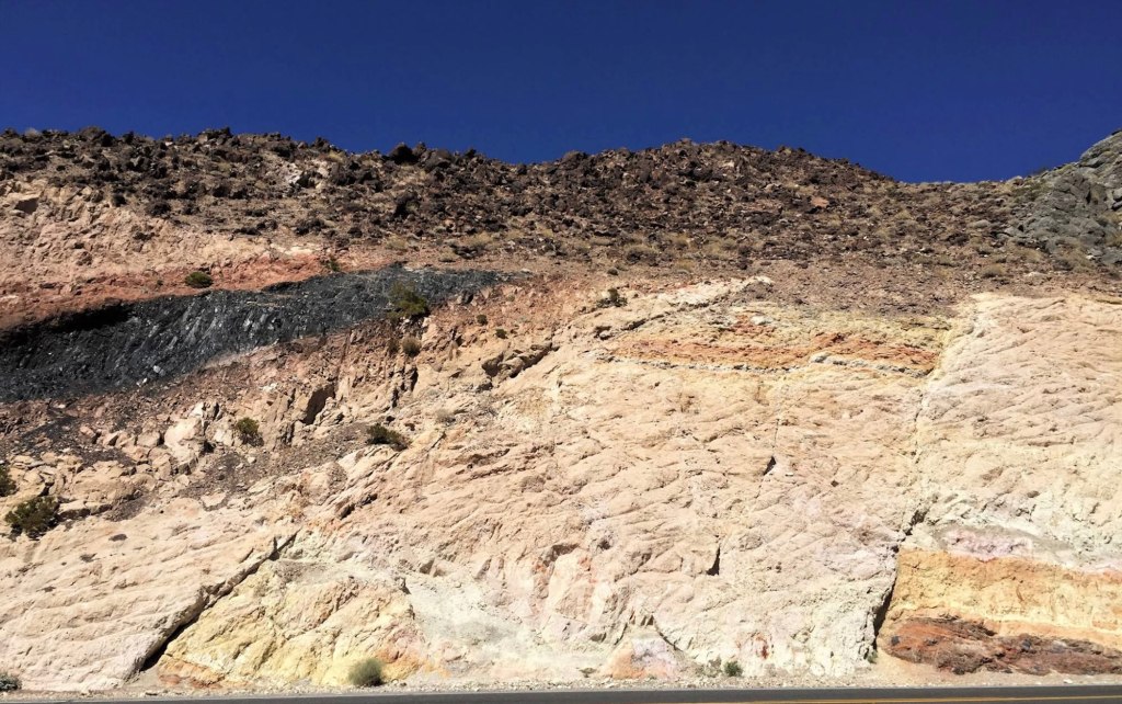
The construction of the PCH was an engineering marvel, given the challenging terrain it had to navigate. The road had to be carved out of steep cliffs, cross numerous rivers, and be supported by bridges spanning deep ravines. One of the most significant and iconic portions of the highway, the Big Sur section, presented formidable challenges. This stretch of the road, which runs between San Simeon and Carmel, required extensive blasting and drilling into the rugged coastal mountains. The effort was spearheaded by the California Division of Highways (now CalTrans), with a workforce comprising both state employees and workers from the Civilian Conservation Corps (CCC), a New Deal program.

PCH

Key figures in the design and construction of the PCH included engineers and architects who had to innovate continuously to address the formidable natural obstacles. One notable engineer was John D. Isaacs, a prominent builder who contributed to the design and construction of several key bridges along the PCH, including the famous Bixby Creek Bridge. His innovative approach to bridge engineering helped overcome the difficulties presented by the steep canyons and coastal bluffs.

The Pacific Coast Highway took decades to complete fully, with different sections being opened to the public at various times. The Big Sur segment, for example, was officially completed in 1937 after nearly 18 years of labor. The total cost of constructing the highway is difficult to pinpoint precisely, given its piecemeal development, but it ran into tens of millions of dollars—an immense sum at the time.

The Pacific Coast Highway near Santa Monica, California, circa 1930s.

Several colorful characters also play a role in the highway’s history. The Pacific Coast Highway might not exist today if May Rindge, a resolute landowner, had succeeded in her long battle against the county. Since at least the 1890s, a primitive road, often submerged at high tide, hugged the rocky coast between Santa Monica and Malibu, passing under a natural arch and ending at a locked gate on Rindge’s 17,000-acre ranch.

As the owner of Rancho Topanga Malibu Sequit, Rindge was determined to protect her property. She and her late husband had long fought to keep homesteaders off their land. In 1906, she even forced the Southern Pacific Railroad to divert its Santa Barbara line around Malibu and through the San Fernando Valley.

In 1907, when the county proposed extending the coastal road through Malibu, Rindge posted armed guards at the entrances to her ranch and contested the county’s power of eminent domain in court. A stalemate ensued for years, but the road’s prospects improved in the early 1920s when it was included in the planned Roosevelt Highway. In 1923, the U.S. Supreme Court upheld the county’s right to appropriate the land for the highway, and in 1925, a superior court judge granted the county title to the right-of-way in exchange for $107,289, finally ending the dispute.

The book “The King and Queen of Malibu: The True Story of the Battle for Paradise” by David K. Randall (2016) tells the story of Ringe and a wonderful history of Malibu.

Lexus on PCH

Today, the Pacific Coast Highway is one of the most famous and iconic strips of road in the world. Featured in countless commercials as well as movies and TV shoots, sections of PCH are immediately recognizable. Of course, it helps a lot that the highway in in such close proximity to legions of DPs (Directors of Photography) who live in Los Angeles and work in commercials and film. Shooting on the highway is an easy day trip from LA and Hollywood, although it can be difficult to get permits to film on the highway given it is such a busy working road.

That said, the highway faces significant challenges due to climate change and coastal erosion. Rising sea levels and increased storm activity are accelerating the natural erosion processes along California’s coast. This has led to frequent landslides and road closures, particularly in the Big Sur region. One notable event was the massive landslide in 2017 at Mud Creek, which buried a section of the highway under 40 feet of debris, closing it for over a year and requiring extensive repairs. A timelapse of the landslide produced by the United States Geological Service can be seen here

The Pacific Coast Highway in Newport Beach (Erik Olsen)

The New Yorker ran a piece on the concerns about the highway’s future viability as a means to travel long distances along the coast.

The Washington Post wrote back in 2021, “the engineering folly of a road built on sheer cliffs has meant that closures are annual events — the “whens,” not “ifs” — for the people and the economy it supports.”

The most recent slide to afflict the region took place in April 2024 following heavy rains, when large chunks of the road broke off, tumbling down a cliff and into the ocean near Rock Creek Bridge. Safety officials closed off about 40 miles of road as crews worked to assess the damage and stabilize the road.

Photo: Caltrans District 5

Rosanna Xia, a reporter for the Los Angeles Times, masterfully chronicles the problems facing PCH and the California coast in general due to climate change and erosion in her book California Against the Sea: Visions for Our Vanishing Coastline

Although the Pacific Coast Highway remains one of the greatest road trip routes of all time, the challenges in maintaining its full length are significant for the state and its residents. Despite its enduring popularity, the highway often operates in sections due to frequent closures and repairs caused by natural disasters like landslides, erosion, and wildfires. These ongoing issues demand substantial resources and effort to keep the entire highway operational, making its full-length service a constant struggle.

Still, it remains a pretty excellent place to take a drive. As the Boss once put it, roll down the window and let the wind blow back your hair.

Hey there! If you enjoy California Curated, consider donating the price of a coffee to support its creation!

Black Gold Beach or How Oil Transformed Long Beach and Built the Southern California Economy

Signal Hill oil development (Photo: The Huntington Library, Art Museum, and Botanical Gardens)

Southern California is best known for its sun-soaked beaches and Hollywood glamour, but it also has a wilder, largely forgotten past: it was once an oil kingdom. It’s a story even many Californians don’t know, a tale of spectacular gushers, fortunes won and lost, and larger-than-life characters straight out of a movie. Without oil, Los Angeles, and much of Southern California, would be very different places today.

The story of oil in Southern California is inextricably linked to the Long Beach fields, an area that once seemed more like a scene from Texas or There Will Be Blood than the Golden State. The discovery of oil in this region wasn’t just a footnote in economic journals; it was a seismic event that transformed the landscape, both literally and metaphorically. And it provided an industrial center of gravity to a region of the state that was just beginning to emerge as one of the world’s great gateways of commerce.

Signal Hill, 1926 (Public Domain)

The early 20th century was the beginning of the era of oil in California. On June 23, 1921 at 9:30 a.m., the Alamitos No. 1 oil well on Signal Hill in Long Beach was drilling 2,765 feet beneath the surface when the drill struck an underground oil deposit. This oil was under high pressure due to natural gas, blowing a gusher of oil over 100 feet high, and heralding the start of the Long Beach oil boom.

This event marked the discovery of one of the most prolific oil fields in the Los Angeles basin. Throughout the 1920s, Signal Hill, along with the nearby Santa Fe Springs field, experienced numerous blowouts, which erupted into dramatic pillars of flame that could be seen for miles. These incidents eventually prompted calls for stricter safety regulations. Consequently, in 1929, the state mandated the use of blow-out prevention equipment on all oil wells drilled in California.

Signal Hill quickly mushroomed into a forest of oil derricks, with fortunes being made overnight. As one of the most productive oil fields in the world, the Long Beach field was at one point yielding a staggering one-third of California’s total oil production. By the mid-1920s, California was producing nearly a quarter of the world’s entire petroleum supply, much of it from the Long Beach area.

Signal Hill, Long Beach oil development. (Public domain)

That so much oil is present beneath the surface of this stretch of Southern California is a gift of geology. Millions of years ago, the area that is now Long Beach was covered by the ocean. This marine environment was ideal for the accumulation of organic material, such as the remains of tiny plants and animals, on the ocean floor.

CALIFORNIA CURATED ON ETSY

Purchase stunning art prints of iconic California scenes.
Check out our Etsy store.

Over time, layers of sediment buried this organic matter. The high pressure and temperatures associated with deep burial initiated the transformation of this organic material into hydrocarbons – essentially, the formation of oil. Southern California is, of course, known for its active tectonics, influenced by the Pacific and North American Plate boundary. This tectonic activity has created a complex network of faults and folds in the earth’s crust in the Long Beach area.

The folding of the earth’s layers into anticlines (a type of fold that is convex up and has its oldest beds at its core) and the formation of fault traps (where displaced rocks create a seal that traps oil) are particularly important. These structures create reservoirs where oil can accumulate and be preserved over geological time scales.

Map of the Long Beach oil field.

As the oil flowed, so did the stories of those who sought their fortune in black gold. Perhaps the most famous of these was Edward L. Doheny, a name synonymous with California oil. Doheny, an ambitious prospector, was one of the first to recognize the potential of the Los Angeles Basin’s oil fields. His success in the oil industry was meteoric, but it was not without controversy, as he was later embroiled in the infamous Teapot Dome scandal.

Portrait of oil magnate Edward L. Doheny (Wikipedia)

The impact of oil production in Southern California extended beyond economics. It reshaped the region’s landscape, both physically and culturally. Towns sprung up around oil fields, and workers flocked to the area, drawn by the promise of jobs and prosperity. Long Beach, once a sleepy coastal town, burgeoned into a bustling city.

During the 1920s, regulations on well spacing were minimal, allowing Signal Hill to market narrow town lots. These lots were swiftly purchased by aspiring oil tycoons who installed wells so close to each other that they almost touched. Despite the dense placement, the wells generally remained profitable, though they rapidly depleted the oil field. The hill earned the nickname “Porcupine Hill” due to its appearance from afar, bristling with numerous wooden oil derricks since the more compact “nodding-donkey” pumpjack had not yet been developed.

The booming oil industry in the region attracted a massive influx of workers and investments. As oil fields expanded, Long Beach rapidly transformed from a seaside resort into an industrial powerhouse. The surge in economic activity and the availability of abundant oil fueled the growth of industries in and around Long Beach, including the burgeoning shipping and maritime sectors.

Container ships outside the Port of Los Angeles during the Covid lockdown in 2020. (Photo: Erik Olsen)

The construction of the Port of Los Angeles, which began in earnest in the early 1900s, was driven by the need to support the growing economic activities in Southern California, including agriculture, manufacturing, and oil. The proximity of Long Beach to the port, only about 20 miles south, meant that it was strategically positioned to benefit from and contribute to the port’s activities. The port served as a critical node for shipping oil, among other goods, which further integrated Long Beach, and Southern California as a whole, into the global trade system.

Signal Hill in Long Beach today. (Erik Olsen)

Moreover, the infrastructure developments necessary to support the oil industry, such as roads, railroads, and later pipelines, also facilitated the growth of the port. These developments enhanced the logistical capabilities of the region, making it more attractive for commercial and industrial activities. The oil boom thus not only transformed Long Beach but also had a cascading effect on the development of the Port of Los Angeles, cementing the region’s role as a vital hub in international trade and commerce.

As big and diverse in industry Los Angeles has become, it mostly started with oil. The fact that Los Angeles is now hardly known for oil, but better known for its massive entertainment and tourism economies is an astonishing transformation.

Of course, the influx of wealth and people also brought challenges, including environmental concerns and the need for regulatory oversight. It is well known that several major oil spills have taken place off the coast, ruining beaches and killing animals by the millions. In 1969, the Santa Barbara oil spill released vast quantities of oil into the ocean, creating an environmental disaster along the California coastline. This catastrophic event galvanized public awareness and activism, leading to the creation of the first Earth Day, as well as significant environmental legislation, including the establishment of the U.S. Environmental Protection Agency.

The oil slick visible around Platform A in the Santa Barbara Channel emanated from fissures in the seabed. (Photo: USGS)

Oil spills continue to take place in Southern California and the existence of 26 rigs off the coast are a reminder of that oil boom era. Those rigs are coming to the end of their productive life, however, and an on-gong controversy is what to do with them. Remove them or leave them — or part of them — as artificial reefs?

Over time, oil production in Southern California has waxed and waned. The easily accessible oil has largely been extracted, and production has declined from its mid-20th-century peak. Yet, the legacy of this era persists. It’s etched into the region’s physical and cultural landscape, from the bobbing oil derricks still dotting Signal Hill to the fortunes and institutions built on oil money.

The story of oil in Southern California, particularly the Long Beach fields, is a saga of geologic luck, ambition, ingenuity, and, at times, dangerous greed. It’s a chapter in the state’s history that’s as rich and complex as the oil that still lies beneath its surface, and yet it remains largely unknown to many people who think of Southern California as a paradise of sand and rolling waves.

JPL and the Voyager Golden Record: Humanity’s A Cosmic Mixtape in Space

The Jet Propulsion Laboratory (JPL) in La Canada Flintridge, California is well-known for building and sending spacecraft far into the cosmos to help us better understand the universe. But the agency was also extensively involved in one of the most ambitious and symbolic projects in the history of space exploration, one that in many ways was more art than science: the Voyager Golden Record.

In 1977, as the twin Voyager spacecraft prepared to journey beyond the confines of our solar system, they carried with them what might be the most profound artifacts ever created by humanity: the Voyager Golden Records. These records, designed to last a billion years, are time capsules intended not for Earthlings but for potential extraterrestrial finders or future humans. Engraved in gold-plated copper discs, the records encapsulate the Earth’s diverse cultural and natural heritage—from music to languages to sounds of nature.

Photo: NASA/JPL-Cal Tech

The idea of the Golden Record was developed by a talented team led by Carl Sagan, the renowned astronomer and science communicator. Sagan, alongside other prominent figures such as Frank Drake, Ann Druyan, science journalist Jon Lomberg, and Linda Salzman Sagan, crafted a selection that aimed to represent the entirety of Earth. The content ranged from classical music by Bach and Beethoven to greetings in 55 languages, natural sounds like thunderstorms and whales, and a diverse set of 115 images depicting life and culture on Earth.

But producing a record that could survive the harsh environment of space, while also being understandable and playable by beings of unknown technology, posed unique challenges. This is where the Jet Propulsion Laboratory (JPL) stepped in, playing a pivotal role in transforming this ambitious vision into a tangible, durable artifact capable of traversing the cosmos.

Inspection of the engraving of the Voyager Golden Record.
Photo: NASA/JPL-Cal Tech

JPL, managed by Caltech under a NASA contract, was primarily responsible for the construction and operation of the Voyager spacecraft. Their expertise was crucial not just in the scientific instrumentation and engineering of the spacecraft but also in integrating the Golden Records. The lab’s engineers worked meticulously to ensure that the records were equipped with everything needed for potential playback: a cartridge, a needle, and symbolic instructions detailing their use. These instructions, etched onto the record’s cover, provided a universal map indicating Earth’s location in relation to pulsar stars, which are highly stable and can be used as galactic landmarks.

JPL’s involvement extended to the actual physical preparation of the records. They coordinated closely with RCA Records to produce the master disc from which the Voyager records were replicated. The final products were then plated in gold and encased in a protective aluminum jacket, designed to withstand the vacuum of space, cosmic rays, and extreme temperatures.

Photo: NASA/JPL-Cal Tech

The technical contributions of JPL ensured that the Golden Records were not only a feat of cultural expression but also a marvel of scientific and engineering ingenuity. By equipping the Voyager spacecraft with these messages, JPL helped bridge the human desire to explore and communicate with the tangible reality of space travel. The records, mounted aboard Voyagers 1 and 2, continue to be ambassadors of Earth, carrying sounds, music, and images intended to convey the story of our world to whoever, or whatever, might find them.

Today, both Voyager spacecraft, with their Golden Records, have entered interstellar space, marking them as the most distant human-made objects in existence. They serve as reminders of humanity’s ambition to reach beyond our immediate grasp and to communicate across vast cosmic distances. JPL’s role in this historic endeavor highlights the profound connection between human creativity and technological advancement, ensuring that our message to the cosmos will endure long after the original voices have faded.

JPL written on the Voyager Golden Record
Photo: NASA/JPL-Cal Tech

As these records voyage through the cosmos, they remind us not just of where we have been, but also of the far reaches that our curiosity can take us. Through the combined efforts of visionaries like Carl Sagan and the engineering prowess of JPL, the Voyager Golden Record stands as a testament to the best of human knowledge, culture, and technological achievement.


The Voyager Golden Records are phonograph records, much like the vinyl records used to listen to music before digital media became widespread. They are constructed from copper discs coated in gold to withstand the harsh environment of space. Each record is encased in a protective aluminum jacket, along with a cartridge and a needle. Instructions in symbolic language explain the origin of the spacecraft and indicate how the record should be played. The playback speed (16 2/3 revolutions per minute) is much slower than typical records, which typically spin at 33 1/3 or 45 rpm.

The content of the Golden Record is a meticulously curated selection intended to represent the diversity of life and culture on Earth:

Sounds of Earth: The records include audio of nature sounds like thunder, wind, and animals (including the songs of birds and whales). Human sounds like footsteps, a heartbeat, and laughter are also embedded, capturing the biological and social essence of Earth.

The DNA structure magnified, light hit image is one of the pictures electronically placed on the phonograph records which are carried onboard the Voyager 1 and 2 spacecraft. Credit: Jon Lomberg

Musical Selections: There are 27 musical tracks from different cultures and eras, ranging from classical pieces by Bach and Beethoven to traditional songs from various cultures, including a Navajo chant and a Peruvian wedding song. These selections were intended to showcase the diversity of musical expression on Earth.

Greetings in 55 Languages: A variety of spoken greetings from “Hello” in English to ancient languages like Akkadian. The inclusion of a broad range of languages aims to depict the linguistic diversity of humanity.

Images: The record also contains 115 analog-encoded photographs and diagrams. These images show a wide range of subjects, including humans of different sexes and races, everyday activities, scientific knowledge like mathematical definitions, and the Solar System. The intent was to offer a visual summary of our planet and its inhabitants.

CALIFORNIA CURATED ART ON ETSY

Purchase stunning art prints of iconic California scenes.
Check out our Etsy store.

Message from the UN Secretary-General and the President of the United States: There are also printed messages from prominent global leaders at the time, including U.S. President Jimmy Carter and United Nations Secretary-General Kurt Waldheim.

Sounds of Human Origin: Beyond natural and environmental sounds, the record also includes a montage of the sounds of Earth, a screaming chimpanzee, a medley of human-originated noises like tools, vehicles, and a kiss, among others.

The idea behind the Voyager Golden Record is not just to communicate where and who we are but also to share a message of hope and peace with any possible recipient, even if that recipient is far in the future. The chances of the Voyager spacecraft actually being found by extraterrestrial life are slim, but the Golden Record serves as a profound gesture of goodwill and a testament to the human spirit’s longing to reach out and explore the universe.

Geologist Thomas Dibblee Jr. and the Theory Behind Pinnacles National Park’s 200-Mile Tectonic Journey

Pinnacles National Park (NPS)

Pinnacles National Park’s open landscape of dramatic rock formations and craggy spires looks otherworldly, especially in golden hour light. But few people who visit the park, located in Central California, southeast of the San Francisco Bay Area, are aware that the rock formations were once at the center of a fierce debate in the history of California geology.  

And at the center of the controversy was a young geologist named Thomas Dibblee Jr. 

Pinnacles National Park, formerly Pinnacles National Monument, tells the story of ancient volcanic activity and the relentless geologic forces of the San Andreas Fault. This fault, a major boundary between the Pacific and North American tectonic plates, is the platform for the dramatic northward journey of the park’s volcanic remnants. Dibblee’s research illuminated how, over millions of years, the landscapes we see today were sculpted by the movements of these tectonic plates and how the shape of California as a state has changed dramatically as a result.

Thomas Dibblee Jr. (Source: Wikipedia)

The crux of Dibblee’s discovery lies in the relationship between Pinnacles National Park and a volcanic source located near present-day Neenach, close to Palmdale in Southern California. The geological narrative that Dibblee pieced together revealed that the rock formations at Pinnacles originated from volcanic eruptions that occurred approximately 23 million years ago, near what is now Neenach. Over millions of years, the relentless movement along the San Andreas Fault has transported these formations over 195 miles (314 kilometers) to their current location. At the time, very few people, geologists included, believed that was possible.

CALIFORNIA CURATED ON ETSY

Purchase stunning coffee mugs and art prints of iconic California scenes.
Check out our Etsy store.

Dibblee had to be wrong. But it turned out, he was not, and his measurements and discovery launched a passionate debate about the speed of geologic forces.

Dibblee’s findings not only shed light on the significant distances that landscapes can travel over geological timeframes but also provided a tangible connection between the theory of plate tectonics and observable geological features. The juxtaposition of Pinnacles National Park and the Neenach volcanic formation serves as a clear indicator of the San Andreas Fault’s role in shaping California’s geological, indeed it’s physical, identity.

Pinnacles National Park (NPS)

A key aspect of Dibblee’s methodology was his keen observational skills, which enabled him to recognize that the rocks at Pinnacles National Park were strikingly similar in composition and age to those near Neenach, even though these areas are separated by about 195 miles (314 kilometers) today. He noted the volcanic origins of these formations and, through detailed mapping, was able to correlate specific rock types and strata between these distant locations.

Another crucial element in Dibblee’s discovery was his understanding of the San Andreas Fault as a major geological feature capable of significant lateral movement (remember the San Andreas is a slip or sliding fault). By correlating the age and type of rocks across this fault line, Dibblee inferred that the only plausible explanation for the similarity between the rocks at Pinnacles and those near Neenach was that they had once been part of the same volcanic field, which had been split and displaced over millions of years due to the movement of the San Andreas Fault.

Rock formations at Pinnacles National Park (Brocken Inaglory)

Dibblee’s work also benefited from the broader scientific context of his time, particularly the emerging theory of plate tectonics in the mid-20th century. This theoretical framework provided a mechanism for understanding how large-scale movements of the Earth’s crust could result in the displacement of geological formations over vast distances. Dibblee’s findings at Pinnacles and Neenach became a compelling piece of evidence supporting the theory of plate tectonics, showcasing the San Andreas Fault’s role in shaping California’s landscape.

But Dibblee’s ideas were controversial at the time. Many in the scientific community were hesitant to embrace a theory that suggested such dramatic movement across the Earth’s crust, partly because it challenged existing paradigms and partly due to the limitations of the geological evidence available at the time. The prevailing theories favored more static models of the earth’s crust, with changes occurring slowly over immense periods. Dibblee’s insights into tectonic movements and the geological history of regions like the Pinnacles National Park were ahead of their time and laid the groundwork for the acceptance of plate tectonics.

This Pinnacles revelation was groundbreaking, emphasizing the dynamic and ever-changing nature of the Earth’s surface. Dibblee’s ability to piece together these monumental shifts in the Earth’s crust from his detailed maps and observations has left a lasting impact on our understanding of geological processes. His work at Pinnacles and the recognition of its journey alongside the San Andreas Fault underscores the importance of detailed geological mapping in unraveling the Earth’s complex history.

San Andreas Fault looking northwest onto the Carrizo Plain (John Wiley)

Born in 1911 in Santa Barbara, California, Dibblee’s life and work were deeply intertwined with the rugged terrains and picturesque landscapes of the Golden State, Dibblee’s journey into geology began at a young age, fostered by his natural curiosity and the geological richness of his native state.

After earning his degree from Stanford in 1936, Dibblee embarked on his professional journey with Union Oil, later moving to Richfield. It was during this period that his extensive field mapping efforts culminated in the discovery of the Russell Ranch oil field near New Cuyama. By 1952, Dibblee had meticulously mapped every sedimentary basin in California with potential for oil, cementing his legendary status as a petroleum geologist. His reputation for traversing the state’s backcountry on foot for extended weeks became a defining aspect of his character and contributed to his storied career in geology. 

Dibblee moved on to a career at the United States Geological Survey (USGS) that would span over six decades, much of it spent with the agency and then later through independent projects. His work ethic and passion for fieldwork were unparalleled; Dibblee was known for his meticulous and comprehensive approach, often spending long days in the field, mapping out California’s complex strata with precision and care.

Over his career, Dibblee mapped over 240,000 square kilometers of California’s terrain, an achievement that provided an invaluable resource for understanding the state’s geological history and structure. He mapped large swaths of the Mojave Desert, the Coast Range and the Los Padres National Forest, earning a presidential volunteer action award in 1983 from President Reagan.

His maps are celebrated for their accuracy and detail, serving as critical tools for academic research, oil exploration, environmental planning, and education. The Dibblee Geological Foundation, established to honor his work, continues to publish these maps, ensuring that his legacy lives on.

Dibblee Map

Dibblee’s insights into the geology of California were pivotal in several areas, including the understanding of the San Andreas Fault, a major fault line that has been the focus of extensive seismic research due to its potential for large earthquakes. Dibblee’s mapping efforts helped to clarify the fault’s characteristics and behavior, contributing to our understanding of earthquake risks in California and aiding in the development of safer building practices and disaster preparedness strategies.

Furthermore, Dibblee’s work shed light on the process of plate tectonics and the geological history of the western United States. His observations and mapping of sedimentary formations and fault systems in California provided empirical evidence that supported the theory of plate tectonics, a cornerstone of modern geology that explains the movement of the Earth’s lithospheric plates and the formation of various geological features.

Thomas Dibblee Jr.’s contributions to the field of geology are not just confined to his maps and scientific discoveries. He was also a mentor and inspiration to many aspiring geologists, sharing his knowledge and passion for the Earth’s history through lectures, field trips, and personal guidance. His dedication to his work and his ability to convey complex geological concepts in an accessible manner made him a respected figure among his peers and students alike. Through his dedication and pioneering work, Dibblee has left an indelible mark on the field of geology, making him a true giant in the scientific exploration of California as well as our planet.

The Blythe Intaglios are the California’s Nazca Lines. They are True Mysteries Etched in Earth.

Blythe Intaglio of a human figure in Southern California (Wikipedia)

In the vast expanses of California’s Colorado Desert, less than four hours from Los Angeles, a series of ancient and enigmatic figures etched into the earth—the Blythe Intaglios—have long puzzled anthropologists and captivated the imagination of those who visit them or view them from the sky. They were brought to modern attention somewhat by chance. In 1932, George Palmer, a pilot flying over the Mojave Desert between Las Vegas, Nevada and Blythe, glimpsed these enigmatic formations, sparking curiosity and awe. 

Named for the nearby town of Blythe, California, these large geoglyphs (human-made designs created on the ground by arranging or moving objects in a landscape), sprawl across the desert floor, and are an extraordinary example of prehistoric art, yet they remain one of the lesser-known archaeological wonders of North America. The Colorado Desert, just south of the Mojave, contains the only known desert intaglios in North America. 

The Blythe Intaglios are best observed from above by drone or by plane, where their full scale and intricacy become apparent. The largest figure – of a human with outstretched arms – spans an immense 171 feet, an impressive endeavor considering the primitive tools likely used in their creation. One has to wonder why they were created at all since the people who made them certainly had no way of viewing them from the air. In addition to humans, the figures depict animals such as a rattlesnake and possibly a horse (yeah, what is that thing?), as well as geometric shapes, each meticulously carved by removing the dark desert varnish to reveal the lighter soil underneath. Intaglios in general are classified by their shapes, such as anthropomorphs (humanlike), zoomorphs (animal-like) and various geometric shapes.

Blythe Intaglio quadruped (Wikipedia)

The intaglios are mostly located along the Colorado River, a fact that some scientists consider significant. Rivers often hold a central place in the spiritual and cultural lives of indigenous peoples. For the tribes associated with the Blythe Intaglios, such as the Mojave and Quechan, the Colorado River was likely a vital part of their spiritual and everyday life. The proximity of these geoglyphs to the river suggests that they could have been part of a broader cultural landscape that included the river as a critical element. The river may have been seen as a source of life and a spiritual boundary, making the nearby land a significant place for creating these monumental figures.

While the Nazca Lines in Peru have gained worldwide fame, the Blythe Intaglios, though similar in form and function, have remained relatively obscure. Most Californians probably have no idea that such unique archaeological artifacts can be found in the state, let alone so close to a major urban center. This obscurity, however, adds to their mystique. 

The geoglyphs are believed to date back at least a thousand years, but their exact age remains uncertain. If the quadruped figures represent horses (reintroduced in North America by the Spanish) then a historical date of sometime after the 1500s would be supported. Archaeologist Jay von Werlhof obtained radiocarbon dates for the figures, ranging from 900 BCE to 1200 CE. The human figures, particularly the largest, are thought to represent Mastamho, the creator of life in Mojave and Quechan mythology. The animal figures, like the mountain lions, are steeped in symbolic meaning, potentially reflecting the tribes’ cosmology and spiritual beliefs.

Nazca Lines in Peru. (UNESCO World Heritage Site)

The precise purpose of the Blythe Intaglios is a matter of ongoing debate. Some scholars propose that they were part of religious rituals or celestial observances. The alignment and positioning of the figures suggest a possible astronomical function, marking significant events in the lunar or solar calendars. Or perhaps making them was just a fun way to pass the time and express creativity.  

CALIFORNIA CURATED ON ETSY

Purchase stunning coffee mugs and art prints of iconic California species.
Check out our Etsy store.

Despite their historical and cultural significance, the Blythe Intaglios have not been immune to threats. Off-road vehicle traffic and natural erosion have damaged some of the figures. Conservation efforts are in place, but the remote location and sheer scale of the site present unique challenges. Fences have been erected around some figures to protect them, but much work remains to ensure their preservation.

California’s Colorado Desert (Wikipedia)

The Blythe Intaglios are more than just ancient art; they are a wonderful example of the rich and diverse cultural heritage of the indigenous peoples of the Southwest. These geoglyphs offer a window into a past that likely predates European influence, a past that is integral to understanding the complex tapestry of American history. Places like the Blythe Intaglios are in constant threat of disappearing forever, but they’re important because they connect us with the human past and remind us of the power of human expression over time and the mysteries beneath our feet.

Roadcut Revelations: Unearthing California’s Deep History Along the Highway

Roadcut in Southern California on Angeles Crest Highway (Photo: Erik Olsen)

“Man is a geologic agent,” the late California geologist Eldridge Moores.

Roadcuts in California, those slices through hills and mountainsides made during the construction of roads, are like open books to geologists. They reveal the intricate and often dramatic geological history of the state. When you drive along the highways of California, you’re likely to pass by these exposed cliffs of rock. To the everyday traveler, they might just be a part of the landscape, but to geologists, they are invaluable windows into the Earth’s past.

““Geologists on the whole are inconsistent drivers. When a roadcut presents itself, they tend to lurch and weave,” wrote the great geology (and many other topics) writer John McPhee in his excellent book Annals of the Former World. “To them, the roadcut is a portal, a fragment of a regional story, a proscenium arch that leads their imaginations into the earth and through the surrounding terrane.”

Glacier carved domes tell the story of thousands of years of glaciation in California. (Photo: Erik Olsen)

Roadcuts expose layers of rock that have been hidden from view for millions of years. Each layer, or stratum, tells a story of what the environment was like when that layer was deposited. By studying these layers, geologists can reconstruct a timeline of events that shaped the region. For example, they can identify periods of volcanic activity, times when the area was submerged under an ancient ocean, or epochs when massive glaciers were carving out the valleys.

California is especially interesting due to its active tectonic setting. It’s not just the San Andreas Fault that captivates geologists; there are numerous lesser-known faults that crisscross the state, and roadcuts can expose these hidden fractures. By studying the composition of rocks along these faults, geologists learn about the nature of past seismic activity and can make predictions about future earthquakes.

The rock composition in California varies widely, offering a rich tapestry of geological history. In the Sierra Nevada, granite roadcuts tell of a time when massive chambers of magma slowly cooled and crystallized deep beneath the Earth’s surface. Elsewhere, roadcuts through sedimentary rocks like sandstone and shale may contain fossils, giving clues about the life forms that once inhabited the region.

The San Gabriel Mountains consist of granite rocks of several kinds and a variety of other crystalline rocks, mainly schists, some of which were originally shales and sandstones but have been altered (metamorphosed) by great igneous intrusions and compression. (Photo: Erik Olsen)

These man-made artifacts also reveal the forces that have shaped California’s diverse landscapes. In roadcuts, geologists might find evidence of powerful geological processes such as metamorphism, where existing rock types are transformed into new types due to high pressure and temperature conditions. For instance, the presence of metamorphic rocks like schist and gneiss can indicate ancient collision zones where Earth’s tectonic plates have crashed together.

The value of California roadcuts is wonderfully illustrated in John McPhee’s “Assembling California.” The book is an excellent narrative that weaves the tale of California’s complex geology with the lives of the geologists who study it. Eldridge Moores, a late prominent geologist from the University of California, Davis (Moores died in 2018), played a significant role in deciphering the geological history of the region, particularly through his fieldwork involving roadcuts.

Roadcut in San Gabriel mountains. (Photo: Erik Olsen)

At the time Eldridge Moores entered the field, the theory of plate tectonics was only beginning to gain traction. In the early 1960s, the idea that continents drifted and that vast slabs of the Earth’s crust moved over the mantle was still controversial, met with skepticism by many geologists trained in older, fixist models. Moores, however, embraced the theory early, recognizing in it an explanation for the chaotic structures he saw in California’s mountain belts. As a young researcher, he studied the Troodos ophiolite in Cyprus, an exposed section of ancient oceanic crust, and realized that similar rock assemblages—serpentinized peridotites, deep-sea sediments, and basaltic lavas—were scattered across California.

“It was a very exciting time. I still get goosebumps even talking about it,” Moores told KQED in 2017. “A turning point, I think it was, in the plate tectonic revolution, that was the watershed of geology.”

With plate tectonics as a guiding framework, Moores understood that these rocks were remnants of vanished oceans, relics of seafloor that had been uplifted and accreted onto the edge of North America. His work helped reveal that much of California had arrived in pieces, a geological patchwork of island arcs, deep-sea basins, and continental fragments welded together by subduction. While others were still debating the validity of plate tectonics, Moores was already applying it, using it to decode the assembly of an entire state.

Eldridge Moores at the Cordelia fault.  (Photo: UC Davis)

Moores was renowned for his work on ophiolites, sections of the ocean floor that have been thrust up onto the continent. One of his notable discoveries was the identification of ophiolite sequences in the roadcuts along the highways of the Sierra Nevada. These discoveries were crucial in understanding the ancient tectonic movements that shaped western North America.

Through roadcuts, Moores and his colleagues were able to observe and study the juxtaposition of different rock types, providing further evidence for the theory of plate tectonics. They could literally walk along the cuts and see how different terranes—large packets of rock with a distinct geological history—were stitched together like a geological quilt, offering insight into the past locations of tectonic plates.

CALIFORNIA CURATED ON ETSY

Purchase stunning coffee mugs and art prints of iconic California species.
Check out our Etsy store.

“Nature is messy,” Moores once told McPhee. “Don’t expect it to be uniform and consistent.”

There are thousands of roadcuts across California, each exposing a fragment of the state’s chaotic geology. The Palmdale Roadcut, a striking geological feature along the San Andreas Fault, has been an invaluable resource for geologists studying the dynamics of this infamous fault line. This natural cut exposes a cross-section of the earth, revealing layers of rock and sediment that have been shifted and shaped by seismic activity over millions of years. The rock here is a chaotic mélange—fault gouge, shattered granite, and twisted layers of sedimentary rock that have been pulverized and ground together by the relentless motion of the Pacific and North American plates. By analyzing these layers, geologists can better understand the history and behavior of the San Andreas Fault, including the patterns of past earthquakes and the movements of tectonic plates. This, in turn, contributes significantly to the broader understanding of seismic risks and aids in preparing for future seismic events.

The Palmdale Road Cut on Hwy 14 in Southern California is a 90-foot slice through swirling sediments that have spent millions of years being squeezed and twisted by the San Andreas fault. Some say that this view of the fault is one of the best in all of California.
(Photo: Erik Olsen)

Another geologist, Garniss Curtis, used California roadcuts to study volcanic rocks and their embedded minerals, which allowed for the dating of geologic events with greater precision. His work on the potassium-argon dating method turned roadcuts into time machines, where the age of rocks could be determined with the help of exposed minerals.

One of California’s most well-known roadcuts, the Charlie Brown Outcrop (map), is a favorite among geologists. Located along Highway 178 near the Nevada border, it has been highlighted by geology teacher Garry Hayes, author of the acclaimed Geotripper blog. Hayes says of the roadcut (also known as the Shoshone Roadcut):

“There are really three stories told in this exposure, that of distant ash eruptions, a violent eruption close by, and earthquakes with associated mountain-building.”

Charlie Brown outcrop along highway 178 in California. (Google Maps)

These geologists, among others, have used roadcuts as a means to peel back the layers of time, revealing the processes that have operated to create the state’s diverse geologic scenery. Roadcuts have provided the evidence for groundbreaking theories and have been instrumental in mapping the geological evolution of California. The work of these scientists exemplifies the roadcut’s role as a natural laboratory, a place where Earth’s geologic history is on full display for those who know how to read the rocks.

Moreover, roadcuts are crucial for educating the next generation of geologists. They serve as natural laboratories where students can practice identifying rock types, deciphering the sequence of geological events, and understanding the dynamic forces that continue to shape the Earth.

Roadcuts in California, those slices through hills and mountainsides made during the construction of roads, are like open books to geologists. They reveal the intricate and often dramatic geological history of the state. (Photo: Erik Olsen)

In Assembling California, McPhee remarked that “geologists are like dermatologists: they study, for the most part, the outermost two per cent of the earth. They crawl around like fleas on the world’s tough hide, exploring every wrinkle and crease, and try to figure out what makes the animal move.”

Manmade creations like roadcuts greatly assist geologists in their work. In essence, roadcuts are not just incidental byproducts of infrastructure development; they are key to understanding California’s complex geological evolution. They tell stories of ancient environments, tectonic upheavals, and the slow but inexorable forces that continue to mold the landscape. For geologists in California, the roadcut is a portal into the deep past, offering a tangible connection to the processes that have made the state what it is today.

Underground Fury: The 1985 Methane Blast That Rocked Los Angeles and Rerouted Its Subways

A 1985 methane explosion in L.A.’s Fairfax district turned a Ross Dress for Less into a disaster scene.
Photo by Dean Musgrove, courtesy of the Herald-Examiner Collection – Los Angeles Public Library.

In the heart of Los Angeles, on a seemingly ordinary spring day in 1985, a sudden explosion tore through the Ross Dress for Less store at the corner of 3rd Street and Fairfax Avenue. This wasn’t an industrial accident nor was it an act of malice—it was a force of nature that had been lurking unseen beneath the city’s streets: methane gas.

The Fairfax District, a bustling area known for its shopping and historic Farmers Market, is also part of the larger Salt Lake Oil Field, a subterranean landscape rich in hydrocarbons. Over millions of years, decaying organic matter trapped in the earth’s crust had transformed into vast reservoirs of oil and methane gas. It was this methane that had stealthily migrated close to the surface, building up in closed spaces, waiting for an ignition source to set off a dramatic release.

On that day, as shoppers browsed through discounted apparel, an explosive mixture of methane, oxygen, and sewer gases found its spark. The blast shattered the storefront windows and caused a partial cave-in of the roof, turning the shop’s interior into a mangled wreck of metal debris. Twenty-three individuals were left with injuries severe enough to necessitate hospital care. In the aftermath, police cordoned off a four-block radius encompassing the bizarre spectacle of gas fires that jetted into the night sky, a haunting tableau that persisted until dawn.

The aftermath of the explosion was a scene of chaos and confusion. Emergency services sprang into action, addressing the immediate humanitarian concerns. But once the dust settled, a more profound issue loomed: the implications for the city’s ambitious underground Metro Rail project.

At the time, Los Angeles was in the throes of planning and constructing the Metro Red Line, a subway system that promised to link various parts of the sprawling city. Wilshire Boulevard, one of the busiest thoroughfares in Los Angeles, was to be a central artery in this new subterranean network. However, the explosion at Ross Dress for Less exposed the heretofore underestimated risk of tunneling through methane-rich zones.

The city of Los Angeles created a methane zone map showing shaded regions of the methane zone and methane buffer zones.

Fears quickly escalated about the potential for similar explosions occurring elsewhere, particularly along the planned subway routes. The public, already wary of the high costs and disruptions associated with the Metro line, grew increasingly concerned about the dangers of tunneling through methane pockets.

In the wake of the explosion, city officials and Metro Rail engineers faced a daunting challenge. They needed to ensure public safety without derailing the critical infrastructure project. This task required a multifaceted approach. First, there was a thorough scientific investigation. Experts from various fields, including geologists, engineers, and safety specialists, were brought in to assess the risks of methane gas in the Fairfax District and along the proposed Metro route.

In a comprehensive regulatory response, the city imposed stringent building codes and established the Methane Zone Ordinance, which required new constructions in certain areas to implement gas detection and venting systems.

But the blast also resulted in a measure of technological innovation. The Metro Rail project incorporated state-of-the-art methane detection systems and emergency ventilation procedures in its design, setting a new standard for subway safety. The process was aided to some extent by significant community engagement. Public meetings and forums were held to address community concerns, offer reassurances, and provide education on the measures being taken to prevent future incidents.

B Line train at Union Station (Wikipedia)

Despite these efforts, the fear of what lay beneath Los Angeles’ streets had a chilling effect on the Metro’s progress. The Red Line faced delays as policymakers and the public grappled with the cost and complexity of making the subway safe. It wasn’t until the early 2000s, with the introduction of advanced tunneling technologies and robust safety protocols, that the Metro expansion regained momentum.

The 1985 methane explosion, while a localized event, reverberated through time to shape the development of Los Angeles in profound ways. It brought to the forefront the invisible risks of urban growth, challenged engineers and city planners to innovate, and ultimately reaffirmed the resilience of a city determined to rise above its subterranean challenges.

1983 rendering for the planned subway station at Wilshire and Fairfax – a casualty of the Ross explosion.
\Courtesy of the Metro Transportation Library and Archive.

The dangers of methane beneath Los Angeles are far from gone. The Porter Ranch leak, also known as the Aliso Canyon gas leak, was a massive methane leak in the Santa Susana Mountains near the neighborhood of Porter Ranch in the northwest section of the San Fernando Valley.. Discovered on October 23, 2015, gas was discovered escaping from a well within the Aliso Canyon underground storage facility. On January 6, 2016, Governor Jerry Brown issued a state of emergency, and numerous media reports suggested that the methane could be dangerous to residents.  On February 11, the gas company reported that it had the leak under control, and finally  on February 18, state officials announced that the leak was permanently plugged. Still, an estimated 97,100 tonnes (95,600 long tons; 107,000 short tons) of methane and 7,300 tonnes (7,200 long tons; 8,000 short tons) of ethane were released into the atmosphere.

Today, as the Los Angeles Metro continues to expand, the lessons learned from that explosive day in 1985 continue to resonate, ensuring that safety remains at the core of the city’s march toward the future.

Hey there! If you enjoy California Curated, consider donating the price of a coffee to support its creation!