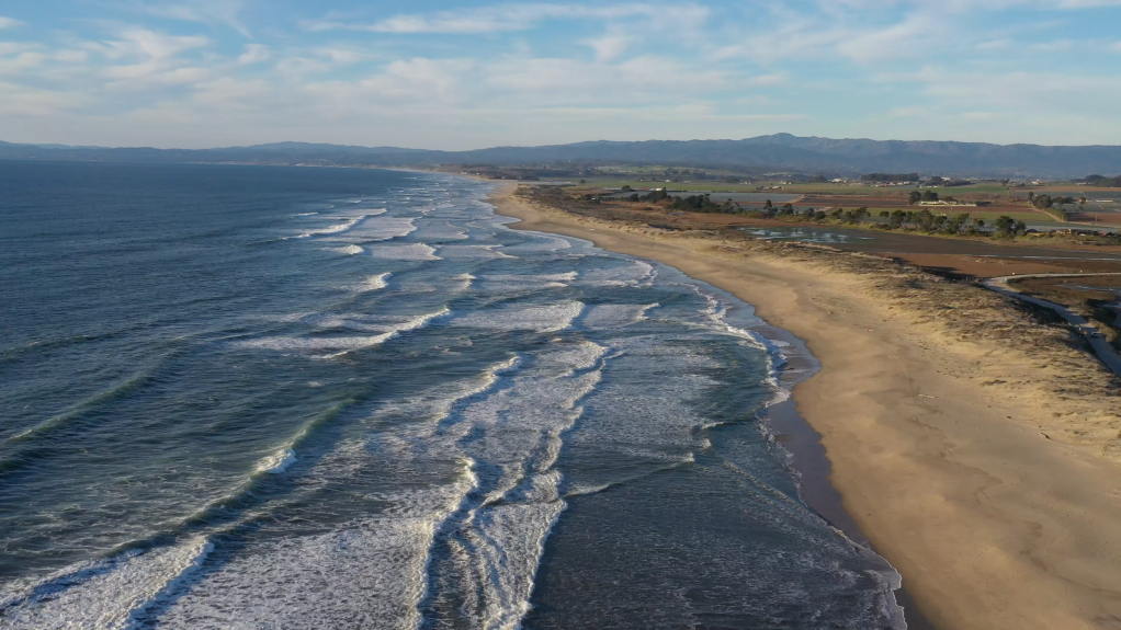
In the 18th century, when Spanish and French explorers ventured along the northern California coast they encountered Monterey Bay and marveled at the astonishing ecological abundance of this 25-mile wide bite mark in the land. The shores buzzed with the lively interactions of sea birds, sea otters played amidst the luxuriant kelp beds, and the waters teemed with many species of whale.
Yet, by the late 19th and early 20th centuries, this rich tapestry of marine life and biodiversity had largely been erased, replaced by the destructive industrial operations of sardine canneries. These factories, though they brought economic activity and prosperity to a few, also introduced a plague of environmental problems that began a period of staggering ecological decline.
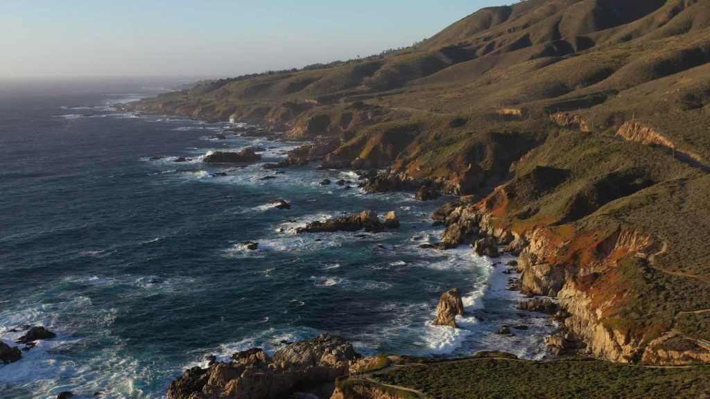
California Coast out of Big Sur (photo: Erik Olsen)
But the tide turned in the early 20th century, in large part due to the efforts of a determined, pioneering woman who took a stand against the sardine industry and began an effort of restoration that helped make Monterey Bay one of the most celebrated shorelines in the world.
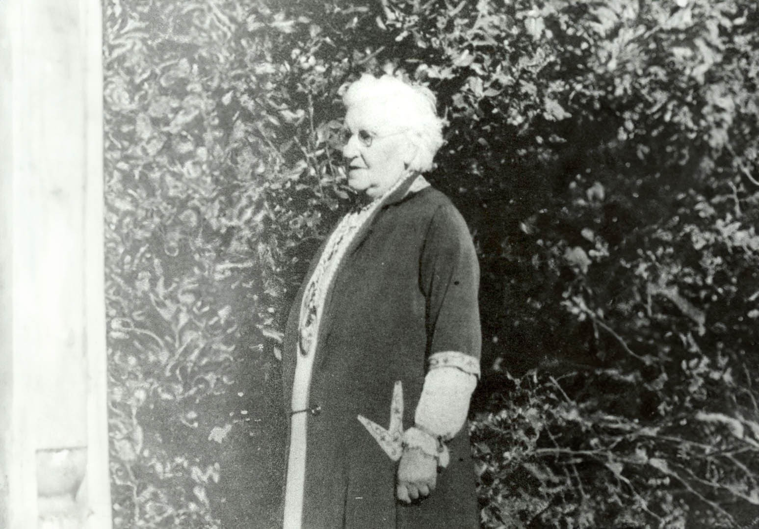
This transformational figure was Julia Platt, whose contributions were instrumental in the conservation efforts that led to the revival of Monterey’s natural and economic landscape. As mayor of Pacific Grove and a pioneer in marine conservation, Platt used her authority and vision to establish protected marine areas and implement regulations that curbed overfishing and habitat destruction. Her efforts laid the groundwork for a broader environmental awareness and action within the community.
Julia Platt began her career not in politics, but in science. She was born on September 14, 1857, in San Francisco, California, and later moved to Burlington, Vermont. She studied at the University of Vermont and then at Harvard University for her graduate studies.
During her academic journey, Julia faced the limitations imposed on women in academia at the time. In the late 1800s in the United States, it was nearly impossible for a woman to pursue a Ph.D. in zoology due to prevailing gender biases. However, the University of Freiburg in Baden, Germany, presented her with an opportunity to break through these barriers. She seized this chance and became one of the first women to earn a zoological Ph.D. there, challenging the norms and paving the way for future generations.
Her academic achievements were significant, and she had already made significant contributions to science, including pioneering research on chick embryo development and identifying a new head segment in shark embryos.
But upon returning to the US, she once again ran up against the glass ceiling of academia. While she worked with some of the top zoologists of the time, she could not find steady work in science. Admitting defeat, but determined to make her mark, she decided on politics, writing to a friend, “Without work, life isn’t worth living. If I cannot obtain the work I wish, then I must take up with the next best.”
Cannery Row in Monterey 2023 – (Photo by Erik Olsen)
Monterey Bay’s legendary biodiversity was under serious threat. In 1854, a whale was as valuable as several pounds of pure gold, and J.P. Davenport harvested them using exploding lances, processing the carcasses in shore-based vats of boiling oil. By the late 19th century, the lucrative abalone industry had attracted Chinese fishermen village to the shores of Pacific Grove over-burdening the population. During the Gold Rush, prospectors consumed fourteen million seabird eggs from the Farallon islands, a practice that decimated seabird populations. From the 1910s to the 1940s, Monterey Bay’s sardine population fueled a burgeoning canning industry, reaching unprecedented scales that caused horrific smells in town and rendered the beach useless for recreation.
Each of these industries ultimately collapsed under the weight of its own exploitation; otters, whales, seabirds, abalone, and sardines were all harvested to the brink of extinction.
Whales at Moss Landing near Monterey
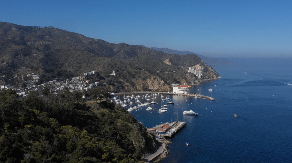
In 1899, as the age of 42, she moved to Pacific Grove, the photogenic seaside hamlet next to Monterey where industrial canning and the environmental destruction wrought by it was at its peak. The pollution from canning operations (romanticized in John Steinbeck’s Cannery Row) made the beaches unusable and the smell wafting from Monterey made conditions almost unlivable. Platt decided to redirect her passion for understanding the intricacies of life into preserving it.
Photo by Eadweard Muybridge of egg collectors on South Farallon Island Courtesy of New York Public Library via Wikicommons
Taking matters into her own hands, she ran for public office. In 1931, at the age of 70, she became the mayor of Pacific Grove. Despite facing challenges as one of the few female mayors of her time, she wielded her position with an iron will and a clear vision for the future. She was an ardent advocate for beach access for all people, and wielded crowbars, hammers and her own strong will against the rich beachfront land owners who sought to fence off their properties. In this regard, she was a pioneer, foreshadowing the California Coastal Act of 1976—one of the most treasured aspects of California’s landmark coastal protection system—which protects the state’s iconic coastlines from unchecked development and preserves their natural beauty and accessibility for future generations.
Platt’s most significant and lasting contribution as mayor was the establishment of one of the first marine protected areas in California. She passionately argued for the designation of a marine refuge along the coastline, driven by her belief in the innate value of conserving marine habitats and their inhabitants. With her guidance, what became the Lovers Point-Julia Platt State Marine Reserve (SMR) and Edward F. Ricketts State Marine Conservation Area (SMCA), became two of four marine protected areas (MPAs) located on the Monterey Peninsula between Monterey and Pacific Grove.
Bixby Bridge near Monterey (Photo: Erik Olsen)
Thanks to Platt’s efforts, the region saw a revival in its marine biodiversity. Her initiatives ensured that the delicate balance of the marine ecosystem was maintained and allowed for species that were on the brink of being decimated due to human activities to thrive once more.
Julia Platt was more than just Pacific Grove’s mayor; she was its guardian. Through her vision and determination, she transformed Monterey into a beacon of marine conservation. Even after her tenure as mayor, Platt’s legacy lived on. Her initiatives paved the way for future conservation efforts, including the establishment of the iconic Monterey Bay Aquarium.
The Jet Propulsion Laboratory (JPL) in La Canada Flintridge, California is well-known for building and sending spacecraft far into the cosmos to help us better understand the universe. But the agency was also extensively involved in one of the most ambitious and symbolic projects in the history of space exploration, one that in many ways was more art than science: the Voyager Golden Record.
In 1977, as the twin Voyager spacecraft prepared to journey beyond the confines of our solar system, they carried with them what might be the most profound artifacts ever created by humanity: the Voyager Golden Records. These records, designed to last a billion years, are time capsules intended not for Earthlings but for potential extraterrestrial finders or future humans. Engraved in gold-plated copper discs, the records encapsulate the Earth’s diverse cultural and natural heritage—from music to languages to sounds of nature.
Photo: NASA/JPL-Cal Tech
The idea of the Golden Record was developed by a talented team led by Carl Sagan, the renowned astronomer and science communicator. Sagan, alongside other prominent figures such as Frank Drake, Ann Druyan, science journalist Jon Lomberg, and Linda Salzman Sagan, crafted a selection that aimed to represent the entirety of Earth. The content ranged from classical music by Bach and Beethoven to greetings in 55 languages, natural sounds like thunderstorms and whales, and a diverse set of 115 images depicting life and culture on Earth.
But producing a record that could survive the harsh environment of space, while also being understandable and playable by beings of unknown technology, posed unique challenges. This is where the Jet Propulsion Laboratory (JPL) stepped in, playing a pivotal role in transforming this ambitious vision into a tangible, durable artifact capable of traversing the cosmos.
Inspection of the engraving of the Voyager Golden Record. Photo: NASA/JPL-Cal Tech
JPL, managed by Caltech under a NASA contract, was primarily responsible for the construction and operation of the Voyager spacecraft. Their expertise was crucial not just in the scientific instrumentation and engineering of the spacecraft but also in integrating the Golden Records. The lab’s engineers worked meticulously to ensure that the records were equipped with everything needed for potential playback: a cartridge, a needle, and symbolic instructions detailing their use. These instructions, etched onto the record’s cover, provided a universal map indicating Earth’s location in relation to pulsar stars, which are highly stable and can be used as galactic landmarks.
JPL’s involvement extended to the actual physical preparation of the records. They coordinated closely with RCA Records to produce the master disc from which the Voyager records were replicated. The final products were then plated in gold and encased in a protective aluminum jacket, designed to withstand the vacuum of space, cosmic rays, and extreme temperatures.
Photo: NASA/JPL-Cal Tech
The technical contributions of JPL ensured that the Golden Records were not only a feat of cultural expression but also a marvel of scientific and engineering ingenuity. By equipping the Voyager spacecraft with these messages, JPL helped bridge the human desire to explore and communicate with the tangible reality of space travel. The records, mounted aboard Voyagers 1 and 2, continue to be ambassadors of Earth, carrying sounds, music, and images intended to convey the story of our world to whoever, or whatever, might find them.
Today, both Voyager spacecraft, with their Golden Records, have entered interstellar space, marking them as the most distant human-made objects in existence. They serve as reminders of humanity’s ambition to reach beyond our immediate grasp and to communicate across vast cosmic distances. JPL’s role in this historic endeavor highlights the profound connection between human creativity and technological advancement, ensuring that our message to the cosmos will endure long after the original voices have faded.
JPL written on the Voyager Golden Record Photo: NASA/JPL-Cal Tech
As these records voyage through the cosmos, they remind us not just of where we have been, but also of the far reaches that our curiosity can take us. Through the combined efforts of visionaries like Carl Sagan and the engineering prowess of JPL, the Voyager Golden Record stands as a testament to the best of human knowledge, culture, and technological achievement.
The Voyager Golden Records are phonograph records, much like the vinyl records used to listen to music before digital media became widespread. They are constructed from copper discs coated in gold to withstand the harsh environment of space. Each record is encased in a protective aluminum jacket, along with a cartridge and a needle. Instructions in symbolic language explain the origin of the spacecraft and indicate how the record should be played. The playback speed (16 2/3 revolutions per minute) is much slower than typical records, which typically spin at 33 1/3 or 45 rpm.
Sounds of Earth: The records include audio of nature sounds like thunder, wind, and animals (including the songs of birds and whales). Human sounds like footsteps, a heartbeat, and laughter are also embedded, capturing the biological and social essence of Earth.
The DNA structure magnified, light hit image is one of the pictures electronically placed on the phonograph records which are carried onboard the Voyager 1 and 2 spacecraft. Credit: Jon Lomberg
Musical Selections: There are 27 musical tracks from different cultures and eras, ranging from classical pieces by Bach and Beethoven to traditional songs from various cultures, including a Navajo chant and a Peruvian wedding song. These selections were intended to showcase the diversity of musical expression on Earth.
Greetings in 55 Languages: A variety of spoken greetings from “Hello” in English to ancient languages like Akkadian. The inclusion of a broad range of languages aims to depict the linguistic diversity of humanity.
Images: The record also contains 115 analog-encoded photographs and diagrams. These images show a wide range of subjects, including humans of different sexes and races, everyday activities, scientific knowledge like mathematical definitions, and the Solar System. The intent was to offer a visual summary of our planet and its inhabitants.
Message from the UN Secretary-General and the President of the United States: There are also printed messages from prominent global leaders at the time, including U.S. President Jimmy Carter and United Nations Secretary-General Kurt Waldheim.
Sounds of Human Origin: Beyond natural and environmental sounds, the record also includes a montage of the sounds of Earth, a screaming chimpanzee, a medley of human-originated noises like tools, vehicles, and a kiss, among others.
The idea behind the Voyager Golden Record is not just to communicate where and who we are but also to share a message of hope and peace with any possible recipient, even if that recipient is far in the future. The chances of the Voyager spacecraft actually being found by extraterrestrial life are slim, but the Golden Record serves as a profound gesture of goodwill and a testament to the human spirit’s longing to reach out and explore the universe.
“Man is a geologic agent,” the late California geologist Eldridge Moores.
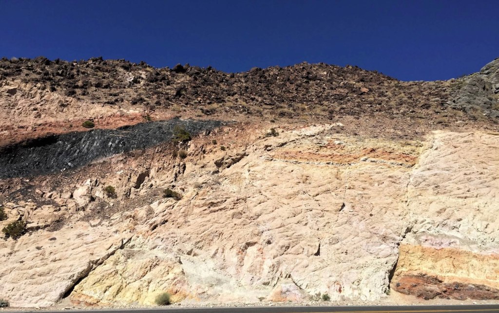
Roadcuts in California, those slices through hills and mountainsides made during the construction of roads, are like open books to geologists. They reveal the intricate and often dramatic geological history of the state. When you drive along the highways of California, you’re likely to pass by these exposed cliffs of rock. To the everyday traveler, they might just be a part of the landscape, but to geologists, they are invaluable windows into the Earth’s past.
““Geologists on the whole are inconsistent drivers. When a roadcut presents itself, they tend to lurch and weave,” wrote the great geology (and many other topics) writer John McPhee in his excellent book Annals of the Former World. “To them, the roadcut is a portal, a fragment of a regional story, a proscenium arch that leads their imaginations into the earth and through the surrounding terrane.”
Glacier carved domes tell the story of thousands of years of glaciation in California. (Photo: Erik Olsen)
Roadcuts expose layers of rock that have been hidden from view for millions of years. Each layer, or stratum, tells a story of what the environment was like when that layer was deposited. By studying these layers, geologists can reconstruct a timeline of events that shaped the region. For example, they can identify periods of volcanic activity, times when the area was submerged under an ancient ocean, or epochs when massive glaciers were carving out the valleys.
California is especially interesting due to its active tectonic setting. It’s not just the San Andreas Fault that captivates geologists; there are numerous lesser-known faults that crisscross the state, and roadcuts can expose these hidden fractures. By studying the composition of rocks along these faults, geologists learn about the nature of past seismic activity and can make predictions about future earthquakes.
The rock composition in California varies widely, offering a rich tapestry of geological history. In the Sierra Nevada, granite roadcuts tell of a time when massive chambers of magma slowly cooled and crystallized deep beneath the Earth’s surface. Elsewhere, roadcuts through sedimentary rocks like sandstone and shale may contain fossils, giving clues about the life forms that once inhabited the region.
The San Gabriel Mountains consist of granite rocks of several kinds and a variety of other crystalline rocks, mainly schists, some of which were originally shales and sandstones but have been altered (metamorphosed) by great igneous intrusions and compression. (Photo: Erik Olsen)
These man-made artifacts also reveal the forces that have shaped California’s diverse landscapes. In roadcuts, geologists might find evidence of powerful geological processes such as metamorphism, where existing rock types are transformed into new types due to high pressure and temperature conditions. For instance, the presence of metamorphic rocks like schist and gneiss can indicate ancient collision zones where Earth’s tectonic plates have crashed together.
The value of California roadcuts is wonderfully illustrated in John McPhee’s “Assembling California.” The book is an excellent narrative that weaves the tale of California’s complex geology with the lives of the geologists who study it. Eldridge Moores, a late prominent geologist from the University of California, Davis (Moores died in 2018), played a significant role in deciphering the geological history of the region, particularly through his fieldwork involving roadcuts.
Roadcut in San Gabriel mountains. (Photo: Erik Olsen)
At the time Eldridge Moores entered the field, the theory of plate tectonics was only beginning to gain traction. In the early 1960s, the idea that continents drifted and that vast slabs of the Earth’s crust moved over the mantle was still controversial, met with skepticism by many geologists trained in older, fixist models. Moores, however, embraced the theory early, recognizing in it an explanation for the chaotic structures he saw in California’s mountain belts. As a young researcher, he studied the Troodos ophiolite in Cyprus, an exposed section of ancient oceanic crust, and realized that similar rock assemblages—serpentinized peridotites, deep-sea sediments, and basaltic lavas—were scattered across California.
“It was a very exciting time. I still get goosebumps even talking about it,” Moores told KQED in 2017. “A turning point, I think it was, in the plate tectonic revolution, that was the watershed of geology.”
With plate tectonics as a guiding framework, Moores understood that these rocks were remnants of vanished oceans, relics of seafloor that had been uplifted and accreted onto the edge of North America. His work helped reveal that much of California had arrived in pieces, a geological patchwork of island arcs, deep-sea basins, and continental fragments welded together by subduction. While others were still debating the validity of plate tectonics, Moores was already applying it, using it to decode the assembly of an entire state.
Eldridge Moores at the Cordelia fault. (Photo: UC Davis)
Moores was renowned for his work on ophiolites, sections of the ocean floor that have been thrust up onto the continent. One of his notable discoveries was the identification of ophiolite sequences in the roadcuts along the highways of the Sierra Nevada. These discoveries were crucial in understanding the ancient tectonic movements that shaped western North America.
Through roadcuts, Moores and his colleagues were able to observe and study the juxtaposition of different rock types, providing further evidence for the theory of plate tectonics. They could literally walk along the cuts and see how different terranes—large packets of rock with a distinct geological history—were stitched together like a geological quilt, offering insight into the past locations of tectonic plates.
Purchase stunning coffee mugs and art prints of iconic California species. Check out our Etsy store.
“Nature is messy,” Moores once told McPhee. “Don’t expect it to be uniform and consistent.”
There are thousands of roadcuts across California, each exposing a fragment of the state’s chaotic geology. The Palmdale Roadcut, a striking geological feature along the San Andreas Fault, has been an invaluable resource for geologists studying the dynamics of this infamous fault line. This natural cut exposes a cross-section of the earth, revealing layers of rock and sediment that have been shifted and shaped by seismic activity over millions of years. The rock here is a chaotic mélange—fault gouge, shattered granite, and twisted layers of sedimentary rock that have been pulverized and ground together by the relentless motion of the Pacific and North American plates. By analyzing these layers, geologists can better understand the history and behavior of the San Andreas Fault, including the patterns of past earthquakes and the movements of tectonic plates. This, in turn, contributes significantly to the broader understanding of seismic risks and aids in preparing for future seismic events.
The Palmdale Road Cut on Hwy 14 in Southern California is a 90-foot slice through swirling sediments that have spent millions of years being squeezed and twisted by the San Andreas fault. Some say that this view of the fault is one of the best in all of California. (Photo: Erik Olsen)
Another geologist, Garniss Curtis, used California roadcuts to study volcanic rocks and their embedded minerals, which allowed for the dating of geologic events with greater precision. His work on the potassium-argon dating method turned roadcuts into time machines, where the age of rocks could be determined with the help of exposed minerals.
One of California’s most well-known roadcuts, the Charlie Brown Outcrop (map), is a favorite among geologists. Located along Highway 178 near the Nevada border, it has been highlighted by geology teacher Garry Hayes, author of the acclaimed Geotripper blog. Hayes says of the roadcut (also known as the Shoshone Roadcut):
“There are really three stories told in this exposure, that of distant ash eruptions, a violent eruption close by, and earthquakes with associated mountain-building.”
Charlie Brown outcrop along highway 178 in California. (Google Maps)
These geologists, among others, have used roadcuts as a means to peel back the layers of time, revealing the processes that have operated to create the state’s diverse geologic scenery. Roadcuts have provided the evidence for groundbreaking theories and have been instrumental in mapping the geological evolution of California. The work of these scientists exemplifies the roadcut’s role as a natural laboratory, a place where Earth’s geologic history is on full display for those who know how to read the rocks.
Moreover, roadcuts are crucial for educating the next generation of geologists. They serve as natural laboratories where students can practice identifying rock types, deciphering the sequence of geological events, and understanding the dynamic forces that continue to shape the Earth.
Roadcuts in California, those slices through hills and mountainsides made during the construction of roads, are like open books to geologists. They reveal the intricate and often dramatic geological history of the state. (Photo: Erik Olsen)
In Assembling California, McPhee remarked that “geologists are like dermatologists: they study, for the most part, the outermost two per cent of the earth. They crawl around like fleas on the world’s tough hide, exploring every wrinkle and crease, and try to figure out what makes the animal move.”
Manmade creations like roadcuts greatly assist geologists in their work. In essence, roadcuts are not just incidental byproducts of infrastructure development; they are key to understanding California’s complex geological evolution. They tell stories of ancient environments, tectonic upheavals, and the slow but inexorable forces that continue to mold the landscape. For geologists in California, the roadcut is a portal into the deep past, offering a tangible connection to the processes that have made the state what it is today.
Towering over Los Angeles like quiet guardians, the San Gabriel Mountains stretch across the northern edge of the city, keeping watch over the busy sprawl below. More than just a dramatic barrier, these mountains are packed with stories of shifting earth, ancient rock, wild weather, and the people who’ve passed through them for thousands of years. They are also a primary source of Southern California beaches. They’re not just a backdrop; they’re a vital part of the region’s identity, full of science, history, and amazing nature.
Part of the Transverse Ranges, a rare east-west trending group of mountains in California, the San Gabriels rise abruptly from the San Gabriel Valley and form a kind of barrier between L.A. and the Mojave Desert. Framed by Interstate 5 to the west and Interstate 15 to the east, the range is anchored on its north side by the famous San Andreas Fault, where the Pacific and North American tectonic plates constantly grind against each other. That ongoing crush is what helped push these peaks up so quickly. Geologically speaking, they’re growing surprisingly quickly.
Side note: The Transverse Ranges also include the Santa Monica Mountains, San Bernardino Mountains, Santa Ynez Mountains, Topatopa Mountains, Tehachapi Mountains, Santa Susana Mountains, and Sierra Madre Mountains.
Inside the range you’ll find the Angeles and San Bernardino National Forests, along with the San Gabriel Mountains National Monument, first established in 2014 and significantly expanded in 2024 to protect more than 450,000 acres of rugged, biodiverse, and culturally significant terrain. (There is excellent hiking in these mountains.) These protected areas include steep canyons, chaparral, rare wildlife, and sites that are important to the history and traditions of Native American communities.
A pool of water from the Arroyo Seco in the San Gabriel Mountain (Erik Olsen)
The rocks here are some of the oldest in the region, but the mountains also tell stories from more recent times: gold miners, early astronomers, hikers, and wildfire researchers. The San Gabriels help shape the weather, store precious snowpack, and remind everyone in L.A. that nature is always nearby and always in motion.
The San Gabriel Mountains offer an impressive rise in elevation, they really kind of explode out of the earth. While the foothills begin at nearly sea level, the highest point in the range is Mount San Antonio, but most people know it as Mount Baldy because, let’s face it, with its distinctive, treeless summit, it looks kind of bald. This peak reaches an altitude of 10,064 feet (3,068 meters). The quick transition from the bustling city to towering peaks is part of the magic of these mountains, a dramatic wall standing guard over downtown Los Angeles.
While the San Gabriels are much smaller in terms of length than, say the Appalachians, they are significantly taller on average. The highest peak in the Appalachians, Mount Mitchell in North Carolina, reaches 6,684 feet (2,037 meters). That’s considerably lower than Mount Baldy in the San Gabriels. The San Gabriels, therefore, boast higher peaks even though they cover a smaller area. However, compared to the Appalachians, which are thought to be billions of years old, the San Gabriel Mountains are relatively young, geologically speaking, and are characterized by rugged and steep features. In essence, being younger, they’ve undergone less erosion.
San Gabriel mountains from La Cañada Flintridge (Photo: Erik Olsen)
To understand the story of the San Gabriel Mountains, we need to embark on a temporal journey spanning millions of years. The mountains’ tale starts about 100 million years ago, during the Mesozoic Era, when massive tectonic plates—the Pacific and North American plates—began to converge. The interaction of these tectonic plates was dramatic, with the Pacific Plate subducting, or diving beneath, the North American Plate. This subduction caused the rocks to melt and, over time, rise to form granitic masses known as plutons.
Rocks of a roadcut in the San Gabriel Mountains (Erik Olsen)
As the ages rolled on, these plutons were uplifted, and the erosion of the surrounding softer rocks exposed the granitic cores, giving birth to the San Gabriel Mountains we see today. The primary rock composition of these mountains is granite, with large-grained crystals of feldspar, quartz, and mica that glitter when the sun kisses their surfaces. These mountains also feature significant deposits of sedimentary rocks, particularly in the lower elevations, which date back to the Mesozoic and Cenozoic eras.
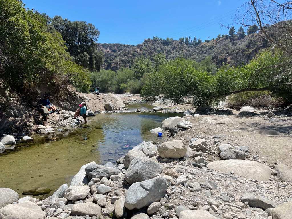
The drainage system of the San Gabriel Mountains is defined by numerous canyons, streams, and arroyos that channel water down from the high elevations into the valleys below. The Arroyo Seco, one of the most well-known waterways, begins near Mount Wilson and flows southwest through Pasadena before merging with the Los Angeles River. Other important streams include the Big Tujunga Creek, which cuts through the mountains to feed into the San Fernando Valley, and the San Gabriel River, which drains much of the range’s eastern side. These waterways are seasonal, swelling during winter rains and spring snowmelt, and often run dry during summer months. Their canyons have been carved by the relentless forces of erosion, creating deep ravines that are vital for wildlife and plant habitats.
Heavy rains cause flooding in the Arroyo Seco near Pasadena. (Erik Olsen)
The San Gabriel Mountains play a critical role in the watershed that serves the greater Los Angeles area. Rain and snowmelt from the mountains replenish groundwater basins and feed into reservoirs, such as the San Gabriel Reservoir and the Morris Reservoir, which are essential for water supply. These mountains act as a natural guidance system, capturing precipitation and funneling it into the region’s aquifers and rivers, supporting both the municipal water supply and flood control efforts. The watershed is crucial for Los Angeles, which depends on these local sources of water to supplement imported supplies from distant regions like the Colorado River and the Owens Valley. The mountain runoff helps maintain the flow of the Los Angeles River, contributing to the city’s efforts to recharge groundwater and ensure a reliable water supply in this semi-arid region.
When it rains it pours, and sometimes causes landslides
Flood control has long been a central concern in managing the water systems of the San Gabriel Mountains, particularly due to the area’s vulnerability to intense, episodic storms. The steep slopes of the mountains funnel rainwater rapidly into urban areas, leading to a heightened risk of flash floods and debris flows. Over time, this led to the construction of a vast network of catchment basins, dams, and debris basins at the foot of the mountains. These basins are designed to capture stormwater runoff, preventing the overflow of water into densely populated areas and managing the sediment and debris that comes with mountain runoff, which can clog waterways and exacerbate flooding.
Catchment basins in the San Gabriel Mountains are critical for controlling debris flows that occur during and after heavy rains, which can be particularly dangerous in areas where wildfires have stripped the landscape of vegetation. When intense rainstorms hit the steep, fire-scarred slopes, they trigger massive torrents of mud, boulders, and tree debris that rush down the mountain canyons toward the urban foothills. These debris flows can overwhelm creeks and spill into residential neighborhoods, causing widespread destruction. The catchment basins are designed to trap this debris before it reaches populated areas, but their effectiveness depends on regular maintenance and clearing. When these basins fill up too quickly or are not properly maintained, debris can overtop them, leading to significant flooding and property damage.
default
A stark example of the dangers posed by debris flows occurred in Montrose in 1934. Following a series of intense storms in the aftermath of the New Year’s Day floods, massive debris flows roared out of the San Gabriel Mountains, devastating the communities of Montrose, La Crescenta, and Tujunga. The floods and debris flows buried homes and roads under several feet of mud and debris, killing at least 45 people. The Montrose landslide became a tragic reminder of the risks associated with living near the San Gabriel Mountains, particularly in the face of severe weather. This event spurred greater investments in flood control infrastructure, including the construction of more robust debris basins to mitigate the effects of future storms.
The San Gabriel Mountains aren’t just a spectacle of natural processes; they’ve also been a silent witness to numerous significant historical events. The grave of Owen Brown can be found in the mountains just outside of La Canada Flintridge. Owen was the third son of abolitionist John Brown, and has a resting place that has stirred intrigue and speculation for generations. Owen’s grave has become a kind of pilgrimage site for those interested in American history.
Locals gather to celebrate the installation of a gravestone honoring abolitionist Owen Brown on January 29, 1898, nearly a decade after his death. Photo: Brown family and Paul Ayers.
Owen Brown was a fervent abolitionist like his father and participated in the famous raid on Harpers Ferry. After the tumultuous events that marked his early life, he moved to California, seeking solace in the west. He settled near El Prieto Canyon and lived a relatively secluded life. After his death in 1889, he was buried on a hillside overlooking the canyon, and his grave was marked with a simple headstone. Over time, nature, vandals, and other factors led to the original headstone’s disappearance, adding a layer of mystique to the grave’s location. However, in 2019, a replica of the gravestone was installed.
Mount Wilson is another historical wonder in the range. Standing at a towering height of 5,710 feet, it’s not just its elevation that sets Mt. Wilson apart. In the early 20th century, the Mount Wilson Observatory was established, and it soon became a hub of astronomical discoveries. It was here that Edwin Hubble, using the Hooker Telescope, provided evidence of the expansion of the universe—a groundbreaking observation that eventually led to the Big Bang Theory.
Infrastructure Marvel: The Angeles Crest Highway The human connection to the San Gabriel Mountains was further cemented with the construction of the Angeles Crest Highway in the 1930s. Spanning approximately 66 miles, this scenic byway was a colossal engineering challenge. Its creation provided access to previously remote regions and breathtaking panoramic views that today lure thousands of tourists and nature enthusiasts. The highway is also one of the highest in Southern California, with a summit of 7,903 feet at the Dawson Saddle.
Angeles Crest Highway roadcut (Photo: Erik Olsen)
Driving on the Angeles Crest Highway is an experience that’s both thrilling and a bit nerve-wracking. Winding and twisting through the mountains, you can come across steep drop-offs, sharp turns, and narrow lanes. With elevation changes ranging from around 1,200 feet to more than 7,900 feet, it’s a route that demands respect and attention from those behind the wheel.
Flora, Fauna, and Natural History: A Biodiversity Hotspot Beyond geology and history, the San Gabriel Mountains are a treasure trove of biodiversity. The montane environment, with its varied elevation and climate zones, has given rise to a rich tapestry of flora and fauna. Iconic trees like the Jeffrey pine, Coulter pine, and California black oak adorn the landscape. Wildflowers paint the meadows in vibrant hues, from the golden yarrow to the scarlet larkspur.
The fauna is just as diverse, with animals like the California condor, bighorn sheep, and mountain lions roaming the rugged terrain. The waters that trickle and rush down these mountains are home to arroyo chubs and Santa Ana suckers.
The California condor is known to inhabit the San Gabriel range
Protection of this vital ecosystem came in the form of the San Gabriel Mountains National Monument designation in 2014, ensuring that the mountains’ rich biodiversity and cultural significance will be preserved for generations.
The San Gabriel Mountains are more than just a scenic backdrop. They reflect the Earth’s active geology, hold key historical moments, and support diverse ecosystems. Amid growing urbanization, these mountains remain a lasting reminder of the interconnectedness of life, history, and natural forces.
California has long been a hub for berry innovation, boasting a rich history of developing countless berry cultivars. While it’s tough to pin down an exact number, the state’s contributions span a wide range of fruits, from strawberries to blackberries to loganberries, raspberries, and even blueberries.
Somewhere in the pantheon of berries, tucked between the familiar blackberry and the enigmatic lingonberry (a Scandinavian staple, just ask the Swedes, or swing by IKEA), you’ll find the boysenberry. With its deep maroon color, plump size, and a flavor that dances between sweet and tart, the boysenberry is a delicious emblem of California’s horticultural creativity. (Who knew we needed yet another berry?) But how did this berry come to be, and what’s the story behind a Southern California amusement park helping to make it famous?
The journey of the boysenberry begins with its namesake, Rudolph Boysen. In the early 1920s, Boysen, a curious California-based farmer and horticulturist, began experimenting with berry plants at his home in Napa, California. His objective? To develop a new hybrid berry that combined the best attributes of the European raspberry, blackberry, American dewberry, and loganberry.
Rudolph Boysen
On relocating to Orange County, he didn’t leave his passion behind; instead, he brought along his precious berry vines, planting them on his in-law’s property in Anaheim, which at that time was a relatively unpopulated expanse dominated by vast orange and lemon groves, interspersed with small farms and ranches.
Between 1921 and 1950, Boysen dedicated his professional life to serving as the Anaheim City Parks superintendent. His persistent efforts bore fruit (ha) in 1923 when his hybrid successfully grafted and flourished. However, while Boysen was successful in creating the berry, he faced challenges in cultivating it on a larger scale. Some years after his initial success, a near-fatal accident sidelined him, and his boysenberry plants began to wither, seemingly destined for obscurity.
Enter Walter Knott, another farmer with an insatiable curiosity and a healthy dose of ambition,. Upon discovering that Boysen had given up his cultivation experiments and sold his property, Knott went in search of the delicious berry. Accompanied by George M. Darrow of the USDA, the duo ventured to Boysen’s former farm. There, amidst an overgrowth of weeds, they discovered a few withering vines clinging to life. Determined to give these vines a new lease on life, they carefully relocated them to Knott’s farm in Buena Park, California. With diligent care and attention, Knott revived these plants, enabling them to thrive and produce fruit once again. As a result, Walter Knott became the pioneering figure in the commercial cultivation of the berry in Southern California. Knott learned about Boysen’s creation and, understanding its potential, sought out the remaining withered vines.
Knott’s Berry Farm
With a blend of horticultural expertise and an entrepreneur’s spirit, Knott not only rescued the dying boysenberry vines but also began cultivating and selling the berries on his own farm, which was located in Buena Park, California.
As the berries grew in popularity, so did Knott’s business. By the 1940s, Knott’s farm had transformed into a bustling destination, offering visitors not just the chance to buy fresh boysenberries and boysenberry products, but also to experience the charm of a recreated ghost town and other attractions. As the business evolved, it gave birth to what is now known as Knott’s Berry Farm, one of the most popular amusement parks in Southern California.
Today, it’s a full-blown amusement park with high-speed roller coasters like GhostRider, a massive wooden coaster, and Silver Bullet, a looping steel ride that twists over the park’s lake. The Timber Mountain Log Ride, one of the park’s most beloved attractions, simulates a journey through a 19th-century logging camp, complete with animatronic lumberjacks and sawmills. It’s a tribute to the massive wooden flumes that loggers once built to move timber from deep in the forest down to the mills and markets. One of the largest of these flumes was at Converse Basin, once home to the biggest contiguous grove of giant sequoias on Earth. That same area became the site of one of the most devastating logging operations in American history, where thousands of ancient sequoias—some millenia old—were cut down in the rush to harvest timber. We did a story about it you can read here. It’s a sobering reminder of how quickly early California’s natural wonders were exploited in the name of progress.
But back to Boysenberries. Let’s finish this one up, shall we?
Biologically, the boysenberry is a testament to the wonders of plant hybridization, showcasing the ability to combine distinct plant species to produce something entirely new. And tasty. The boysenberry isn’t just a product of careful crossbreeding, it’s a classic California story of perseverance, partnership, and a dose of luck. Sunshine helps too. It’s about how a nearly forgotten berry was saved from obscurity by two determined farmers and went on to become a symbol of California itself, thanks in part to the magic of an amusement park.
“Here in Pasadena, it is like Paradise. Always sunshine and clear air, gardens with palms and pepper trees and friendly people who smile at one and ask for autographs.” – Albert Einstein (U.S. Travel Diary, 1930-31, p. 28)
Albert Einstein is often associated with Princeton, where he spent his later years as a towering intellectual figure, and with Switzerland, where he worked as a young patent clerk in Bern. It was in that spartan, dimly lit office, far from the great universities of the time, that Einstein quietly transformed the world. In 1905, his annus mirabilis or “miracle year,” he published a series of four groundbreaking papers that upended physics and reshaped humanity’s understanding of space, time, and matter. With his insights into the photoelectric effect, Brownian motion, special relativity, and the equivalence of mass and energy (remember E=mc2?), he not only laid the foundation for quantum mechanics and modern physics but also set in motion technological revolutions that continue to shape the future. Pretty good for a guy who was just 26.
Albert Einstein spent his later years as a world-famous scientist traveling the globe and drawing crowds wherever he went. His letters and travel diaries show how much he loved exploring new places, whether it was the mountains of Switzerland, the temples of Japan, or the intellectual circles of his native Germany. In 1922, while on his way to accept the Nobel Prize, he and his wife, Elsa, arrived in Japan for a six-week tour, visiting Tokyo, Kyoto, and Osaka.
But of all the places he visited, one city stood out for him in particular. Pasadena, with its warm weather, lively culture, and, most importantly, its reputation as a scientific hub, had a deep personal appeal to Einstein. He visited Pasadena during the winters of 1931, 1932, and 1933, each time staying for approximately two to three months. These stays were longer than many of his other travels, giving him time to fully immerse himself in the city. He spent time at Caltech, exchanging ideas with some of the brightest minds in physics, and fully embraced the California experience, rubbing elbows with Hollywood stars (Charlie Chapman among them), watching the Rose Parade, and even tutoring local kids. Einstein may have only been a visitor, but his time in Pasadena underscores how deeply rooted science was in the city then, and how strongly that legacy endures today. Pasadena remains one of the rare places in the country where scientific inquiry and creative spirit continue to thrive side by side. Pasadena was among the earliest cities to get an Apple Store, with its Old Pasadena location opening in 2003.
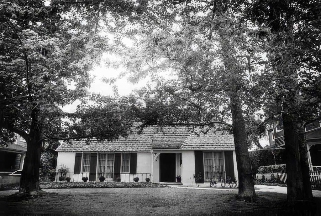
Einstein’s residence at 707 South Oakland Avenue in Pasadena, where he stayed his first winter in California (CalTech Archives)
Few scientists have received the public adulation that Einstein did during his winter stays in Pasadena. As a hobbyist violinist, he engaged in one-on-one performances with the conductor of the Los Angeles Philharmonic. Local artists not only painted his image and cast him in bronze but also transformed him into a puppet figure. Frank J. Callier, a renowned violin craftsman, etched Einstein’s name into a specially carved bow and case.
During his first winter of residence in 1931, Einstein lived in a bungalow at 707 South Oakland Avenue. During the following two winters, he resided at Caltech’s faculty club, the Athenaeum, a faculty and private social club that is still there today.
Yet, the FBI was keeping a watchful eye on Einstein as well. He was one of just four German intellectuals, including Wilhelm Foerster, Georg Nicolai, and Otto Buek, to sign a pacifist manifesto opposing Germany’s entry into World War I. Later, Einstein aligned himself with Labor Zionism, a movement that supported Jewish cultural and educational development in Palestine, but he opposed the formation of a conventional Jewish state, instead calling for a peaceful, binational arrangement between Jews and Arabs.
In front of the Athenaeum Faculty Club, Caltech, 1932. (Courtesy of the Caltech Archives.)
After his annus mirabilis in 1905, Einstein’s influence grew rapidly. In 1919, his theory of relativity was confirmed during a solar eclipse by the English astronomer Sir Arthur Eddington. The announcement to the Royal Society made Einstein an overnight sensation among the general public, and in 1922, he was awarded the 1921 Nobel Prize in Physics. While teaching at the University of Berlin in 1930, Arthur H. Fleming, a lumber magnate and president of Caltech’s board, successfully persuaded him to visit the university during the winter. The visit was intended to remain a secret, but Einstein’s own travel arrangements inadvertently made it public knowledge.
Einstein speaking at the dedication of the Pasadena Junior College (now PCC) astronomy building, February 1931. (Courtesy of the Caltech Archives)
After arriving in San Diego on New Year’s Eve 1930, following a month-long journey on the passenger ship Belgenland, Einstein was swarmed by reporters and photographers. He and his second wife, Elsa, were greeted with cheers and Christmas carols. Fleming then drove them to Pasadena, where they settled into the bungalow on S Oakland Ave.
Albert Einstein and his violin (Caltech Archives)
During their first California stay, the Einsteins attended Charlie Chaplin’s film premiere and were guests at his Beverly Hills home. “Here in Pasadena, it is like Paradise,” Einstein wrote in a letter. He also visited the Mt. Wilson Observatory high in the San Gabriel Mountains. Einstein’s intellectual curiosity extended far beyond his scientific endeavors, leading him to explore the Huntington Library in San Marino, delighting in its rich collections. At the Montecito home of fellow scientist Ludwig Kast, he found comfort in being treated more as a tourist than a celebrity, relishing a brief respite from the spotlight.
In Palm Springs, Einstein relaxed at the winter estate of renowned New York attorney and human rights advocate Samuel Untermeyer. He also embarked on a unique adventure to the date ranch of King Gillette, the razor blade tycoon, where he left with a crate of dates and an intriguing observation. He noted that female date trees thrived with nurturing care, while male trees fared better in tough condition: “I discovered that date trees, the female, or negative, flourished under coddling and care, but in adverse conditions the male, or positive trees, succeeded best,” he said in a 1933 interview.
Not exactly relativity, but a curiosity-driven insight reflecting his ceaseless fascination with the world.
During his three winters in Pasadena, Einstein’s presence was a source of intrigue and inspiration. Students at Caltech were treated to the sight of the disheveled-haired genius pedaling around campus on a bicycle, launching paper airplanes from balconies, and even engaging in a heated debate with the stern Caltech president and Nobel laureate, Robert A. Millikan, on the steps of Throop Hall. Precisely what they debated remains a mystery. (Maybe something about the dates?)
Einstein with Robert A. Millikan, a prominent physicist who served as the first president of Caltech from 1921 to 1945 and won the Nobel Prize in Physics in 1923. (Courtesy of the Caltech Archives.)
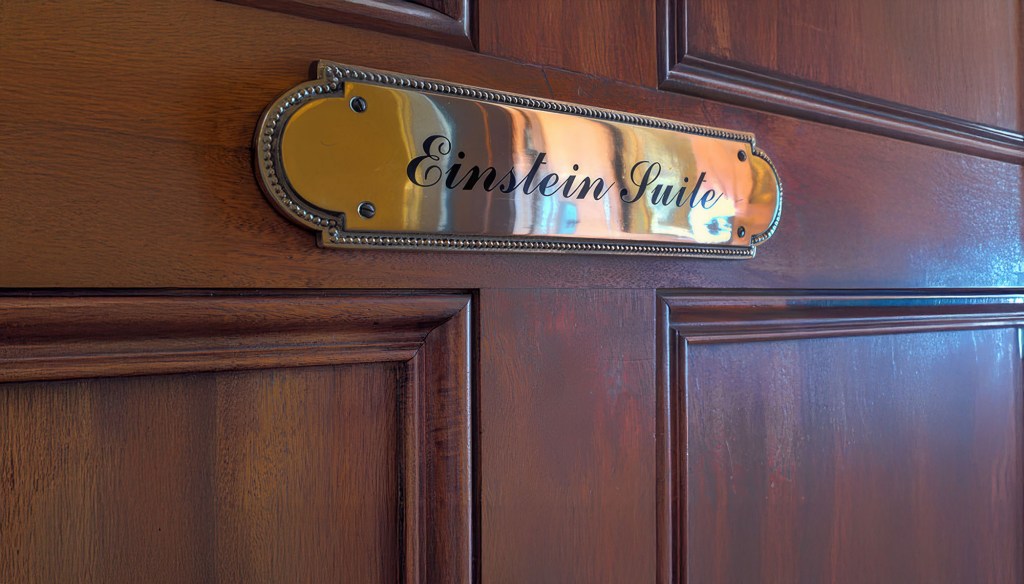
During his final winter in California, a near-accident led the couple to move into Caltech’s Athenaeum. His suite, No. 20, was marked with a distinctive mahogany door, a personal touch from his sponsor, Fleming. In 1933, as Nazi power intensified in Germany, Einstein began searching for a safe place to continue his work. Although Caltech made an offer, it was Princeton University‘s proposal that ultimately won him over. Einstein relocated to Princeton that same year, where he played a significant role in the development of the Institute for Advanced Study and remained there until his death in 1955.
Suite No. 20, Einstein’s mahogany door at the Caltech Athenaeum
Today, a large collection of Einstein’s papers are part of the Einstein Papers Project at Caltech. And Einstein’s suite at Caltech’s Athenaeum, still displaying the mahogany door, serves as a physical reminder of his visits.
During his third and final visit to Caltech in 1933, Hitler rose to power as Chancellor of Germany. Realizing that, as a Jew, he could not safely return home, Einstein lingered in Pasadena a little longer before traveling on to Belgium and eventually Princeton, where he received tenure. He never returned to Germany, or to Pasadena. Yet he often spoke fondly of the California sunshine, which he missed, and in its own way, the sunshine seemed to miss him too.
In 1962, Swiss physicist and deep-sea diving pioneer Hannes Keller embarked on an ambitious and perilous mission to push the boundaries of human endurance and underwater exploration. California, with its dramatic coastline and history of daring maritime ventures, became the setting for this bold effort to make history in diving. Partnered with British diver and journalist Peter Small, Keller aimed to descend inside a specially designed diving bell named Atlantis to an unprecedented depth of 1,000 feet off the coast of Catalina Island. Their plan involved exiting the pressurized diving bell once it reached the ocean floor, a groundbreaking and dangerous procedure that would allow them to perform tasks outside in the extreme depths. What promised to be a historic achievement, however, took a tragic turn.
Keller’s passion for deep-sea diving had recently garnered international attention, fueled by his record-breaking dives and groundbreaking research into advanced breathing gas mixtures. Working alongside Dr. Albert Bühlmann, a renowned physiologist specializing in respiration, Keller employed cutting-edge technology, including an IBM computer, to meticulously design gas formulas that could counteract the dangers of deep diving. Their innovative work addressed the twin challenges of nitrogen narcosis and decompression sickness, promising to revolutionize underwater exploration.
For Keller, diving was initially an unconventional pursuit. He was engaged in teaching mathematics to engineering students in his native town of Winterthur, close to Zurich, and had aspirations to become a pilot. However, the prohibitive cost of flying on a teacher’s salary led him to explore other avenues. Introduced to the burgeoning sport of scuba diving by a friend in the late 1950s, Keller applied his mathematical and scientific acumen to the field. He soon concluded that the existing techniques in deep-sea diving were outdated and ripe for revolutionary advancement.
“If a man could go, for instance, to 1,000 feet down and do practical work,” Mr. Keller wrote in The Sydney Morning Herald, “then all the continental shelf zone could be explored, a total of more than 16 million square miles.”
Keller prepares for his May 1961 chamber dive at the United States Navy Experimental Diving Unit (NEDU). Photo: US Navy
Keller and Bühlmann worked collaboratively to expand their computerized concoction of breathing gases, ultimately selecting a dive site off near Avalon Bay at Catalina Island in Southern California. This location was chosen due to its dramatic underwater geography, where the ocean floor descends sharply from the coast into the deep ocean.
At the time, it was widely believed that no human being could safely dive to depths beyond three hundred feet. That was because, beginning at a depth of one hundred feet, a diver breathing normal air starts to lose his mind due to nitrogen narcosis.
Partnering with Peter Small, co-founder of the British Sub Aqua Club, Hannes Keller planned their historic descent using a specially designed diving bell named Atlantis. This advanced pressurized chamber, deployed from a surface support vessel, was staffed by a skilled technical crew tasked with monitoring gas levels and maintaining constant communication with the divers through a surface-to-bell phone link. The Atlantis diving bell represented a significant leap in underwater technology, providing a controlled environment that allowed divers to venture into previously unreachable depths. Its design and operational success revolutionized the field of deep-sea exploration, offering invaluable insights into human physiology under extreme pressure and laying the groundwork for future advancements in underwater science and technology.
Keller’s experimental dives piqued the interest of the U.S. Navy, as they saw the potential to revolutionize diving safety and practicality. If proven successful, Keller’s methods could transform existing dive tables and enable safer, more practical deep-sea exploration. Encouraged by the promising outcomes of Keller’s preliminary chamber tests and several less extreme open-sea trials, the Navy allowed him to perform a test dive at their primary experimental facility, adjacent to the Washington dive school. They also became a financial supporter of Keller’s ambitious thousand-foot dive.
To carefully scrutinize the operation, the Navy designated Dr. Robert Workman, one of their foremost decompression specialists, to be present on site. A few days after reaching Catalina in late November, Dr. Workman joined Dr. Bühlmann, the rest of Keller’s team, and various onlookers aboard Eureka, an experimental offshore drilling vessel provided by Shell Oil Co. Shell, like other oil and gas enterprises, had a vested interest in innovative techniques that could enhance the productivity of commercial divers. If the dive was successful, the company would receive Keller’s secret air mixture technology and thereby become an instant frontrunner in offshore oil exploration. Their interest was particularly relevant as offshore drilling initiatives were venturing into deeper waters, both off the California shore and in the Gulf of Mexico.
Resembling a huge can of soup, Atlantis stood seven feet tall and had a diameter slightly greater than four feet. Its structure featured an access hatch at the bottom and was adorned with an array of protruding pipes and valves, adding to its industrial appearance.
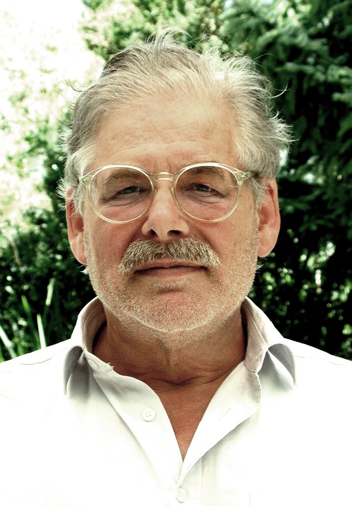
British journalist Peter Small (BSAC)
As a journalist, Peter Small intended to pen a first-hand narrative of the groundbreaking dive. On December 1, as part of a final preparatory dive, Small and Keller were lowered inside Atlantis to a depth of three hundred feet, where they spent an hour scuba diving outside the bell. During the decompression process within the bell, both divers experienced relatively mild symptoms of decompression sickness, commonly known as the bends. Keller felt the effects in his belly, while Small was afflicted in his right arm. Decompression sickness is still a relatively poorly understood phenomenon, and it remains unpredictable as to which part of the body it might affect.
Keller’s symptoms abated on their own that night, but Small’s discomfort lingered until he underwent recompression treatment. Despite this warning sign, Keller was determined to continue with the dive as planned, without conducting further incremental tests at increasing depths before the ambitious thousand-foot descent. His decision was likely influenced, at least in part, by the assembled crowd of journalists and other spectators eager to witness the historic dive. The constraints of time, finances, and equipment availability added to the pressure, compelling the team to proceed with the experimental dive as scheduled.
The diving bell Atlantis is lifted out of the water after Keller and the journalist Peter Small descended 1,020 feet to the Pacific Ocean floor in December 1962.
On Monday, December 3, around noon, Atlantis began its descent beneath the surface of the Pacific, enclosing its two divers within. The journey towards the ocean floor took under thirty minutes. Upon reaching the target depth of a thousand feet, a series of dark and chaotic moments ensued. Keller exited the bell to plant a Swiss flag and an American flag on the ocean floor. In the process, his breathing hoses became entangled with the flags, and after clambering back inside Atlantis, he lost consciousness.
The gas mixture had somehow become compromised. Peter Small also blacked out, despite never having left the diving bell. As Atlantis was hastily ascended to within two hundred feet of the surface, several support divers swam down to meet the bell. Tragically, one of these support divers, Christopher Whittaker, a young man of just nineteen, disappeared without a trace.
Pacific Ocean off Catalina Island (Erik Olsen)
Keller came to roughly a half-hour after the incident, and Small regained consciousness, but it took nearly two hours for him to do so. Upon awakening, Small engaged Keller in coherent questions about what had transpired. He reported feeling cold and, although he retained the ability to speak, see, and hear, he could not feel his legs. Despite not experiencing any pain, he was too weak to stand. Leaning against his Swiss counterpart, he drifted off to sleep as their decompression within the bell continued.
Several hours later, as Atlantis was being transported back to shore to Long Beach from the dive site near Catalina, Keller discovered that Small had ceased breathing and had no pulse. Desperate to revive him, Keller administered mouth-to-mouth resuscitation and cardiac massage, but to no avail. Small was cold and pallid. The remaining pressure inside the bell, about two atmospheres, was hastily released in a frantic effort to get Small to a hospital after being trapped inside Atlantis for eight hours. Tragically, upon arrival, he was promptly pronounced dead.
The Atlantis diving bell (Paul Tzimoulis)
The Los Angeles County coroner identified the cause of death as decompression sickness. An examination revealed that Small’s tissues and organs were filled with Nitrogen gas bubbles. However, Keller contended that other factors, such as a potential heart attack and the panic Small displayed upon reaching the thousand-foot mark, contributed to the tragedy.
Regardless of the underlying causes, the catastrophic dive to thirty atmospheres and the loss of two lives led to a rapid waning of interest in Keller’s previously sensational methods. The potential for failure of this magnitude had been a concern to many in the deep diving community and the day’s events set back research in the emerging field of saturation diving. Even before this event, saturation diving had only tepid support from the Navy, but this made some people loss faith in the technique. Of course, it would not be the end of saturation diving, not by a long shot.
Hannes Keller in his later years. (Credit: Keller, Esther, Niederglatt, Switzerland)
Modern deep-water diving owes much to the groundbreaking experiments of Hannes Keller. His historic dive to 1,020 feet (311 meters) off Catalina Island was a remarkable achievement that captivated the world. Far from being a mere stunt, as some critics claimed, Keller’s dive was a meticulously planned scientific endeavor designed to push the boundaries of human exploration of the ocean depths. This Swiss adventurer’s pioneering work laid the foundation for advances in deep-sea diving techniques, leaving an enduring legacy in the field.
Christopher Swann, a diving historian, said the dive “was a milepost in the sense that it was the first time something like that had been done.”
Keller ended up living a rich and long life, dying on December 1, 2022, at at a nursing home in Wallisellen, Switzerland, near his home in Niederglatt. He was 88.


