The Lost Island of Santarosae off California’s Coast

Santarosae Midjourney rendering

Imagine a massive island off the coast of California roughly thrice the size of Maui, a lush and wild place where miniature mammoths once roamed and ancient humans hunted in the shadows of towering trees. This island once existed and it’s called Santarosae, and while it is gone now, it was once a thriving ecosystem, teeming with life. Its story provides a captivating window into the ever-changing natural history of the California coast region.

During the last Ice Age, approximately 20,000 to 25,000 years ago, when sea levels were significantly lower, Santarosae Island was a single, expansive landmass that now comprises most of California’s Channel Islands. As the cooler Pleistocene climate transitioned into the warmer Holocene (the epoch we are in now), the Earth’s oceans heated and expanded. Continental ice sheets and glaciers melted, releasing vast amounts of water and causing sea levels to rise dramatically.

At its peak, Santarosae was massive—four of today’s Channel Islands (San Miguel, Santa Rosa, Santa Cruz, and Anacapa) were all connected into a single landmass. It spanned around 1,500 square miles, making it a significant feature of the Pacific coast landscape. Today, only remnants remain in the form of those four separate islands, but evidence of Santarosae’s ancient past continues to reveal itself to scientists.

Map depicting the reconstructed geography of Santarosae.

Anacapa was the first to break away, around 10,300 to 10,900 years ago, as rising waters gradually submerged the narrow isthmus that once connected it to the rest of Santarosae. This slow disintegration of the super island was witnessed by the humans already inhabiting the region. Having arrived between 12,710 and 13,010 years ago, possibly even earlier, these early settlers likely traveled by boat, following the “kelp highway“—a rich, coastal ecosystem of underwater seaweed forests stretching from northern Japan and Kamchatka, along the southern shores of Beringia, down the Pacific Northwest, and into Baja California. For these early explorers, Santarosae would have appeared as a land of abundant resources.

One of the island’s most captivating features was its population of pygmy mammoths, found exclusively on Santarosae. Standing between 4.5 to 7 feet tall at the shoulder and weighing around 2,000 pounds, these miniaturized versions of mainland Columbian mammoths were about the size of a large horse and evolved to suit their isolated island habitat (see our story on the island biogeography of the Channel Islands). The reasons for their dwarfism stem from a phenomenon called island rule, where species on islands often shrink due to limited resources and isolation, as well as a shortage of predators. Despite their smaller size, these island-dwelling mammoths likely shared many characteristics with their larger relatives, including a similar body shape, short fur, and a large head. These mammoths roamed Santarosae until they disappeared around 13,000 years ago, coinciding with both climate changes and the arrival of humans.

Pygmy Mammoth excavation on the Channel Islands (NPS)

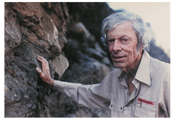
The first discovery of “elephant” remains on Santa Rosa Island was reported in 1873. Over time, additional excavations provided insight into the island’s mammoth population, which gradually became smaller over generations, eventually disappearing at the end of the Pleistocene. Notably, paleontological digs conducted on Santa Rosa Island in 1927 and 1928 unearthed the remains of a new species, Mammuthus exilis. In the 1940s and 1950s, Philip Orr of the Santa Barbara Museum of Natural History recovered further specimens while conducting archaeological and geological work on the island.

CALIFORNIA CURATED ON ETSY

Purchase stunning art prints of iconic California scenes.
Check out our Etsy store.

Most pygmy mammoth remains have been discovered on Santa Rosa and San Miguel Islands, with fewer finds from Santa Cruz Island and even fewer from San Nicolas Island, which lies outside the Channel Islands National Park.

Santarosae was not just a wilderness for megafauna—it was home to some of the earliest known human settlers in North America. Archaeological discoveries, such as the remains of a 13,000-year-old woman unearthed on Santa Rosa Island, point to a sophisticated maritime culture. These ancient humans, likely ancestors of the Chumash people, navigated the waters around Santarosae in plank canoes, hunting seals, birds, and fish, while gathering plants and shellfish.

Archaeologists excavate a anthropological site at the Channel Islands (NPS)

The island provided ample resources, but it wasn’t isolated from the rest of the world. The people of Santarosae were part of a complex trade network that stretched across the California coast. Evidence of these connections can be seen in the tools and materials found on the island, some of which came from distant sources. As sea levels rose, however, these early inhabitants had to adapt to the shrinking island, eventually migrating to the mainland.

Santarosae’s landscape during the Ice Age was strikingly different from what we see on today’s Channel Islands. Dense forests of pines, oaks, and other vegetation covered much of the island, supporting a rich diversity of life. The island’s topography included hills, valleys, and freshwater sources, offering an ideal environment for both humans and animals. As the climate warmed and sea levels rose, the island’s ecology shifted. Forests retreated, and the landscape began to resemble the wind-swept, scrubby terrain seen on the modern Channel Islands.

Anacapa Island today (Erik Olsen)

The rise in sea levels didn’t just transform the landscape; it also altered the ecosystems. Many of the animals, like the pygmy mammoths, couldn’t survive the changing conditions (or human hunters), while new species adapted to the shrinking landmass. Birds, insects, and plant species began to dominate, and the island ecosystems became more specialized.

Today, the remnants of Santarosae offer an invaluable window into the past. The Channel Islands National Park protects much of the area, and researchers continue to uncover clues about the island’s history. Ongoing archaeological digs and ecological studies on the islands help piece together the story of Santarosae’s people, animals, and landscape.

Tourists now enjoy the natural beauty of the Channel Islands (Erik Olsen)

For those who visit the Channel Islands today, it’s hard to imagine the ancient world of Santarosae—a much larger island teeming with life. But the remnants of this lost island still hold secrets waiting to be uncovered, offering a fascinating glimpse into California’s distant past and a reminder of how the forces of nature continually reshape our world.

Though Santarosae is now submerged, its influence is still a significant part of California’s natural history.

California’s Elephant Seals are the Giants of the Golden Coast

Elephant seal in California.

Once teetering on the brink of extinction, the California elephant seal has made an astounding recovery thanks to stringent conservation efforts. But as you’ll read below, their recovery comes with an asterisk. These remarkable creatures, once hunted for their blubber, now thrive along California’s iconic coastline. With their distinctive trunk-like snouts and massive size (They really are huge. I’ve visited the beach near San Simeon several times to photograph them), elephant seals are an incredible sight.

Elephant seals can be seen along the California coast year-round, but specific times are better for different activities. The peak times to observe them are during their breeding season (December to March) and molting season (April to August). During these times, especially from January to March, beaches are filled with males battling for dominance and females giving birth. Outside these seasons, many seals are out at sea, but some can still be spotted during quieter months.

Even considering the animal’s unique appearance, the elephant seal is not just any ordinary seal. Its eating and mating habits are a riveting blend of deep-sea dives in pursuit of prey and intense beachfront battles for dominance during the breeding season.

The species has two main branches: the northern and southern elephant seal. The ones lolling on the California shores belong to the northern branch. Adult males can weigh as much as 2,300 kg (around 5,000 lbs) and can reach up to 14 feet in length. Females, though smaller, play a pivotal role in the seal’s lifecycle.

Baby elephant seal. Photo: NOAA

Elephant seals are deep-sea aficionados, embarking on two major foraging trips each year. To fuel the intense energy demands of mating season, they dive to impressive depths, often around 1,700 feet (518 m), but have been recorded reaching as deep as 5,015 feet (1,529 m). These long dives, sometimes lasting over an hour, help them hunt squids and fishes while also avoiding predators like great white sharks. Only sperm whales dive deeper and longer, showcasing the elephant seal’s mastery of the deep ocean.

The mating habits of the California elephant seal are a spectacle, a mix between The Biggest Loser and UFC. In wintertime, the beaches teem with activity. The males arrive first, establishing territories and preparing to woo potential mates. Skirmishes between rival males are like mixed martial arts battles between extreme heavyweights (ok, I’ll stop). As they fight for dominance and the right to mate, the elephant seal mating ritual can be quite intense. They engage in ferocious body slam battles, using their massive bodies and long proboscises to assert their strength. These skirmishes, often leading to visible scars and wounds, as well as broken bones, are all for the right to mate. The victor, having established his dominance, can then secure a harem of females, while the less dominant males must wait their turn or go without. This intense ritual underscores the seal’s primal drive to ensure its lineage in the face of fierce competition.

Mating battles between elephant seals can be brutal. Photo: NOAA

A 2023 study published in the Royal Society Open Science showed that the mating battles take their toll on the animals, revealing that males with large harems who fought the most, also lived markedly shorter lives.

By the end of the season, successful males might have a harem of up to 50 females. After the mating rituals, females give birth to pups from the previous year’s mating season. The shores become dotted with adorable seal pups, drawing gawkers and photographers from around the globe.

Elephant seal near San Simeon, California. Photo: National Park Service

To catch a glimpse of these magnificent creatures, the California coastline offers several attractive vantage points. Popular spots include Año Nuevo State Park, Point Reyes National Seashore, and Piedras Blancas near San Simeon. Further offshore, the Channel Islands serve as a remote sanctuary for these seals, away from the bustling mainland. Specifically, San Miguel Island and Santa Rosa Island, both part of the Channel Islands National Park, are known hotspots for elephant seal rookeries. These islands provide remote and undisturbed habitats, making them ideal locations for elephant seals to mate, give birth, and molt. 

Elephant seal rookery at Piedras Blancas near San Simeon

The elephant seal, despite its impressive size and strength, is not exempt from the challenges of predation. Great white sharks and orcas, or killer whales, are the primary natural predators of the elephant seal. While younger seals and females are more vulnerable due to their smaller size, even the massive adult males are not entirely safe. Great white sharks tend to target the seals when they’re in deep waters, ambushing them from below. Orcas, on the other hand, have been known to employ strategic hunting techniques to isolate and attack seals, especially near the shorelines. Several rather astonishing videos have been captured of orcas going after elephant seals in the wild.

The threat of these apex predators plays a significant role in shaping the behaviors and migratory patterns of the elephant seal, as they navigate the perilous waters of the Pacific in search of food and safe breeding grounds.

Elephant seals are known to be migratory, traveling thousands of miles across the Pacific. After their foraging trips, they return to their natal beaches to molt, shedding and replacing their fur and the outer layer of their skin.

Elephant seals on the beach at Piedras Blancas near San Simeon. (Erik Olsen)

However, the journey of the California elephant seal hasn’t always been smooth sailing. Over the past 50 years, there have been significant fluctuations in their population. In the late 19th century, they were nearly hunted to extinction for their blubber, which was valuable in oil production. By the end of the 1800s, only a small colony of fewer than 100 seals (some place the number closer to 25) was believed to exist. But here’s where the story takes a hopeful turn. Thanks to robust conservation efforts and protective legislation, their numbers began to rebound. Today, it’s estimated that the population is around 250,000, a testament to what protective measures can achieve. That said, an unknown proportion of elephant seal populations is always at sea, making accurate assessments of total population size is difficult. 

Recent research in 2024 reveals a deeper consequence of this near-extinction event. Genetic analyses show that Northern Elephant seals, while rebounding, still bear “genetic scars.” The dramatic population decline going into the 20th century led to the loss of genetic diversity, raising concerns about inbreeding and potential future vulnerabilities to environmental changes or diseases. However, despite reduced diversity, no immediate health issues have been observed in the species.

Given the many other biological and ecological riches of California (this magazine highlights many of them), the elephant seal owns a precious spot in the pantheon of California’s natural wonders. With their unique lifecycle, impressive size, and dramatic beach battles, elephant seals hold a special place alongside the state’s ancient redwoods, vast deserts, and diverse marine life. Their remarkable comeback from near extinction and the key role they play in coastal ecosystems make them a symbol of resilience and the enduring power of nature to regenerate when given the chance.

How Theodore Roosevelt’s 1903 trip to California gave birth to modern conservation

Theodore Roosevelt and John Muir in Yosemite. Credit: National Park Service

Theodore Roosevelt is our hero. 

The 26th President of the United States was a soldier, a historian, an amateur scientist, a best-selling writer, an avid outdoorsman and much much more. He has been called the “father of conservation,” because, as president, he authorized the creation of 150 national forests, 18 national monuments, 5 national parks, 4 national game preserves, and 51 federal bird reservations. We think he deserves the moniker. 

President Roosevelt and John Muir at the base of the Grizzly Giant.
Credit: Photographer: Joseph Nisbet LeConte; Yosemite NP Archives

But many people may be unaware that TR has a very important California connection. 121 years ago, in 1903, just two years after becoming our nation’s youngest president at the age of forty-two, following the assassination of President William McKinley, Roosevelt embarked on one of the most important Presidential trips in the history of America. 

In 1903, President Theodore Roosevelt embarked on a grand tour of the western United States. At the time, Roosevelt was already known for his passion for the outdoors and his desire to protect the nation’s natural resources. This trip would cement his legacy as a conservationist and lead to the expansion of America’s national parks.

The impact of his trip to California is still being felt today. 

The trip, taken by railroad, took Roosevelt across the American continent. The 3,000-mile journey began in April from Washington D.C., and took TR through twenty-five states, and lasted nine weeks. He traveled through the American West and stopped at Yellowstone National Park for a hiking and camping trip with naturalist and essayist John Burroughs. He continued on and ended up touring a large swath of the state of California, including Yosemite, which had been declared a national park in 1890

Yellowstone National Park (National Park Service)

It was a tenuous time for the American environment. Millions of buffalo had been slaughtered across the plains, often for sport, their carcasses left to rot in the sun. The passenger pigeon, a bird that once filled the skies by the billions, had been exterminated. But America was also in the midst of a nature renaissance, and Roosevelt was one of its pivotal figures. The impact of his trip to California is still felt today. 

Millions of buffalo were slaughtered during the western expansion of the United States (Wikipedia)

In California, Teddy Roosevelt’s journey was a mix of official duties and personal exploration, reflecting his dual role as a statesman and an outdoorsman. After arriving in San Francisco, Roosevelt was greeted with great fanfare, delivering speeches to large crowds and meeting with local dignitaries. His visit to the city included a tour of its bustling port, symbolizing the growing importance of California as a gateway to the Pacific. Roosevelt also visited Stanford University, where he spoke about education, progress, and the future of the American West. His time in the urban centers highlighted California’s rapid development and its significance in the nation’s expansion.

However, the most profound part of Roosevelt’s time in California came during his visit to Yosemite National Park. He met with naturalist John Muir on May 15th, 1903. The meeting took place on a train in the dusty town of Raymond, California, the closest station to Yosemite.  From there, the men traveled 40 miles (about 8 hours) by stagecoach, which gave them the opportunity to get acquainted.  They stopped in Mariposa Grove, where TR saw his first sequoia and had his picture taken driving through the “Tunnel Tree,” which no longer stands.  

That first night, President Roosevelt dismissed his aides and the press, which was unusual for him because he was a publicity hound. In the wilds of Yosemite, he and Muir spent three days “roughing it,” camping beneath the stars and enjoying conversation around a campfire. It was during those conversations that Muir made the case for the preservation of forests and other natural resources. Likely, these talks created the impetus for Roosevelt’s support for the 1906 Antiquities Act, arguably one of the most important pieces of conservation law in the United States.  With the power to proclaim lands as monuments in the public interest, Roosevelt in 1908 set aside some 800,000 acres as Grand Canyon National Monument. Congress later gave it a national park status.

Arguably, no other President has had such a singular impact on protecting American lands, and it’s fair to say, we think, that his visit to California had a lot to do with it. 

Dark Parks in California Allow Us to Reconnect with the Universe

The Milky Way above the Eastern Sierra.

Despite its vast expanse (over 163,000 square miles) California offers surprisingly few places where one can truly gaze upon the night sky in all its glory. Urban light pollution has dimmed the stars across much of the state, making it a rare treat to see more than a handful of celestial points on a clear night. In California’s largest metropolitan areas, like Los Angeles and the Bay Area, the glow from light pollution is so intense that the Milky Way is almost entirely washed out, leaving just the brightest planets and stars visible.

Of course, this is not just a California problem. It’s a sobering reality that underscores a serious global issue: as of 2016, due to artificial lighting, about one-third of humanity could no longer see the Milky Way. Yikes. The problem has only worsened as many cities switch to LED lighting. While LEDs have revolutionized how we light our world and reduced the cost of illumination compared to incandescent bulbs, they have also diminished our ability to see the stars.

Light pollution in Los Angeles as seen from Angeles National Forest (Photo: Erik Olsen)

All that light at night also messes with our lives, interfering with circadian rhythms, leading to sleep disorders, increased stress, and potential long-term health issues such as obesity and cardiovascular disease, according to studies. Artificial light also disrupts ecosystems, affecting nocturnal wildlife by altering their natural behaviors and migration patterns, and can lead to decreased biodiversity. In fact, scientific evidence suggests that artificial light at night has negative and deadly effects on many creatures, including amphibians, reptiles, birds, mammals, insects, and plants.

CALIFORNIA CURATED ON ETSY

Purchase stunning art prints of iconic California scenes.
Check out our Etsy store.

Dark parks in California offer a refuge from light pollution, providing a glimpse into the cosmos that most urban dwellers rarely experience. These parks are sanctuaries for stargazers, astronomers, and anyone longing to witness the majesty of the night sky. Spend a night camping in the Eastern Sierra, and you will know what I mean. There are few experiences in the natural world as profound as gazing into a blanket of millions and billions of stars and pondering the number of other worlds that might exist in the cosmos (it’s pretty much guaranteed there’s more than one, more than just us).

If only there was an organized effort to create and protect areas where darkness reigns. Enter the DarkSky International.

DarkSky International (previously the International Dark-Sky Association), founded in 1988, is dedicated to combating light pollution and preserving night skies through advocacy, education, and promotion of responsible outdoor lighting practices. They designate Dark Sky Places, including parks, reserves, and communities that meet rigorous lighting standards. As of now, there are just two designated Dark Sky Parks in California (see below) and over 130 across the United States. The IDA also works with policymakers to develop lighting regulations, supports scientific research on light pollution, and raises public awareness about the benefits of preserving dark skies for human health, wildlife, and the environment.

Death Valley National Park (Photo: NPS)

Dark skies are categorized using the Bortle Dark-Sky Scale, a system developed by amateur astronomer John E. Bortle to measure how much light pollution affects the visibility of stars and celestial objects. The scale ranges from Class 1, where the sky is pristine and free from artificial light, to Class 9, where the glow of urban lights makes it nearly impossible to see even the brightest stars. In a Bortle Class 1 sky, found in the most remote wilderness areas, you can see the Milky Way as a bright, detailed arc across the sky, along with countless stars and deep-sky objects. By contrast, in a Bortle Class 9 sky, such as in the heart of Los Angeles or New York City, only the moon, a few planets, and a handful of the brightest stars are visible. This scale offers a standardized way for scientists, conservationists, and amateur stargazers to assess the impact of artificial lighting and advocate for the preservation of natural darkness.

The night sky has always been a source of wonder and inspiration. For centuries, humans have looked up at the stars to navigate, tell time, and dream. Dark skies allow us to see celestial phenomena such as meteor showers, the Milky Way, and distant planets. They also foster a connection to the universe, reminding us of our place in a vast and mysterious cosmos. Beyond their aesthetic and inspirational value, dark skies have practical benefits too. They aid scientific research, support wildlife, and even improve human health by regulating our circadian rhythms, say researchers.

California light pollution map.

Advances in technology have revolutionized astrophotography, enabling photographers to capture the night sky in unprecedented detail. High-sensitivity digital cameras, sophisticated telescopes, and powerful image processing software allow for breathtakingly detailed images of celestial phenomena, from the intricate structures of distant galaxies to the ethereal glow of the Milky Way. These advancements have also made time-lapse photography more accessible, leading to a surge in mesmerizing time-lapse videos of the night sky. These videos, widely shared online (I’ve watched scores of them), showcase the dynamic beauty of the cosmos as stars and planets traverse the heavens. They offer viewers an immersive experience that reveals the universe’s grandeur and motion in a way static images cannot. This booming genre draws in audiences and encourages a deeper appreciation for the night sky, as well as the technology that makes stunning visual storytelling possible. Which raises an odd and unsettling question: what does it mean when we can have a better experience of the night sky by looking at a screen than by looking up at the sky itself?

For a glimpse into the latest in astrophotography, the Milky Way Photographer of the Year awards showcase some of the genre’s best work. Now in its seventh year, the competition by Capture the Atlas highlights 25 stunning images selected from over 5,000 entries, offering breathtaking views of our star-studded galaxy from around the world.

But all is not lost dear California friends. Outside the blazing urban megalopolises of Los Angeles/San Diego and San Francisco/San Jose, California boasts numerous places where visitors can escape the pervasive glow of artificial light. Here are a few of the best:

1. Death Valley National Park: Known for its extreme conditions and vast desert landscapes, Death Valley is one of the darkest places in the United States. The park is one of the two designated dark parks in California and the only one in the state classified as a Gold Tier Dark Sky Park. Its remote location and low humidity create ideal conditions for stargazing.The top ranger suggestions for star gazing locations in Death Valley National Park are: Mesquite Flat Sand Dunes, Harmony Borax Works, Badwater Basin and Ubehebe Crater.

2. Joshua Tree National Park: Famous for its unique rock formations and Joshua trees, this park is also a haven for astronomy enthusiasts. This is the second of California’s official dark parks. The park’s rugged terrain and minimal light pollution offer excellent visibility of the night sky. There are four designated stargazing areas in the park. They are the parking lots of Quail Springs, Hidden Valley, Cap Rock, and Ryan Mountain

Night skies ablaze with stars and the Milky Way in Joshua Tree National Park (Unsplash)

3. Anza-Borrego Desert State Park: As California’s largest state park, the 600,000-acre Anza-Borrego Desert State Park provides expansive desert vistas perfect for stargazing. The park is the third and final designated dark park in the state and hosts regular star parties and events to educate the public about the night sky. If you’re looking for a guided tour, check out the Borrego Night Sky Tours.

4. Mount Shasta: If you’re able to go further north, Mount Shasta’s high elevation and clear skies make it a prime spot for observing the stars. The area’s natural beauty adds to the experience of a night under the stars. Everitt Vista Point and Bunny Flat at Mt. Shasta are prime spots for stargazing, along with Lake Siskiyou, Somes Bar, and Shafter Campground. Medicine Lake, near Lava Beds National Monument, also shines in this celestial line-up. Lake Siskiyou offers stunning reflections of the night sky, while Somes Bar and Shafter Campground are known for minimal light pollution and excellent visibility.

5. Pfeiffer Big Sur State Park: Stretching along the central coast, this park offers stunning views of the Pacific Ocean and a dark sky backdrop perfect for stargazing. The park’s coastal location can provide unique opportunities to see the stars reflected in the ocean below.

Pfeiffer Big Sur State Park (Photo: Reddit)

6. Mount Wilson Observatory: Perched atop a 1,740-meter peak in the San Gabriel Mountains, the Mount Wilson Observatory in Southern California, founded in 1904, boasts some of the largest telescopes available for public use. While primarily an educational venue, it offers an exceptional stargazing experience and a chance to delve into astronomy, appealing to both enthusiasts and experts. It’s just above Los Angeles, so, yeah, the skies aren’t that clear, but we have seen the Milky Way up there before. The observatory provides guided and self-guided tours year-round, making it an ideal destination for learning about the cosmos.

7. Oasis. Said to be the darkest place in California, this tiny little farming town tucked in between Death Valley National Park and the Nevada state line is the gateway to some of the best night gazing skies in the California desert. There’s a whole lot of wild area to the south, between Oasis and Ubehebe Crater in DVNP, that boasts skies as dark as any in the United States.

Photo: NASA

Dark parks in California, like Death Valley National Park and Anza-Borrego Desert State Park, offer incredible opportunities to reflect on your place in the cosmos. Beneath the inky blackness of a truly dark sky, the Milky Way stretches across the heavens in astonishing detail, and countless stars shimmer with a clarity that feels almost unreal. Just think about this for a moment: The Milky Way galaxy is home to an estimated 100 to 400 billion stars. And that’s just one galaxy! There are estimated to be between 100 billion and 2 trillion other galaxies out there. I mean, what?! It’s a scale so vast it’s almost impossible to comprehend.

And that’s what makes light pollution so sad and tragic. While we gain comfort and protection in our cities, the light we generate robs us of the chance to truly grasp our place in the universe. We are so small, and yet, as far as we know, we’re the only life out there. That’s a lot more thought-provoking than any Marvel movie (no offense to Marvel fans).

It’s true that the profound experience of stargazing fosters a deeper connection to the natural world and our place within it, reminding us of the wonder and mystery that lie beyond our planet. These are important things to remember. We owe it to ourselves to occasionally step away from the glow of our homes and cities and stand beneath a truly dark sky, where the universe stretches out above in a breathtaking display. In moments of reflection, we appreciate the invaluable gift of darkness, which not only preserves the nocturnal environment but also fuels our curiosity and sense of wonder—just as it has for our ancestors for thousands of years. By celebrating and protecting these dark parks, we ensure that future generations can continue to gaze up in awe, finding inspiration in the endless expanse of the cosmos.

Giants Fallen: The Destruction of Converse Basin Grove and its Giant Sequoias

The true tragic story of one of the worst environmental crimes in California history.

The stump of a Giant Sequoia at Converse Grove in California. (Photo: National Park Service)

“A story of greed and mass destruction of a mighty forest.”

California has faced its share of environmental calamities. We’ve experienced wildfires that have denuded the landscape, destroying valuable forests and homes, and taking human lives. Oil spills have soiled coastlines and killed wildlife. But of all the great environmental crimes the state has faced, perhaps few rank as high as the destruction of Converse Basin Grove in the late 1800s. And yet very few people have ever heard of it.  

Located in the southern part of the Sierra Nevada Mountains east of Fresno, just outside Kings Canyon National Park, Converse Basin Grove spans over 6,000 acres and 700 feet of elevation. The basin was once home to the densest and most majestic expanse of Giant Sequoia (Sequoiadendron giganteum) on the planet. This remarkable concentration of trees was largely due to the basin’s unique combination of geological and climatic conditions.

The grove’s deep, well-draining granitic soils provided a stable foundation for sequoia growth, allowing their extensive root systems to spread and access water efficiently. Additionally, the region’s position in the Sierra Nevada ensured a steady supply of moisture from winter snowfall, which melted slowly into the summer, maintaining the soil’s hydration even during dry months. Sequoias also depend on periodic low-intensity wildfires, which clear competing vegetation, release seeds from their cones, and create the mineral-rich soil conditions necessary for seedlings to establish. This natural fire cycle once maintained the grove’s density, fostering the exceptional concentration of ancient trees that once dominated area.

Loggers and a team of horses pose on a fallen sequoia 26 feet in diameter. Converse Grove, California 1917. (Wikipedia)

Between 1892–1918, the Sanger Lumber Company logged the grove using ruinous clearcutting practices, and cut down 8,000 giant sequoias, some of them over 2000 years old, in a decade-long event that has been described as “the greatest orgy of destructive lumbering in the history of the world.” Only 60-100 large specimens survived.

CALIFORNIA CURATED ON ETSY

Purchase stunning art prints of iconic California scenes.
Check out our Etsy store.

Currently, the most expansive remaining sequoia domain is the Giant Forest in Sequoia National Park, which has an estimated 8,400 giant sequoia trees that are more than one foot in diameter at their bases. The park is home to the world’s biggest tree, the General Sherman

(See our feature on the biology behind the immense size of redwoods and sequoias here.)

General Sherman Tree (Photo: Erik Olsen)

So how did this happen? The Converse Basin grove’s discovery in the late 19th century coincided with a burgeoning demand for lumber in the wake of California’s Gold Rush and subsequent population boom, particularly in San Francisco. A huge portion of early San Francisco was built using redwood. In fact, redwood was the dominant building material in much of 19th-century California, and San Francisco was practically a redwood city.

This demand drew the attention of loggers to the massive potential of sequoias. In particular, the Kings River Lumber Company, which secured this coveted area through both lawful and dubious means shortly after its incorporation in 1888. This marked the first instance of industrial-scale logging targeting the Sierra redwoods, a venture that required substantial initial investment due to the challenges of building a mill in the mountains and the engineering marvel needed to transport the colossal timber to lower elevations.

The 54-mile-long flume, or log conveyor, from Converse Basic Grove to the town of Sanger, about 20 miles from Fresno.
(Photo: National Park Service)

To get the logs to mills from the High Sierra Mountains the SF-based company constructed a 54-mile-long flume, or log conveyor, from Converse Basic Grove to the town of Sanger, about 20 miles from Fresno. This giant wooden waterslide, balanced on trestles along steep canyon sides, allowed lumber to be swiftly transported to the nearest train station, some 60 miles away, in just half a day. Upon reaching the station in Sanger, a town that proudly proclaimed itself the “Flumeopolis of the West,” the lumber was dried, finished and prepared for rail transport to markets across California.

Fun fact: the massive flume later inspired modern amusement park log rides like the Timber Mountain Log Ride at Knotts Berry Farm in Southern California.

High trestle under construction on the Sanger Flume 1905. (Public Domain)

But how did this happen in the first place?

Rugged terrain and unnavigable streams had protected these big trees for decades. That it became possible to log so many magnificent trees in such a hard-to-reach place was due to the passage of one of the most unintentionally destructive environmental laws ever passed in the United States.

In 1878, the United States Congress enacted the Timber and Stone Act to promote the private ownership of timberland and support the logging industry. This legislation permitted individuals to claim federal lands in the Sierra Nevada mountains, acquiring individual parcels of 160 acres for a nominal fee if they simply filed a claim.  Like other land laws of the era, it was also designed to encourage westward expansion by making it easier for settlers and speculators to acquire and develop land in the American West.

Stacks of lumber with workers at Converse Basin (Public Domain)

Prior to this legislation, there was no legal framework allowing individuals to purchase timberland directly from the government specifically for logging purposes, as opposed to agricultural use. However, following the enactment of the law in 1878, it became possible to acquire nonarable, nonmineral public lands at a minimal cost of $2.50 per acre. To claim these 160-acre parcels, the claimant only needed to attest that their intention was to utilize the land for practical, non-speculative purposes, excluding any plans for resale or contractual transfer to another entity.

This enabled the easy transfer of vast expanses of land from the government to lumber companies, which commonly enlisted and compensated individuals to file claims on their behalf. Among these companies was the Kings River Lumber Company, which acquired some of the lands legally, but also got its hands on vast acreages using dubious and illegal tactics that took place right under the noses of government regulators. 

Converse Basin Panorama from 1900. (Photo: National Park Service)

The Timber and Stone Act required buyers to use the land for personal, non-speculative purposes, but the company circumvented these restrictions by using a practice known as “dummying.” In this scheme, the lumber company recruited individuals to act as stand-ins or “dummies” to file claims on parcels of the Converse Basin under the pretense that these claims were for personal use. After securing the claims, these individuals would then transfer the parcels to the Kings River Lumber Company, often for a profit. This allowed the company to amass large areas of prime sequoia forest, much of which was still old-growth timber, under dubious legal pretenses.

Lumber production began in Converse Basin in 1891, launching with 20 million board feet of timber flowing down the flume. But the company had been created through the issuance of massive debt, and the company was under pressure to increase output to become profitable. However, the flume frequently required costly repairs. In 1895, following an unsuccessful reorganization attempt, the firm was taken over by creditors and renamed Sanger Lumber. The new management pushed for maximum production, extending the narrow-gauge railroad deeper into the basin and constructing a new sawmill in 1897.

Cut end of tree showing welded crosscut saws. (Photo: National Park Service)

During its operation, Sanger Lumber was responsible for the felling of approximately eight thousand mature sequoias within the 5,000-acre Converse Basin, leaving only one giant standing. At the northern edge of the grove, overlooking Kings Canyon, loggers spared a single large tree, now among the world’s ten largest, and named it after their foreman, Frank Boole. The Boole Tree still stands today. It is the eighth tallest sequoia in the world and ranks No. 1 in base circumference, at 112 feet. Estimated to be more than 2,000 years old, the behemoth is the largest tree in America’s national forests, but it stands less as a monument to the grandeur of the trees themselves than as a testament to human avarice and recklessness. 

The operation peaked in 1903 with a production of 191 million board feet, employing up to seven hundred men. However, the process was notoriously unsafe and wasteful. Decades later, the superintendent of Sequoia National Park noted the profound damage and inefficiency of the logging, with many fallen trunks left unprocessed, free to decompose over time.

Logging, Converse Basin, near Boole Tree. (Photo: National Park Service)

The entire operation ended without profit, leading to the sale of the company in 1905 and the eventual destruction of the Converse Basin mill. What followed was a period of secondary logging, akin to scavenging, that persisted into the 1910s. In a Harpers’ essay titled The Last Stand of the Redwoods, the Yale English professor Henry Seidel Canby wrote that a visit to the basin evoked a deep sense of melancholy, describing what he saw as “a vast and lonely cemetery”.

By 1905, after depleting the majestic stand of trees without turning a profit, a Michigan lumberman acquired the operation and shifted focus to a lower-elevation, mixed-species forest. The remaining structures at Converse Basin were deliberately burned, and logging continued on a smaller scale, resembling scavenging more than harvesting.

In 1935, the U.S. government repurchased the ravaged land for fifteen dollars per acre, incorporating it into what is now the Giant Sequoia National Monument. This area, marked by fields of blackened stumps and surrounded by new growth, stands as a public testament to the historic exploitation and a somber reminder of the past.

Converse Basin Grove today (Wikipedia)

The devastation of Converse Basin helped to catalyze the conservation movement in the early 20th century. Galvanized by the widespread destruction of such majestic trees, naturalists and conservationists, led by figures like John Muir, began to advocate more vehemently for the protection of natural landscapes. Their efforts were instrumental in the establishment of national parks and protected areas, ensuring that other groves and natural habitats were spared from the fate of Converse Basin.

Today, most remaining sequoia groves are publicly owned and managed for conservation purposes. Giant sequoia forests have faced extensive fire exclusion over the past century and suffer from the lack of frequent low-intensity fires that are necessary for giant sequoia reproduction. The long-term trend of Sierra snowpack reduction, in combination with warmer temperatures and widespread fir, pine, and cedar tree mortality from drought and pests, is greatly increasing the risk of severe fire and threatening the giant sequoia ecosystem. 

U.S. Forest Service wildland firefighters protect Giant Sequoia tree during the Castle Fire in August 2020.
(Photo: US Forest Service)

The 2020 Castle Fire, part of the larger SQF Complex Fire in California, was particularly devastating for the giant sequoia population. Estimates suggest that approximately 7,500 to 10,600 mature giant sequoias were killed by this fire, which represents 10-14% of the total population. These numbers underscore the severe impact of intense wildfires on these ancient trees, which are typically resilient to fire but have been increasingly vulnerable due to factors like drought and climate change. This event has highlighted the need for new strategies in forest management and fire prevention to protect these iconic trees.

Today, the area, with its fields of blackened stumps encircled by new growth, stands as a testament to both the destructive power of industrial logging and the fragility and resilience of nature.

Geologist Thomas Dibblee Jr. and the Theory Behind Pinnacles National Park’s 200-Mile Tectonic Journey

Pinnacles National Park (NPS)

Pinnacles National Park’s open landscape of dramatic rock formations and craggy spires looks otherworldly, especially in golden hour light. But few people who visit the park, located in Central California, southeast of the San Francisco Bay Area, are aware that the rock formations were once at the center of a fierce debate in the history of California geology.  

And at the center of the controversy was a young geologist named Thomas Dibblee Jr. 

Pinnacles National Park, formerly Pinnacles National Monument, tells the story of ancient volcanic activity and the relentless geologic forces of the San Andreas Fault. This fault, a major boundary between the Pacific and North American tectonic plates, is the platform for the dramatic northward journey of the park’s volcanic remnants. Dibblee’s research illuminated how, over millions of years, the landscapes we see today were sculpted by the movements of these tectonic plates and how the shape of California as a state has changed dramatically as a result.

Thomas Dibblee Jr. (Source: Wikipedia)

The crux of Dibblee’s discovery lies in the relationship between Pinnacles National Park and a volcanic source located near present-day Neenach, close to Palmdale in Southern California. The geological narrative that Dibblee pieced together revealed that the rock formations at Pinnacles originated from volcanic eruptions that occurred approximately 23 million years ago, near what is now Neenach. Over millions of years, the relentless movement along the San Andreas Fault has transported these formations over 195 miles (314 kilometers) to their current location. At the time, very few people, geologists included, believed that was possible.

CALIFORNIA CURATED ON ETSY

Purchase stunning coffee mugs and art prints of iconic California scenes.
Check out our Etsy store.

Dibblee had to be wrong. But it turned out, he was not, and his measurements and discovery launched a passionate debate about the speed of geologic forces.

Dibblee’s findings not only shed light on the significant distances that landscapes can travel over geological timeframes but also provided a tangible connection between the theory of plate tectonics and observable geological features. The juxtaposition of Pinnacles National Park and the Neenach volcanic formation serves as a clear indicator of the San Andreas Fault’s role in shaping California’s geological, indeed it’s physical, identity.

Pinnacles National Park (NPS)

A key aspect of Dibblee’s methodology was his keen observational skills, which enabled him to recognize that the rocks at Pinnacles National Park were strikingly similar in composition and age to those near Neenach, even though these areas are separated by about 195 miles (314 kilometers) today. He noted the volcanic origins of these formations and, through detailed mapping, was able to correlate specific rock types and strata between these distant locations.

Another crucial element in Dibblee’s discovery was his understanding of the San Andreas Fault as a major geological feature capable of significant lateral movement (remember the San Andreas is a slip or sliding fault). By correlating the age and type of rocks across this fault line, Dibblee inferred that the only plausible explanation for the similarity between the rocks at Pinnacles and those near Neenach was that they had once been part of the same volcanic field, which had been split and displaced over millions of years due to the movement of the San Andreas Fault.

Rock formations at Pinnacles National Park (Brocken Inaglory)

Dibblee’s work also benefited from the broader scientific context of his time, particularly the emerging theory of plate tectonics in the mid-20th century. This theoretical framework provided a mechanism for understanding how large-scale movements of the Earth’s crust could result in the displacement of geological formations over vast distances. Dibblee’s findings at Pinnacles and Neenach became a compelling piece of evidence supporting the theory of plate tectonics, showcasing the San Andreas Fault’s role in shaping California’s landscape.

But Dibblee’s ideas were controversial at the time. Many in the scientific community were hesitant to embrace a theory that suggested such dramatic movement across the Earth’s crust, partly because it challenged existing paradigms and partly due to the limitations of the geological evidence available at the time. The prevailing theories favored more static models of the earth’s crust, with changes occurring slowly over immense periods. Dibblee’s insights into tectonic movements and the geological history of regions like the Pinnacles National Park were ahead of their time and laid the groundwork for the acceptance of plate tectonics.

This Pinnacles revelation was groundbreaking, emphasizing the dynamic and ever-changing nature of the Earth’s surface. Dibblee’s ability to piece together these monumental shifts in the Earth’s crust from his detailed maps and observations has left a lasting impact on our understanding of geological processes. His work at Pinnacles and the recognition of its journey alongside the San Andreas Fault underscores the importance of detailed geological mapping in unraveling the Earth’s complex history.

San Andreas Fault looking northwest onto the Carrizo Plain (John Wiley)

Born in 1911 in Santa Barbara, California, Dibblee’s life and work were deeply intertwined with the rugged terrains and picturesque landscapes of the Golden State, Dibblee’s journey into geology began at a young age, fostered by his natural curiosity and the geological richness of his native state.

After earning his degree from Stanford in 1936, Dibblee embarked on his professional journey with Union Oil, later moving to Richfield. It was during this period that his extensive field mapping efforts culminated in the discovery of the Russell Ranch oil field near New Cuyama. By 1952, Dibblee had meticulously mapped every sedimentary basin in California with potential for oil, cementing his legendary status as a petroleum geologist. His reputation for traversing the state’s backcountry on foot for extended weeks became a defining aspect of his character and contributed to his storied career in geology. 

Dibblee moved on to a career at the United States Geological Survey (USGS) that would span over six decades, much of it spent with the agency and then later through independent projects. His work ethic and passion for fieldwork were unparalleled; Dibblee was known for his meticulous and comprehensive approach, often spending long days in the field, mapping out California’s complex strata with precision and care.

Over his career, Dibblee mapped over 240,000 square kilometers of California’s terrain, an achievement that provided an invaluable resource for understanding the state’s geological history and structure. He mapped large swaths of the Mojave Desert, the Coast Range and the Los Padres National Forest, earning a presidential volunteer action award in 1983 from President Reagan.

His maps are celebrated for their accuracy and detail, serving as critical tools for academic research, oil exploration, environmental planning, and education. The Dibblee Geological Foundation, established to honor his work, continues to publish these maps, ensuring that his legacy lives on.

Dibblee Map

Dibblee’s insights into the geology of California were pivotal in several areas, including the understanding of the San Andreas Fault, a major fault line that has been the focus of extensive seismic research due to its potential for large earthquakes. Dibblee’s mapping efforts helped to clarify the fault’s characteristics and behavior, contributing to our understanding of earthquake risks in California and aiding in the development of safer building practices and disaster preparedness strategies.

Furthermore, Dibblee’s work shed light on the process of plate tectonics and the geological history of the western United States. His observations and mapping of sedimentary formations and fault systems in California provided empirical evidence that supported the theory of plate tectonics, a cornerstone of modern geology that explains the movement of the Earth’s lithospheric plates and the formation of various geological features.

Thomas Dibblee Jr.’s contributions to the field of geology are not just confined to his maps and scientific discoveries. He was also a mentor and inspiration to many aspiring geologists, sharing his knowledge and passion for the Earth’s history through lectures, field trips, and personal guidance. His dedication to his work and his ability to convey complex geological concepts in an accessible manner made him a respected figure among his peers and students alike. Through his dedication and pioneering work, Dibblee has left an indelible mark on the field of geology, making him a true giant in the scientific exploration of California as well as our planet.

The Ocean’s Invisible Elevator: How Upwelling Fuels California’s Marine Bounty

The Vital Role of Upwelling in California’s Rich Ocean Life

Few marine processes have been as impactful on the abundance of sea life off the coast of California as upwelling. It may not be a term you’ve heard before, but the natural oceanic process of upwelling is one of the most important engines driving climate, biological diversity, and the ocean’s food web. It’s time to pay attention.

In simple terms, upwelling happens when deep, cold, nutrient-laden water moves toward the ocean surface, replacing the warm surface water. Along the California coast, it’s fueled by the California Current, which flows southward, and by prevailing northerly winds. The wind pushes surface water offshore, allowing the deeper water to well up and take its place. This isn’t just an abstract idea; it’s been studied extensively.

In California, upwelling occurs year-round off the northern and central coast. It’s strongest in the spring and summer when northwesterly winds are at their most powerful. Upwelling is reduced in the fall and winter when winds are more variable.

Killer whales benefit from upwelling because the nutrient-rich waters fuel a surge in phytoplankton, which triggers an increase in the populations of smaller prey fish and marine mammals that orcas rely on for sustenance. (Photo: NOAA)

Researchers from institutions like the Scripps Institution of Oceanography and Stanford University have used a variety of methods, including satellite observations and computer modeling, to study upwelling. One of the groundbreaking studies was the CalCOFI program (California Cooperative Oceanic Fisheries Investigations), which began in the late 1940s. It was a joint venture between Scripps and state and federal agencies to investigate the collapse of the sardine fishery. Over decades, it has expanded its scope and now provides invaluable long-term datasets that help scientists understand the dynamics of upwelling and its effects on marine populations.

CALIFORNIA CURATED ART ON ETSY

Purchase stunning art prints of iconic California scenes.
Check out our Etsy store.

The key to understanding the phenomenon of upwelling off the California coast begins with the importance of cold water. In colder regions, nutrients from the deeper layers of the ocean are more readily brought to the surface through various oceanic processes like upwelling, tidal action, and seasonal mixing.

Think of a well-fertilized garden versus a nutrient-poor one. In the former, you’d expect a lush array of plants that not only thrive, but also support a diversity of insect and animal life. Similarly, the nutrient-rich cold waters support “blooms” of phytoplankton, a critical component of the oceanic food web. Phytoplankton are microscopic, photosynthetic organisms that form the foundation of aquatic food webs, producing oxygen and serving as a primary food source for marine life. When these primary producers flourish, it sets off a chain reaction throughout the ecosystem. Zooplankton (tiny ocean-borne animals like krill) feast on phytoplankton, small fish feast on zooplankton, and larger predators, including larger fish, marine mammals, and seabirds, find an abundant food supply in these teeming waters.

Moreover, cold water has a higher capacity to hold dissolved gases like oxygen compared to warm water (one of the reasons that warming seas could be a problem in the future). Oxygen is a key factor for respiration in marine animals. In cold, oxygen-rich environments, organisms can efficiently carry out metabolic processes, which often results in higher rates of feeding, growth, and reproduction, thereby further boosting biological productivity.

A recent study has also shed light on how California’s rich marine ecosystem responds to climate patterns, particularly the El Niño and La Niña phases of the El Niño/Southern Oscillation (ENSO). Scientists found that during El Niño events, warmer waters and weaker upwelling lead to reduced nutrient levels in the California Current, which supports less phytoplankton and affects the entire food web, including fish populations. In contrast, La Niña conditions boost upwelling, bringing nutrient-rich waters to the surface and enhancing marine productivity. This research highlights the far-reaching impacts of climate cycles on ocean life and could help in forecasting changes that affect fisheries and marine biodiversity in California.

Sardines off the coast of California (Photo: NOAA)

Studies have also shown the direct correlation between the intensity of upwelling and the success of fish populations. A study published in the journal “Science Advances” in 2019 explored how variations in upwelling affect the foraging behavior and success of California sea lions. Researchers found that in years with strong upwelling, sea lions didn’t have to travel as far to find food, which, in turn, positively impacted their population’s health.

Upwelling is a critical oceanic process that helps maintain the stable and immensely productive California marine ecosystem, but there are serious concerns that the dynamics behind upwelling could be changing due to climate change.

Of course, upwelling isn’t just a California thing; it’s a global phenomenon that occurs in various parts of the world, from the coasts of Peru to the Canary Islands. But California is like the poster child, thanks to extensive research and its vital role in a multi-billion dollar fishing industry that includes coveted species like albacore tuna, swordfish, Dungeness crab, squid, and sardines.

Inspiration Point Channel Islands (Photo: NPS)

The Channel Islands provide an excellent example of a place off the California coast where the impacts of upwelling and ocean currents are particularly significant. Channel Islands National Park is uniquely located in a “transition zone” of less than 100 km where many ocean currents converge. This results in strikingly different ocean conditions at individual islands and affects where different species are found and how abundant they are.

Long-term studies of upwelling and the California Current system have shed further light on the importance of these complex and ever changing phenomenon. For example, the annual California Current Ecosystem Status Report captures the big picture of the biology, climate, physical, and social conditions of the marine ecosystem. In 2021, the California Current continued a recent cooling trend, with researchers recording the coldest conditions on the continental shelf in nearly a decade. These cooler coastal waters resulted from strong wind-driven upwelling—nutrient-rich, deep ocean water coming to the surface.

Sea surface temperature anomalies across the northeastern Pacific in August, 2019. A marine heat wave spread across the northeastern Pacific Ocean from 2014 to 2016 and the expanse of warm surface water returned to the region in 2019. (NASA Earth Observatory)

But things have grown more precarious in the north and out to sea. For the last ten years, the northeast Pacific Ocean has been a hotspot for marine heatwaves. Just this past year, scientists monitored the seventh most intense marine heatwave in this region since records began in 1982. However, there was a twist in the tale: unlike in previous years, the elevated water temperatures remained further offshore, a phenomenon partly attributable to stronger-than-average coastal upwelling. As a result, the strip of waters closer to the coast was able to maintain its cooler temperatures, thereby preserving a productive environment for marine life.

Visit the California Curated store on Etsy for original prints showing the beauty and natural wonder of California.

Upwelling is a critical oceanic process that helps maintain the stable and immensely productive California marine ecosystem, but there are serious concerns that the dynamics behind upwelling could be changing due to climate change. Warming ocean temperatures and changes in wind patterns could potentially disrupt the timing and intensity of upwelling, putting the bounty of California’s coast at risk.

Understanding these shifts is imperative for devising strategies to mitigate adverse effects on marine life and commercial fisheries. Therefore, sustained research efforts must continue to dissect this complex (and incredibly important) oceanic process and its increasingly uncertain future.