I’m going to keep this week’s article shorter than usual. I want to talk about the ocean. I know I do this a lot; many articles on California Curated are ocean-related (please explore, I think you’ll enjoy them). But that’s because I honestly believe it’s the most important feature on the planet. Protecting the ocean is the most important thing we can do. Let me explain.
The ocean covers more than 70 percent of Earth’s surface. So why do we even call this place Earth? We should call it Planet Ocean. Or Thalassa, from the Greek word for sea.
But it’s not just the size that matters, it’s the ocean’s vast, mysterious depth and the essential role it plays in sustaining life on Earth. The ocean is vital to all living things. Tiny organisms called phytoplankton absorb more carbon dioxide from the atmosphere than any other biological force on the planet. Through photosynthesis, they transform sunlight and carbon into organic matter, forming the base of the marine food web. Despite making up just a fraction of Earth’s plant biomass, phytoplankton are responsible for nearly half of all global carbon fixation. Zooplankton are tiny animals that eat phytoplankton. Zooplankton feed small fish, which feed bigger fish, which feed us. That’s the food chain. It’s literally a scaffolding for all life on earth. And a huge percentage of humanity depends on it to survive. If one link breaks, the whole thing risks collapse.
Phytoplankton (Photo: NOAA)
Which brings me to why I’m writing this. I recently watched the new National Geographic documentary Oceans, narrated by David Attenborough. I love Attenborough. His calm, British-inflected voice has been the backdrop to so much of my science education over the years. He feels like a wise grandfather. Kind, brilliant, and usually right.
In this film, he is absolutely right.
The documentary takes us to places no human has ever seen. In one scene, the team attaches cameras to a deep-sea trawling net. The footage is devastating. These massive nets kill everything in their path. Octopuses, fish, coral, entire ecosystems. Most of the species caught never even make it to market. They are bycatch, considered waste and tossed back into the sea. It’s wasteful, brutal, and legal. These trawlers are still out there, operating at scale, stripping the sea of life.
Bottom Trawling scene from Oceans with David Attenborough (National Geographic)
The film also shows how industrial fishing has hammered fish populations around the world. We are seeing species crash and food chains fracture. According to the Food and Agriculture Organization, nearly 35 percent of the world’s fish stocks are being overfished, a figure that has more than tripled since the 1970s. This kind of collapse has never happened before at this scale. And it is not getting better. We are talking about extinctions. We are talking about systems breaking down.
Friends often tell me the biggest threats to our planet are climate change, pollution, and microplastics. They’re not wrong. All this stuff is connected in a way. But if you ask me what really threatens human survival, it’s the breakdown of ocean ecosystems. If we lose one part of that chain for good, it won’t just be bad. It could be the beginning of the end. And I mean for humans, for organized society, not for all life on earth.
And yet, there is hope.
Kelp bed and bass in a marine protected area (MPA) in California’s Channel Islands (Photo: Erik Olsen)
Like any great documentary, Oceans ends with a sliver of optimism. It brings us back to California. Specifically, to the Channel Islands, one of my favorite places on Earth. I’ve been out there many times, several times recently reporting on ghost lobster traps and exploring. It’s stunning. And there is something very special going on.
Park rangers patrol the waters off the Channel Islands (Photo: Erik Olsen)
Much of the Channel Islands are protected as a Marine Protected Area, or MPA. You can’t fish. You can’t extract. And, most importantly, the rules are enforced. There are rangers out there at most all times patrolling. That part is key. I’ve done stories in places like Belize, Kiribati and Indonesia where the protections exist on paper but don’t work in practice. Kiribati, for instance, established the Phoenix Islands Protected Area, one of the largest MPAs on the planet. But it’s so vast and remote that enforcing its protections is nearly impossible. It’s a good idea on paper, but a cautionary tale in execution. But here in California, the rangers take it seriously. Because of that, the ecosystem is bouncing back. Twenty years after protection began, the kelp, the fish, the invertebrates, they’re thriving. These islands are alive.
California’s MPAs are a model for the world. They prove that if we give the ocean space and time, it will heal. But they remain the exception. They don’t have to be.
Marine Protected Area (MPA) sign in Corona del Mar, CA (Photo: Erik Olsen)
There’s a global movement right now to protect 30 percent of the world’s oceans by 2030. It’s called 30 by 30. Just recently, at the 2025 UN Ocean Conference in Nice, France, more than 70 countries reaffirmed their commitment to the 30 by 30 goal, calling for urgent action to protect ocean biodiversity and create well-managed, effectively enforced MPAs around the world. I’m not naive. I don’t think we’ll hit that goal perfectly. But we are finally moving in the right direction. And we don’t have another option. The ocean is too important.
So I’ll step off the soapbox now and let you enjoy your day. But before you click away, please take a moment to think about the ocean. Think about what it gives us. Think about how it restores us. As a diver, I can tell you there’s nothing like the world beneath the waves. It’s as strange, beautiful, and alien as any other planet we’ve imagined. The creatures there rival anything you’d find in Mos Eisley on Tatooine.
The author filming cuttlefish in Indonesia. Such strange creatures. (Photo: Erik Olsen)
Watch the documentary. Let it educate and inspire you. It might fill you with dread too. But in the end, its message is hopeful. And that message lands right here off the coast of California, the greatest state in the country. Or at least, that’s the opinion of one well-traveled guy with a newsletter about the state he loves.
At Inspiration Point, Yosemite, sticky whiteleaf manzanita tends to occupy south slopes, greenleaf manzanita tends to occupy north slopes. (Photo: NPS)
As an avid hiker in Southern California, I’ve become a deep admirer of the chaparral that carpets so many of the hills and mountains in the region. When I was younger, I didn’t think much of these plants. They seemed dry, brittle, and uninviting, and they’d often leave nasty red scrapes on your legs if you ever ventured off-trail.
But I’ve come to respect them, not only because they’ve proven to be remarkably hardy, but because when you look closer, they reveal a kind of beauty I failed to appreciate when I was younger. I’ve written here and elsewhere about a few of them: the fascinating history of the toyon (Heteromeles arbutifolia), also known as California holly, which likely inspired the name Hollywood and is now officially recognized as Los Angeles’ native city plant; the incredible durability of creosote bush, featured in a recent Green Planet episode with David Attenborough; and the laurel sumac, whose taco-shaped leaves help it survive the region’s brutal summer heat.
Manzanita branches in the high Sierra. The deep red colored bark enhanced by water. (Photo: Erik Olsen)
But there’s another plant I’ve come to admire, one that stands out not just for its resilience but for its deep red bark and often gnarled, sculptural form. It’s manzanita, sometimes called the Jewel of the Chaparral, and it might be one of the most quietly extraordinary plants in California.
If you’ve ever hiked a sun-baked ridge or wandered a chaparral trail, chances are you’ve brushed past a manzanita. With twisting, muscular limbs the color of stained terra cotta and bark so smooth it looks hand-polished, manzanita doesn’t just grow. It sculpts itself into the landscape, twisting and bending with the contours of hillsides, rocks, and other plants.
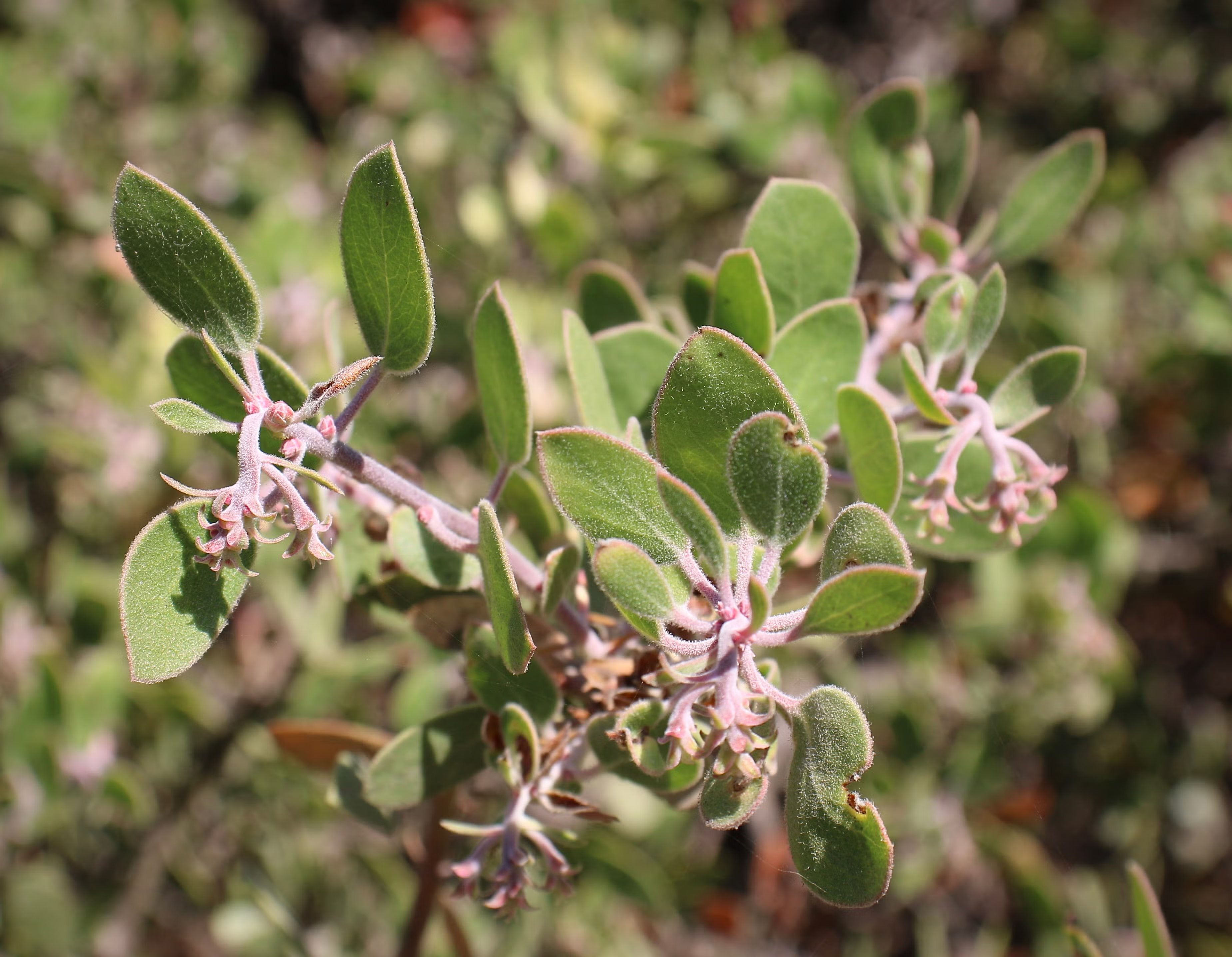
There are more than 60 species and subspecies of manzanita (Arctostaphylos), and most are found only in California. Some stand tall like small trees as much as 30 feet high; others crawl low along rocky slopes. But all of them are masters of survival. Their small, leathery leaves are coated with a waxy film to lock in moisture during the long dry seasons. They bloom in late winter with tiny pink or white bell-shaped flowers, feeding early pollinators when little else is flowering. By springtime, those flowers ripen into red fruits: the “little apples” that give the plant its name.
Manzanita flowers (Santa Barbara Botanical Garden)
One of manzanita’s more fascinating traits is how it deals with dead wood. Instead of dropping old branches, it often retains them, letting new growth seal off or grow around the dead tissue. You’ll see branches striped with gray and red, or dead limbs still anchored to the plant. It’s a survival strategy, conserving water, limiting exposure, and creating the twisted, sculptural forms that make manzanita distinctive.
And fire is key to understanding manzanita’s world. Like many California plants, many manzanita species are fire-adapted: some die in flames but leave behind seeds that only germinate after exposure to heat or smoke. Others resprout from underground burls after burning. Either way, manzanita is often one of the first plants to return to the land after a wildfire, along with laurel sumac, stabilizing the soil, feeding animals (and people), and shading the way for the next wave of regrowth.
Manzanita’s astonishing red bark The reddish color of manzanita bark is primarily due to tannins, naturally occurring compounds that also contribute to the bark’s bitter taste and deter insects and other organisms from feeding on it. (Photo: NPS)
Botanically, manzanitas are a bit of a mystery. They readily hybridize and evolve in isolation, which means there are tiny populations of hyper-local species, some found only on a single hill or canyon slope. That makes them incredibly interesting to scientists and especially vulnerable to development and climate change.
Their red bark is the result of high concentrations of tannins, bitter compounds that serve as a natural defense. Tannins are present in many plants like oaks, walnuts and grapes, and in manzanitas, they make the bark unpalatable to insects and animals and help resist bacteria, fungi, and decay. The bark often peels away in thin sheets, shedding microbes and exposing fresh layers underneath. It’s a protective skin, both chemical and physical, built for survival in the dry, fire-prone landscapes of California.
Whiteleaf manzanita leaves and berries (Photo: NPS)
The plants still have mysteries that are being uncovered. For example, a new species of manzanita was only just discovered in early 2024, growing in a rugged canyon in San Diego County. Named Arctostaphylos nipumu to honor the Nipomo Mesa where it was discovered and its indigenous heritage, it had gone unnoticed despite being located just 35 miles from the coast and not far from populated areas. The discovery, announced by botanists at UC Riverside, highlights that unique species localization, as the plants are found sometimes growing only on a single ridge or in a specific type of soil. Unfortunately, this newly identified species is already at risk due to development pressures and habitat loss. According to researchers, only about 50 individuals are known to exist in the wild, making A. nipumu one of California’s rarest native plants, and a reminder that the story of manzanita is still unfolding, even in places we think we know well.
A new species of manzanita – A. nipumu – was discovered in San Diego County last year (2024), surprising reserachers. (Photo: UCR)
For hikers, photographers, and anyone with an eye for the unusual, manzanita is a cool plant to stumble upon. I will often stop and admire a particularly striking plant. I love when its smooth bark peels back in delicate curls, looking like sunburned skin or shavings of polished cinnamon. It’s hard to walk past a manzanita without reaching out to touch that smooth, cool bark. That irresistible texture may not serve any evolutionary purpose for the plant, but it’s one more reason to wander into California’s fragrant chaparral, where more species of manzanita grow than anywhere else on Earth.
Ghost lobster trap off Santa Cruz Island in California’s Channel Islands (Photo: Erik Olsen)
Lobster is delicious. Let’s just get that out of the way. Yes, I’m sure there are some who either don’t enjoy the taste of this prolific crustacean, or who are allergic, but for my part, lobster (with a small vial of melted butter) is ambrosia from the sea.
But beyond its place on the plate, the California spiny lobster plays a vital ecological role: hunting sea urchins, hiding in rocky reefs, and helping to keep kelp forests in balance. Its value extends far beyond what it fetches at market. But beneath the surface, particularly around the Channel Islands lurks a growing problem that doesn’t just threaten lobsters. It threatens the entire marine ecosystem: ghost traps.
Dive ship Spectre off of Anacapa Island in California’s Channel Islands (Photo: Erik Olsen)
In Southern California, lobster fishing is both a cultural tradition and a thriving industry, worth an estimated $44 million annually to California’s economy from commercial landings as well as recreational fishing, tourism, and seafood markets.
In late April, I traveled to the Channel Islands with my colleague Tod Mesirow to see the problem of ghost lobster traps firsthand. We were aboard the Spectre dive ship and pulled out of Ventura Harbor on an overcast morning, the sky a uniform gray that blurred the line between sea and cloud. The swell was gentle, but the air carried a sense of anticipati on. We were invited by the Benioff Ocean Science Laboratory, which is conducting research and outreach in the area. Our visit took us to Anacapa and Santa Cruz Islands, where I would be diving to observe the traps littering the sea floor. Tod, meanwhile, remained topside, capturing footage and speaking with marine scientists. Even before entering the water, we could see the toll: frayed lines tangled in kelp, buoys adrift, and entire areas where dive teams had marked clusters of lost gear.
California spiny lobsters alive when the ghost trap was recovered (Photo: Erik Olsen)
Ghost traps are lobster pots that have been lost or abandoned at sea. Made of durable metal mesh and often outfitted with bait containers and strong ropes, these traps are built to last. And they do. For years. Sometimes decades. The problem is, even when their human operators are long gone, these traps keep fishing.
“It’s not uncommon to find multiple animals dead inside a single trap,” said Douglas McCauley, a marine science professor at UC Santa Barbara and director of the Benioff Ocean Science Laboratory who was onboard with us and leading the project. “It’s heartbreaking. These traps are still doing exactly what they were built to do, just without anyone coming back to check them.”
Douglas McCauley, director of the Benioff Ocean Science Laboratory at the University of California Santa Barbara holding a lobster caught in a ghost trap off the coast of the Channel Islands (Photo: Erik Olsen)
Around the Channel Islands National Marine Sanctuary, where fishing pressure is high and waters can be rough, thousands of traps are lost every season. Currents, storms, or boat propellers can sever buoys from their lines, leaving the traps invisible and unrecoverable. Yet they keep doing what they were designed to do: lure lobsters and other sea creatures inside, where they die and become bait for the next unfortunate animal. It’s a vicious cycle known as “ghost fishing.”
“They call them ghost traps because, like a ghost sailing ship, they keep doing their thing. They keep fishing.” said McCauley.
Statewide, the numbers are staggering. Approximately 6,500 traps are reported lost off the California coast each fishing season, according to The California Department of Fish and Wildlife. The folks at the Benioff Ocean Science Laboratory said as many as 6,000 may lie off the coast of the Channel Islands alone. Ocean Divers removing marine debris have found traps stacked three and four high in underwater ravines—rusting, tangled, but still deadly. These ghost traps don’t just catch lobsters; they also trap protected species like sheephead, cabezon, octopuses, and even the occasional sea turtle or diving seabird.
Diver and Project Scientist Chase Brewster of the Benioff Ocean Science Laboratory collecting data on ghost lobster traps near California’s Channel Islands (Photo: Erik Olsen)
Nowhere is this more evident than around the Channel Islands. These rugged islands are home to some of California’s richest kelp forests and underwater canyons. The islands and their surrounding waters are home to over 2,000 plant and animal species, with 145 of them being unique to the islands and found nowhere else on Earth. In fact, the Channel Islands are often referred to as North America’s Galapagos for the immense diversity of species here.
The islands are also the site of the state’s most productive spiny lobster fisheries. Every fall, hundreds of commercial and recreational fishers flood the area, setting thousands of traps in a race to catch California spiny lobsters (Panulirus interruptus). But rough swells and heavy gear mean traps go missing. Boats sometimes cut the lines of traps, making them near impossible to retrieve from the surface. And because this region is a patchwork of state waters, federal waters, and marine protected areas (MPAs), cleanup and regulation are anything but straightforward.
California Spiny Lobster off Anacapa Island (Photo: Erik Olsen)
The traps are often difficult to locate, partly because of their remote placement and the notoriously rough waters around the Channel Islands. But the Benioff Ocean Science Laboratory has a powerful asset: side scan sonar. From the ship, they can scan and map the seafloor, where the ghost traps often appear as dark, rectangular shapes against the sand. Once spotted, the team uses GPS to log their exact location.
“It’s creates a picture made of sound on the seafloor and you see these large lego blocks staring at you in bright yellow on the screen and those are your lobster traps,” sayd McCauley. “There’s nothing else except a ghost trap that looks like that.”
Plunging into the frigid waters off Santa Cruz Island was a jolt to the system. Visibility was limited, just 10 to 15 feet, but I followed two scientists from the Benioff Ocean Science Laboratory down to a depth of 45 feet. Their task: to attach a rope to the trap so it could be hauled up by the boat’s winch.
Dive ship Spectre off the coast of Santa Cruz Island in California’s Channel Islands (Photo: Erik Olsen)
The water was thick with suspended particles, the light dimming quickly as we dropped lower. My 7mm wetsuit was just barely enough to stave off the cold. On the seafloor, the ghost trap emerged, a large rectangular cage resting dark and ominous in the sand. And it was teeming with life. Fish darted around its edges, lobsters clambered along the frame, and inside, several animals moved about, trapped and slowly dying. It was easy to see how a single trap could wreak quiet havoc for years.
California law technically requires all lobster traps to include biodegradable “escape panels” with zinc hinges that degrade over time, eventually allowing trapped animals to escape. But enforcement is tricky, and the panels don’t always work as intended. In practice, many traps, especially older or illegally modified ones, keep fishing long after they should have stopped. That’s what we were out here to find.
A baby octopus caught in a ghost trap in the waters off California’s Channel Islands (Photo: Erik Olsen)
Complicating matters is the fact that once a trap goes missing, there’s no easy way to retrieve it. Fishers are not legally allowed to touch traps that aren’t theirs, even if they’re obviously abandoned. And while a few small nonprofits and volunteer dive teams conduct periodic ghost gear removal missions, they can’t keep pace with the scale of the problem.
“At this fishery, we can’t get them all,” says McCauley. “But by going through and getting some species out and getting them back in the water, we’re making a difference. But in the process, we’re coming up with new ideas, new technologies, new research methods, which we think could play a role in and actually stopping this problem in the first instance.”
Once abundant along California’s coast, this large abalone spotted off Santa Cruz Island is a rare sight today—a quiet reminder of how overfishing, disease, and environmental change have decimated their populations. (Photo: Erik Olsen)
Back topside, the recovery team aboard the Spectre used a powerful hydraulic winch to haul the trap onto the deck. After climbing out of the cold water, still shivering, I joined the others to get a closer look. The trap was heavy and foul-smelling, but what stood out most was what was inside: lobsters, maybe ten or more. Some had perished, but many were alive and thrashed their tails when lifted by the scientists. Females could be identified by their broader, flatter tail fins—adapted to hold eggs. The team carefully measured each one before tossing them back into the sea, the lobsters flipping backward through the air and disappearing into the depths.
There were other animals, too. Large, rounded crabs known as Sheep crabs, common to these waters, scuttled at the bottom of the trap. Sea snails were clustered along the mesh, and in one cage, there were dozens of them, clinging and crawling with slow purpose. Even baby octopuses made appearances, slithering out onto the deck like confused aliens. I picked one up gently, marveling at its strange, intelligent eyes and soft, shifting forms, before tossing it back into the sea in hopes it would have another chance at life.
Ghost lobster trap lies on the seafloor off of Santa Cruz Island in California’s Channel Islands (Photo: Erik Olsen)
By then, the day had brightened and the sun had come out, easing the chill that lingered after the dive. The traps would be taken back to Ventura, where they’d likely be documented and disposed of. But this day wasn’t just about saving individual animals or pulling traps off the seafloor—it was about data. The Benioff team wants to understand just how big of a problem ghost traps really are. It’s not just about the number of traps lost each season, but the broader ecological toll: how many animals get caught, how many die, and how these traps alter the underwater food web. Every recovered trap adds a piece to the puzzle. This trip was about science as much as rescue.
State agencies, including the California Department of Fish and Wildlife (CDFW), have started pilot programs aimed at tackling ghost gear. In 2023, CDFW launched a limited recovery permit program that allows fishers to collect derelict traps at the end of the season, provided they notify the state. But participation is voluntary and poorly funded.
Elsewhere, states like Maine and Florida have created large-scale, state-funded programs to identify and remove ghost traps, often employing fishers in the off-season. California, despite having the nation’s fourth-largest lobster fishery, has yet to make a similar investment.
Ghost lobster traps recovered from the seafloor off the coast of California’s Channel Islands (Photo: Erik Olsen)
Some solutions are already within reach. Mandating GPS-equipped buoys for commercial traps could help track and retrieve gear before it’s lost. More robust escape hatch designs, made from materials that dissolve in weeks rather than months, would shorten the lifespan of a lost trap. And expanding retrieval programs with funding from fishing license fees or federal grants could make a big dent in ghost gear accumulation.
But even more powerful than regulation may be public awareness. Ghost traps are out of sight, but their damage is far from invisible. Every trap left behind in the Channel Islands’ waters becomes another threat to biodiversity, another source of plastic and metal waste, and another reminder that marine stewardship doesn’t stop when the fishing season ends.
Key to the whole effort is data:
“Every one of the animals that we put back in the water today, we’ll be taking a measure,” says McCauley. “After a little bit of crunching in the lab, we’ll be able to say, oh, actually, you know, every single trap undercuts the fishery by x percent for every single year that we don’t solve the problem.”
Doug McCauley with a lobster trap retrieved from the seafloor off the coast of California’s Channel Islands (Photo: Erik Olsen)
As we headed back toward Ventura, Tod and I talked with Douglas McCauley and Project Scientist Neil Nathan from the Benioff Ocean Science Laboratory. The team had collected a total of 13 traps that day alone, and 34 over the several days they’d been out. There was a sense of satisfaction on board, quiet but real. Each trap removed was a small win for the ecosystem, a little less pressure on an already strained marine environment.
“I would call today an incredible success, ” said Neil Nathan. “Feeling great about the number of traps we collected.”
California has long been a leader in ocean conservation. If it wants to stay that way, it needs to take ghost fishing seriously, not just around the Channel Islands, but up and down the coast. After all, we owe it to the lobsters, yes, but also to the underwater forests, reef communities, and countless species whose lives are tangled in the nets we leave behind.
Before the late 1960s, understanding Earth’s shifting surface, particularly in a geologically active region like California, was a major scientific challenge. For most of human history, the causes of earthquakes remained an enigma—mysterious and terrifying, often attributed to supernatural forces. In Japan, for example, earthquakes were traditionally believed to be caused by Namazu, a giant catfish said to live beneath the earth and whose thrashing would shake the land. Many societies believed earthquakes were divine punishments or omens, while others considered them an essential part of creation, events necessary to form a world habitable by us humans.
The complexity of California’s landscape, its mountains, valleys, deserts, and intricate network of faults, posed difficulties for early geologists. The land appeared chaotically interwoven, with many different types of rock making up the gaping deserts and soaring peaks. As the great University of California at Davis geologist Eldridge Moores once put it, “Nature is messy. Don’t expect it to be uniform and consistent.”
An image of humans battling a Namazu (Credit: Tokyo University Library. Public Domain)
But there was no overarching explanation for how these earthly features got there. Scientists could observe and record earthquakes, but without a unifying theory, they struggled to piece together the deeper mechanisms driving these powerful events.
This frustration lingered until the late 1960s when an intellectual revolution in geology took shape. Despite the dawn of the space age and the rise of computing power, many earth scientists still clung to the belief that the continents were fixed, immovable features on the Earth’s surface. The breakthrough came with the acceptance of plate tectonics—a theory that elegantly explained not just earthquakes, but the entire dynamic nature of Earth’s surface. And for many geologists, the moment this new understanding solidified was in December 1969, at a groundbreaking conference at the Asilomar Conference Center in California that reshaped the future of the field. (Notably, Asilomar was also the site of the historic 1975 conference on recombinant DNA, where scientists gathered to establish ethical guidelines for genetic research, an event we have explored previously.) This was the moment when plate tectonics, a concept that would fundamentally reshape our view of the planet, truly took hold in the Western American geological community.
At California’s Asilomar Conference Grounds, nestled amid Monterey pines and dramatic granite formations, scientists gathered to rewrite our understanding of tectonics—and reshape how we think about Earth’s restless surface. (Erik Olsen)
For centuries, explanations for Earth’s features ranged from catastrophic events to gradual uplift and erosion, a debate that became known as uniformitarianism versus catastrophism. In California, the sheer complexity of the geology, with its links go far beyond the borders of the state, hinted at powerful forces at play. Scientists grappled with the origins of the Sierra Nevada, the formation of the Central Valley, and the persistent threat of earthquakes along the now-famous San Andreas Fault. The prevailing models, however, lacked the comprehensive framework to connect these disparate observations into a coherent narrative.
The seeds of the plate tectonic revolution had been sown earlier in the 20th century with Alfred Wegener’s theory of continental drift. Anyone looking at a world map or globe could see how the coastlines of certain continents, particularly South America and Africa, seemed to fit together like pieces of a puzzle, suggesting they were once joined. Wegener proposed that the continents were once joined together in a supercontinent called Pangaea and had gradually drifted apart over millions of years. While his ideas were initially met with skepticism, particularly regarding the mechanism that could drive such massive movements, compelling evidence from paleontology, glacial geology, and the jigsaw-like fit of continental coastlines slowly began to sway opinions. The discovery of seafloor spreading in the 1960s (itself a great story, featuring the brilliant geologist and cartographer Marie Tharp) which revealed that new oceanic crust was constantly being generated at mid-ocean ridges and that the ocean floor itself was moving like a conveyor belt, provided the crucial mechanism Wegener lacked.
Heinrich Berann’s 1977 painting of the Heezen-Tharp “World Ocean Floor” map, a landmark in cartography that showed how the earths plates in some areas are pulling apart while others collide. (Library of Congress)
It was against this backdrop of burgeoning evidence that the Geological Society of America convened one of its annual Penrose Conferences in December 1969 at the Asilomar Conference Center in Pacific Grove, California. Titled “The Meaning of the New Global Tectonics,” the event drew structural geologists from all over the world. The geological world changed overnight. A key figure in the conference was William R. Dickinson, a leading structural geologist whose work helped bridge the gap between traditional geological interpretations and the emerging plate tectonic framework. Dickinson’s research on sedimentary basins and tectonic evolution provided critical insights into how plate movements shaped the western United States, further solidifying the new theory’s acceptance.
These conferences were designed to be intimate gatherings where geologists could engage in focused discussions on cutting-edge research. The 1969 meeting proved to be a pivotal one. As UC Davis’ Moores, then a youthful figure who would become a leading voice of the “New Geology” in the West, later wrote, “the full import of the plate tectonic revolution burst on the participants like a dam failure”.
The Palmdale Road Cut on Hwy 14 in Southern California is a 90-foot slice through swirling sediments that have spent millions of years being squeezed and twisted by the San Andreas fault. Some say that this view of the fault is one of the best in all of California. (Photo: Erik Olsen)
Paper after paper presented at the conference demonstrated how the seemingly simple notion of large plates floating atop the Earth’s plastic mantle (the asthenosphere) could explain a vast array of geological phenomena. The location of volcanoes, the folding of mountains (orogeny), the distribution of earthquakes, the shape of the continents, and the history of the oceans all suddenly found a compelling and unified explanation within the framework of plate tectonics. Geologist John Tuzo Wilson famously referred to plate tectonics as ‘the dance of the continents,’ a phrase that captured the excitement and transformative nature of this intellectual breakthrough.
For Moores, the conference was a moment of profound realization. “It was a very exciting time. I still get goosebumps even talking about it,” he told the writer John McPhee. “A turning point, I think it was, in the plate tectonic revolution, that was the watershed of geology.” Moores had been contemplating the perplexing presence of ophiolite sequences – distinctive rock assemblages consisting of serpentines, gabbro/lava, and sediments – found high in the mountains of the West, including California. He suddenly grasped that these strange and “exotic” rock sequences were remnants of ancient ocean floors that had been lifted on top of the continent through the collision of tectonic plates.
Asilomar Conference Grounds Interior (Erik Olsen)
Moores reasoned that the serpentines and coarsely crystalline igneous rocks at the base of these sequences were characteristic of the rocks underlying all the world’s oceans. The “green rocks” in the middle (now the state rock of California) showed evidence of moderate pressure and temperatures, indicating they had been subjected to significant geological forces. By connecting these ophiolite sequences to the processes of plate collision and obduction (where one plate rides over another), Moores provided a powerful piece of evidence for plate tectonics and offered a new lens through which to understand the complex geological architecture of the American West.
His deduction was in line with what is now known about plate tectonics. The geological “confusion” apparent in the Rockies, the Sierra Nevada, and other western mountain chains was now understood as the result of neighboring plates bumping into each other repeatedly over vast geological timescales. The concept of terranes, foreign rock slabs or slices or sequences that have traveled vast distances and become accreted to continents, further illustrated the dynamic and assembly-like nature of California’s geological landscape.
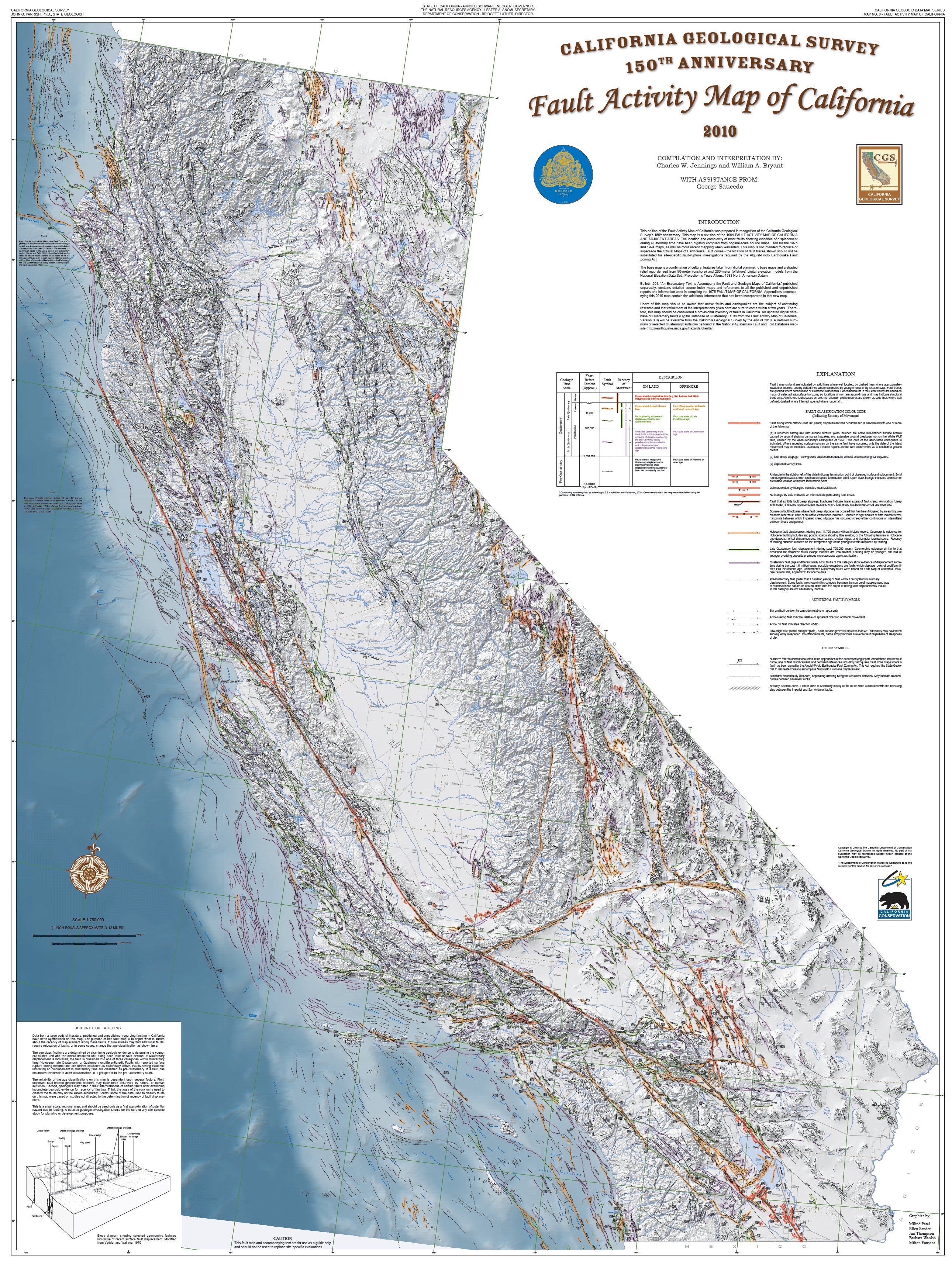
Fault Activity Map of LA Area in California (California Geological Survey) )
California, situated at the active boundary between the massive Pacific Plate and the North American Plate, became a prime natural laboratory for studying the principles of plate tectonics. The San Andreas Fault, a “right-lateral strike-slip fault” where the Pacific Plate slides northward relative to the North American Plate, is a direct consequence of this ongoing tectonic interaction. Places like Parkfield, California, lying directly on the fault, became the center of the seismic universe, offering invaluable opportunities to study the processes of locking and unlocking that precede earthquakes.
The San Andreas Fault at Wallace Creek. On January 9, 1857, the M 7.9 Fort Tejon earthquake occurred just north of the Carrizo Plain. Here, at Wallace Creek, the fault moved 30 feet (9m), forming the offset stream channel seen in the photo. (USGS)
The dramatic offsets of streams like Wallace Creek on the Carrizo Plain vividly demonstrate the horizontal movement along the fault. These offsets, where streams appear abruptly displaced, serve as clear, visual records of the fault’s slip history, showing just how much the land has shifted over time. Further proof of the movement of plates along the fault was uncovered in a remarkable investigation by Thomas Dibblee Jr., a pioneering field geologist who meticulously mapped vast regions of California. One of his most compelling discoveries was the striking geological similarity between rocks found at Pinnacles National Park and those in the Neenach Volcanic Field, located more than 195 miles to the southeast. Dibblee determined that these formations were once part of the same volcanic complex but had been separated by the gradual (but pretty damn quick in geological time) movement of the Pacific Plate along the San Andreas Fault over millions of years.
The insights gained from the plate tectonic revolution, sparked in part by that pivotal conference in Pacific Grove, continue to inform our understanding of California’s geological hazards and history. The work of scientists like Eldridge Moores and the subsequent advancements in the field have provided a robust framework for interpreting the state’s complex and ever-evolving landscape. The 1969 Penrose Conference marked not just a shift in scientific thinking but a fundamental unlocking of some of the Earth’s deep secrets, with California the place, once again, at the center of scientific advance.
The Legacy of One of North America’s Largest Volcanic Eruptions
The Long Valley Caldera is one of the most active volcanic sites in the United States. Here, the Owens River flows through it, winding south through Owens Valley. (Erik Olsen)
Driving up Highway 395 toward Mammoth Lakes is one of the most breathtaking road trips in California. The highway winds through the rugged Eastern Sierra, offering stunning views of snow-capped peaks, alpine meadows, and vast chaparral plains. But beneath this dramatic landscape lurks a hidden danger—an ancient volcanic giant that still stirs beneath the surface.
The Long Valley Caldera in eastern California is an extraordinary geological feature, spanning about 20 miles in length and 11 miles in width. It owes its existence to one of the most dramatic volcanic events in Earth’s history, a supereruption that occurred approximately 760,000 years ago. This event, known as the Bishop Tuff eruption, ejected an estimated 150 cubic miles of molten rock and ash into the atmosphere, far surpassing the 1980 eruption of Mount St. Helens, which released just 0.3 cubic miles of material. The magnitude of the Bishop Tuff eruption resulted in the collapse of the ground above the magma chamber, creating a massive depression known as a caldera. In other words, it’s hard to get your head around how big this eruption was.
The Long Valley Caldera is a striking reminder of Earth’s immense, often hidden, volcanic power and its potential for destruction—located right here in California, near one of the nation’s most popular ski towns, Mammoth Lakes. Geothermal activity, visible in the form of hot springs, fumaroles, and hydrothermal systems, is a constant feature of the landscape. This activity has made the caldera a hub for geothermal energy production, with the Casa Diablo thermal power plant utilizing its subterranean heat to generate electricity. The energy produced at Casa Diablo is enough to power about 36,000 homes, making it an important renewable energy source for the region.
Casa Diablo Geothermal Facility, Long Valley Caldera, California (Erik Olsen)
The surface of the caldera is also marked by the Bishop Tuff, a layer of welded volcanic ash that provides a vivid record of the eruption’s intensity and the pyroclastic flows that reshaped the landscape. Pyroclastic flows are fast-moving, hot clouds of gas and volcanic material that can destroy everything in their path. Often they are considered more dangerous than the lava that pours forth from an erupting volcano. For example, pyroclastic flows killed far more people at Pompeii than lava, as the 79 AD eruption of Mount Vesuvius unleashed fast-moving clouds of superheated gas, ash, and volcanic debris that raced down the slopes at over 100 mph, reaching temperatures above 1,000°F, instantly asphyxiating and incinerating thousands, while the slower-moving lava played a minimal role in fatalities.
Geothermal features at the Long Valley Caldera commonly support microbial communities of thermophilic bacteria and algae, which thrive in the caldera’s hot springs and fumaroles. These organisms not only influence the terrain by contributing to mineral precipitation but also serve as models for studying life in extreme environments, offering analogs for early Earth and potential extraterrestrial ecosystems. Scientists are just beginning to understand how these bacteria live and thrive in deep ocean vent systems. In some areas around the Long Valley Caldera and Mono Lake, mats of thermophilic bacteria and algae thrive around the geothermal features, like the many hot tubs that dot the landscape, forming colorful, textured surfaces. These microbial communities contribute to the unique environment and can even make the ground feel crunchy underfoot, offering a tangible connection to the caldera’s dynamic, living systems.
The Owens River flows through the Long Valley Caldera near Mammoth Lakes, California (Erik Olsen)
While the caldera’s formation was sudden and catastrophic, its story stretches back millions of years. Scientific studies at the Long Valley Caldera have advanced our understanding of volcanic processes, crustal dynamics, and geothermal systems. The Long Valley Caldera sits within the Basin and Range Province, an area of North America characterized by extensional tectonics, where the Earth’s crust is being pulled apart, allowing magma to rise to the surface.
Using seismic tomography, researchers have mapped the magma chamber beneath the caldera, revealing a layered structure with a partially molten zone capped by solidified magma. This configuration, as highlighted in a 2023 study published in Science Advances, helps explain the periodic episodes of unrest observed in the caldera and provides a basis for assessing potential future activity. Before the eruption, the region experienced significant volcanic activity, with lava flows and smaller eruptions setting the stage for what was to come. Even after the formation of the caldera, volcanic activity continued in the area. Rhyolitic lava flows emerged within the caldera, and the nearby Mono-Inyo Craters volcanic chain has seen eruptions as recently as 600 years ago, underscoring the region’s enduring geological vitality.
Horseshoe Lake in the Mammoth Lakes area, where underground carbon dioxide emissions have caused widespread tree die-off (Photo: Erik Olsen)
Another place where the region’s volcanic activity can be experienced firsthand is Horseshoe Lake, where carbon dioxide continuously seeps from the ground, suffocating tree roots and causing a vast die-off of trees. The result is a barren, almost ghostly landscape of skeletal trunks and lifeless ground, a stark reminder that Long Valley’s volcanic system is still active beneath the surface. The area is not just eerie but also hazardous—high concentrations of CO₂ can accumulate in low-lying areas, posing a serious risk to humans and animals. Signs around the site warn visitors of the danger, as pockets of odorless, colorless gas can be lethal if inhaled in high enough doses.
Hot Springs geological site near Mammoth Lakes, California. (Erik Olsen)
The caldera has not been entirely quiet since its dramatic birth. Ground deformation studies, using GPS and InSAR technology (satellites), have tracked uplift in the caldera’s floor, offering critical data on magma movement and hydrothermal activity. In a 2016 study published in Geophysical Research Letters, researchers linked changes in uplift patterns to deeper magmatic processes, reinforcing the importance of continuous monitoring. In 1980, a series of magnitude 6 earthquakes occurred along its southern margin, drawing the attention of volcanologists from USGS. These earthquakes were accompanied by noticeable uplift in the caldera’s floor, a sign of magma movement beneath the surface. Since then, the region has experienced periodic episodes of ground deformation and seismic activity, reminding scientists that the volcanic system beneath Long Valley is far from dormant.
Recent research has provided valuable insights into the caldera’s potential for future activity. While there is currently no indication of an imminent eruption, the area is closely monitored by the United States Geological Survey (USGS). This surveillance includes the measurement of ground deformation, gas emissions, and seismic activity, all of which serve as indicators of changes within the magma chamber. The 1980s unrest heightened awareness of the need for vigilance, particularly in regions where volcanic hazards could affect human populations.
Mono Lake is home to thermophilic (heat-loving) and extremophilic (extreme-condition-loving) bacteria. These microorganisms thrive in the lake’s unusual environment, characterized by high alkalinity, high salinity, and elevated levels of carbonate. (Erik Olsen)
As a result of these studies, the town of Mammoth Lakes took proactive measures to ensure public safety. Local authorities constructed an emergency evacuation route to serve as an escape in the event of a volcanic eruption or other natural disaster stemming from the Long Valley Caldera. After local businesses and residents expressed concerns that the original name implied danger, it was changed to Mammoth Scenic Loop to emphasize the area’s beauty and appeal. The United States Geological Survey (USGS) also intensified its monitoring efforts, implementing a color-coded alert system to communicate volcanic activity risks.
Beyond its scientific significance, the Long Valley Caldera is a destination for outdoor enthusiasts and other researchers. Numerous hot springs dot the landscape and are immensely popular among tourists and residents. Mammoth Lakes is one of California’s top recreational spots, providing amazing opportunities to hike and fish during the summer and excellent skiing in the winter months. For geologists, the caldera serves as a natural laboratory, providing an opportunity to study volcanic processes in a setting shaped by one of the most powerful eruptions in recent geological history.
The eastern Sierra reflected in Little Alkali Lake near the Long Valley Caldera (Erik Olsen)
Of course, there remain certain dangers to all this volcanic activity. On April 6, 2006, three members of the Mammoth Mountain ski patrol tragically lost their lives after falling into a volcanic fumarole near the summit. The incident happened while they were conducting safety operations to secure a snow-covered geothermal vent following an unprecedented snowfall. If you’ve ever skied Mammoth before, there is a distinct sulphurous smell around the Christmas Bowl ski run at Chair 3 near McCoy Station.
Steam from an active fumarole near McCoy Station on Mammoth Mountain in 2012. (Flickr)
Standing at the center of the Long Valley Caldera, surrounded by the remnants of a prehistoric supereruption, offers a profound sense of scale and wonder. The vastness of the caldera, framed by the Sierra Nevada and dotted with geothermal vents, creates a landscape that feels alive yet ancient. It’s amazing place to be, both during the day and at night when the stars spread out across the gaping Sierra sky. The ground beneath your feet, shaped by cataclysmic forces, whispers of Earth’s power and the quiet persistence of geological time. Yet beneath the surface, the processes that shaped it continue to evolve, as magma slowly shifts and geothermal systems release heat from the planet’s interior. As research continues and technology advances, the Long Valley Caldera will undoubtedly yield further insights into the intricate workings of our planet’s volcanic systems.
Here’s another article exploring some of California’s native plants. With a remarkable abundance of flora, California is home to over 6,500 species that play a vital role in shaping its diverse and iconic landscapes.
While hiking through the chaparral-covered hills of Southern California, from the Santa Monica to the San Bernardino and San Gabriel Mountains, you’ll encounter a rich variety of plants, each adapted to thrive in the harsh, dry conditions. Some of them will inevitably be foreign, as California’s mild Mediterranean climate is a perfect incubator for invasive species. But there are many indigenous plants (aka: endemic) that are touchstones of resilience, survivors that thrive here and help make the California chaparral ecosystem incredibly diverse and hearty. Among these is the laurel sumac, a stalwart of the coastal sage scrub, its waxy, aromatic leaves adapted to withstand the sun-baked hillsides and dry seasons that define so much of California’s natural landscape.
Laurel sumac (Malosma laurina) is a large, rounded evergreen shrub or small tree that can grow up to 20 feet tall and wide. When in bloom (late spring through summer), it gives off a strong, aromatic scent that can be very pleasant. The plant is native to southern California and Baja California, and is also found on the southern Channel Islands.
The plant is characterized by lance-shaped leaves with reddish veins and stems, adding a touch of color to the landscape. Laurel sumac has a unique ability to curl its leaves upward when exposed to extreme heat. This reduces the surface area exposed to the sun, minimizing water loss and preventing overheating. This trait has earned the plant the nickname “taco plant,” as its leaves often fold up like a taco shell. The clusters of small white flowers that bloom at the tips of its branches resemble lilac blossoms. After blooming, the small, creamy-white flowers develop into clusters of tiny, reddish-brown, berry-like fruits known as drupes. Each drupe contains a single seed and is covered with a thin, leathery skin.
From a hike in the San Gabriel Mountains. Most of the large clumpy bushes are Laurel sumac (Erik Olsen)
Although named “laurel” for its resemblance to bay laurel, laurel sumac actually belongs to the cashew family (Anacardiaceae). This family includes other well-known plants like poison oak, mango, and pistachio, highlighting the diverse characteristics within this botanical group. Laurel sumac is a vital species in the coastal sage scrub and chaparral ecosystems, offering habitat and food for wildlife. Its berries are particularly enjoyed by songbirds, including warblers. The plant blooms from late spring to early summer, producing clusters of small, white flowers that attract various pollinators, including bees and butterflies.
After flowering, it produces small, reddish-brown fruits that are a food source for birds and other wildlife. Interestingly, the shrub’s ability to thrive in the arid conditions of Southern California, combined with its distinctive red stems and fragrant blooms, make it a key contributor to the region’s natural beauty and biodiversity.
Laurel sumac along a trail in the San Gabriel Mountains (Erik Olsen)
The plant is amazingly drought-tolerant, with deep roots that allow it to access water during dry periods, making it a critical species in fire-prone environments. In fact, its ability to quickly resprout after fire is one reason it’s so prevalent in chaparral communities.
Laurel sumac is also notable for its role in traditional indigenous practices. Native peoples of the region used various parts of the plant for medicinal purposes, including treating skin conditions and respiratory ailments. Known as “ektii” by the Kumeyaay people, Laurel sumac held a prominent place in their traditional practices. The Kumeyaay are indigenous to the region that spans southern California, including San Diego County, and northern Baja California, Mexico. After childbirth, a tea or wash made from the plant was used for its soothing and medicinal properties, demonstrating its role in maternal care.
Laurel sumac with its fragrant white blossoms.
Beyond its medicinal uses, the sturdy wood of laurel sumac was utilized in construction, reflecting its practical value to the Kumeyaay. In a modern twist, the dried flower clusters of the plant have found a niche in model railroading, where enthusiasts often paint them and use them as miniature trees to create realistic landscapes.
Laurel sumac is just one of the many incredible native plant species that contribute to California’s rich biodiversity. Its abundance in some of the southern mountain ranges makes it a quintessential part of the landscape and an essential topic when exploring native flora. Stay tuned as we continue to highlight more species that make California such a unique and extraordinary place.
When we step outside and see wildlife, we often think of it as unchanging. A bird on a branch, a crab in a tide pool, a lizard skittering across a sidewalk. It feels timeless. But in truth, these animals are evolving, slowly and steadily, right in front of us. As climates become more unpredictable, habitats shift, food sources change, and nature adapts. This is especially true in our cities. Built over just the past few centuries, these sprawling human environments are reshaping the natural world and pushing wildlife to adjust in new and often surprising ways.
As California’s cities have expanded and encroached upon natural landscapes, it turns out the state’s wildlife is adapting in fascinating ways. Studying these changes is central to urban evolution, or how species adapt over time, both genetically and behaviorally, to the unique pressures of city life. From coyotes navigating traffic to birds adjusting their songs to be heard over city noise, urban evolution reveals how nature is not just surviving in cities, but evolving with them. Darwin believed natural selection was too slow to observe in real time, but today we know evolution can happen rapidly, sometimes within just a few generations.
Thanks for reading California Curated Newsletter! Subscribe for free to receive new posts and support my work.
Dark-eyed junco in Southern California (Photo: Alex Fu)
One cool example of urban evolution in California is the story of the dark-eyed junco (Junco hyemalis), a small songbird traditionally found in mountainous forests that is now thriving in urban environments like San Diego and Los Angeles. If you’re a birder or simply someone who enjoys watching the wildlife in your backyard, you’ve almost certainly seen them. Dark-eyed juncos are small songbirds with distinctive dark heads, often spotted hopping around on the ground rather than perching at feeders. I see them all the time, pecking at the spilled seeds beneath my feeder (or, I should say feeders, as I have several…nerd alert!). It turns out they’re classic ground foragers, evolved to search for food by scratching through leaf litter or snow, uncovering seeds, insects, and other hidden bits.
Recent research has revealed that dark-eyed juncos are evolving in direct response to urban life. Traditionally migratory, these birds once spent summers breeding in cool mountain forests and winters at lower elevations. But in the early 1980s, a group of juncos broke from that pattern and settled year-round on the campus of UC San Diego. There, researchers began documenting striking behavioral shifts. The urban juncos were bolder, less fearful of humans, and had even altered their mating and nesting habits. These changes, observed over just a few decades, offer a vivid example of how quickly species can adapt to city environments, a real-time case study in urban evolution unfolding in human-shaped habitats.
University of California San Diego (Photo: Erik Olsen)
Similarly, at the University of California, Los Angeles (UCLA), a junco population has been thriving for decades, with numbers reaching approximately 300. This long-term success has provided the Yeh Lab at UCLA with a unique opportunity to study how urban environments influence the evolution and behavior of these adaptable songbirds. Their research sheds light on how juncos have adjusted to city life, offering broader insights into wildlife resilience in human-altered habitats.
“It’s impressive how rapidly these vertebrate species can evolve. In a matter of a handful of years, we can find some pretty significant changes,” Pamela Yeh, an associate professor in ecology and evolutionary biology at UCLA, told California Curated. Yeh studied the junco population at UC San Diego when she was an undergraduate student there and wanted to expand the research to the population at UCLA. Studying the two different populations may offer insights into how species evolve in urban environments.
“We want to know, does a city make you evolve?” asks Yeh. “Do the different cities make you evolve similarly? Do the birds all become smaller? Do they all become bigger? Do they all have different-sized beaks? Or is each city unique?”
Dark-eyed junco at UCLA (Photo: Sierra Glassman)
With decades of data, the work echoes the groundbreaking research of Princeton scientists Peter and Rosemary Grant, whose studies of Galápagos finches transformed our understanding of how swiftly natural selection can operate. Now, the junco studies are taking that idea further, showing evolution unfolding not on remote islands, but in the heart of our cities.
“I think it’s now really considered a model vertebrate system for urban evolution,” says Yeh.
In their natural forest environments, juncos breed in response to the changing seasons, triggered by increasing daylight hours and rising temperatures. But in urban areas like those around UCSD and UCLA, where food is plentiful year-round, juncos have begun breeding earlier than normal and throughout the year. They build nests higher off the ground, often on artificial structures, and have increased the number of clutches per breeding season. The availability of artificial light, abundant food from human sources, and fewer natural predators in the city all play roles in these behavioral shifts.
Yeh believes it’s no accident that junco populations have surged on college campuses in recent decades. In fact, she sees it as a direct response to the unique conditions these urban environments provide.
“We think it is is partially that [urban university environments] mimic the natural environment, which is a mix of meadows and tall trees. But the other thing that we think could be important is the irrigation in grassy areas that allow the juncos, even when it’s extremely hot, there are still small insects and worms to grab and feed their offspring.”
One of the most striking adaptations among urban juncos is their behavioral shift in regards to people. Unlike their shy mountain counterparts, urban juncos are much more tolerant of human presence. This is not only a matter of convenience; it’s a survival mechanism. In the city, humans are not a threat, and urban birds need to capitalize on the resources provided by their proximity to people. Their lack of fear “allows them to keep eating even when we walk by,” says Yeh.
Dark-eyed junco in Southern California (Photo: Alex Fu)
Studying junco evolution isn’t just a scientific curiosity. It has real conservation stakes. Things haven’t been looking good for birds. An October 2019 study published in Science by the Cornell Lab of Ornithology revealed that North America has lost nearly 3 billion birds over the past 50 years, with dark-eyed juncos alone declining by 168 million. Yet their ability to adapt to urban life suggests they may have the evolutionary tools needed to weather these dramatic changes.
Beyond behavior, there are physical differences between urban and rural populations of dark-eyed juncos. Urban juncos, for example, developed duller black plumage on their heads and showed reduced white markings in their tail feathers. Yeh and her team have also documented that the wings of urban juncos are smaller, an adaptation likely driven by the demands of maneuvering through a dense, built environment rather than long-distance flight.
Ellie Diamant, currently a Ph.D. candidate in the Department of Ecology and Evolutionary Biology at UCLA in the Yeh Lab, holding a dark-eyed junco. (Photo: Ellie Diamant)
“Juncos historically were migratory birds. The ones that live in the mountains still are. But in the urban environments, we see them year-round,” says Dr. Ellie Diamant, Visiting Assistant Professor at Bard College. “So the benefits are gone for the longer-distance flight, but there seems to be more benefit for these short wings.” Diamant completed her Ph.D. in the Department of Ecology and Evolutionary Biology at UCLA in the Yeh Lab.
The dark-eyed junco is just one example of the broader phenomenon of urban evolution, where species adjust to the challenges and opportunities posed by city life. In California, this phenomenon extends beyond birds. Coyotes, for example, have become fixtures in cities like Los Angeles, adapting to scavenge food from human waste. Coastal animals like sea lions and pelicans have also made urban waterfronts their home, thriving amid the bustle of human activity. Similarly, the Western Fence Lizard has swiftly adapted to life in an urbanized environment.
Junco hatchlings at UCLA. (Photo: Sierra Glassman)
In his book Darwin Comes to Town, Dutch evolutionary biologist Menno Schilthuizen highlights the junco as an exemplar of rapid evolution in urban settings, but it also goes much further, documenting how our manmade environments are accelerating and changing the evolution of the animals and plants around us. Of course, it’s not all good news. Not by a long shot.
Studies published in Evolutionary Applications, underscore that urbanization is a double-edged sword, offering opportunities for adaptation but also introducing serious threats. In Los Angeles, for instance, the fragmentation of habitat by highways has led to the deaths of countless animals, a problem now being tackled through the construction of wildlife bridges like the Wallis Annenberg Wildlife Crossing opening in 2026, designed to reconnect critical migration routes.
Wallis Annenberg Wildlife Crossing currently under construction (Photo: State of California)
The dark-eyed junco’s ability to adapt to city life is both encouraging and a bit sobering. It shows how some wildlife can adjust and find ways to thrive even as human development spreads. But it also reflects the growing pressure we’re putting on natural ecosystems. In other words, it’s not all good, and it’s not all bad. As scientists dig deeper into urban ecology in California and elsewhere, the junco stands out as a clear example of how life shifts and changes in response to the world we’re shaping.
For those of us who live in cities, the juncos flitting through parks, pecking in our yards, and hopping across college campuses offer a chance to see evolution happening right in front of us. Nature isn’t some distant thing beyond the city limits. It’s here, threaded into the daily patterns of urban life.


