How a 1969 Meeting at Asilomar Made California the Center of the Plate Tectonics Revolution
In December 1969, geologists gathered at Asilomar in Pacific Grove, and plate tectonics finally clicked. How the theory explained California’s earthquakes, mountains and jumbled rocks.
Updated
It’s hard to believe now, but until the late 1960s, geologists couldn’t really explain why California has earthquakes. For most of human history, nobody could. In Japan, people blamed Namazu, a giant catfish living underground whose thrashing shook the land. Other cultures saw earthquakes as divine punishment or omens.
California was especially confusing. Its mountains, valleys, deserts and tangle of faults are made of a jumble of rock types that don’t seem to belong together. As the great University of California at Davis geologist Eldridge Moores once put it, “Nature is messy. Don’t expect it to be uniform and consistent.”
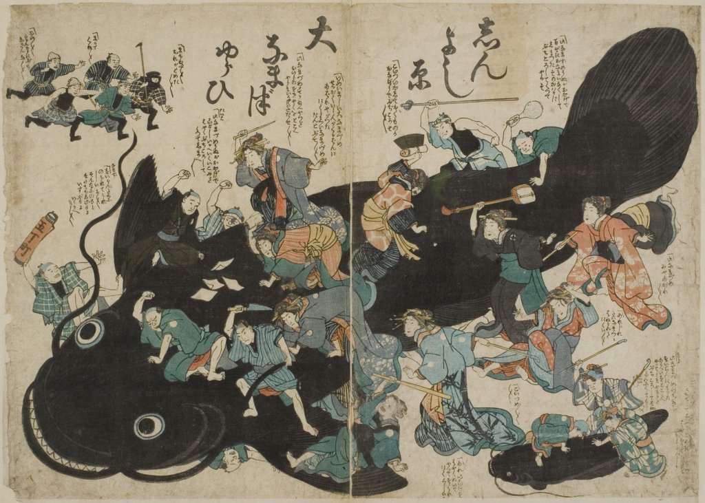 An image of humans battling a Namazu (Credit: Tokyo University Library. Public Domain)
Scientists could measure earthquakes, but they had no big theory explaining what caused them or how the landscape got built.
Even as humans were heading to the moon, many earth scientists still believed the continents were fixed in place. Then, in the late 1960s, came a revolution: plate tectonics, a theory that explained not just earthquakes but almost everything about the shape of the Earth’s surface. And for a lot of geologists, the moment it all clicked came in December 1969, at a conference at the Asilomar Conference Center in California. (Asilomar, by the way, was also the site of the historic 1975 conference on recombinant DNA, where scientists gathered to establish ethical guidelines for genetic research, an event we have explored previously.)
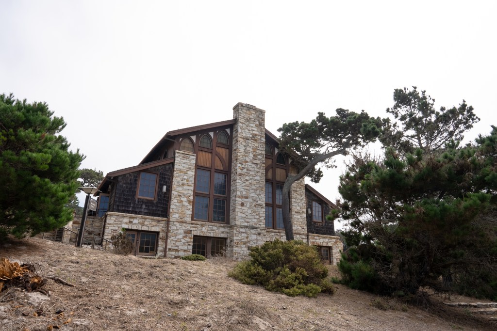 Asilomar Conference Grounds in Pacific Grove, where geologists met in 1969. (Erik Olsen)
For centuries, geologists had argued about whether the Earth was shaped by sudden catastrophes or slow, steady change, a fight known as uniformitarianism versus catastrophism. In California, they puzzled over where the Sierra Nevada came from, how the Central Valley formed and why the San Andreas Fault kept shaking. Nothing tied it all together.

The idea had been around since the early 1900s, with Alfred Wegener’s theory of continental drift. Anyone looking at a globe can see that South America and Africa fit together like puzzle pieces. Wegener argued that the continents had once been joined in a supercontinent called Pangaea and had slowly drifted apart. Most geologists rejected it, mainly because nobody could explain what would push continents around. Then came seafloor spreading in the 1960s (a great story in itself, starring the brilliant geologist and mapmaker Marie Tharp). New ocean crust is constantly being made at mid-ocean ridges, and the seafloor moves away from them like a conveyor belt. That was the engine Wegener had been missing.
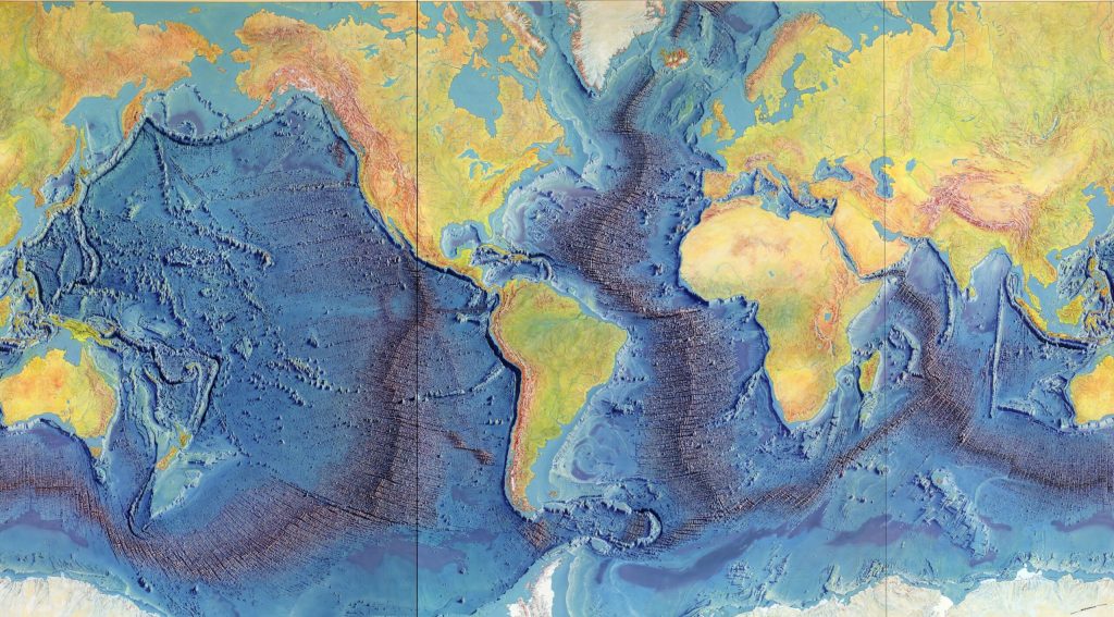 Heinrich Berann’s 1977 painting of the Heezen-Tharp “World Ocean Floor” map, a landmark in cartography that showed how the Earth’s plates in some areas are pulling apart while others collide. (Library of Congress)
It was against this backdrop of burgeoning evidence that the Geological Society of America convened one of its annual Penrose Conferences in December 1969 at Asilomar, in Pacific Grove. It was called “The Meaning of the New Global Tectonics,” and it brought geologists from around the world. One of the organizers was William R. Dickinson, whose research on sedimentary basins helped show how plate movements had shaped the western United States.
Penrose conferences are small, focused meetings, and this one turned out to be historic. As Moores, then a young geologist who would become a leading voice of the “new geology” in the West, later wrote, “the full import of the plate tectonic revolution burst on the participants like a dam failure.”
 The Palmdale Road Cut on Hwy 14 in Southern California is a 90-foot slice through swirling sediments that have spent millions of years being squeezed and twisted by the San Andreas fault. Some say that this view of the fault is one of the best in all of California.
(Photo: Erik Olsen)
Talk after talk showed how one simple idea, big rigid plates riding on the soft, slowly flowing layer of the mantle (the asthenosphere), could explain where volcanoes are, how mountains get folded up, where earthquakes happen, the shapes of the continents and the history of the oceans. Pioneers like the Canadian geologist J. Tuzo Wilson had already worked out key pieces, and now it all fit.
For Moores, it was a lightbulb moment. “It was a very exciting time. I still get goosebumps even talking about it,” he told the writer John McPhee. “A turning point, I think it was, in the plate tectonic revolution, that was the watershed of geology.” He had been puzzling over strange ophiolite sequences, stacks of rock with serpentine at the bottom, then gabbro and lava, then ocean sediments, found high in the mountains of the West, including California. He suddenly realized they were slices of ancient ocean floor that had been shoved up onto the continent when plates collided.
 Asilomar Conference Grounds Interior (Erik Olsen)
The serpentine (now California’s state rock) and coarse igneous rocks at the bottom matched what lies under the oceans, and the “green rocks” in the middle, altered lava called greenstone, showed they’d been squeezed and heated along the way. By tying ophiolites to plate collisions and obduction, where a slab of ocean crust is pushed up over a continent, Moores gave plate tectonics a powerful piece of evidence and gave geologists a new way to read the West.
Suddenly the jumble made sense. The “confusion” in the Sierra Nevada, the Rockies and other western ranges was the result of plates crashing together again and again over millions of years. Geologists started talking about terranes, chunks of crust that traveled long distances before getting stuck onto the edge of the continent. California, it turned out, was assembled piece by piece.
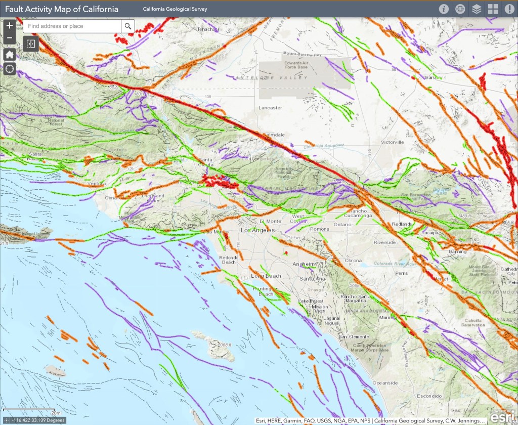 Fault Activity Map of LA Area in California (California Geological Survey)
)
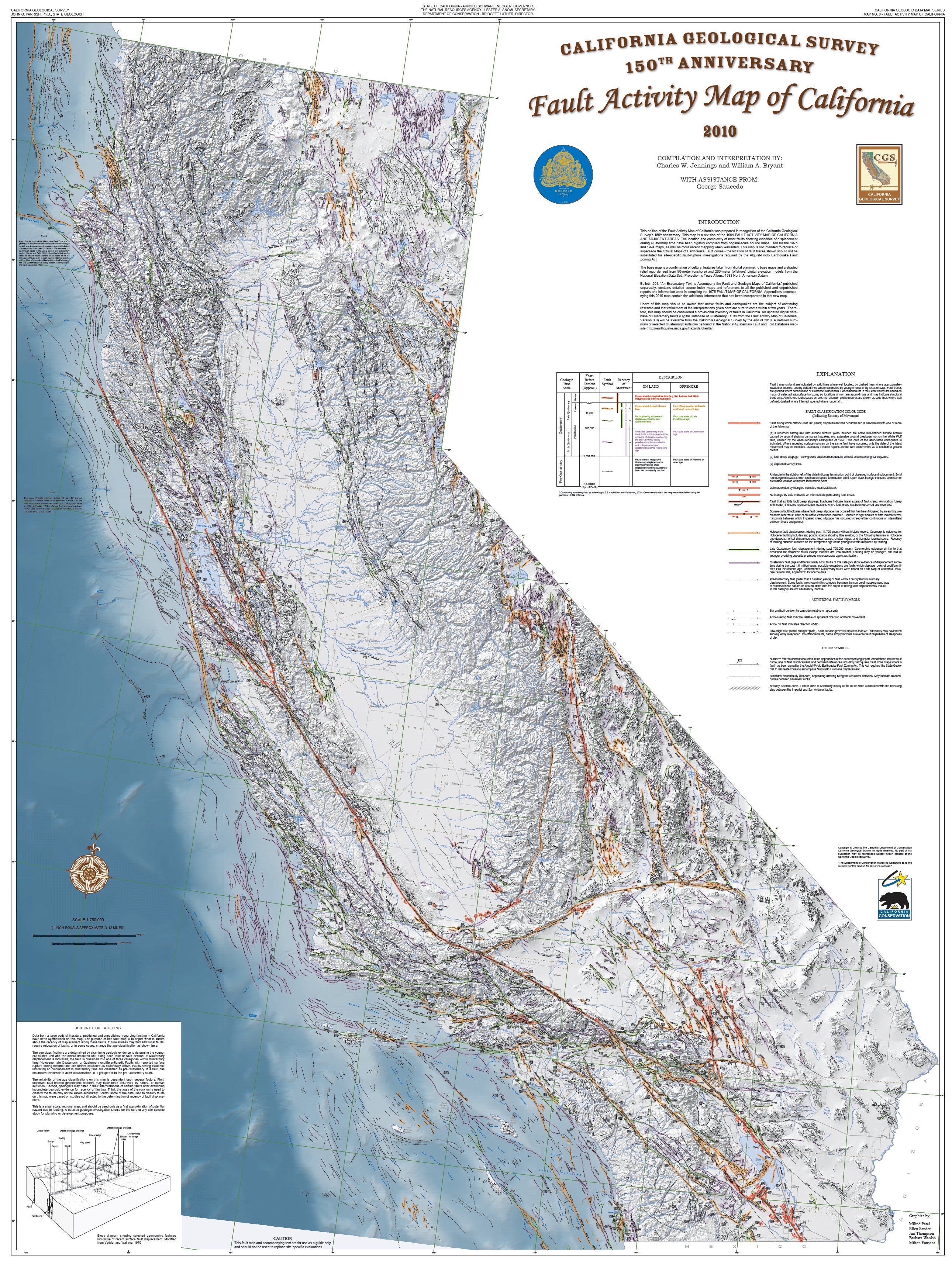
California, sitting right on the boundary between the Pacific and North American plates, became the best place in the world to study it. The San Andreas Fault is a “right-lateral strike-slip fault”, where the Pacific Plate grinds northwest past North America. Parkfield, a tiny town right on the fault, became the center of the earthquake universe, packed with instruments to catch the fault in the act.
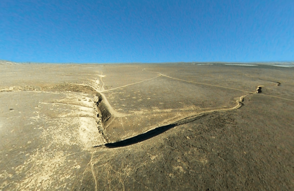 The San Andreas Fault at Wallace Creek. On January 9, 1857, the M 7.9 Fort Tejon earthquake occurred just north of the Carrizo Plain. Here, at Wallace Creek, the fault moved 30 feet (9m), forming the offset stream channel seen in the photo. (USGS)
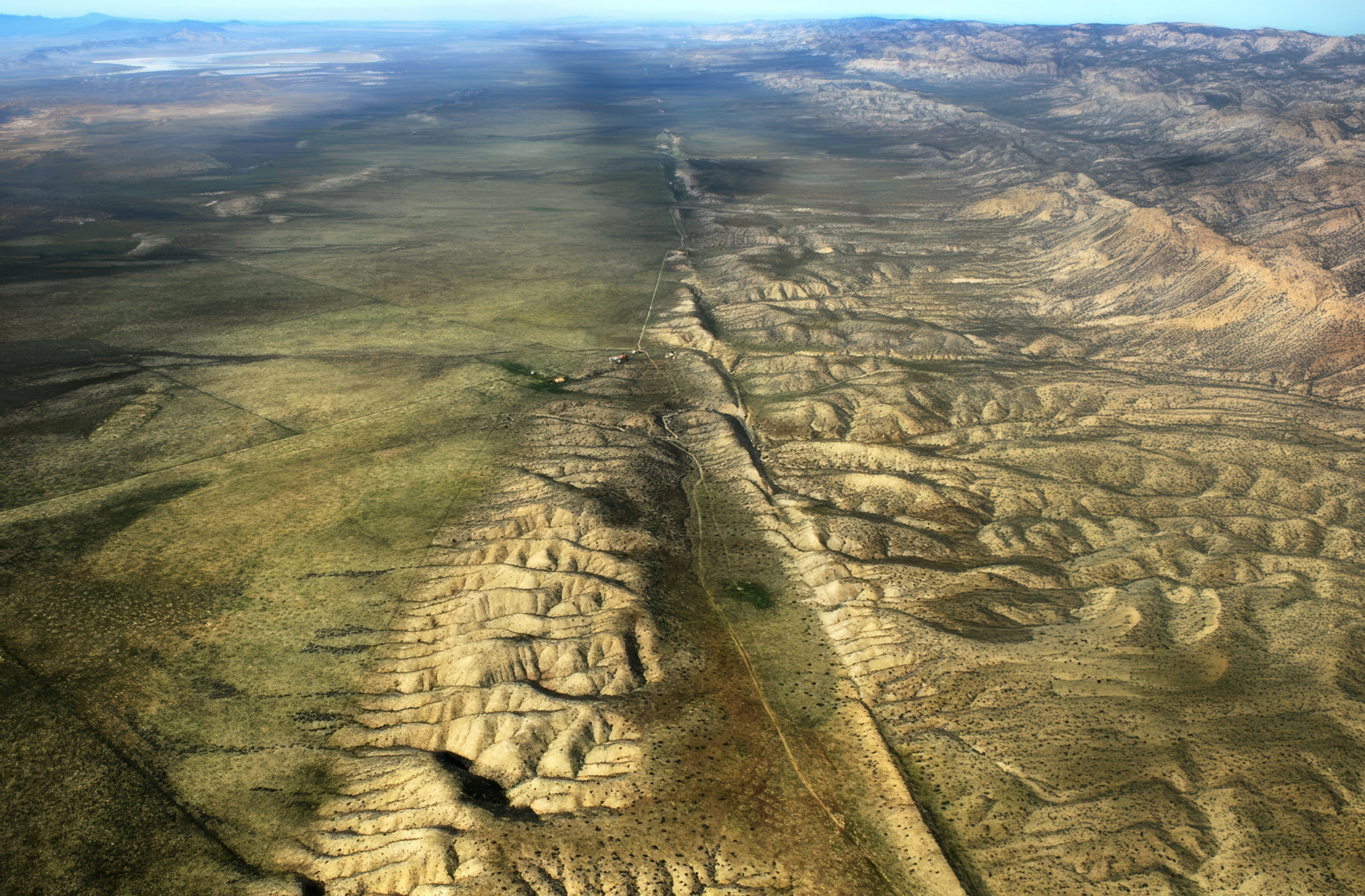
The dramatic offsets of streams like Wallace Creek on the Carrizo Plain show the sideways motion plainly: the stream runs straight to the fault, jogs sideways and then keeps going. Some of the best evidence for how far the fault has moved came from geologists like Thomas Dibblee Jr., the legendary field geologist who mapped huge swaths of California. In 1953, he and Mason Hill made the then-radical argument that the San Andreas had moved hundreds of miles. Later, geologists showed that the volcanic rocks of Pinnacles National Park match the Neenach volcanics, more than 195 miles to the southeast. They were once a single volcanic field, torn in two and dragged apart by the fault over about 23 million years, slow by human standards but pretty damn quick in geological time.
Everything we know today about California’s earthquakes and how the state was built rests on the ideas that came together that week at Asilomar. It’s one more time that California, a place literally being pulled apart, ended up at the center of a scientific revolution.
More California science, photography and wild places on Instagram @californiacuratedus