Southern California’s beaches are a miracle. More than just landscapes, they’re cultural treasures. In movies, ads, and music, the coastline often feels like its own character. To many of us who live here, the coastline is not just a place to swim or sunbathe but a symbol of freedom, fun, and the state’s enduring connection to the Pacific Ocean.
And let’s face it, the beach would not be the beach without sand.
Pick up some California wildlife gifts at our Etsy store. Seriously, they’re cool.
I didn’t realize how essential sand is until I read Vince Beiser’s The World in a Grain. It quickly became one of my favorite nonfiction books in recent years … and I read a lot of nonfiction. Think about it: without sand, there would be no roads, no skyscrapers, no glass. That means no windows, no windshields, no microscopes or telescopes. No fiber-optic cables. No computer chips, since silicon, the foundation of modern technology, is essentially refined sand. The list is endless. I get that it’s not all beach sand per se, but that’s a quibble.
However, that’s not what I want to focus on here. What struck me, as I was walking along the beach the other day, was a simpler question: where does all the sand on Southern California’s beaches actually come from?
San Gabriel Mountains (Photo: Erik Olsen)
Well, put yourself for a moment on the beach in Southern California. No shoes. It turns out most of the grains between your toes actually began their journey high in the mountains above LA, on craggy slopes far from the shore. Mostly, we are talking about the San Gabriel Mountains and other peaks in the Transverse Ranges that run east-west across Southern California. The rugged, crumbling peaks are made of granite and other crystalline rocks rich in quartz, feldspar, and mica. Through the relentless process of erosion, wind and rain loosen these minerals, which tumble into streams and rivers, such as the San Gabriel and Santa Ana and are carried out to sea. During storms, torrents of sediment rush downhill toward the coast, and that’s where ocean currents take over.
This region where wave action dominates is called the littoral zone (no, not the literal zone), and it is where sand gets pushed around through a process known as longshore drift. Waves arriving at an angle push sediment along the shore, creating a conveyor belt that can carry grains for miles.
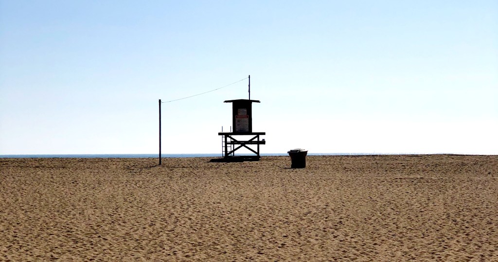
Lifeguard tower in Southern California (Photo: Erik Olsen)
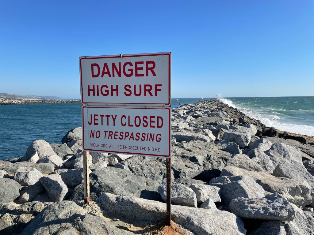
In Southern California, this natural process has been reshaping the shoreline for thousands of years, constantly adding sand to some beaches while stripping it away from others. A lot has changed recently though (I mean “recent” in geologic terms). Humans, as we often do, have f*cked things up a bit, changing the nature of our beaches since the late 1800s. The piece I wrote recently about the Wedge in Newport is a good example. Breakwaters and other “shoreline armoring” built along our coast have altered the movement of sand, sending much of it into deep water where it is lost.
Dams have also cut off a huge portion of sediment that would once have reached the coast, reducing Southern California’s natural sand supply by nearly half. To make up the difference, beach managers spend millions each year dredging sand from offshore deposits or harbor entrances and pumping it onto the shore. We’ve been doing this for nearly a century. Between 1930 and 1993, more than 130 million cubic yards of sand were placed on Southern California beaches, creating wide stretches like Santa Monica and the Silver Strand that are much larger today than they would have been naturally. And if you think this is a temporary thing, forget it. With climate change driving stronger storms and rising seas, the need to keep replenishing sand is only going to grow.
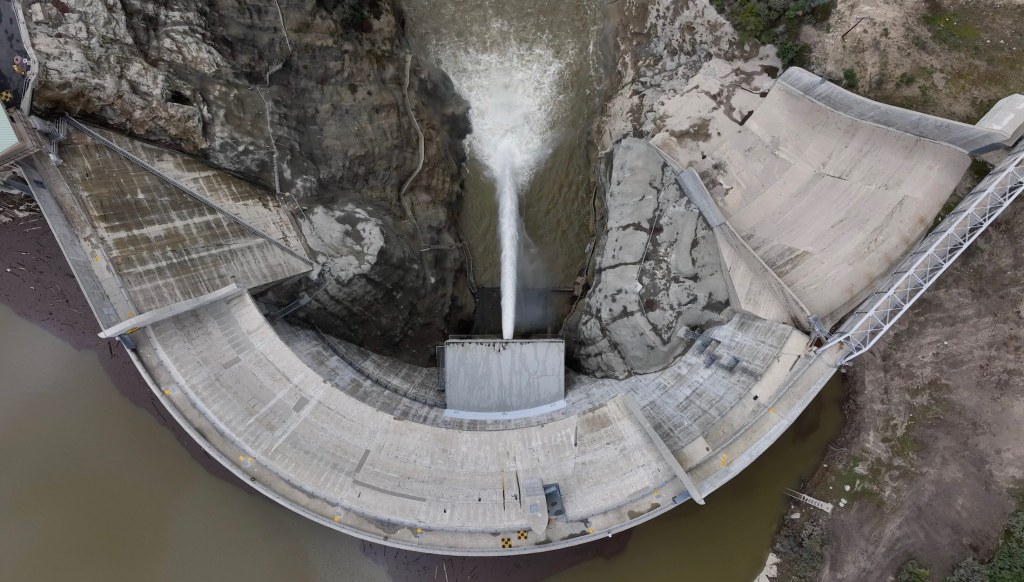
Big Tujunga Dam in Southern California (Photo: Erik Olsen)
For decades, geologists believed that rivers supplied as much as 90 percent of California’s beach sand. That view has shifted. Research from Scripps Institution of Oceanography shows that coastal cliffs also play a huge role on some beaches. Along the stretch from Dana Point to La Jolla, cliff erosion has been shown to contribute about half of the beach-sized sediment, and in some places up to 68 percent. This is especially true in dry years, when rivers deliver less. Still, on a statewide scale, rivers remain the main suppliers of sand. Studies from the California Coastal Sediment Management Workgroup show that, under present conditions, rivers account for about 90 percent of sand reaching Southern California beaches, with bluff erosion contributing roughly 10 percent.
Littoral cells in Southern California (Source: California Coastal Commission)
The sand’s story does not end at the shoreline. California’s coast is divided into littoral cells, essentially self-contained systems with their own sand sources, transport pathways, and sinks. Most sand in Southern California moves north to south, carried by waves arriving from the northwest. Eventually, much of it is lost into submarine canyons like Mugu, Newport, and Redondo, where it drops into deep water and exits the system.
Beach sand can also come from more subtle sources. Shell fragments from marine life, volcanic ash from distant eruptions, and even windblown desert dust can mix into the sediment. Perhaps not surprisingly, in recent decades, scientists have discovered another ingredient in our sand: plastic. Studies at Point Reyes and Golden Gate National Parks found an average of about 140 microplastic particles per kilogram of beach sand, which works out to roughly 50 pieces in a single measuring cup. Even beaches farther south, like Cabrillo, average nearly 40 pieces per kilogram.
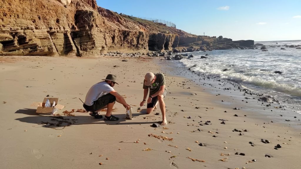
Staff collect sand samples at Cabrillo National Monument. Testing revealed that Cabrillo sand had the lowest average concentration of microplastics of all of the West Coast parks studied. Point Reyes and Golden Gate had the highest. (Photo: National Park Service)
Offshore sediment cores show that microplastic deposition has doubled every 15 years since the 1940s, with most fragments being synthetic fibers shed from clothing. These findings show that California’s sand is no longer entirely natural; it now carries the pernicious imprint of modern consumer life, with fragments of plastic woven into its mix of minerals and shells. Interestingly, the concentration of microplastics off the coast of California, where researchers carried out their studies, appears to be lower than in many other parts of the world. “If they were doing the same thing in the Yellow Sea in China, right outside some of the big rivers like the Yangtze and Yellow River, the concentrations would probably be huge and cause adverse effects,” University of Michigan eco-toxicologist Allen Burton told Wired Magazine.
But look, the chance to walk or run on the beach is one of the real gifts of living in California. The sand that sticks to your towel, finds its way into your shoes, or gets stuck into your hair has traveled a long, remarkable journey to reach the shore. It’s true that some of it now includes plastic, which is unfortunate, but that doesn’t diminish the joy of being at the beach. In a world where so much feels fast, fleeting, and digital, there’s something really cool and satisfying about putting your toes in the sand, a remarkable substance that is totally crucial to modern civilization, yet which is also timeless and ancient and part of the natural world around us.
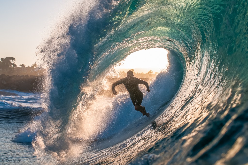
Having spent much of my youth in Newport Beach, my life was shaped by the ocean. I spent countless days in the surf, bodyboarding, bodysurfing, or playing volleyball on the sand with friends. When a southern storm rolled through, we’d rush to Big Corona and throw ourselves into the heavy swells, often getting slammed hard and learning deep respect for the ocean, a respect that I still harbor today. Sometimes the waves were so large they were genuinely terrifying, the kind of surf that would have made my mother gasp, had this not been an era when parents rarely knew what their kids were doing from dawn to dusk. That freedom, especially in Southern California, made the ocean feel like both a playground and a proving ground.
Across the channel at the Newport jetty was where the action was most intense. The surf was bigger, louder. We sat on the sand and held back, watching the brave and sometimes the foolish throw themselves into the water. That place, then and now, is called the Wedge.
The Wedge in Newport Beach, California (Photo: Alex Verharst 2016)
There is something unforgettable about the Wedge and the way its waves crash with such raw force. Sometimes they detonate just offshore, sending water skyrocketing into the air; other times they slam thunderously against the sand, eliciting groans and whoops from bystanders. The waves behave strangely at the Wedge, smashing into one another, often combining their force, and creating moments of exquisite chaos.
These colliding waves are what make the place both spectacular and dangerous, the result of a unique mix of physics and geology that exists almost nowhere else on earth. That combination has made it, to this day, one of the world’s most famous surf and bodysurfing spots. If you want a glimpse of what I mean, just search YouTube, where the insanity speaks for itself. This compilation is from earlier this year.
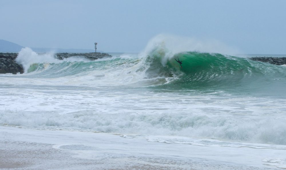
The Wedge’s origin story begins in the 1930s, when the U.S. Army Corps of Engineers extended Newport Harbor’s West Jetty to protect the harbor mouth from sand buildup and currents. What no one anticipated was that this angled wall of rock would create a perfect mirror for waves arriving from the south and southwest. Instead of dispersing, these waves slam into the jetty and reflect diagonally back toward the shore. The reflected energy doesn’t dissipate, it collides with the next incoming wave. When the two wave crests line up in phase, their energies combine, and the result is a much steeper, taller, and more powerful wave. In physics this is known as constructive interference: two sets of energy stacking into a single, towering peak.
This wave-doubling effect only works under specific conditions. Long-period south swells, often generated by hurricanes off Mexico or storms deep in the South Pacific, line up nearly parallel to the jetty. Their orientation means maximum contact and reflection. Surfers and bodysurfers describe the result as a pyramid-shaped breaker, or wedge, rising steeply before collapsing with extraordinary force. On the biggest days, these waves can reach 20 to 30 feet, twice the size of surrounding surf.
Crowds gather to watch the carnage at The Wedge in Newport Beach (Photo by D Ramey Logan)
Geology and geography make the situation even more dramatic. The seafloor near The Wedge slopes upward very steeply into a narrow strip of beach. Instead of allowing waves to break gradually, the bathymetry forces them to jack up suddenly, creating a thick lip that pitches forward into shallow water. It’s called a shorebreak, and man, they can be dangerous. More on that in a moment.
Unlike classic point breaks such as Malibu, where waves peel cleanly along a gradual reef, The Wedge produces brutal closeouts: vertical walls of water that crash all at once, leaving no escape route.
It actually can get worse. After each wave explodes on the beach, the backwash races seaward, colliding with the next incoming swell and adding more turbulence. Surfers call it chaos; lifeguards call it dangerous, even life-threatening. Spinal injuries, broken bones, and concussions are common at The Wedge. By 2013, the Encyclopedia of Surfing estimated that the Wedge had claimed eight lives, left 35 people paralyzed, and sent thousands more to the hospital with broken bones, dislocations, and other trauma—making it the most injury-prone wave break in the world. A 2020 epidemiological survey places The Wedge among the most lethal surf breaks globally (alongside Pipeline and Teahupo’o), largely due to head-first “over the falls” impacts on the shallow sea floor.
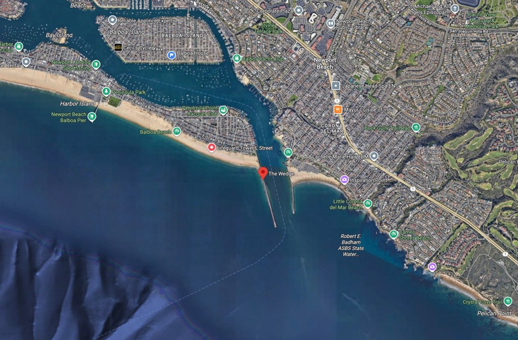
The Wedge in Google Maps
Interesting fact: Long before the Wedge was built, the waves pounding that corner of the Newport Beach jetty were already fierce. In 1926, Hollywood icon John Wayne (then still Marion Morrison) tried bodysurfing there while he was a USC football player. He was slammed into the sand, shattering his shoulder and ending his athletic scholarship. The accident closed the door on his football career but opened the one that led him to Hollywood stardom.
Oceanographers have studied the physics behind the Wedge’s unique surfbreak in broader terms. Research into wave reflection and interference confirms what locals have known for decades: man-made structures like jetties can redirect swell energy in ways that amplify, rather than reduce, wave height. Studies on steep nearshore bathymetry show how sudden shoaling increases the violence of breaking waves. The Wedge combines both effects in one location, making it a rare and extreme case study in coastal dynamics. In other words, yes, it’s gnarly.
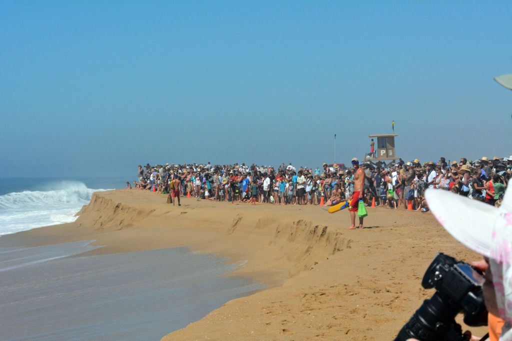
Of course, with all that danger comes spectacle, and when the Wedge is firing, it’s not unusual for hundreds of spectators to line the sand and jetty to watch. In August 2025, the California Coastal Commission approved plans for a 200-foot ADA-compliant concrete pathway and a 10-foot-wide viewing pad along the northern jetty, designed to make the experience safer and more inclusive. The project will provide better access for people using wheelchairs, walkers, and strollers, while also giving life guards and first responders improved vantage points when the surf turns chaotic.
I still get to the Wedge on occasion to watch the carnage. And while in my younger years, I might have ventured out to catch a wave or two if the conditions were relatively mellow, today, I prefer the view from shore, leaving the powerful surf to the younger bodysurfers hungry for a rush.
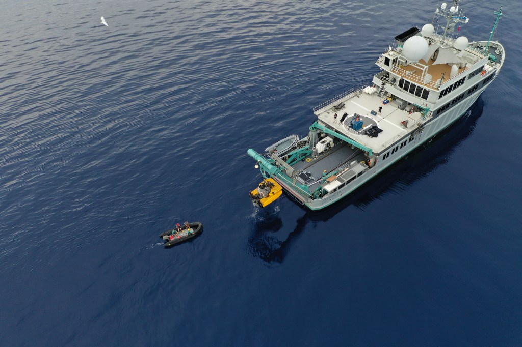
It’s time for California to put people back in the deep. A human-occupied submersible belongs in California waters, and we’ve waited long enough.
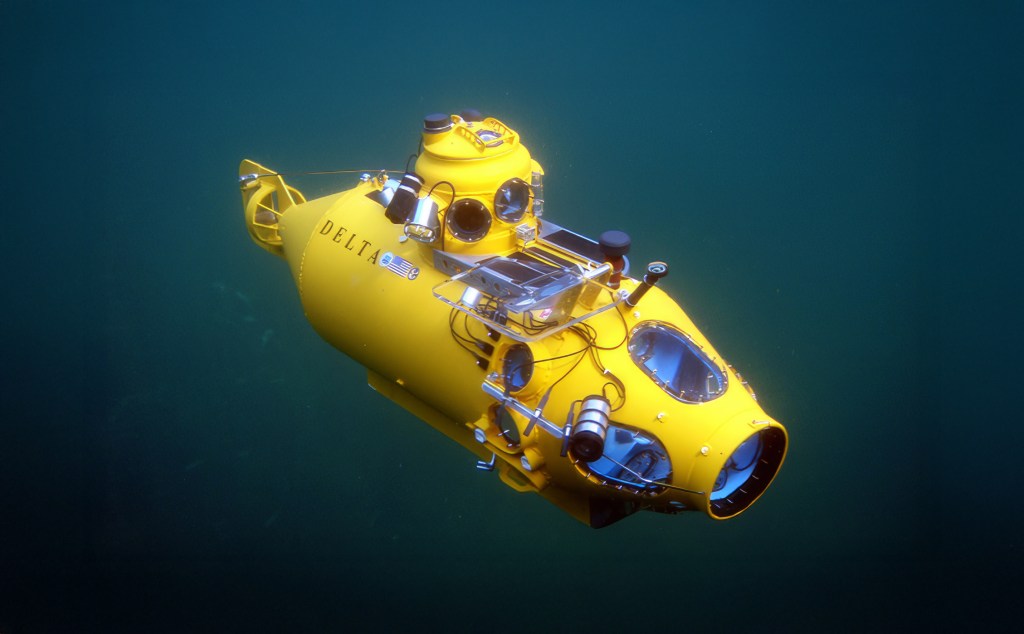
For decades, the state had a strong human-occupied submersible presence, from Navy test craft in San Diego to long-serving civilian science HOVs like the Delta. Those vehicles have been retired or relocated, leaving the West Coast without a single home-based, active human-occupied research submersible (I am not counting OceanGate’s Titan sub for numerous reasons, like the fact it was based in Seattle, but foremost is it was not “classed,” nor was it created for scientific use). Restoring that capability would not only honor California’s legacy of ocean exploration but also put the state back at the forefront of direct human observation in the deep sea. The time has come.
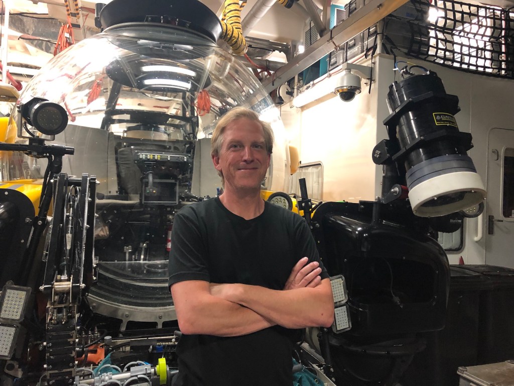
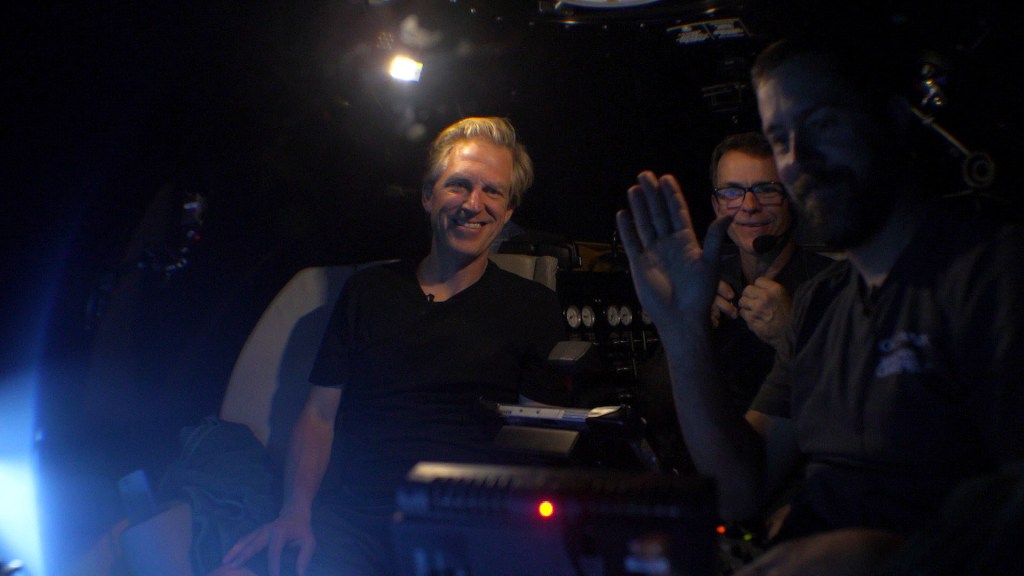
Side note: I’ve had the rare privilege of diving beneath the waves in a submersible three times in three different subs, including one descent to more than 2,000 feet with scientists from the Woods Hole Oceanographic Institution. Without exaggeration, it stands among the greatest experiences of my life.
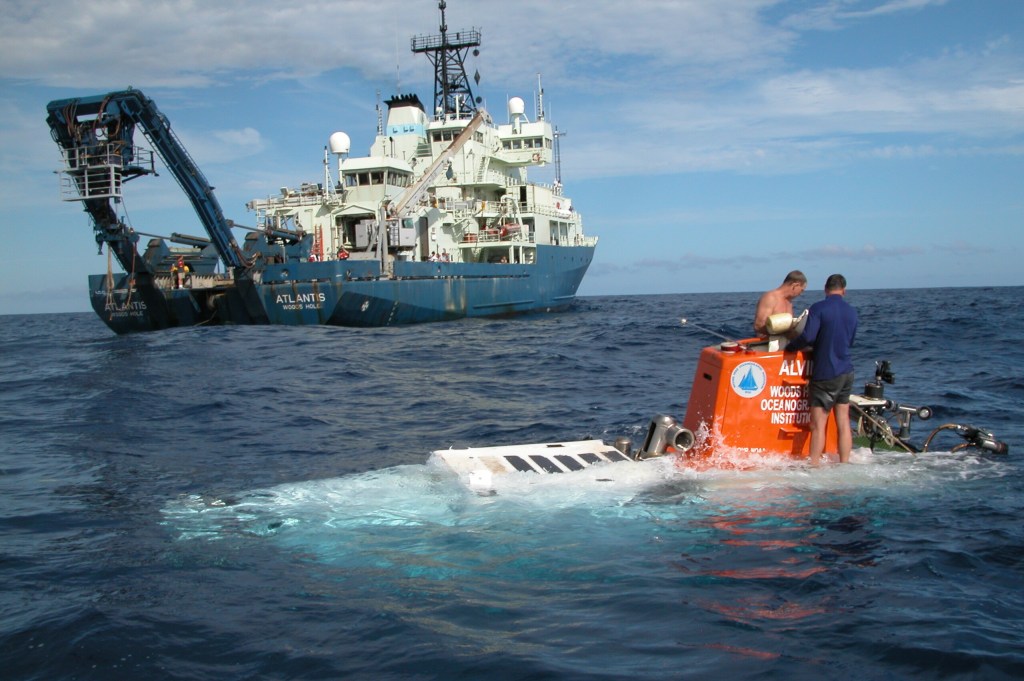
The United States once had a small fleet of working research HOVs. Today it has essentially one deep-diving scientific HOV in regular service: Alvin, operated by Woods Hole Oceanographic Institution (WHOI) for the National Deep Submergence Facility. Alvin is magnificent, now upgraded to reach 6,500 meters, but it is based on the Atlantic (in Massachusetts) and scheduled years in advance at immense cost.
The human-occupied submersible Alvin surfaces during the 2004 “Mountains in the Sea” Expedition, returning from a dive to explore deep seamount habitats teeming with corals, sponges, and other rarely seen marine life. (Photo: NOAA, Public Domain)
It helps to remember how we got here. The Navy placed Alvin in service in 1964, a Cold War investment that later became a pillar of basic research, investigating hydrothermal vents, shipwrecks and underwater volcanoes, among many, many other accomplishments. Over six decades of safe operations, Alvin has logged thousands of dives and undergone multiple retrofits, each expanding its depth range. Now rated to 6,500 meters, it can reach 98 percent of the ocean floor. WHOI’s partnership model with the Navy and universities shows exactly how public investment and science can reinforce each other. But Alvin is based on the East Coast: all that capability, history, and expertise is thousands of miles away. California needs its own Alvin. Or something even better…and perhaps cheaper. Though by cheaper I do not mean less safe.
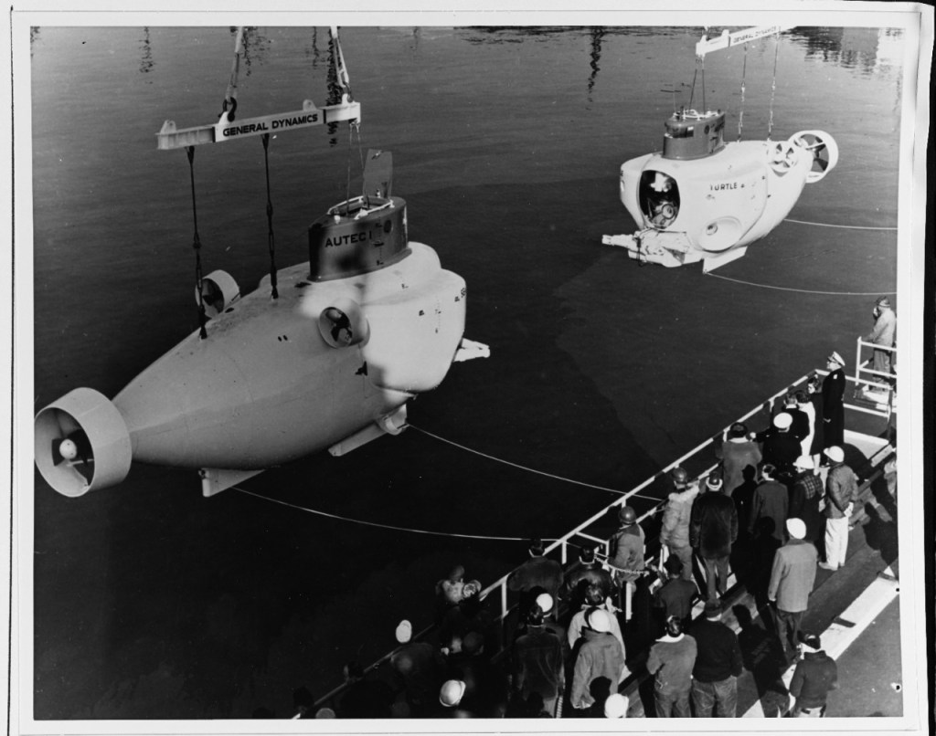
For a time, California actually had multiple HOVs. The Navy fielded sister craft to Alvin, including Turtle and Sea Cliff. Both Turtle and Sea Cliff spent their careers with Submarine Development Group ONE in San Diego. Turtle was retired in the late 1990s, and Sea Cliff, launched in 1968 and later upgraded for greater depths, also left service by the end of that decade, ending the Navy’s home-ported HOV presence on the West Coast.
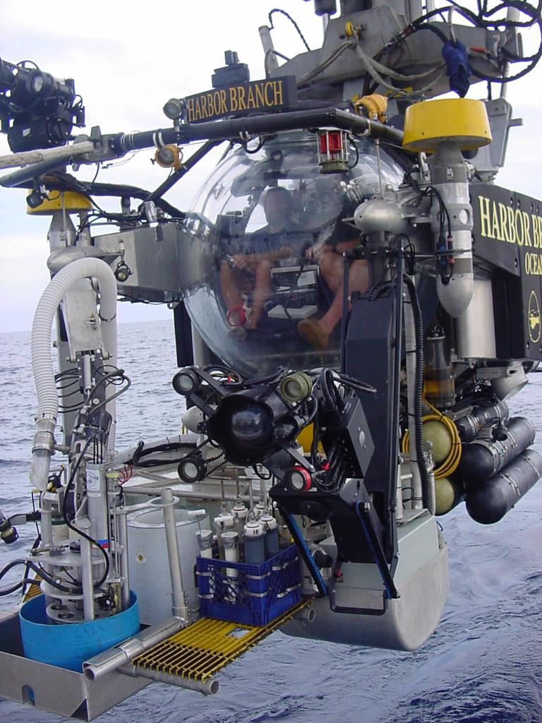
On the Atlantic side, Harbor Branch’s two Johnson Sea Link HOVs supported science and search-and-recovery work for decades before the program ended in 2011 due to funding constraints and shifting research priorities. I’ve interviewed renowned marine biologist Edith Widder several times, and she often speaks about how pivotal her dives in the Johnson Sea Link submersibles were to her career studying animal bioluminescence.
“Submersibles are essential for exploring the planet’s largest and least understood habitat, ” Widder told me. “A human-occupied, untethered submersible offers an unmatched window into ocean life, far surpassing what remotely operated vehicles can provide. ROVs, with their noisy thrusters and blazing lights, often scare away marine animals, and even the most advanced cameras still can’t match the sensitivity of the fully dark-adapted human eye for observing bioluminescence.”
In the central Pacific, the University of Hawaiʻi’s HURL operated Pisces IV and V for much of the 2000s and 2010s, then suspended operations amid funding and ship transitions. Through attrition and budget choices, the working U.S. fleet shrank from a handful to essentially one deep-diving research HOV today.
Manned submersibles are costly to build and operate, and they demand specialized crews, maintenance, and support ships or platforms. It’s easy to list reasons why California shouldn’t invest in a new generation of human-occupied subs. But that mindset has kept us out of the deep for far too long. It’s time to turn the conversation around and recognize why having one here would be a transformative asset for science, education, and exploration.
The Seacliff and Turtle submersibles (Photo: U.S. Naval History and Heritage Command photo. Public Domain)
California’s own human-occupied sub legacy is short, but notable. In addition to the Navy submersibles noted above, the Delta submersible, a compact, ABS-class HOV rated to about 1,200 feet, operated from Ventura and later Moss Landing, supporting dozens of fishery and habitat studies from the Southern California Bight to central California. Built by Delta Oceanographics in Torrance, Delta dives in the mid-1990s produced baseline data that still underpin rockfish management, MPA assessments, and predictive habitat maps. The sub’s ability to place scientists directly on the seafloor allowed for nuanced observations of species behavior, habitat complexity, and human impacts that remote tools often miss. Many of these datasets remain among the most detailed visual records of California’s deeper reef ecosystems.
The Monterey Bay Aquarium Research Institute (MBARI) operates a world-class research fleet with a robust remotely operated vehicle (ROV) program, but no human-occupied vehicle—a strategic decision the institute made years ago in favor of robotics over direct human dives. (Photo: Erik Olsen)
In the late 1990s, the program shifted north to Moss Landing, where it was operated in partnership with the Monterey Bay Aquarium Research Institute (MBARI) and other institutions. At the time, MBARI was still in the early years of exploring human-occupied vehicles, like Bruce Robison’s experience piloting the Deep Rover HOV in Monterey Canyon in 1985. To many at MBARI, human occupancy in submersibles began to seem more like a luxury than a necessity. If the goal was to maximize scientific output and engineering innovation, remotely operated vehicles offered longer bottom times, greater payload capacity, and fewer safety constraints. That realization drove MBARI to invest heavily in ROV technology, setting the stage for a long-term move away from human-occupied systems.
Which leads us to the present moment: California’s spectacular coast faces mounting environmental threats, just as public interest in ocean science wanes. And yet, we have no human-occupied research submersible, no way for scientists or the public to directly experience the deep ocean that shapes our state’s future.
The Delta submersible, once a workhorse of California’s deep-sea research with over 5,800 dives, operated from Ventura and later Moss Landing between the 1980s and 2000s. Sold in 2011 in a non-functional state, it remains out of service—symbolizing the end of the state’s home-ported human-occupied submersible era.
Look, robots are incredible. MBARI’s ROVs and AUVs set global standards, and they should continue to be funded and expanded. But if you talk to veteran deep-sea biologists and geologists, they will tell you that being inside the environment changes the science.
Dr. Adam Soule, chief scientist for Deep Submergence at the Woods Hole Oceanographic Institution (WHOI) agrees, “Having a human presence in the deep sea is irreplaceable. The ability for humans to quickly and efficiently process the inherently 3D world around them allows for really efficient operations and excellent sampling potential. Besides, there is no better experience for inspiring young scientists and for ensuring that any scientist can get the most out of unmanned systems than immersing themselves in the environment.”
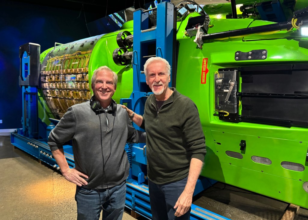
Some of our most prominent voices are also speaking out about the need to explore the ocean. I recently produced an hour-long episode of the PBS science program NOVA and one episode was about the new generation of submersibles being built right now by companies like Florida-based Triton Submarines. I had the privilege of talking to filmmaker and ocean explorer James Cameron, who was adamant that human participation in ocean exploration is critical to sustaining public interest and political will.
“The more you understand the ocean, the more you love the ocean, the more you’re fascinated by it, and the more you’ll fight to protect it,” Cameron told me.
The author with James Cameron in front of his submersible the Deepsea Challenger. (Erik Olsen)
Human eyes and brains pick up weak bioluminescence out of the corner of vision, pivot to follow a squid that just appeared at the edge of a light cone, or decide in the moment to pause and watch a behavior a diving team has never seen before. NOAA’s own materials explain the basic value of HOVs this way: you put scientists directly into the natural deep-ocean environment, which can improve environmental evaluation and sensory surveillance. Presence is a measurement instrument.
California is exactly where that presence would pay off. Think about Davidson Seamount, an underwater mountain larger than many national parks, added to the Monterey Bay National Marine Sanctuary because of its ancient coral gardens and extraordinary biodiversity. We know this place mostly through ROVs, and we should keep using them, but a California HOV could carry sanctuary scientists, MBARI biologists, and students from Hopkins Marine Station or Scripps into those coral forests to make fine-scale observations, sample with delicacy, and come home with stories that move the public. Put a student in that viewport and you create a career. Put a donor there and you create a program.
A time-lapse camera designed by MBARI engineers allowed researchers to observe activity at the Octopus Garden between research expeditions. (Photo: MBARI)
Cold seeps and methane ecology are another natural fit. Off Southern California and along the borderlands there are active methane seep fields with complex microbial and animal communities. Recent work near seeps has even turned up newly described sea spiders associated with methane-oxidizing bacteria, a striking reminder that the deep Pacific still surprises us. An HOV complements ROV sampling by letting observers linger, follow odor plumes by sight and instrument, and make rapid, in-situ decisions about fragile communities that are easy to miss on video. That kind of fine-grained exploration connects directly to California’s climate priorities, since methane processes in the ocean intersect with carbon budgets.
There are practical use cases all over the coast. A California HOV could support geohazard work on active faults and slope failures that threaten seafloor cables and coastal infrastructure. It could conduct pre- and post-event surveys at oil-and-gas seep sites in the Santa Barbara Channel to ground-truth airborne methane measurements. It could document deep-water MPA effectiveness where visual census by divers is impossible. It could make repeated visits to whale falls, oxygen minimum zone interfaces, or sponge grounds to study change across seasons.
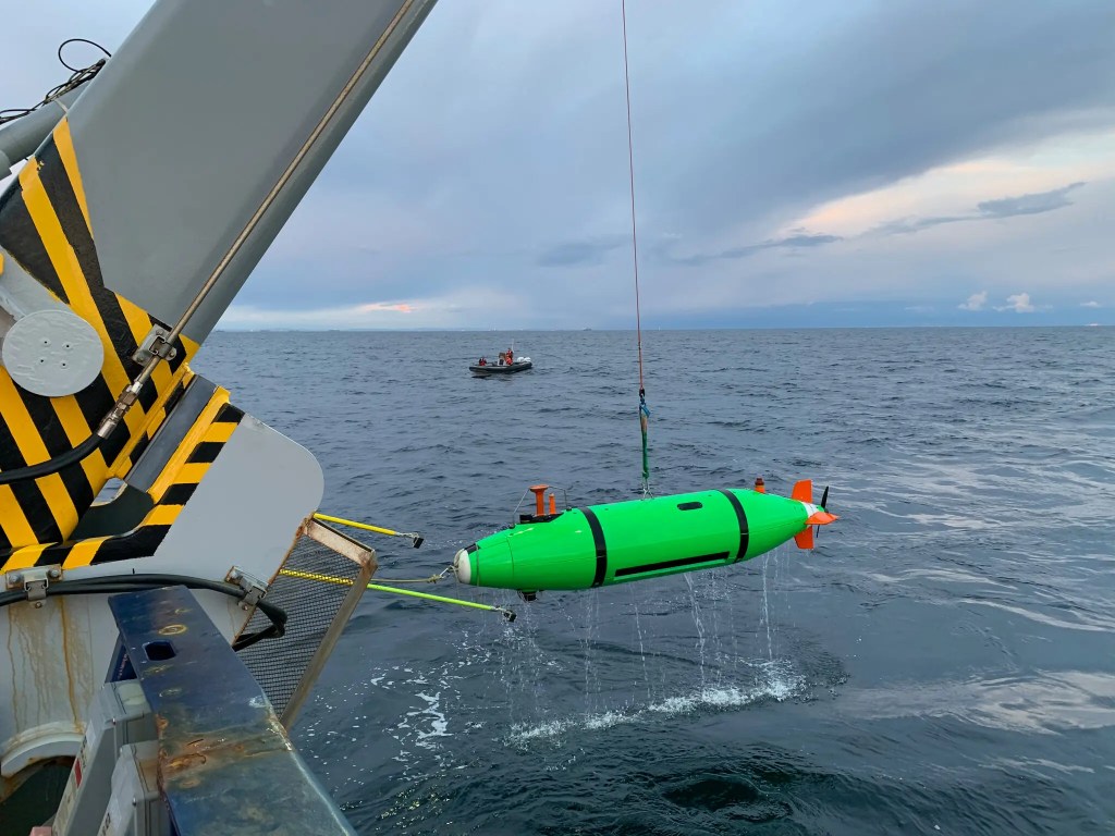
An autonomous underwater craft used to map DDT barrels on the seafloor off California. (Photo: Scripps Institution of Oceanography at U.C. San Diego)
It could also play a crucial role in high-profile discoveries like the recent ROV surveys that revealed thousands of corroding barrels linked to mid-20th-century DDT dumping off Southern California. Those missions produced stark imagery of the problem, but a human-occupied dive would have allowed scientists to make on-the-spot decisions about barrel sampling, trace-chemical measurements, and sediment core collection, as well as to inspect surrounding habitats for contamination impacts in real time. The immediacy of human observation could help shape quicker, more targeted responses to environmental threats of this scale.
And it’s not just the seafloor that matters. Some of the most biologically important parts of the ocean lie well above the bottom. The ocean’s twilight zone, roughly 200 to 1,000 meters deep, is a vast, dimly lit layer that contains one of the planet’s largest reservoirs of life by biomass. (My dive with WHOI was done to study the ocean’s twilight zone). Every day, trillions of organisms participate in the planet’s largest migration, the diel vertical migration, moving up toward the surface at night to feed and returning to depth by day. This zone drives global carbon cycling, supports commercial fish stocks, and is home to remarkable gelatinous animals, squid, and deepwater fishes that are rarely seen in situ.
Launching the Triton 3300/3 (Photo: Erik Olsen)
The Triton 3300/3’s 1,000-meter depth rating (I’ve been in one twice) puts the entire twilight zone within reach, enabling direct observation of these daily movements, predator-prey interactions, and delicate species that often disintegrate into goo in nets. Human presence here allows scientists to make real-time decisions to follow unusual aggregations, sample with precision, and record high-quality imagery that captures how this midwater world works, something uncrewed systems alone rarely match.
It could even serve as a classroom at depth for carefully designed outreach dives, giving educators footage and first-person accounts that no livestream can quite match. Each of these missions is stronger with people on site, conferring, pointing, deciding, and noticing.
While Monterey Bay would be a natural fit because of MBARI, Hopkins, and the sanctuary’s deepwater treasures, Southern California could be just as compelling. Catalina Island, with its proximity to submarine canyons, coral gardens, and cold seeps of the Southern California Bight, offers rich science targets and the existing facilities of USC’s Wrigley Marine Science Center. Los Angeles or Long Beach would add the advantage of major port infrastructure and a vast urban audience, making it easier to combine high-impact research with public tours, donor events, and media outreach. And San Diego with its deep naval history, active maritime industry, Scripps Institution of Oceanography, and proximity to both U.S. and Mexican waters, could serve as a southern hub for exploration and rapid response to discoveries or environmental events. These regions could even share the vehicle seasonally: Monterey in summer for sanctuary work, Catalina/LA or San Diego in winter for Southern California Bight missions, spreading both benefits and funding responsibility.
The author in front of the Triton 3300/3 in the Bahamas (Photo: Erik Olsen)
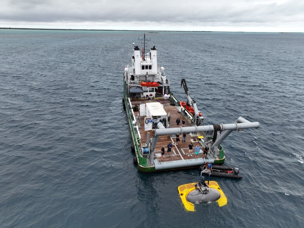
For budgeting, a proven benchmark is the Triton 3300/3, a three-person, 1,000-meter (3,300-foot) human-occupied vehicle used widely in science and filming. New units are quoted in the four to five million dollar range, with recent builds coming in around $4–4.75 million depending on specifications. Beyond the vehicle, launch and recovery systems such as a 25–30-ton A-frame or LARS and the deck integration required for a suitable support ship can run into the high six to low seven figures. Modern acrylic-sphere subs like the Triton are designed for predictable, minimized scheduled maintenance, but budgets still need to account for annual surveys, battery service, insurance, and ongoing crew training. Taken together, a California-based HOV program could be launched for an initial capital investment of roughly $6–7 million, with operating budgets scaled to the number of missions each year. So, not cheap. But doable for someone of means and purpose and curiosity. See below.
Who would benefit if California restored this capability? Everyone who already works here. MBARI operates a world-class fleet of ROVs and AUVs but has no resident HOV. Scripps Institution of Oceanography, Hopkins Marine Station, and USC’s Wrigley Marine Science Center train generations of ocean scientists who rarely get the option to do HOV work without flying across the country and waiting for a slot. NOAA and the sanctuaries need efficient ways to inspect resources and respond to events. A west-coast human-occupied research submersible based in Monterey Bay, Catalina, Los Angeles, or San Diego would plug into ship time on vessels already here, coordinate with ROV teams for hybrid dives, and cut mobilization costs for Pacific missions.
A new Triton 660 AVA submersible slips into the turquoise waters of the Bahamas, beginning its first voyage. Built for dives to 660 feet (200 meters), it offers passengers a front-row seat to reefs, shipwrecks, and marine life far beyond normal scuba limits, making it an ideal draw for high-end tourism. (Photo: Erik Olsen)
What would it take? A benefactor and a compact partnership. California has the donors (hello, curious billionaires!), companies, and public-private institutions to do this right. A philanthropic lead gift could underwrite acquisition of a proven, classed HOV and its support systems, while MBARI, Scripps, or USC could provide engineering, pilots, and safety culture within the UNOLS standards that govern HOV operations. No OceanGates. Alvin’s long record shows the model. Add a state match for workforce and student access, and a sanctuary partnership to guarantee annual science priorities, and you have a durable program that serves research, stewardship, and public engagement.
Skeptics will say that robots already do the job. They do a lot of it. They do not do all of it. If the U.S. is content to have only one deep research HOV based on the opposite coast, we will forego the unique perspectives and serendipity that only people bring, and we will keep telling California students to wait their turn or watch the ROV feed from their laptops or phones. California can do better. We did, for years, when the Delta sub spent long seasons quietly counting fish and mapping habitats off Ventura and the Channel Islands. Then that capability faded. If we rebuild it here, we restore a missing rung on the ladder from tidepools to trenches, and we align the state’s science, climate, and education missions with a tool that is both a laboratory and a conversion experience.
The author at more than 2000 feet beneath the surface of the ocean. (Photo: Erik Olsen)
Start with a compact, 1,000-meter-class HOV that can work daily in most of California’s shelf and slope habitats. Pair it with our ROVs for tandem missions and cinematography of the sub and its occupants in action. Commit a share of dives to student and educator participation, recorded and repackaged for museums and broadcast. Reserve another share for rapid-response science at seeps, landslides, unusual biological events, or contamination crises like the DDT dumpsite. Build a donor program around named expeditions to Davidson Seamount, Catalina’s coral gardens, and the Channel Islands. Then, if the community wants to go deeper, plan toward a second vehicle or an upgrade path. The science is waiting. The coast is ready. And the case is clear. California should restore its human-occupied submersible fleet.
I’m going to keep this week’s article shorter than usual. I want to talk about the ocean. I know I do this a lot; many articles on California Curated are ocean-related (please explore, I think you’ll enjoy them). But that’s because I honestly believe it’s the most important feature on the planet. Protecting the ocean is the most important thing we can do. Let me explain.
The ocean covers more than 70 percent of Earth’s surface. So why do we even call this place Earth? We should call it Planet Ocean. Or Thalassa, from the Greek word for sea.
But it’s not just the size that matters, it’s the ocean’s vast, mysterious depth and the essential role it plays in sustaining life on Earth. The ocean is vital to all living things. Tiny organisms called phytoplankton absorb more carbon dioxide from the atmosphere than any other biological force on the planet. Through photosynthesis, they transform sunlight and carbon into organic matter, forming the base of the marine food web. Despite making up just a fraction of Earth’s plant biomass, phytoplankton are responsible for nearly half of all global carbon fixation. Zooplankton are tiny animals that eat phytoplankton. Zooplankton feed small fish, which feed bigger fish, which feed us. That’s the food chain. It’s literally a scaffolding for all life on earth. And a huge percentage of humanity depends on it to survive. If one link breaks, the whole thing risks collapse.
Phytoplankton (Photo: NOAA)
Which brings me to why I’m writing this. I recently watched the new National Geographic documentary Oceans, narrated by David Attenborough. I love Attenborough. His calm, British-inflected voice has been the backdrop to so much of my science education over the years. He feels like a wise grandfather. Kind, brilliant, and usually right.
In this film, he is absolutely right.
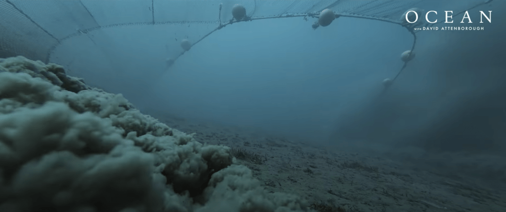
The documentary takes us to places no human has ever seen. In one scene, the team attaches cameras to a deep-sea trawling net. The footage is devastating. These massive nets kill everything in their path. Octopuses, fish, coral, entire ecosystems. Most of the species caught never even make it to market. They are bycatch, considered waste and tossed back into the sea. It’s wasteful, brutal, and legal. These trawlers are still out there, operating at scale, stripping the sea of life.
Bottom Trawling scene from Oceans with David Attenborough (National Geographic)
The film also shows how industrial fishing has hammered fish populations around the world. We are seeing species crash and food chains fracture. According to the Food and Agriculture Organization, nearly 35 percent of the world’s fish stocks are being overfished, a figure that has more than tripled since the 1970s. This kind of collapse has never happened before at this scale. And it is not getting better. We are talking about extinctions. We are talking about systems breaking down.
Friends often tell me the biggest threats to our planet are climate change, pollution, and microplastics. They’re not wrong. All this stuff is connected in a way. But if you ask me what really threatens human survival, it’s the breakdown of ocean ecosystems. If we lose one part of that chain for good, it won’t just be bad. It could be the beginning of the end. And I mean for humans, for organized society, not for all life on earth.
And yet, there is hope.
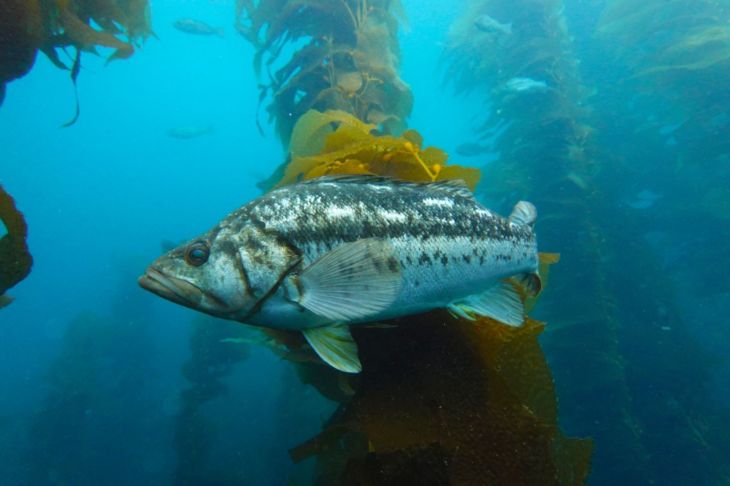
Kelp bed and bass in a marine protected area (MPA) in California’s Channel Islands (Photo: Erik Olsen)
Like any great documentary, Oceans ends with a sliver of optimism. It brings us back to California. Specifically, to the Channel Islands, one of my favorite places on Earth. I’ve been out there many times, several times recently reporting on ghost lobster traps and exploring. It’s stunning. And there is something very special going on.
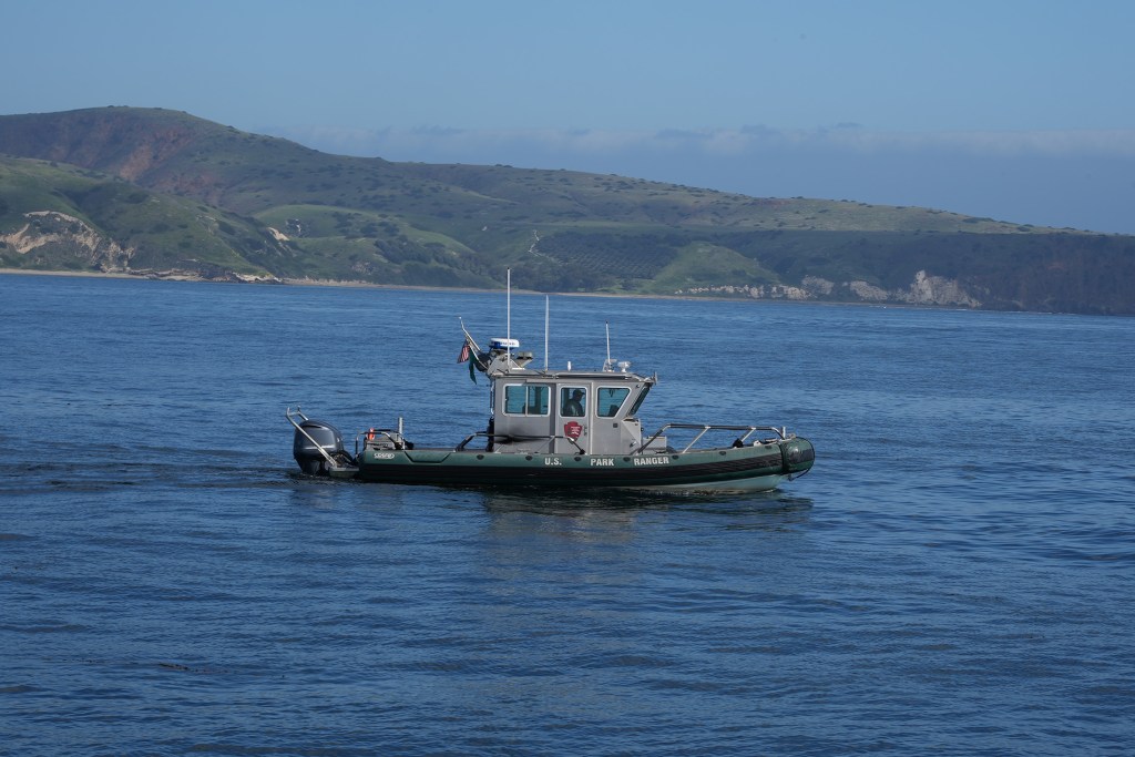
Park rangers patrol the waters off the Channel Islands (Photo: Erik Olsen)
Much of the Channel Islands are protected as a Marine Protected Area, or MPA. You can’t fish. You can’t extract. And, most importantly, the rules are enforced. There are rangers out there at most all times patrolling. That part is key. I’ve done stories in places like Belize, Kiribati and Indonesia where the protections exist on paper but don’t work in practice. Kiribati, for instance, established the Phoenix Islands Protected Area, one of the largest MPAs on the planet. But it’s so vast and remote that enforcing its protections is nearly impossible. It’s a good idea on paper, but a cautionary tale in execution. But here in California, the rangers take it seriously. Because of that, the ecosystem is bouncing back. Twenty years after protection began, the kelp, the fish, the invertebrates, they’re thriving. These islands are alive.
California’s MPAs are a model for the world. They prove that if we give the ocean space and time, it will heal. But they remain the exception. They don’t have to be.
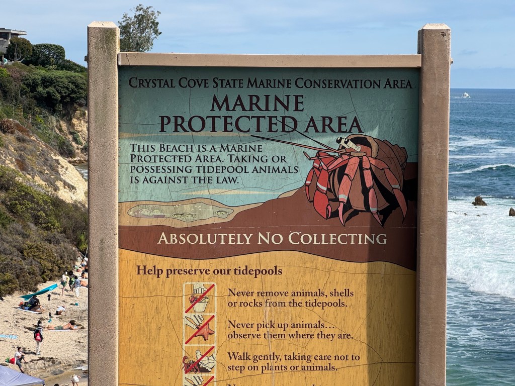
Marine Protected Area (MPA) sign in Corona del Mar, CA (Photo: Erik Olsen)
There’s a global movement right now to protect 30 percent of the world’s oceans by 2030. It’s called 30 by 30. Just recently, at the 2025 UN Ocean Conference in Nice, France, more than 70 countries reaffirmed their commitment to the 30 by 30 goal, calling for urgent action to protect ocean biodiversity and create well-managed, effectively enforced MPAs around the world. I’m not naive. I don’t think we’ll hit that goal perfectly. But we are finally moving in the right direction. And we don’t have another option. The ocean is too important.
So I’ll step off the soapbox now and let you enjoy your day. But before you click away, please take a moment to think about the ocean. Think about what it gives us. Think about how it restores us. As a diver, I can tell you there’s nothing like the world beneath the waves. It’s as strange, beautiful, and alien as any other planet we’ve imagined. The creatures there rival anything you’d find in Mos Eisley on Tatooine.
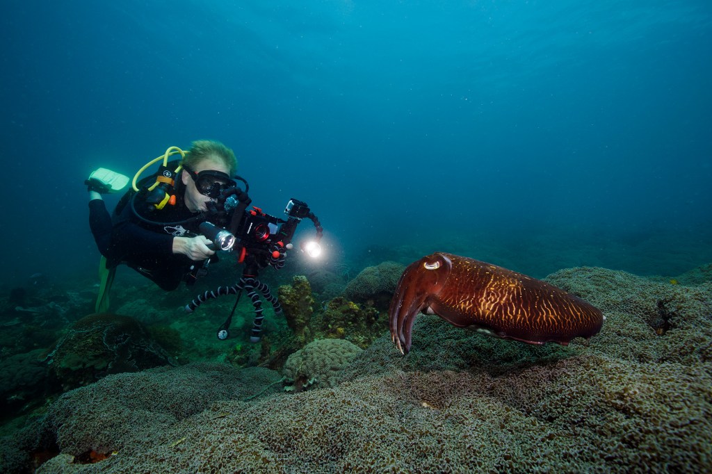
The author filming cuttlefish in Indonesia. Such strange creatures. (Photo: Erik Olsen)
Watch the documentary. Let it educate and inspire you. It might fill you with dread too. But in the end, its message is hopeful. And that message lands right here off the coast of California, the greatest state in the country. Or at least, that’s the opinion of one well-traveled guy with a newsletter about the state he loves.
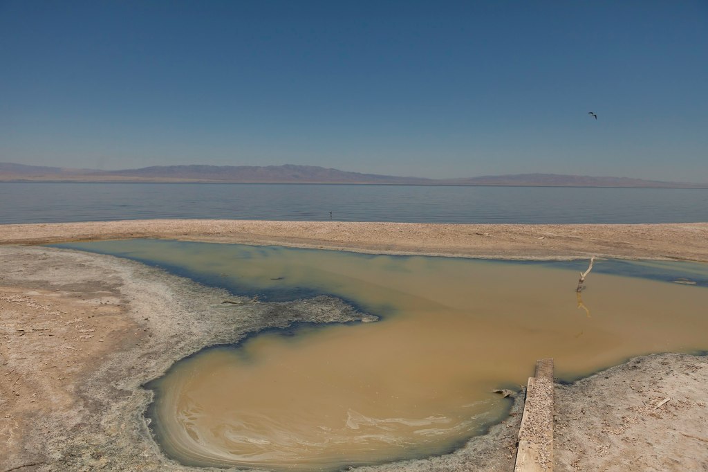
In California’s southeastern desert, the Salton Sea stretches across a wide, shimmering basin, a lake where there shouldn’t be one. At about 340 square miles, it’s the state’s largest lake. But it wasn’t created by natural forces. It was the result of a major engineering failure. I’ve long been fascinated with the place: its contradictions, its strangeness, its collision of nature and human ambition. It reflects so many of California’s tensions: water and drought, industry and wilderness, beauty and decay. And it was only relatively recently that I came to understand not just how the Salton Sea came to exist, but how remarkable the region’s geological past really is, and how it could play a major role in the country’s sustainable energy future.
In the early 1900s, the Imperial Valley was seen as promising farmland: its deep, silty soil ideal for agriculture, but the land was arid and desperately needed irrigation. To bring water from the Colorado River, engineers created the Imperial Canal, a massive infrastructure project meant to transform the desert into productive farmland. But the job was rushed. The canal had to pass through the Mexican border and loop back into California, and much of it ran through highly erodible soil. Maintenance was difficult, and by 1904, silt and sediment had clogged portions of the canal.
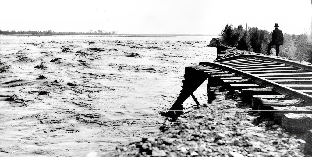
The Southern Pacific Railroad was forced to move it lines several times as the raging, unleashed Colorado River expanded the Salton Sea. (Credit: Imperial Irrigation District)
To keep water flowing, engineers hastily dug a temporary bypass channel south of the clogged area, hoping it would only be used for a few months. But they failed to build proper headgates, critical structures for controlling water flow. In 1905, an unusually heavy season of rain and snowmelt in the Rockies caused the Colorado River to swell. The torrent surged downriver and overwhelmed the temporary channel, carving it wider and deeper. Before long, the river completely abandoned its natural course and began flowing unchecked into the Salton Sink, an ancient, dry lakebed that had once held water during wetter epochs but had long since evaporated. (This has happened many times over in the region’s history).
For nearly two years, the Colorado River flowed uncontrolled into this depression, creating what is now known as the Salton Sea. Efforts to redirect the river back to its original course involved a frantic, expensive engineering campaign that included the Southern Pacific Railroad and U.S. government assistance. The breach wasn’t fully sealed until early 1907. By then, the sea had already formed: a shimmering, accidental lake nearly 35 miles long and 15 miles wide, with no natural outlet, in the middle of the California desert.
In the 1950s and early ’60s, the Salton Sea was a glamorous desert escape, drawing crowds with boating, fishing, and waterskiing. Resorts popped up along the shore, and celebrities like Frank Sinatra, Jerry Lewis, Rock Hudson, the Beach Boys, and the Marx Brothers came to visit and perform. It was billed as a new Palm Springs with water, until rising salinity and environmental decline ended the dream. There have been few if any similarly starge ecological accidents like it.
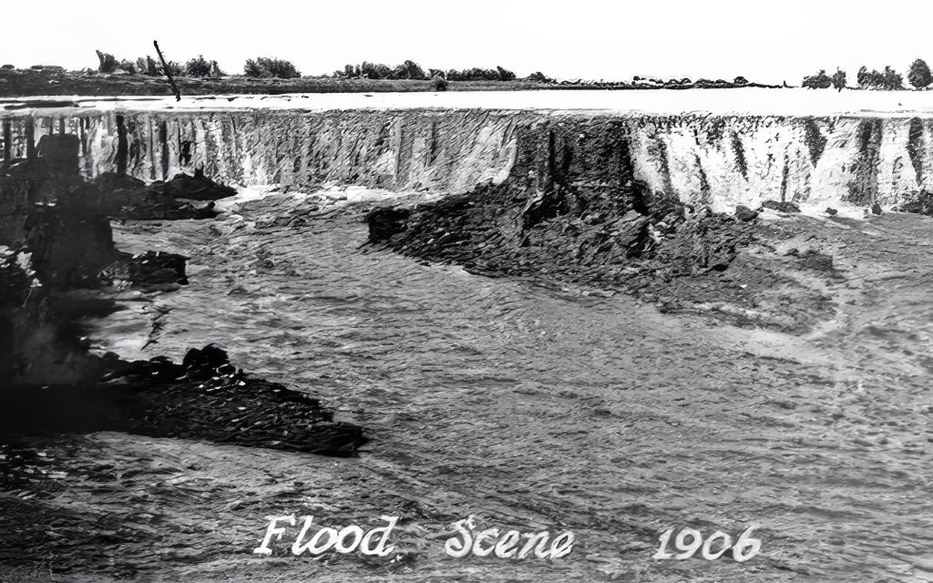
The erosive power of the floodwaters was immense. The river repeatedly scoured channels that created waterfalls, which cut back through the ground, eroding soil at a rate of about 1,200 meters per day and carving gorges 15 to 25 meters deep and more than 300 meters wide. (Credit: Imperial Irrigation District)
The creation of the Salton Sea was both a blessing and a curse for the people of the Imperial Valley. On the one hand, the lake provided a new source of water for irrigation, and the fertile soil around its shores proved ideal for growing crops. On the other hand, the water was highly saline, and the lake became increasingly polluted over time, posing a threat to both human health and the environment.
Recently, with most flows diverted from the Salton Sea for irrigation, it has begun to dry up and is now considered a major health hazard, as toxic dust is whipped up by heavy winds in the area. The disappearance of the Salton sea has also been killing off fish species that attract migratory birds.
The New York Times recently wrote about the struggles that farmers face as the Salton Sea disappears, and how the sea itself will likely disappear entirely at some point.
“There’s going to be collateral damage everywhere,” Frank Ruiz, a program director with California Audubon, told the Times. “Less water coming to the farmers, less water coming into the Salton Sea. That’s just the pure math.”
Salton Sea can be beautiful, if toxic (Photo: Wikipedia)
To me, the story of the Salton Sea is fascinating: a vivid example of how human intervention can radically reshape the environment. Of course, there are countless cases of humans altering the natural world, but this one feels particularly surreal: an enormous inland lake created entirely by accident, simply because a river, the Colorado, one of the most powerful in North America, was diverted from its course. It’s incredible, and incredibly strange. What makes the region even more fascinating, though, is that the human-made lake sits in a landscape already full of geological drama.
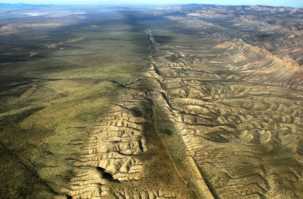
The area around the Salton Sea is located in a techtonically active region, with the San Andreas Fault running directly through it. The San Andreas Fault is a major plate boundary, where the Pacific Plate is moving north relative to the North American Plate (see our story about how fast it’s moving here). As pretty much every Californian knows, the legendary fault is responsible for the earthquakes and other tectonic activity across much of California.
If you look at a map of the area, you can see how the low lying southern portion of the Salton Sea basin goes directly into the Gulf of California. Over millions of years, the desert basin has been flooded numerous times throughout history by what is now the Gulf of California. As the fault system cuts through the region, the Pacific Plate is slowly sliding northwest, gradually pulling the Baja Peninsula away from mainland Mexico. Over millions of years, this tectonic motion is stretching and thinning the crust beneath the Imperial Valley and Salton Basin. If the process continues, geologists believe the area could eventually flood again, forming a vast inland sea, perhaps even making an island out of what is today Baja California. (We wrote about this earlier.)
Entrance to the Salton Sea Recreation Area (Wikipedia)
Yet even as the land shifts beneath it, the Salton Sea’s future may be shaped not just by geology, but by energy. Despite the ongoing controversy over the evaporating water body, the Salton Sea may play a crucial role in California’s renewable energy future. The region sits atop the Imperial Valley’s geothermal hotspot, where underground heat from all that tectonic activity creates ideal conditions for producing clean, reliable energy. Already home to one of the largest geothermal fields in the country, the area is now gaining attention for something even more strategic: lithium.
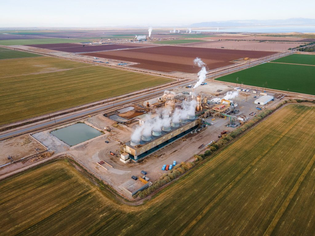
An aerial view of geothermal power plants among the farmland around the southern shore of the Salton Sea. (Credit: Courtesy Lawrence Berkeley National Lab)
Beneath the surface, the hot, mineral-rich brine used in geothermal energy production contains high concentrations of lithium, a critical component in electric vehicle batteries. Known as “Lithium Valley,” the Salton Sea region has become the focus of several ambitious extraction projects aiming to tap into this resource without the large environmental footprint of traditional lithium mining. Gov. Gavin Newsom called the area is “the Saudi Arabia of lithium.” Even the Los Angeles Times has weighed in, claiming that “California’s Imperial Valley will be a major player in the clean energy transition.”
Companies like Controlled Thermal Resources (CTR) and EnergySource are developing direct lithium extraction (DLE) technologies that pull lithium from brine as part of their geothermal operations. The promise is a closed-loop system that produces both renewable energy and battery-grade lithium on the same site. If it proves viable, the Salton Sea could significantly reduce U.S. dependence on foreign lithium and cement California’s role in the global shift to clean energy. That’s a big if…and one we’ll be exploring in depth in future articles.
Toxic salt ponds along the Western shoreline (Photo: EmpireFootage)
Such projects could also potentially provide significant economic investment in the region and help power California’s green energy ambitions. So for a place that looks kind of wrecked and desolate, there actually a lot going on. We promise to keep an eye on what happens. Stay tuned.
Before the late 1960s, understanding Earth’s shifting surface, particularly in a geologically active region like California, was a major scientific challenge. For most of human history, the causes of earthquakes remained an enigma—mysterious and terrifying, often attributed to supernatural forces. In Japan, for example, earthquakes were traditionally believed to be caused by Namazu, a giant catfish said to live beneath the earth and whose thrashing would shake the land. Many societies believed earthquakes were divine punishments or omens, while others considered them an essential part of creation, events necessary to form a world habitable by us humans.
The complexity of California’s landscape, its mountains, valleys, deserts, and intricate network of faults, posed difficulties for early geologists. The land appeared chaotically interwoven, with many different types of rock making up the gaping deserts and soaring peaks. As the great University of California at Davis geologist Eldridge Moores once put it, “Nature is messy. Don’t expect it to be uniform and consistent.”
An image of humans battling a Namazu (Credit: Tokyo University Library. Public Domain)
But there was no overarching explanation for how these earthly features got there. Scientists could observe and record earthquakes, but without a unifying theory, they struggled to piece together the deeper mechanisms driving these powerful events.
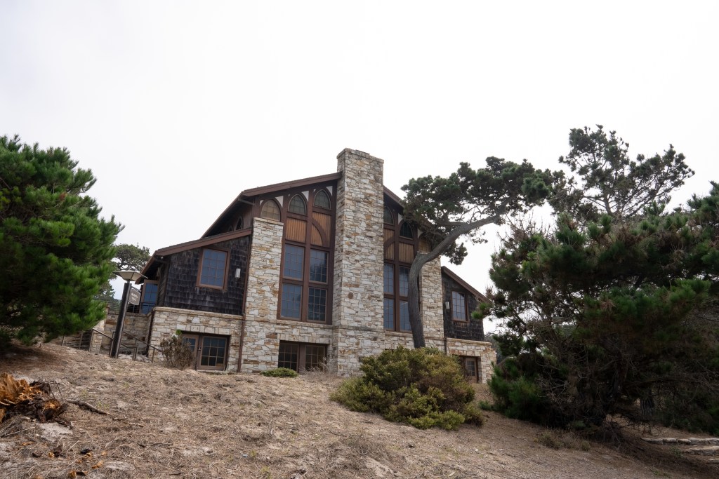
This frustration lingered until the late 1960s when an intellectual revolution in geology took shape. Despite the dawn of the space age and the rise of computing power, many earth scientists still clung to the belief that the continents were fixed, immovable features on the Earth’s surface. The breakthrough came with the acceptance of plate tectonics—a theory that elegantly explained not just earthquakes, but the entire dynamic nature of Earth’s surface. And for many geologists, the moment this new understanding solidified was in December 1969, at a groundbreaking conference at the Asilomar Conference Center in California that reshaped the future of the field. (Notably, Asilomar was also the site of the historic 1975 conference on recombinant DNA, where scientists gathered to establish ethical guidelines for genetic research, an event we have explored previously.) This was the moment when plate tectonics, a concept that would fundamentally reshape our view of the planet, truly took hold in the Western American geological community.
At California’s Asilomar Conference Grounds, nestled amid Monterey pines and dramatic granite formations, scientists gathered to rewrite our understanding of tectonics—and reshape how we think about Earth’s restless surface. (Erik Olsen)
For centuries, explanations for Earth’s features ranged from catastrophic events to gradual uplift and erosion, a debate that became known as uniformitarianism versus catastrophism. In California, the sheer complexity of the geology, with its links go far beyond the borders of the state, hinted at powerful forces at play. Scientists grappled with the origins of the Sierra Nevada, the formation of the Central Valley, and the persistent threat of earthquakes along the now-famous San Andreas Fault. The prevailing models, however, lacked the comprehensive framework to connect these disparate observations into a coherent narrative.
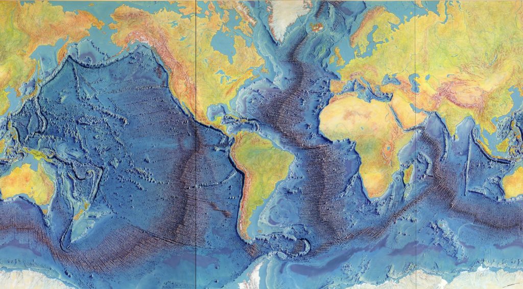
The seeds of the plate tectonic revolution had been sown earlier in the 20th century with Alfred Wegener’s theory of continental drift. Anyone looking at a world map or globe could see how the coastlines of certain continents, particularly South America and Africa, seemed to fit together like pieces of a puzzle, suggesting they were once joined. Wegener proposed that the continents were once joined together in a supercontinent called Pangaea and had gradually drifted apart over millions of years. While his ideas were initially met with skepticism, particularly regarding the mechanism that could drive such massive movements, compelling evidence from paleontology, glacial geology, and the jigsaw-like fit of continental coastlines slowly began to sway opinions. The discovery of seafloor spreading in the 1960s (itself a great story, featuring the brilliant geologist and cartographer Marie Tharp) which revealed that new oceanic crust was constantly being generated at mid-ocean ridges and that the ocean floor itself was moving like a conveyor belt, provided the crucial mechanism Wegener lacked.
Heinrich Berann’s 1977 painting of the Heezen-Tharp “World Ocean Floor” map, a landmark in cartography that showed how the earths plates in some areas are pulling apart while others collide. (Library of Congress)
It was against this backdrop of burgeoning evidence that the Geological Society of America convened one of its annual Penrose Conferences in December 1969 at the Asilomar Conference Center in Pacific Grove, California. Titled “The Meaning of the New Global Tectonics,” the event drew structural geologists from all over the world. The geological world changed overnight. A key figure in the conference was William R. Dickinson, a leading structural geologist whose work helped bridge the gap between traditional geological interpretations and the emerging plate tectonic framework. Dickinson’s research on sedimentary basins and tectonic evolution provided critical insights into how plate movements shaped the western United States, further solidifying the new theory’s acceptance.
These conferences were designed to be intimate gatherings where geologists could engage in focused discussions on cutting-edge research. The 1969 meeting proved to be a pivotal one. As UC Davis’ Moores, then a youthful figure who would become a leading voice of the “New Geology” in the West, later wrote, “the full import of the plate tectonic revolution burst on the participants like a dam failure”.
The Palmdale Road Cut on Hwy 14 in Southern California is a 90-foot slice through swirling sediments that have spent millions of years being squeezed and twisted by the San Andreas fault. Some say that this view of the fault is one of the best in all of California. (Photo: Erik Olsen)
Paper after paper presented at the conference demonstrated how the seemingly simple notion of large plates floating atop the Earth’s plastic mantle (the asthenosphere) could explain a vast array of geological phenomena. The location of volcanoes, the folding of mountains (orogeny), the distribution of earthquakes, the shape of the continents, and the history of the oceans all suddenly found a compelling and unified explanation within the framework of plate tectonics. Geologist John Tuzo Wilson famously referred to plate tectonics as ‘the dance of the continents,’ a phrase that captured the excitement and transformative nature of this intellectual breakthrough.
For Moores, the conference was a moment of profound realization. “It was a very exciting time. I still get goosebumps even talking about it,” he told the writer John McPhee. “A turning point, I think it was, in the plate tectonic revolution, that was the watershed of geology.” Moores had been contemplating the perplexing presence of ophiolite sequences – distinctive rock assemblages consisting of serpentines, gabbro/lava, and sediments – found high in the mountains of the West, including California. He suddenly grasped that these strange and “exotic” rock sequences were remnants of ancient ocean floors that had been lifted on top of the continent through the collision of tectonic plates.
Asilomar Conference Grounds Interior (Erik Olsen)
Moores reasoned that the serpentines and coarsely crystalline igneous rocks at the base of these sequences were characteristic of the rocks underlying all the world’s oceans. The “green rocks” in the middle (now the state rock of California) showed evidence of moderate pressure and temperatures, indicating they had been subjected to significant geological forces. By connecting these ophiolite sequences to the processes of plate collision and obduction (where one plate rides over another), Moores provided a powerful piece of evidence for plate tectonics and offered a new lens through which to understand the complex geological architecture of the American West.
His deduction was in line with what is now known about plate tectonics. The geological “confusion” apparent in the Rockies, the Sierra Nevada, and other western mountain chains was now understood as the result of neighboring plates bumping into each other repeatedly over vast geological timescales. The concept of terranes, foreign rock slabs or slices or sequences that have traveled vast distances and become accreted to continents, further illustrated the dynamic and assembly-like nature of California’s geological landscape.
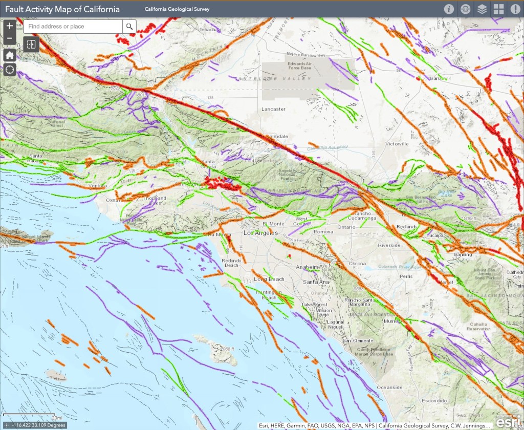
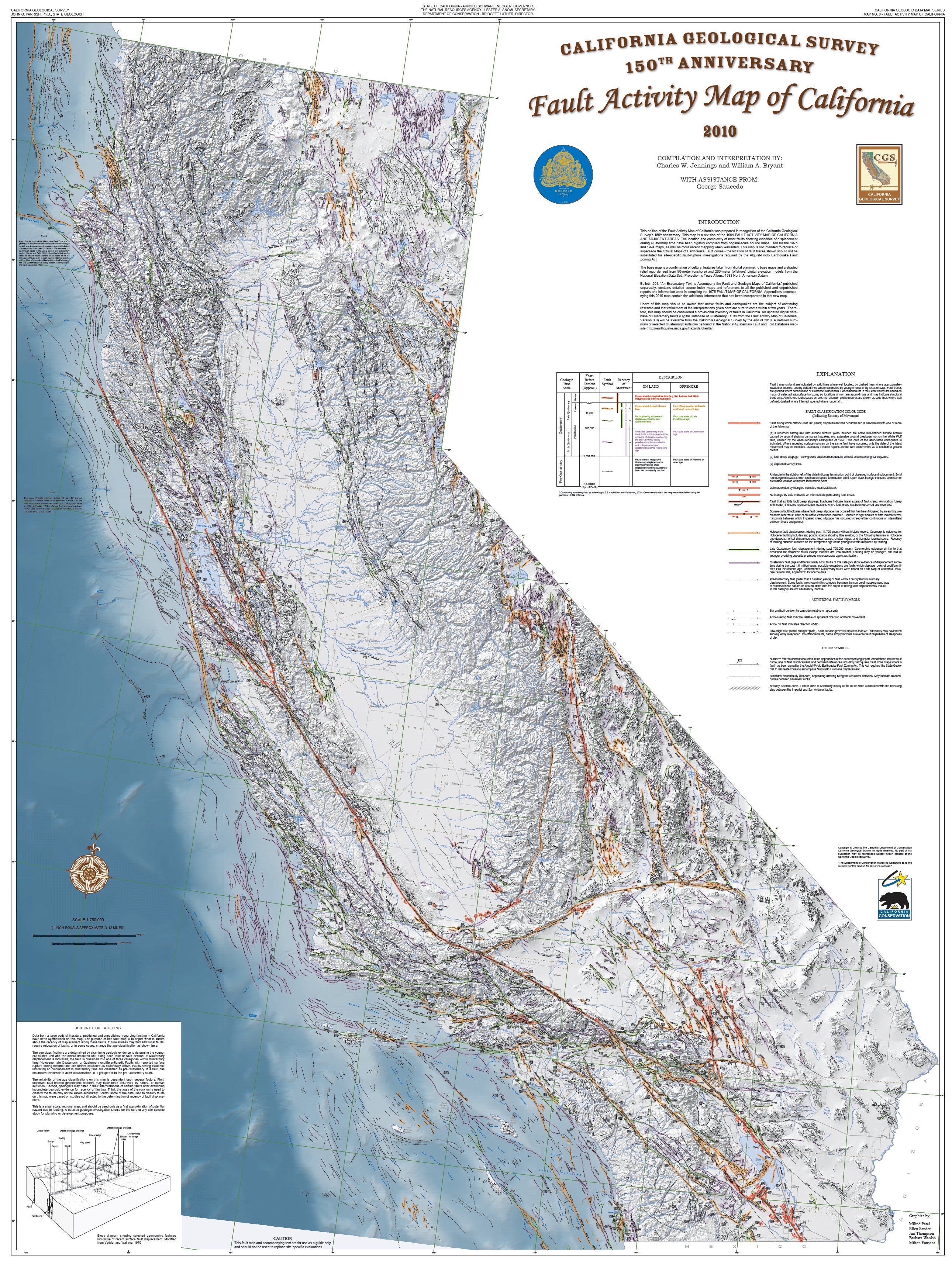
Fault Activity Map of LA Area in California (California Geological Survey) )
California, situated at the active boundary between the massive Pacific Plate and the North American Plate, became a prime natural laboratory for studying the principles of plate tectonics. The San Andreas Fault, a “right-lateral strike-slip fault” where the Pacific Plate slides northward relative to the North American Plate, is a direct consequence of this ongoing tectonic interaction. Places like Parkfield, California, lying directly on the fault, became the center of the seismic universe, offering invaluable opportunities to study the processes of locking and unlocking that precede earthquakes.
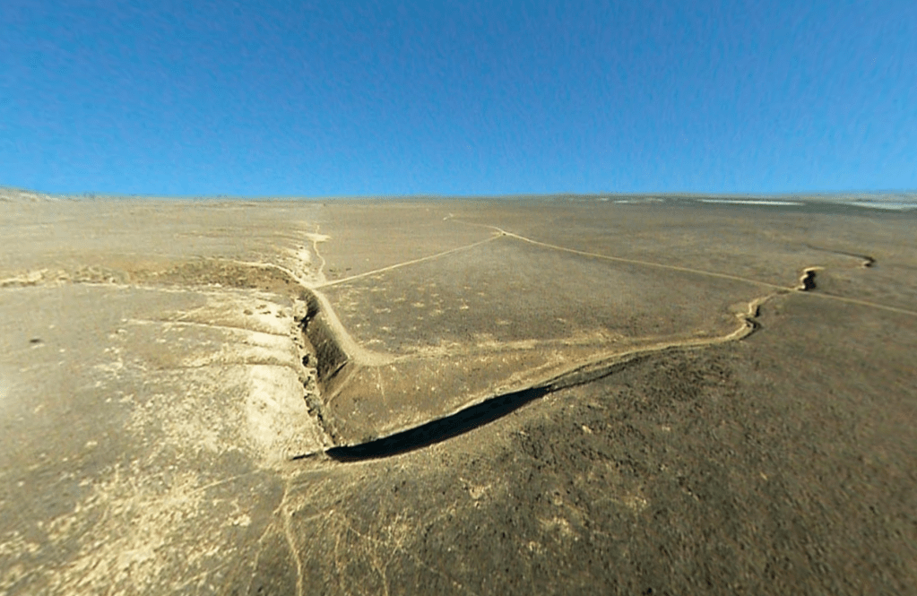
The San Andreas Fault at Wallace Creek. On January 9, 1857, the M 7.9 Fort Tejon earthquake occurred just north of the Carrizo Plain. Here, at Wallace Creek, the fault moved 30 feet (9m), forming the offset stream channel seen in the photo. (USGS)
The dramatic offsets of streams like Wallace Creek on the Carrizo Plain vividly demonstrate the horizontal movement along the fault. These offsets, where streams appear abruptly displaced, serve as clear, visual records of the fault’s slip history, showing just how much the land has shifted over time. Further proof of the movement of plates along the fault was uncovered in a remarkable investigation by Thomas Dibblee Jr., a pioneering field geologist who meticulously mapped vast regions of California. One of his most compelling discoveries was the striking geological similarity between rocks found at Pinnacles National Park and those in the Neenach Volcanic Field, located more than 195 miles to the southeast. Dibblee determined that these formations were once part of the same volcanic complex but had been separated by the gradual (but pretty damn quick in geological time) movement of the Pacific Plate along the San Andreas Fault over millions of years.
The insights gained from the plate tectonic revolution, sparked in part by that pivotal conference in Pacific Grove, continue to inform our understanding of California’s geological hazards and history. The work of scientists like Eldridge Moores and the subsequent advancements in the field have provided a robust framework for interpreting the state’s complex and ever-evolving landscape. The 1969 Penrose Conference marked not just a shift in scientific thinking but a fundamental unlocking of some of the Earth’s deep secrets, with California the place, once again, at the center of scientific advance.
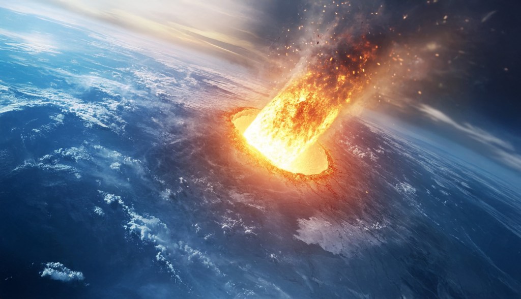
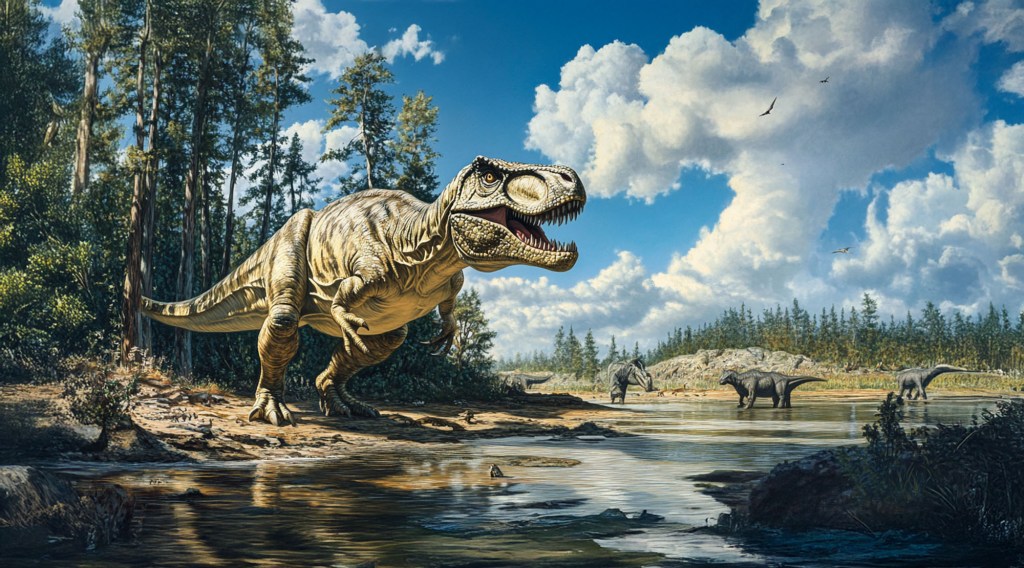
Artist’s rendering of the colossal Chicxulub meteor hurtling toward Earth, moments before impact on the Yucatán Peninsula, an event that reshaped life on our planet 66 million years ago. (Erik Olsen)
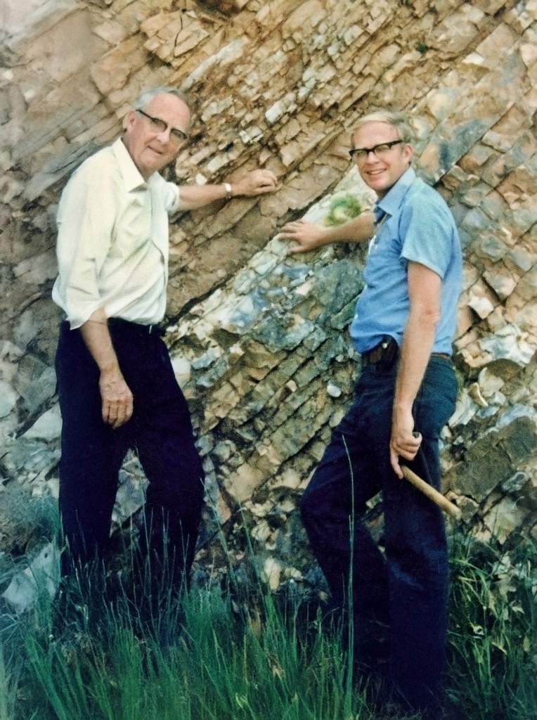
In 1977, Walter Alvarez arrived at Berkeley with rock samples from a small Italian town called Gubbio, unaware that they would help rewrite the history of life on Earth. He had spent years studying plate tectonics, but his father, Luis Alvarez, a Nobel Prize-winning physicist known for his unorthodox problem-solving at Berkeley, would propel him into a new kind of investigation, one deeply rooted in geology and Earth sciences. Their work led to one of the most significant scientific breakthroughs of the 20th century: the discovery that a massive meteorite impact was responsible for the extinction of the dinosaurs and much of life on Earth.
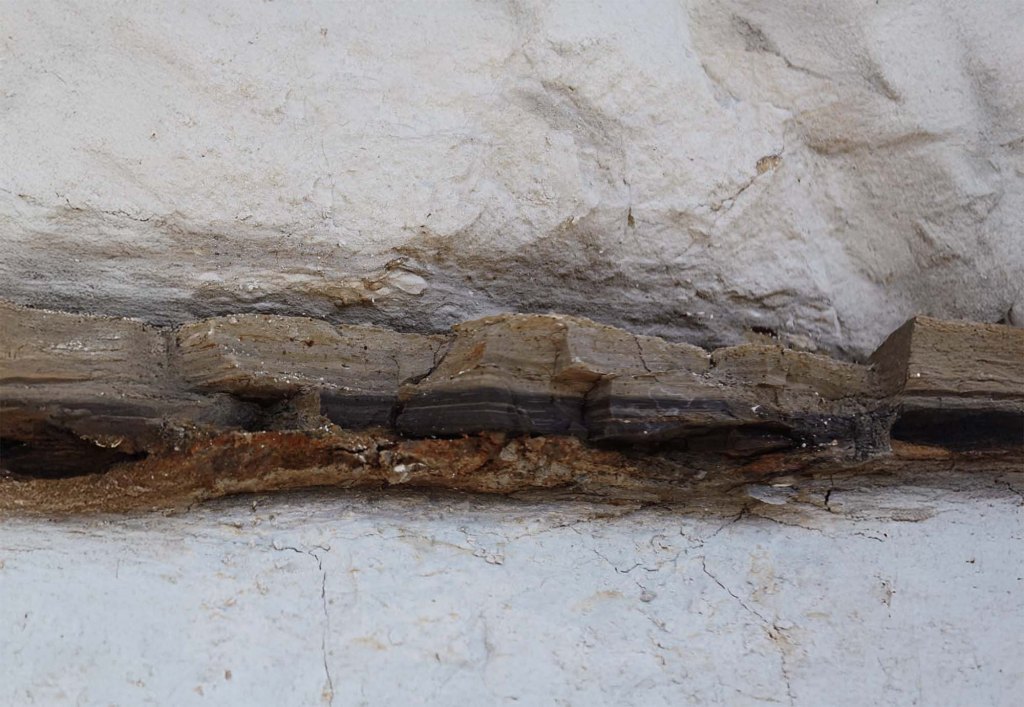
Luis and Walter Alvarez stand at the K–Pg boundary within the rock layers of a limestone outcrop near Gubbio, Italy, in 1981. This geological marker is linked to the asteroid impact that triggered the mass extinction 66 million years ago. (Lawrence Berkeley National Laboratory)
The samples Walter had collected contained a puzzling clay layer sandwiched between older and younger limestone deposits. This clay was rich in iridium—an element rare on Earth’s surface. The discovery of such an unusually high concentration of iridium in a single layer of buried rock was perplexing. Given that iridium is far more common in extraterrestrial bodies than on Earth’s surface, its presence suggested an extraordinary event—one that had no precedent in scientific understanding at the time. The implications were staggering: if this iridium had arrived all at once, it pointed to a cataclysmic event unlike anything previously considered in Earth’s history. Although some scientists had speculated about meteor impacts, solid evidence was scarce.
Alvarez determined that this layer corresponded precisely to the Cretaceous-Paleogene (K-Pg) boundary (formerly called Cretaceous–Tertiary or K–T boundary), the geological marker of the mass extinction that eradicated the non-avian dinosaurs 66 million years ago. Scientists had long debated the cause of this catastrophe, proposing theories ranging from volcanic activity to gradual climate change. But the Alvarez team would introduce a radical new idea—one that required looking beyond Earth.
Layers of sediment at Stevns Klint, Denmark, showcasing the distinct K–Pg boundary. The dark clay layer, rich in iridium, marks the asteroid impact that led to the mass extinction of the dinosaurs 66 million years ago. (UNESCO)
Mass extinctions stand out so distinctly in the fossil record that the very structure of geological time is based on them. In 1841, geologist John Phillips divided life’s history into three chapters: the Paleozoic, or “ancient life”; the Mesozoic, or “middle life”; and the Cenozoic, or “new life.” These divisions were based on abrupt breaks in the fossil record, the most striking of which were the end-Permian extinction and the end-Cretaceous extinction, noted here. The fossils from these three eras were so different that Phillips originally believed they reflected separate acts of creation. Charles Lyell, one of the founders of modern geology, observed a “chasm” in the fossil record at the end of the Cretaceous period, where species such as belemnites, ammonites, and rudist bivalves vanished entirely. However, Lyell and later Charles Darwin dismissed these apparent sudden extinctions as mere gaps in the fossil record, preferring the idea of slow, gradual change (known as gradualism, versus catastrophism). Darwin famously compared the fossil record to a book where only scattered pages and fragments of lines had been preserved, making abrupt transitions appear more dramatic than they were.
Luis Alvarez was a physicist whose career had spanned a remarkable range of disciplines, from particle physics to aviation radar to Cold War forensics. He had a history of bold ideas, from using muon detectors to search for hidden chambers in pyramids to testing ballistic theories in the Kennedy assassination with watermelons. When Walter shared his perplexing stratigraphic findings, Luis proposed a novel method to measure how long the clay layer had taken to form: by analyzing its iridium content.
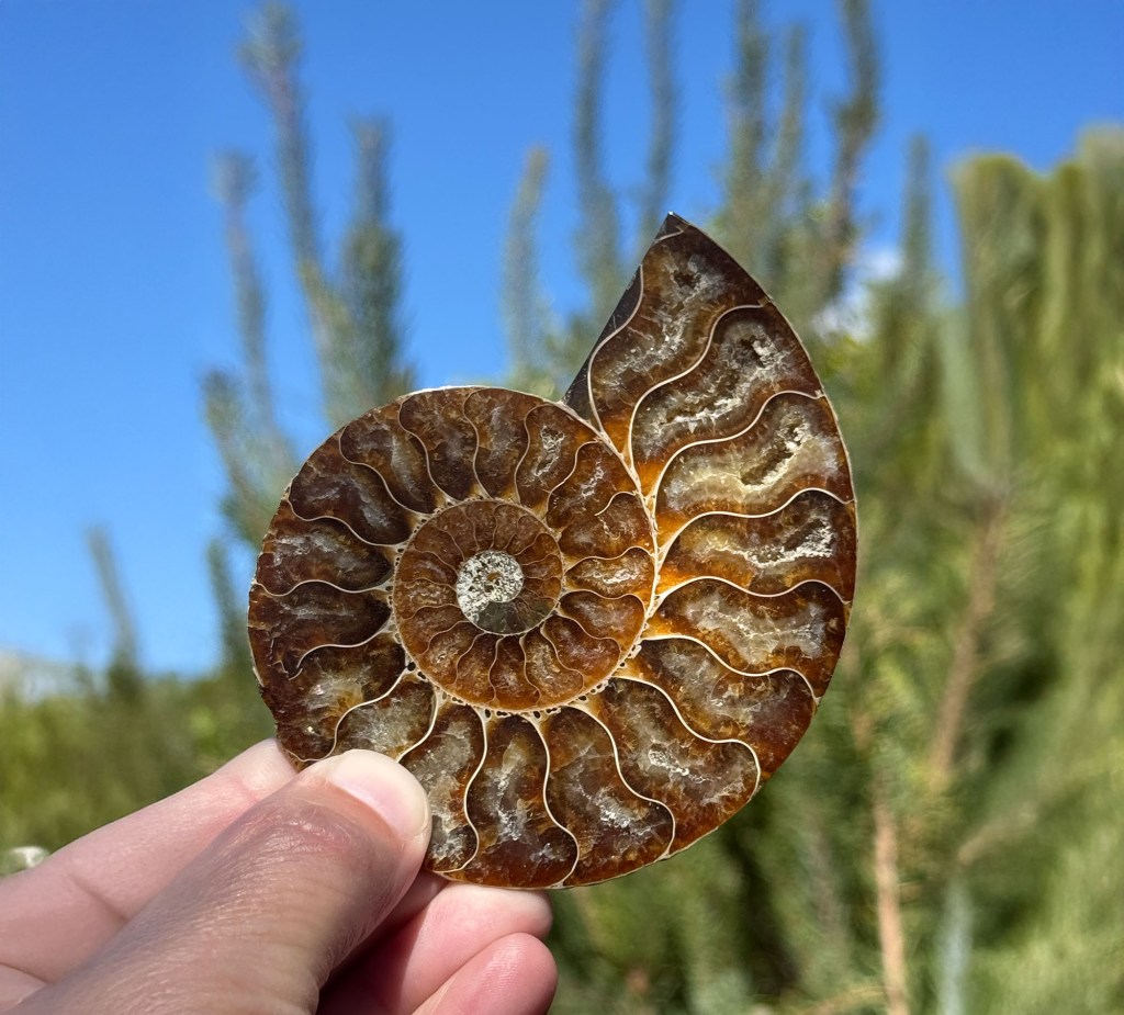
A fossilized ammonite, one of many marine species that vanished at the K–Pg boundary, marking a sharp “chasm” in the fossil record after the asteroid impact 66 million years ago. (Photo: Erik Olsen)
As discusses, Iridium is a rare element on Earth’s surface but is far more abundant in meteorites. Luis hypothesized that if the clay had accumulated slowly over thousands or millions of years, it would contain only tiny traces of iridium from cosmic dust. But if it had been deposited rapidly—perhaps by a single catastrophic event—it might show an anomalously high concentration of the element. He reached out to a Berkeley colleague, Frank Asaro, whose lab had the sophisticated equipment necessary for this kind of analysis.
Nine months after submitting their samples, Walter received a call. Asaro had found something extraordinary: the iridium levels in the clay layer were off the charts—orders of magnitude higher than expected. No one knew what to make of this. Was it a weird anomaly, or something more significant? Walter flew to Denmark to collect some late-Cretaceous sediments from a set of limestone cliffs known as Stevns Klint. At Stevns Klint, the end of the Cretaceous period shows up as a layer of clay that’s jet black and contains high amounts of organic material, including remnants of ancient marine life. When the stinky Danish samples were analyzed, they, too, revealed astronomical levels of iridium. A third set of samples, from the South Island of New Zealand, also showed an iridium “spike” right at the end of the Cretaceous. Luis, according to a colleague, reacted to the news “like a shark smelling blood”; he sensed the opportunity for a great discovery.
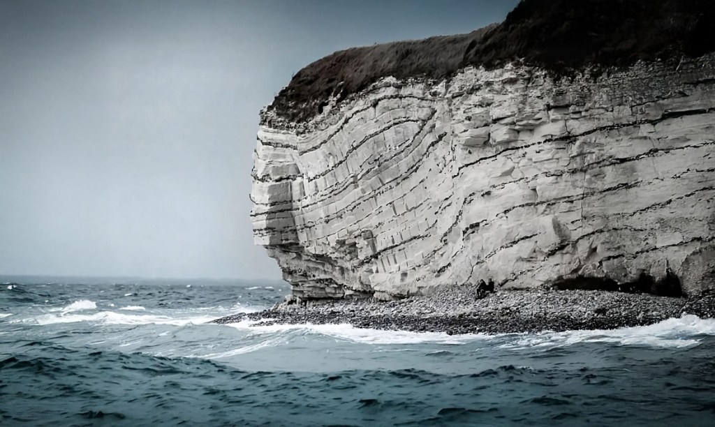
Stevns Klint’s towering white chalk cliffs stand as a dramatic testament to Earth’s history, preserving the thin, dark Fish Clay layer that marks the cataclysmic asteroid impact that ended the age of dinosaurs 66 million years ago. (UNESCO)
The Alvarezes batted around theories. But all the ones they could think of either didn’t fit the available data or were ruled out by further tests. Then, finally, after almost a year’s worth of dead ends, they arrived at the impact hypothesis. On an otherwise ordinary day sixty-six million years ago, an asteroid six miles wide collided with the Earth. Exploding on contact, it released energy on the order of a hundred million megatons of TNT, or more than a million of the most powerful H-bombs ever tested. Debris, including iridium from the pulverized asteroid, spread around the globe. Day turned to night, and temperatures plunged. A mass extinction ensued. Even groups that survived, like mammals and lizards, suffered dramatic die-offs in the aftermath. Who perished, and who survived, set the stage for the next 66 million years—including our own origin 300,000 years ago.
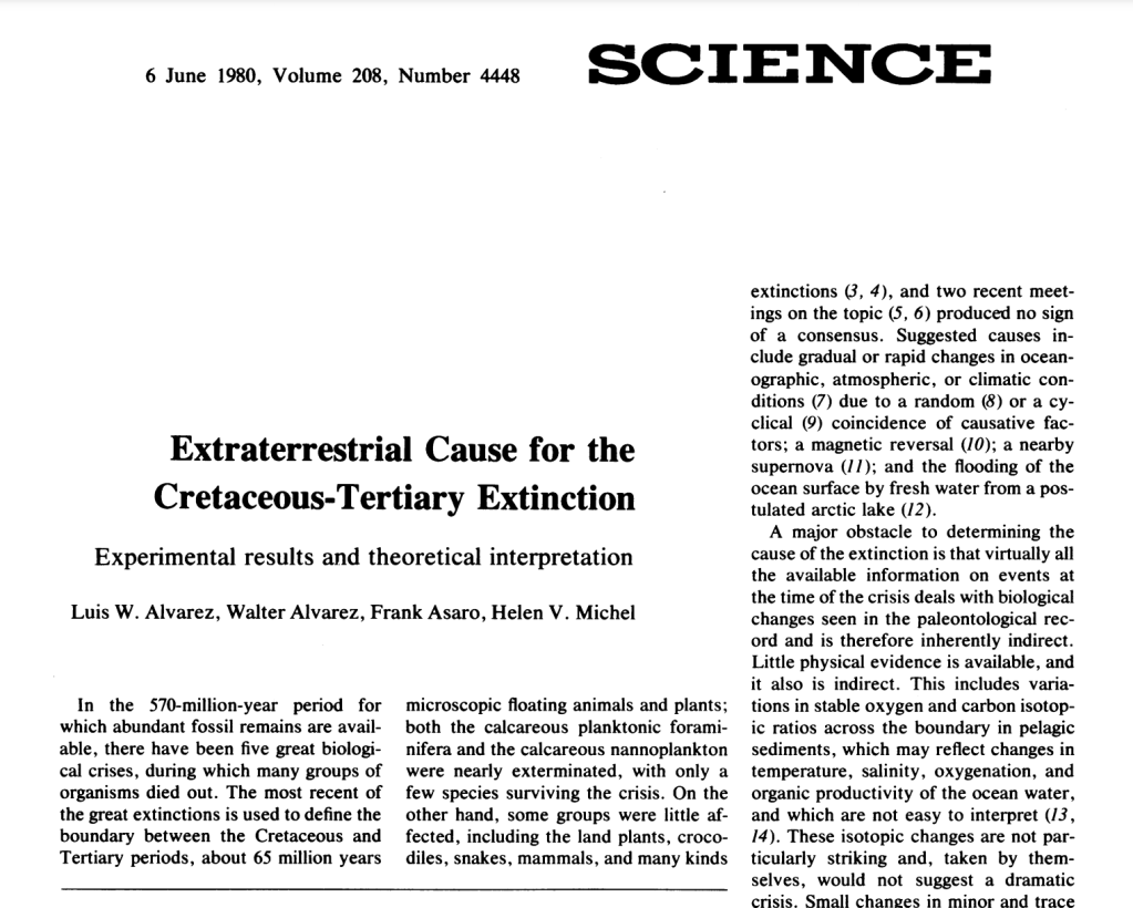
The Alvarezes wrote up the results from Gubbio and Stevns Klint and sent them, along with their proposed explanation, to Science. “I can remember working very hard to make that paper just as solid as it could possibly be,” Walter later recalled. Their paper, Extraterrestrial Cause for the Cretaceous-Tertiary Extinction, was published in June 1980. It generated enormous excitement, much of it beyond the bounds of paleontology, but it was also ridiculed by some who considered the idea far-fetched, if not ridiculous. Journals in disciplines ranging from clinical psychology to herpetology reported on the Alvarezes’ findings, and soon the idea of an end-Cretaceous asteroid was picked up by magazines like Time and Newsweek. In an essay in The New York Review of Books, the late American paleontologist Stephen Jay Gould quipped that linking dinosaurs—long an object of fascination—to a major cosmic event was “like a scheme a clever publisher might devise to ensure high readership.”
Inspired by the impact hypothesis, a group of astrophysicists led by Carl Sagan decided to try to model the effects of an all-out war and came up with the concept of “nuclear winter,” which, in turn, generated its own wave of media coverage. But as the discovery sank in among many professional paleontologists, the Alvarezes’ idea—and in many cases, the Alvarezes themselves—were met with hostility. “The apparent mass extinction is an artifact of statistics and poor understanding of the taxonomy,” one paleontologist told The New York Times. “The arrogance.”
Skepticism was immediate and intense. Paleontologists, geologists, and physicists debated the implications of the iridium anomaly. But as the search for supporting evidence intensified, the pieces of the puzzle began to fall into place. Shocked quartz, a telltale sign of high-energy impacts, was found at sites around the world. Soot deposits suggested massive wildfires had raged in the aftermath.
Artists rendering of T-rex and other dinosaurs prior to the impact of the asteroid (Erik Olsen)
In the early 1990s, conclusive evidence finally emerged. The Chicxulub crater, measuring roughly 180 kilometers across and buried under about half a mile of sediment in Mexico’s Yucatán Peninsula, was identified as the likely impact site. Although it was first detected by Mexico’s state-run oil company (PEMEX) in the 1950s during geophysical surveys, core samples taken decades later clinched the identification of Chicxulub as the long-sought impact site linked to the mass extinction that ended the Cretaceous era.
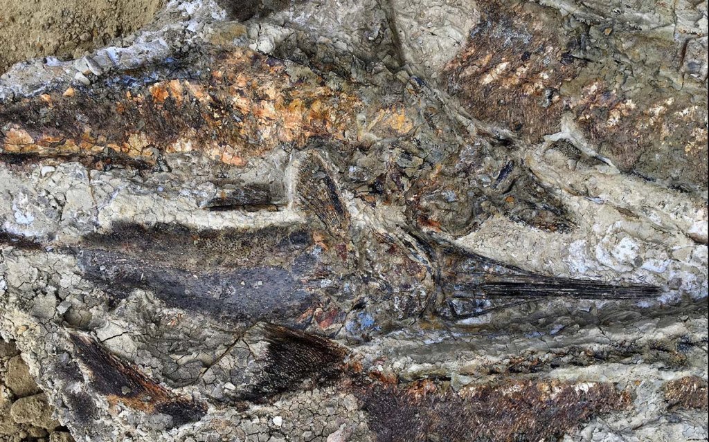
One of the more intriguing (if not astounding) recent discoveries tied to the end-Cretaceous impact is a site called Tanis, located in North Dakota’s Hell Creek Formation. Discovered in 2019 by a team led by Robert DePalma and spotlighted in a New Yorker article, Tanis preserves a remarkable snapshot of what appears to be the immediate aftermath of the asteroid strike.
Tanis fossils (Image credit: Courtesy of Robert DePalma)
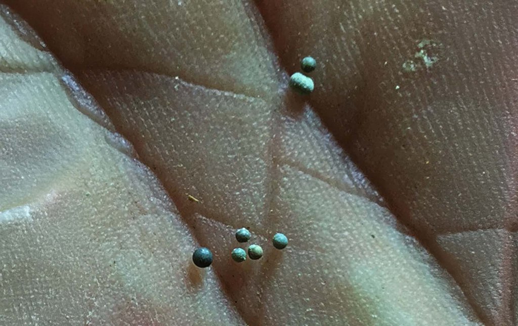
The sedimentary layers at Tanis indicate large waves—often called “seiche waves”—that may have surged inland in the immediate aftermath of the impact. They also contain countless tiny glass spherules that rained down after the explosion. Known as microtektites, these blobs form when molten rock is hurled into the atmosphere by an asteroid collision and solidifies as it falls back to Earth. The site appears to hold them by the millions. In some cases, fish fossils have been found with these glass droplets lodged in their gills—a striking testament to how suddenly life was disrupted.
Although still under investigation, Tanis has drawn attention for its exceptional level of detail, potentially capturing events that took place within mere hours of the impact. The precise interpretation of this site continues to spark controversy among researchers. There is also controversy about the broader cause of the mass extinction itself: the main competing hypothesis is that the colossal “Deccan” volcanic eruptions, in what would become India, spewed enough sulfur and carbon dioxide into the atmosphere to cause a dramatic climatic shift. However, the wave-like deposits, along with the abundant glass spherules, suggest a rapid and violent disturbance consistent with a massive asteroid strike. Researchers hope to learn more about the precise sequence of disasters that followed—tidal waves, intense firestorms, and global darkness—further fleshing out the story of how the world changed so drastically, so quickly.
Glass spherules from cosmic impacts—microtektites from Tanis, tiny relics of Earth’s violent encounters with space. (Image credit: Courtesy of Robert DePalma)
All said, today the Alvarez hypothesis is widely accepted as the leading explanation for the K-Pg mass extinction. Their contributions at UC Berkeley—widely recognized as one of the world’s preeminent public institutions—not only reshaped our understanding of Earth’s history but also changed how we perceive planetary hazards. The realization that cosmic collisions have shaped life’s trajectory has led to renewed interest in asteroid detection and planetary defense.
Walter and Luis Alvarez’s discovery was a testament to the power of interdisciplinary science and the willingness to follow unconventional ideas. Their pursuit of an extraterrestrial explanation for a terrestrial mystery reshaped paleontology, geology, and astrophysics. What began with a father and son pondering an ancient Italian rock layer ended in a revelation that forever changed how we understand the history of life—and its vulnerability to forces from beyond our world.


