Feathers on the Flyway: Unraveling Avian Mysteries at Bear Divide with the Moore Lab

Western tanager (Ryan Terrill)

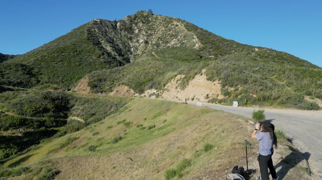
Within a 45 minute drive from the urban chaos of downtown Los Angeles, lies a natural, ornithological marvel: Bear Divide, a vital corridor for the annual migration of numerous bird species. The divide is a small dip in the otherwise impregnable San Gabriel mountains, allowing birds in the midst of their migration to pass through safely at relatively low altitudes. This area is not just a haven for bird enthusiasts but also a critical research site, especially for the team from the Moore Lab of Zoology at Occidental College, who have been delving into the intricacies of these migratory patterns.

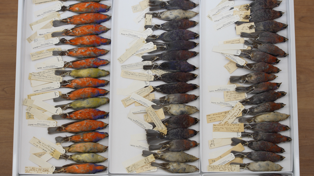
The Moore Lab of Zoology is renowned for its extensive bird specimen collection, one of the largest of its kind in the world for Mexican birds.

Part of the large bird collection at the Moore Lab (Erik Olsen)

Bear Divide is strategically positioned along the Pacific Flyway, a significant north-south migratory route used by birds traveling between Alaska and Patagonia. The geographical features of the San Gabriels provide an ideal resting and feeding ground for these birds, making Bear Divide a crucial stopover during their long journeys. It’s this unique combination of location and topography that makes Bear Divide an essential component of avian migration.

U.S. Fish and Wildlife Service

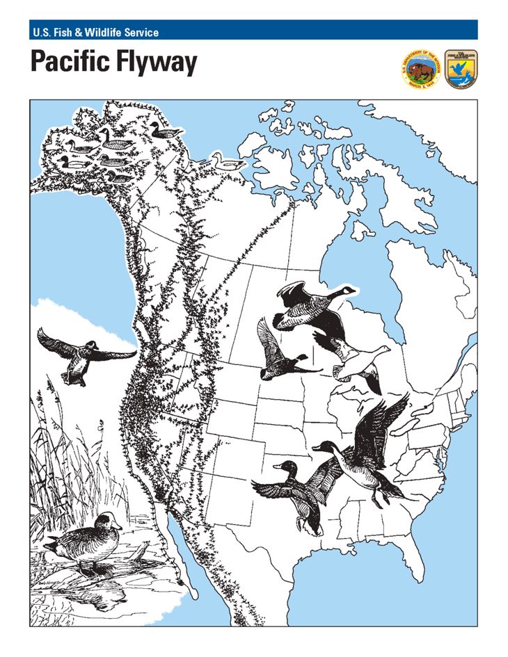
The discovery of Bear Divide was a lucky happenstance. A bird researcher was conducting overnight monitoring in the spring of 2016, and when morning came, he noticed legions of small songbirds whizzing past his monitoring spot. His report caught the attention of postdoc bird scientist Ryan Terrill at Moore Lab at the time, and he began an effort to monitor the birds. Terrill and his team would ultimately record as many as 20,000 birds in a single morning. The effort has continued to this day with startling results. Terrill has since left and is now the science director at the Klamath Bird Observatory.

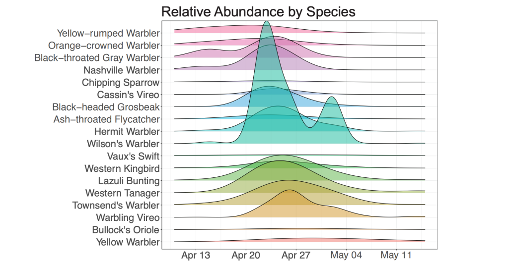
“Last year 2023 we counted 53,511 birds of 140 species from February to May,” said John McCormack, a professor of biology and the Director and Curator of the Moore Laboratory of Zoology. “And of course, we missed many thousands more because most travel at night. It’s easy to say that there are hundreds of thousands of birds passing through Bear Divide.”

Swainson’s Hawk (Marky Mutchler)

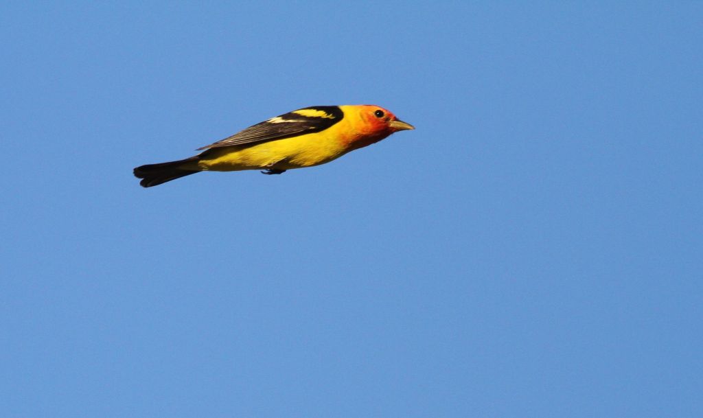
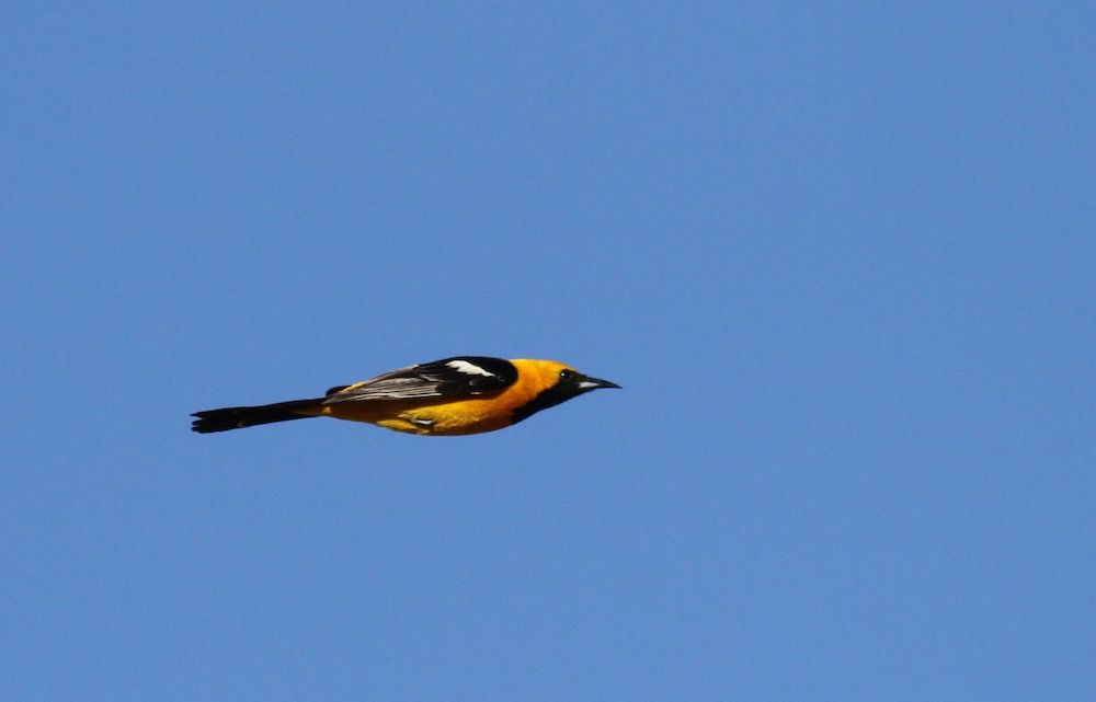
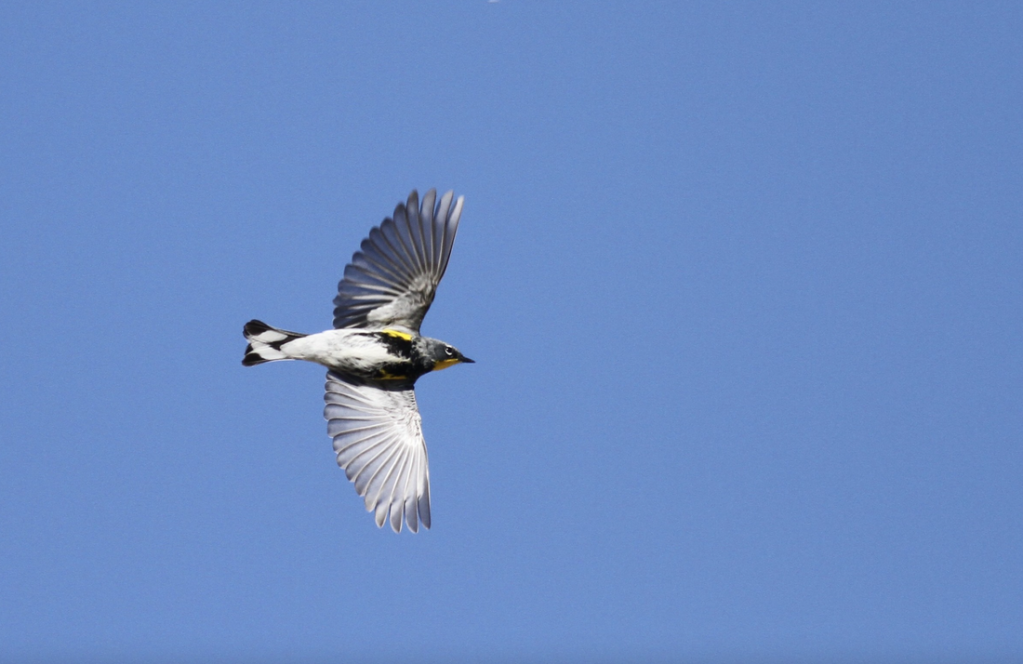
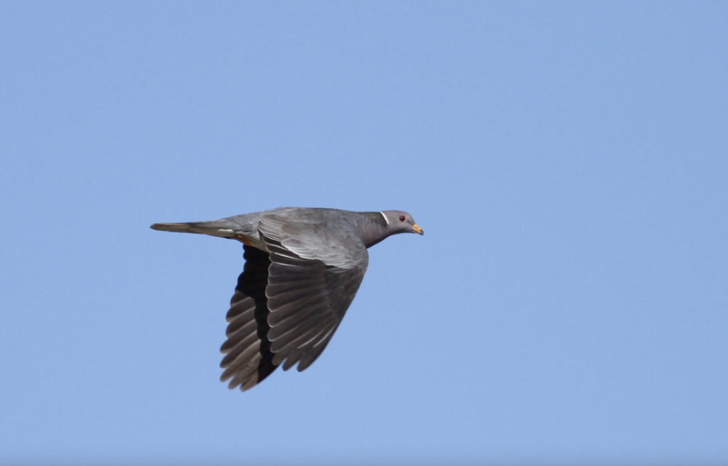
As many as 13,000 western tanagers, lazuli buntings, chipping sparrows, hermit warblers, orioles, grosbeaks and warblers pass through Bear Divide on a single day. Why they do so, is not entirely understood. The unusual topography of Bear Divide essentially serves as a funnel for the migrating birds, with many of them shooting through the gap just a meter or two above ground.

“Personally, I really think it’s one of the best birding spots in the world,” Terrill told the LA Times.

McCormack says that the “ultimate goal is to better understand the Pacific Flyway and how it’s used, especially by small terrestrial birds. Little is known about their movements because they are hard to see and usually travel at night.”

Hooded Oriole (Ryan Terrill)

Because many of the species sighted at Bear Divide are in steep decline. The lab says that year-to-year counts will help set a baseline for future trends that can be associated with weather, climate, and urbanization. “Tracking individual birds will give granular knowledge on how migratory birds use the landscape, which helps individuals and homeowners create corridors for them to travel,” says McCormack.

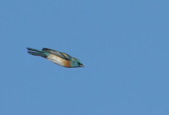
The best time to catch the show at Bear Divide is late winter early Spring. McCormack says Cliff Swallows and Lawrence’s Goldfinch are some of the early movers in March, and that by May, streaking by are Yellow Warblers, sunset-faced Western Tanagers, and bright blue Lazuli Buntings.

“There is so much we still don’t know about these birds and their world,” Lauren Hill, the site’s lead bird bander, told the Los Angeles Times. “For example, no one knows where they were before showing up here after sunrise.”

Lazuli Bunting zips past the camera at Bear Divide (Ryan Terrill)

The team is counting birds in order to establish a baseline of the populations coming through Bear Divide so they can understand how much we are changing the environment and what effect that may have on bird populations, many of which are in severe decline.

Their research spans a variety of topics, including how climate change is impacting migration routes and the effects of urbanization on bird populations. The lab has recently begun a program to put satellite trackers on birds at Bear Divide to follow individual birds, providing deep insight into their migration and resting patterns. This research is not only pivotal in understanding avian behavior but also crucial in shaping conservation policies.

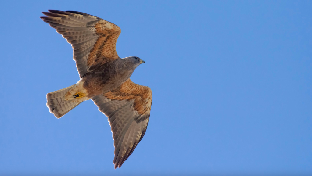
One of the most fascinating aspects of Bear Divide is the sheer variety of bird species it attracts. From the diminutive hummingbirds to the impressive birds of prey, each species adds a unique dimension to the study of migration. The Moore lab’s findings have shed light on the varied responses of different species to environmental changes, offering a glimpse into the broader ecological shifts occurring across the globe.

Yellow-rumped Warbler (Ryan Terrill)

One compelling result of the Moore Lab’s study at Bear Divide suggests that the peak of a particular species’ migration is correlated with the latitude of its breeding site. Species that breed at higher latitudes migrated through Bear Divide at later dates. It’s also unusual in the West for species to migrate during the day. Most species of birds using the Pacific Flyway are known to migrate at night.

The Moore Lab of Zoology

In addition to its scientific contributions, the Moore lab is also known for its involvement in citizen science. Collaborating with local birdwatchers and volunteers, the lab extends its research capabilities and cultivates a community actively engaged in bird conservation. This collaborative approach not only enhances the breadth of their research but also underscores the importance of community involvement in conservation efforts.

Bear Divide is that it’s public land, so anyone with a legitimate research project can get permission to work there. UCLA graduate student Kelsey Reckling, who has worked as a counter at Bear Divide since the beginning, is leading the counting efforts this Spring to understand changes in numbers of birds and species across years. Cal State L.A. graduate student Lauren Hill leads the group of bird banders, who catch some of the birds and record data, attaching a lightweight metal band around one leg and releasing them. Her lab mate Tania Romero is putting small, lightweight tracking devices on Yellow Warblers, which send signals to a network of tracking (MOTUS) towers across the continent.

Many bird species are under serious threat around the globe from a number of different impacts, including climate change, pesticides and habitat loss. Birds play a critical role in the health of our planet. They regulate ecosystems by preying on insects, pollinating plants, and spreading seeds. Healthy ecosystems are important for breathable air, food, and a regulated climate.

Bear Divide (Ian Davies)

According to a 2019 study, nearly 3 billion breeding birds have been lost in North America and the European Union since 1970. That’s about 30% of the bird population in North America. The 2022 State of the Birds Report for the United States found that bird declines are continuing in almost every habitat, except wetlands. Protecting birds’ habitats, and migration routes and reducing mortality through conservation efforts are crucial to ensuring the survival of these magnificent creatures.

The research conducted at Bear Divide by the Moore lab transcends academic interests, emphasizing the interconnectivity of ecosystems and underscoring the need to preserve natural migration corridors amid urban expansion. The insights gained here are invaluable to both the scientific community and conservation efforts, highlighting the need for a balanced approach to wildlife preservation and ecological sustainability.

Band-tailed Pigeon (Ryan Terrill)

“What’s magical about Bear Divide is that it’s the first real place to see small, migrating birds at eye level in daylight hours,” says McCormack. “I don’t want to oversell it: it’s still a lot of small birds zinging by in a wide open place and it takes a while to get good at identifying them. But by seeing them out there, struggling against the wind and the cold, but still making progress, it gives you a real sense of how amazing their journeys are–and how we shouldn’t make them harder if there’s anything we can do about it.”

The Blythe Intaglios: Unraveling the Secrets of California’s Nazca Lines. Mysteries Etched in Earth

Blythe Intaglio of a human figure in Southern California (Wikipedia)

In the vast expanses of California’s Colorado Desert, less than four hours from Los Angeles, a series of ancient and enigmatic figures etched into the earth—the Blythe Intaglios—have long puzzled anthropologists and captivated the imagination of those who visit them or view them from the sky. They were brought to modern attention somewhat by chance. In 1932, George Palmer, a pilot flying over the Mojave Desert between Las Vegas, Nevada and Blythe, glimpsed these enigmatic formations, sparking curiosity and awe. 

Named for the nearby town of Blythe, California, these large geoglyphs (human-made designs created on the ground by arranging or moving objects in a landscape), sprawl across the desert floor, and are an extraordinary example of prehistoric art, yet they remain one of the lesser-known archaeological wonders of North America. The Colorado Desert, just south of the Mojave, contains the only known desert intaglios in North America. 

The Blythe Intaglios are best observed from above by drone or by plane, where their full scale and intricacy become apparent. The largest figure – of a human with outstretched arms – spans an immense 171 feet, an impressive endeavor considering the primitive tools likely used in their creation. One has to wonder why they were created at all since the people who made them certainly had no way of viewing them from the air. In addition to humans, the figures depict animals such as a rattlesnake and possibly a horse (yeah, what is that thing?), as well as geometric shapes, each meticulously carved by removing the dark desert varnish to reveal the lighter soil underneath. Intaglios in general are classified by their shapes, such as anthropomorphs (humanlike), zoomorphs (animal-like) and various geometric shapes.

Blythe Intaglio quadruped (Wikipedia)

The intaglios are mostly located along the Colorado River, a fact that some scientists consider significant. Rivers often hold a central place in the spiritual and cultural lives of indigenous peoples. For the tribes associated with the Blythe Intaglios, such as the Mojave and Quechan, the Colorado River was likely a vital part of their spiritual and everyday life. The proximity of these geoglyphs to the river suggests that they could have been part of a broader cultural landscape that included the river as a critical element. The river may have been seen as a source of life and a spiritual boundary, making the nearby land a significant place for creating these monumental figures.

While the Nazca Lines in Peru have gained worldwide fame, the Blythe Intaglios, though similar in form and function, have remained relatively obscure. Most Californians probably have no idea that such unique archaeological artifacts can be found in the state, let alone so close to a major urban center. This obscurity, however, adds to their mystique. 

The geoglyphs are believed to date back at least a thousand years, but their exact age remains uncertain. If the quadruped figures represent horses (reintroduced in North America by the Spanish) then a historical date of sometime after the 1500s would be supported. Archaeologist Jay von Werlhof obtained radiocarbon dates for the figures, ranging from 900 BCE to 1200 CE. The human figures, particularly the largest, are thought to represent Mastamho, the creator of life in Mojave and Quechan mythology. The animal figures, like the mountain lions, are steeped in symbolic meaning, potentially reflecting the tribes’ cosmology and spiritual beliefs.

Nazca Lines in Peru. (UNESCO World Heritage Site)

The precise purpose of the Blythe Intaglios is a matter of ongoing debate. Some scholars propose that they were part of religious rituals or celestial observances. The alignment and positioning of the figures suggest a possible astronomical function, marking significant events in the lunar or solar calendars. Or perhaps making them was just a fun way to pass the time and express creativity.  

Despite their historical and cultural significance, the Blythe Intaglios have not been immune to threats. Off-road vehicle traffic and natural erosion have damaged some of the figures. Conservation efforts are in place, but the remote location and sheer scale of the site present unique challenges. Fences have been erected around some figures to protect them, but much work remains to ensure their preservation.

The Blythe Intaglios are more than just ancient art; they are a profound testament to the rich and diverse cultural heritage of the indigenous peoples of the Southwest. These geoglyphs offer a window into a past that likely predates European influence, a past that is integral to understanding the complex tapestry of American history. In a world where such treasures are increasingly vulnerable to the ravages of time and human interference, the Blythe Intaglios are a fascinating example of the enduring power of human expression over time and the mysteries beneath our feet.

Islands of Insight: Unraveling the Mysteries of Island Biogeography in California’s Channel Islands

The Channel Islands, located as close as 40 miles off the coast of Southern California are a hidden gem, an enchanting archipelago where the rush of modern life gives way to the soothing rhythms of nature. In addition to an abundance of natural beauty, this cluster of eight islands, often referred to as the “Galápagos of North America,” provides a unique stage where isolation and diverse ecosystems converge, allowing scientists and nature enthusiasts alike to witness the captivating dance of evolutionary processes in real-time.

In particular, the Channel Islands offer a fascinating natural laboratory for the study of island biogeography. This field of biology, which explores the distribution of species and ecosystems in island environments, finds a perfect case study in these islands. Each island, with its unique size, isolation, and ecological features, provides invaluable insights into the processes shaping biodiversity and evolution on islands worldwide.

Sea lions on the Channel Islands

Island biogeography is anchored in the theory proposed by E.O. Wilson and Robert MacArthur in the 1960s. Their theory, focusing on the balance between immigration and extinction of species on islands, is brilliantly exemplified in the Channel Islands. The islands’ diverse range of habitats, from rocky shores to lush kelp forests, allows for the study of numerous species and ecological interactions.

One significant study conducted in the Channel Islands involved the island fox (Urocyon littoralis), a species endemic to the islands. Research by Robert Wayne and others revealed that each island’s fox population had evolved independently, offering a unique opportunity to study speciation and adaptive evolution. This case underscores the islands’ role as a natural setting for observing evolutionary processes in a relatively controlled environment.

Another fascinating aspect of the Channel Islands is the study of island gigantism and dwarfism. For instance, the discovery of remains of the pygmy mammoth (Mammuthus exilis) on Santa Rosa Island provides a classic example of how isolation and limited resources can lead to significant evolutionary changes. These remains, studied extensively, illustrate how large continental species can evolve into smaller forms on islands, a phenomenon widely recognized in island biogeography.

Excavation of pygmy mammoth bones on the Channel Islands (National Park Service)

Furthermore, the Channel Islands have been instrumental in studying plant species’ colonization and adaptation. Due to their isolation, the islands host a variety of endemic plant species. A study by Kaius Helenurm demonstrated how these plants have adapted to the islands’ unique environmental conditions. Their research highlighted the role of geographic isolation in promoting speciation and ecological differentiation.

The islands have been a scientific boon to researchers over the decades because they are not only home to many diverse and endemic species, but their proximity to the urban centers and the universities of California make them amazingly accessible. It’s been suggested that if Darwin had landed on the Channel Islands, he arguably could have come up with the theory of natural selection off of California, rather than happening upon the Galapagoes A 2019 book about the islands, titled North America’s Galapagos: The Historic Channel Islands Biological Survey recounts the story of a group of researchers, naturalists, adventurers, cooks, and scientifically curious teenagers who came together on the islands in the late 1930s to embark upon a series of ambitious scientific expeditions never before attempted. 

The Channel Islands are renowned for their high levels of endemism — species that are found nowhere else in the world. This is a hallmark of island biogeography, as isolated landmasses often lead to the development of unique species. Charles Darwin’s On the Origin of Species was one of the first extensive efforts to describe this phenomenon. For example, the Channel Islands are home to the island fox (Urocyon littoralis), a small carnivore found only here. Each island has its own subspecies of the fox, differing slightly in size and genetics, a striking example of adaptive radiation — where a single species gives rise to multiple different forms in response to isolation and environmental pressures.

Island Fox (photo: Erik Olsen)

Bird life on the islands also demonstrates significant diversity and endemism. Similar to the finches of the Galapagos, the Channel Islands provide habitat for unique species like the Santa Cruz Island Scrub Jay and the San Clemente House Finch, each adapted to specific niches within their respective islands.

The impacts of invasive species on island ecosystems, another critical aspect of island biogeography, are also evident in the Channel Islands. The islands have been an excellent laboratory for the practice of conservation and human-driven species recovery. For example, efforts to remove invasive species, like pigs and rats, and the subsequent recovery of native species, like the island fox, provide real-time insights into ecological restoration and the resilience of island ecosystems.

Kelp forest at the Channel Islands (Photo: National Park Service)

These efforts at conservation and species recovery extend beyond the island fox. In 1997, the U.S. Fish and Wildlife Service identified that 13 plant species native to the northern Channel Islands in California were in dire need of protection under the Endangered Species Act. This need arose due to several decades of habitat degradation, primarily attributed to extensive sheep grazing. Additionally, these plants faced competition from invasive grass species and the detrimental impact of soil erosion caused by non-native feral pigs rooting in the area.

In response to this ecological crisis, measures were taken to mitigate these threats. By the year 2000, sheep grazing on the islands was completely halted, and by 2006, a significant ecological restoration milestone was achieved with the removal of all non-native feral pigs from the islands. Parallel to these conservation efforts, in 2000, the US Fish and Wildlife Service collaborated with expert botanists and land managers to formulate a comprehensive recovery plan. This plan was designed to provide a strategic framework for the future conservation and recovery of these endangered plants, ensuring their survival and ecological restoration.

Santa Cruz Island Dudleya (Photo: National Park Service)

As a result of this program, two plants that live on California’s Channel Islands and nowhere else on earth – the Santa Cruz Island Dudleya, an attractive and fragile succulent, and island bedstraw, a rare species of flowering plant in the coffee family – were brought back, helping these unique and valuable plants recover from near extinction due to habitat loss. In 2023, the two plants were declared fully recovered by the U.S. Fish and Wildlife Service due to the collaborative efforts of conservation partners and no longer require Endangered Species Act protections. coincidentally, the delisting of the two species took place in the same year as the 50th anniversary of the Endangered Species act, passed by the Nixon administration in 1973.

The Channel Islands of California, with their unique and varied ecosystems, are a microcosm of the larger processes at play in island biogeography worldwide. The studies conducted on the islands not only deepen our understanding of unique ecosystems but also contribute significantly to our broader understanding of ecological and evolutionary processes on islands globally. They serve as a crucial reminder of the delicate balance of island ecosystems and the importance of conservation efforts to protect these unique environments and their inhabitants.

The Enigmatic Island Fox: A Tale of Survival and Conservation

Nature Conservancy

In the rugged, isolated beauty of California’s Channel Islands, a small, curious creature scampers through the chapparal, playing a crucial role in the archipelago’s ecosystem. It’s the Island Fox (Urocyon littoralis), a species that encapsulates both the vulnerability and resilience of island ecosystems.

The island fox only lives on six of the eight Channel Islands off the coast of southern California–they are found nowhere else on Earth. Each island population is recognized as a separate endemic or unique subspecies. This divergence is a classic case of allopatric speciation, where geographic isolation leads to the evolution of different species.

The Island Fox, notably smaller than its mainland cousin, the gray fox, stands as a striking example of insular dwarfism – a phenomenon found in the theory of island biogeography where species evolve smaller sizes on islands. It should be noted that island biogeography, which explores the distribution of species and ecosystems in island environments, finds a perfect case study in the Channel Islands. For instance, the discovery of remains of the pygmy mammoth (Mammuthus exilis) on Santa Rosa Island provides a classic example of how isolation and limited resources can lead to significant evolutionary changes. 

Skeleton of the Pygmy Mammoth at the Santa Barbara Museum of Natural History

The Island Fox is known for its curiosity and intelligence. It’s primarily nocturnal but is often active during the day, especially when tourists and their food are around. Visitors to the most popular Channel Islands like Anacapa, Santa Rosa, and Santa Cruz may regularly see the foxes scurrying around campsites looking for scraps of food. They readily approach humans, perhaps an unfortunate sign that they have become too habituated to humans. The island fox is an omnivore, with a diet ranging from fruits and insects to small mammals and birds. Its diet shifts with the seasons, reflecting the availability of different food sources on the islands.

Island Foxes typically form monogamous pairs during the breeding season, which runs from January to March. The female gives birth to a litter of two to four pups around 50 days after mating. These pups are weaned and ready to fend for themselves after about 9 months, reaching sexual maturity at 10 months. The average lifespan of an Island Fox in the wild is 4 to 6 years, though they can live longer in captivity.

Island Fox on the Channel Islands (Photo: Erik Olsen)

The story of the Island Fox’s conservation is one of remarkable success but also a stark reminder of the fragility of island ecosystems. In the late 1990s, the Island Fox population faced a catastrophic decline, primarily due to predation by golden eagles and a disease outbreak. By 2004, fewer than 100 foxes remained on some islands, leading to their classification as an endangered species.

Island Fox looking for food scraps. (Photo: Erik Olsen)

A concerted effort by conservationists, including the National Park Service and the Nature Conservancy, initiated a recovery program. This program involved breeding foxes in captivity, vaccinating them against diseases, and relocating golden eagles while reintroducing bald eagles, a natural competitor. Remarkably, by 2016, the Island Fox populations had bounced back sufficiently for them to be removed from the endangered species list, marking one of the fastest recoveries of an endangered species in U.S. history.

The Island Fox’s journey from the brink of extinction to a conservation success story is a testament to the power of dedicated conservation efforts. It also highlights the importance of maintaining ecological balance in sensitive environments like the Channel Islands.

Salt to Salvation: The Desalination Revolution in California’s Drought Battle

Visibly low water conditions at Shasta Lake in Shasta County, on October 13, 2022.
Andrew Innerarity / California Department of Water Resources.

Water, water, every where, nor any drop to drink. 

— Samuel Taylor Coleridge’s poem The Rime of the Ancient Mariner. 

Desalination, the process of turning seawater into potable water, is gaining traction as a viable solution to California’s perennial drought issues. The Golden State, with its sprawling 850-mile coastline and notorious aridity, is primed for desalination to play a pivotal role in its water management strategies.

The mission of the Seawater Desalination Test Facility in Port Hueneme, Ventura. John Chacon / California Department of Water Resources

California’s history with droughts is long and storied, with the state experiencing some of its driest years on record recently. Traditional sources of water, such as snowpacks and reservoirs, have become increasingly unreliable due to the erratic patterns of climate change. While an atmospheric river storm in 2023 significantly eased California’s drought conditions for the time being, there is widespread concern that serious drought conditions will soon return and become the new norm.

As a response, several desalination plants have emerged along the coast. One notable example is the Carlsbad Desalination Plant in San Diego County, which is the largest in the Western Hemisphere, providing about 50 million gallons of drinking water daily.

Carlsbad Desalination Plant – Photo courtesy of Carlsbad Desalination Project

Desalination is not just a process but a symphony of advanced technologies working in concert. The most prevalent method used in California is reverse osmosis (RO). RO employs a semi-permeable membrane that allows water molecules to pass through while blocking salt and other impurities. This membrane is the linchpin of the operation, designed to withstand the high pressures necessary to reverse the natural process of osmosis where normally, water would move from a low-solute concentration to a high-solute concentration.

Reverse osmosis desalination is an energy-intensive process, one that demands a significant amount of power to be effective. At its core, the technique involves forcing seawater through a semi-permeable membrane to separate salt and other minerals, yielding fresh water. This process, however, requires substantial pressure, much higher than the natural osmotic pressure of seawater, to push the water through the membrane. Achieving and maintaining this pressure consumes a considerable amount of energy. Furthermore, the energy demands are compounded by the need for constant system maintenance and the treatment of the highly saline brine that’s left over. This energy requirement is a key challenge in making reverse osmosis desalination a more widespread solution for water scarcity, as it not only increases operational costs but also has environmental implications, especially if the energy comes from non-renewable sources.

John Chacon / California Department of Water Resources

The science behind these membranes is fascinating. They are not just filters; they are engineered at the molecular level. The membranes are typically made from polyamide, created through complex chemical reactions that result in a thin film where the magic happens. Water molecules navigate through this film via tiny pores, leaving behind salts and minerals.

This scientific marvel, however, has additional environmental challenges. Along with the vast energy needs of reverse osmosis, there are also concerns about water pollution. Brine, which is the concentrated saltwater byproduct, must be carefully managed to avoid harming marine ecosystems when it’s discharged back into the ocean.

Charles E. Meyer Desalination Plant in Santa Barbara, California, plays a key role in improving water reliability and resiliency during the drought years. Florence Low / California Department of Water Resources.

Innovations continue to surge forward, aiming to make desalination more energy-efficient and environmentally friendly. New approaches such as forward osmosis, which uses a natural osmotic pressure difference rather than mechanical pressure, and the use of alternative energies like solar and wind power are on the horizon. There’s also ongoing research into biomimetic membranes, inspired by nature’s own filtration systems, such as those found in the roots of mangrove trees or in the kidneys of animals.

In addition to the sprawling, successful desalination plant in Carlsbad, numerous other projects are on the way. The Doheny Ocean Desalination Project, located in Dana Point, has seen a significant increase in projected costs but is still moving forward. It’s expected to be completed by 2027 and will provide about 5 million gallons of drinking water daily to residents in Orange County.

In November, the California Coastal Commission greenlit a permit for the Monterey Bay Area Desalination Plant, a vast $330 million seawater desalination plant in Marina, a modest city of 22,500 people located roughly 15 minutes north of the more prosperous Monterey. The proposed Cal-Am desalination facility, if finalized, is set to produce 4.8 million gallons of fresh water daily.

Monterey Bay at Moss Landing, California. Photo: Erik Olsen

However, Marina’s Mayor, Bruce Delgado, stands in opposition to the project. He argues that it would alter the character of Marina and negatively impact its natural surroundings. Delgado contends that while his city would shoulder the environmental and industrial impacts of the plant, the adjacent, wealthier areas such as Carmel-by-the-Sea, Pacific Grove, and Pebble Beach would enjoy most of the benefits.

As California looks to the future, the role of desalination is poised to expand. The state’s water plan includes the potential for more desalination facilities, particularly in coastal cities that are most affected by drought and have direct access to the sea. The integration of desalination technology with California’s complex water infrastructure speaks to a broader trend of marrying innovation with necessity.

The implications for drought-prone regions extend beyond just survival; they encompass the sustainability of ecosystems, economies, and communities. While desalination is not a panacea for all of California’s water woes, it represents a critical piece of the puzzle in the quest for water security in an era of uncertainty. As the technology advances, it may well become a cornerstone of how humanity adapts to a changing climate, making what was once undrinkable, a wellspring of life.