
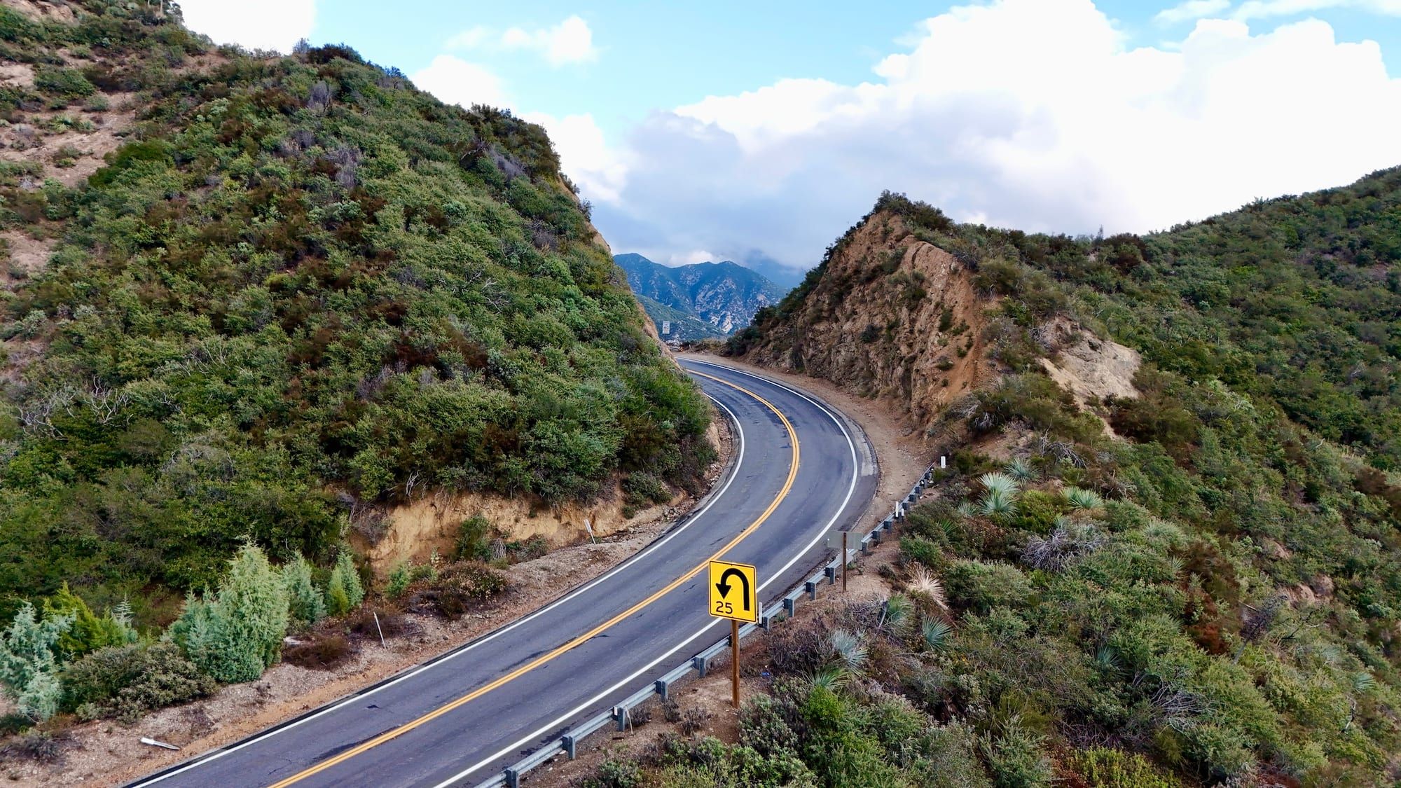
Reading California's History in Highway Roadcuts
How geologists read millions of years of history in California's highway roadcuts.
“Man is a geologic agent,” the late UC Davis geologist Eldridge Moores.
I’ve got a pretty consistent answer whenever someone asks, “Window or aisle?”
Window. Always.
I can spend an entire flight staring at the Earth below, trying to place myself on the map, guessing the familiar latticework of a particular city, admiring mountain ranges, or taking in the dull sprawl of the desert.
I’m the same way when I drive. I love looking out the window. And one thing I particularly enjoy looking more closely at is roadcuts.
Roadcuts are the places where highway builders blasted away hillsides and mountains to make room for the road. In doing so, they expose deep history.
Each one is different. Some reveal ancient seabeds. Others reveal rocks that were folded, fractured, or uplifted by plate tectonics. Many are bizarre and beautiful.
Once you start noticing them, you see them everywhere in California (sorry, Kansas). I’m not a geologist, although I took a geology class or two in school, and the discipline has always fascinated me. But you don’t need to have a Ph.D to appreciate the stories that roadcuts can tell us.
To get those stories, though, you will probably have to read a book or two, or talk to a geologist. Both of which I did for this story.
“Geologists on the whole are inconsistent drivers. When a roadcut presents itself, they tend to lurch and weave,” wrote the great New Yorker writer John McPhee in his excellent book Annals of the Former World. “To them, the roadcut is a portal, a fragment of a regional story, a proscenium arch that leads their imaginations into the earth and through the surrounding terrane.”
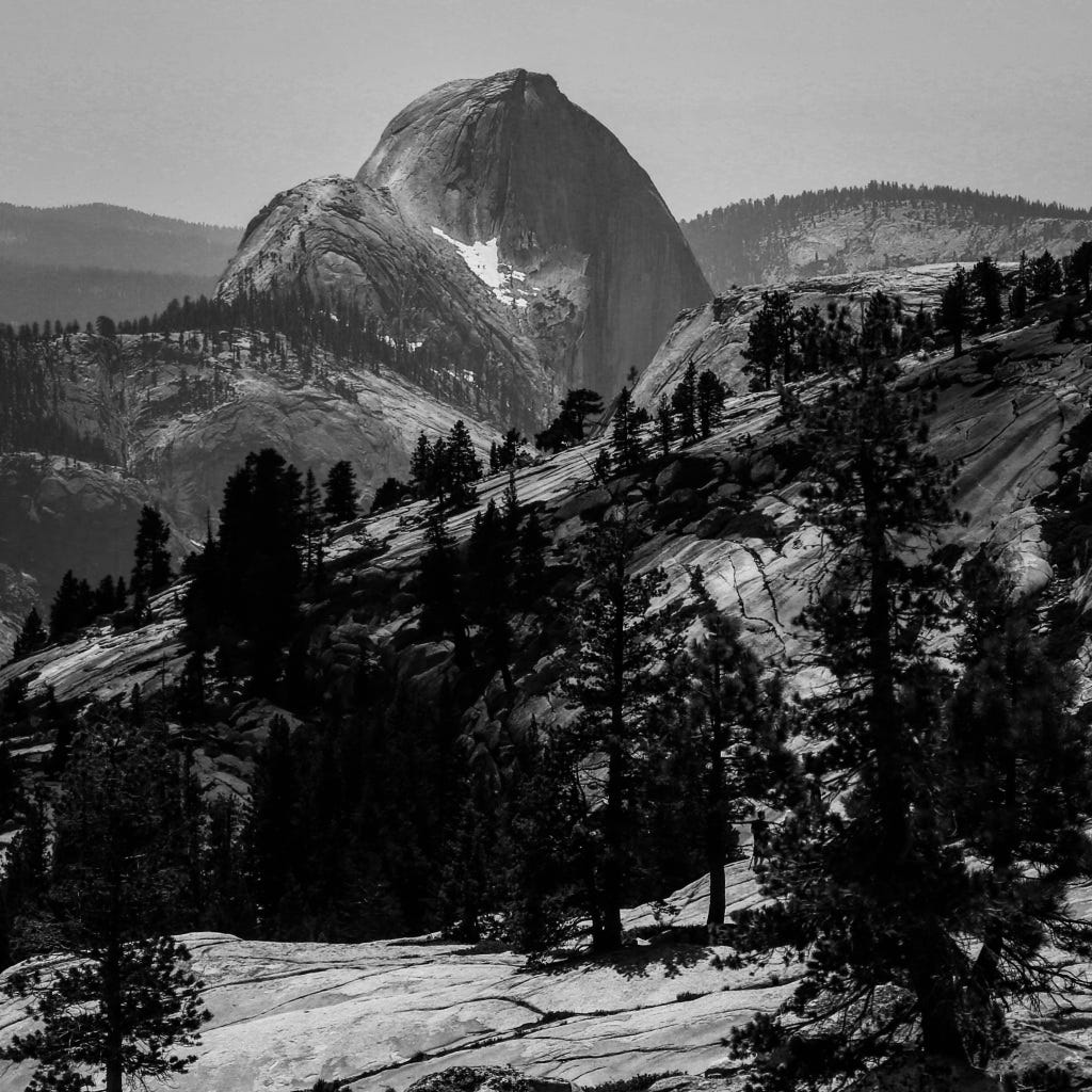 Glacier-carved domes tell the story of thousands of years of glaciation in California. (Photo: Erik Olsen)
When you spy a roadcut during a drive, you are seeing exposed layers of rock that have been hidden from view for millions of years. Each layer, or stratum, tells a story of what the environment was like when that layer was deposited. By studying these layers, geologists can reconstruct a timeline of events that shaped the region. For example, they can identify periods of volcanic activity, times when the area was submerged under an ancient ocean, or epochs when massive glaciers were carving out valleys.
“Road cuts are the best because, especially if they’re recent, you see what cannot be seen anywhere else,” said Donald Prothero, a California-based geologist, paleontologist, and author of many books, including the wonderful The Story of the Earth in 25 Rocks. “In Southern California, we’re lucky because of our dry climate, we can go to the Mojave Desert — as I did through my entire college career at Riverside — and see lots of stuff that doesn’t require digging a hole.”
California is especially interesting due to its active tectonic setting, which is, of course, why we have so many earthquakes. It’s not just the San Andreas Fault that fires up geologists; there are numerous lesser-known faults that crisscross the state, and roadcuts can expose these hidden fractures. By studying the composition of rocks along these faults, geologists learn about the nature of past seismic activity and can make predictions about future earthquakes.
The rock composition in California varies widely, crazily so.
“We have everything,” Prothero told me. “We have everything from billion-year-old, multi-billion-year-old rocks, up to volcanoes that erupted as recently as 1912. We have fault zones, we have subduction zones. We have everything from the oldest to the youngest, almost every geologic phenomenon you can imagine, we have.”
In the Sierra Nevada, granite roadcuts tell of a time when massive chambers of magma slowly cooled and crystallized deep beneath the Earth’s surface. Elsewhere, roadcuts through sedimentary rocks like sandstone and shale may contain fossils, giving clues about the life forms that once inhabited the region.
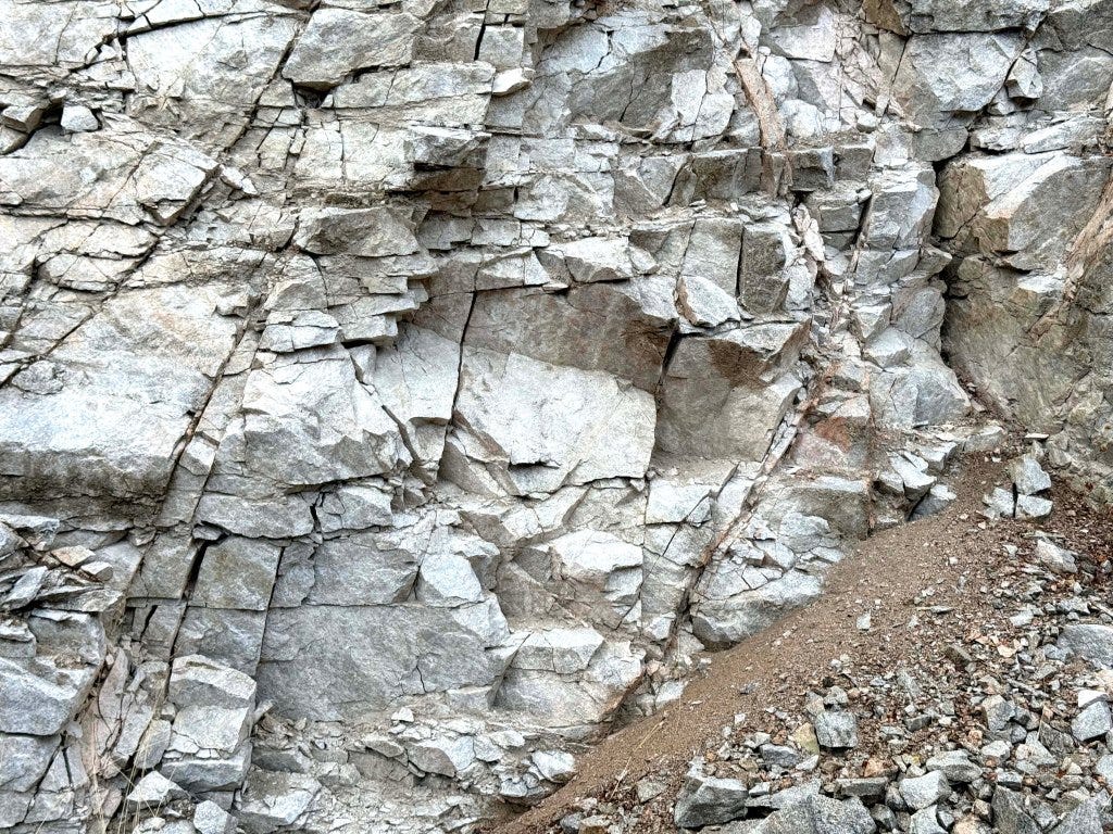 The San Gabriel Mountains consist of granite rocks of several kinds and a variety of other crystalline rocks, mainly schists, some of which were originally shales and sandstones but have been altered (metamorphosed) by compression. (Photo: Erik Olsen)
In roadcuts, geologists might find evidence of powerful geological processes such as metamorphism, where existing rock types are transformed into new types due to high pressure and temperature conditions. For instance, the presence of metamorphic rocks like schist and gneiss can indicate ancient collision zones where Earth’s tectonic plates have crashed together.
The value of California roadcuts is wonderfully illustrated in John McPhee’s “Assembling California.” (It’s hard to write about California geology without citing McPhee). The book is a fascinating narrative that weaves together the tale of California’s complex geology with the lives of the geologists who study it. One of McPhee’s favorite geologists was Eldridge Moores, from the University of California, Davis (Moores died in 2018). Moores played a significant role in deciphering the geological history of the region, particularly through his fieldwork involving, yes, roadcuts.
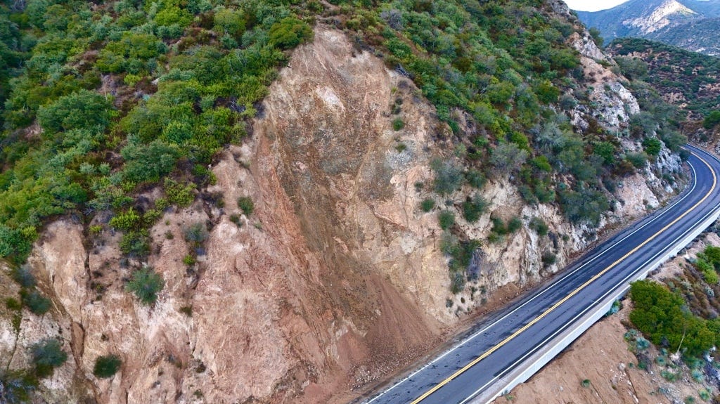 Roadcut in San Gabriel mountains. (Photo: Erik Olsen)
At the time Moores entered the field, the theory of plate tectonics was only beginning to gain traction. In the early 1960s, the idea that continents drifted and that vast slabs of the Earth’s crust moved over the mantle was still controversial, and it was met with extreme skepticism by many geologists trained in older, “fixist” models. Moores, however, embraced the theory early, recognizing in it an explanation for the chaotic structures he saw in California’s mountain belts. As a young researcher, he studied the Troodos ophiolite in Cyprus, an exposed section of ancient oceanic crust, and realized that similar rock assemblages were scattered across California.
“It was a very exciting time. I still get goosebumps even talking about it,” Moores told KQED in 2017. “A turning point, I think it was, in the plate tectonic revolution, that was the watershed of geology.”
Moores understood that the rocks he saw in California were remnants of vanished oceans, relics of seafloor that had been uplifted and accreted onto the edge of North America. His work helped reveal that much of California had arrived in pieces, a geological patchwork of island arcs, deep-sea basins, and continental fragments welded together by subduction. While others were still debating the validity of plate tectonics, Moores was already applying it, using it to decode the assembly of an entire state.
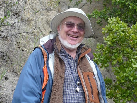 Eldridge Moores at the Cordelia fault. (Photo: UC Davis)
Moores was renowned for his work on ophiolites, sections of the ocean floor that have been thrust up onto the continent. One of his notable discoveries was the identification of ophiolite sequences in the roadcuts along the highways of the Sierra Nevada. These discoveries were crucial in understanding the ancient tectonic movements that shaped western North America.
Through roadcuts, Moores and his colleagues were able to observe and study the juxtaposition of different rock types. They could literally walk along the cuts and see how different terranes, or large packets of rock with a distinct geological history, were stitched together like a geological quilt, offering insight into the past locations of tectonic plates.
“Nature is messy,” Moores once told McPhee. “Don’t expect it to be uniform and consistent.”
He also meant: California is messy.
There are thousands of roadcuts across California; each one is different, and each tells a slightly different story. The Palmdale Roadcut, which I have visited many times, is a fascinating geological feature along the San Andreas Fault. It has been an invaluable resource for geologists studying the dynamics of this world-famous fault line.
“It’s a pressure ridge,” says Prothero. “The fault line strikes left, right, sliding horizontally, but there’s always compression on it. So it generates these pressure ridges in multiple places, and that’s when the bed’s exposed. They’re all crumpled up like a carpet. So that’s how much horizontal compression has existed. If you flatten that thing out, it’d be twice as wide.”
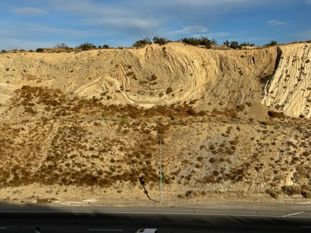 The Palmdale roadcut along Highway 14 is one of California’s great geologic windows. This 90-foot-deep cut exposes four-million-year-old lake sediments that have been compressed so intensely by the San Andreas Fault that they appear “crumpled up like a carpet.” Many geologists consider it one of the best places in the state to see the fault’s immense power on display. (Photo: Erik Olsen)
The rock here is a chaotic mélange: fault gouge, shattered granite, and twisted layers of sedimentary rock that have been pulverized and ground together by the powerful motion of the Pacific and North American plates, grinding past one another. By analyzing these layers, geologists can better understand the history and behavior of the San Andreas Fault, including the patterns of past earthquakes and the movements of tectonic plates. This, in turn, contributes significantly to the broader understanding of seismic risks and aids in preparing for future seismic events.
Another one of California’s well-known roadcuts, the Charlie Brown Outcrop, is located along Highway 178 near the Nevada border. It has been highlighted by geology teacher Garry Hayes, author of the Geotripper blog. Hayes writes:
“There are really three stories told in this exposure, that of distant ash eruptions, a violent eruption close by, and earthquakes with associated mountain-building.”
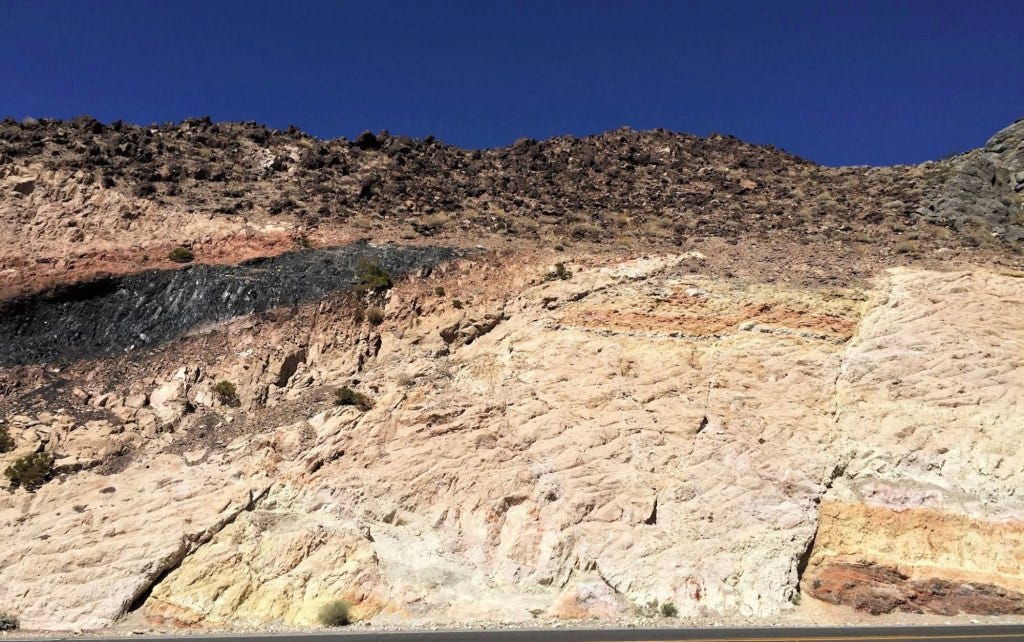 Charlie Brown outcrop along Highway 178 in California. (Google Maps)
Roadcuts are also crucial for educating the next generation of geologists. What could be more exciting for a budding geologist than a road trip? All the geologists I know, and I know a few, say this is the most fun a geologist can have. They allow students to identify rock types while piecing together the geologic history recorded in the rocks.
Prothero loves taking drives into the Sierra (who doesn’t?) “You’ve got things like the Alabama Hills. And then the other side, the White Mountains and the Inyo Mountains. All those have spectacular geology.”
Prothero also has a favorite roadcut up in the San Gabriel Mountains near Angeles Forest Highway that he takes students to see. “It’s a really nice outcrop because it’s cut right through almost all the bedrock that you have in the San Gabriel Mountains,” he told me. “We had students sketch in where the faults are and figure out the sequence of events like we do in a class exercise. But this is real. And I don’t think there’s any place in the country where you can do that so easily.”
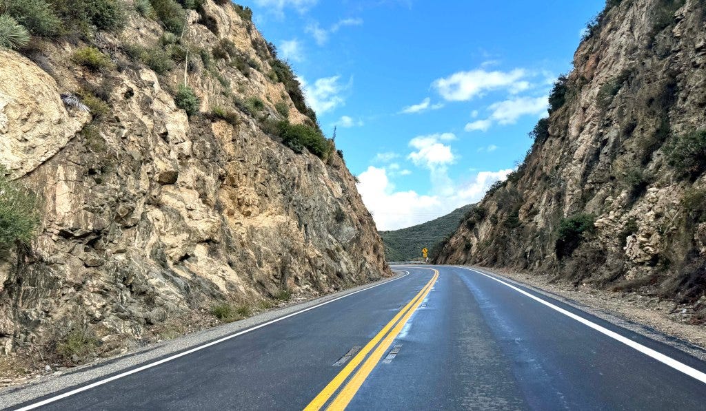 A roadcut in the San Gabriel Mountains reveals millions of years of California’s geologic history. (Photo: Erik Olsen)
In Assembling California, McPhee remarked that “geologists are like dermatologists: they study, for the most part, the outermost two per cent of the earth. They crawl around like fleas on the world’s tough hide, exploring every wrinkle and crease, and try to figure out what makes the animal move.”
Basically, roadcuts are not just the incidental byproduct of infrastructure development; they are key to understanding California’s complex geological evolution. Think of them as windows, exposing part of Earth’s history that would otherwise remain hidden underground. They’re an invitation to see the landscape differently. Once you have even a small sense of what you’re looking at, an ordinary drive through California becomes part of a much bigger story.