

The Monterey Formation, the Layered Rock Behind California’s Oil and Its Crumbling Cliffs
Those stacked, cream-colored cliffs at Crystal Cove and Montaña de Oro are the Monterey Formation, an ancient seafloor built from tiny algae. It’s the source of most of California’s oil and a big reason the coast keeps sliding.
Updated
If you’ve walked the beach at Crystal Cove or Montaña de Oro and noticed cliffs made of thin, stacked, cream-colored layers, like a pile of old paperbacks, you’ve seen the Monterey Formation. It runs along the coast from roughly San Francisco to Los Angeles, and it’s made mostly of rocks rich in silica: shale, chert, diatomite and porcelanite. It’s also where most of California’s oil came from. The Journal of Petroleum Technology called it “California’s primary petroleum source rock.”
 Fracture network of joints and cross-joints exposed on bedding surface of siliceous shale. Note linked, larger-aperture fracture in center with oxidation rim. Montaña de Oro State Park. (NASA JPL)
The Monterey is good at making oil and good at holding it. Its layers of organic-rich shale, silica-rich rock, carbonate and diatomite are full of pores and cracks, and oil seeps into them and stays there, like water in a sponge. More than 38 billion barrels of oil have been pumped from fields whose oil came from the Monterey.

Purchase stunning art prints of iconic California scenes.
**Check out our Etsy store. **
A lot of the Monterey is diatomite, a light, chalky rock made of the remains of diatoms, microscopic algae that build their cell walls out of glass-like silica. Diatoms bloomed in huge numbers in the ancient ocean here, and when they died, their shells piled up on the seafloor. Over time, some of that silica recrystallized into hard chert. Mixed in are dark shales packed with organic matter called kerogen. Buried deep and cooked by heat and pressure for millions of years, kerogen turns into oil and gas, the backbone of California’s petroleum industry (see our story on the history of the Long Beach oil industry).
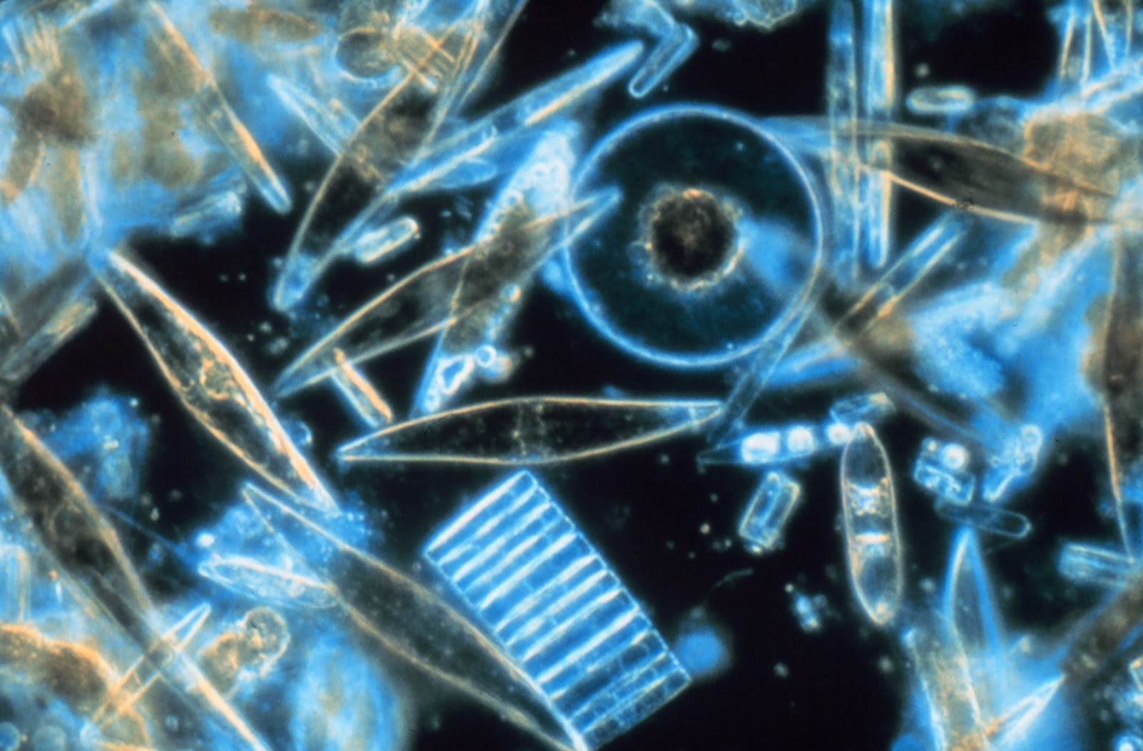
The Monterey was laid down during the Miocene, roughly 6 to 18 million years ago, in settings that ranged from deep ocean basins to shallow shelves. Back then, as now, upwelling currents along the coast pulled nutrient-rich water up from the deep, feeding enormous blooms of life and leaving behind huge amounts of biogenic silica, silica made by living things. Sea levels rose and fell with changes in climate and the movement of the plates. When the sea dropped, parts of the shelf were exposed and eroded. When it rose, deep-water mud piled up again. Some layers contain evaporites, minerals left behind when water evaporates, a sign of long dry spells, not unlike California’s recurring periods of drought.
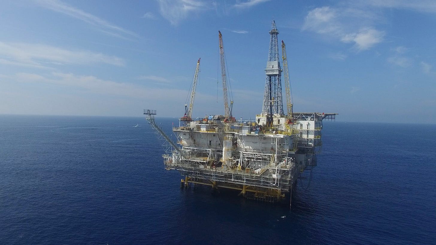 Offshore oil platforms along California’s coast drill into the Monterey Formation, either tapping directly into its fractured shale or extracting oil that has migrated into more porous sandstone reservoirs. (Photo: Erik Olsen)
Much of what we know about the Monterey comes from the late Robert Garrison, a professor of oceanography at the University of California, Santa Cruz. Garrison was considered the leading expert on the formation, and his work showed how its diatom-rich and phosphate-rich layers were shaped by upwelling, climate swings and tectonics during the Miocene.
Petroleum geologists love the Monterey because it’s both a source of oil and a place where oil collects, which makes it a natural laboratory for figuring out how oil forms, moves and gets trapped. The rocks are also pretty. Walk the beach at Crystal Cove in Orange County, and you’ll see them everywhere.
 Monterey Formation rocks near Little Corona in Newport Beach (Erik Olsen)
Here’s the short version of how it works. Plankton and algae die, sink and get buried. Over millions of years, heat and pressure turn them into hydrocarbons. Some of that oil moves up into more porous rock and collects, forming the oil fields that have been exploited for decades in Southern California. Some parts of the Monterey itself, especially the cracked chert and dolomite layers, hold oil and gas too.
The Monterey is also full of fossils. Its layers hold huge numbers of microscopic ones, like diatoms, radiolarians, foraminifera and coccolithophores, which scientists use to work out what the Miocene ocean and climate were like. The formation also contains fossils of larger marine vertebrates, including whales, seals and fish.
 Microscope image of microfossils and organic matter in Monterey rocks. (Cal State Long Beach)
There’s a downside. The soft diatomite layers are weak, especially when they’re wet or cracked, and they slide. Where the Monterey is exposed along the coast, cliffs and hillsides can give way, which is a real problem for anyone who built on top of them. The California coast is falling into the sea faster and faster, and a great book on the subject is Rosanna Xia’s California Against the Sea: Visions for Our Vanishing Coastline.
So next time you’re at the beach and see those layered cliffs, take a closer look. Those stripes are an ancient ocean floor, built from countless tiny algae that lived millions of years ago. They powered California’s oil boom, and they’re still slowly sliding into the sea.

More California science, photography and wild places on Instagram @californiacuratedus