
Mountain of Knives
Lookout Mountain obsidian became prized toolstone, traded through Indigenous networks from the eastern Sierra to the Channel Islands.
The road to Lookout Mountain does not look out for you.
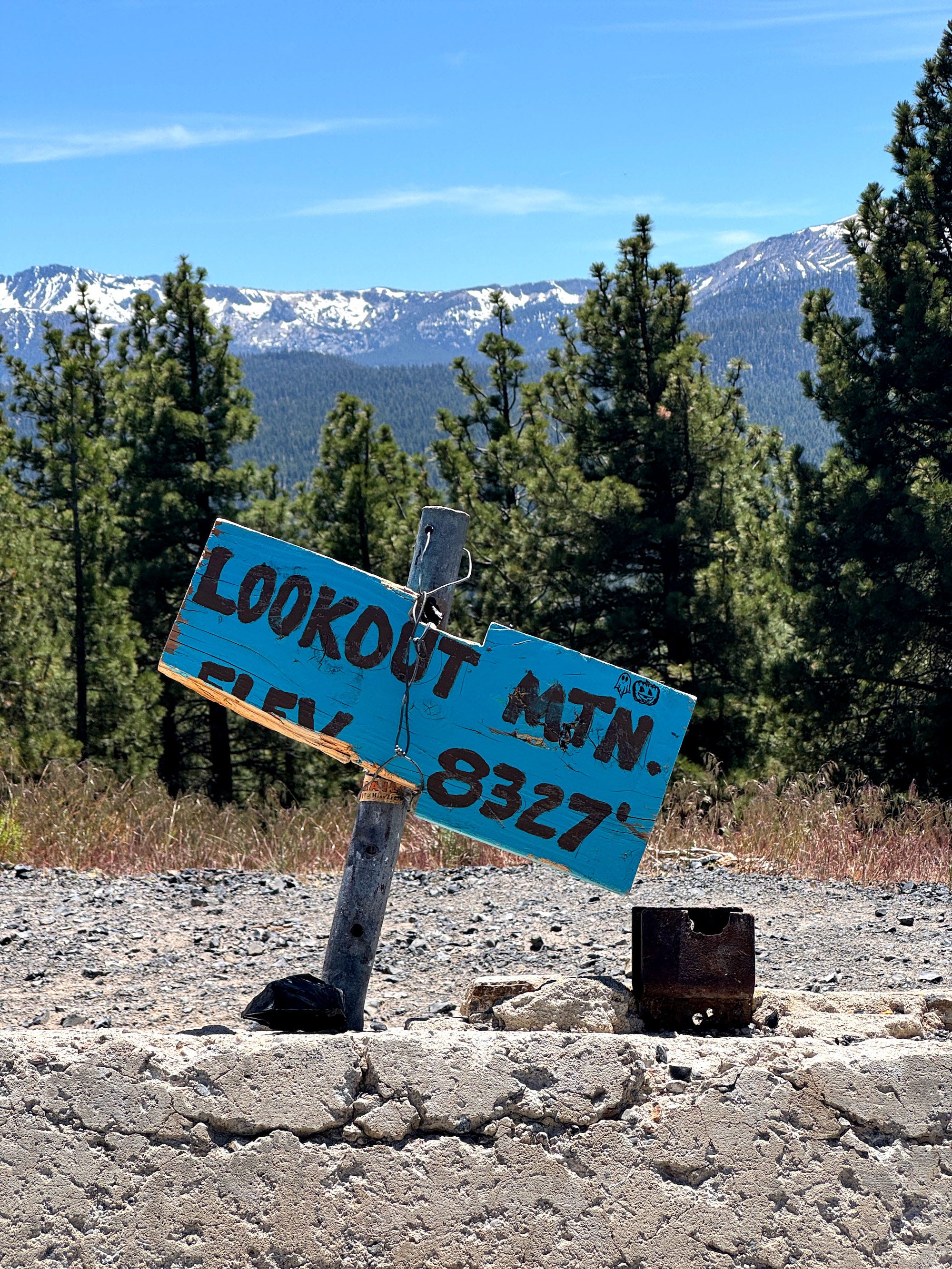
It peels off Highway 395 just south of Mono Lake as a washboard gravel track, climbs through sage and Jeffrey pine, and then simply stops pretending to be a road for cars. The last mile and a half is loose volcanic scree stacked into switchbacks, and my Honda Pilot, built for urban life and paved highways, did not like it. I almost bottomed out twice before I gave up trying to protect the oil pan and just committed. By the time I crested the final pitch and parked at 8,300 feet at the summit, the engine was hot, the AC was blasting, and the Eastern Sierra sun was directly overhead, blazing down on me.
I got out into a wall of heat, and what looked like thousands of shards of glass blinked back at me.
It was everywhere. Underfoot, in every direction. I crouched down to look closer, and the glitter resolved into something else: black, glassy, sharp-edged stone. Obsidian, and not a few pieces, but what looked like millions, carpeted the entire summit.
 Lookout Mountain in the Eastern Sierra. (Photo: Erik Olsen)
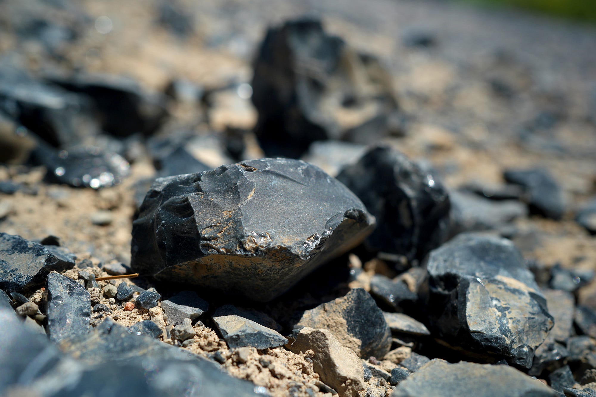
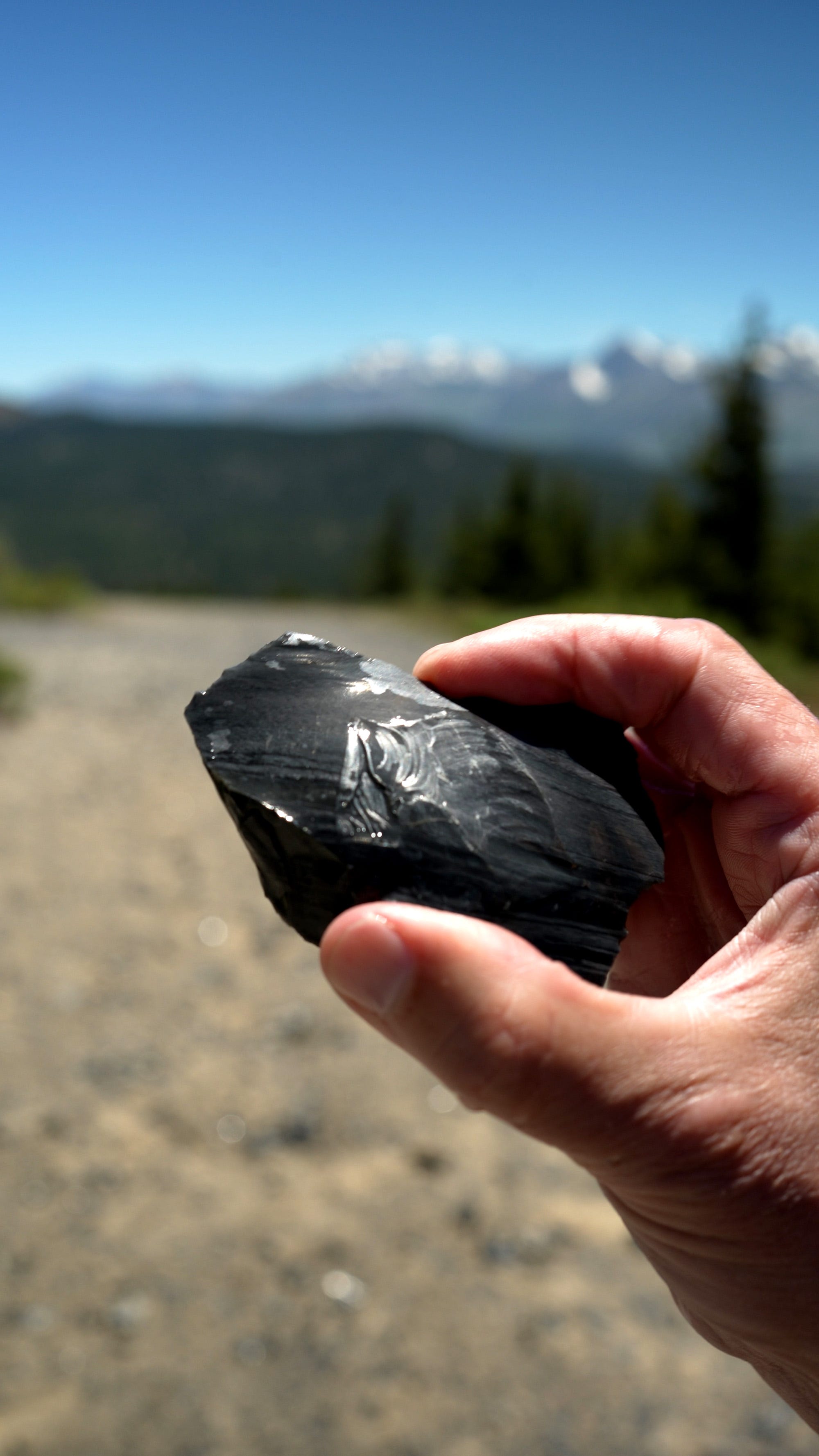
Some pieces were fist-sized chunks, blocky, raw, and covered in dust. Others were thin, almost translucent flakes that were so sharp, you could easily cut a piece of meat. Or a finger. I considered for a moment how lucky I was that I had not popped a tire on the way up. Basically, everywhere I looked were little black knives, sitting in the dirt.
I am producing a video about the area, the obsidian here, and its wide use among indigenous people in California, and so I set up on the summit and stood in front of my camera to record a few standups. Within ten minutes, my camera had overheated and shut down (it’s a Sony A7V). I had to go back into the car, turn on the AC, and let things cool down.
Much of the summit of Lookout Mountain is capped in obsidian, and according to a 2023 paper published in the IAOS Bulletin, the mountain, along with the broader Casa Diablo obsidian complex, was “one of the most significant toolstone quarries in California” in pre-colonial times.
The obsidian at Lookout Mountain is exceptionally pure. According to the U.S. Geological Survey (USGS), unlike some obsidian deposits, it lacks visible crystals and vesicles (gas bubbles), which is what allows it to fracture predictably into razor-sharp edges. Thousands of years ago, Indigenous people came here to quarry this volcanic glass and turn it into tools that were traded across the West.
 Obsidian on the summit of Lookout Mountain near Mammoth Lakes, CA. (Photo: Erik Olsen)
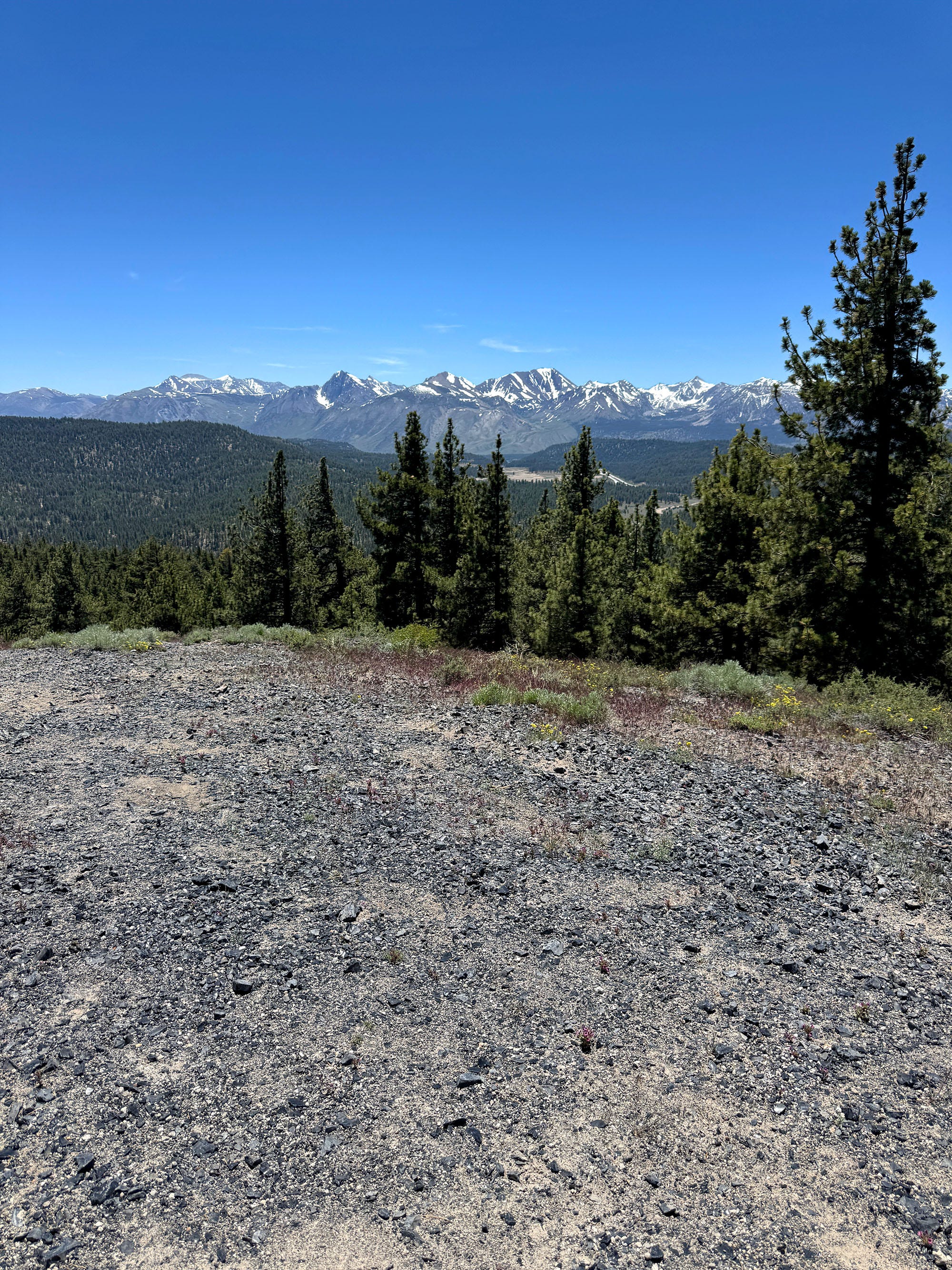
What’s fascinating is that when you’re standing on Lookout Mountain, you can also see other volcanic features such as Obsidian Dome, Glass Creek Dome, and the Inyo Craters, all much younger than the summit I was on. In a single panorama, you’re looking at hundreds of thousands of years of volcanic activity. Lookout Mountain itself erupted roughly 677,000 to 692,000 years ago, while Obsidian Dome and its neighbors across the valley are infants by comparison, having erupted roughly 600 to 650 years ago.
You might think Obsidian Dome, a glassy mound nearly a mile across, would have made just as fine a quarry as Lookout Mountain. Geologically, though, the two are not quite the same kind of glass. Drill cores taken from Obsidian Dome by researchers in the 1980s show its obsidian is shot through with tiny embedded mineral crystals, the result of slower cooling, while that from Lookout Mountain is more pure and much older.
Whether that difference actually steered prehistoric toolmakers toward one mountain over the other isn’t something I found any direct support for, but it would make sense given the predominance of Lookout Mountain/Casa Diablo obsidian that has been found in tools found around California.
I would have thought obsidian is obsidian, wherever it erupted. It turns out you can tell exactly where a piece came from, and quite accurately. That fact has become a boon to archaeologists trying to reconstruct the lives, migration patterns, and trading practices of early Californians.
Here’s how it works:
Obsidian is volcanic glass. It cools too fast to form crystals, and in that speed, it does something enormously useful to scientists much later on: it locks in the precise trace-element chemistry of the exact magma that produced it. It’s complicated stuff, and I don’t profess to understand it, but ratios of zirconium, strontium, rubidium, barium, and rare earth elements vary, often quite narrowly, from eruption to eruption. No two volcanic sources produce identical chemistry, and within a single field like this one, even neighboring outcrops can be told apart.
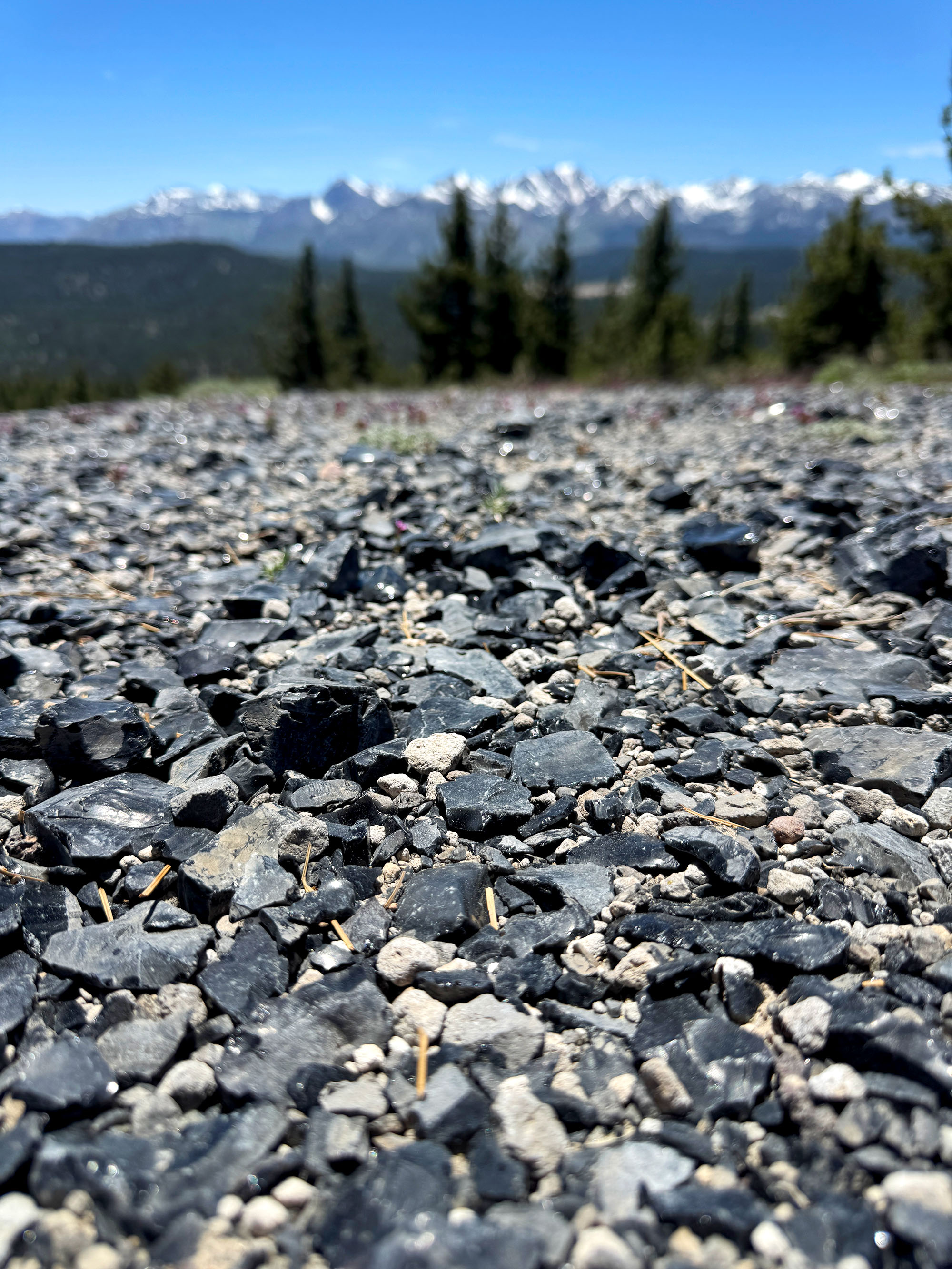
 The view from the summit of Lookout Mountain. The ground is covered in millions of pieces of obsidian. The Sierra Nevada is the backdrop. (Photo: Erik Olsen)
That’s the basis of obsidian sourcing. Using portable X-ray fluorescence (XRF) units or laser-induced breakdown spectroscopy (LIBS), researchers fire a beam at a piece of obsidian and read back its elemental signature, resulting in a specific geochemical fingerprint. That fingerprint gets compared against a reference library built from known volcanic sources and is fine enough to distinguish one dome from its neighbor a few miles away.
I more or less got the idea for this story from Kim Stanley Robinson’s marvelous book The High Sierra: A Love Story, where he put it like this: “Scientists can identify by chemical composition where obsidian flakes originated, and they can even determine when chips or tools were flaked, by measuring how far water has penetrated any newly exposed glass surfaces; this happens at a regular and measurable rate (which I find amazing).”
Amazing is the right word.
That second technique Robinson mentions is what lets archaeologists put a date on the glass itself. Obsidian absorbs water from the air after it’s freshly broken, forming a microscopic rim that thickens steadily over time. The rim is visible under microscopy. The technique dates back to 1960, and lets researchers estimate, often within a few centuries, how long ago a given flake was struck. Combine the two and you can figure out not just where a tool came from, but when.
Many of the millions of little pieces around me on Lookout Mountain were almost certainly debitage, not only a cool-sounding noun, but also the technical word for knapping waste, because there were so many small flakes everywhere. At least I’d like to think so. And there is some documentation to back that up. If true, then I wasn’t just standing on a random summit, or a natural aggregation of obsidian, but on a workshop.
 A piece of obsidian on the summit of Lookout Mountain in the Eastern Sierra. (Photo: Erik Olsen)
The people working the obsidian here were almost certainly ancestors of the Kootzaduka’a, the southernmost band of the Northern Paiute, who have resided in the Mono Basin region for more than 6,000 years. Obsidian was immensely valuable, like the microchips of the day. It was used not just for arrowheads and spear points, but also for scrapers to get meat and fat off animal hides, among many other uses.
The Kootzaduka’a carried obsidian west across the Sierra into Yosemite, trading with Miwok groups who had none of their own. But the chemistry shows the longest journeys ran south: Casa Diablo/Mount Lookout obsidian dominates sites in the San Joaquin Valley from the Merced River down to Tulare Lake, and it has turned up among Chumash trade goods on the Southern California coast, nearly two hundred miles away. The stones were likely carried hand to hand through what archaeologists call “down-the-line exchange,” a relay of trading partners, rather than one continuous trip.
Perhaps the most surprising thing to me is that obsidian made its way all the way to the Channel Islands, where XRF analysis of 69 obsidian artifacts from 28 island sites found Chumash and Tongva peoples obtaining obsidian from at least five eastern California sources, including Casa Diablo, through an exchange running across thousands of years.
After about two hours of filming, exploring, chilling in the car and wiping sweat off my face, I headed back down the rough road to Mammoth Lakes. I’d gone up that mountain to film some glittering rocks for a story that kind of fascinated me. But I came down having stood, basically, in the middle of one of prehistoric California’s longest supply chains.
Help support me: you can purchase amazing California wildlife gifts that I have designed myself.