

The San Gabriel Mountains Are Still Growing. Here's Their Story
The mountains hovering above Los Angeles are geologically young, tectonically restless, and still getting taller.
Updated
Look north from almost anywhere in Los Angeles on a clear day and there they are: the San Gabriel Mountains, a long wall of peaks running along the edge of the basin. More than just a dramatic barrier, these mountains are packed with stories of shifting earth, ancient rock, wild weather, and the people who’ve passed through them for thousands of years. They are also a primary source of Southern California’s beaches. They’re not just a backdrop; they’re a vital part of the region’s identity, full of science, history, and some genuinely remarkable nature.
Part of the Transverse Ranges, a rare east-west trending group of mountains in California, the San Gabriels rise abruptly from the San Gabriel Valley and form a kind of wall between L.A. and the Mojave Desert. Framed by Interstate 5 to the west and Interstate 15 to the east, the range is anchored on its north side by the famous San Andreas Fault, where the Pacific and North American tectonic plates constantly grind against each other. That ongoing collision is what keeps pushing these peaks upward. Geologically speaking, they’re growing surprisingly fast.

Side note: The Transverse Ranges also include the Santa Monica Mountains, San Bernardino Mountains, Santa Ynez Mountains, Topatopa Mountains, Tehachapi Mountains, Santa Susana Mountains, and Sierra Madre Mountains.
Inside the range you’ll find the Angeles and San Bernardino National Forests, along with the San Gabriel Mountains National Monument, first established in 2014 and significantly expanded in 2024 to protect more than 450,000 acres of rugged, biodiverse, and culturally significant terrain. (There is excellent hiking in these mountains.) These protected areas include steep canyons, chaparral, rare wildlife, and sites important to the history and traditions of Native American communities.
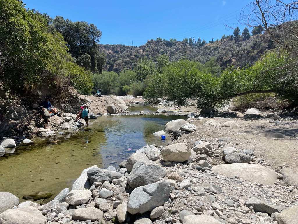 A pool of water from the Arroyo Seco in the San Gabriel Mountain (Erik Olsen)
The rocks here are some of the oldest in the region, but the mountains tell stories from more recent times too: gold miners, early astronomers, hikers, wildfire researchers. The San Gabriels help shape the weather, store precious snowpack, and remind everyone in L.A. that nature is always nearby and never really finished with its work.
The San Gabriels offer a startling rise in elevation. They really do explode out of the earth. The foothills begin near sea level, and the highest point in the range is Mount San Antonio, better known as Mount Baldy because, let’s face it, with that distinctive treeless summit, it looks kind of bald. That peak reaches 10,064 feet (3,068 meters). The quick transition from the city to towering peaks is part of what makes these mountains so dramatic, a wall standing guard over downtown Los Angeles.
The San Gabriels are much smaller in total length than, say, the Appalachians, but significantly taller on average. The highest peak in the Appalachians, Mount Mitchell in North Carolina, tops out at 6,684 feet (2,037 meters), considerably lower than Mount Baldy. The San Gabriels are younger, geologically speaking, which is exactly why they’re so steep and rugged: less time to erode.
 San Gabriel mountains from La Cañada Flintridge (Photo: Erik Olsen)
It is believed that much of the sand on California’s legendary beaches originated in the San Gabriel Mountains, carried by erosion and the rivers and streams that flow into the Pacific.
The story of how they formed goes back about 100 million years. During the Mesozoic Era, the Pacific Plate was slowly diving beneath the North American Plate, a process called subduction. Deep underground, rock melted, rose, and cooled into massive granite bodies called plutons. Over millions of years, the surrounding softer rock eroded away, exposing those granite cores.
 Rocks of a roadcut in the San Gabriel Mountains (Erik Olsen)
That’s largely what you’re looking at now: ancient, deep-earth granite, with softer sedimentary layers filling in the lower elevations. Up close, the granite sparkles, full of large crystals of feldspar, quartz, and mica, the glittery kind you’ll notice on any roadcut through the range.

Purchase stunning art prints of iconic California scenes.
**Check out our Etsy store. **
Water shapes these mountains as much as rock does. The Arroyo Seco, starts near Mount Wilson, drops through Pasadena, and merges with the Los Angeles River. Big Tujunga Creek cuts north into the San Fernando Valley. The San Gabriel River handles much of the eastern drainage. These are seasonal systems: they surge with winter rain and spring snowmelt, then go quiet through summer. The canyons they’ve carved over centuries are some of the best wildlife habitat in the range.
 Heavy rains cause flooding in the Arroyo Seco near Pasadena. (Erik Olsen)
Los Angeles drinks from these mountains. Rain and snowmelt feed the San Gabriel Reservoir and the Morris Reservoir, while the rest percolates into groundwater basins below the valley. The city has always depended on this local supply to offset what it imports from far away: the Colorado River, the Owens Valley. The San Gabriels are, quietly, a piece of L.A.’s infrastructure.

Visit the California Curated store on Etsy for original prints showing the beauty and natural wonder of California.
Flood control has long been a central challenge. The steep slopes funnel rainwater fast into urban areas, and the risk of flash floods and debris flows is real. Over time, a vast network of catchment basins, dams, and debris basins was built at the foot of the mountains to capture stormwater and slow the sediment that comes with it.
Those debris basins become especially critical after wildfires. When intense rain hits fire-scarred slopes, it triggers torrents of mud, boulders, and debris that rush down canyons toward neighborhoods below. The basins are designed to catch that before it arrives. But their effectiveness depends on maintenance, and when they fill up too fast or aren’t cleared in time, debris overtops them, and the results can be catastrophic.
 Morris Dam in the San Gabriel Mountains (Photo: Erik Olsen)
A stark example: the Montrose disaster of 1934. On New Year’s Eve 1933, following weeks of fire-scarred slopes and days of intense rain, massive debris flows roared out of the San Gabriel Mountains, burying homes in Montrose, La Crescenta, and Tujunga under several feet of mud. Around 30 people were killed. It spurred a generation of flood-control investment that still defines how Southern California manages its mountain edges today.
A fascinating piece on the efforts to control debris flows from the San Gabriels, though a bit dated, was written by John McPhee, whose work we greatly admire. Still worth reading.
The San Gabriels have been a witness to some genuinely strange history. The grave of Owen Brown sits in the mountains above Altadena. Owen was the third son of abolitionist John Brown, and his burial place has stirred curiosity for generations. Owen’s grave has become a kind of pilgrimage site for people interested in American history.
 Locals gather to celebrate the installation of a gravestone honoring abolitionist Owen Brown on January 29, 1898,
nearly a decade after his death. Photo: Brown family and Paul Ayers.
Owen was a fervent abolitionist like his father and participated in the famous raid on Harpers Ferry. After those tumultuous years, he came west, settled near El Prieto Canyon, and lived quietly until his death in 1889. He was buried on a hillside overlooking the canyon. The original headstone eventually disappeared (adding to the mystique), and a replica was restored in 2021. Worth the hike.
 Mount Wilson telescope (Photo: Erik Olsen)
Mount Wilson is another story. Standing at 5,710 feet, it’s home to the Mount Wilson Observatory, established in the early 20th century and soon one of the most productive astronomical sites on earth. It was here that Edwin Hubble, using the Hooker Telescope, found evidence that the universe is expanding, an observation that eventually underpinned the Big Bang Theory. Not bad for a mountaintop above Pasadena.
The Angeles Crest Highway was a massive engineering undertaking. Construction began in 1929 and took nearly three decades to complete; the full 66-mile route didn’t open until 1956. Its summit at Dawson Saddle reaches 7,903 feet, making it one of the highest roads in Southern California. Before it existed, much of this terrain was accessible only on foot or horseback.
 Angeles Crest Highway roadcut (Photo: Erik Olsen)
Driving it today is an experience. Winding and twisting through the mountains, you’ll find steep drop-offs, sharp turns, and elevation swings from around 1,200 feet to over 7,900 feet. It rewards attention. It also rewards stopping. The views are genuinely stunning.
The biodiversity can be startling, especially if you’re coming from the valley floor where everything is concrete. The elevation change drives it all. Jeffrey pine and Coulter pine higher up, California black oak at mid-elevation, chaparral down low. In spring, the meadows fill with wildflowers: golden yarrow and scarlet larkspur.
California condors once soared here in significant numbers; the San Gabriels were a stronghold for them until World War II, and there’s hope they’ll return as the reintroduction program continues. Nelson’s bighorn sheep still persist in the range in small, endangered groups around Mount Baldy, Iron Mountain, and Twin Peaks, though you’re unlikely to see one. Mountain lions hold large territories through the range; we know they’re there even if most visitors never see one either. In the creeks, endangered arroyo chubs and Santa Ana suckers hold on in water that gets scarcer every dry decade.
 The California condor is known to inhabit the San Gabriel range
The San Gabriel Mountains National Monument designation in 2014, expanded significantly in 2024, put real protection around this ecosystem. The goal is to make sure future generations have the same mountains to look up at.
Next time you’re stuck on the 210, look north. Those mountains are still moving. Not fast, but faster than you’d think.
More California science, photography and wild places on Instagram @californiacuratedus